Hollandse Kust (zuid) Wind Farm Zone - Wind Farm Sites I & II Project and Site Description - rvo

Page created by Paula Holt
 
CONTINUE READING
Hollandse Kust (zuid) Wind Farm Zone - Wind Farm Sites I & II Project and Site Description - rvo
Hollandse Kust (zuid) Wind Farm Zone
Wind Farm Sites I & II

Project and Site Description

October 2017

                               >>	Sustainable. Agricultural. Innovative. International.
Hollandse Kust (zuid) Wind Farm Zone - Wind Farm Sites I & II Project and Site Description - rvo
Foreword4

Contents   1 Objectives and reading guide
             1.1 Objectives
             1.2 Reading guide
                                                                                                                                                         8
                                                                                                                                                         9
                                                                                                                                                         9

           2 Hollandse Kust (zuid) - The region and the opportunities                                                                                  10
             2.1 Regional overview                                                                                                                     11
             2.2 Wind power development in the Hollandse Kust region                                                                                   11
             2.3 Support and opportunities in the Hollandse Kust region                                                                                12

           3 Hollandse Kust (zuid) - Site I and II - site description                                                                                  14
             3.1 General description of the Hollandse Kust (zuid) Wind Farm Zone                                                                       15
             3.2 Layout and coordinates of HKZWFS I and II                                                                                             15
             3.3 Existing infrastructure                                                                                                               16
             3.4 TenneT offshore grid connection system                                                                                                18

           4 Site Studies                                                                                                                              20
             4.1 Archaeological desk study                                                                                                             22
             4.2 Unexploded ordnance (UXO) risk assessment desk study                                                                                  23
             4.3 Geological desk study                                                                                                                 25
             4.4 Geophysical survey                                                                                                                    25
             4.5 Archaeological assessment of geophysical survey results                                                                               27
             4.6 Geotechnical survey                                                                                                                   28
             4.7 Morphodynamical desk study                                                                                                            36
             4.8 Technical note on scour and scour mitigation                                                                                          38
             4.9 Wind Resource Assessment                                                                                                              40
             4.10 Metocean measurement campaign                                                                                                        42
             4.11 Metocean desk study                                                                                                                  44
             4.12 Site Investigations quality and certification	                                                                                       47

           5 Legal framework and specific requirements of the HKZWFS I and II permit tender                                                            50
             5.1 Introduction - Offshore wind road map                                                                                                 51
             5.2 Legal framework                                                                                                                       51
             5.3 Permit tendering                                                                                                                      52
             5.4 TenneT offshore grid operator                                                                                                         53

           6 Specific requirements and relevant information from the legal framework                                                                   58
             6.1 Boundaries and coordinates                                                                                                            59
             6.2 Design and operation requirements                                                                                                     59

           7 Next steps preparing a bid                                                                                                                68
             7.1 Key dates                                                                                                                             69
             7.2 Useful websites to help keep track                                                                                                    69
             7.3 Dutch energy policy and the State’s role in reducing the cost of offshore wind                                                        70
             7.4 The right skills, the right location - the perfect base for a strong supply chain                                                     73
             7.5 Key stakeholders in the Hollandse Kust region                                                                                         75
             7.6 Overview of the Dutch Ports                                                                                                           76

           8 Applicable documents                                                                                                                      80
             8.1 Bibliography                                                                                                                          81

           Appendices82
             Appendix A: Applicable Law
             Appendix B: Summary Environmental Impact Assessment
             Appendix C: Boundaries and Coordinates HKZWFS I and II
             Map: Existing port and manufacturing infrastructure base
                                                                           Project and Site Description Hollandse Kust (zuid) - Wind Farm Sites I & II | 3
Hollandse Kust (zuid) Wind Farm Zone - Wind Farm Sites I & II Project and Site Description - rvo
Foreword                            In 2016, the Netherlands embarked on its journey towards fulfilling its
                                    goal of adding 3,500 MW of new offshore wind power capacity by end
                                    2023 to take the country’s cumulative offshore total to 4,500 MW. Two
                                    tender rounds have so far been conducted, seeking bids from companies
                                    to win grants and project permits for developments with a combined
                                    capacity of 1,380 MW in the Borssele Wind Farm Zone.

                                    With this Project and Site Description (PSD) for Wind Farm        Nonetheless, there can be no room for complacency. We
                                    Sites I and II of the Hollandse Kust (zuid) Wind Farm Zone        have learned valuable lessons from the previous tenders and
                                    (HKZWFZ), the country is implementing the lessons learned         adapted our approach accordingly to help in our joint
                                    from the 2016 Borssele tenders and taking the next step in        efforts with industry to maintain the downward cost curve.
                                    its five-year offshore wind tender programme. After the
                                    five-year offshore wind tender programme the Dutch                Whilst a permit without any subsidy is in place for the
                                    Government has planned an additional seven-year                   HKZWFS I and II tender, The Netherlands Enterprise Agency,
                                    programme of 1,000 MW of extra offshore wind power                in Dutch known as RVO.nl, has increased its emphasis on
                                    capacity each year. This has been formulated in the Energy        providing more complete and high-quality site data
                                    Agenda of December 2016.                                          compared to the process for the Borssele tenders.

                                    The first Borssele tender offered a combined total of 700         In fact, with our new approach, RVO.nl has set a new global
                                    MW at Borssele Wind Farm Sites I and II (BWFS I and II),          standard that acts as benchmark for governments world-
                                    while the second offered 680 MW across BWFS III and IV.           wide. We followed a thorough quality assurance procedure
                                    Now, as this PSD shows, work for the first request for            for the HKZ site investigations, including verification
                                    tenders for projects in the HKZWFZ is firmly underway.            against applicable standards by accredited certification
                                    As with the first Borssele tender, the first one for HKZWFZ       bodies. DNV GL verified the metocean study, the soil
                                    will offer two 350 MW projects for development: one at            investigations and the morphodynamic study. The metocean
                                    Site I of the zone, the other at Site II.                         campaign was verified by ECN. The archaeology study was
                                                                                                      verified by RCE whilst the UXO report was verified by the
                                    This next tender round is scheduled for opening and closing       Ministry of Defense.
                                    in December 2017. The Government has published the
                                    Ministerial Order for Offshore Wind Energy 2017 in                We then also asked DNV GL to assess the overall package of
                                    October 2017. This order sets out the final requirements          site studies conducted with a view to awarding an overar-
                                    for applications in the HKZWFZ tender and provides the            ching certificate confirming that the work has been
                                    legal framework to ensure companies can fully prepare             conducted in line with industry best practice. The objective
                                    a successful tender submission this year.                         of this final procedure was to validate the quality of all the
                                                                                                      site studies and to ensure overall high quality, completeness
                                    The aim of our offshore wind programme is not simply to           and consistency between them and ensure the whole
                                    add new capacity, but also to reduce the cost of electricity      package forms a suitable basis for the preliminary design of
                                    from offshore wind in a sustainable and socially responsible      offshore wind farms.
                                    way. Our belief this can be achieved has been reinforced
                                    with the winning bids of DONG Energy Borssele I B.V. and          DNV GL's overarching certification report confirms that
                                    Blauwwind II C.V. for the Borssele Wind Farm Sites. Our           RVO.nl receives a statement of compliance regarding
                                    proactive strategy of reducing risk and costs for developers      meeting the requirements of DNVGL-SE-0190:2015-12
                                    and operators by providing a stable market framework,             (Project certification of wind power plants) with regards to
                                    taking on more of the pre-construction work ourselves, and        its metocean investigations, geotechnical investigations
                                    appointing TSO TenneT to take on all the grid-connection          and geological ground model, morphological investigations
                                    infrastructure responsibilities, was clearly shown to work in     and wind investigation and that, in doing so, it has also
                                    those rounds.                                                     fulfilled the Site Assessment Requirements listed in IEC

4 | Netherlands Enterprise Agency                                                                   Project and Site Description Hollandse Kust (zuid) - Wind Farm Sites I & II | 5
Hollandse Kust (zuid) Wind Farm Zone - Wind Farm Sites I & II Project and Site Description - rvo
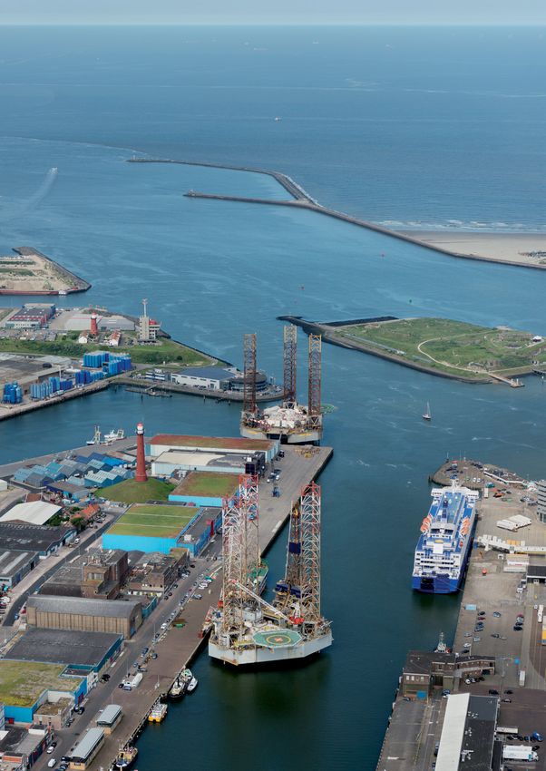
61400-22:2010-05 (Wind turbines – Part 22: Conformity           We have also expanded the coverage of this PSD, incorpora-
Testing and Certification). It concludes "the site-conditions   ting additional useful background information that should
have been established correctly and that risks and uncer-       also further assist companies when they come to prepare
tainties have been minimised according to state-of-the-art      their project bids. This includes an overview of the
methods."                                                       Hollandse Kust region and key stakeholders, plus an
                                                                overview of our Dutch ports, which will prove instrumental
In summary, the results of the HKZWFZ site studies indicate     in helping bidders reduce cost and increase efficiency.
conditions are perhaps even more favourable than at
Borssele. HKZWFZ Site I and II are closer to shore than the     The overall aim of our increased efforts is to further reduce
Borssele sites (reducing transport distances and times for      risks for developers and stimulate design optimisation in
offshore wind installation vessels and maintenance crews),      the tender stage. With that in mind, we very much look
water depth is shallower whilst soil conditions (mostly         forward to receiving cost-effective and innovative bid
sand) should allow for the use of simple foundation             submissions that ensure economic, social and environmen-
methods (eg monopiles). Furthermore, the extreme wave           tal benefits can be maximised for both the local communi-
height is lower, as is the level of seabed dynamics. The        ties of the Hollandse Kust region and for the Netherlands
combination of these favourable parameters and the more         generally. We have no doubt that once again the wind
comprehensive data compiled by RVO.nl for developers to         industry will rise to the challenge and make 2017 another
help in the preparation of their bids means we are optimi-      exciting year for offshore wind power in the Netherlands.
stic that the downward cost curve for offshore wind can be
maintained.

 6 | Netherlands Enterprise Agency                                                                                              Project and Site Description Hollandse Kust (zuid) - Wind Farm Sites I & II | 7
Hollandse Kust (zuid) Wind Farm Zone - Wind Farm Sites I & II Project and Site Description - rvo
1.                                  1.1 Objectives
                                    This Project and Site Description (PSD) is designed to help
                                                                                                        topography), existing cable and pipeline infrastructure,
                                                                                                        nearby wind farms and TenneT grid connection system.

Objectives and
                                    any party with an interest in participating in the planned          Chapter 4: Site Studies - an updated overview of all the
                                    permit tender for Hollandse Kust (zuid) Wind Farm Sites I           studies and measuring campaigns performed to date on the
                                    and II (HKZWFS I and II) in the Hollandse Kust (zuid) Wind          HKZWFZ, covering the following:
                                    Farm Zone (HKZWFZ) in the Netherlands. This is the final            • Obstructions: Archaeological desk study, Archaeological

reading guide
                                    version of the PSD and includes updated data (including               assessment of geophysical survey results, UXO risk
                                    maps and tables), site investigation results, and legislative         assessment desk study
                                    decisions.                                                          • Soil: Geological desk study, Geophysical survey,
                                                                                                          Geotechnical survey, Morphodynamical desk study and a
                                    This document summarises:                                             technical note on scour
                                                                                                        • Wind and Water: Wind Resource Assessment, Metocean
                                    A description of the site, surroundings and characteristics           assessment, Metocean measurement campaign.
                                    of HKZWFS I and II.
                                                                                                        Chapter 5: Legal framework and specific requirements of
                                    • A
                                      	 ll data collected by the Netherlands Enterprise Agency         the HKZWFS I and II permit tender - an overview of the legal
                                      (RVO.nl) regarding the physical environment of the                framework that is and will be implemented to facilitate the
                                      Hollandse Kust (zuid) area.                                       Dutch offshore wind programme rollout.
                                    • A selection of constraints, technical requirements and
                                      grant related issues that are deemed to be most relevant          Chapter 6: Specific requirements and relevant informa-
                                      for development of the Hollandse Kust (zuid) area.                tion from the legal framework - an overview of the
                                    • The process for the permit and the legal framework.               most relevant design parameters, coordinates, permit
                                                                                                        requirements found in the various acts, decrees, ministerial
                                    This document has been produced for information                     orders and Wind Farm Site Decisions (WFSD), described in
                                    purposes only and is not intended to replace any legal or           chapters 3 and 5. It also provides an overview of the status
                                    formally communicated rules, regulations or requirements.           of the framework. This overview does not replace any legal
                                    More information on the site studies, including all reports         documents, but it aims to provide information that is rele-
                                    and other deliverables mentioned in this PSD, can be found          vant to prepare a tender bid submission in December 2017.
                                    at offshorewind.rvo.nl. When the tender is officially opened
                                    in December 2017, the application forms and related bid             Chapter 7: Next steps preparing a bid - an overview of
                                    documents will be available to download at www.mijnrvo.nl           the process for receiving a permit, including key dates,
                                                                                                        useful links for further information or help (including those
                                                                                                        relating to the Dutch offshore wind programme, incentives
                                    1.2 Reading guide                                                   and finance, and national and regional stakeholders), back-
                                                                                                        ground information on Dutch energy policy and the State's
                                    This is the final version of the PSD for HKZWFS I and II. It        role in reducing the cost of offshore wind, and an overview
                                    presents an updated overview of all relevant information            of Dutch ports.
                                    for parties interested in preparing a bid for a permit to build
                                    and operate wind farms at these sites. This PSD covers the          Chapter 8: Applicable documents - this PSD contains
                                    following aspects in the different chapters:                        three appendices, all updated as well, and a map of the
                                                                                                        Netherlands with the existing port and manufacturing infra-
                                    Chapter 1: Objectives and reading guide                             structure base which can be found as separate documents:

                                    Chapter 2: Hollandse Kust (zuid) - The region and the               Appendix A: Applicable Law
                                    opportunities - some background information on the
                                    region generally, including wind power development to               Appendix B: Summary of Environmental Impact
                                    date and what you need to know about doing business in              Assessment HKZWFS I and HKZWFS II
                                    this region.
                                                                                                        Appendix C: Boundaries and Coordinates
                                    Chapter 3: Hollandse Kust (zuid) - Site I and II - site             HKZWFS I and II
                                    description - general information on the HKZWFZ,
                                    the location, surroundings, its bathymetry (submarine               Map: Existing port and manufacturing infrastructure base

8 | Netherlands Enterprise Agency                                                                     Project and Site Description Hollandse Kust (zuid) - Wind Farm Sites I & II | 9
Hollandse Kust (zuid) Wind Farm Zone - Wind Farm Sites I & II Project and Site Description - rvo
2.                                   The Hollandse Kust (zuid) Wind Farm Zone (HKZWFZ) lies to the west
                                     of the Netherlands, offshore from the provinces of Zuid-Holland (South

Hollandse Kust (zuid)
                                     Holland) and Noord-Holland (North Holland). For companies involved in
                                     the development, construction and operation of the projects planned
                                     across the HKZWFZ, both Zuid-Holland and Noord-Holland will play key

The region and                       roles. This PSD therefore discusses both provinces.

                                     2.1 Regional overview
the opportunities
                                                                                                          offshore, along with energy (there have been over
                                                                                                          €6 billion of investments in offshore energy and maritime
                                     Zuid-Holland and Noord-Holland are the two most densely              in the region over the last decade). The city of Den Helder,
                                     populated provinces of the Netherlands. Zuid-Holland                 for instance, is known for being a centre of the offshore oil
                                     includes the cities of The Hague, Rotterdam, Delft, Leiden           and gas industry while the northern Noord-Holland region
                                     and Dordrecht and is home to a population of 3.5 million             is already a leader in the Dutch wind energy sector, with the
                                     people (and a labour force of 1.6 million people).                   port of IJmuiden in the North Sea Canal area being the base
                                     Meanwhile, 2.8 million people live in Noord-Holland,                 for the installation and maintenance of the Netherland's
                                     with around 50% of those making up its labour force.                 first three offshore wind farms, for example.
                                     The province of Noord-Holland is home to Amsterdam, the
                                     capital of the Netherlands, which alone attracts approxima-
                                     tely 5 of the 6 million annual tourists that visit the province.     2.2 W
                                                                                                               ind power development
                                     Other cities are Haarlem, IJmuiden, Den Helder, Alkmaar.
                                                                                                              in the Hollandse Kust
                                     Both provinces have proactive local and regional
                                     governments and flourishing economies thanks to a strong                 region
                                     business base, attracting companies and people from all
                                     over the world. The Amsterdam Metropolitan Area alone                In the province of Zuid-Holland there are currently 167 turbines
                                     counts 2,200 international companies and is home to 170              installed with a combined capacity of 360 MW. Offshore there
                                     nationalities, for example. The gross domestic product               is the 129 MW Luchterduinen Wind Farm near Noordwijk (23
                                     (GDP) of Zuid-Holland alone, meanwhile, makes up                     km offshore). The province has set an onshore wind goal of
                                     20.9% of the total GDP for the Netherlands.                          735.5 MW installed by end 2020, as part of the Dutch national
                                                                                                          plan targeting 6,000 MW of installed onshore wind power
                                     Both Zuid-Holland and Noord-Holland are very well                    within the same timeframe. Based on projects currently
                                     connected to the rest of the world with direct train                 planned or under construction, however, Zuid-Holland is
                                     connections to major European cities, two international              expected to exceed its goal, instead achieving an installed
                                     airports and the key ports of Rotterdam in Zuid-Holland              onshore total of 811 MW in 2020, rising to 833 MW in 2023.
                                     (Europe’s largest port) and Amsterdam, IJmuiden,
                                     and Den Helder in Noord-Holland (see chapter 7 for                   In the province of Noord-Holland, there is currently 578 MW
                                     more information on Dutch ports).                                    of wind power installed, 228 MW of that offshore at the OWEZ
                                                                                                          Wind Farm (10-18 km offshore , 108 MW) and the Prinses
                                     Both provinces are a hotspot for the maritime and offshore           Amalia Wind Farm (23 km offshore, 120 MW). Onshore, the
                                     industry and energy R&D. Zuid-Holland, in particular,                provincial goal is to increase capacity from the 350 MW
                                     hosts one of the most diversified maritime clusters in the           currently operating (from 332 turbines) to 685 MW. This is
                                     world, with 4,375 companies located there and some 70,000            being achieved via repowering projects, whereby older
                                     employees (45% of the Dutch total). The cluster consists of          turbines are dismantled and replaced by a fewer number
                                     companies active in design, shipbuilding, maintenance,               of quieter, larger capacity, modern models. Provincial
                                     asset owners, suppliers, maritime service suppliers and the          regulations require that for each new onshore turbine
                                     world renowned university, Delft University of Technology            installed, at least two older turbines should be dismantled.
                                     (TU Delft), which is ranked among the top technological              In this way, visual and noise intrusion can be minimised for
                                     universities worldwide. Similarly the north of Noord-                the local community while energy sourced from wind power
                                     Holland has a significant industrial focus on maritime and           can be increased and produced more efficiently.

10 | Netherlands Enterprise Agency                                                                      Project and Site Description Hollandse Kust (zuid) - Wind Farm Sites I & II | 11
Hollandse Kust (zuid) Wind Farm Zone - Wind Farm Sites I & II Project and Site Description - rvo
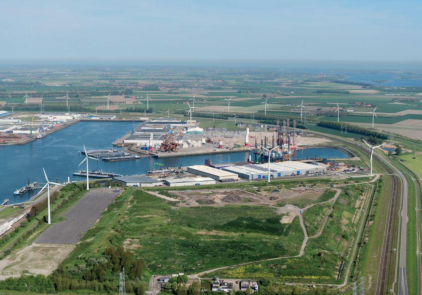
'Today, the onshore wind
Around 450-500 MW of onshore turbines are currently being
installed or planned onshore in the Wieringermeer polder
                                                                     Amsterdam IJmuiden Offshore Ports (AYOP) initiative.
                                                                     AYOP facilitates offshore wind installation, operation and
                                                                     maintenance as well as services relating to electrical infra-
                                                                                                                                              and offshore oil and gas
to achieve the 685 MW target. This includes the 350 MW               structure. It has also recently launched a vocational education

                                                                                                                                            sectors work very closely'
Wieringermeer wind farm repowering project. Located                  programme for wind technicians.
60 km north of Amsterdam, comprising 100 turbines, it will be
one of the largest onshore wind farms in the Netherlands -
almost three times bigger than the Prinses Alexia Wind Farm          2.3 Support and opportunities
inaugurated in 2013. Meanwhile, the Port of Amsterdam area
will also contribute to the goal with an ambition to increase             in the Hollandse Kust
its onshore wind capacity to over 100 MW, up from 69 MW
currently. Eneco and the Port of Amsterdam jointly operate                region
the Afrikahaven onshore wind farm in the Western port area.
                                                                     The provincial administrations of Zuid-Holland and Noord-
The projects planned under the Dutch Government’s current            Holland value investments in offshore wind given the goals
offshore wind programme will boost the wind capacity in              of the energy transition. The strengthening of this sector
the two provinces of Zuid-Holland and Noord-Holland by               and the need for further innovation can be assisted by the
2,100 MW - 1,400 MW is planned in the HKZWFZ (700 MW at              knowledge clusters present in the West Holland region,
sites I and II which are the subject of this PSD and 700 MW at       while opportunities for growth exist and are welcome in
sites III and IV planned for tendering in 2018) and 700 MW off       the maritime clusters.
the coast in the Hollandse Kust (noord) Wind Farm Zone (due
to be offered up for tenders in 2019).                               As the projects planned in the HKZWFZ are relatively close
                                                                     to shore (see Chapter 3), a good, open, working relationship
Over the past decade, a complete value chain has been                between project developers and local stakeholders in the
developed in both Zuid-Holland and Noord-Holland to                  Hollandse Kust region is seen as paramount to ensuring
install, operate and maintain offshore wind farms thanks             success. The overall aim is to ensure any concerns by local
to the growing cooperation between the onshore wind                  community groups, such as those involved in tourism or
industry and the traditional offshore energy industry.               fishing, are addressed while the potential benefits to the
For example, some well-known Dutch offshore dredging                 region resulting from the construction and operation of
contractors and manufacturers which have their headquarters          the wind farms are fully maximised.
in Zuid-Holland, also lead market offshore installation of
turbines and foundations globally.                                   This is, to some extent, legislated for in the Wind Farm Site
                                                                     Decisions for the zone (see Chapters 5 and 6), which contain
Today, the onshore and offshore wind and offshore oil and gas        regulations about how the region should benefit from the
sectors work very closely. Potential for further cooperation still   wind farm site developments. Regulation 2.16, for example,
exists, for example in the management of the complex                 states that the developer must show how the design,
construction/installation of projects, and in integrated design      construction and exploitation of the wind farm actively
of masts and foundations. In Zuid-Holland and Noord-                 contributes to the regional and local economy. This might
Holland there is a strong commitment amongst local business          involve the use of harbours and its facilities, suppliers,
communities and regional authorities to strengthen that              supply of electricity directly to locals or local companies,
cooperation and drive the offshore wind sector forward.              collaborations with companies in the recreational and
For example, recently a number of Rotterdam offshore                 leisure sector, sponsoring, contribution to the local
companies signed a manifesto with the aim of strengthening           communities, the use of hotel rooms for employees
the Rotterdam cluster and to indicate the commitment                 etcetera.
to the development of offshore wind energy, not only in
construction but also in exploitation, maintenance and               For further background information about the Hollandse Kust region
services. The port further aims to create an “Offshore Center        and wind power development in the Netherlands generally, including a
Maasvlakte II”, which will provide room for companies                list of key authorities and organisations, see Chapter 7.
involved in offshore wind, offshore oil and gas and
decommissioning. Similarly, in the North Sea Canal area,
government agencies and local administrations, educational
establishments, two seaports (Port of IJmuiden and Port of
Amsterdam) and over 70 companies cooperate as part of the

12 | Netherlands Enterprise Agency                                                                                                                      Project and Site Description Hollandse Kust (zuid) - Wind Farm Sites I & II | 13
Hollandse Kust (zuid) Wind Farm Zone - Wind Farm Sites I & II Project and Site Description - rvo
3.                                   3.1 General description of
                                          the Hollandse Kust (zuid)
                                                                                                                  Figure 3b The Hollandse Kust (zuid) Wind Farm Sites I, II, III and IV

Hollandse Kust (zuid)                     Wind Farm Zone
                                     Covering an area of 235.8 km2, the Hollandse Kust (zuid)

Site I and II -
                                     Wind Farm Zone (HKZWFZ) shown below in Figure 3a is
                                     a designated wind farm zone located off the province of
                                     Zuid-Holland (South Holland). It is enclosed by the main
                                     shipping routes of IJmuiden and Rotterdam and the

site description
                                     coastline. There is one sand extraction area bordering the
                                     north of the HKZWFZ, while others are in the vicinity of the
                                     HKZWFZ. In addition anchorage areas lie to the north and
                                     south. The HKZWFZ encloses the Luchterduinen Wind Farm,
                                     operational since late 2015, in the north eastern part of the
                                     zone (see section 3.3.2 for more information on the
                                     Luchterduinen Wind Farm).

                                     Figure 3a The Hollandse Kust (zuid) Wind Farm Zone and surrounding areas

                                                                                                                  3.2 Layout and coordinates
                                                                                                                       of HKZWFS I and II
                                                                                                                  The HKZWFS I covers an area of 67.2 km2. The area includes
                                                                                                                  the maintenance zones of infrastructure (active cables
                                                                                                                  crossing the site and one planned telecom cable forming
                                                                                                                  the northern border of site II and the south of site I).
                                                                                                                  This reduces the effective area available for new wind farm
                                                                                                                  construction. On this basis, the effective area available for
                                                                                                                  HKZWFS I is 56.5 km2.

                                                                                                                  There is no existing or planned infrastructure crossing
                                                                                                                  HKZWFS II - the effective area of HKZWFS II is 47.7 km2.
                                                                                                                  The maintenance zone for a planned telecom cable forms
                                                                                                                  the northern border of site II. Figure 3c shows the boundaries
                                                                                                                  of HKZWFS I and II and the Luchterduinen Wind Farm.
                                     Four wind farms are planned for the HKZWFZ in total.                         All coordinates tables for boundaries, maintenance zones,
                                     This PSD relates to the two projects planned at Wind Farm                    infield cable corridors and safety zones are published in the
                                     Sites I and II (HKZWFS I and II). The two additional wind                    Memo Boundaries and Coordinates. This memo, published
                                     farms planned, HKZWFS III and IV, will be offered to tender                  in April 2017, can be found in Appendix C. The memo and
                                     in 2018 and, while they are shown in some of the illustrative                related GIS files can also be found on offshorewind.rvo.nl. All
                                     figures, they are not the subject of this PSD. They are                      figures in this document are based on this reference.
                                     therefore not discussed further in this PSD.

14 | Netherlands Enterprise Agency                                                                              Project and Site Description Hollandse Kust (zuid) - Wind Farm Sites I & II | 15
Hollandse Kust (zuid) Wind Farm Zone - Wind Farm Sites I & II Project and Site Description - rvo
Figure 3c The Hollandse Kust (zuid) Wind Farm Zone and the corner       3.3 Existing infrastructure                                                     Table 3a Description of pipelines and cables in the HKZWFZ
coordinates of Wind Farm Sites I and II
                                                                        3.3.1 Cables and pipelines
                                                                                                                                                            Cables     Name                               Route                                           Material                 Type            Status
                                                                        There are several existing and planned cables and pipelines                         in use
                                                                        (both active and inactive) crossing the wind farm zone.
                                                                        These can be seen in Figure 3e, while the characteristics of                    1             Concerto 1 Segment 1 North         Zandvoort (NL) to Sizewell (GB)                 Fibre Optic             Telecom          In use
                                                                        the different cables and pipelines are described in Table 3a.                   2             Circe 1 North                      Zandvoort (NL) to Lowesoft (GB)                 Fibre Optic             Telecom          In use

                                                                        Figure 3e Existing infrastructure in the Hollandse Kust (zuid) Wind Farm Zone   3             Ulysses 2                          IJmuiden (NL) to Lowesoft (GB)                  Fibre Optic             Telecom          In use

                                                                                                                                                        4             TAT14 Segment I                    Katwijk (NL) to Saint Valery en Caux (F)        Fibre Optic             Telecom          In use

                                                                                                                                                        5             COAM                               Cork (IR) to Katwijk (NL)                       Fibre Optic             Telecom          Planned

                                                                                                                                                        6             TAT14 Segment J                    Katwijk (NL) to Norden (D)                      Fibre Optic             Telecom          In use

                                                                                                                                                        7             Luchterduinen                      Noordwijk (NL) to Luchterduinen (NL)            Copper                  Electricity      In use

                                                                                                                                                            Pipelines in use

                                                                                                                                                        8             PL0228_PR                          Q13a-A to P15-C                                 Pipeline                Oil              In use

                                                                                                                                                        9             PL0039_PR                          P15-C to Hoek van Holland (NL)                  Pipeline                Oil              In use

                                                                                                                                                        10            PL0099_PR                          P15-D to Maasvlakte (NL)                        Pipeline                Gas              In use

                                                                                                                                                            Cables inactive

                                                                                                                                                        11            Hermes 1                           Zandvoort (NL) to Aldeburgh (GB)                Fibre Optic             Telecom          Inactive

The water depth ranges from 18.1 m to 27.8 m with respect                                                                                               12            UK - NL 6                          Katwijk (NL) to Covehithe (GB)                  Coaxial                 Telecom          Inactive
to Lowest Astronomical Tide (LAT) across HKZWFS I and                                                                                                   13            UK - NL 7                          Katwijk (NL) to Covehithe (GB)                  Coaxial                 Telecom          Inactive
18.8 m to 26.6 m LAT across HKZWFS II. The bathymetry of
                                                                                                                                                        14            Concerto 1 Segment 1 East          Zandvoort (NL) to Zeebrugge (B)                 Fibre Optic             Telecom          Inactive
HKZWFS I and II is shown in Figure 3d.

Figure 3d Bathymetry of Hollandse Kust (zuid) Wind Farm Zone. Seabed
levels are given in metres relative to Lowest Astronomical Tide (LAT)                                                                                   Figure 3f Location of the 43 turbines of the Luchterduinen Wind Farm         Wake effects from the Luchterduinen Wind Farm will have
                                                                                                                                                                                                                                     an impact on the energy yield of the wind farms that will be
                                                                         Two inactive cables (11 and 12) cross HKZWFS II. As they are                                                                                                developed in the HKZWFZ and vice versa. This has been the
                                                                         no longer in use, they do not require maintenance zones                                                                                                     subject of a study by ECN in August 2016 MHI called Scoping
                                                                         and they are assumed not to affect the effective area. An                                                                                                   analysis of the potential yield of the Hollandse Kust (zuid) wind farm
                                                                         overview of all the existing infrastructure can be found in                                                                                                 sites and the influence on the existing wind farms in the proximity (see
                                                                         the GIS files at: offshorewind.rvo.nl.                                                                                                                      www.ecn.nl/publicaties/ECN-E--16-021). The OWEZ (Offshore
                                                                                                                                                                                                                                     Windpark Egmond aan Zee) and Prinses Amalia Wind Farm,
                                                                         3.3.2 The nearby Luchterduinen Wind Farm                                                                                                                    located further away from the HKZWFZ, will have negligible
                                                                         The Luchterduinen Wind Farm, commissioned late 2015 and                                                                                                     impact on the energy production of wind farms in the zone.
                                                                         operated by Dutch energy company Eneco, is located within                                                                                                   The wake effects of Luchterduinen on HKZWFS I and II will be
                                                                         the HKZWFZ. The 129 MW wind farm consists of 43 Vestas                                                                                                      taken into account in the wind resource assessment for the
                                                                         3 MW V112 turbines which each have a tip height of 137 m.                                                                                                   HKZWFZ (see Chapter 4). Appendix C includes detailed
                                                                         Figure 3f shows the lay-out of the Luchterduinen Wind                                                                                                       information about these wind farms.
                                                                         Farm’s turbines.
                                                                                                                                                                                                                                     3.3.3 Offshore oil and gas platforms
                                                                                                                                                                                                                                     Several offshore oil and gas production platforms are located
                                                                                                                                                                                                                                     in the vicinity of the HKZWFZ, see Figure 3g. Terminal
                                                                                                                                                                                                                                     Manoeuvring Areas (TMAs) around Amsterdam Airport (TMA 1
                                                                                                                                                                                                                                     and 2) and Rotterdam Airport (TMA 1 and 3) are also located
                                                                                                                                                                                                                                     above the HKZWFZ. These are approach control areas
                                                                                                                                                                                                                                     surrounding military and civil airports where traffic
                                                                                                                                                                                                                                     approaching the airport is controlled. These TMAs do not
                                                                                                                                                                                                                                     impose any building restrictions on the planned wind farms.

16 | Netherlands Enterprise Agency                                                                                                                                                                                              Project and Site Description Hollandse Kust (zuid) - Wind Farm Sites I & II | 17
Hollandse Kust (zuid) Wind Farm Zone - Wind Farm Sites I & II Project and Site Description - rvo
Figure 3g Oil and gas production platforms in the vicinity of the Hollandse   export cables. The preferred route has been decided; the
Kust (zuid) Wind Farm Zone                                                    export cables will connect to the to be built onshore
                                                                              substation Maasvlakte-Noord. A table in Appendix C shows
                                                                              the border coordinates of the export cable corridor.

                                                                              Figure 3h The location of HKZWFZ TenneT alpha platform

3.3.4 Exclusion zones
A 500 m safety zone is defined around the Luchterduinen
Wind Farm and the HKZWFZ (see Appendix C). No construc-
tion ships or building activities are allowed in this safety
zone. Pipelines and cables, including their maintenance                       The first part of the Environmental Impact Assessment
zones (500 m on both sides of the pipelines/cables), are also                 documents and other documents related to spatial
excluded from the different sites (see Appendix C). The                       planning and licensing for grid connection system
turbines need to be constructed and located in such a way                     Hollandse Kust (zuid) have been published in 2017 under
that their blade tips are within the site boundaries. There are               the ‘Rijkscoördinatieregeling’. Regular updates
not any shipping corridors within the HKZWFZ. However,                        regarding the project status can be found at:
under the National Water Plan 2016-2021, vessels up to 24 m                   netopzee.eu/hollandsekustzuid
are allowed to cross the entire area.
                                                                              Table 3b Coordinates HKZWFZ alpha platform by TenneT
                                                                              UTM (ETRS89, zone 31)
3.4 TenneT offshore grid                                                       TenneT platform        Easting               Northing
     connection system                                                          Alpha                  5,71100.0             5,797,090.0

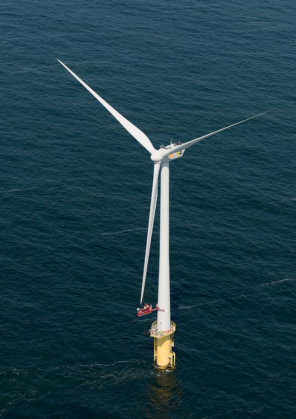
The planned Hollandse Kust (zuid) alpha platform is shown
in Figure 3h, while Table 3b shows its coordinates. Infield
cables from the wind farm will connect directly to this
station. Cable entry zones are designated as the area to place
infield cables connecting the wind farms at HKZWFS I and II
to the Hollandse Kust (zuid) alpha platform. These zones are
confirmed for HKZWFS I and II in the Wind Farm Site
Decisions. The Hollandse Kust (zuid) alpha platform will
transform the power of HKZWFS I and II from 66 kV
to 220 kV and transport the electricity to shore through two

18 | Netherlands Enterprise Agency                                                                                                         Project and Site Description Hollandse Kust (zuid) - Wind Farm Sites I & II | 19
4.                                    The Netherlands Enterprise Agency (RVO.nl) is responsible for publishing
                                      the site information companies require to prepare bids for the permit
                                      tenders for the HKZWFZ. The site information package should be of

Site Studies                          sufficient detail and quality to be used as input for preliminary engineering
                                      design studies.

                                      Results from previous tenders show that this approach will                               Figure 4a shows how the various studies and investigations
                                      provide the basis for an optimal tender result. In providing                             relate to each other as well to which element of the wind
                                      a more comprehensive data package, risk is significantly                                 farm design they feed into.
                                      reduced for the developer, as is the need for conservatism in
                                      the assumptions of the tender design, while the business case                            The findings of the archaeological, UXO and geological desk
                                      for the project and the overall planning can be optimised.                               study were used to define the scope of work and basis of the
                                      In this chapter, the scope of work and results of the individual                         geophysical site investigation. The results of this more
                                      studies and investigations are summarised, covering the                                  detailed geophysical site investigation refine and partly
                                      following:                                                                               supersede those of the three earlier desk studies and further
                                      • Obstructions: Archaeological desk study, Archaeological                                feeds into the main archaeological assessment (now
                                         assessment of geophysical survey results, UXO risk                                    completed), the geotechnical site investigation and the
                                         assessment desk study                                                                 morphodynamical study. Meanwhile, the wind resource
                                      • Soil: Geological desk study, Geophysical survey,                                       assessment takes into account the findings of the metocean
                                         Geotechnical survey, Morphodynamical desk study and a                                 measurement campaign. Please note that this version of the
                                         technical note on scour and scour mitigation                                          PSD for HKZWFS I and II includes a summary of the results
                                      • Wind and Water: Wind Resource Assessment, Metocean                                     of all final studies and site investigations.
                                         measurement campaign, Metocean desk study

                                      Figure 4a Site studies and investigations for the Hollandse Kust (zuid) Wind Farm Zone

                                                                    Obstructions                                        Soil                                     Wind & Water

                                                          Archaeology               UXO                 Geology                   Seabed             Wind resource              Metocean

                                                          Archaeological       UXO risk                Geological
                                                            desk study        assessment               desk study

                                                                                   Geophysical site investigation
                                                                                                                                                              Metocean campaign

                                     Research by RVO.nl
                                                          Archaeological                                                        Morphology           Wind resource              Metocean
                                                           assessment                               Geotechnical site             study               assessment                desk study
                                                                                                     investigation

                                                                                                                                                                                 Turbine,
                                                                              Installation
                                                          Turbine layout                                 Foundation and cable design                Yield assessment         foundation and
                                                                              procedures
                                                                                                                                                                               cable design

20 | Netherlands Enterprise Agency                                                                                        Project and Site Description Hollandse Kust (zuid) - Wind Farm Sites I & II | 21
In the remainder of this Chapter, we provide an overview                                                                              19 shipwrecks are known to be in the area, although details                                                                                  Figure 4c Historic chart of the Hollandse Kust (zuid) Wind Farm Zone and its surroundings
of the site studies and investigations. In sections                                                                                   like names, types and date of sinking are not known, nor
4.1 - 4.8 we discuss the studies and investigations regarding                                                                         are the exact locations. The desk study also concluded that
obstructions and soil conditions, while in sections                                                                                   locally, in situ remains of prehistoric sites may also be
4.9 - 4.11, the studies and investigations relating to wind                                                                           present. Meantime, Periplus Archeomare found two
and water conditions (metocean campaign, metocean desk                                                                                previous geophysical surveys of the area - one covering
study and Wind Resource Assessment) are discussed. Lastly,                                                                            5% of the area for the Luchterduinen Wind Farm and the
a detailed overview of the approach, the procurement of                                                                               other for Delta Hydrocarbons (2% of survey area). Just three
the studies and quality assurance follows in section 4.12                                                                             objects were classified as of possible archaeological value,
(site investigations quality and certification).                                                                                      all identified in the Luchterduinen survey. Over 90% of the
                                                                                                                                      surface of the HKZWFZ has not previously been investigated
                                                                                                                                      by detailed geophysical surveys.
4.1 Archaeological desk study
                                                                                                                                      Figure 4b The maritime archaeological desk study of the Hollandse Kust
4.1.1 Overview - aims, objectives and approach                         (zuid) Wind Farm Zone suggested that 19 known shipwrecks could be present
The purpose of this study was to provide insight into any              in the area. However none of these were detected in the geophysical survey
archaeological aspects that may have an impact on the
                                                                                                                                           5,810,000

development of the HKZWFZ using existing data and
                                                                                                                                                                                                                                         !
                                                                                                                                                                                                                                         (
information gathered from previous research in the area.                                                                                                                                                                                 !
                                                                                                                                                                                                                                         (

The main objectives of the study were to:                                                                                                                                                                        !
                                                                                                                                                                                                                 (
                                                                                                                                                                                                                                                     !
                                                                                                                                                                                                                                                     (
1. Assess whether archaeological remains (e.g. plane and
                                                                                                                                                                                                                             !
                                                                                                                                                                                                                             (       !
                                                                                                                                                                                                                                     (
                                                                                                                                                                                                     !
                                                                                                                                                                                                     (
                                                                                                                                                                                                !
                                                                                                                                                                                                (                                        !
                                                                                                                                                                                                                                         (
                                                                                                          WFS I
   ship wrecks or prehistoric life) are (or likely to be) present                                                                                                                                                    !
                                                                                                                                                                                                                     (
                                                                                                                                           5,800,000

   at the HKZWFZ;
                                                                                                5,810,000

                                                                                                                                                                                                                                 !
                                                                                                                                                                                                                                 (
                                                                                                                       WFS IV                                                      !
                                                                                                                                                                                   (
2. If present, present the known information (location, size                                                                                                      New object exposed at the seabed
                                                                                                                                                                                                                                                                            !
                                                                                                                                                                                                                                                                            (
                                                                                                                                                                  As Found by Side scan sonar
                                                                                                                                                                               !
                                                                                                                                                                               (       !
                                                                                                                                                                                       (                     !
                                                                                                                                                                                                             (           !
                                                                                                                                                                                                                         (

   and dating) of these remains;                                                                                                                                                       !
                                                                                                                                                                                       (

                                                                                                                                                                  Known object exposed at the seabed
                                                                                                                                                                                                         !
                                                                                                                                                                                                         (
                                                                                                                                                                                                                                             !
                                                                                                                                                                                                                                             (                              !
3. Assess possible risks of offshore wind farm installation on                                                                                                                                                                                                                     The findings of this desk study have served as a starting                    		 •	Determining the different sites in the wind farm
                                                                                                                                                                                                                                                                            (
                                                                                              WFS II                                                              As Found by Side scan sonar
                                                                                                                                                           !
                                                                                                                                                           (                                                                                 ( !
                                                                                                                                                                                                                                             ! (
                                                                                                                                                                  Known object covered by sand
                                                                                                                                                                       !
                                                                                                                                                                       (
                                                                                                                                                                                               !
                                                                                                                                                                                               (         !
                                                                                                                                                                                                         (

   these remains;                                                                                                                                                                                                                                                                  point for subsequent investigation, most notably the                               zone;
                                                                                                                                       !
                                                                                                                                       (                                       !
                                                                                                                                                                               (                                                                                            !
                                                                                                                                                                                                                                                                            (
                                                                                                                                  !
                                                                                                                                  (
                                                                                                                                                                  As Found by Magnetometer
                                                                                                                                                                                       !
                                                                                                                                                                                       (
                                                                                                                                           5,790,000

                                                                             WFS I
                                                                                                                                                                  Known object covered with sediments
4. Assess options to mitigate disturbance on these remains;                                                                                                                                                                                                                        geophysical site investigation (section 4.4) and, following                  		 •	Carrying out safe geophysical and geotechnical
                   5,810,000

                                                                                                                                                                                                                                                                            !
                                                                                                                                                                                                                                                                            (
                                                                                                                                                               !
                                                                                                                                                               (
                                                                                                                                                                  NCN Database location
                                                                                                5,800,000

                                                                                                                                                                           ( !
                                                                                                                                                                           ! (                           !
                                                                                                                                                                                                         (

5. Determine whether further archaeological assessments                                     !
                                                                                            (
                                                                                                                                                                  Wind Farm Site I Boundary
                                                                                                                                                                           !
                                                                                                                                                                           (
                                                                                                                                                                                       !
                                                                                                                                                                                       (                                                                                           that, an archaeological assessment of the geophysical site                         investigations;
                                                                                         WFS IV WFS III
                                                                                            !
                                                                                            (                        !
                                                                                                                     (
                                                                                                                                                                  Wind Farm Site II Boundary                         !
                                                                                                                                                                                                                     (
   should be carried out and make a recommendation on                                                                                 New object exposed at the seabed                                                                                                             investigation (section 4.5). The results of this desk study                  		 • Safe installation of wind turbine foundations;
                                                                                                                                      As Found by Side scan sonar Wind Farm Site III Boundary
                                                                                                                 !
                                                                                                                 (                                     !           !
                                                                                                                                                                   (                                                                             !
                                                                                                                                                                                                                                                 (
                                                                                                                                                       (
   the scope of future investigations;                              !
                                                                    (
                                                                                !
                                                                                (       !
                                                                                        (
                                                                                                            !
                                                                                                            (
                                                                                                                                           !
                                                                                                                                           (
                                                                                                                                                                                        !
                                                                                                                                                                                        (

                                                                                                                                                                  Wind Farm Site IV Boundary
                                                                                                                                      Known object exposed at the seabed                   !
                                                                                                                                                                                           (
                                                                                                                                                                                                                                                                                   are now to large extent superseded by the findings of these                  		 • Safe installation of cables.
                                                        !
                                                        (                                                                                                                                      !
                                                                                                                                                                                               (

6. Specify obligations and requirements     for any activity                                                                                                                                                                                                                       reports.
                                                                                                                                                                                                                                                 !
                                                                                                                                                                                                                                                 (
                                                                  WFS II
                                                                                            !
                                                                                            (                                         As Found by Side scan sonar
                                     WFS I
                                                    !
                                                    (
                                                                                                                                                                  Wind Farm Luchterduinen      ( !
                                                                                                                                                                                               ! (
                                                                                                                                 !
                                                                                                                                 (    Known object covered by sand
   carried out in the wind farm zone (including site                    !
                                                                        (
                                                                                                                                      As Found by Magnetometer Designated Wind Farm Zone
                                                                                                                                                                                                                                                 !
                                                                                                                                                                                                                                                 (
                                                                                                                                                                                                                                                                                                                                                                The UXO desk study was performed in Q4 of 2015. In Q1
                   5,800,000

                                                                                                5,790,000

                                                                                                     570,000                    580,000
                                                                                                                                      Known object covered with sediments
   investigations or monitoring activities, installation                                              metres ETRS89 / UTM zone 31N                                                                                                               !                                                                                                              of 2017 the study was extended with an additional report
                                                                                                                                                                                                                                                                                   4.2 Unexploded ordnance
                                                                                                                                                                                                                                                 (
                                    !
                                    (           WFS IV
                                                                                    !
                                                                                    (
                                                                                                                ( !
                                                                                                                ! (
                                                                                                                                      NCN Database location
                                                                                                                                              !
                                                                                                                                              (

   activities and operational activities) that may affect the
                                !
                                (                               !
                                                                (           !
                                                                            (
                                                                                   New object exposed  at the
                                                                                   As Found by Side scan sonar
                                                                                                              seabed     !
                                                                                                                         (            Wind Farm Site I Boundary
                                                                                                                                                       !
                                                                                                                                                       (                                                                                                                                                                                                        containing newly available information from historical
                                                                     WFS III                                                          Wind Farm Site II Boundary
   archaeological aspects.                                                                                                                                                                                                                                                                                                                                      archives of the Bundesarchiv-Militärarchiv in Germany and
                                                                                                                                                               !
                                                                                                                                                               (
                                                            !
                                                            (
                                                                                   Known object exposed at the seabed

                                                                                                                                                                                                                                                                                        (UXO) risk assessment
                                                                                                   !
                                                                                                   (                                                   !
                                                                                                                                                       (
                                                                                                                                                               As Found by Side scan sonar                                                           Wind Farm Site III Boundary
                                            WFS II
                                                !
                                                (
                                                                                                  ( !
                                                                                                  ! (
                                                                                                                             !
                                                                                                                             (

                                                                                                                             !
                                                                                                                             (                                 Known object covered by sand                                                          Wind Farm Site IV Boundary
                                                                                                                                                                                                                                                                                                                                                                The National Archives in the United Kingdom. The new
                                                                                                                                                       !
                                                                                                                                                       (
                                                                                                                                                               As Found by Magnetometer
4.1.2 Supplier                                                                                                                                                                                                                                                                                                                                                  information provides more details regarding the type
                                                                                                                                                                                                                                                                                        desk study
                                                                                                                                                                                                                                                     Wind Farm Luchterduinen
                   5,790,000

                                                                                                                                                               Known object covered with sediments
Periplus Archeomare was assigned by RVO.nl to conduct
                               ( !
                               ! (                          !
                                                            (
                                                                                                                                                       !
                                                                                                                                                       (
                                                                                                                                                               NCN Database location                                                                 Designated Wind Farm Zone                                                                                  of ordnances (mines) to be expected in the area and
                                                                                                                                       570,000    Wind Farm Site 580,000
                                                                                                                                                                   I Boundary
a maritime archaeological assessment
                                WFS III
                                        !
                                        (
                                           of the HKZWFZ.                                                                               metres ETRS89 / UTM zone 31N                                                                                                                                                                                            recommendations for UXO detection operations that follow
                                                                        !
                                                                        (                                                                                      Wind Farm Site II Boundary
This company has a track record in maritime archaeological                                                                            4.1.4 Conclusions        and recommendations
                                                                                                                                                Wind Farm Site III Boundary
                                                                                                                                                                                                                                                                                   4.2.1 Overview - aims, objectives and approach                               from this new information.
                                        !
                                        (
preparatory research, most notably the archaeological desk
                                            !
                                            (                                                                                         Within the   investigated
                                                                                                                                                Wind                  area of the wind farm zone there is
                                                                                                                                                     Farm Site IV Boundary                                                                                                         The UXO desk study provided the initial insight into the risk
study and assessment of geophysical data for the                                                                                      a high probability     for the presence of (remains of ) ship and
                                                                                                                                                Wind Farm Luchterduinen                                                                                                            of encountering unexploded ordnances (UXOs). The main                        4.2.2 Supplier
                                                                                                                                                Designated Wind Farm Zone
Luchterduinen Wind Farm and a570,000
                                   desk study for a fibre   580,000
                                                                   optic                                                              plane wrecks,    mostly resulting from WWII.                                                                                                 objectives of this study were to:                                            REASeuro performed the UXO desk study including the
subsea cable to be installed later, metres
                                     bothETRS89
                                           of which      are located
                                                / UTM zone 31N
                                                                                                                                      During the geophysical survey no wrecks have been detected                                                                                   1.		Identify risks and/or constraints for offshore wind farm                additional report. The company is specialised in (offshore)
within HKZWFZ. Moreover, Periplus Archeomare conducted                                                                                in HKZWFS I and II, see 4.4.3b. No early prehistoric sites have                                                                                   related activities in the HKZWFZ as a result of the                     UXO desk studies, risk assessments and UXO clearance
similar desk studies for the site of Borssele, Tromp-Binnen                                                                           been identified but these might be present. Periplus                                                                                              presence of UXOs;                                                       operations. Since 2012, REASeuro has been involved with
and Q4 (permit does not exist anymore).                                                                                               Archeomare recommended that further exploratory field                                                                                        2.		Identify areas within the HKZWFZ where wind farm                        several offshore projects in the North Sea and Persian Gulf,
                                                                                                                                      investigation should be conducted in order to:                                                                                                    construction or cable installation should be avoided;                   performing data analysis, project risk assessment and
4.1.3 Results                                                                                                                         •	Map the locations of known and unknown wreck sites in                                                                                     3.		Identify requirements from a UXO perspective that                       coordination of UXO clearance activities. Moreover, the
The results of this desk study indicated that, within the                                                                                detail to be able to assess their archaeological value; and                                                                                    should be taken into account for:                                       company has performed the UXO desk study for the Borssele
HKZWFZ as a whole, the presence of ship and plane wrecks                                                                              •	Create an inventory of the parts of the HKZWFZ which have                                                                                                                                                              Wind Farm Zone, the previous tender location of the Dutch
(mostly resulting from WWII) is likely. For example,                                                                                     not been investigated in previous surveys.                                                                                                                                                                             offshore wind rollout.

22 | Netherlands Enterprise Agency                                                                                                                                                                                                                                                                                                                           Project and Site Description Hollandse Kust (zuid) - Wind Farm Sites I & II | 23
4.2.3 Results                                                       A UXO can be sensitive to hard jolts, change in water               4.2.4 Conclusion and recommendations                               HKZWFS I and II. Furthermore the geophysical results were
The HKZWFZ and surrounding areas were the scene of many             pressure and accelerations with an amplitude >1m/s2.                UXOs from both world wars are likely to be present at the          used for the planning of the geotechnical campaign, which
war-related activities during World War I and World War II.         Detonation can lead to serious damage to equipment and              site, which is therefore considered a UXO risk area. Due to        was integrated with the geophysical data to create a ground
Additional historical research has shown that intense min-          injuries to crew members. The possible presence of UXOs             the types and sizes of UXO likely to be present there is no        model. The ground model will serve as the base for the
ing operations took place in and near the HKZWFZ in World           in the area, however, is no constraint for offshore wind farm       'silver bullet solution' for the UXO geophysical survey.           design and installation of support structures and cables.
War I and in World War II, but the mines were only partially        related activities. With proper UXO risk management                 Especially the possible presence of non-ferrous ground
recovered after the war. In addition, the HKZWFZ is located         strategies, risks can be reduced to a level that is as low as       mines (LMB) might necessitate a combination of geophysi-           Specifically, the aim of the geophysical survey is to:
slightly north of the main flight path of allied bomber raids       reasonably practicable (ALARP).                                     cal survey methodologies to mitigate UXO related risks to a        1.	Obtain an accurate bathymetric chart of the development
- many bombs were dropped and a large number of aircraft                                                                                level that is considered ALARP. The provisional thresholds in          areas HKZWFS I and II;
have crashed in the North Sea. As a result many bombs,              A main challenge in UXO risk management at HKZWFZ is the            the geophysical survey needed to mitigate the risk to a level      2.	Identify or confirm the position of wrecks, pipelines,
wrecks and crashed aircraft are likely to be found in the           dynamic character of the seabed (see section 4.7, morpho-           that is considered ALARP are set.                                      possible electrical cables, and natural objects;
HKZWFZ. a few types of mines that may be present in the             dynamical desk study). This may cause UXOs that were                                                                                   3.	Produce isopach charts showing the thickness of the
HKZWFZ, according to the consulted historical sources, are          buried during preliminary scanning to resurface and                 Due to the highly dynamic soil morphology and possible                 main geological formations including any mobile
German moored mines, German LMB ground mines,                       become subject to migration. Also sand dune migration               associated migration and burial of UXOs, it is recommended             sediments and any other significant reflector levels which
British Mark XIX contact mines and British Mark XVII                may have led to burial of UXOs. Furthermore, migration of           companies conduct UXO search (and removal) operations                  might impact on the engineering design;
moored mines.                                                       UXOs may occur as a result of waves and currents or fishing         immediately prior to construction activities at the intended       4. Locate and identify any structural complexities or geo-
                                                                    activities. The possibility of UXO migration and burial needs       construction locations. The limited temporal validity of the           hazards within the shallow geological succession such as
It must be taken into account that this overview is based on        to be considered in all development phases and closely              collected survey data should be taken into account when                faulting, accumulations of shallow gas, buried cables, etc;
the minefields actually present in (the vicinity of ) the area of   integrated into the UXO risk management strategy.                   planning survey and construction operations. Due to the            5. 	Provide detailed geological interpretation showing facies
investigation. Since the war, some ordnances are likely to          The report provides a number of recommendations to                  time-limited nature of findings and the required survey                variations and structural feature changes via appropriate
                                                                    manage UXO risks in each development phase:                         demands (dense grid spacing), a dense magnetometer                     maps and sections;
Figure 4d An overview of all known wreck locations and cleared
                                                                    1.	Preparation phase                                               survey to detect UXOs was not part of the geophysical survey       6. List the exact position of existing (active & inactive) cables
ammunition in the vicinity of HKZWFZ
                                                                        a.	A geophysical survey should be conducted to assess          performed by RVO.nl. However, the survey does include a                and pipelines;
                                                                            geomorphology and identify objects, consisting of           magnetometer survey on a grid spacing of 100 m.                    7. 	Provide proposed positions for a geotechnical sampling
                                                                            at least a high-resolution multibeam and side scan                                                                                 and testing programme following the completion of the
                                                                            sonar. This has now been completed, with the results        4.2.5 UXO removal procedure                                            geophysical survey;
                                                                            now superseding those of this UXO desk study - see          If a wind farm developer identifies a UXO at a location            8. Prepare a comprehensive interpretative report on the
                                                                            section 4.4.                                                where activities are planned, it needs to be removed. This             survey results in order to assist design of the offshore
                                                                        b.	In case of any soil intrusive operations (e.g. anchoring,   should be reported to the Dutch Coastguard. The Royal                  foundations/structures and cable burial and assist in the
                                                                            CPTs or boreholes), a UXO search of the area of planned     Netherlands Navy will dispose of the UXO. No disposal costs            preparation of the geotechnical investigation (discussed
                                                                            activity should be conducted and any discovered UXOs        will be charged to the wind farm developer.                            in section 4.6).
                                                                            should be cleared or avoided. The clearance operation
                                                                            should be conducted by a certified UXO clearance                                                                               The survey itself was carried out from 7 March to
                                                                            company (see 4.2.5).                                        4.3 Geological desk study                                          18 April 2016, using the survey vessels MV Fugro Pioneer
                                                                    2. Execution Phase                                                                                                                     and MV Victor Hensen with Scheveningen used as the main
                                                                        a. 	A UXO-related risk assessment should be prepared           This study was the starting point for several other studies.       reference port. The equipment used in this campaign was
                                                                           based on the first draft of the wind farm design and         However, more in-depth geophysical and geotechnical site           state-of-the-art and included sidescan sonar (SSS), single
                                                                           optimisation of the design may be performed based on         investigations have since been conducted hence the desk            beam echo sounder (SBES), multibeam echo sounder
                                                                           the outcomes.                                                study is not described further in this PSD.                        (MBES), pinger (SBP), ultra high resolution (UHR)
                                                                        b.	A UXO risk mitigation strategy should be prepared,                                                                             multichannel and single channel seismic (SCS)
                                                                            which includes a search for and safe removal of UXOs                                                                           and magnetometer (MAG). The approach towards the
                                                                            within the areas of planned activity. Because the           4.4 Geophysical survey                                             geophysical survey for the HKZWFZ was therefore similar
                                                                            validity of the collected data is time-limited, it is                                                                          to the one adopted for the Borssele Wind Farm Zone.
have moved as a result of fishing, wave and current loads and               recommended that the period between the survey and          4.4.1 Overview - aims, objectives and approach                     An important distinction, however, is the application of
seabed dynamics. The entire wind farm zone is considered                    installation work is minimised.                             Following up on the findings of the geological desk study          UHR MCS with a mix of two seismic sources: this improves
a UXO risk area. This conclusion is supported by the fact           3. Operational phase                                                and the archaeological desk studies (discussed earlier in this     the resolution in the shallow subsurface.
that since 2005 fishermen have found eight UXOs within                  a. 	After completion of construction activities, it is still   chapter), the objective of the geophysical survey is to
the HKZWFZ. However the types of mines mentioned in the                    important for developers to remain vigilant and              provide more detailed, accurate soil information for               4.4.2 Supplier
additional research are considered the most plausible types                remember that UXOs can migrate as a result of loads          developers planning to submit tenders for HKZWFS I and II.         Fugro Survey B.V. was contracted by RVO.nl to conduct the
of mines to be present. An overview of all known wreck loca-               from tidal currents and waves, mobility of sand waves                                                                           geophysical survey for HKZWFZ. Fugro is an integrator of
tions and cleared ammunition in the vicinity of HKZWFZ can                 and seabed usage.                                            The geophysical survey is designed to improve the bathyme-         geotechnical, survey, subsea and geosciences services.
be found in figure 4d. Note that locations of crashed aircraft          b. Produce a UXO maintenance and monitoring plan.               trical, morphological and geological understanding of
are only indicative.

24 | Netherlands Enterprise Agency                                                                                                                                                                       Project and Site Description Hollandse Kust (zuid) - Wind Farm Sites I & II | 25
Figure 4e Geological Cross Section of the HKZWFZ                                                                                   database provided. Four active telecom cables were also                campaign to produce a ground model for the wind farm site.
                                                                                                                                   confirmed in or adjacent to the HKZWFS I area, along with              The presence of gravel layers and their thickness were
                                                                                                                                   one active and two inactive telecom cables in the HKZWFS II            confirmed by the geotechnical campaign. Meanwhile, an
                                                                                                                                   area. Again these had been listed in the database provided.            archaeological assessment of the geophysical data reported
                                                                                                                                                                                                          in the geophysical survey has been performed (section 4.5).
                                                                                                                                   The survey reports for both sites note the reason why the
                                                                                                                                   known wrecks were not detected may be due to the strong
                                                                                                                                   currents and sediment movements (i.e. sand dune migration)             4.5 Archaeological
                                                                                                                                   in the area that can bury or relocate possible objects on the
                                                                                                                                   seabed. Moreover, wreck locations are seldom reliable as                    assessment of geo-
                                                                                                                                   often their final positions are ‘last known’ or ‘mayday’
                                                                                                                                   positions instead of the actual sinking location. These                     physical survey results
                                                                                                                                   positions are also often derived from less accurate
                                                                                                                                   positioning systems.                                                   4.5.1 Overview - aims, objectives and approach
                                                                                                                                                                                                          Periplus Archeomare was asked to conduct an archaeological
                                                                                                                                   The geophysical survey identified several seabed and                   assessment of the geophysical survey results to further
                                                                                                                                   sub-seabed geohazards at both sites. For example, at both              investigate the presence of archaeological remains in
                                                                                                                                   sites, high seabed gradients up to 20° are found on the lee            the HKZWFZ.
                                                                                                                                   side of the very large dunes. Meantime, in HKZWFS I survey
                                                                                                                                   area 132 SSS contacts and 546 magnetometer contacts were               The goals set for this assessment were:
                                                                                                                                   detected. Similarly, in the HKZWFS II area 101 SSS contacts            1.		To determine the historical or archaeological value of
                                                                                                                                   and 403 magnetometer contacts were found. The SSS                           contacts found in the geophysical survey;
                                                                                                                                   contacts were observed scattered across the survey areas and           2.		 To validate the locations of known wrecks; and
                                                                                                                                   were interpreted as debris items except for eleven (11) high           3.		 Assess the prehistoric landscape based on the seismic data.
                                                                                                                                   backscatter patches that might have originated from local
Services are designed to support engineering design               The shallow sub-surface geological conditions within the         reworking of sediments.                                                4.5.2 Supplier
and large structure building projects. The company has            survey areas for HKZWFS I and II were interpreted based on                                                                              Periplus Archeomare was contracted by Fugro Survey B.V.,
previously performed investigations for offshore wind             single channel and multichannel UHR sparker data and             Meantime, in terms of the magnetometer contacts, at                    on behalf of RVO.nl, to conduct an archaeological assess-
farm projects in The Netherlands, Belgium, United                 information from BGS standard geological maps. The limit         HKZWFS I the magnetic anomalies ranged from 2 nT to                    ment of the geophysical survey.
Kingdom, Denmark and Germany. The company is familiar             of interpretation of the UHR data to achieve satisfactory        1845 nT, whilst at HKZWFS II they ranged from 3 nT to 2761 nT.
with the local conditions and technical requirements for a        results was set at a depth of 100 m below seabed. Four           Most of the strongest anomalies are associated with the                4.5.3 Results
geophysical survey of the HKZWFZ. DNV GL was contracted           lithological units were identified in each area with generally   buried cables or pipelines, the survey report says. It adds that       Periplus Archeomare’s analysis of the geophysical survey
to review the study results and provide a Verification Report.    similar results identified across the two sites: sediments       unknown, high amplitude magnetic anomalies were                        concluded that at HKZWFS I there are possibly two unknown
                                                                  found within the two top units/layers at both HKZWFS I and       observed across both sites.                                            objects (detected by SSS) and one known object beneath the
4.4.3 Results                                                     II mostly consist of medium to coarse sand with shells and                                                                              seabed surface (found with MAG). Meanwhile, seven known
                                                                  shell fragments, silt, clay and gravel. These were all also      At sub seabed level, when assessing Palaeochannel infills,             objects expected to be in the area of HKZWFS I and four
4.4.3a Bathymetry and seabed features                             found in the lower two units although generally they tend to     numerous buried channels were also detected in seismic Unit            known objects expected in the HKZWFS II area were not
The bathymetry data from the geophysical survey shows             be of a finer consistency (material) here. Thin layers of peat   B (Kreftenheye Fm - Upper Pleistocene) at both wind farm               found. Periplus Archeomare suggests these could simply
water depth ranging from 18.1 m to 27.9 m bLAT across             were also detected in these lower level units at both sites.     sites. In this regard, the survey notes that fluvio-glacial /delta     be covered with sediments however.
HKZWFS I and 18.8 m to 26.6 m bLAT across HKZWFS II,                                                                               front channel infills are expected to be highly heterogeneous
whilst the seabed for both sites is characterised by very large   4.4.3b Wrecks, cables and pipelines                              and can pose an engineering hazard due to lateral changes in           The company’s report suggests a buffer zone of 100 m
sand dunes. These dunes were observed throughout both             In order to confirm and/or identify the presence of wrecks,      mechanical resistance. Coarser sediments or gravel layers              should be applied around the few objects found which have
areas with NW to SE trending crests with wavelengths              cables and pipelines at HKZWFS I and II, Fugro was provided      were also identified within seismic Unit C (Brown Bank                 yet to be determined to have no archaeological value. This
ranging from 250 - 1050 m for HKZWFS I and 300 - 900 m            with a database listing those believed to be in the vicinity.    Member/ Eem Fm - Upper Pleistocene) in the HKZWFS I                    also applies to cable trenching and anchorages of work
for HKZWFS II, and height ranging from 2 - 6 m for                Fugro was also provided with the desk studies previously         survey area, showing high amplitude reflections. In Unit C of          vessels. The buffer zone may be reduced if it can be
HKZWFS I and 2 - 5 m for HKZWFS II. At both sites, medium         mentioned in this chapter. Key results of its geophysical        the HKZWFS II, meanwhile, some localised, high amplitude,              substantiated that the applied activity and disturbance has
sized dunes are superimposed on the very large dunes and          survey were:                                                     reversed polarity reflectors were observed, possibly related to        no effect on the archaeological object. For example, when
have the same crest orientations. They have 4 - 20 m              • No wrecks detected at either site                              the presence of shallow gas and/or peat layers.                        no anchoring is used during cable lay operations the buffer
wavelengths and are typically 0.2 - 0.4 m in height.              • No pipelines at HKZWFS I                                                                                                              zone can be decreased. Reduction of the distance may be
The very large sand dunes are expected to migrate at a rate                                                                        As mentioned earlier in this section, the geophysical results          obtained after consultation with Rijkswaterstaat on behalf
of 2 - 4 m/year in a north-easterly direction.                    One pipeline lies adjacent to HKZWFS II, the survey confir-      are used for planning a geotechnical campaign (see section             of the Ministry of EZ and their advisor the Cultural Heritage
                                                                  med. This is the ENGIE Q13a-A to P15-C 8 inch oil pipeline,      4.6). The geological interpretation from the geophysical               Agency.
                                                                  identified by magnetometer data in the location cited in the     survey was integrated with the results of the geotechnical

26 | Netherlands Enterprise Agency                                                                                                                                                                      Project and Site Description Hollandse Kust (zuid) - Wind Farm Sites I & II | 27
You can also read