HURRICANE & SEVERE HOUSTON/GALVESTON National Weather Service - WEATHER GUIDE
←
→
Page content transcription
If your browser does not render page correctly, please read the page content below
HOUSTON/GALVESTON
  National Weather Service
HURRICANE & SEVERE
  WEATHER GUIDE

                         Hurricane Harvey, NOAA
INTRODUCTION ABOUT THE HURRICANE
Index of Pages
A hurricane is the strongest type of tropical
cyclone, a weather system that derives its energy
The 2017 hurricane season was extremely active with
several major hurricane landfalls including Harvey, Irma from warm ocean waters and is characterized
About the Hurricane by a closed counterclockwise circulation in the
Page 3 and Maria. Hurricane Harvey made landfall as a category
4 on the Saffir Simpson Hurricane Wind Scale, the first cat Northern Hemisphere. It typically has a cluster of
Storm Surge thunderstorms around the center of circulation
Page 4 4 Texas landfall since Hurricane Carla in 1961. Harvey then
stalled and looped back tracking slowly toward and off and bands of thunderstorms spiraling outward. The
Flooding from Heavy Rain tropical cyclone is called a tropical depression,
Page 5 the Southeast Texas coast, making a second landfall along
Zip Zone Evacuation the Louisiana coast. Slow moving tropical cyclones are tropical storm or hurricane depending on the
Pages 6 - 7 notorious for producing tremendous amounts of rainfall strength of the maximum winds in the storm. The
Damaging Winds and often measured in feet not inches. In June 2001 Tropical hurricane often has an eye, a rain free area in
Tornadoes Storm Allison produced around 3 feet of rain over portions the center of the storm where the winds are very
Pages 8 of Harris County. In 1979 slow moving Tropical Storm light. Every storm is different and contains some
Contacts and Disaster Claudette produced 45 inches in Alvin, TX, 43 of which fell combination of the following hazards: damaging
Supply Kit in a day, a CONUS record for 24-hr rainfall that still stands winds, storm surge flooding, tornadoes and
Page 9
today. Harvey broke records both in terms of the amount flooding from heavy rainfall. The greatest chance
Planning and Preparing of rain and the large area impacted with much of SE Texas
Pages 10 - 11 of a hurricane landfall for Texas is during August
receiving greater than 3 feet of rain, many counties greater and September although hurricanes have struck
For Those Who Need than 4 feet and the record-setting maximum rainfall of Hurricanes Matthew and Nicole, 2016 Photo credit: NASA
Assistance the Upper Texas coast during every month from
Page 12 60.58 inches measured near Nederland, TX over the 4-day June to October.
period. Hurricane Harvey was was characterized by all the
Definitions
Preparing Pets and Livestock
Page 13 hazards associated with tropical cyclones with destructive
Insurance Tips
winds and storm surge across the Texas Coastal Bend closer
Page 14 to the track of the center, and with rainbands on the right
side of the storm bringing periods of very heavy rain and
Final Checklist
Pages 15
Hurricane Tracking Chart
numerous tornadoes to Southeast Texas. Not surprisingly
with that amount of rain much of Southeast Texas
experienced catastrophic flooding. Of course a tropical
L TROPICAL DEPRESSION: HURRICANE WATCH/WARNING:
A tropical cyclone with maximum sustained Hurricane force winds are possible/
winds of 38 mph or less. expected within the watch/warning area
Page 16 - 17
cyclone is not necessary to produce these hazards. Slow within 48/36 hours.
Hurricane Forecasts/Links moving thunderstorms with very high rain rates have led TROPICAL STORM:
A tropical cyclone with maximum sustained STORM SURGE WATCH:
Page 18
to deadly flash flooding in the greater Houston Metro area
Hurricane Harvey/Ike Comparison on numerous occasions. Thunderstorms can also produce winds between 39 and 73 mph. The possibility of life-threatening inundation
Page 19 - 20
hail, damaging winds, tornadoes and of course lightning. from rising water moving inland from the
After the Storm HURRICANE: shoreline (storm surge flooding) somewhere
Page 21 - 22
This guide will cover how to prepare for these different An intense tropical cyclone with sustained within the specified area, generally within
Flood Safety weather hazards and how to stay safe. There are numerous winds of 74 mph or higher. 48 hours.
Page 23
checklists on what to do before, during and after the storm. STORM SURGE WARNING:
Tornado Safety The guide contains contact information for your local TROPICAL STORM WATCH/WARNING:
Tropical Storm force winds are possible/ The danger of life-threatening inundation
Pages 24 emergency manager and numerous resources/links where from rising water moving inland from the
Other Thunderstorm Hazards to find more information. We hope you find this guide expected in the watch/warning area
generally within 48/36 hours. shoreline (storm surge flooding) somewhere
Page 25 useful and will share the information with your family, friends within the specified area, generally within
Weather Alerts to Cell Phone and coworkers. An electronic version of this guide will be 36 hours.
Page 26 found on the National Weather Service Houston/Galveston
Forecast Office web site weather.gov/houston and also at
2017 Hurricane Season
Pages 27 the Extreme Weather Expo page extremeweatherexpo.
com. You are welcome to place the link to the guide on
Saffir Simpson
EMC Contacts, Phone numbers
Page 28 - 30
your web site and/or share it out through email or social Hurricane Wind Scale www.nhc.noaa.gov/prepare/wwa.php
media. Category 1- Winds 74 to 95 mph www.nhc.noaa.gov/experimental/surgewarning
Additional Contacts and
Links Category 2 - Winds 96 to 110 mph www.nhc.noaa.gov/aboutsshws.php
Page 31 Daniel Reilly Category 3 - Winds 111 to 129 mph
Warning Coordination Meteorologist Category 4 - Winds 130 to 156 mph
National Weather Service Houston/Galveston Category 5 - Winds 157 mph or higher
2 3
Storm Surge Flooding                                                                                 Flooding from Heavy Rain
Storm surge is the abnormal rise of water generated by a storm, over and above the predicted astronomical
tides. The storm tide is the height of water relative to a reference level or datum that includes storm       Flooding from Heavy Rain
surge and astronomical tide. The combination of storm surge flooding and battering waves can be very          There are numerous examples of significant flooding caused by slow moving hurricanes and tropical
                                                                                                              storms in Texas. Harvey in 2017 and Allison in 2001 are two recent examples. Extreme rainfall totals and
destructive as seen with Hurricanes Ike (2008), Carla (1961), the 1900 Galveston Hurricane and many others.
                                                                                                              rain rates in some cases over 4,5 or even 6 inches per hour produced devastating flooding in these
                                                                                                              cases. The figure below shows the amount of rainfall from Harvey and the looping track of the center.
                                                                                                              While the rainfall and associated flooding with Allison was extreme, the maximum rainfall and area
                                                                                                              covered was much greater with Harvey leading to even more catastrophic and widespread flooding.

When a hurricane or strong tropical storm approaches the National Weather Service (NWS) will produce
two maps to convey the storm surge flood threat. The first is the storm surge watch and warning
map showing areas at risk for life threatening surge (see page 3 for watch/warning definitions). The
other type of map, referred to shows the reasonable worst case scenario for depth of water above
ground due to storm surge flooding for a given storm. The following are examples from Harvey in 2017.

                                                                                                              Tips to Prepare for Flooding
                                                                                                              ● Protect Your Personal Documents and Special Items
                                                                                                                  ● Store in plastic tubs with lockable tops on high shelves or in the attic
                                                                                                                  ● Consider storing critical documents in a safe deposit box if in a flood prone area
                                                                                                              ●   Buy flood insurance even if not in the 100 year flood plain! Your homeowners policy will not
                                                                                                                  cover your flood loss. A separate policy is needed through the National Flood Insurance Program
                                                                                                                  (NFIP). For more information go to www.floodsmart.gov
                                                                                                              ●   Know your risk. Is your home, business or school in a flood plain? Where is water likely to collect on
                                                                                                                  the roadways you most often travel? What is the fastest way to get to higher ground?
                                                                                                              ●   Most of the time it is safer to stay put than get on the roads. Is that true where you live?
                                                                                                                  Knowing the answers to these questions ahead of time can save your life. Flood plain
                                                                                                                  maps can be accessed here: https://msc.fema.gov/portal

                                                                                                              ●   Never attempt to drive on flooded roads. If you encounter flood waters when driving,
                                                                                                                  Turn Around, Don’t Drown! Most flash flood fatalities occur in vehicles.
                                                                                                                  http://www.nws.noaa.gov/os/water/tadd
             For more information on these storm surge related maps refer to the following links:
                          https://www.nhc.noaa.gov/experimental/surgewarning
                                                                                                                                     Additional flood safety information can be found on page 23
                                https://www.nhc.noaa.gov/surge/inundation
4                                                                                                                                                                                                                          5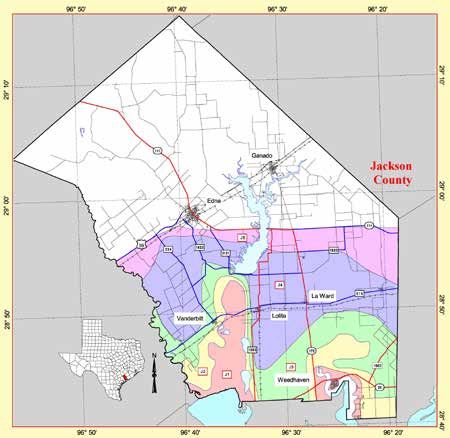
Zip Zone Evacuation

                                                                                                                 Different colors/zones roughly correspond to surge flooding for different
                                                                                                                 hurricane categories (J1 corresponds to cat 1, etc). However because
                                                                                                                    surge depends on more than category, this is not always the case.

    ZipZone evacuation zones roughly correspond to the following hurricane categories. However because surge
    depends on more than category, this is not always the case. Hurricane Ike was a category 2 but had a surge
             more like a typical 3 or a 4: Coastal-cat 1; Zone A-cat 1 or 2; Zone B-cat 3; Zone C-cat 4,5.
6                                                                                                                                                                                            7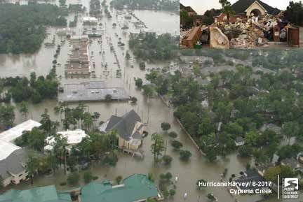
Damaging Winds and Tornadoes Contacts and Disaster Supply Kit
Hurricane force winds of 74 mph or more
can destroy buildings, mobile homes, trees
and power poles. Debris such as signs,
T he Greater Houston Area Chapter of the American Red
Cross recommends that you have the following items in your
roofing material, siding, and small items left Hurricane Supply Kit. Do not forget to have a family meeting
outside become flying missiles in a hurricane. before hurricane season and review your communication
The strongest winds occur in a region of the information and evacuation plan. Make sure the contact
hurricane called the eyewall. Wind gusts information such as home, work, school, cell phone numbers,
in the right side of the eyewall are the most and your “Out of Town” contact person’s information is current.
destructive. Hurricane force wind gusts
can be felt well inland, far from the coast, Emergency Contact Information
especially for stronger fast moving hurricanes.
Out of Town Contact Address:
It is imperative to ensure your home or Out of Town Contact Phone Number:
business is well constructed to minimize the Work Telephone Number:
damage from the wind. See the Planning and
Cell Number/Spouse Cell Number:
Above: Wind damgage to home from Preparing section in this guide for cost effective
Hurricane Alicia in August 1983. home improvement tips that can help you Children Cell Number:
reduce your damage from a hurricane. School Telephone Number:
!
Doctor Telephone Number:
MOBILE HOME RESIDENTS MUST EVACUATE! Bank/Credit Card Telephone Number:
Insurance Company Information:
● No mobile home or manufactured
home - no matter how new it is - can
●
provide safe shelter from hurricane
force winds.
Straps or other tie-downs will not ●
! HURRICANE SUPPLY KIT
At least a 7-day supply of non-perishable ● Photocopies of identification, insurance,
!
food and a manual can opener prescriptions, household inventory, credit
protect a mobile home from the high
cards, and your latest utility bill
winds associated with a hurricane. ● At least a 7-day supply of water. One gallon
per person per day is recommended ● CD or photocopies of important documents
such as birth/marriage certificates and titles
● Mobile home residents must evacuate ● Battery powered portable television or radio
● Prescription medications, eyeglasses,
when told to do so by local authorities. with extra batteries
contact lens solution, and hearing aid
● Flashlight with extra batteries
Tornadoes ● First Aid kit and manual ●
batteries
Formula, baby food, diapers, and pacifiers
T ropical cyclones can also produce tornadoes which most often ● Sanitation and hygiene items such as instant ● Pet carriers, leashes, shot records, and food
occur in thunderstorms embedded in outer rain bands on the right hand sanitizing gel, moist towelettes, toilet for each animal evacuating with you
hand side of the track, away from the center of the hurricane. They paper, and feminine hygiene products ● A good map showing county roads and
can also occur in the eyewall. Tornadoes produced by tropical
cyclones are usually relatively weak and short-lived but not always. ● Matches in a waterproof container highways
A tornado that developed in Hurricane Carla’s outer bands killed 6 ● Whistle ● Tire repair kit, booster cables, pump, and flares
in Galveston in 1961. Twenty-three tornadoes were confirmed with ● Kitchen accessories and cooking utensils ● White distress flag
Harvey, all forming in the outer rainbands on the right side of the storm. ● Toys and games for children
● Cash
● List of family phone numbers and addresses
More information on tornado safety can be found on page 24 ● Extra clothing, blankets, and sleeping bags outside the area
8 9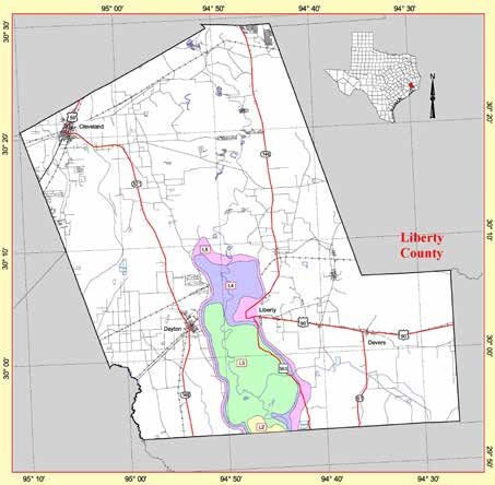
Planning and Preparing                                                                                          Planning and Preparing

 Preparing Your Home Before the Storm                                                                                                                               Business and Employee Preparation
 P
                                                                                                                                                                                 !
     roper hurricane preparations made ahead of time will not
 completely protect your property from damage. However,
 following a few simple tips may greatly reduce the damage to
                                                                                                                                                                                       Tips for Businesses
 your home and property.                                                                                                                                             ●   Identify and protect vital records. Backup and
                                                                                                                                                                         store key files off site.
                                                                                                                                                                     ●   Protect electronic equipment from possible water
                                                                                                                                                                         damage.

     !     Important Home Preparation Tips
                                                                                                                                                                     ●   Have extra cash and blank checks in case extra
                                                                                                                                                                         money is needed after the storm.

 Elevation Matters                                                                                               ●   Establish a temporary location for business     ●   Identify a safe room for employees who must
 ●   Know the elevation of your home! Are you in a surge, flood and/or evacuation zone?                              operations in case your facility is damaged.        remain in the building.

 Mobile Homes                                                                                                    ●   Give employees enough time to secure            ●   Develop a 24-hour emergency contact list with
 ●   Check tie-downs for rust or breakage.                                                                           their homes and families.                           phone numbers of key employees.
 ●   Residents of mobile homes must evacuate when told to do so!                                                 ●   Consider paying employees before they           ●   Set up telephone numbers for employees to
                                                                                                                     leave to prepare their homes.                       check in and receive company information.
 Landscaping
 ●   Trim trees, shrubbery and dead limbs, especially ones close to your home.
 ●   Repair or replace broken or damaged fences.                                                                 Protecting Your Boat - Marine Preparations
 ●   Shredded bark is preferred instead of small gravel or stone bedding.

 Roofing
 ●   Inspect the roof for loose tiles, shingles or debris. Consider replacing old or damaged shingles with new
     ones rated for hurricane force winds.
                                                                                                                                                                         !   Tips for Boat Owners
 ●   Check for and/or install hurricane clips to secure roof trusses to side walls.                                                                                  ●   Check your marina contract for policies and
                                                                                                                                                                         procedures for hurricanes.
 ●   Clear loose and clogged rain gutters and downspouts.
                                                                                                                                                                     ●   Check with the manufacturer for proper ways
 Doors                                                                                                                                                                   to secure your boat during a storm.
 ●   Reinforce garage doors and tracks or replace with a hurricane tested door. (See above image)
                                                                                                                                                                     ●   Consider  moving    arrangements       well   in
 ●   Reinforce double entry doors with heavy duty foot and head bolts.                                                                                                   advance of an approaching storm.
 ●   Use a security dead bolt with a one inch minimum bolt length.
                                                                                                                                                                     ●   Trailer boats should be removed from the water
 ●   Doors may be shuttered, but one entry must be left easily accessible.                                                                                               and securely stored at least 48 hours before
 Windows                                                                                                                                                                 a hurricane is expected to make landfall.
 ●   If possible, install tested/manufactured hurricane shutters.                                                ●   Purchase necessary hurricane materials such as additional mooring lines, crew anchors,
 ●   Inspect existing shutters to ensure they are in good working order.                                             fenders, fender boards, chafing gear, and anchors.
 ●   Alternative: Use 5/8” or greater exterior grade plywood secured by 2 1/2” screws and/or special clips.      ●   Safe storm moorings should consist of good condition ropes of sufficient diameter and
 ●   Obtain wood and fasteners, cut wood to size, pre-drill holes and place anchors on homes.                        length, with at least three or four substantial anchor points.
 ●   Store shutters or plywood lying flat to avoid warping when not in use.
                                                                                                                 ●   Do not moor parallel to bank. Receding tides often capsize boats in this type of anchorage.
10               For more information on how to prepare your home visit www.flash.org                                                                                                                                   11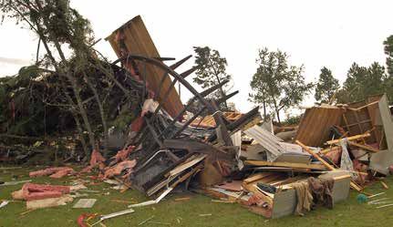
For Those Needing Extra Assistance                                                                                           Preparing Pets and Livestock
 Preparations for People with Medical, Functional or Access Needs
                                                                                                                      Preparing for Your Pet’s Safety
                                       I f you or someone you know have medical, functional or access                 Your pet should be part of your overall hurricane preparation
                                       needs, such as impaired vision, hearing loss, or limited mobility, it          plans. Below are a few important things to help you prepare:
                                       is important to make sure there is a support structure in place to
                                       help that person respond to a hurricane threat. Such individuals can           ●   Make sure your pet’s vaccinations are current and have
                                       often benefit from a caretaker or “hurricane helper,” someone who                  proof they are current. DO NOT assume that a public
                                       can look out for that individual and ensure they have the necessary                shelter or hotel will accept your pet.
                                       resources to evacuate and/or shelter when the storm threatens.
                                       For more information: www.togetheragainsttheweather.com                        ●   Be sure to have a current photo of your pet.
                                                                                                                      ●   Each animal should have a properly sized pet carrier. The
                                                                                                                          carrier should be large enough for the animal to stand up

                                           !
 FEMA News Photo
                                                                                                                          and turn around.

                                                Important Tips                                                        ●   Make sure your pet has a proper ID collar.
                                                                                                                      ●   Pack enough food and bottled water for the duration of your evacuation. DO NOT let your pet eat
 ●   Identify things you need every day such as food, medicines, water and other items you may rely on such               food or drink water from outside that may have become contaminated.
     as a walker, oxygen tanks or medical equipment. Start building up a supply before the hurricane season of
     non-perishable food items, bottled water, medicines, etc. that can be used in the event you lose power and/
                                                                                                                      ●   Be sure to pack all medications your pet may need along with a muzzle, collar, leash, paper towels,
     or water supply. Have at least two weeks’ supply of food and water, and 1 month supply of medications. If
                                                                                                                          and trash bags.
     you have vital medical equipment that you rely on that requires power, be sure to have a back-up source of
     power such as a battery or generator.

 ●   Store important documents in a plastic bag such as prescriptions, emergency contact information for family
                                                                                                                                                                           Preparations for Livestock
     and doctor, insurance cards, identification etc.                                                                                                                  ●    Ensure all animals have some form of visible
                                                                                                                                                                            identification.
 ●   If evacuation is necessary, identify where you will evacuate to, who you will stay with and how you will get
     there. If you cannot drive, make sure you have someone designated who will drive you where you need to                                                            ●    Evacuate        animals    whenever      possible.
     go in advance of the hurricane. Make sure your transportation can accommodate any equipment or other                                                                   Arrangements for evacuation, including routes and
     supplies that need to be taken with you.                                                                                                                               host sites, should be made in advance.
                                                                                                                                                                       ●    The evacuation sites should have or be able
                                                                                                                                                                            to readily obtain food, water, veterinary care,
                                                                                                                                                                            handling equipment and facilities.
 State of Texas                                                                                                                                                        ●    Obtain vehicles and trailers needed for
                                                                                                                                                                            transporting each type of animal. Also make
 Emergency Assistance Registry (STEAR) - Dial 211                                                                                                                           available experienced handlers and drivers.
 If you will need help evacuating from a hurricane or any other hazard, dial 2-1-1 to register in advance. You will   ●   If evacuation is not possible, a decision must be made whether to move large animals to available
 be asked a series of questions which will allow emergency managers to identify those who need extra assistance
                                                                                                                          shelter or turn them outside. This decision should be determined based on soundness and
 evacuating. It is necessary to do this each calendar year. There is also an option to register online.
                                                                                                                          location of the shelter (structure).
 The City of Galveston has a separate “need a ride” number for their residents which is 409-797-3701. Once you        ●   When necessary, move livestock to higher ground and deny access to flood prone pastures,
 register contact your emergency management office (pp.28-30) for more information on what type of assistance             barns, and other structures.
 will be offered in your jurisdiction.
                                                  STEAR.dps.texas.gov                                                 ●   It is important that livestock have plenty of food and clean water.
                                       www.txdps.state.tx.us/dem/stear/public.htm
                                    www.galvestontx.gov/561/Need-A-Ride-Program
12                                                                                                                                                                                                                              13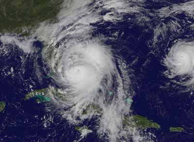
Insurance Tips                                                                                                     Final Checklist
 Insurance Tips - Before the Storm
 ●   Keep a written inventory of your possessions. Take photos or videotape of each room and the exterior of your
     home to keep with your inventory.
                                                                                                                      Actions to Take When a Storm is in the Gulf
 ●   Gather important documents and insurance cards and policies. Unless they are stored in a safe place, take
     them with you if you evacuate along with an inventory of your possessions, including receipts and photos or      ●   Listen frequently to radio, TV, or NOAA weather radio for bulletins and forecasts of the storm’s progress.
     videos.                                                                                                          ●   Double check items in your emergency supply kit.
 ●   Know what your policy covers. Check your auto policy to see if you have comprehensive coverage “other            ●   Fuel and service your vehicles.
     than collision.” Comprehensive coverage pays if a storm, fire, or flood damages your car. Find out how much
     coverage you have for “additional living expenses” to cover lodging, food, and other expenses if you’re          ●   Inspect and secure mobile home tie-downs.
     forced to vacate your residence after suffering a covered loss.                                                  ●   Make sure you have supplies to survive on your own for at least one week if you plan on staying.
 ●   Know your policy limits. Your limits may be too low if replacement costs have risen because of new additions,    ●   Board up windows (if shutters do not exist) in case storm moves quickly and you have to leave.
     improvements, or inflation.                                                                                          TAPE PROVIDES NO PROTECTION!
 ●   Review your health coverage. Find out if you’ll be able to receive non-emergency care from out-of-network        ●   Store lawn furniture and other loose, light weight objects, such as garbage cans and garden tools.
     providers, if needed, without accruing additional out-of-pocket costs.
                                                                                                                      ●   Get plenty of extra cash in case power goes out and ATMs do not work.
 ●   Consider renters insurance if you don’t have it. If you rent an apartment, duplex, house, or townhouse, you
                                                                                                                      ●   Garage or store vehicles that are not being used.
     may need renters insurance to protect your belongings.
 ●   Consider purchasing flood, wind and hail coverage. You may have to buy separate policies to cover wind,          ●   Follow instructions issued by local officials. EVACUATE IMMEDIATELY IF ORDERED TO DO SO!
     hail, and flood damage. Homeowners, farm and ranch, renters, windstorm, and condominium policies do not
     cover damage from rising waters.
                                                                                                                      Final Actions to Take if Leaving
 National Flood Insurance Program (NFIP)
 Homeowners and commercial property policies specifically exclude coverage for damage from flooding from              ●   Turn off propane tanks.
 rising waters. To protect yourself from losses caused by most flooding, you'll need to purchase a separate flood     ●   Unplug small appliances.
 insurance policy from the National Flood Insurance Program (NFIP)For more information about flood insurance,
 contact the NFIP 1-800-427-4661. www.floodsmart.gov
                                                                                                                      ●   Turn refrigerator and freezer to lowest setting.
                                                                                                                      ●   Turn off utilities if ordered to do so.
 Texas Windstorm Insurance Association (TWIA)                                                                         ●   Notify family members of your evacuation plans.
 If your property is located in one of Texas' 14 coastal counties, or parts of southeastern Harris County, you will
 likely only be able to obtain insurance coverage for windstorm or hail damage from a special insurance pool          ●   Lower water level in swimming pool by at least one foot.
 called the Texas Windstorm Insurance Association (TWIA.) To qualify for TWIA coverage, your property must
 pass a windstorm inspection and must meet certain windstorm-resistant building standards. You cannot buy or
                                                                                                                      ●   Lock home securely.
 change TWIA coverage once a hurricane has entered the Gulf of Mexico. For more information about wind-               ●   Board up remaining doors and brace garage door.
 storm coverage call TWIA or visit its website 1-800-788-8247. www.twia.org                                           ●   Take pets with you.
 Insurance Tips - After the Storm
 Contact your insurance agent or company promptly. Keep a record of all contacts you have with your com-
 pany. Be prepared to answer questions about the extent and severity of the damage.
                                                                                                                      Final Actions to Take if Staying
 If your home is not insured, contact your local Red Cross or FEMA Disaster Recovery Center for assistance. Call      ●   Close storm shutters, if available.
 FEMA at 1-800-621-FEMA (3362).                                                                                       ●   Turn refrigerator or freezer to coldest setting and open only if necessary.
                                                                                                                          (25 pounds of dry ice will keep a 10-cubic foot freezer below freezing for 3-4 days.)
 Make a list of your damaged property. Photograph or videotape the damage if possible. Don't throw away               ●   Follow instructions from emergency managers and be prepared to turn off utilities if ordered to do so.
 damaged items until your insurance adjuster has had a chance to view them.
                                                                                                                      ●   Board up remaining doors, brace garage door, and remain inside. Stay away from boarded
 If there is partial damage to your home, take reasonable and necessary repairs to protect your home and                  up windows.
 property from further damage. Cover broken windows and holes to keep rain out. Don't make permanent re-
 pairs until instructed by your insurance company. Keep a record of your repair expenses and save all receipts.
                                                                                                                      ●   Beware of the calm winds in the eye of the storm and do not venture outside. Some of the
                                                                                                                          strongest winds may occur shortly after the eye passes.
            Texas Department of Insurance        Texas Windstorm Insurance Association                                    DO NOT EXPECT EMERGENCY RESPONDERS TO BE OF ANY ASSISTANCE DURING A LANDFALLING
            www.tdi.texas.gov					                                       www.twia.org                                     HURRICANE!
            Consumer help line 1-800-252-3439			    Consumer help line 1-800-788-8247
14                                                                                                                                                                                                                                 15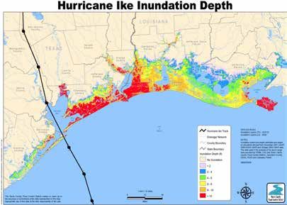
2018 Hurricane Names
     □   Alberto     □   Leslie
     □   Beryl       □   Michael
     □   Chris       □   Nadine
     □   Debby       □   Oscar
     □   Ernesto     □   Patty
     □   Florence    □   Rafael
     □   Gordon      □   Sara
     □   Helene      □   Tony
     □   Isaac       □   Valerie
     □   Joyce       □   William
     □   Kirk

     2019 Hurricane Names
     □   Andrea      □ Lorenzo
     □   Barry       □ Melissa
     □   Chantal     □ Nestor
     □   Dorian      □ Olga
     □   Erin        □ Pablo
     □   Fernand     □ Rebekah
     □   Gabrielle   □ Sebastien
     □   Humberto    □ Tanya
     □   Imelda      □ Van
     □   Jerry       □ Wendy
     □   Karen

     2020 Hurricane Names
     □   Arthur      □   Laura
     □   Bertha      □   Marco
     □   Cristobal   □   Nana
     □   Dolly       □   Omar
     □   Edouard     □   Paulette
     □   Fay         □   Rene
     □   Gonzalo     □   Sally
     □   Hanna       □   Teddy
     □   Isaias      □   Vicky
     □   Josephine   □   Wilfred
     □   Kyle

16                                  17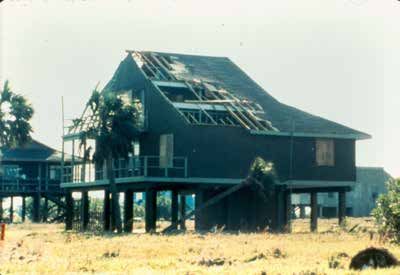
Hurricane Forecast Resources                                                                       A Tale of Two Storms: Ike and Harvey

 T
                                                                                                                   This year (2018) marks the 10-year anniversary of Hurricane Ike which tracked for days from the Atlantic
                                                                                                          into the Gulf before making landfall on the east end of Galveston Island on September 13th 2008. The greatest
    he National Hurricane Center (NHC) in                  Weather Information                            impact from Ike was its tremendous storm surge and associated flooding over a large portion of the Gulf coast.
 Miami, FL is the official source for tropical             National Weather Service                       The large hurricane produced wind damage over a vast area consistent with category 1 and 2 winds on the
                                                                                                          Saffir Simpson Hurricane Wind Scale. At the time Ike was the 3rd costliest hurricane on record when adjusting for
 cyclone advisories and forecasts and is                     www.weather.gov/houston
                                                                                                          inflation causing 29.5 billion dollars in damage. There were at least 18 direct fatalities in Texas, mostly drownings
 responsible for issuing tropical cyclone                 National Hurricane Center                       of individuals caught in the storm surge flooding. The death toll may have been higher as there were several
 watches and warnings for the United States.                     www.hurricanes.gov                       people unaccounted for.

                              Graphical Tropical Weather Outlook
                                 Provides an overview of all tropical cyclone activity.
                                  Indicates areas of interest where tropical cyclones could develop
                                  over next 5 days. A percent chance that it will develop is assigned.
                                  Moving the cursor over the highlighted areas will provide a more
                                  detailed text description.
                              NHC Forecast Advisory
                                  Most recent position for a storm along with all coastline watches
                                  and warnings. Includes a 3 or 5 day track with error cone.
                                  Error cone represents a 5 year average error. The center of the
                                  storms only stays within the error cone 67% of the time.
                                  DO NOT focus too closely on the exact track forecast - the little
                                  black line. If you are in or near the cone, the center of the storm
                                  could head your way. Impacts are often felt well outside the cone.
                                                                                                              Map showing depth of water above ground due to storm surge flooding from Hurricane Ike.
                                                                                                                                        From Harris County Flood Control.
                                                                                                         Harvey in 2017 brought much different impacts to Southeast TX. Hurricane Harvey redeveloped and intensified
                              Tropical Storm Wind Time of Arrival Graphic                                rapidly over the western Gulf of Mexico making landfall as a category 4 storm on the Middle Texas coast bringing
                                  Graphic shows estimated time of arrival of tropical storm force        damaging winds and storm surge to that area. It then stalled and looped toward the southeast, moving back
                                  winds, both most likely time and earliest reasonable time.                                                                           out over the Gulf, then tracked more toward the
                                                                                                                                                                       east, slowly paralleling the Southeast Texas coast as
                                  Designed to account for forecast uncertainty.                                                                                        a Tropical Storm. Harvey made a second landfall

                                  May be useful for evacuation planning.

                                                                                                                                                                               Flooding from Tropical Storm Harvey,
                              Potential Surge Inundation Graphic                                                                                                                        Bear Creek Village.
                                                                                                                                                                                           Photo Credit:
                                  Issued by National Hurricane Center about 48 hours prior to                                                                                   Harris County Flood Control District.
                                  impacts being felt at the coast.
                                  Shows reasonable worst case for the amount of flooding from ocean
                                  water surging over land. Data is plotted as depth of water above
                                  ground.
                                  Storm Surge watch/warning also may be issued.

18                                                                                                                                                                                                                          19
A Tale of Two Storms: Ike and Harvey After the Storm
along the Louisiana coast. Rainbands on Harvey’s right flank brought bouts of very heavy rain over a 4 day period ● Listen to local officials for updates and instructions. Don’t return until notified it is safe
which led to catastrophic flooding over a large portion of Southeast Texas. Several gauges reported rainfall
to do so. A list of emergency manager contacts is included in the back of this guide.
amounts of greater than 50 inches with the highest reading 60.5 inches near Nederland, TX. This established a
new record for total rainfall with a tropical cyclone. Harvey’s rainbands spawned at least 23 tornadoes over ● Watch out for debris and downed power lines.
Southeast Texas based on known damage. In contrast to Ike, the effects of storm surge and high winds were
relatively minor for Southeast Texas although certainly were primary hazards down the coast along the Coastal ● Avoid walking or driving through flood waters. Just 6 inches of moving water can
Bend of Texas closer to landfall. knock you down, and fast-moving water can sweep your vehicle away.
Harvey and Ike demonstrate how each hurricane and and tropical storm is different not only in terms of the ● Avoid flood water as it may be electrically charged from underground or downed
hazards it brings and the relative impacts from these hazards but also in the time available to prepare for the power lines and may hide dangerous debris or places where the ground is washed
landfall. Harvey gave very little lead time for residents of the Mid-Texas Coast intensifying from a 35 mph tropical away. Snakes, alligators, fire ants can also be found in and around flood waters.
depression to a 130 mph category 4 hurricane landfall in just 48 hours! That is why it is so important to prepare
ahead of time before the hurricane season. Follow some of the tips in this book so you’ll be ready should you ● Photograph the damage to your property in order to assist in filing an insurance claim.
need to act quickly. ● Make sure to inspect your home after a hurricane. Do what you can to prevent further
damage to your property, (e.g., putting a tarp on a damaged roof), as insurance may
not cover additional damage that occurs after the storm.
● Continue listening to local news for updated information and instructions.
● Do not use water that could be contaminated to drink, wash dishes, brush teeth,
prepare food, wash hands, make ice or make baby formula. Use only bottled, boiled
Storm surge flood damage near Caplen,
TX. Note house destroyed from flowing or treated water until you know that the water is safe.
water from bottom up.
Photo credit: NOAA/NWS.
Piles of flood debris outside home, a
common sight after Harvey.
Photo credit:
Harris County Flood Control.
References: Photo Credit: FEMA
https://www.nhc.noaa.gov/data/tcr/AL092008_Ike.pdf
https://www.nhc.noaa.gov/data/tcr/AL092017_Harvey.pdf
20 21After the Storm Flood Safety
Flash floods from heavy rains are the most dangerous hazard for Southeast Texas,
especially inland from the coast. With the Gulf of Mexico providing abundant
moisture, high rain rates are not uncommon, with greater than 4 inches per hour
observed on occasion. When thunderstorms follow each other or “train” over one
area, rainfall amounts of around a foot or more over a 12 hour period can occur.
It is important to understand what actions to take to protect yourself from flash
flooding hazards.
Flood Related Watches, Warnings, Advisories
● Flash Flood Watch: Be Prepared, Stay Alert, Keep Watch. A watch is issued
when conditions are favorable for flash flooding but occurrence, timing, and
location is still uncertain.
● Flood Advisory: Be advised, be cautious. A Flood Advisory is issued when
flooding may cause significant inconvenience and if caution is not exercised,
could lead to situations that may threaten life and/or property. Conditions are
not quite as severe as with a warning.
● Flash Flood Warning: Take Action! A warning is issued when potentially life
threatening flash flooding is imminent or occurring. A flash flood is a sudden
violent flood that can develop quickly...within hours.
● Flash Flood Emergency: Extreme Danger! Rarely used. Reserved for rare cases of extreme danger to life and
property from flash flooding, a historic event with an extreme threat to life and property.
● Help people who require additional assistance—infants, elderly people, those During a Flood
without transportation, large families who may need additional help in an emergency ● Avoid walking or driving through flood waters.
situation, people with disabilities, and the people who care for them. Turn Around, Don’t Drown! Just 6 inches of
moving water can knock you down, and 2 feet
● Keep away from loose or dangling power lines. Report them immediately to the power of water can sweep your vehicle away. Most
company. Check for gas leaks. If you smell or hear gas leaking leave immediately and flash flood fatalities occur in vehicles.
call the gas company or fire department. ● If floodwaters rise around your car, abandon the
car immediately and move to higher ground.
● Wear protective clothing, including rubber gloves and rubber boots, and be cautious Best option is to get out through the windows.
Force door open if necessary before becoming
when cleaning up.
completely submerged.
● DO NOT run generators indoors but only in well ventilated outdoor areas. Many ● Avoid camping or parking along streams, rivers,
and creeks during heavy rainfall. These areas
deaths after the storm are due to carbon monoxide poisoning due to improper use of
can flood quickly and with little warning.
generators. ● If in a flood prone area from a nearby stream
or creek you may be asked to evacuate and
● Do not use open flames indoors. Be extremely cautious if using candles. Many fires
move to higher ground. Obey evacuation orders
have resulted post storm due to candles getting knocked over. if given.
● Never drive around barricades.
● Listen for instructions on debris clean up and pick up for your community. You may be
After A Flood
instructed to sort the debris and put by curbside. ● Return home only when authorities say it is safe.
● Be aware of areas where floodwaters have receded and watch out for debris, snakes, fire ants, alligators,
● If you suspect water and sewer lines are out do not use your plumbing (toilets, sinks, etc. Floodwaters often erode roads and walkways.
etc). Your toilet can be used by flushing until the bowl has no water. If you have filled ● Do not attempt to drive through areas that are still flooded.
your bath tub with water before the storm you can draw from this with a bucket ● Avoid standing water as it may be electrically charged from underground or downed power lines.
and pour in the toilet to aid in flushing. ● Photograph damage to your property for insurance purposes.
● If widespread sewer outages have occurred, instructions for disposal of human waste www.floodsafety.noaa.gov
www.ready.gov/floods
will be announced. www.redcross.org/get-help/prepare-for-emergencies/types-of-emergencies/flood
22 23Tornado Safety Other Thunderstorm Hazards:
Hail, Damaging Winds, Lightning
Tornadoes are fairly common in Southeast Texas. A tornado can strike very quickly with little warning. Thunderstorms can bring a variety of hazards including tornadoes, flash flooding, hail, lightning and
It’s important to know what to do should a tornado approach so you can take quick protective action.
damaging winds. The National Weather Service issues Severe Thunderstorm Warnings for thunderstorms
First a few terms and then tips on what to do.
believed to contain large hail (greater than 1 inch in diameter) and/or damaging winds. Here are
Tornado Watch - Conditions favor the development of tornadoes. Stay alert, be ready to act should some guidelines on how to stay safe when dealing with thunderstorm hazards lightning, hail and high
a tornado threaten. Watch the sky and have a way to receive warnings (smart phone apps, NOAA winds.
Weather Radio, commercial radio or television).
Lightning Safety:
Tornado Warning - A tornado has been sighted or indicated by weather radar. Take shelter immediately ● A good rule of thumb, if you can hear thunder you are
close enough to be struck by lightning.
if in the warned area. “When Thunder Roars, Go Indoors!”
“See a Flash, Dash Inside”
Tornado Emergency - Issued in exceedingly rare circumstances when there is a severe threat to human ● Get inside a home, building, or closed automobile (not a
life and/or catastrophic damage is imminent or ongoing and reliable sources confirm tornado. convertible). You are much safer inside a vehicle than
outside.
If you are in a structure (e.g. residence, small building, school, nursing home, hospital, factory, shopping ● Avoid open fields, the top of a hill or a ridge top.
center, high-rise building) go to the center of a small interior room or interior hallway on the lowest level, ● Stay away from tall, isolated trees or other tall objects
away from corners, windows, doors, and outside walls. Put as many walls as possible between you
and the outside. Avoid large rooms with large span roofs (gymnasiums, cafeterias, etc). If in a high-rise (power poles, antennae). If you are in a
building go to a small interior room or hallway on the lowest floor possible away from windows. Have a forest, stay near a lower stand of trees.
pair of sturdy shoes stored in your shelter room and put them on. Do not open windows. ● If you are in a group, spread out to avoid the current
traveling between group members.
● Stay away from water, wet items, such as ropes, and metal
If you are in a manufactured or mobile home get out immediately and go to a pre-identified location
such as the lowest floor of a sturdy, nearby building or storm shelter. Mobile homes, even if tied down, objects, such as fences and poles.
offer little protection from tornadoes. It is important to identify such a sturdy shelter you can get to ● Unplug any electronic equipment well before the storm
quickly as part of your severe weather plan. arrives.
● If planning an outdoor event, make sure you have a
If caught outside with no shelter make every effort to get to a safe shelter. If this is not possible your best lightning safety plan; have a designated weather watcher;
course of action is to lie in a low spot or ditch and cover your head with your hands. It is not advisable identify shelters that can be reached quickly.
to get under a bridge or overpass.
www.lightningsafety.noaa.gov
www.ready.gov/thunderstorms-lightning
www.ncaa.org/health-and-safety/lightning-safety
Large Hail and High Winds:
● Seek shelter in a sturdy structure away from windows
● Before the storm close your drapes or blinds; this
offers you extra protection from flying glass.
● Inspect your home and roof after a large hail storm.
Cover any damaged areas to prevent leaks.
flash.org/peril_inside.php?id=75
24 25Weather Alerts to Your Cell Phone Review of 2017 Hurricane Season
Wireless Emergency Alerts (WEA)
1. What are WEA messages?
Wireless Emergency Alerts (WEA) are emergency messages sent by authorized government alerting authorities
through your mobile carrier. Government partners include local and state public safety agencies, FEMA, the
FCC, the Department of Homeland Security, and the National Weather
Service.
No signup is required! Alerts are sent automatically to WEA-capable
phones during an emergency.
2. Why is this important to me?
Alerts received at the right time can help keep you safe during an
emergency. With WEA, alerts can be sent to your mobile device when
you may be in harm's way, without need to download an app or
subscribe to a service.
3. What types of alerts will I receive?
● Extreme weather warnings
● Local emergencies requiring evacuation or immediate action
● AMBER Alerts
● Presidential Alerts during a national emergency
4. What types of weather warnings are included?
● Flash Flood, Tornado and Hurricane Warnings
● Less Common: Tsunami, Extreme Wind and Dust Storm Warnings
4. What does a WEA message look like?
WEA will look like a text message. The WEA message will typically
show the type and time of the alert, any action you should take, and
the agency issuing the alert. The message will be no more than 90
characters.
5. Will I receive a WEA message if I'm visiting an area where I don't live,
or outside the area where my phone is registered?
Yes, if you have a WEA-capable phone.
6. How will I know the difference between WEA and a regular text message?
WEA messages include a special tone and vibration, both repeated twice.
7. What if I don’t want to receive these emergency messages?
The 2017 Atlantic Hurricane Season was extremely active with 17 named storms (includes
You can opt out of the Amber or Extreme Weather WEAs. Details on how to set your phone up for these alerts tropical storms and hurricanes), 10 hurricanes including 6 major (Category 3, 4, or 5). Hurricane
including opt out instructions can be found by searching your wireless carrier's website for WEA or wireless Harvey and Irma were the first two major hurricanes to hit the Continental U.S. and 12 years.
emergency alerts. The details on how to set these up are dependent on your carrier and smart phone model.
Hurricane Maria devastated Puerto Rico and parts of the Leeward Islands with Category 4 &
Other weather alert apps 5 damage. Based on Accumulated Cyclone Energy (ACE) index 2017 was the seventh most
There are many weather alert apps, many free, that have some of the same functionality as the WEA system in active season in the historical record and the most active since 2005. The Texas coast received
that they will send you a weather alert usually as a text message for your location and any others you specify.
more of a glancing blow from Tropical Storm Cindy which made landfall just east of the TX/LA
Do a search for “weather alerts” at the App Store or wherever you find apps on your phone.
border in June. Hurricane Harvey struck the Texas coast as a Category 4 hurricane, the first
since Carla in 1961. Harvey brought destructive winds and surge to the mid-Texas coast and
www.nws.noaa.gov/com/weatherreadynation/wea.html catastrophic flooding to Southeast Texas.
www.ready.gov/alerts
http://www.noaa.gov/media-release/extremely-active-2017-atlantic-hurricane-season-finally-ends
www.ready.gov/get-tech-ready
26 27Emergency Management Contacts Emergency Management Contacts
AUSTIN ● Pearland
FORT BEND GALVESTON GRIMES ● Pasadena
281-997-4648 713-475-5588
cityofpearland.com/prepredness www.PasadenaPrepares.net
● County Emergency ● County Emergency ● County Emergency ● County Emergency
Management ● Richwood Management Management Management ● Seabrook
979-865-5911 979-265-8157 281-342-6185 888-384-2000 936-873-4404 281-291-5700
Austincounty.com www.fbcoem.org www.gcoem.org
● Surfside Beach
HARRIS ● Shoreacres
BRAZORIA 979-239-1151 ● Arcola ● Bayou Vista 281-471-2244
281-431-0606 409-935-0449
● Sweeny ● County Office of Homeland ● South Houston
● County Emergency
Management
979-548-3321 ● Beasley ● Clear Lake Shores Security & Emergency Mgt 713-947-7700
979-548-4541 979-387-2775 281-334-1034 713-881-3100
979-864-1201 www.sweenytx.gov 281-334-2799 www.readyharris.org ● Taylor Lake Village
brazoriacountytx.gov/departments/
● Quintana ● Fairchilds 281-326-2843
emergency-management
979-233-0848
281-341-4638 ● Dickinson ● Baytown
281-337-4700 281-420-6556 ● Tomball
● Alvin
● West Columbia ● Fulshear www.ci.dickinson.tx.us www.oembaytown.org 281-290-1301
281-388-4363 281-346-1796
979-345-5121
www.alvin-tx.gov ● Friendswood ● Bellaire ● Webster
● Kendleton 281-996-3335 713-662-8222 281-332-1826
● Angleton BRAZOS 979-532-8240 www.ci.friendswood.tx.us www.bellairetx.gov
979-849-2383 ● West University Place
● County Emergency ● Meadows Place ● Galveston ● Deer Park 713-662-5836
● Bailey’s Prarie Management 281-983-2900 409-765-3710 281-478-7298
HOUSTON COUNTY
979-849-0134 galvestontx.gov www.deerparktx.gov
979-821-1011
www.bcdem.org ● Missouri City
● Brazoria 281-403-8500 ● Hitchcock ● El Lago
979-798-2489
● Bryan www.missouricityready.com 409-986-5559 281-326-5900 ● County Emergency
Management
979-821-1030 www.hitchcockpd.com
● Brookside www.bryantx.gov ● Needville ● Galena Park (936) 544-7175
281-485-3048 979-793-4255 ● Jamaica Beach 713-672-2556 (936) 544-2862
Hyper-reach.com/txhoustonsignup.html
● Clute ● College Station ● Orchard
409-737-1142
www.ci.jamaicabeach.tx.us ● Houston
979-821-1000
979-265-6194 www.cstx.gov/dem 979-478-6893
● Kemah
713-884-4500
www.houstonoem.org JACKSON
● Danbury ● Pleak 281-334-5414
979-922-1551 BURLESON 281-239-8504
● La Marque
● Jacinto City
713-674-8424
● County Emergency
Management
● Freeport
● County Emergency ● Richmond 409-938-9269 361-782-3398
979-239-1211
Management 281-342-5456 www.cityoflamarque.org ● Humble www.co.jackson.tx.us
www.richmondtx.gov 281-446-4928
979-567-2001
● Hillcrest Village co.burleson.tx.us/burleson-county-alert-system ● League City http://www.cityofhumble.net ● Edna
281-748-7149 ● Rosenberg 281-554-1000 361-782-3122
835-595-3700 www.leaguecity.com ● Jersey Village
● Holiday Lakes
CHAMBERS www.rosenbergtx.gov 713-466-2130 ● Ganado
979-849-1136 ● Santa Fe 361-771-2800
● County Emergency ● Simonton 409-925-3092 ● Katy
● Iowa Colony
Management
281-533-9809 281-574-8633
281-369-3444
409-267-2445 ● Texas City 281-391-3500
www.chamberstx.gov ● Stafford 409-643-5840 www.cityofkaty.com
● Jones Creek 281-841-0355
979-233-3091
● City of Mont Belvieu ● Tiki Island ● La Porte
281-576-2021 ● Sugar Land 409-935-1427 281-470-0010
● Lake Jackson 281-275-2700
sugarlandresponds.com
www.lpoem.org
979-415-2500
● Liverpool
COLORADO ● Thompsons
● Morgan’s Point
281-471-2171
281-581-2342 281-343-9929
● County Emergency ● Nassau Bay
Management
● Manvel 979-733-0184 ● Weston lakes 281-336-6298
281-489-1212 281-533-0907 www.nassaubay.com
● Oyster Creek
979-233-8481
28 29Emergency Management Contacts Regional National Weather Service Offices
LIBERTY POLK WALLER NWS Lake Charles
500 Airport Blvd #115
Lake Charles, LA 70607 NWS New Orleans/Baton Rouge
● County Emergency ● County Emergency ● County Emergency NWS Houston/Galveston (337) 477-5285 62300 Airport Road
Management Management Management 1353 FM 646 Suite 202 MIC: Andy Patrick Slidell, LA 70460
936-334-3219 936-327-6826 979-826-8282 Dickinson, TX 77539 http://www.srh.noaa.gov/lch (985) 649-0357
www.co.liberty.tx.us www.oem.polk.tx.us (281) 337-5074 @NWSLakeCharles WCM: Frank Revitte
http://www.srh.noaa.gov/lix
● Cleveland ● Alabama-Coushatta WASHINGTON MIC: Jeffry Evans
http://www.srh.noaa.gov/hgx
www.facebook.com/NWSLakeCharles
@NWSNewOrleans
281-592-2667 936-563-1100 @NWSHouston www.facebook.com/NWSNewOrleans
● County Emergency www.facebook.com/NWSHouston
● Dayton
SAN JACINTO Management
936-258-7621 979-353-7683
● Liberty ● County Emergency ● Brenham
NWS Corpus Christi
936-336-8118 Management 979-337-7300
936-653-3395 300 Pinson Drive
Corpus Christi, TX 79406
MADISON www.co.san-jacinto.tx.us
WHARTON (361) 289-0959
WALKER
MIC: Tom Johnstone
● County Emergency ● County Emergency http://www.srh.noaa.gov/crp
Management Management @NWSCorpus
936-348-3810 ● County Emergency 979-532-1123 www.facebook.com/NWSCorpus
www.co.madison.tx.us Management co.wharton.tx.us
936-435-8740 www.facebook.com/Wharton-County-Office-of-
Emergency-Management-221712291190574/
MATAGORDA www.walker.tx.us
● El Campo NWS Brownsville
979-543-5311 20 S. Vermillion
● County Emergency Brownsville, TX 78521
Management ● Wharton (956) 504-1432
979-323-0707 979-532-4811 x570 MIC: Jim Reynolds
www.co.matagorda.tx.us www.facebook.com/WhartonOEM http://www.srh.noaa.gov/bro
@NWSBrownsville
MONTGOMERY www.facebook.com/NWSBrownsville
● County Emergency The National Weather Service would like to acknowledge the Greater Houston LEPC for
Management their assistance in the production of this severe weather guide. An LEPC (Local Emergency
936-523-3900
www.mctxoem.org US Department of Homeland Security Planning Committee) is a gathering of representatives in your community that have an
www.ready.gov interest in hazardous materials safety. As a group, they are tasked with identifying potential
● Conroe
936-522-3200
Red Cross risks that your community faces, from chemicals stored in and/or transported throughout your
● Shenendoah www.redcross.org community. The LEPC seeks ways to help minimize the risk, prevent accidents and assist in
281-367-8952
National - 800-733-2767 the development of plans to deal with a chemical emergency. Education and community
● The Woodlands Township Gulf Coast Assistance Line 866-526-8300 outreach is another core component of an LEPC. Through the LEPC, the public will be able to
281-210-3800
www.thewoodlandstownship-tx.gov/stayinformed seek out information about chemicals in their communities and learn how to safely shelter in
FEMA place. For more information on LEPCs in Texas go to this link:
www.fema.gov www.tceq.texas.gov/assets/public/permitting/tier2/LEPC-contact-list.pdf
Community Resource Information:
Do Not Call 911 for Non-Emergencies!
30 31Sponsored By: Supported By: Featured Presenter:
Contributors:
Fort Bend County
Galveston County
Harris County
Montgomery County
Walmart
Houston Red Cross
The Church of Jesus Christ of Latter-day Saints
Mayor’s Office for People with Disabilities
Harris County Flood Control District
Houston Commission on Disabilities
METRO HoustonYou can also read