Improving public utilities operations and customer experiences with Google Maps
←
→
Page content transcription
If your browser does not render page correctly, please read the page content below

White Paper

Improving public utilities operations and
customer experiences with Google Maps

Public utility companies, which provide electric,   For these reasons, public utility providers seek
natural gas, telephony and internet, and water      tools to improve their performance, whether
and wastewater services, must manage                through better asset management, more
complicated assets and a large volume of            comprehensive visualization and sharing of
information.                                        information, or improving real-time
                                                    communication. As a flexible set of APIs that
Increasingly, they are under pressure to expand     expand companies’ location-based capabilities,
and improve the services they provide to their      Google Maps Platform provides distinct
customers, as well as ensure compliance with        advantages to utility companies, helping them
government regulations, improve sustainability,     solve these challenges and deliver tangible
and reduce losses and operating costs.              benefits and results for their operations and
                                                    customers.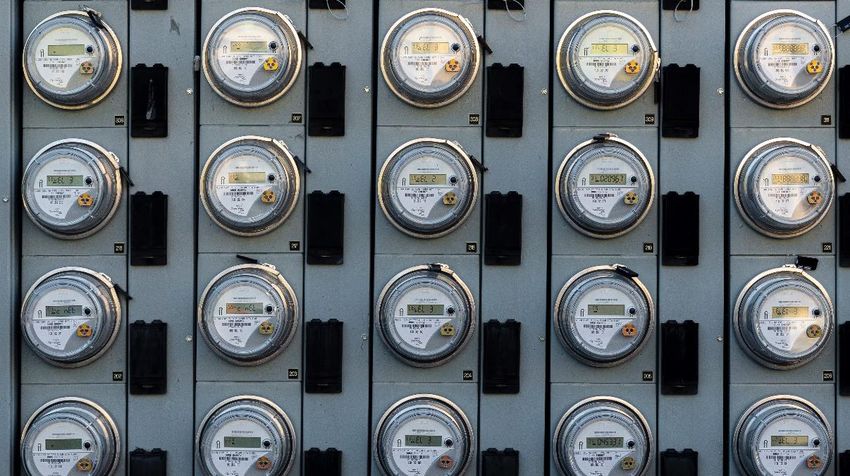
Reducing customer wait times with                     To further ensure addresses are correct, the
accurate addresses                                    Google map can be used for visual confirmation.
                                                      In addition to providing the complete address,
Customer acquisition is a long, laborious process     from country down to street number, Places
that requires effort from across a utility company.   Autocomplete also provides the geolocation of
The initiation of a service request is a crucial      the address, which can be used in conjunction
moment in the customer relationship. A bad            with the company’s existing geospatial data.
impression may cause a customer to switch to a
competitor.                                           Customers also have the option of pointing to
                                                      their geolocation directly on the map, and from
Because utility companies can receive                 that, Google Maps can provide complete address
thousands of service calls every day, it’s crucial    information through the Geocoding API and the
to reduce customer wait times and ensure a            Reverse Geocoding functionality.
positive experience.
                                                      Such customer solutions can be accessed via the
One pitfall is the capture of erroneous customer      web, using the Maps JavaScript API, or via
data, which may lead to wrong decisions and           smartphones using the Google Maps SDKs for
delays. A data entry error could cause the            Android and iOS. If customers access the
company to believe the requestor's address was        solution with smartphones, their geolocations can
outside its service territory. Even worse, the        automatically be acquired from the device and
company could dispatch a crew for work at the         shown on the map; address information can be
wrong location. Such scenarios frustrate              acquired using the Geocoding API.
customers and waste the company’s time.
                                                      If the call request is received by an internal
With Google Maps, utility companies can
                                                      company agent or in call centers, the attendants
implement self-service capabilities for customers.
                                                      can use these same features to find the address
Customers can enter their own addresses in a
                                                      of the request in an optimized way, and can also
company portal and check the services offered at
                                                      perform the search based on call points. In both
their locations. The Google Maps interface is
                                                      cases, to confirm the location of the request, the
already well known to customers, and the Places
                                                      Street View API can also be used — this allows a
Autocomplete API shows suggestions as users
                                                      360-degree view at street level using photos
type, making address acquisition faster and more
                                                      captured by Google.
accurate.
Improving response to new service                    information in hand, the company can judge the
requests                                             feasibility of installing the new request.

                                                     By adopting these solutions, the company will
Acquiring the correct location for a connection
                                                     be able to improve service for new service
request leads to more productive installation
                                                     requests, provide a better user experience, and
feasibility analysis. It also accurately shows
                                                     ensure the quality of the information provided
which services are available at that location. For
                                                     via call centers.
some types of service, the supply network must
be present in front of the property, so with         With more precise information and reduced
Google Maps-based visualization of the property      service time, more customers will be served
and the company's network, attendants can            more efficiently with the same number of
easily determine the availability of services.       employees. In addition, when addresses are
                                                     correct, planning for calls is more effective and
It is also possible to create a tool, using Google
                                                     teams are sent to the correct locations, reducing
Maps features or combining it with spatial
                                                     operating costs.
analysis tools from Google Cloud, which
automatically performs this feasibility analysis.    With Google Maps, companies will not have to
                                                     worry about offline data storage databases for
In cases where service must be derived from a
                                                     customer information and records of work. In
point/derivation box, the Distance Matrix API
                                                     many cases, offline storage solutions come with
can be used to identify the nearest derivation
                                                     high costs and are outdated quickly.
points. Setting the derivation points as sources
and the installation location as a destination
                                                     When all maintenance is managed with Google
generates distances from all sources to all
                                                     Maps street data, which is always up to date
destinations. After the nearest point/junction box
                                                     and offers superior territorial coverage, both
is established, the Directions API can be used to
                                                     customer satisfaction and work efficiency
identify the best cabling route. With this
                                                     increase.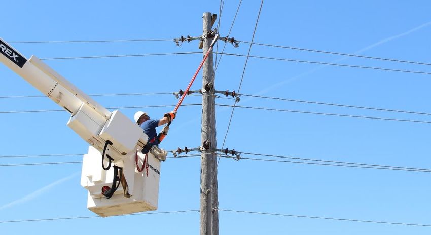
Eliminating duplications for better                   For some utility sectors, the government sets
customer communications                               fines based on indicators of service provision.
                                                      Inspection, maintenance, and problem-solving
When service is disrupted, many of the affected       activities are directly linked to these indicators, so
customers will report the problem. If these calls     improving a company's operations leads, in turn,
are not handled properly, they may end up being       to better indicators. This operational gain can be
duplicated in the system, creating confusion. It is   obtained through improved planning.
important to be able to identify and group calls
related to the same cause. With the correct           One way is to reduce teams’ unproductive time
spatialization and display of tickets on Google       by cutting unnecessary travel via better routing.
Maps, attendants will be able to identify and         The Directions API can automatically optimize a
classify duplicate tickets and prevent two teams      route for up to 23 crossing points. For more
from being sent to solve the same problem.            complex optimizations involving more visit points,
                                                      teams, and other factors — such as team skills,
Associated tickets also make it much easier for       service priority, and service hours — distance
attendants to notify customers when problems          information and travel time between points are
are resolved. Companies often warn customers          very important.
that their services are experiencing problems, but
they do not specify the exact areas affected or       The Distance Matrix API and Directions API use
the status of work. By proactively disclosing this    historical traffic data to create a predictive traffic
information, companies can avoid a flood of           model for accurate distance and travel times.
complaints and questions.                             (The accuracy of travel times and estimated time
                                                      of arrival provided by Google is 97%1.)
With the Places Geolocation API, companies can
offer a solution that identifies a customer’s         Instead of increasing the number of professionals
geolocation and provides the relevant                 (and consequently the operational and human
information: if a service area is experiencing a      resources expenses) to answer more calls,
problem, whether the company has identified the       companies can achieve the same or better
problem and is acting on it, and the timeframe for    results by optimizing the teams already in the
an expected return to normal service. By              field. Before departing for a call, the designated
demonstrating knowledge of supply problems            team can use Street View to make a “virtual visit”
and prompt action to solve them, companies can        to the area, making them better prepared.
build even more trust with customers.
                                                      Companies can provide their field teams with
                                                      mobile apps, built using the Google Maps SDKs
Optimizing planning for operational                   for Android and iOS, that contain information
                                                      about the company's assets. Teams can then
efficiency
                                                      access any information necessary to carry out
                                                      their tasks quickly and easily using a familiar map
Utility companies deal with a large number of
                                                      interface that does not require training.
field operations: they are called in to respond to
incidents, perform network inspection and
                                                      These improvements to a company's operational
maintenance activities, set up services for new
                                                      efficiency will lead to improvements in the
customers, and cut service supply. Due to the
                                                      services provided and in the company's quality
varying nature of the tasks and the
                                                      indicators, which may reduce the incidence of
characteristics of the teams needed for each, it is
                                                      fines and the company's costs. Increased
a great challenge to create an optimized plan.
                                                      efficiency also boosts customer satisfaction,
Operational efficiency is key to increasing the
                                                      which may increase customer retention and help
number of hours that a team spends answering
                                                      with the acquisition of new customers.
calls and cutting travel time.
Responding faster to emergency                         location of the call can be obtained with the
calls                                                  Distance Matrix API, which uses real-time traffic
                                                       information to provide reliable travel time
Some public utility services cannot be
                                                       information. The Directions API can then be
interrupted without potentially putting lives at
                                                       used to trace the best route from the team to the
risk— the rupture of a natural gas pipeline, for
                                                       call, reducing the risk of a delay.
example, or the interruption of electricity supply
to a hospital. In these cases, the faster the call     During the entire call, the situation room can
is answered, the greater the chances of                monitor the location of teams on Google Maps
reducing the severity of the incident. This starts     in real time and thus better coordinate action.
with quickly identifying the location of the           Rapid emergency response will decrease the
occurrence through Google Maps APIs. The               severity of the event, prevent the destruction
next step is determining the optimal allocation of     and loss of assets, and reduce damage to the
teams to answer the call. Real-time tracking           network, making it quicker and cheaper to re-
data of the location of teams, the network, and        establish service. It also raises customer
the call for service can be displayed on Google        satisfaction in the company, reducing poor
Maps, bringing situational awareness to all            service experiences that hurt the company's
involved – from the office to the situation room       image and undermine customer confidence.
to the field.

Additionally, when analyzing the possible impact       Simplifying asset management
of an incident, an assessment of the site’s            Sharing of information and documents about the
previous status can be carried out using the           various assets of a public utility company is a
high-resolution satellite images provided by the       challenge. Sometimes asset data and
Maps JavaScript API and Street View. The               documents are managed in different systems,
places of interest provided by the Places API          making it difficult or even impossible to access
can be used to identify which types of                 all the necessary information. Additionally, some
establishments exist in the vicinity of the            companies use complex specialist systems for
occurrence (for example, whether there are             the management of their network and assets,
hospitals, schools, parks, or industries).             which have interfaces aimed at a specific
                                                       audience. These are not suitable for everyone,
When choosing the best team to answer a call,
                                                       and often the cost of acquiring licenses is
a key element is the travel time of the teams to
                                                       prohibitive.
the location of the call. Priority must be given to
the those with the shortest travel time, as they       Google Maps can be used as an integrating tool
will be able to get to the incident faster and start   to access asset information and documents
the work sooner. For this, travel times to the         across systems and to spatially display the
network beyond specialist systems and users. APIs, and tools enable companies to build fully
Employees can navigate to assets on the map customized applications according to their specific needs.
and display asset information via a mouse click,
including a list of documents associated with the This offers many benefits, including:
asset.
• Enabling data-driven decision-making
Additionally, indicators and dashboards on
Google Maps facilitate awareness and use of • Optimizing operations
information across employees and departments.
• Lowering operating costs
Whether in the office or in the field, according to • Improving response to emergency
their access permissions, users will be able to events
access the information they need to carry out
their work in a simple way. To make navigation • Simplifying information dissemination to
even easier, users can rely on the best-known employees
Google Maps tools, such as the address search • Enhancing customer satisfaction
with Places Autocomplete API and Street View.
• Increasing trust in the company
Conclusion
With more precise data, a larger coverage area
Google Maps Platform-based solutions allow updated in real time, reliable directions
public utility companies to view their own data anywhere in the world, a dynamic database of
overlaid on Google Maps and securely share streets and points of interest, and a familiar user
that information with employees, stakeholders, interface, Google Maps Platform provides all the
and the public. The Google Maps data set, tools utility companies need for success.
Contact Us
Contact us to learn more about how Hexagon can help your organization implement and optimize Google
Maps for your business workflows.
https://go.hexagongeospatial.com/gmp-pricing
1 Lau, J. (September 3, 2020). Google Maps 101: How AI helps predict traffic and determine routes. Source: Google Blog - The Keyword:
https://blog.google/products/maps/google-maps-101-how-ai-helps-predict-traffic-and-determine-routes/Hexagon is a global leader in sensor, software and Hexagon’s Geospatial division creates solutions that
autonomous solutions. We are putting data to work to deliver a 5D smart digital reality with insight into what
boost efficiency, productivity, and quality across was, what is, what could be, what should be, and
industrial, manufacturing, infrastructure, safety, and ultimately, what will be.
mobility applications.
Hexagon (Nasdaq Stockholm: HEXA B) has
Our technologies are shaping urban and production approximately 21,000 employees in 50 countries and
ecosystems to become increasingly connected and net sales of approximately 4.4bn USD. Learn more at
autonomous - ensuring a scalable, sustainable future. hexagon.com and follow us @HexagonAB.
© 2021 Hexagon AB and/or its subsidiaries and affiliates. All rights reserved. Hexagon and the Hexagon logo are registered trademarks of
Hexagon AB or its subsidiaries. All other trademarks or service marks used herein are property of their respective owners.You can also read