Integrating Land Use & Mobility: Supporting Sustainable Growth
←
→
Page content transcription
If your browser does not render page correctly, please read the page content below
Integrating Land Use & Mobility:
Supporting Sustainable Growth
In Singapore, a small and densely built-up city state, an integrated
approach to transport and land use planning is essential to creating a
highly liveable and sustainable environment. This Urban Systems Study

                                                                                    URBAN SYSTEMS STUDIES
traces more than five decades of integration between the planning
and development of transport and land use, to minimise congestion
and inefficient use of land. Singapore’s visionary, long-term planning
enables the development of housing estates and commercial centres
outside of the Central Area, closely served by a robust transport
network of roads and a rail-based mass rapid transit (MRT) system.
At the local level, comprehensive urban design guidelines ensure
close integration between transport nodes and their surrounding
developments, enhancing accessibility and connectivity. This integrated
framework for land use and transport development continues to evolve

                                                                                                                                                      Integrating Land

                                                                                     Integrating Land Use & Mobility: Supporting Sustainable Growth
to meet changing needs through the years.

                                                                                                                                                      Use & Mobility:
                                                                                                                                                      Supporting
                                                                                                                                                      Sustainable
                                                                                                                                                      Growth

                                                                  9 789811 170911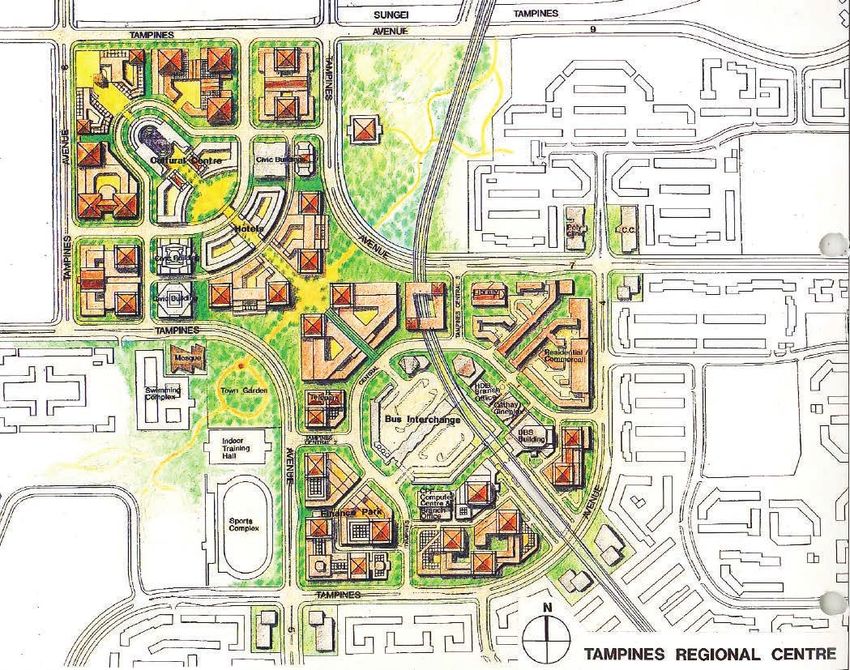
Integrating Land
  Use & Mobility:
    Supporting
Sustainable Growth
Urban Systems Studies (USS) Books

             Financing a City: Developing Foundations for Sustainable Growth

         Land Acquisition and Resettlement: Securing Resources for Development

            Built by Singapore: From Slums to a Sustainable Living Environment

                    Planning for Tourism: Creating a Vibrant Singapore

                Cleaning a Nation: Cultivating a Healthy Living Environment

                 Urban Redevelopment: From Urban Squalor to Global City

                    Port and the City: Balancing Growth and Liveability

     The Active, Beautiful, Clean Waters Programme: Water as an Environmental Asset

    Working with Markets: Harnessing Market Forces and Private Sector for Development

                           A City of Culture: Planning for the Arts

       Sino-Singapore Guangzhou Knowledge City: A New Paradigm in Collaboration

Land Framework of Singapore: Building a Sound Land Administration and Management System

                                                                                            Integrating Land
   Engaging Well, Forging Bonds: The Community as Stakeholders in Urban Development

       For product information, visit http://www.clc.gov.sg/Publications/USS2014.htm

                     Singapore Urban Systems Studies Booklet Series                          Use & Mobility:
                      Water: From Scarce Resource to National Asset

                  Transport: Overcoming Constraints, Sustaining Mobility
                                                                                               Supporting
              Industrial Infrastructure: Growing in Tandem with the Economy

             Sustainable Environment: Balancing Growth with the Environment
                                                                                           Sustainable Growth
                       Housing: Turning Squatters into Stakeholders

              Biodiversity: Nature Conservation in the Greening of Singapore

       For product information, visit https://www.clc.gov.sg/publications/uss2013.htm

                      Liveable and Sustainable Cities: A Framework

                                   For product information,
     visit https://www.clc.gov.sg/publications/books-liveable-and-sustainable-cities.htm
                                                                                              First Edition, Singapore, 2018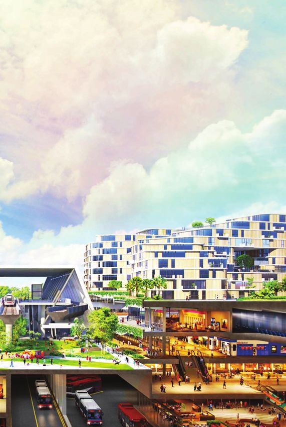
Editorial Team
Writers:	Clarice Chow, Manager, Centre for Liveable Cities                                                          CONTENTS
                                   Jean Chia, Senior Assistant Director, Centre for Liveable Cities
                                   Mina Zhan, Senior Assistant Director, Centre for Liveable Cities
Research Advisor:                  Wong Kai Yeng, Expert, Centre for Liveable Cities                                 List of Illustrations                                                       ix
Editor:	Amit Prakash, Adjunct, Centre for Liveable Cities                                                           Foreword				                                                                xi
Production Supervisor:	Eunice Rachel Low, Adjunct, Centre for Liveable Cities                                       Preface				                                                                xiii
© 2018 Centre for Liveable Cities (CLC), Singapore. All rights reserved.                                             Acknowledgements                                                           xv
                                                                                                                     The Singapore Liveability Framework                                        xvi
                                               CLC is a division of
                                                                                                                     Overview				                                                                 1
                                                                                                                     Chapter 1	Early Integration: Self-Sufficient Residential Towns              3
Set up in 2008 by the Ministry of National Development and the Ministry of the Environment
and Water Resources, the Centre for Liveable Cities (CLC) has as its mission “to distil, create                      Chapter 2	A Long-term Vision                                                7
and share knowledge on liveable and sustainable cities”. The CLC’s work spans four main                                         •	The First Concept Plan                                         8
areas—Research, Capability Development, Knowledge Platforms, and Advisory. Through these                                        •	Upgrading Roads                                              14
activities, the CLC hopes to provide urban leaders and practitioners with the knowledge and
support needed to make our cities better. For more information, please visit www.clc.gov.sg.                                    •	Establishing the Need for Public Transportation              20
                                                                                                                                •	The MRT Solution to Road Congestion                           21
Research Advisors for the CLC’s Urban Systems Studies are experts who have generously
provided their guidance and advice. However, they are not responsible for any remaining                              Chapter 3	Laying the Foundation for the MRT                               23
errors or omissions, which remain the responsibility of the author(s) and the CLC.                                              •	Beyond the State and City Planning Project:
                                                                                                                                   Further Studies and Implementation                           24
                                                                                                                                •	Constructing the Compass Line                                28
For product information, please contact
                                                                                                                     		Financing Development Integrated with Transport                         30
CLC Publications
+65 66459576                                                                                                                    •	Going Underground in the Central Area                        32
Centre for Liveable Cities                                                                                                      •	Connecting Housing Corridors                                 35
45 Maxwell Road #07-01
                                                                                                                                •	Rationalising and Reorganising the Public Transport System   36
The URA Centre
Singapore 069118                                                                                                     Chapter 4	A Strategy for Decentralisation                                 37
MND_CLC_Enquiries@mnd.gov.sg                                                                                                    •	The Constellation Concept                                    38
                                                                                                                                •	Case Study: A Tale of Three Regional Centres                 41
ISBN 978-981-11-7091-1 (print)
ISBN 978-981-11-7142-0 (e-version)                                                                                              •	Supporting the 1991 Concept Plan                             49
                                                                                                                     Chapter 5	Connecting the Developmental Corridors                           51
All rights reserved. No part of this publication may be reproduced, distributed, or transmitted in any form or by
                                                                                                                                •	Connecting New Towns                                         52
any means, including photocopying, recording, or other electronic or mechanical methods, without the prior
written permission of the publisher.                                                                                 		Buangkok’s White Elephant: Challenges of
Every effort has been made to trace all sources and copyright holders of news articles, figures and information in                 Phasing Housing and Transport Development                    56
this book before publication. If any have been inadvertently overlooked, CLC will ensure that full credit is given              •	Localised Integration: Linking Developments to
at the earliest opportunity.
                                                                                                                                   MRT Stations                                                 59
Cover photo:
Conceptual image of Tengah, a car-lite forest town. Tengah will have the first “car-free” HDB town centre in
                                                                                                                                •	Case Study: Dhoby Ghaut—A New
Singapore, with roads, parking facilities and services plying below ground. The town centre will be nestled in                      Developmental Approach                                      60
a large “Central Park”—integrated with water bodies and a 100-m wide and 5-km long “Forest Corridor” that
would be safe for walking, cycling and recreational activities.
                                                                                                                                •	Nurturing a Multi-Modal Transport System                     63
                                                                                                                                •	 Case Study: Sengkang—Integration from Scratch              68
Perspective courtesy of the Housing & Development Board.
Illustrations are artist’s impressions only. Actual developments may differ.
Chapter 6	A Pedestrian-Friendly Central Area
           •	Planning for Walkability
                                                                        71
                                                                        72
                                                                              LIST OF ILLUSTRATIONS
           •	An Engaging Walking Experience                            74
                                                                              Diagrams
           •	Case Study: CityLink Mall—Singapore’s First
                                                                              •   Singapore Liveability Framework                               xvi
              Purpose-Built Underground Shopping Centre                 76
           •	Case Study: Marina Bay—Planning for                             •   Timeline: Integrating Land Use and Mobility                   110
              People-Centred Accessibility                              79
Chapter 7	Going Car-lite                                               85    Exhibits
           •	Doubling the MRT Network                                  86    •   Exhibit 1 : Central Area Expressway Box                       16
		Learning from Disruptions: Playing Catch-Up on                             •   Exhibit 2 :	Proposed MRT Alignments Linking the
              Upgrading Rail Infrastructure                             88                     North South Line to the East West Line           25
           •	Evolving Challenges: Integrating New Lines in a                 •   Exhibit 3 :	Roles and Responsibilities of Government
              Built-up City                                              91                    Agencies Involved in MRT Construction            29
           •	Active Mobility: Covering the Last Mile                   94    •   Exhibit 4 :	Development Radius around Central Area
           •	Laying the Path for Cycling                               96                     MRT stations                                     34
		Tengah: A Car-lite Forest Town                                      100    •   Exhibit 5 : Commercial Centres outside the Central Area       40
           •	Sharing the Road                                         103    •   Exhibit 6 :	Working Structure of the Strategic
		Abandoning SURS: Towards a Car-Lite Future                          104                     Transportation Plan                              49
Chapter 8	Conclusion: Guiding Principles of Integrated Planning for          •   Exhibit 7 :	Integrating Land Use and Mobility:
           Land Use and Mobility                                       107                     In Retrospect                                    54
                                                                              •   Exhibit 8 : Rail Network Expansion Plan up to 2030            87
Endnotes				                                                            116
Bibliography			                                                        125    Photographs and Images
                                                                              •   Toa Payoh Town Centre in the 1970s                            5
                                                                              •	Passengers disembarking at the Toa Payoh
                                                                                 Bus Interchange                                                6
                                                                              •	Draft of Ring Plan (diagram K) from Second Stage Ideation of
                                                                                 the SCP				                                                    10
                                                                              •	High-density developmental corridors and
                                                                                 home-to-work movements                                         11
                                                                              •   The 1971 Concept Plan and Transportation Plan                 12
                                                                              •   Construction of the East Coast Parkway (ECP)                  17
                                                                              •   Shenton Way area, and the ECP passing through Marina South    18
                                                                              •	Area Licensing Scheme gantry in operation at the
                                                                                 Restricted Zone, and City Shuttle Services facilitating
                                                                                 the Park-and-Ride Scheme.                                      19
                                                                              •
                                                                                Alternative MRT Systems:
                                                                                Proposed Basic and Extensive Systems                            22
                                                                              •   Alignment of the completed Compass Line                       28
• Wheelock Place, a GLS site adjoining the Orchard Road MRT
• Seamless interface between Tanjong Pagar Centre and
31
FOREWORD
the MRT station 33
At the start of its journey as an independent nation, Singapore was
• The Constellation Concept and proposed rail connections 39
already familiar with the woes of urbanisation. Congestion was a critical
• 1991 master plan and urban design for Tampines
issue in the 1960s, with vehicles crawling along narrow and winding roads
Regional Centre 42
in a crowded city centre. The government was quick to recognise that
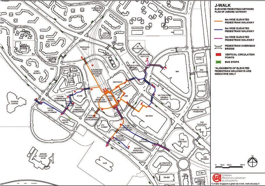
• Schematic plan of the Elevated Pedestrian Network (J-Walk) 47
to develop in a liveable and sustainable manner, Singapore’s biggest
• Proposed MRT and major road network for Year X in the challenge would be to make the best possible use of scarce land for
1991 Concept Plan 52 facilitating mobility. Singapore is today a densely populated and built-up
• The Atrium@Orchard built above Dhoby Ghaut city, equipped with a modern transport system comprising a growing
NEL station 62 number of commuter train lines and a comprehensive road network,
• Woodlands MRT station above the bus interchange and which are aligned tightly with its most developed areas. This is the result
Toa Payoh Integrated Transport Hub 64 of a long-term vision and decades of planning to integrate land use
• Bukit Panjang LRT station 66 and mobility.
• Sengkang LRT 68
• ION Orchard and entrance to the underground Singapore embarked upon long-term urban planning in 1967, with
Orchard MRT station 73 the commencement of the State and City Planning Project (SCP).
• Underground Pedestrian Network across the Central Area 75 Undertaken jointly by the government and the United Nations
• Alignment of CityLink Mall and One Raffles Link 77 Development Programme, the SCP led to the creation of Singapore’s first
• Realignment of the East Coast Parkway 79 Concept Plan in 1971 to guide the city’s physical development. The SCP
recognised that along with large-scale land development for housing and
• Street-level pedestrian walkway 80
industries, it was equally important to build a comprehensive transport
•
Schematic of Underground Pedestrian Network and
system to serve these newly developed areas. It proposed a network of
areas for mandatory activity-generating uses at Marina Bay 81
expressways, but warned that excessive reliance on private cars would
• Underground Marina Bay Link Mall 83
be the bane of a land-scarce city as road-building alone would not be
• Construction of Tampines West Downtown Line MRT
sufficient to meet growing demand. Therefore, it also recommended
station close to an HDB estate 91
building a rail-based Mass Rapid Transit system (MRT) as a reliable and
• Two possible alignments under consideration for the comfortable form of public transport.
Cross Island Line 93
• Covered walkways and cycling path in Tampines HDB town 95 However, given the heavy financial burden of the MRT, it took 10 years
• Bicycle parking at an MRT station 97 of feasibility studies before the government gave the go ahead for
• Ang Mo Kio Linear Park under the viaduct of the construction in 1982. Strict safeguarding and acquisition of land in the
North South Line 98 interim helped to ensure that construction proceeded smoothly from the
• Artist’s impression of Tengah Town Centre 101 point of approval, and Singapore’s first MRT lines opened in 1987.
• Tengah’s comprehensive commuting networks 102
• Singapore Underground Road System (SURS) alignment 105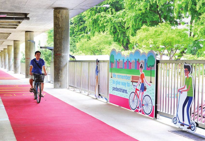
Meanwhile, self-contained satellite townships were already being built to
decongest the city centre and create employment opportunities closer
                                                                              PREFACE
to home. Toa Payoh, the first of such townships, was equipped with light
                                                                              The Centre for Liveable Cities’ (CLC) research in urban systems unpacks
industries along with town and neighbourhood centres that provided
                                                                              the systematic components that make up the city of Singapore, capturing
shopping and entertainment options—all within walking distances of
                                                                              knowledge not only within each of these systems, but also the threads
homes. Such decentralisation strategies also prevented the overloading
                                                                              that link these systems and how they make sense as a whole. The studies
of planned transport systems, underscoring the importance of integrating
                                                                              are scoped to venture deep into the key domain areas the Centre has
land use and mobility.
                                                                              identified under the Singapore Liveability Framework, attempting to
                                                                              answer two key questions: how Singapore has transformed itself into a
The Constellation Concept developed in the 1990s led to the creation
                                                                              highly liveable city within the last four to five decades, and how Singapore
of suburban commercial centres—zones of employment and activity to
                                                                              can build on our urban development experience to create knowledge and
complement the Central Area. At the same time, the Central Area itself
                                                                              urban solutions for current and future challenges relevant to Singapore
was reshaped to become highly walkable and so well-connected by public
                                                                              and other cities through applied research. Integrating Land Use & Mobility:
transport that there would be less reason to drive. Today, air-conditioned
                                                                              Supporting Sustainable Growth is the latest publication from the Urban
passageways and outdoor walkways allow commuters to move seamlessly
                                                                              System Studies (USS) series.
around the Central Area. These are the results of specific urban design
conditions that guided developers to make the area pedestrian-friendly.
                                                                              The research process involves close and rigorous engagement of CLC
                                                                              researchers with our stakeholder agencies, and oral history interviews
More recently, Singapore’s mobility ecosystem has expanded to include
                                                                              with Singapore’s urban pioneers and leaders to gain insights into
active modes of transport, such as cycling, which require dedicated
                                                                              development processes and distil tacit knowledge that has been
infrastructure and place new demands on scarce land. This further
                                                                              gleaned from planning and implementation, as well as the governance of
increases the importance and complexity of integrating land use and
                                                                              Singapore. As a body of knowledge, the Urban Systems Studies, which
mobility to meet the needs of a growing population in an increasingly
                                                                              cover aspects such as water, transport, housing, industrial infrastructure
dense urban environment.
                                                                              and sustainable environment, reveal not only the visible outcomes of
Integrating Land Use & Mobility: Supporting Sustainable Growth captures       Singapore’s development, but the complex support structures of our
Singapore’s journey over the past five decades towards building a             urban achievements.
comprehensive transport network to serve a modern and vibrant global
                                                                              The CLC would like to thank the Housing & Development Board, Land
city. While there have been tremendous successes, significant challenges
                                                                              Transport Authority, Urban Redevelopment Authority and all those
and some hard lessons, it remains critical to retain and build upon the
                                                                              who have contributed their knowledge, expertise and time to make this
fundamentals of good planning for achieving optimal outcomes. I hope
                                                                              publication possible. I wish you an enjoyable read.
that you will find Singapore’s story both insightful and inspiring.

                                                                                                                                        Khoo Teng Chye
                                                            Loh Ngai Seng
                                                                                                                                      Executive Director
                                                     Permanent Secretary
                                                                                                                                Centre for Liveable Cities
                                              for the Ministry of Transport
ACKNOWLEDGEMENTS
The Centre for Liveable Cities (CLC) is grateful to the following
interviewees and partners for their contributions: Cheng Hsing Yao,
Fong Chun Wah, Fun Siew Leng, Hengky Tay, Michael Koh, Dr Liu Thai
Ker, Mohinder Singh and Wong Kai Yeng. The CLC is also grateful for the
inputs and assistance provided by the Housing & Development Board,
Land Transport Authority and Urban Redevelopment Authority in the
publication of this study.

The researchers, Clarice Chow, Jean Chia and Mina Zhan, would like to
thank their CLC colleagues for their inputs and support in the publication.
In particular, they would like to extend special thanks to research advisor
Wong Kai Yeng for his knowledge sharing and guidance.
Integrated Master Planning and Development
THE SINGAPORE                                                                Think Long Term
LIVEABILITY FRAMEWORK                                                        Singapore, with its land scarcity and growing population, could not hope
                                                                             to rely solely on private transport and yet avoid urban congestion. The
The Singapore Liveability Framework is derived from Singapore’s              1971 Concept Plan called for an efficient public transport system to meet
urban development experience and is a useful guide for developing            travel needs, and proposed a rail-based Mass Rapid Transit system.
sustainable and liveable cities.
                                                                             (See The MRT Solution to Road Congestion, p. 21)

The general principles under Integrated Master Planning and
                                                                             Build in Flexibility
Development and Dynamic Urban Governance are reflected in the
                                                                             Development of rail infrastructure and surrounding buildings may
themes found in Integrating Land Use & Mobility: Supporting
                                                                             not always be synchronised. However, the option to integrate future
Sustainable Growth.
                                                                             developments adjacent to train stations can be preserved through urban
                                                                             design guidelines and mechanisms such as knock-out panels. These are
                                                                             used to ensure proper linkages to enhance walkability, and encourage the
                                                                             use of public transport.

                                                                             (See Going Underground in the Central Area, p. 32)

                                                                             Execute Effectively
                                   High                                      Due to the hefty costs, construction of the MRT system only commenced
                                  Quality                                    10 years after it was proposed. During that period, strict safeguarding
                                  of Life                                    measures and land acquisition helped to ensure that construction could
                                                                             proceed without a hitch when the go-ahead was finally given.

                                                                             (See Constructing the Compass Line, p. 28)
                    Competitive           Sustainable
                     Economy              Environment                        Dynamic Urban Governance
                                                                             Cultivate Sound Institutions
                                                                             The Land Transport Authority (LTA) was formed in 1995 to consolidate
                                                                             land transport responsibilities that were previously fragmented among
               Integrated Master Planning and Development
               •   Think Long Term                                           multiple government agencies. The LTA works closely with the Urban
               •   Fight Productively                                        Redevelopment Authority and Housing & Development Board to ensure
               •   Build in Flexibility
               •   Execute Effectively                                       proper integration of transport infrastructure in land use plans.
               •   Innovate Systemically
                                                                             (See Setting up the Land Transport Authority, p. 50)
                                  Dynamic Urban Governance
                                  •  Lead with Vision and Pragmatism
                                  •  Build a Culture of Integrity            Work with Markets
                                  •  Cultivate Sound Institutions
                                  •  Involve the Community as Stakeholders   Developers and building owners in the Central Area were incentivised to
                                  •  Work with Markets                       contribute to the construction of underground pedestrian links. These
                                                                             would connect to the extensive Underground Pedestrian Network to help
                                                                             create a pedestrian-friendly Central Area.

                                                                             (See An Engaging Walking Experience, p. 74)
1

OVERVIEW
In the 1960s, urban congestion was a common problem as land-scarce
Singapore began charting its course as an independent nation. Reliance
on private vehicles as the main mode of transportation would have been
unsustainable, hence there was a need to provide viable alternatives.

Integrated planning for land use and mobility was considered essential for
maximising the utility and value of spaces surrounding transport nodes.
This was achieved by aligning key transport networks with high-density
developmental corridors comprising housing townships and commercial
centres. Integration of facilities was also emphasised at the local level.
Such transport nodes have today become vibrant places that typically
constitute Mass Rapid Transport (MRT) stations and bus interchanges
connected to surrounding developments. By encouraging the use of
the public transport system over driving, they provide Singaporeans
convenient ways to travel and meet their everyday needs.

By 2030, 80% of Singaporean households will be within a 10-minute walk
from the nearest train station and a ride away from a growing number
of destinations island-wide. Buses will also be available to ferry them to
the nearest MRT station, or all the way into the city along strategically
aligned expressways. Seamless transfers between transport modes would
be possible via air-conditioned walkways, with the option of visiting some
retail facilities conveniently located along the way. Beyond motorised
options, infrastructure will be in place to complement the growing public
interest in cycling to cover the last mile.

This study examines the development of land use and transport planning
in Singapore. It covers the principles and strategies that have enabled
a high level of integration, and the systemic manner in which successes
were built upon and hard lessons learned. Case studies of selected
integrated developments are used to illustrate the importance of good
land use planning and sustainable transportation strategies, backed by
effective regulatory and financing frameworks.
Integrating Land Use & Mobility:
Supporting Sustainable Growth
                                       CHAPTER 1

                                   Early Integration:
                                    Self-Sufficient
                                   Residential Towns
Integrating Land Use & Mobility: Chapter 1 4 5
Supporting Sustainable Growth
A fundamental principle of integrated land use and transport planning However, transportation remained an issue, especially for residents
is to reduce the need for people to travel long distances on a regular needing to travel elsewhere for work. It was only in 1967 that public buses
basis. This was evident in the early stages of urban planning in Singapore. began operating in Toa Payoh, with the Singapore Traction Company
Even before the start of the State and City Planning Project (SCP), plying three services towards the Central Business District (CBD).4 Before
and the development of Singapore’s Mass Rapid Transit (MRT) system, that, residents who did not drive had been relying on illegal pirate taxis.5
self-contained townships were being built to serve the majority of their
residents’ daily needs. Within the township, good walkability was prioritised to reduce the need
for additional motorised transport. Dr Liu recalls that studies showed
In 1964, development began on the first self-sufficient satellite township a sharp decline in people’s willingness to walk beyond 400 m given
comprehensively planned by the Housing & Development Board (HDB) Singapore’s tropical climate. Dr Liu’s team also studied the population
—Toa Payoh New Town. The main structure of Toa Payoh was put in density required to create demand levels that could support an
place by 1972, and the town continues to be developed over the years. acceptable variety of shops in neighbourhood centres. As a compromise,
In preparation for a growing population, it was built to house up to the HDB built neighbourhoods within an average radius of 500 m of a
200,000 residents, twice as many as Queenstown which was built in nucleus of shops. The town centre itself was designed to be pedestrian-
the 1950s by the HDB’s predecessor, the Singapore Improvement Trust. friendly, with an unobstructed pedestrian-only mall and ample greenery to
The new town was developed based on the “Neighbourhood Principle” provide shelter from the sun.6
to reduce the need for commuting, with a town centre surrounded by
five neighbourhoods, each equipped with their own markets, shops
and schools. Other necessary amenities such as clinics, post offices
and theatres were also provided in the town.1 This would be applied to
all future townships as one of the HDB’s comprehensive town planning
principles, equipping them with a full range of facilities and creating a self-
sufficient environment for their residents to “Live, Work, Play and Learn”.
In Toa Payoh, the HDB successfully implemented the satellite town
concept, which envisioned the island “dotted with self-contained,
skyward-reaching complexes of homes and services” surrounding the
city centre, a precursor to future decentralisation.2 Land was set aside
for employment-generating light industries, such as toy and electronics
assembly lines. Dr Liu Thai Ker, who headed the HDB’s Design and
Research Section from 1969 to 1975, and later became its Chief Executive
Officer, highlighted that commercial centres—which acted as employment,
retail and transport hubs—accounted for the bulk of journeys made:
Traffic planning cannot [be done] without land use. In fact, I want to
highlight that the basic purpose for traffic is to move people from
home...to commercial centres. Of course people will say, “What about
schools and factories and so on?” The volume is small. If you solve the
movement from home to commercial centres, you solve the majority of
traffic need[s].
Toa Payoh Town Centre in the 1970s.
Photo from the Ministry of Information and the Arts Collection, courtesy of National Archives of Singapore.
Dr Liu Thai Ker3Integrating Land Use & Mobility:
Supporting Sustainable Growth
CHAPTER 2
Passengers disembarking at the Toa Payoh Bus Interchange.
Photo from the Ministry of Information and the Arts Collection, courtesy of National Archives of Singapore.
In 1971, an interchange capable of accommodating 300 buses was built to
A Long-term
improve Toa Payoh’s internal and external connectivity. It was situated in
the town centre along with a pedestrianised shopping complex that was
touted as the largest in Singapore at the time,7 nurturing a bustling mixed-
Vision
use environment. This model would subsequently be implemented in
other townships, where town centres formed the hub of activity anchored
around the bus interchange which, in future, would be integrated with
MRT stations.
In 1973, the Singapore Bus Service (SBS) was formed through the merger
of disparate bus operators that controlled services in different areas. The
consolidation of the fragmented bus industry resulted in better coverage,
efficiency and profitability.8 HDB residents could now take feeder services
from near home to the interchange, where they could hop onto trunk
services connecting to other towns, or to the CBD. This also helped to
lower operational costs by concentrating demand at a central point and
reducing the overlapping of routes.9 The HDB and the Public Works
Department (PWD) also worked closely with the SBS to locate bus stops
at ideal intervals and facilitated access by ensuring good connections to
footpaths.10 However, buses of the day were crowded, filthy and unreliable,
with brand new and older buses equally liable to breakdown. People found
themselves aspiring to travel in greater comfort by private car if they could
afford to.11
The congestion that plagued Singapore throughout the 1960s went
beyond residential towns and highlighted an urgent need for a better
island-wide transportation system. Fortunately, planning for such a
system had begun years before it was eventually implemented in the
1980s. For example, during the construction of Toa Payoh, land was
already set aside for future MRT infrastructure that would eventually cut
through the township.12Integrating Land Use & Mobility: Chapter 2 8 9
Supporting Sustainable Growth
THE FIRST CONCEPT PLAN Many young engineers and planners, some of whom had been sent
overseas for training as part of the UNDP’s assistance for the SCP,
Upon gaining independence in 1965, Singapore entered a phase of rapid were involved in the project so that they could ensure its effective
nation building focused on industrial development and housing a growing implementation upon completion. One of them, Joseph Yee, who joined
population in satellite towns. These developments would lead to more the SCP as a young urban planner in 1968, recounted that prior to the
people living outside the Central Area and a corresponding increase in commencement of the project, transportation-related work mostly
travel demand. However, the main mode of local transportation at the time involved road-building by the Public Works Department (PWD) to relieve
was by car, and the existing road infrastructure was already congested.13 bottlenecks in the city and in the immediate suburbs.17
Recognising that Singapore needed a more sustainable solution for land The SCP employed four strategic thrusts that would endure and become
use and transportation, the government approached the United Nations the fundamental principles for all future developmental plans:18
Development Programme (UNDP) for assistance in 1967. The UNDP
awarded a $4 million grant for the State and City Planning Project (SCP), i. Very long-term planning for land use and transport requirements
which culminated in Singapore’s first Concept Plan to guide land usage.
ii. Expanding the road network to serve a growing population
The Concept Plan has since become an integral part of the country’s
urban planning. It guides development over 40 to 50 years to ensure iii. Managing travel demand
that “there is sufficient land to meet long-term population and economic iv. Improving public transportation
growth needs, while providing a quality living environment for the
people”.14 The plan is reviewed every 10 years, taking stock of changing However, as this was Singapore’s first foray into comprehensive long-
trends in Singapore’s economy, population and demographics. Based term planning, there existed no database that planners could use for
on these, land requirements are derived for major uses such as housing, modelling. Hence, a significant portion of the four-year study was spent
industries and supporting infrastructure including transportation and collecting data suitable for transportation planning. A wide range of
community facilities. surveys—from premises and land use to population size, household
income and employment—were conducted to study existing trends. These
Completed in 1971, the SCP was a joint undertaking with the UNDP enabled planners to forecast traffic conditions as far as 25 years ahead.
and technical consultancy firm Crooks Michell Peacock Stewart, Only then could the real work on the Concept Plan and its accompanying
with the objective of developing a comprehensive plan for land use Transportation Plan begin.19
and transportation in Singapore.15 The authors observed, “With a
comprehensive development plan and the machinery and determination
to put it into effect, a government can shape a city’s future. In Singapore,
the opportunities for such a plan are especially favourable.”16Integrating Land Use & Mobility: Chapter 2 10 11
Supporting Sustainable Growth
Laying the Ring Plan
The first step was to decide on a long-term development pattern for the
island. After multiple rounds of ideation, the “Ring Plan” was identified
as the most suitable given Singapore’s infrastructure and urbanisation
pattern at that time. It envisioned high-density housing estates and
commercial centres encircling the central catchment area, joined by a
band of developments along the southern coast. An efficient transport
network would serve these developmental corridors. The “Ring Plan” was
essentially the draft that developed into the first Concept Plan, and all its
successors retained the ring formation.20
High-density developmental corridors and home-to-work movements.
DEVELOPED AREA © Urban Redevelopment Authority. All rights reserved.
MAJOR CENTRES
MAJOR ROADS
MRT
The SCP also recommended the creation of smaller employment centres,
Draft of Ring Plan (diagram K) from Second Stage ideation of the SCP. comprising industrial and non-industrial estates, along the developmental
© Urban Redevelopment Authority. All rights reserved.
corridors outside the Central Area. This would shorten the average length
of work trips and reduce the load on the transport system as workers
Principle of Decentralisation
could choose jobs closer to home. This contrasted with massive waves of
A close relationship between place-of-living and place-of-work has long commuters entering and leaving the Central Area, pressurising the system
been regarded as a prime objective of a good plan, because it can have during peak periods. Spreading out demand would also help to optimise
such a marked influence on the time and cost of the journey-to-work public transport operations because fixed-route carriers would not have
and can also help to reduce congestion and improve convenience. to run empty as they moved away from the Central Area.21
Crooks Michell Peacock StewartIntegrating Land Use & Mobility: Chapter 2 12 13
Supporting Sustainable Growth
Recommendations Recommendations were provided in four key areas:
The SCP culminated in a 1971 report that became known as the first
i. Expanding the road network
Concept Plan (CP 1971). It provided a long-term planning framework to
guide Singapore’s physical development and land use planning up to 1992, ii. Vehicle ownership and usage controls
when its population was projected to reach 3.4 million. The CP 1971 also iii. Improving public transport
made recommendations towards an arbitrary Year X, when the population iv. Implementing a mass transit system at the earliest opportunity
would hit four million. A Transportation Plan was produced in tandem with
the CP 1971 and acted as the transport master plan up to 1992, addressing The plan was the first to give significant consideration to Singapore’s
the long-term roles of private and public transport and their respective transport needs and had a lasting impact on its planning approach for
development programmes.22 land use and mobility. Its major proposals included building an extensive
network of expressways and a commuter rail system aligned with the
developmental corridors. This would provide “efficient, fast transport
facilities” linking all major activities and residential districts with the
Central Area.23
The 1971 Concept Plan (left) and Transportation Plan (right).
© Urban Redevelopment Authority. All rights reserved.Integrating Land Use & Mobility: Chapter 2 14 15
Supporting Sustainable Growth
UPGRADING ROADS capacity corridors in concentrated residential or industrial areas.29 With
this broad and long-term vision, staging plans could be produced to guide
Road transportation provided the only means of travelling within near-term developments in greater detail. This included a short-term road
Singapore before the rail-based Mass Rapid Transit (MRT) system started programme that identified areas in more immediate need of attention.30
in 1987. Before 1971, the road network featured eight major radial routes The inter-ministerial Road Transport Action Committee (RTAC) was also
converging in the Central Area and joined by two ring routes. Within the formed in 1973 to coordinate transport planning and formulate policies.31
Central Area, roads were laid out in a rectangular grid pattern of one-way
streets.24 Prepared under the instructions of Sir Stamford Raffles himself, A slew of improvement works followed, such as the widening of junctions
this layout had served the city well, being highly navigable and efficiently and the opening of slip roads. Safety features were also implemented,
governed by traffic lights.25 However, congestion had become a problem including the installation of traffic light controls and segregating
and the prevailing mindset was to simply build more parking spaces to pedestrian and vehicular traffic using footpaths, overhead bridges and
accommodate a growing demand for cars.26 underpasses.32 The PWD also initiated the process of safeguarding land
in preparation for the construction of new roads and the widening of
The SCP examined the deteriorating road congestion through detailed existing ones. This required the PWD to work closely with the HDB and
surveys and traffic counts. By 1970, the PWD had also seconded its traffic the Urban Renewal Department, Singapore’s land use planning body that
section to the SCP Department, where its officers worked closely with became the Urban Redevelopment Authority (URA) in 1974.33 Mohinder
town planners and architects to develop a comprehensive transport Singh, formerly of the PWD and subsequently Director of Planning of its
solution. The team determined that the most congested area lay along the successor, the Land Transport Authority (LTA), recalls “there was very
radial approaches to the Central Area, where the average speeds reached close coordination among the three agencies—the PWD, HDB and URA”.
no higher than 20 miles (32.2 km) per hour. The study also uncovered This was especially important for defining the positioning of roads in
drastic road fatalities and haphazard road-based public transport developmental plans, such as aligning the Tampines Expressway (TPE) to
services provided by a range of private companies and illegal operators. serve new townships.34
It declared that major improvements were needed which required a
significant increase in spending on road construction and maintenance.27 A Central Area Expressway Study (CAES) was also conducted from 1974
Despite the scarcity of land, the study emphasised the importance of to 1976 to map out in detail the configuration of the expressway network
road development to handle Singapore’s growing population. To be hugging the Central Area. A “box” was deliberately designed into the
sustainable, this would have to be paired with restraints on the ownership network, made up of segments of the Pan Island Expressway (PIE), East
and usage of private cars.28 Coast Parkway (ECP), Kallang Expressway (KLE), Central Expressway
(CTE) and Ayer Rajah Expressway (AYE). This “box” encompassed the
Drawing Up the Plans boundaries of the Central Area, linking with roads inside it and creating
a bypass for those wishing to avoid entering the city. This was essential
The Transportation Plan presented a road network that was to be
given the presence of the Area Licensing Scheme (ALS), a traffic demand
completed by 1992, improving capacity and connectivity to housing
management system implemented in the CBD, charging motorists for
towns and industrial estates. It included a hierarchy of roads comprising
entering restricted zones during peak periods.35 Detailed planning was
nine expressways supported by arterial and collector roads connecting
done in the CAES, building upon the broad, strategic proposals from the
to developmental areas specified in the CP 1971. A hierarchical structure
SCP. This included provisions for lanes and ramps, and enabled the PWD
was crucial for optimising the road network’s capacity, directness and
to safeguard the land efficiently.36
accessibility of routes, and for preserving the surrounding environment.
This way, heavy traffic volumes would not be forced through lowerIntegrating Land Use & Mobility: Chapter 2 16 17
Supporting Sustainable Growth
Exhibit 1: Beyond geometry and geology, there were a host of other factors to
Central Area Expressway Box account for. Land acquisition, in particular, was complex and the PWD
worked with the Land Office (today’s Singapore Land Authority) to
expedite the process. The land had to be valued and gazetted, and its
owners compensated, before the government could move in to resettle
the occupants. Only then could road construction begin. Heritage and
religious buildings as well as embassies were considered “sensitive”, and
acquiring them was avoided where possible. However, road geometry—the
maintenance of straight and level alignments—remained a priority. Hence,
they were not completely exempt from acquisition and demolition. The
difficulty of land acquisition was often closely tied to the provision of
resettlement benefits. Construction was thus sometimes phased according
Central to the progress of acquisition and resettlement rather than waiting for all
Area the required land to become available, which could take years.
Pan Island
1 Expressway Kallang
2 Expressway In some cases, the road alignments crossed into environments under the
purview of other government agencies. Bridges across waterways had
to be cleared with the Ministry of Environment, as with drainage systems
East Coast
3 Expressway along regular roads. Big trees, given their importance in maintaining
Central
Expressway
5 Singapore’s image as a garden city, were a source of friction between
4 Ayeh Rajah
Expressway the PWD and the National Parks Board (NParks). As with all large-scale
developments, the road network expansion was also subjected to a
rigorous evaluation process in order to get funding approved.38
Large-Scale Construction
After the road alignments were planned, they had to be designed
individually by the PWD, accounting for topographical features, land
ownership, existing infrastructure and future island-wide development plans
by the URA. Junctions were also incorporated where new roads crossed
existing ones.37 However, the presence of large transport infrastructure
could become disruptive in key locations such as the Central Area. This
was especially so for long roads and expressways that passed through
areas with different “tolerances” with regard to visual impact. In these
cases, a combination of viaducts and tunnels could be used to minimise
the total cost of the entire route. For example, the CTE’s underground
segment through the Central Area was initially proposed as a viaduct in the
SCP. However, the PWD decided to build a tunnel instead after thorough
examination. While this made the CTE the most expensive expressway at
the time, it helped to preserve the aesthetics of the “showpiece” Central
Area, minimise environmental and noise pollution, and also prevented the
creation of a potential barrier both physically and visually. Construction of the East Coast Parkway (ECP).
Photo from the Ministry of Information and the Arts Collection, courtesy of National Archives of Singapore.Integrating Land Use & Mobility: Chapter 2 18 19
Supporting Sustainable Growth
The PIE had already been planned as a “super road” to link up all satellite
towns from Jurong to Changi. It was built in phases from 1964, and was
one of the PWD’s costliest undertakings in the 1960s and 1970s.41 The
PIE was also extended to connect the Jurong Industrial Estate, which
was being developed into a major employment centre. Construction of
the other expressways proceeded through the 1980s and 1990s. These
included the Bukit Timah Expressway (BKE), which was built in the 1980s
to reach the Causeway, passing by Woodlands Town, a township primed
to become a future Regional Centre and gateway to Malaysia (see Chapter
4). In 2008, the Kallang–Paya Lebar Expressway (KPE) opened as the last
of the original nine, after a particularly rocky process (see Chapter 5).
Traffic Demand Management
The planners realised that physical improvements to the transport
Shenton Way area, and the ECP passing through Marina South.
system alone would not suffice. These would need to be supplemented
Photo courtesy of the Kouo Shang-Wei Collection 郭尚慰收集, National Library Board, Singapore 2018.
by restraints on car ownership and usage through pricing and demand-
management policies. Additionally, the effectiveness of the public
Backbone of Expressways
transport system relied in part on transfer of demand from users of
Expressways were prioritised in the road-building process, with the private vehicles. Public transport fares were thus kept low, while charges
planned 135 km-long system forming the backbone of the entire road were imposed on those who drove and parked in the Central Area.
network.39 The building of expressways was staged according to major
developments unfolding across the island so that useful connections
were created systemically. For example, as preparations began in 1975 for
a new international airport at Changi to replace the one at Paya Lebar,
alignments for the PIE and ECP—Singapore’s first two expressways,
completed in 1981—were designed to link the new airport to the city. The
ECP was built on reclaimed land which, as Singh explained, “enabled quite
a few things to be done”.
East Coast Parkway was built as part of the shifting of the airport
from Paya Lebar to the East Coast, to Changi. The idea was that the
airport should be linked to the city. But then, how are you going to
link it because the [existing] developments have been built up to the
coastline? There wasn’t such a thing as reserving the foreshores at that
time. So, it would have necessitated either quite a massive acquisition
of land along the route in order to build the expressway, or the
alternative that was adopted, which was to reclaim.
Area Licensing Scheme gantry in operation at the Restricted Zone (left), and
Mohinder Singh40 City Shuttle Services facilitating the Park-and-Ride Scheme (right).
Photos from the Ministry of Information and the Arts Collection, courtesy of National Archives of Singapore.Integrating Land Use & Mobility: Chapter 2 20 21
Supporting Sustainable Growth
In June 1975, these concepts evolved into the Area Licensing Scheme Conditions for these public transport options were simulated, and two wholly
(ALS) and the Central Area was designated as a Restricted Zone (RZ) road-based scenarios were considered. In one, buses shared the streets with
guarded by 27 gantries. Commuters were given two options to avoid other vehicles, and in the other, buses would operate on the same streets but
paying the higher fees. The first was to car-pool—a driver ferrying four or be given special right-of-way in the form of dedicated lanes. Both options
more passengers was exempt from paying the fee. To facilitate this, the proved impractical. The shared option would increase traffic volumes to
government formed a Car Pooling Management Unit to help the public unfeasible levels for existing road capacities. Dedicated lanes for buses would
form car pools. Otherwise, motorists could make use of the “Park-and- improve their carrying capacity, but at high cost and greater congestion on
Ride” scheme to park their cars at one of 15 fringe car parks outside the the narrowed road space for other vehicles. The cost of providing special
RZ and take special shuttle buses into the city.42 These measures resulted right-of-way was estimated to match even that of a rail-based system. Each
in a 73% decrease in the number of vehicles entering the RZ during scenario failed to attain a standard of service that would be attractive to
restricted hours between March and September 1975.43 commuters, leading to the conclusion that strictly road-based options would
not only fail to ease traffic congestion, but might even worsen it.
ESTABLISHING THE NEED FOR PUBLIC
TRANSPORTATION THE MRT SOLUTION TO ROAD CONGESTION
If you want to curtail the travel [by] cars, you’ve got to provide a good These simulations highlighted the need for a high-capacity system with
public transport alternative. And the bus system at that time was very exclusive right-of-way, away from road traffic. A rail-based MRT system was
deemed best as it could provide both comfort and capacity for moving
pathetic. They were breaking down on the roads, smoky exhausts and
people. In existing rail-based MRT systems overseas, a single track can
all kinds of problems.
move up to six times more passengers per hour than one traffic lane.45
Lim Leong Geok, former Executive Director of the Mass Rapid Transit Corporation44 Additionally, the MRT system had the propensity to bring other benefits,
such as stimulating future economic growth.
In addition to the improved road network, an efficient public transport
The alignment for a basic MRT system was proposed, connecting existing
system was needed to cope with projected population growth and curb
housing estates such as Toa Payoh and Queenstown to the Central Area. The
demand for private cars. The SCP report forecasted that unrestrained
plan also specified that a stretch of the system cutting through the Central
demand growth for private vehicles would bring about an almost fourfold
Area would be located underground. With construction plans still uncertain,
increase in cars in 20 years, or by 1992. A corresponding increase in
the plan for the basic alignment of the MRT system would protect the route
road space to accommodate this would turn busy thoroughfares such
against possible encroachment in the meantime. Plans for an extensive
as Havelock Road into monster 18-laners. This would not only destroy
system covering a larger area were also drawn up for consideration.
Singapore’s environment, but also quickly use up its scarce land.
Congestion would squeeze out road-based public transportation by The basic system included seven stations in the Central Area conveniently
adversely impacting its quality, making car ownership and usage more situated within walking distance to areas of high employment concentration.
attractive. This would only worsen the congestion, creating a vicious cycle. This was also advantageous for developing at high plot ratios in the vicinity,
creating new opportunities for coordinated urban renewal. However,
The SCP assessed that Singapore’s public transport system was in serious planners remained mindful of the implications of development intensity on
need of improvement and examined various options. The studies covered land values and the spread of activities in the Central Area. While a high
buses, taxis, informal road-based options such as trishaws (cycle-rickshaws concentration of commercial activities could yield the highest land values,
or pedicabs) and a heavy rail system. It recommended the eradication of it could potentially lead to “dead” areas outside of working hours. Instead,
informal transport options and the regulation of taxis and shuttle services a more dispersed pattern would spread out activities and help minimise
to serve specialised functions. By reducing clutter on the roads, efforts congestion in key areas. The SCP recommended a careful study of these
could be directed to improving formal public transportation in the form of conflicting implications and the development of a framework that would
buses and a possible rail-based MRT system. balance transportation considerations and the need for intensification to
boost land values.46Integrating Land Use & Mobility:
Supporting Sustainable Growth
CHAPTER 3
BASIC MRT SYSTEM
EXTENSIVE MRT SYSTEM
Laying the
Foundation
for the MRT
Alternative MRT Systems: Proposed Basic and Extensive Systems.
© Urban Redevelopment Authority. All rights reserved.
Aligning the MRT route with high-density housing corridors also created a
win-win situation. An established public transport network running close to
Singaporeans’ doorsteps would encourage them to use the system instead
of cars. This would in turn generate demand for the system and increase
its viability. The improved accessibility would also boost the attractiveness
and value of properties in housing estates. MRT stations would be best
located in areas surrounded by a mix of dense residential and commercial
uses, and become transportation nodes that also helped to meet the daily
needs of residents. Middle-to-low-density developments situated further
away would be connected to MRT stations by buses.
The SCP acknowledged that the rail-based MRT might not be built
immediately due to the heavy financial commitment, but urged that
corridors of the basic system be safeguarded so that it could be
constructed as soon as possible upon approval.47Integrating Land Use & Mobility: Chapter 3 24 25
Supporting Sustainable Growth
BEYOND THE STATE AND CITY PLANNING Smith and Associates and subsequently as part of the Mass Rapid Transit
PROJECT: FURTHER STUDIES AND Corporation (MRTC)—recalled having a “really big fight” with the MTS
IMPLEMENTATION engineers over the alignment of the North South Line (NSL) linking from
Toa Payoh to the East West Line (EWL).53 The engineers favoured the
Given the high cost of a heavy rail system—projected at $5 billion— easier option of building it above ground and through the Kallang Basin,
construction of the proposed Mass Rapid Transit (MRT) system did not which was then a no-man’s land.54 Wildermuth, however, insisted that it
commence until a decade after the State and City Planning Project (SCP) run through Orchard Road because it was important to connect popular
submitted its 1971 report, known as the first Concept Plan (CP 1971). destinations like the shopping belt.
The government had further embarked on a three-phase Mass Transit
Study (MTS), between 1972 and 1980, to confirm if such a sophisticated This complex proposition would involve higher costs arising from
system was really needed. The MTS was a joint undertaking between the constructing the line through a built-up area and concealing the rail
government and Wilbur Smith and Associates, a US transport planning infrastructure underground to preserve the shopping belt’s aesthetics.
firm. The firm noted that since Singapore’s “pattern of development This led to at least 10 rounds of cost–benefit analyses before an inverted
has succeeded in concentrating residences and jobs in well-defined T-shaped alignment was agreed upon. It proved to be a worthwhile
locations”, it was likely to avoid the problem of a sprawling urban undertaking that turned Orchard Road into the star commercial
landscape, “which, in so many other places, has frustrated public destination55 it is today.
transport service”. It added that, with the government and various
statutory boards owning 60% of Singapore’s land area, state action Exhibit 2:
would continue to guide major urban developments.48 Proposed MRT Alignments Linking the North South Line
to the East West Line
Phase one (1972–74) of the MTS revisited population forecasts up to
1992 and examined two possible categories of mass transit options: an
all-bus system and a rail system combined with extensive bus services.49
Phase two (1975–77) established that a bus-rail system was technically
and economically the more viable option. For an all-bus system to meet
future demand, multiple bus lanes per roadway would be necessary, along
with boarding platforms in the middle of the road. This would practically
rule out all other forms of road-based transport and create “bumper-to-
bumper bus queues” given the sheer volume of buses required.50 Phase
three of the MTS (1979–80) involved preliminary engineering studies to Orchard Road
better define the exact route alignment and potential locations of the
stations.51 The MTS eventually recommended a bus and train system, with
the rail route adapted from the original SCP recommendation.52
Choosing the Alignment: High Density Principle
The SCP Transportation Plan recommended aligning the MRT lines
Basic Alignment
with high-density housing and industrial corridors, and linking them to
the Central Area. Thereafter, further detailed planning was needed. To
Final Alignment
maximise its reach and convenience, the rail system had to be able to
carry people where they wanted to go. Bruno Wildermuth, a key person
involved in development of the MRT—first as a consultant with WilburIntegrating Land Use & Mobility: Chapter 3 26 27
Supporting Sustainable Growth
Safeguarding the MRT Alignment The strict safeguarding procedures meant that only three permanent
buildings were eventually affected by the construction of the NSL and
A disciplined approach to long-term planning allowed Singapore to build
EWL. These were the Chartered Bank and Indian Overseas Bank buildings
a well-connected transport network by safeguarding key routes years
in the Central Area, and a block of Housing & Development Board (HDB)
in advance. By the time phase three of the MTS began, the government
flats situated over an MRT tunnel in Braddell.
had already started preparations for a potential pro-rail decision,
including safeguarding the inverted T-shaped alignment proposed in
phase two. A Provisional Mass Rapid Transit Authority (PMRTA) was Breakthrough and Approval
also formed in 1980 to prepare for the construction of an MRT system The three-phase MTS was not the last of the additional feasibility studies
in the near future.56 carried out. In 1980, a team from Harvard University led by Professor
Kenneth Hansen produced a report vouching for an all-bus system
No permanent building was allowed to be built on the land to protect the over the bus-rail option. The Hansen Report, as it had become known,
route and to avoid the cost and hassle of land acquisition and demolitions attracted much public attention. The issue culminated in the Great MRT
in the future. Such safeguarding allowed construction of the MRT to Debate, with several cabinet members and planning experts sparring on
commence smoothly in 1984. A safeguarding system had been instituted national television.64 This sparked a final Comprehensive Traffic Study
in the mid-1970s in which the Public Works Department (PWD), in (CTS) between 1980 and 1982 to evaluate the two proposals.65 Eventually,
cooperation with the Urban Redevelopment Authority (URA), was the all-bus option was debunked after it emerged that Hansen’s team had
involved in identifying the corridors to be protected.57 The URA, which failed to account for important ground conditions, such as the surge in
had oversight of land use plans, would identify proposed developments peak-hour travel demand to and from the Central Area.66
close to the MRT alignment and hand them to the PWD for review. The
PWD would then evaluate and decide whether developments could be The reclamation of Marina South, which began in the 1970s for
built without affecting the safeguarded corridor, or if modifications development into a new downtown area, provided the turning point in
were required.58 the MRT debate and highlighted the need for transportation and urban
development to go hand in hand.
Pok Sheung Foo, a PWD transport planner who had been involved in
safeguarding the route, recounted a significant case in the Central Area. In The breakthrough came with the reclamation of Marina South. Well, as
the late 1970s, the Chartered Bank’s pre-war premises had been acquired you know, Marina South is adjoining the city centre, Telok Ayer Basin,
for demolition to make way for the Raffles Place MRT station. The bank south of Shenton Way. And the only way you can get to Marina South is
had submitted plans for a new building at a site at Battery Road, which through a road by the side of Telok Ayer Basin. Only one road!
also lay over the underground MRT alignment.59 Pok had rejected their
plans since the foundations would obstruct the MRT tunnels and in turn, So we said, “Alright, if large numbers of people want to get to Marina
affect two lines because Raffles Place was to be an interchange for the South, the only way is to have MRT. If there is no MRT, Marina South will
NSL and EWL. The bank then submitted a revised proposal that provided remain predominantly an open space. Right? If you have MRT going to
for an MRT tunnel,60 which was subsequently approved by Pok and his Marina South, then that open space can be developed. And all that you
team in early 1980.61 Thus, the new Chartered Bank Building was built with need is to sell only part of that developable land to pay for all your MRT
arching foundations to accommodate the MRT, with the bank bearing the costs. Now you have a big chunk of land here. Do you want to develop
$14 million cost.62 This was done long before the station and tunnels were it or not? If you want to develop, have MRT.”
constructed so that no retrofitting would be needed to accommodate
the future rail infrastructure.63 As of 2017, the building (renamed 6 Battery Ong Teng Cheong, then Minister for Communications67
Road) retains its direct entry point to the underground station, which was
built later.You can also read