Japanese Rose (Rosa rugosa): its invasion and colonisation of the Sefton Coast, north Merseyside
←
→
Page content transcription
If your browser does not render page correctly, please read the page content below
British & Irish Botany 1(3): 185-201, 2019

    Japanese Rose (Rosa rugosa): its invasion and
  colonisation of the Sefton Coast, north Merseyside,
                           UK
                          Philip H. Smith*, Ben Deed
         9 Hayward Court, Watchyard Lane, Formby, Liverpool L37 3QP

*Corresponding author: Philip Smith: philsmith1941@tiscali.co.uk

This pdf constitutes the Version of Record published on 13th August 2019

Abstract
A spiny shrub native to north-west Pacific coasts, Rosa rugosa Thunb. (Japanese
Rose) was introduced into Britain in the 19th century as a garden plant. It has
since become a well-established and widespread naturalised alien, especially on
sand-dunes, shingle beaches and other dry coastal habitats. The plant is also
considered invasive on coasts of many other countries in Northwest Europe.
Mounting concern about its recent spread on the internationally important sand-
dune system of the Sefton Coast, north Merseyside, led to a volunteer survey
being organised in 2014, involving 47 participants. They searched most of the 27
km-long coastal zone, recording almost 500 patches with a total area of nearly 6
ha. R. rugosa occurred especially on younger calcareous dunes (soil pH 5.6 –
8.2) near the sea and close to roads and human habitation. Few patches were
found on older, more acidic duneland, or on a 5 km erosion front around Formby
Point. This pattern of occurrence accords with that reported elsewhere for R.
rugosa, indicating that the sea is implicated in the dispersion of propagules and
that the species also establishes from anthropogenic sources, including
ornamental plantings. It is concluded that the plant is a threat to dune habitats
and species on the Sefton Coast. Control measures are discussed and the early
stages of patch removal are described.

Keywords: Dispersal; introduction; management; non-native; sand dune.

Introduction
Origin and geographical distribution
Rosa rugosa Thunb. (Japanese Rose) is a deciduous, spiny, strongly suckering
shrub native to northern Japan, north-east China and the Russian far-east.
Having large, attractive, pink or white flowers and large red hips, it was first
introduced to Britain in 1796 but was not successfully grown as a garden and
landscape ornamental until after its re-introduction in 1845. The shrub was first
recorded in the wild in Cumberland in 1927 (Maskew, 2002), since when it has

                                       185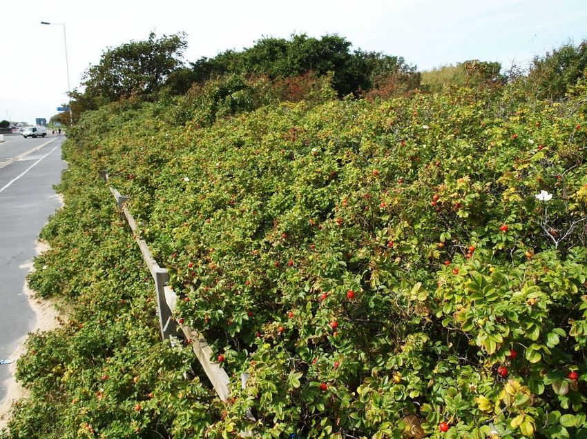
become a well-established naturalised alien throughout Britain and in parts of
Ireland. The Botanical Society of Britain & Ireland (BSBI) Maps Project shows an
exponential rate of spread (Fig. 1), though some of this increase is thought to be
due to better recording (Maskew, 2002). By 2014, R. rugosa had been observed
in 1325 hectads (10 x 10 km UK National Grid squares) in Britain and Ireland.
The plant is also naturalised in large parts of northwest and central Europe,
being considered invasive along coasts of the North Atlantic, North Sea and
Baltic, including the Netherlands, Germany, Denmark, Norway, Sweden and
Lithuania (Bruun, 2005; Weidema, 2006). Infestations have also been reported
in dunes on the Atlantic coasts of Canada (Hill et al. 2010).
Figure 1. Rate of colonisation of Britain & Ireland by Rosa rugosa based on
BSBI hectad records. The fitted line is an exponential.
Biology
In Britain, there appear to be no limitations to growth of R. rugosa from
southern England to Shetland but the shrub occurs especially on sand dunes,
shingle beaches and other dry coastal habitats. It grows less vigorously inland
and is rarely found in the uplands, being largely absent from strongly acid soils
(Bruun, 2005).
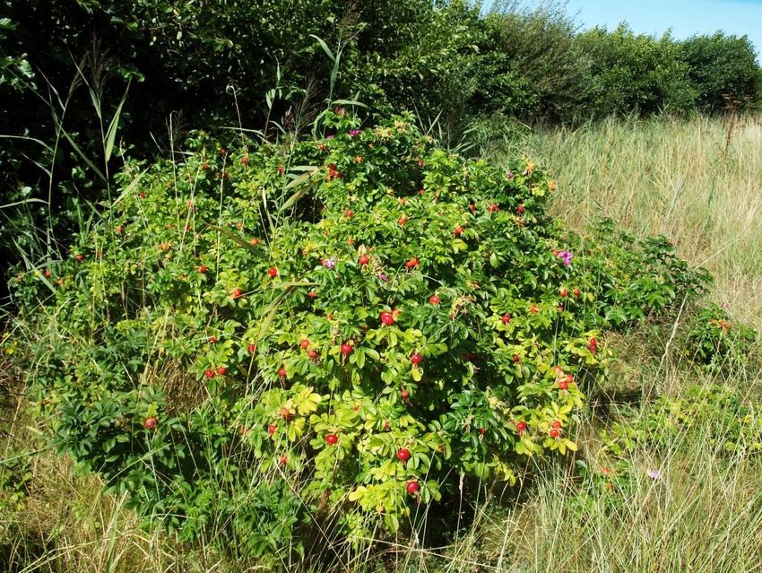
Dense stands can form by suckering on both mobile dunes dominated by
Ammophila arenaria (Marram), fixed dunes and dune grasslands (Fig. 2). The
plant tolerates and seems to benefit from a sand covering of up to 30 cm per
annum. It is also resistant to frost, heat, drought and salinity, even spreading
along salt-treated roads in Scandinavia (Bruun, 2005). R. rugosa is largely
excluded from pastures but, once present, it resists grazing, only seedling and
juvenile stages being susceptible (Weidema, 2006). Pollination is mainly by bees,
especially bumblebees (Bombus) and the bushes produce abundant hips whose
seeds are dispersed by a variety of birds, including thrushes (Turdus) and by
186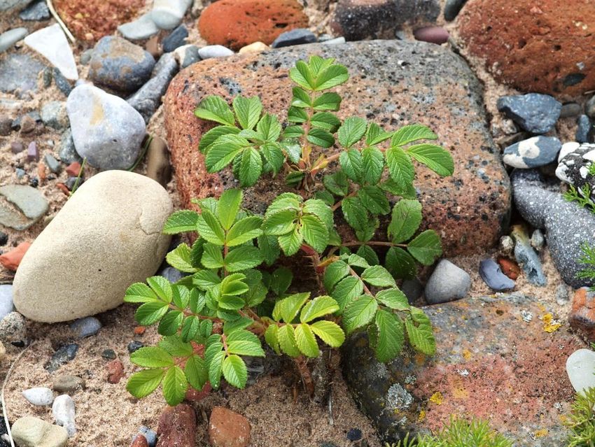
seawater. Both hips and achenes are buoyant and can float for several weeks,
occurrences on uninhabited Scandinavian islands being thought to be due to
maritime dispersal (Weidema, 2006). However, once established the main
mechanism of spread is through vegetative reproduction via suckers (Bruun,
2005; Weidema, 2006).

    Figure 2. Large patch of R. rugosa, Hightown sand dunes, June 2008

Impacts
R. rugosa can form impenetrable thickets of up to 100% cover in all dry dune
habitats, excluding almost all other plants and the animals associated with them.
It even replaces typical duneland shrubs, such as Salix repens (Creeping Willow)
and Rosa spinosissima (Burnet Rose). This strong reduction in species diversity is
caused by shading and represents a serious conservation problem (Isermann,
2008). In addition to ecological impacts, the plant can be a nuisance to
landowners and coastal visitors because the thorny thickets hinder walking and
sun-bathing. Such is the prevalence of this species that, in some places, it is
regarded as a typical component of the landscape. Thus, the plant is known on
the German island of Sylt as the “Sylt Rose” and may even appear on tourist
brochures (Weidema, 2006).

Occurrence on the Sefton Coast
The Sefton Coast in North Merseyside, UK includes extensive saltmarshes at the
mouth of the Ribble Estuary and the largest sand dune system in England
(2100ha). The international importance of these features for nature conservation
is recognised by European Special Area of Conservation and Special Protection
                                       187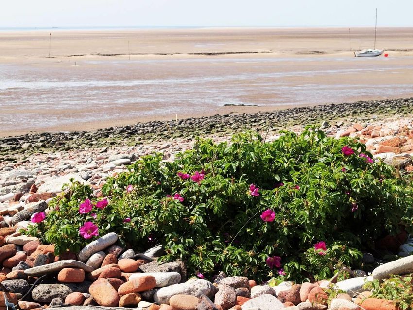
Area status, as well as RAMSAR designation, while most of the dune system and
estuary lie within Sites of Special Scientific Interest. There are also three National
Nature Reserves (NNR) and two Local Nature Reserves (LNR).
        The widespread presence of R. rugosa on the Sefton Coast is a relatively
recent phenomenon. The earliest records were in 1927 (the same year as the
first British record in a wild state), when J.D. Massey identified the plant in
sandhills at Formby and a pine plantation at Freshfield (D. P. Earl, personal
communication, 2013). Green (1933) cited this 1927 observation while Savidge
et al. (1963) described the plant as “rare”, adding only sightings in 1961 at
Freshfield and Ainsdale. The comprehensive National Vegetation Classification
(NVC) of the dune system by Edmondson et al. (1988/89) included only three
records of R. rugosa. However, a second NVC survey carried out in 2003/04
found 13 patches dominated by the plant, together with several other
occurrences in stands of mixed scrub (Gateley & Michell, 2004). These surveys
divided the Sefton dunes into 23 divisions, three of which contained R. rugosa in
1988/89, increasing to nine in 2003/04. Edmondson (2010) suggested it may
have originated from landscape plantings around carparks and amenity areas, as
well as escaping from gardens.
        Currently, R. rugosa occurs sporadically throughout most of the dune
system, having been recorded in all the coastal tetrads (2 x 2 km squares) and
most of the monads (1 km squares) (D.P. Earl, personal communication, 2014).
To the north of the dune system, R. rugosa was also known to be present on
upper saltmarsh habitat and reclaimed grazing-marsh managed as the Marshside
Nature Reserve by the Royal Society for the Protection of Birds. Large spreading
patches of the plant have long been present at Altcar Training Camp, Birkdale
Sandhills LNR and at Hightown, where it has colonised a botanically interesting
“shingle” beach derived from brick-rubble eroding from a tipped embankment
(Smith, 2010). With concern mounting about the shrub’s recent increase, it was
thought opportune to organise an investigation into its distribution and extent,
with the aim of collecting information that could be used in the formulation of a
management strategy. Accordingly, it was decided to recruit a team of
volunteers for a coastwide survey of R. rugosa.

Methods
Early in 2014, 47 volunteers, including the authors, were recruited for the
survey. A survey protocol outlined field work methods: to record the position (UK
National Grid Reference), area in square metres (derived from length × breadth)
and maximum height (cm) of each patch. In addition, an assessment was made
of the general habitat type: fore-dune, fixed-dune, shingle (Hightown only),
dune-scrub, woodland edge, old field, etc.
        Surface soil samples were taken at 48 sites supporting R. rugosa, pH
being determined using a Lutron PH-212 soil pH meter buffered at pH 4 and 7.
The distances of these locations from the coastline were determined by
reference to aerial photographs and the ‘ruler’ tool on Google Earth.

                                         188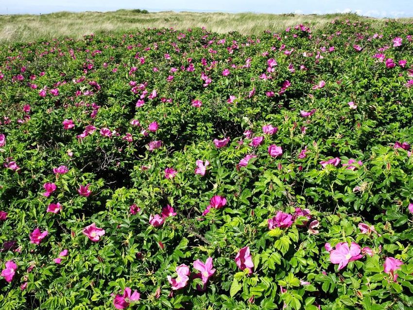
As far as possible, volunteers were organised to work in pairs or small
teams, each being allocated one of 22 units that could reasonably be searched in
a small number of half-day sessions. Maps derived from aerial photographs were
provided, defining search areas and aiding navigation in the field. They covered
the 27 km coastal zone from Seaforth in the south to Crossens in the north,
including the whole of the dune-system, with the exception of the golf courses,
these being excluded for practical and safety reasons. Mapinfo GIS was used to
calculate the search area of each mapped survey unit. A lone working procedure,
based on a Natural England document was circulated to the few individuals who
opted to work on their own. In addition, a risk assessment proforma was
prepared and sent to all volunteers. Finally, each team was provided with survey
forms to be completed in the field and returned to the organisers. Most field-
work took place between June and August 2014, patches of R. rugosa being
easier to locate while in flower.

Results
Distribution and numbers
Within the search area of about 2000 ha, 496 patches were recorded covering
58158 m2 (5.8 ha) with an average area of 117 m2 (Table 1; Fig. 3). Most plants
were pink-flowered (Fig. 2) but white flowered specimens were also well
represented. Five individuals were thought to be referable to Rosa ‘Hollandica’, a
hybrid between R. rugosa and another unknown parent (Bruun, 2005). The
largest number of patches (89) was found in unit 5, Birkdale frontal dunes (2),
which extends south from Selworthy Road for about 1.5 km. However, by far the
greatest area of R. rugosa occurred in unit 17: Altcar Training Camp, where 54
patches covered 16,315 m2 (1.6 ha), with a mean area of 302 m2 (median 110
m2). Here, the largest individual patch was 460 m long, extending over an
estimated 3260 m2. Median patch area varied greatly from 403 m2 at unit 7:
Birkdale LNR (N) to only 0.5 m2 at unit 14: Lifeboat Road, Formby, while all units
showed a wide range of patch sizes (Table 1). Maximum patch height ranged
from 178 cm at Marshside to 58 cm at Ainsdale LNR, though patches averaged
about 100 cm tall overall (median 125 cm).

 Table 1. Summary of Rosa rugosa patch data for each survey unit (north to
                                 south).

Unit           Locality           No. of       Total    Median         Median
No.                              patches       Area    Area (m2)       Height
                                               (m2)     Range           (cm)
                                                                       Range
  1    Marshside, Southport         40         689         8.5           200
                                                         1-162         100-300
  2    Southport Marine Lake         7         198         12             90
                                                         0.1-80         20-170

                                         189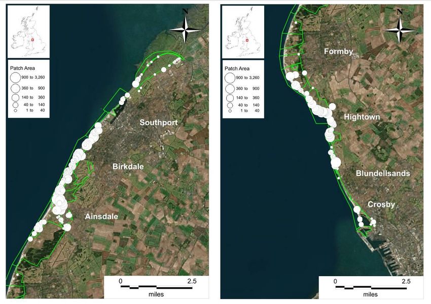
3      Queen’s Jubilee Nature   18         3478        100       150
        Trail, Southport                              4-900      30-250
 4      Birkdale frontal dunes   18         2745         19       100
        (1)                                          2.5-1406    30-170
 5      Birkdale frontal dunes   89         3963         9         85
        (2)                                          0.1-460     40-200
 6a     Sands Lake area,         9          1965         55       150
        Ainsdale                                      1-950      50-250
 6b     Birkdale frontal dunes   68         7112         27       110
        (3)                                          0.2-1258    40-200
 7      Birkdale Sandhills LNR   4          1651        403       150
        (N)                                           72-774    100-150
 8      Birkdale Sandhills LNR   20         7633        269       132
        (S)                                          18-1320     40-200
 9      Falklands Way &          24         2080         23       110
        Kenilworth dunes                              1-700      30-200
10a     Ainsdale Sandhills LNR   8          415         2.4        80
        (1)                                          0.4-468     40-175
10b     Ainsdale Sandhills LNR   8          825          81        50
        (2)                                          1.5-286     20-100
 11     Ainsdale Sand Dunes      3          222         100        90
        NNR (1)                                       2-120      50-125
 12     Ainsdale Sand Dunes      1           78          78        60
        NNR (2)                                           -         -
 13     National Trust, Formby   2           35          18       125
        Point                                          5-30      50-200
 14     Lifeboat Road dunes,     3           25         0.5        90
        Formby                                        0.2-24     70-220
 15     Ravenmeols Hills LNR     18         1567         27        50
                                                      1-468      50-300
 16     Cabin Hill NNR           17         150         1.6        54
                                                      0.1-31     44-110
 17     Altcar Training Camp     54         16315       110        70
                                                      1-3260     30-150
 18     Hightown dunes           41         3880         21        50
                                                      1-455      30-180
 19     Hall Road,               29         2405         20        90
        Blundellsands                               0.75-1280    30-130
 20     Crosby & Seaforth        15         727          23        70
                                                      2-251      20-130
Total                            496        58158

                                      190
It is evident from Table 1 and also the distribution maps (Fig. 3) that the highest
numbers and greatest extent of patches were found towards the northern and
southern extremities of the coast, especially at Birkdale and Altcar/Hightown,
while the central section from Ainsdale to Formby (units 10-14) was much less
infested by R. rugosa. Furthermore, areas of highest patch concentration seemed
to be either in areas near the shore, for example at Marshside, Birkdale, Altcar
and Hightown, or close to roads and other built structures, such as at Birkdale
LNR (south), Falklands Way, Ainsdale and Hall Road, Blundellsands.
Figure 3. Distribution of Rosa rugosa patches on the north (left) and south
(right) Sefton Coast
These findings are reinforced by reference to patch density in the search
areas. Table 2 shows that the highest densities were found in the southern part
of Birkdale LNR, the Birkdale frontals, Queen’s Jubilee Nature Trail, Falklands
Way & Kenilworth Road dunes in the northern sector and at Altcar Training
Camp, Hightown dunes and Hall Road in the south. Low densities were
associated with Ainsdale NNR, the National Trust and Lifeboat Road dunes along
the central section of the coast.
191Table. 2. Density of Rosa rugosa in survey units
Unit Location Search Bush Density
area area m2 per
(ha) (m2) ha
1 Marshside, Southport 225.7 689 3.1
2 Southport Marine Lake 85.2 198 2.3
3 Queen’s Jubilee Nature Trail, 54.4 3478 63.9
Southport
4, 5, 6a, Birkdale frontal dunes 200.6 15785 78.7
6b
7 Birkdale Sandhills LNR (N) 69.1 1651 23.9
8 Birkdale Sandhills LNR (S) 72.3 7633 105.6
9 Falklands Way & Kenilworth 27.6 2080 75.3
dunes
10a, 10b Ainsdale Sandhills LNR 125.1 1240 9.9
11, 12 Ainsdale Sand Dunes NNR 352.5 300 0.9
13 National Trust Formby Point 223.3 35 0.2
14 Lifeboat Road dunes, Formby 71.5 25 0.4
15 Ravenmeols Hills LNR 140.3 1567 11.2
16 Cabin Hill NNR 32.2 150 4.7
17 Altcar Training Camp 169.6 16315 96.2
18 Hightown dunes 62.1 3880 62.5
19 Hall Road, Blundellsands 33.2 2405 72.5
20 Crosby & Seaforth 175.7 727 4.1
Total 2121 58158
Habitat
The main habitats supporting bushes are listed in Table 3.
Table 3. Main habitats on the Sefton Coast occupied by Rosa rugosa
Habitat No. of %
bushes
Saltmarsh transition 17 4
Shingle/rubble 26 6
Frontal/mobile dune 14 3
Semi-fixed dune 89 21
Fixed dune 167 38
Dune scrub/woodland 56 13
Alder fringe 65 15
Slack 2 0.5
192It should be noted that 60 patches (12%) were not ascribed a habitat on the
recording forms and are therefore excluded from this analysis. Fixed-dunes were
the preferred habitat for R. rugosa, supporting 38% of patches, followed by
semi-fixed dunes (21%), while dune-scrub/woodland fringe held 13% of
patches. Habitats little favoured by the plant included mobile dune (3%) and
dune-slack (0.5%). The transition between saltmarsh and terrestrial habitat at
Marshside on the Ribble Estuary supported 4% of patches, while 15% were
found on the fringe of Alnus glutinosa (Alder) woodland along a seepage zone on
the eastern edge of Birkdale Green Beach (Fig. 5). A weathered brick rubble
embankment between Hall Road and Hightown held 6% of the patches (Fig. 6).
Figure 5. R. rugosa growing with Alnus glutinosa, Birkdale Green Beach,
August 2014
Soil pH
Forty-eight soil samples from representative sites occupied by R. rugosa had a
mean pH of 7.2 (median = 7.3), a standard deviation of ±0.5 and a range of
5.6-8.2. Fig. 7 shows that soil pH declines with distance from the shore over the
first 250 m, then remains more-or-less constant.
193Figure 6. R. rugosa on brick rubble “shingle” at Hightown, June 2015
Figure 7. Relation between soil pH and distance from the shore for Sefton
sites supporting R. rugosa
194Discussion
The role of a large team of volunteers in the survey was crucial, as to employ
professionals would have been prohibitively expensive and time consuming,
probably requiring more than one field season. However, partly because of the
varied abilities of the participants, collection of supporting ecological information
was limited and recommendations for habitat recording were sometimes
misconstrued. Another shortcoming was the exclusion of the golf courses which
occupy about 25% of the dune system (Smith, 2009), though R. rugosa is not
thought to have a strong representation on these land-holdings (personal
observations).
Although it was known that R. rugosa had become more frequent in
recent years, the size of the current population, with around 500 patches
covering nearly 6 ha, was unexpected. Of particular interest is the distribution
pattern, most patches being concentrated in a fairly narrow zone within about
200 m of the shore (Fig. 3; Fig. 7). Although a few plants were found up to 1300
m inland, none was encountered on decalcified acid grasslands and dune heath
on the eastern fringes of the duneland. The distribution pattern of R. rugosa with
most patches in a narrow zone near the shore and few further inland accords
with the ancestral habitat of this species in the north-west Pacific. Here, Bruun
(2005) found that R. rugosa inhabits stabilised dunes, rocky shores, single
beaches and meadows, always near the coast and often in a narrow fringe
between the sandy beach and dune forest. On continental European North Sea
coasts, the shrub is also predominantly associated with yellow-dune vegetation
but has also colonised a range of acidic communities, including dune-heath with
Empetrum nigrum (Crowberry) (Isermann, 2008).
The pattern of distribution on the Sefton Coast suggests that propagules
often arrived by sea. This is also supported by the plant’s abundance on a former
beach-cleanings tip in the Birkdale frontal dunes, where tidal debris was
deposited by the council during the 1970s and 1980s (Smith, 2009). On Birkdale
Green Beach, R. rugosa is associated with strips of Alnus glutinosa woodland that
are thought to have arisen as seeds washed up on former strand-lines (Smith,
2007) (Fig. 5).
A similar survey by Jørgensen & Kollmann (2009) in northwest Denmark
also found patches of R. rugosa most abundant in “white-dunes” close to the
shore, this habitat having the highest seedling establishment in a related study
(Kollmann et al., 2007). Weidema (2006) describes how R. rugosa hips can float
for up to 40 weeks in both fresh and sea-water, the achenes also having good
buoyancy when released from the disintegrating hips. She maintains that, in
contrast to other Rosa spp., this plant is well adapted to dispersion by water.
Following storm surge damage during the winter of 2013/14, large numbers of
R. rugosa seedlings were observed on the Hightown shingle beach, having
presumably arisen from propagules dispersed by the exceptionally high tides
(Fig. 8).
195The relative absence of patches in the central section of the Sefton coast is
readily explained by the fact that a 5 km stretch around Formby Point has been
subject to coastal erosion at an average rate of about 4 m per annum for over
100 years (Smith, 2009). Thus, the frontal dune habitat in which R. rugosa would
normally become established has been regularly washed away.
Figure 8. Seedling R. rugosa on Hightown brick rubble “shingle”, July 2014,
following a storm-surge
Jørgensen & Kollmann’s (2009) study showed that the distribution of R.
rugosa in Denmark was positively correlated with roads, tracks and houses. This
suggests that the plant’s occurrence is partly determined by anthropogenic
factors, such as ornamental plantings. They also argue that sites near habitations
are likely to have higher nutrient loads, leading to improved establishment and
growth. Their findings accord with occurrences on the Sefton Coast, where many
large patches of R. rugosa were found on road-sides, for example at Birkdale,
Ainsdale and Falklands Way (Fig. 9). The only patches recorded at the Formby
Point National Trust estate were associated with a caravan site, the recorders
finding documentation to show that these were part of a 1982 planting scheme
(D. Thompson, personal communication, 2014).
196Figure 9. Large patch of R. rugosa at Shore Road, Ainsdale, August 2014
Having an Ellenberg F value of 3, R. rugosa is regarded as a dry-site
indicator (Hill et al., 2004). However, the presence of numerous patches
associated with Alnus seepage zones on the eastern edge of Birkdale Green
Beach shows that the plant can tolerate occasional water-logging.
Our soil pH data are similar to those cited by Millington et al. (2010) for
relatively dry calcareous dune habitats on the Sefton Coast: 7.7 for mobile
dunes; 6.4 for fixed dunes. Bruun (2005) quotes soil pH values of 5.7 to 7.6
(median 6.4) in top-soil and 5.4-8.5 (median 6.9) in lower soil horizons for the
native range of R. rugosa in Japan, these being comparable to, though a little
lower than, the Sefton results. However, German studies (Isermann, 2008)
report soil pH of 3.5-6.4 (mean 5.1) for stands of R. rugosa, while values of 4.7-
7.7 were obtained in Denmark (Bruun, 2005), these being generally lower than
the Japanese data. The range of soil pH values recorded in Sefton is closer to
those quoted for Japan than for continental Europe. The trend of lower pH
values further from the coast is attributed to leaching of the initially high calcium
carbonate content of the sand over time. Thus, Salisbury (1925) estimated that it
took about 200 years for the pH of soils on the “Southport dunes” to fall from
about 8.2 at the top of the beach to 6.4 on the fixed dunes.
Jørgensen and Kollmann (2009) considered that patch size was related to
age. They also found some of the largest patches near to villages. Several of the
197large patches, for example at Ainsdale and Birkdale, are known to date back to
at least the 1970s (personal observations). Using GIS and field survey, Boardman
& Smith (2016) reported that a sample of large R. rugosa patches at Birkdale
grew at an average rate of 22% per annum over a period of 24 years, i.e.
doubling every 4-5 years. This compares with estimated annual growth rates of
12-27% recorded by Jørgensen and Kollmannn (2009) and 16.4% by Kollmann
et al. (2009) in Denmark.
Implications for management
Weidema (2006) recommended “prevention” by not including R. rugosa in
planting schemes, especially near the coast. She also emphasised the importance
of action in the early stages of establishment to prevent rapid spread, the need
for a long-term commitment to control and a strategic approach over a wide
area. Once the shrub is well established, the public may perceive it as an
attractive component of the landscape and react adversely to its removal for
conservation of native species. In Britain, R. rugosa is still widely advertised and
sold on the internet and through garden centres, though the plant is listed under
schedule 9 of the Wildlife & Countryside Act 1981 (as amended), making it an
offence to plant or otherwise allow this species to grow in the wild.
Several techniques have been employed to control or eradicate R. rugosa
on sand dunes, including digging up patches, cutting or mowing, grazing by
livestock and herbicide treatment. Burning is ineffective. For example, there is no
evidence that any plants were killed by a large fire at Altcar Training Camp in
July 2018 (J. A. Houston, personal communication, 2018). Isermann et al. (2014)
report that the most effective control method for large areas is mechanical
removal, followed by burning or deep burial of material. Annual follow-up was
necessary for up to five years to deal with re-growth. Small bushes could be dug
out manually with similar follow-up treatment. Year-round grazing with sheep or
“robust” cattle gave good results after five years, while cutting/mowing up to five
times per annum was required for up to ten years. Spraying (with Glyphosate)
up to four times a year for five years was usually successful but was not
recommended due to the possibility of environmental contamination. Thus,
depending on formulation, Glyphosate is classed as moderately to highly toxic to
amphibians (Govindarajula, 2008). The importance of the Sefton Coast for
Natterjack Toads (Epidalea calamita) (Smith & Skelcher, 2019) means that uses
of this chemical should be restricted.
Based on these recommendations, control of R. rugosa on the Sefton dunes
commenced in 2017 with excavation and deep burial of several patches on Cabin
Hill NNR organised by Natural England and the Gems in the Dunes project. This
was followed by similar work to deal with the severe infestation on the frontal
dunes at Altcar Training Camp, funded jointly by Gems in the Dunes and the
Defence Infrastructure Organisation. By late 2018, a 900 m length of frontal
dunes had been cleared using heavy machinery. The work at Altcar will continue
in 2019, a coastwide programme of R. rugosa removal being supported between
1982019 and 2023 by the Dynamic Dunescapes LIFE project coordinated by Natural
England.
Acknowledgements
This project would not have possible without the efforts of the volunteer
surveyors: Barbara Allen, Katherine Allen, Joe Barnes, Claire Boardman, Susan
Bowden, Mike Brown, Richard Burkmar, Margaret Connor, Lynsey Crellin, Chris
Dalzeil, John Dalzeil, Sally Edmondson, David Flynn, Peter Gateley, Val Gateley,
Peter Gawthorne, Helen Greaves, Elspeth Green, Howard Harris, John Houston,
David Jarvis, Joyce Jarvis, Cathy Jones, Bob Jude, Norma Jude, Paula Kelly,
Rosalind King, Patricia Lockwood, Iain Mackennon, Tom Marshall, Jasmine
Morgan, Ron Moyes, Emma O’Leary, Peter Olson, Rachael Parks, Stefanie Pearce,
Alex Pigott, Bruno Sampaio, Elizabeth Seal, Matthew Spencer, A. Thompson, Don
Thompson, Richard Walker, Matt Wiggins and Brian Wilby,
We are grateful to Dr Maike Isermann for helpful information, references
and control suggestions. Dave Earl kindly provided information from the draft
New Flora of South Lancashire, while land-owners and managers gave
permission for the survey on their coastal properties. John Houston provided
details of control work at Altcar Training Camp.
References
Boardman, C. & Smith, P.H. 2016. Rates of spread of Rosa rugosa (Japanese
Rose) determined by GIS on a coastal sand-dune system in Northwest
England. Journal of Coastal Conservation, 20: 281-287.
Bruun, H.H. 2005. Rosa rugosa Thunb. Ex Murray. Journal of Ecology, 93: 441-
470.
Edmondson, S.E. (2010). Non-native plants on the Sefton Coast sand-dunes. In
Worsley, A.T., Lymbery, G., Holden V.J.C. & Newton, M. eds. Sefton’s Dynamic
Coast, 201-213. Southport: Sefton Technical Services Department.
Edmondson, S.E., Gateley, P.S. & Nissenbaum, D.A. 1988/89. National
Sand Dune Vegetation Survey: the Sefton Coast. Report no. 917. Peterborough:
Nature Conservancy Council.
Gateley, P.S. & Michell, P.E. 2004. Sand Dune Survey of the Sefton Coast.
Report by TEP, Warrington to Sefton Metropolitan Borough Council, Bootle.
Govindarajula, P.P. 2008. Literature review of the impacts of Glyphosate
herbicide on amphibians: What risks can the silvicultural use of this
herbicide pose from amphibians in B.C.? British Columbia Ministry of
Environment, Victoria, B.C. wildlife report no. R-28 [online]. [Accessed 8
March 2013]. Available at: ˂http://www.env.gov.bc.ca/wld/˃.
Green, C.T. 1933. The flora of the Liverpool district. Arbroath: Buncle & co.
Hill, M.O., Preston, C.D. & Roy, D.B. 2004. PLANTATT. Attributes of British
and Irish plants: status, size, life history, geography and habitats.
Cambridge: Centre for Ecology & Hydrology, Monks Wood.
199Hill, N., Beveridge, L., Flynn, A. & Garbary, D.J. 2010. Rosa rugosa as an invader
of coastal sand dunes of Cape Breton Island and mainland of Nova Scotia.
The Canadian Field Naturalist, 124: 151-158.
Isermann, M. 2008. Classification and habitat characteristics of plant
communities invaded by the non-native Rosa rugosa Thunb. In NW Europe.
Phytocoenologia 38: 133-150.
Isermann M., Adriaens, T., Artmann, K., Bele, B., Bengtsson, O., Boesen, M.,
Burkhard, B., Buttenschøn, R.M., Fløistad, I.S., Grell, H., Grenne, S.,
Hammeken, K., Hoffmann, H., Jørgensen, H.H., Kiehl, K., Kobarg, N.,
Labuz, T., Lehtomaa, L., Ludwig, M., Kollmann, J., Leeten, M., Mansen,
W., Nilsen, L.S., Provoost, S., Tschöpe, O., Ravn, H.P., Räikkönen, N.,
Ryttäri, T., Schimansky, P., Schmidt, S., Schulze Dieckhoff., M, Struyve, T.,
Dijck, D. van, Waldeck, J., Wietjes, H. & Wittefeld, M. 2014. Best practice in
management of Rosa rugosa, 179-181. NEOBIOTA. 8th international
conference on biological invasions. Antalya, Turkey.
Jørgensen, R.H. & Kollmann, J. 2009. Invasion of coastal dunes by the alien
shrub Rosa rugosa is associated with roads, tracks and houses. Flora, 204:
289-297.
Kollmann, J., Jørgensen, R.H., Roelsgaard, J. & Skove-Petersen, H. 2009.
Establishment and clonal spread of the alien shrub Rosa rugosa in coastal
dunes. A method for reconstructing and predicting invasion patters.
Landscape and urban planning, 93: 194-200.
Maskew, R. 2002. Rosa rugosa Japanese Rose. In: C.D. Preston, D.A. Pearman &
T.D. Dines eds. New atlas of the British and Irish flora, 346. Oxford: Oxford
University Press.
Millington, J.A., Booth, C.A., Fullen, M.A., Trueman, I.C. & Worsley, A.T. 2010.
Distinguishing dune environments based on topsoil characteristics: a case
study on the Sefton Coast. In: Worsley, A.T., Lymbery, G., Holden V.J.C. &
Newton, M. eds. Sefton’s dynamic coast, 116-130. Southport: Sefton
Technical Services Department.
Salisbury, E.J. 1925. Note on the edaphic succession in some dune soils with
special reference to the time factor. Journal of Ecology, 13: 322-328.
Savidge, J.P., Heywood, V.H. & Gordon, V. eds. 1963. Travis’s flora of South
Lancashire. Liverpool: Liverpool Botanical Society.
Smith, P.H. 2007. The Birkdale Green Beach – a sand-dune biodiversity hotspot.
British Wildlife, 19: 11-16.
Smith, P.H. 2009. The sands of time revisited: an introduction to the sand-dunes
of the Sefton coast. Stroud: Amberley Publishing.
Smith, P.H. 2010. The Hall Road-Hightown shingle beach. In: Worsley, A.T.,
Lymbery, G., Holden V.J.C. & Newton, M. eds. Sefton’s dynamic coast, 258-
262. Southport: Sefton Technical Services Department.
Smith, P.H. & Skelcher, G. 2019. Effects of environmental factors and
conservation measures on a sand-dune population of the natterjack toad
200(Epidalea calamita) in northwest England – a 31-year study. Herpetological
Journal, 29: 146-154.
Weidema, I. 2006. NOBANIS-invasive alien species fact sheet-Rosa rugosa
[online]. [Accessed 10 March 2013]. Available at: ˂www.nobanis.org˃.
Copyright retained by author(s). Published by BSBI under the terms of the
Creative Commons Attribution 4.0 International Public License.
ISSN: 2632-4970
https://doi.org/10.33928/bib.2019.01.185
201You can also read