Latrobe. Be in it. TRACKS, TRAILS & PATHS STRATEGY - LATROBE CITY COUNCIL
←
→
Page content transcription
If your browser does not render page correctly, please read the page content below
TRACKS, TRAILS & PATHS STRATEGY

Latrobe. Be in it.
LATROBE CITY COUNCIL
                                  April 2016
LATROBE CITY | TRACKS, TRAILS AND PATHS
© Planisphere 2016.
This Publication is copyright. No part may be reproduced by any process
except in accordance with the provisions of the Copyright Act 1968.
PROJECT CONTROL
Checked Checked Date
Status Version
PM PD released
Draft Strategy 1 CE MS 02/02/2015
Strategy for Consultation 1 CE MS 12/03/2015
Strategy for Consultation 2 CE MS 19/03/2015
Strategy for Consultation 3 CE MS 20/03/2015
Final Strategy 1 JM MS 24/02/2016
Final Strategy 2 JM MS 01/04/2016
II | © 2014
LATROBE CITY | TRACKS, TRAILS AND PATHS

CONTENTS

           1
               INTRODUCTION.................................................................... 1
               The Project............................................................................ 3
               Latrobe. Be in it..................................................................... 4
               Strategy Product................................................................... 6

           2
               PROGRAMS.......................................................................... 7
               Educate................................................................................. 9
               Encourage........................................................................... 10
               Safety.................................................................................. 14

           3
               INFRASTRUCTURE............................................................. 17
               The Latrobe. Be in it. Network............................................. 18
               Local Streets....................................................................... 27
               Local Street Case Studies................................................... 28
               Network Components......................................................... 40
               Aspirational Paths & Links................................................... 46
               Existing Parks/National Parks/Tracks................................. 47
               Signage and Wayfinding...................................................... 48

           4
               COMMUNICATION.............................................................. 49
               Communication Strategy..................................................... 51
               Health and Wellbeing Information....................................... 52
               Network Information: A Latrobe. Be in it. Map.................... 54
               Community Ownership........................................................ 55

           5   IMPLEMENTATION.............................................................. 57

               APPENDICES
               Programs...............................................................................A
               Path Types & Service Levels.................................................B
               Walking Audits.......................................................................C

                                                       © 2016                                       |        III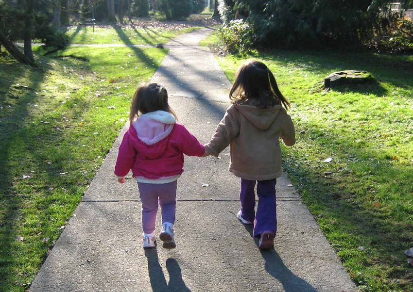
LATROBE CITY | TRACKS, TRAILS AND PATHS IV | © 2014
1
                                   INTRODUCTION

Federation University, Churchill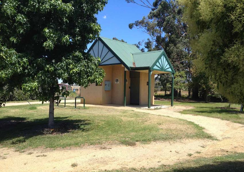
LATROBE CITY | TRACKS, TRAILS AND PATHS 2 | © 2014
LATROBE CITY | TRACKS, TRAILS AND PATHS

THE PROJECT
The Latrobe City Tracks, Trails and Paths Strategy is a       •   Coordinate planning and delivery of priority walking   Latrobe City Council is located in eastern Victoria in the
municipal wide strategy to guide planning, development,           and cycling infrastructure including assisting in      Gippsland region. It has a land area of 1,426 square
management and promotion of tracks, trails and paths.             directing capital works expenditure.                   kilometres and a population of over 72,000 people.

The municipality already has a successful network             •   Establish principal pedestrian networks in the         Latrobe City scores 939.7 on the Socio-Economic
of paths, tracks and trails that connect a majority of            four major towns of Traralgon, Morwell, Moe and        Index for Areas (SEIFA) which is lower than the
locations, yet usage in places is very low. The strategy          Churchill based around key activity centres.           Regional Victorian average of 978.0 in terms of level
not only looks to fill gaps in the network and ensure links                                                              of advantage. The SEFIA Index measures and ranks
to destinations but to examine ways to promote greater        •   Identify opportunities to link planned or guided       areas in Australia according to relative socio-economic
use.                                                              walks for walking groups or tourism based upon the     advantage and disadvantage.
                                                                  principal pedestrian networks.
The project objectives are:                                                                                              Increasing walking and cycling within Latrobe City
                                                              •   Develop strategies for promotion, education,           are elements imperative to delivering on the strategic
•   Provide an appreciation of the benefits of walking            advocacy and support of walking and cycling            objectives of the Latrobe City Council Plan (2013 –
    and cycling and active transport in achieving                 to create a culture within Latrobe City which          2017).
    councils strategic direction towards community                respects and embraces walking and cycling both
    health and wellbeing.                                         at a strategic decision making level and at a local    The Council produced a Municipal Public Health and
                                                                  community level.                                       Wellbeing plan for 2013 to 2017. The plan outlines
•   To evaluate the existing walking and cycling                                                                         residents’ and the council’s goals of improving the
    networks to assess the connectivity, adequacy in          •   Develop strategies for the promotion, education,       health and welling being of people in the area, which
    operation, safety, comfort and amenity.                       advocacy and support for users of mobility devices.    includes developing a Tracks, Trails and Paths Strategy.

•   Provide strategies for improving the function of                                                                     A bicycle plan was adopted in 2007 that looked at the
    walking and cycling so they become a viable                                                                          physical connections between areas and focussed
    transport and recreation option for all Latrobe City                                                                 more on bicycle use on roads.
    visitors and residents.
                                                                                                                         The need for a Tracks, Trails and Paths Strategy
                                                                                                                         for Latrobe City was clearly identified as a priority
                                                                                                                         recommendation in the Public Open Space Strategy
                                                                                                                         (2013).

                                                                                                                         A Background Report, containing information
                                                                                                                         about the project, a demographic analysis, and a
                                                                                                                         summary of trends, community values and health
                                                                                                                         benefits, was prepared early in the process, and can
                                                                                                                         be made available on request.

                                                                                                                                                     © 2016                       |   3
LATROBE CITY | TRACKS, TRAILS AND PATHS
LATROBE. BE IN IT.
Following a community competition to name the strategy the winner was ‘Latrobe. Be • Nearly two-thirds of Latrobe City citizens are overweight or obese
in it’. This name is linked to the well known television adverts, originating in the 1970s, • Almost a third reported having hypertension (high blood pressure)
starring ‘Norm’, an average Aussie bloke, who was used to promote a healthier • Fewer than 1 in 30 walk or cycle to work
lifestyle. The ‘Life. Be in it’ organisation, formally government funded and now a not-
for-profit organisation, has kindly agreed to Latrobe utilising their branding as ‘Latrobe.
WHY 30 MINUTES A DAY?
Be in it’.
• Over 40% of car trips are for just two kilometres, the distance you can walk in 30
The strategy will be led by the Council, however many of the programs and
minutes
communication are likely to be in partnership with community groups. Latrobe. Be in
• Short car trips are inefficient in fuel use and wear-and-tear on the vehicle
it. is primarily about encouraging people into active travel (walking and cycling) for their
• Walking 30 minutes is sustainable
day to day short journeys. Journeys up to half an hour of walking would be part of
• It’s useful for shopping, travel to school and daily tasks
their daily routine – getting to work, to school, to the shops and so on. For cyclists,
• A 30 minute round trip accesses useful destinations – eg. primary school, milk
the same target of 30 minutes applies, but can allow them to travel a much greater
bar, local park
distance, approximately 10km.
• It’s achievable by most people
• It’s healthy
The strategy is a response to what some describe as a public health crisis. Latrobe
• It is a target that changes habits that can grow into better behaviour such as
City citizens are more overweight or obese, and engage in less exercise, than the
cycling long trips
Victorian average.
• Older people may find this a challenge, but the concept is also about doing short
local trips that are achievable for the individual.
PHYSICAL HEALTH BENEFITS PSYCHOLOGICAL HEALTH SOCIAL BENEFITS URBAN BENEFITS
BENEFITS
The physical health benefits for walking, Mental health conditions such as There is an increased social benefit Walking, jogging and cycling have
jogging and cycling: depression, stress and anxiety can be from walking and cycling through a range of benefits for the urban
• Improves general health, helps to reduced by regular walking and bike the increased opportunity for social environment:
lower both blood pressure and riding. This is due to the effects of the interaction between people in the • A decrease in vehicular traffic.
improves heart health. exercise itself due to of the enjoyment community. This helps to make • More people on trails and streets,
• Helps with weight management. that riding a bike and walking can bring. connections between people, which providing passive surveillance, which
• Improves fitness. Walking and cycling help with stress provides a wide range of benefits, increases safety and security.
• In congested areas, cyclists and management by providing time to relax including increased support and allowing • A decrease in pollution.
pedestrians breathe fewer fumes without annoyances that driving can for knowledge sharing on all issues from • Reduced fuel expenditure.
than drivers. bring. child education, to jobs, and health. • Increased retail opportunities on
• Fewer cars on the road and more The increased support from neighbours routes.
cyclists and pedestrians means also helps, from simply collecting mail • Council needs less capital
safer roads. on vacation to a greater reporting of expenditure for road maintenance
domestic violence. compared to paths and trails.
• Walkers and cyclists have fewer
days ill each year.
4 | © 2014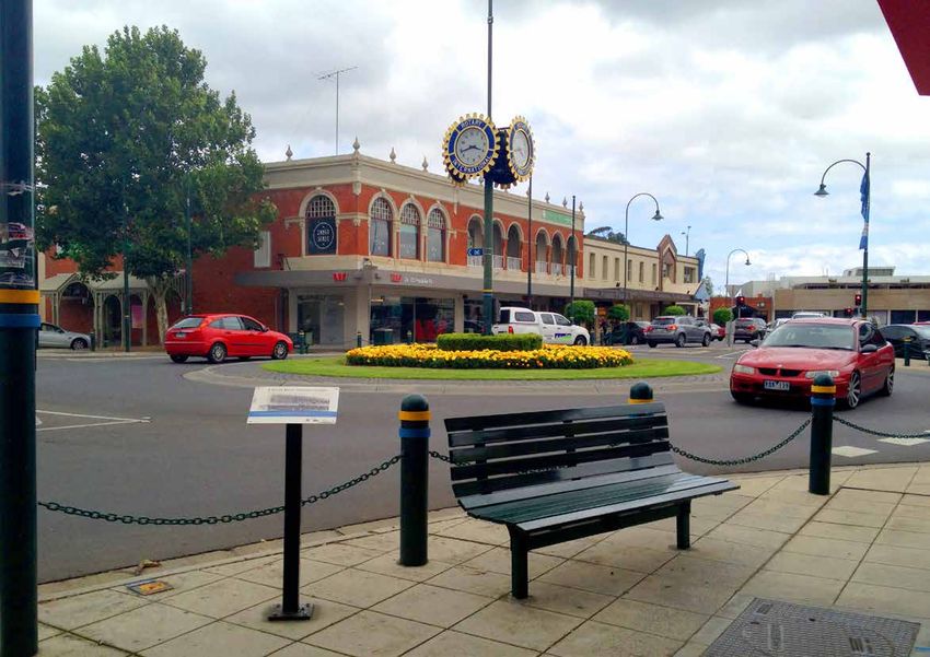
LATROBE CITY | TRACKS, TRAILS AND PATHS

                                                     STRATEGY

                               Latrobe. Be in it.

            Programs                                                                       Communication

Educate                                        Infrastructure
                                                                               Health &                           Community
                      Safety                                                  Wellbeing                           Ownership
          Encourage                                                          Information         Network
                                                                                               Information
                                      The                         Network
                                Latrobe. Be in it.
                                    Network                     Components
                                                       Local
                                                      Streets

                                                                                                   © 2016                     |      5
LATROBE CITY | TRACKS, TRAILS AND PATHS
STRATEGY PRODUCT
The Latrobe. Be in it. vision has three
strategy bundles:
1. Programs
2. Infrastructure
3. Communication
Each strategy bundle has three action
plans:
PROGRAMS INFRASTRUCTURE COMMUNICATION
• Programs The Programs chapter (Educate, The strategy’s main infrastructure Much of the Latrobe. Be in it. strategy will
Educate Encourage, Safety) contains program recommendation is that a Latrobe. Be rely on good communication, not only
Encourage possibilities – national, international, in it. Network be established, to lay a between Council and the community,
Safety or Victorian programs, that could be primary network of walking and cycling but also facilitating members of the
considered for application locally. routes across the municipality. The community to interact with each other.
• Infrastructure Latrobe City already has a number of priority routes would become the ‘trunk Ensuring that people know about walking
The Latrobe. Be in it. Network encouragement programs, and these routes’ for journeys beyond an immediate and cycling groups and when they meet
Local Streets are listed. Appendix A contains fuller neighbourhood, and would serve both will create greater momentum for the
Network Components information about each program. a recreational and active transport community to become more active and
(eg journey to work, shops or school) reduce social exclusion.
• Communication function.
Health & Wellbeing Information Strategies for communication are
Network Information Case studies of local street types have outlined in the final chapter.
Community Ownership been analysed to explore the kinds of
issues that arise for active transport, and
Information on the scope of each of recommendations made to establish
these strategies can be found in the an understanding of issues that arise in
following pages. Latrobe City.
The Network Components section
looks on a detail level at paths and
associated components with some
recommendations.
6 | © 20142
PROGRAMS
TraralgonLATROBE CITY | TRACKS, TRAILS AND PATHS The first task is to establish the need for the Tracks, Trails & Paths Strategy Programs and to generate community support and action. The starting point is awareness of the health benefits gained through walking, cycling and other forms of active transport. What follows are an outline to various programs organised into three categories: • Educate • Encourage • Safety USER GROUPS Pedestrians and cyclists can be divided into many user groups ranging from school children, to commuters, as well as the elderly enjoying a neighbourhood stroll. Each group will have a different level of requirements for footpaths. The strategy focuses a level of provision that is DDA (Disability Discrimination Act) compliant. The different groups are addressed at a program level. Traralgon 8 | © 2014
LATROBE CITY | TRACKS, TRAILS AND PATHS

EDUCATE
There are various examples of education programs relating to active transport, these
existing campaigns predominantly focus on communicating road safety messages to
pedestrians, cyclists and other road users in order to prevent death and injury as a
result of road accidents. Education programs relating to encouraging physical activity
typically communicate broad and generalised messages about the importance and
benefits of physical activity not including specific or localised information.

PROGRAMS IN LATROBE                          OTHER PROGRAM POSSIBILITIES

LIVE LIGHTER                                 A METRE MATTERS                              DON’T TUNE OUT                              CYCLING IN THE CITY

LiveLighter is a campaign aimed at           ‘A metre Matters’ is a campaign run by       Rates of pedestrian-vehicle accidents       The Cycling in the City course is an
helping the Australian population lead       the Amy Gillett Foundation with the dual     have increased in recent years. The         education program facilitated by the City
healthier lifestyles by making changes to    purpose of raising awareness of the          ‘Don’t Tune Out’ campaign was               of Sydney which is designed to give
what they eat and drink, and increasing      safe minimum overtaking distance and         commissioned by the Pedestrian Council      participants the skills and confidence to
their levels of physical activity. The       advocating for it to be legislated in road   of Australia with the aim to change         be an effective bike rider in Sydney’s city
campaign provides general health             law. The campaign encourages drivers         pedestrian behaviour and improve safety     centre. The Cycling in the City course
recommendations and information              to adopt a safe passing distance of 1        outcomes for pedestrians. The campaign      involves both classroom lessons and
on how to lead a healthier lifestyle         metre to avoid accidents and injuries to     employed broadcast advertising on           practical cycling activities.
including issues such as food, nutrition     cyclists.                                    radio, print and billboards.
and physical activity. It doesn’t include
localised information.

LATROBE CITY TRAFFIC SCHOOL                  CYCLING IN THE CITY: RUSTY                   POINT-OF-DECISION PROMPTS                   MOBILITY DEVICES
                                             RIDERS COURSE
Latrobe City Traffic School is an            Riding a bike is something that most         Point-of-decision prompts at pedestrian-    Mobility devices are being used by some
educational facility owned by the Latrobe    people learn during childhood however        road intersections are a common way of      users on roads instead of paths. The
City Council that provides traffic safety    over time the basic riding skills and        encouraging safe walking practices from     Disability Services Community Building
education programs for children across       confidence developed at a young age          pedestrians. Pedestrian point-of-decision   Program is a part of the City of Bendigo’s
the region including pedestrian and bike     can be forgotten. Rusty Riders Course        prompts at intersections generally          vision to work towards building inclusive
safety. The school runs a traffic safety     is a program delivered by the City of        involve prompts painted on the ground       communities. The program works with
and pedestrian education session with        Sydney designed at developing the skills     at intersections employing a number of      a Disability Inclusion Team which aims
a qualified traffic educator and includes    of cyclists who lack the confidence and      simple messages such as ‘look right’        to deliver the vision. The team ensures
hands on and practical activities in a       skills to confidentially ride. Concepts      or ‘look both ways before you cross’.       the needs of people with a disability are
controlled environment. The use of this      covered in the course include the            Prompts can be strategically located in     the focus of community planning. This
facility could be expanded to include        rights and responsibilities of cyclists,     high-traffic areas, accident hot-spots or   includes access and social inclusion.
new initiatives such as a Rusty Riders       appropriate route planning, correct road-    intersections close to schools or other
program or mobility scooter training.        cycling positioning and basic bicycle        sensitive uses.
                                             control and technique.

                                                                                                                                                  © 2016                      |     9
LATROBE CITY | TRACKS, TRAILS AND PATHS
ENCOURAGE
To encourage fitness and greater use of tracks, trails and paths, special programs can
raise walking/cycling as a viable form of transport.
The Latrobe. Be in it. concept promotes walking for 30 minutes a day which should
be achievable for the elderly, people with time constrains (as it can be combined with
commuting or doing shopping), and for children.
BENEFITS OF 30 MINUTES A DAY 10,000 STEPS A DAY SPECIAL EVENTS CYCLE TO WORK PROGRAMS
Walking for 30 minutes can provide The 10,000 steps a day program is Special events such as the Traralgon Ride2Work encourages Australians
the physical and mental health benefits to help improve health with the goal Marathon which is Australia’s oldest to start riding to work and promotes
without the daunting task of long of walking 10,000 steps which is 8 Marathon helps to raise awareness of commuting by bike as a regular habit.
distances or the under performing Kilometres, recorded on a Pedometer. physical exercise in Latrobe City. Individual companies, Councils or
short distances. This length of journey A sedentary person, may only walk on Cycling events, fun runs, night walks bicycling organisations may take the lead
places the local milk bar and school average 1,000 to 3,000 steps a day, etc. all help promote physical exercise in the program.
in reachable distances for many so adding steps has physical health in the public realm and range in level of Physical facilities at the work place could
residents. The concept is to help benefits. experience from amateur to professional. be bicycle parking areas and showers
people in understanding their walkable A criticism of the program maybe that Special events can be tailored for can help to promote cycling to work as a
neighbourhood and that short distances 10,000 steps may seem a lot and specific population groups including real alternative to driving.
are suitable for walking rather than daunting to some people, and it does young people, seniors and families.
driving. not encourage the idea of getting out of Routes that cater for these events could
the house on to tracks, trails and paths be formalised through the use of way
which has many additional benefits. finding signs, alternative surfacing for
paths and water bubblers to encourage
use during nonevent days.
10 | © 2014LATROBE CITY | TRACKS, TRAILS AND PATHS
ENCOURAGE
Below is a brief overview of current Latrobe City programs, potential
additional ones and recommendations.
PROGRAMS IN LATROBE
WALK TO SCHOOL MONTH RIDE 2 SCHOOL WALKING GROUPS COMMUNITY FUN RUNS WALK TO SCHOOL
AND WALKS PROGRAMS
A month long program Ride 2 School Day is an annual Organised walking groups The Australia Day Heart Walk Walk to school programs
organised by VicHealth to event organised by Bicycle provide structured walks for is an annual walking event held are organised by the Healthy
encourage primary school Network Victoria to encourage a variety of fitness levels and in Traralgon on Australia Day. Together Latrobe, a partnership
children to walk to school. primary school children to an opportunity to socialise Event participants can complete between Latrobe City Council
In 2014 more than 1.650 cycle, walk, scooter or skate and explore the local area. either the 2.7 km or 4 km and Latrobe Community Health
students in Latrobe participated, to school. The event aims to This should in turn promote an walking course. Services.
recording 26,418 walks build an active travel culture at increase in walking. There are Facilities such as particular safe
covering 18,968 kilometres schools and in communities. many existing walking groups The Traralgon Harriers routes could be set up that
during the month of October. In 2014, 22 schools in Latrobe in Latrobe including a number Community Fun Run and take into account wider paths,
Despite a usually high rate participated in National Ride of walking groups facilitated Walks is held in late summer areas of high visual surveillance,
every year. Individuals, families,
of participation it is unclear if 2 School Day. 8 schools by The Heart Foundation minimal traffic and shade
schools and workplace teams
this translates to an increase participated in the longer-term in conjunction with Healthy structures for waiting areas.
can register. Participants are
in walking to school once the Ride 2 School program over Together Latrobe. There is encourage to train and adopt
month is over. 2014 with 2,175 students scope for walking groups to active lifestyles in the lead up to
participating. introduce low impact walks for the event.
older and less mobile people.
© 2016 | 11LATROBE CITY | TRACKS, TRAILS AND PATHS
ENCOURAGE
OTHER PROGRAM POSSIBILITIES
MAP MY TOWN TOOLKIT BIKE TRAFFIC COUNTER AND OPEN STREETS WALKING TOURS
DISPLAY
The Map my Town Toolkit is a resource A traffic counter is a tool that can be Open streets can serve as popular Walking tours are a structured way to
that promotes active transport and used to quantify the number vehicles community events attracting large engage in walking. Walking tours are
encourages community involvement in traversing through a designated point numbers of participants in active a pre-planned route or circuit that can
the development. The toolkit maps the and can be an accessible way to share transport use. Open Streets is a phrase cover a range of topics or themes such
distance that can be covered by walking, information with the community and can used to describe the temporary closure as history, heritage, environment and
cycling or using a wheelchair in a 10 be a focal point for measuring a common of streets to cars that are re-purposed food. Walking tours appeal to a broad
and 20 minute time frame, community goal. for pedestrian and cyclist use, this cross-section of the community and can
members are directly involved in the For example: The City of Moreland in temporary intervention aims to directly encourage people who wouldn’t usually
project by testing travel times and partnership with Velo Cycles installed encourage walking and cycling through participate in physical activity.
collecting supporting information. The a bicycle traffic counter on the Capital participation in the event and by
Map my Town toolkit has been used in a City Trail that automatically counts and promoting modes of active transport.
number of areas in regional Victoria. displays a real time count for cyclists on
that day and the total figure for the year.
This intervention is designed to promote
the visibility of cycling in the City of
Moreland.
FUN RUNS RIDE 2 WORK DAY WORKPLACE TRAVEL PLAN APPS AND WEBSITES
A workplace travel plan is a tool
A Parkrun is a free weekly running Ride 2 Work Day is an annual event that is developed by a business or A variety of Apps and websites designed
event facilitated by Parkrun volunteers. organized by Bicycle network Victoria organization to address the travel needs to map, track and share walking routes
Participants compete in a weekly 5 and supported by employers, individuals of an organization and aims to reduce and performance are available on the
km timed run on a designated course and local government. Individuals are dependence on private vehicles and market. These Apps and websites are
in a parkland environment. Events encouraged to register and ride to work car parking. Workplace travel plans that designed to aide walkers in recording
are held across 112 locations across on a specified day. Complimentary are supported by management and are the distance, route and time of their
Australia and new locations are regularly events such as a free breakfast either at appropriately resourced are generally walks and also include features aimed
established where there is community work or at a community location are often successful at achieving shifts to walking, at maintaining motivation and sustained
demand for it. provided as an incentive for participation. cycling and public transport. walking habits such as setting goals
The Traralgon Parkrun has recently been and targets, automatic reminders and
established and will be conducted every competition between friends and other
Saturday at 8:00am over a 5 km course users.
through Agnes Brereton Park.
12 | © 2014LATROBE CITY | TRACKS, TRAILS AND PATHS
ENCOURAGE
OTHER PROGRAM POSSIBILITIES
LATROBE. BE IN IT. WALKING APP WALK SAFELY TO SCHOOL DAY WALKING SCHOOL BUS
The Council has started to develop a Walk safely to School Day is an annual The Walking School Bus initiative (now
walking and riding app as part of this event that is organized by the Pedestrian called Walk to School) encourages
strategy. The app is being designed in Council of Australia where schools can children to walk to school in supervised
the same style as the Baw Baw Shire register and encourage students to walk groups, with the children representing
Council’s Trail Trak and will feature short safely to school on Walk Safely to School the bus and adults as the ‘drivers’ and
or long walks and showcase the areas Day. It is unclear as to how effective a ‘conductors’. There have been great
of interest in Latrobe. The app will also single day event can be in encouraging success stories, such as Churchill
allow users to track their physical activity. long term behavioural change. Primary School, serving the Glendonald
An example screenshot of the Baw Baw Estate, which has seen improved
app is below. attendance, better relationships with
the community and police and strong
support. Other initiatives have struggled
however, with issues around lack of
volunteers often cited as a primary
problem.
WAYFINDING SIGNAGE WALKING MAPS BY VICTORIA
WALKS
Wayfinding Signage provides pedestrian The Walking Maps website is published
information at decision points and by Victoria Walks and allows people to
usually displays walking routes, popular both create new walks and search for
destinations and amenities. When existing walks. Detailed information is
correctly designed it can be a useful available such as photographs, maps,
tool to aide navigation and encourage distance and facilities is available and
walking. The location of important walks can be rated for their difficulty and
destinations, distance to destinations popularity. Walks can be searched by
and the duration of time it will take geographic location, accessibility and
to get to key destinations are key features.
features of effective wayfinding signage.
Signage can be tailored to include other
information such as the location of toilets
and drinking fountains could to align with
more targeted audiences.
© 2016 | 13LATROBE CITY | TRACKS, TRAILS AND PATHS
SAFETY
A Tracks, Trails and Paths Strategy cannot be successful through infrastructure alone.
Efforts to improve safety for cyclists and pedestrians helps dispel the myth that these
activities are unsafe, compared to travel by car, for both perception and real levels of
safety.
TRAFFIC CONTROL PARKING RESTRICTIONS COMMUNITY SAFETY TRAFFIC LAW ENFORCEMENT
Victoria Police need to enforce speed Restrictions may limit parking times Latrobe residents feel less safe walking There are often conflicts between
limits, intersection laws and crossings to in a particular area making walking or at day and night compared to the pedestrians, cyclists, motorised scooter
make the streets safer for pedestrians. cycling to these locations an attractive average Victorian. Unsafe areas of the users and motorists, with each accusing
Busy roads, with drivers unaware of the alternative. municipality may prevent people from each other of breaking the law on the
rights of cyclists, and crossing into cycle In other areas, such as a regional walking, particularly at night. road.
lanes, can often deter many people parks, restrictions may be removed to Policed neighbourhoods through regular
from cycling. Law enforcement, coupled encourage longer visits. patrols can give the sense of safety
with clear signage, can help to make Some towns may have a long stay and can help prevent unlawful activity.
roads safer allowing cycling to be a great parking area on the edge of town to Foot patrols are the most successful
transport option. encourage people to park and forget approach as vehicle patrols tend to not
their car for the day. engage with the community and miss
some activity.
Important routes need to have regular
patrols and could become a priority
to reduce the pressures on Police
resources.
14 | © 2014LATROBE CITY | TRACKS, TRAILS AND PATHS
SAFETY
THE “MEGA BLITZ” OPERATION SAFEWAY PARK AND STRIDE SCHEME
GALWAY, IRELAND
Victoria Police’s biggest ever four-month traffic blitz on Operation Safeway campaign, which saw 2,500 officers Parking around schools can often be limited and
speeding, drunk and drug drivers deployed at 170 junctions throughout London following cars parking illegally or waiting for spaces creates a
Victoria’s road toll was 12 more than at the same time the deaths of six cyclists. dangerous environment for pedestrians and cyclists.
the previous year and so the Victoria Police Force Police say that around 900 of those 1,598 tickets Encouraging children to walk to school is also positive
instigated a “mega blitz”, cracking down on drivers issued to cyclists for riding without lights were cancelled for their health and learning.
during the traditionally most dangerous period of the after the riders in question went to designated locations Local businesses are encouraged to allow free parking
year, the Festive Season. to show that they had fitted lights to their bikes. in the mornings and afternoons to allow parents to park
and walk their children to school. This is designed to
alleviate congestion around the school and to allow
children to walk part of the way to school, to encourage
a healthier lifestyle, where walking the entire distance
may not be possible.
Windscreen stickers are provided to participating
parents to allow them free parking in designated car
parks.
© 2016 | 15LATROBE CITY | TRACKS, TRAILS AND PATHS 16 | © 2014
3
                              INFRASTRUCTURE

Toilet facilities in Yinnar
LATROBE CITY | TRACKS, TRAILS AND PATHS
THE LATROBE. BE IN IT. NETWORK
The strategy’s main infrastructure ON-ROAD AND OFF-ROAD OFF-ROAD NETWORK dirt trail or an informal route across parks
recommendation is that a Latrobe. Be in and reserves and needs upgrading to
The Latrobe. Be in it. Network comprises The off-road network would be shared
it. Network is established. It incorporates a formal path, would also be shown as
street-based and off-road elements. The paths or trails to:
Priority Routes and Local Routes. The proposed.
street-based network for pedestrians • Fill network gaps
proposed Network is shown on the is footpaths, in the sense of street • Take advantage of recreation PROPOSED INTERTOWN BIKE
maps in the following pages. The intent footpaths. The full footpath network is opportunities (eg. rail trails, creek LINKS
is to produce and distribute a large discussed in the Local Streets Network corridors) and urban parks and
version that combines these onto a The intertown bicycle routes from for
section. The aim of the strategy is to gardens
single sheet, for public use. the Bicycle Plan (2007-2010), some
fill the gaps in the network, and bring • Extend into newly developed areas
proposed, are shown for reference and
Priority Route footpaths up to the best
way-finding. Although this is not part
PRIORITY ROUTES standard of convenience and safety, for EXISTING AND PROPOSED of the Latrobe. Be in it. strategy as it
all users. The network already largely exists,
The purpose of the Priority Routes is is envisaged that few people will walk
though there are important gaps, some between towns, the opportunity to cycle
to lay a primary network of walking and of which will be costly to fill – these
cycling routes across the municipality. ON-ROAD NETWORK is a possibility for some.
are shown with a broken line on the
They would become the main routes The on-road network for cyclists would Latrobe. Be in it. Network maps. A
for journeys beyond an immediate involve provisions such as: major expenditure challenge will be to
neighbourhood, and would serve both bring the standard of the network up
a recreational and an active transport • Bike lanes
to an acceptable level. In the Network
(eg. journey to work, shops or school) • Shared road space on traffic-calmed Components section of this chapter
function. streets (below), the High standard for each
These routes are derived from the • Shared road space on streets with component could be the ultimate aim for
Latrobe Bicycle Plan (2007-2010), with low traffic speeds the entire Latrobe. Be in it. Network.
revisions that link to neighbourhood A route marked as existing and on a
destinations such as schools, shopping Improvements to benefit both cyclists
and pedestrians would include: main road will have a bicycle lane, if on
centres, attractions and other priority a local road a bicycle lane may not be
routes to form a network. They avoid • Barrier crossings (eg. of main roads, provided and may or may not be planned
areas which may have safety issues and railway lines) RECOMMENDATION
for in the Bicycle Plan. Existing routes will
to direct pedestrians into visible areas of also have footpaths on both sides of the That the Latrobe. Be in it. Network
greater surveillance. • Intersection improvements
road. should be a focus of the Council’s
active transport infrastructure investment
A route marked as proposed and on a
LOCAL ROUTES programs for some years to come.
main road may need a formal bicycle
Local routes connect into each lane and is planned for in the Bicycle
neighbourhood and may consist of a Plan (2007-2010). A route that has a
leisure trail route that is indirect to a gap in the footpath is also marked as
destination. Local routes could be a rural proposed or if it only has a footpath on
route that has few residents. one side of the road. A route that is a
18 | © 2014Latrobe. Be in it. Network
Off Road On Road
il
Tra
PRIORITY ROUTE TOONGABBIE
ail
Existing
sR
Proposed
lain
dP
LOCAL ROUTE
lan
Existing
ps
Proposed
Gip
Intertown
Bike Links
GLENGARRY
YALLOURN
NORTH
TYERS
MOE
Moe-Yallourn
Rail Trail
NEWBOROUGH
TRARALGON
MORWELL
TRARALGON
SOUTH
YINNAR
CHURCHILL
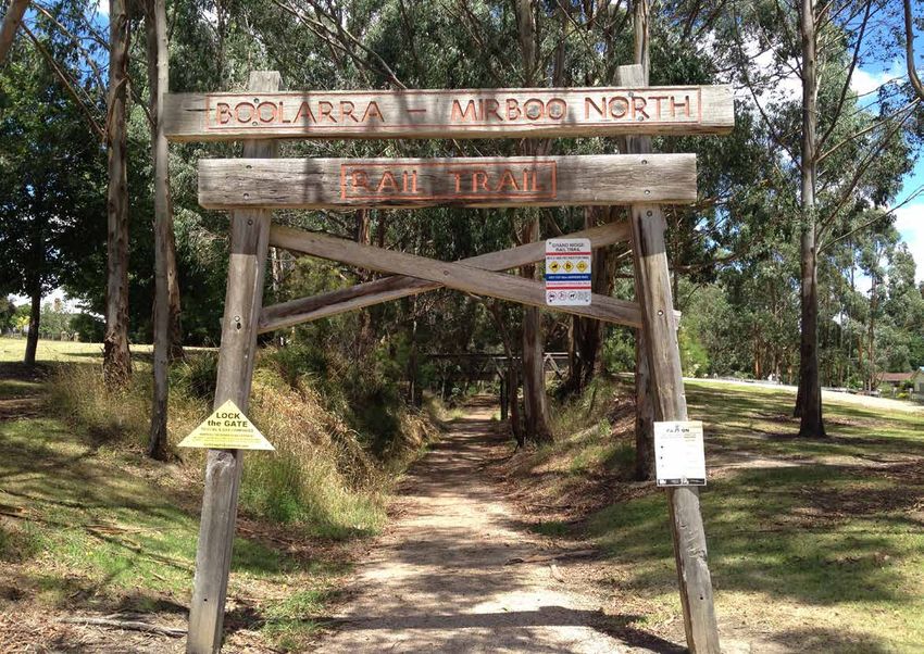
Grand R
idge Rail
Trail
BOOLARRA
Refer to local maps below for details of
existing and proposed routes.MOE-NEWBOROUGH ON ROAD OFF ROAD
PRIORITY ROUTE
Latrobe. Be in it. Network
Existing
Proposed
Off Road On Road
LOCAL ROUTE
PRIORITY ROUTE
Existing
Existing
Proposed
PATH Proposed
Existing
Proposed
LOCAL ROUTE
BICYCLE ROUTE
Existing
Existing
Proposed
Proposed
Intertown
Bike Links
Footpaths
College Park Eastern
Avenue Newborough
Albert Street
Joe Tabuteau Reserve Primary School
Lowanna
Moe Race Course College Federation Training
John Field Yallourn Campus
Reserve
Ollerton Avenue
Bushland Reserve
Botanic Gardens &
Yallourn Golf Club
Narracan Creek Reserve
Newborough East
St Kieran's
Primary School
Primary School
Burrage Reserve
Ted Summerton Reserve, Olympic
Vale Street Reserve Lavalla Catholic
Pool Moe
College Monash Reserve
South Street
Primary School
St Mary's
Primary School
Newborough
Moe Primary
Primary School
School
Edward
Hunter
Reserve
Baringa
Special School
2 KM 10 mins
24 mins 4 minsMORWELL
Latrobe. Be in it. Network
Off Road On Road
PRIORITY ROUTE Crinigan Bushland Reserve
Existing
Proposed
LOCAL ROUTE Morwell
Primary
Existing
School
Proposed
Intertown
Bike Links
Footpaths
Toners Lane Morwell
Maryvale Park
Reserve
Recreation P.S.
Reserve Kurnai
College
Northern
Reserve
Morwell
Secondary
Ronald
College
Reserve
Rose
Garden
Federation Training
Morwell Campus
Morwell Recreation
Reserve Precinct
2 KM 10 mins
24 mins 4 minsTRARALGON
St Paul's Renwick Reserve
Grammar
School
St Gabriel's
Primary
School Agnes Harold
Stockdale Brereton Preston
Road Park Reserve
TarralgonPrimary
Secondary School
College
Grey Street
P.S.
Glenview Park
St Michael's Traralgon
P.S. Racecourse
Traralgon Recreation
Kosciuszko Reserve / Showgrounds
Street
Primary Liddiard
Lavalla School Road
Catholic P.S.
College
Tarralgon
S.C.
Burnet
park Latrobe. Be in it. Network
Off Road On Road
PRIORITY ROUTE
Existing
Traralgon Proposed
Railway
Reservoir LOCAL ROUTE
Conservation Existing
Reserve
Proposed
Intertown
Bike Links
2 KM 10 mins Footpaths
24 mins 4 minsCHURCHILL
Hazelwood South
Recreation Reserve
Andrews
Park - West
Churchill North
Ashman Park Primary School
Mathieson Park
Kurnai
College
Gaskin
Park
Churchill
Primary
School
Federation University
Gippsland Campus
Walkley
Park
Lumen
Christi
School
Glendonald
Park
Latrobe. Be in it. Network
Off Road On Road
PRIORITY ROUTE
Existing
Proposed
LOCAL ROUTE
Existing
Proposed
Intertown
Bike Links
2 KM 10 mins
Footpaths
24 mins 4 minsTOONGABBIE TRARALGON SOUTH GLENGARRY
Apex Park and Gippsla
Plains Rail Trail Glenga
Keith
Morg
an Dr
ive
Traralg
Toongabbie
on Cr
Primary School
e
Toongabbie
ek Ro
Rifle Range
Village Green Road
Glengarry
ad
Recreation Reserve
Glengarry Pre School &
Infant Welfare Centre
Glengarry Primary School
Toongabbie
Recreation
Rail Trail Reserve
Latrobe. Be in it. Network
Off Road On Road
PRIORITY ROUTE
Existing
Proposed
LOCAL ROUTE
Existing
Proposed
2 KM
Intertown
Bike Links
FootpathsYINNAR Stock
Route BOOLARRA
Reserve
Boolarra
Railway
Reserve
and
arry
Yinnar
Yinnar Primary
Centenary School
DSE Reserve -
Gardens Railway Reserve
Charles
Bond
Park
Boolarra
Primary
School
2 KM 1 KM
YALLOURN NORTH TYERS
Tyers Primary
Yallourn North
Latrobe. Be in it. Network School
Recreation Reserve Off Road On Road
PRIORITY ROUTE
Existing Tyers Recreation
Yallourn North
Primary School Proposed Reserve
LOCAL ROUTE
Existing
Proposed
1 KM 1 KM
Intertown
Bike Links
FootpathsToongabbie
LATROBE CITY | TRACKS, TRAILS AND PATHS
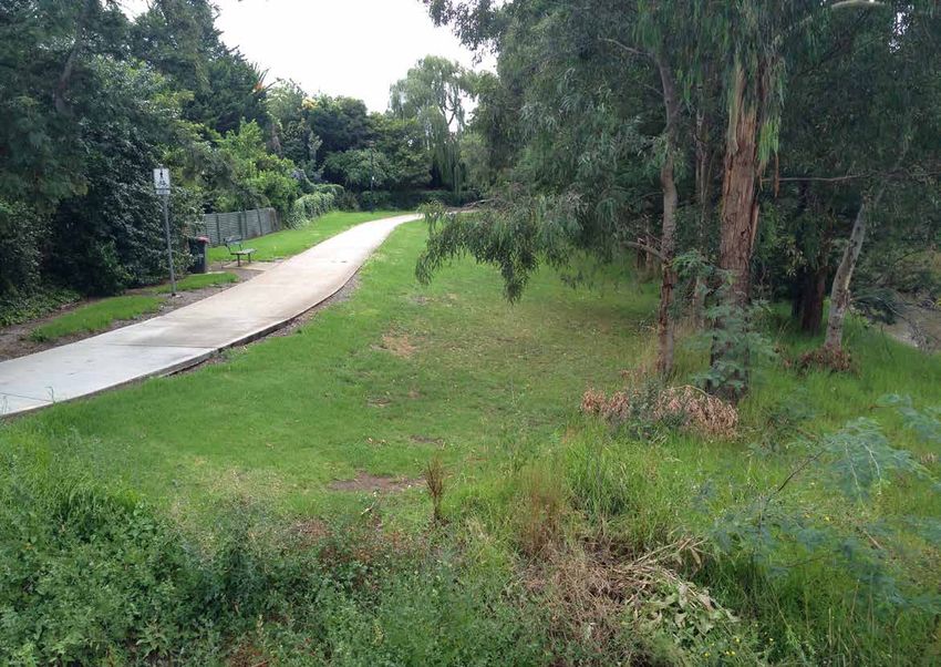
LOCAL STREETS
While a focus of this strategy is development of a Case studies of the walking and cycling conditions
Priority Routes network, the reality is that people will in each of these Local Street types were analysed in
still need to walk and cycle their local streets. Indeed, detail as part of the survey process. The results of this
the strategy’s challenge of walking 30 minutes a day analysis are set out in the following pages. Localised
is aimed at encouraging people to walk (or cycle) their deficiencies in path standard exist, and will continue
local streets for short trips to the milk bar, local park and to arise. Council has monitoring systems in place to
primary school. For trips like these, there will not always respond to these. From a network perspective, the
be Priority or Local Routes nearby. The reality is, and main deficiency is gaps in connectivity.
must remain: Every street is a cycle street; every
street is a walking street.
There are hundreds of kilometres of paths in Latrobe
City, lining a multitude of streets and roads. Council
has a well-maintained data base of its footpath assets,
including maps showing every footpath (see Appendix
X). From these maps it is clear that most urban streets RECOMMENDATION
have footpaths on both sides of the road, but there That the Council establish a connectivity index or
are also many gaps. Path maintenance is a major standard against which to judge priorities for filling gaps
expenditure as there is a need to continually invest in in the footpath network.
upgrades regularly, or construct new infrastructure,
putting a further strain on resources.
This strategy responds to this challenge by categorising
the City’s streets into a number of Local Street types:
Small Block Centre
Medium Block Suburban
Large Block Suburban
Cul-De-Sac Suburban
Rural Network
The location of each of these Local Street types is
shown on the following maps.
© 2016 | 27TOONGABBIE
LOCAL STREET CASE STUDIES
SMALL BLOCK- CENTRE
MEDIUM BLOCK- SUBURBAN
LARGE BLOCK SUBURBAN
CUL-DE-SAC SUBURBAN
RURAL NETWORK
GLENGARRY
TYERS
YALLOURN NORTH
MOE
NEWBOROUGH
TRARALGON
MORWELL
BOOLARRA
CHURCHILL
YINNARLATROBE CITY | TRACKS, TRAILS AND PATHS
LOCAL STREET CASE STUDIES
The layout of the street network is often the initial
ingredient in determining whether a local area is
‘walkable’.
Areas with many route options are said to have ‘high
permeability’, yet landlocked suburbs with few paths in
and out, are considered to have ‘low permeability.’
SMALL BLOCK- MEDIUM BLOCK- LARGE BLOCK CUL-DE-SAC RURAL NETWORK
CENTRE SUBURBAN SUBURBAN SUBURBAN
Inner town areas have street Suburban areas with a finer Suburban areas with large street Street patterns with cul-de-sacs Rural areas tend to have a
networks that are highly grain of streets less than 270 blocks of 300 metres or more in instead of connected streets course grained network, with
permeable with small blocks metres in length provide greater length make walking distances often block direct pedestrian intersections widely spaced.
and lanes connecting streets permeability, meaning more too long to facilitate walking in access to destinations like Often it isn’t possible to walk
within the blocks. This is a ways of walking from point A particular directions. shopping centres. a circuit of roads within a
highly desirable pattern for to point B. This increases the The neighbourhoods may Some examples may have two kilometre distance. The
walking with short trips being opportunity to walk or cycle also lack connectivity to other open space links that provide absence of footpaths on
faster and more efficient than and neighbourhoods are better neighbourhoods, increasing the direct routes for pedestrians/ busier rural roads is a further
driving. connected. reliance on cars. cyclists but indirect for cars, disincentive. Most roads do not
encouraging walking over have a sealed shoulder or wide
driving. kerb side lanes that offer a safer
environment for cyclists.
© 2016 | 29LATROBE CITY | TRACKS, TRAILS AND PATHS
CASE STUDY: SMALL BLOCK CENTRE (TRARALGON)
PATH
30 | © 2014LATROBE CITY | TRACKS, TRAILS AND PATHS
CASE STUDY: SMALL BLOCK CENTRE (TRARALGON)
The inner town area of Traralgon has a typical block size
of approximately 200M by 130M similar to inner Morwell
and Moe, and a lesser extent Churchill. These locations
are highly walkable with lanes connecting within the
blocks as well as a smaller block size.
OVERVIEW FACILITIES TRAFFIC AND ROAD CYCLING AESTHETICS
CROSSING
Two-way road with painted Street facilities such as seating The street caters for cycling The street trees and street
median, angled parking on both and rubbish bins are provided in Crossings are at logical places as a destination but is not furniture make the area
sides. Footpaths are 4.34m good condition. and at regular intervals apart appropriate as a through-route. attractive for walking. Shops
wide on both sides which widen There is also large trees and from near the shopping centre. Angle parking creates a hazard and businesses are well
at corners. Large street trees weather protection canopies The crossings are of the for cyclists. The road surface maintained and accessible. The
right size for the road, views
are located at corners with along the front of shops. though is good, with numerous streets are clear of litter and the
to oncoming traffic are not
smaller street trees located Signage would improve way obstructed and pedestrian bicycle parking facilities. roundabout provides a feature
under shop canopies. There finding in these locations. islands are provided on wider with a floral garden and clocks.
was some water pooling along No Tactile Ground Surface roads.
the footpath. Bollards linked by Indicators were provided, The street layout with narrow
chains create barriers. however, they were used further roads and angle parking on
The footpaths are well down Franklin Street near both sides, as well as the traffic
maintained, although there were Moore Street to cross to the in busy periods, slow traffic
some cafe chairs and tables road to the community facility. down. There are bollards (with
and sandwich boards in the good contrast for those who are
walking path and adjacent to vision impaired) between the
shop front walls. pedestrian areas and roadway.
© 2016 | 31LATROBE CITY | TRACKS, TRAILS AND PATHS
CASE STUDY: MEDIUM BLOCK SUBURBAN (MOE)
Existing Footpath
32 | © 2014LATROBE CITY | TRACKS, TRAILS AND PATHS
CASE STUDY: MEDIUM BLOCK SUBURBAN (MOE)
The area around Vale Street in Moe is an example of
Medium sized suburban blocks, less than 270 m in
length. These areas are similar to the town centres of
Moe, Morwell and to a lesser extent Traralgon.
Blocks are often rectangular with many routes available to
travel across the suburb.
OVERVIEW FACILITIES TRAFFIC AND ROAD CYCLING AESTHETICS
CROSSING
Street trees exist (most There is no street furniture Some routes exist as a result The area is relatively attractive
established, some establishing), along this street type. Although There are no crossings on most of the Latrobe City Bicycle Plan to walk around. The streets are
and footpaths are on both sides parks have seats at various streets as it’s appropriate to 2007-2010. The road surfaces clear of rubbish, although there
but not continuous (175 cm locations. Bus shelters have cross at any point. The main are well maintained with few are no interesting features to
road width, 286 cm footpath on been removed (due to route issues for crossings are the issues for cyclists. Bicycle make the walk enjoyable.
main side, 145 cm other side), closures) and concrete slabs quality of the kerb ramps at parking is available at newer
some locations are covered exist in these locations. Trees street corners and the large recreation facilities.
by debris from trees. Nature are sufficient for shading on intersections with cut off corners
strips are very wide with drains a hot day, and no signage is (where cars can cut the corner
in locations. Traditional kerbs, present. and conflict with pedestrians).
with swept curve corners and a There are some school
variety of kerb ramps at corners crossings along the main roads.
(historical).
© 2016 | 33LATROBE CITY | TRACKS, TRAILS AND PATHS CASE STUDY: LARGE BLOCK SUBURBAN (MORWELL) 34 | © 2014
LATROBE CITY | TRACKS, TRAILS AND PATHS

CASE STUDY: LARGE BLOCK SUBURBAN (MORWELL)
Unlike other municipalities Large Suburban Blocks are
similar to Medium Suburban Blocks. They are defined as
having a distances of around 300 metres, and may have
some cul-de-sacs (courts).
These larger blocks make it difficult to navigate due to
great distance required to simply go to the next street,
although green connections exist making it easier for
pedestrians compared to drivers.

OVERVIEW                           FACILITIES                           TRAFFIC AND ROAD                      CYCLING                             AESTHETICS
                                                                        CROSSING
Footpaths are usually 1.35         No facilities provided in the area   Similar to the medium suburban        There tends to be more bicycle      The area is relatively attractive
metres wide and are on each        except for at specific locations     block, there are no crossings         lanes in this area than in other    to walk around. The streets are
side of the road next to the       such as the milk bar that has a      on most streets, which allows         locations. The road condition       clear of rubbish, although there
nature strip. The streets are      bin and a telephone box.             pedestrians to cross at any           is quite good and suitable for      are no interesting features to
two-way residential streets with   The park has lighting, which is      point.                                cyclists.                           make the walk enjoyable.
traditional kerbs and a lack of    uncommon in Latrobe City.            The main issues for crossings
street trees.                                                           are the quality of the kerb
Park paths are 1.23 metres                                              ramps at street corners and the
wide in one area and 2.5                                                large intersections with cut off
metres wide else where.                                                 corners.
                                                                        There are some school
                                                                        crossings along the main roads.
                                                                        Additionally trail crossing points
                                                                        have fencing to prevent cyclists
                                                                        from riding directly into the road.

                                                                                                                                                    © 2016                     |      35
LATROBE CITY | TRACKS, TRAILS AND PATHS CASE STUDY: CUL-DE-SAC SUBURBAN (CHURCHILL) 36 | © 2014
LATROBE CITY | TRACKS, TRAILS AND PATHS

CASE STUDY: CUL-DE-SAC SUBURBAN (CHURCHILL)
Cul-de-sac or court development predominate many of
the town’s outer suburban areas. The blocks tend to be
very large in size. Paths through open space that connect
streets are, however commonplace, making connectivity
for pedestrians a lot higher than for vehicles, which can
encourage walking journeys.

OVERVIEW                           FACILITIES                           TRAFFIC AND ROAD              CYCLING                            AESTHETICS
                                                                        CROSSING
Two-way roads with nature          There is no street furniture along   Speeding is sometimes an      The road surfaces are well         The area is relatively attractive
strips and footpaths on both       this street type. Some furniture     issue in the area therefore   maintained with few issues for     to walk around. The streets are
sides (1.4 m) mostly with some     is available in the open space.      speed humps have been used    cyclists. There are some shared    clear of rubbish, although there
areas only with one path. Cul-     Bus shelters exist. Although         to slow down traffic.         pathways through parks that link   are no interesting features to
de-sacs may have no footpaths      parks have seats at various                                        into the town centre.              make the walk enjoyable.
in older areas yet new areas       locations. Some trees are
have a path all the way around.    present for shading with newer
                                   areas having less mature trees.

                                                                                                                                            © 2016                     |      37
LATROBE CITY | TRACKS, TRAILS AND PATHS CASE STUDY: RURAL NETWORK (TOONGABBIE) 38 | © 2014
LATROBE CITY | TRACKS, TRAILS AND PATHS

CASE STUDY: RURAL NETWORK (TOONGABBIE)
The rural network of roads are the majority street types
in Latrobe City. The case study chosen is in Toongabbie
due to the range of roads, from higher speed main routes
to typical township streets. It is also the location of the
Gippsland Plains Rail Trail.

OVERVIEW                             FACILITIES                           TRAFFIC AND ROAD                  CYCLING                              AESTHETICS
                                                                          CROSSING
Roads tend to have gravel            The rail trail has some facilities   The speed limit is 100 kph and    The road condition is quite          The streets are very attractive
shoulders which merge into           and the recreation reserves are      no devices to slow traffic at     good and suitable for cyclists       to walk around with remarkable
grass nature strips. There are       well provided for with drinking      down such as islands or speed     although there are often no bike     landscapes and rural features.
ditches well away from the           fountains and toilets.               bumps near crossing points.       lanes.                               The old grandstand and
granitic sand paths that are                                              There are no barriers between     The granitic sand paths              Mechanics institute are
present on one side.                                                      the road and people but the       when properly maintained are         interesting attractions with
                                                                          road side areas are large         suitable for cyclists and the rail   sustainable urban drainage
                                                                          enough that pedestrians are far   trail is perfect for town inter-     systems in this location, makes
                                                                          away from the traffic.            connectivity.                        for an enjoyable walk.

                                                                                                                                                   © 2016                     |      39
LATROBE CITY | TRACKS, TRAILS AND PATHS
NETWORK COMPONENTS
Both the Priority Routes Network and EQUITY OF ACCESS PUBLIC TOILETS SHADE
the Local Street Network depend
Providing access for elderly and people For some people, such as some elderly The path network should be accessible
on their implementation on Network
with young children is a high priority. people, parents with small children or at all times of the year and it important
Components, which are the subject of
Wherever possible, path design should some pregnant women, public toilets that additional tree planting is carried out
this section of the report.
accommodate the needs and aspirations actually determine the route they may to shade the path. Council no longer
of people of all abilities, cultures and take to a destination. Public toilet facilities supports the installation of Shade Sails
ages. It is essential to ensure that people have a range of various criteria to and so the location of benches, water
can use existing or proposed paths and determine their location which includes, fountains and other infrastructure should
trails, and have access to a range of the potential usage, community safety be sited where they are shaded by
locations, irrespective of their mobility and location of other toilet facilities. canopy trees. Other green infrastructure
range. could be considered to improve the
microclimate and provide shading as
RECOMMENDATION RECOMMENDATION RECOMMENDATION well.
That the Council give priority to filling That when network gaps are filled, or Primary routes should be signed As well as providing shade, trees also
gaps in footpath connectivity, prioritised infrastructure upgrades are programmed, indicating distance to destinations such cool the air, are aesthetically pleasing,
by means of a ‘Pathway Service Priority the works should be designed to be as parks, schools and shops as well as improve local property prices, and
Matrix’. DDA compliant. toilet facilities. many other benefits. Tree planting will is
therefore a very cost effective solution for
urban areas to improve the environment
for its residents.
PATH LEVEL OF SERVICE PUBLIC TRANSPORT INTEGRATION
Level of service is a way of determining Paths should connect to train stations
the size and material and location and bus stops as a high priority because
of a path. Council uses a system of these both enable the use of public
high to low priority and is developing transport and walking. Paths along bus
a scoring approach to determine level routes can also provide the opportunity
of service. Level of service is explored for people to walk instead.
further in Appendix B, path types and
recommendations.
RECOMMENDATION RECOMMENDATION
That the Council give critical priority to That the Council develop and implement
paths to bus stops and train stations. a signage strategy for the Latrobe. Be in
it. network.
40 | © 2014LATROBE CITY | TRACKS, TRAILS AND PATHS
SEATING DRINKING FOUNTAINS PATH CONTEXT LIGHTING
Seats along path routes are beneficial Drinking fountains or bubblers, provide The path context plays an important role Lighting along routes, especially off road
for people with mobility issues. Seats water to pedestrians/cyclists on their in usage of paths, tracks and trails. A routes, can enhance both the real and
are present in Latrobe in parks and town journey to a destination. For short local natural context with a stream may be well perceived level of safety.
centres. Seating can be incorporated into trips as discussed in the Latrobe. Be in used whereas a path along a busy road
trails at stopping points, where people it. strategy, they may not be necessary, may be greatly under used. Furthermore,
with mobility issues may rest, or locations but for longer routes it would be a useful public safety is a concern for areas that
with other facilities, playgrounds, or component. The possibility of locating are remote and hidden with walkers
skate parks. They are more often them near sports fields, parks and trails possibly avoiding these routes, especially
associated with more leisurely walking to gain the benefit from both uses would at night.
than for commuter routes to work. when be the best strategy.
specifying material choices for seating
A drinking fountain unit that also provides
wood should be the preferred option.
a bottle refill tap is a must, and a dish
for pets would also be useful for dog
RECOMMENDATION walkers.
That seating be placed at points where
priority paths meet other facilities, or at
common stopping places.
RECOMMENDATION
Drinking fountains are recommended for
locations of greater usage, for example
where priority paths meet sports grounds
or parks and high use retail areas.
Traralgon
© 2016 | 41You can also read