Mining Claims and Sites
on Federal Lands
←
→
Page content transcription
If your browser does not render page correctly, please read the page content below
Mining Claims and Sites on Federal Lands
Credit for cover photo: BLM historical database
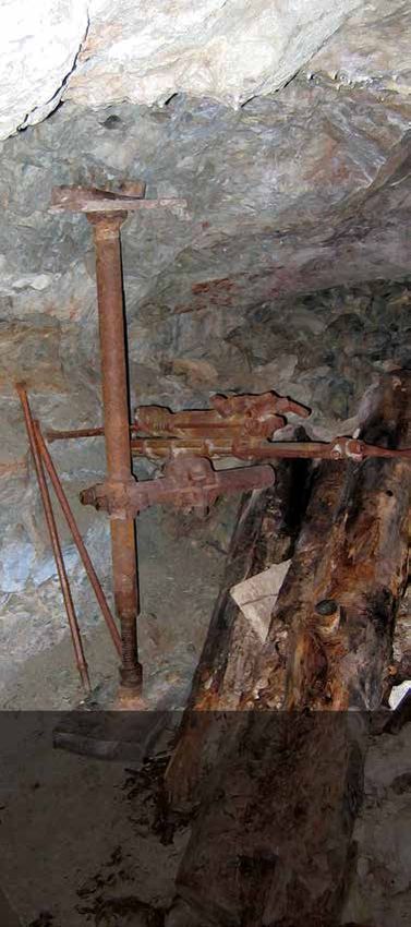
Credit for inside photos: Ron Landberg
Production services were provided by the
BLM National Operations Center’s Information and
Publishing Services Section.
P-048
BLM/WO/GI-17/002+3800+REV21
Foreword
The Bureau of Land Management
(BLM) manages about 245
million acres of public land,
primarily located in 12 western
states, including Alaska. The BLM
also administers about 700 million acres of
subsurface mineral estate throughout the nation. The
BLM’s multiple-use mission is to sustain the health,
diversity, and productivity of the public lands for the
use and enjoyment of present and future generations.
The BLM accomplishes this mission by managing
activities, such as outdoor recreation, livestock grazing,
mineral development, and energy production, and by
conserving natural, cultural, and other resources on
public lands.

The Federal Land Policy and Management Act
(FLPMA) of 1976 provides that the public lands
remain under the stewardship of the Federal
Government, unless disposal is in the national interest
and consistent with publicly approved land use plans,
and that their resources be managed under a multiple-
use concept that will best meet the present and future
needs of the American people. Since mining is one of
the multiple uses of BLM public lands, this pamphlet
provides information on activities that fall under the
Mining Law of 1872, as amended.

                                                      i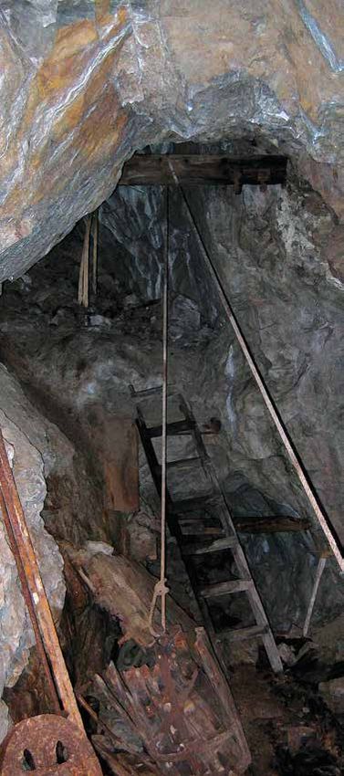
Contents
Introduction . . . . . . . . . . . . . . . . . . . . . . 1
Explanation of “Discovery” . . . . . . . 3
   Locatable Minerals . . . . . . . . . . . . . 3
   Discovery of a Valuable
   Mineral Deposit . . . . . . . . . . . . . . . . . . . . . . . . . . . . . . . . . . .  4
Explanation of “Location” . . . . . . . . . . . . . . . . . . . . . . . . . . . . 7
   Mining Claims and Sites . . . . . . . . . . . . . . . . . . . . . . . . . . . 7
   Federal Lands Open to Mining . . . . . . . . . . . . . . . . . . . . 11
   Staking a Mining Claim or Site . . . . . . . . . . . . . . . . . . .  13
Recording a Mining Claim or Site . . . . . . . . . . . . . . . . . . .  15
Maintenance of a Mining Claim or Site . . . . . . . . . . . . .  19
   Annual Assessment Work . . . . . . . . . . . . . . . . . . . . . . . .  19
   Surface Management . . . . . . . . . . . . . . . . . . . . . . . . . . . . 22
Mineral Patents . . . . . . . . . . . . . . . . . . . . . . . . . . . . . . . . . . . . 27
BLM Land and Mineral Records . . . . . . . . . . . . . . . . . . . 29
More Information  . . . . . . . . . . . . . . . . . . . . . . . . . . . . . . . . . .  31
   Sources of Information  . . . . . . . . . . . . . . . . . . . . . . . . . .  31
   Geology and Minerals, Topographic Maps, and
   Mining Technology . . . . . . . . . . . . . . . . . . . . . . . . . . . . . . . 32
Bureau of Land Management State Offices  . . . . . . . 33
U.S. Forest Service Regional Offices . . . . . . . . . . . . . . . 35

                                                                                    iii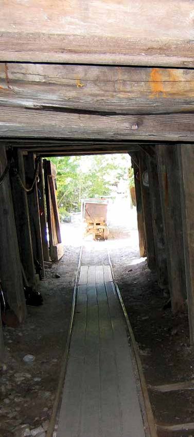
Introduction
The three basic types of minerals
on federal lands include:
1. Locatable minerals (subject
   to the Mining Law of 1872, as
   amended)
2. Leasable minerals (subject to the
   various Mineral Leasing Acts)
3. Salable minerals (subject to mineral materials
   disposed of under the Materials Act of 1947, as
   amended)

Federal laws, regulations, and legal decisions have
defined these minerals. This pamphlet only focuses on
locatable minerals.

The Mining Law of 1872, as amended (30 U.S.C. §§
22-54 and §§ 611-615) allows citizens of the United
States the opportunity to explore for, discover, develop,
and purchase certain valuable mineral deposits on those
federal lands that are open for mining claim location and
patent (“open to mineral entry”). The law sets general
standards and guidelines for claiming the possessory
right to a valuable mineral deposit discovered during
exploration, as well as establishing the right to develop
and extract the mineral deposit. These “locatable”
mineral deposits include most metallic mineral deposits
and certain nonmetallic and industrial minerals. Mining
claims located or perfected after the enactment of the
Surface Resources Act on July 23, 1955 (30 U.S.C.
§ 612) are subject to use for certain purposes by the
United States or its permittees or licensees, provided
that such use does not materially interfere with mining
or processing operations. All mining claims must
comply with all applicable laws and regulations, such
as the BLM’s surface management regulations at
43 CFR 3809. These regulations were issued
pursuant to Section 302(b) of the Federal Land Policy
and Management Act (FLPMA), 43 U.S.C. § 1732(b),
which specifically amended the Mining Law.
                                                     1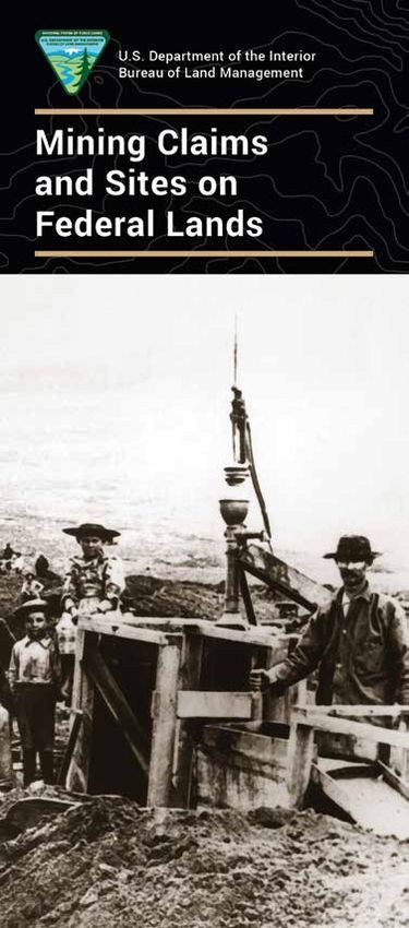
The Mining Law allows for the enactment of state laws
governing location and recording of mining claims and
sites that are consistent with federal law. The federal
regulations implementing the Mining Law are found at
Title 43 of the Code of Federal Regulations (CFR) in
Group 3700 and Part 3800.

The five elements of the Mining Law of 1872, as
amended, are described in this pamphlet:
1. Discovery of a valuable mineral deposit
2. Location of mining claims and sites
3. Recordation of mining claims and sites
4. Annual maintenance (annual assessment work or
   annual fees) for mining claims and sites
5. Mineral patents

This pamphlet also provides a brief introduction
of the BLM Mining Law Administration Program’s
responsibilities on federal lands administered
by the BLM. The program involves mining claim
recordation, annual maintenance (annual assessment
work or annual fees), mineral patents, and surface
management. The last section provides additional
sources for more information on the following topics:
• Geology and mineral resources of a particular area
• Surface management regulations
• Other federal and state legal requirements

  2
Explanation of
“Discovery”
Locatable Minerals
The Mining Law of 1872, as
amended, opened the public lands
of the United States to mineral acquisition by
location and maintenance of mining claims. Mineral
deposits subject to acquisition in this manner are
generally referred to as “locatable minerals.” Locatable
minerals include both metallic mineral deposits (e.g.,
precious, base, nonferrous, and light metals) and
nonmetallic mineral deposits (e.g., industrial minerals,
gemstones, and uncommon varieties of stone).

In 1873, the U.S. Department of the Interior (DOI)
began defining locatable minerals as those minerals
that are recognized as a mineral by the standard
experts, are not subject to disposal under some
other law, and make the land more valuable for
mining purposes than for agriculture. It is difficult
to list all locatable minerals because of the complex
legal requirements for discovery. For example, when
minerals that are typically locatable are found on lands
acquired (purchased or received) under the Mineral
Leasing Act for Acquired Lands of 1947, as amended,
by the United States or found on American Indian
reservations, they are subject to lease only (43 CFR
3500). Therefore, it is easier for the BLM to list the
minerals that are not locatable.

Since July 23, 1955, common varieties of sand, gravel,
stone, pumice, pumicite, and cinders were removed
from the Mining Law and placed under the Materials
Act of 1947, as amended. Use of salable minerals
requires either a sales contract or a free-use permit.
Disposal of salable minerals from BLM-administered
lands are regulated by 43 CFR 3600.

Uncommon varieties of salable-type minerals may be
locatable if the deposits meet certain tests created
                                                    3
by various judicial and administrative decisions. See McClarty v. Secretary of the Interior, 408 F. 2d 907 (9th Cir. 1969). Federally certified mineral examiners determine uncommon variety on a case-by-case basis. (See 43 CFR 3830, Subpart C, for further information concerning the locatability of minerals.) Since 1920, the Federal Government has leased fuels and certain other minerals (43 CFR 3000-3590). Today, minerals that are subject to lease include oil and gas, oil shale, geothermal resources, potash, sodium, native asphalt, solid and semisolid bitumen, bituminous rock, phosphate, and coal. In Louisiana and New Mexico, sulphur is also subject to lease. Discovery of a Valuable Mineral Deposit Federal statute does not describe what constitutes a valuable mineral deposit. Therefore, the government has adopted the “prudent man rule.” This rule determines value based on whether or not a person will consider investing time and money to develop a potentially viable mineral deposit. This rule was first stated by the DOI in 1894, in the adjudication of Castle v. Womble, 19 L.D. 455 (1894), the holding of which states: “…where minerals have been found and the evidence is of such a character that a person of ordinary prudence would be justified in the further expenditure of his labor and means, with a reasonable prospect of success, in developing a valuable mine, the requirements of the statute have been met.” The U.S. Supreme Court approved this definition in Chrisman v. Miller, 197 U.S. 313 (1905). The Solicitor of the Department of the Interior issued an opinion (M-36642) in 1962 on the issue of widespread nonmetallic minerals with questionable marketability. The Solicitor noted a need for a distinct showing that the mineral could be mined, removed, and marketed at a profit. In 1968, the U.S. Supreme 4
Court approved the opinion in U.S. v. Coleman,
390 U.S. 602-603 (1968). The marketability test is
supplemental to the prudent man rule and considers
deposit economics and market entry. The claimant
is required to show a reasonable prospect of making
a profit from the sale of minerals from a claim or a
group of contiguous claims.

DOI decisions require a discovery on each claim based
on an actual physical exposure of the mineral deposit
within the claim boundaries. The DOI’s holding in
Jefferson-Montana Copper Mines Co., 41 L.D. 321
(1912), established the full test for a lode claim:

  “To constitute a valid discovery upon a lode claim,
  three elements are necessary:
    1. There must be a vein or lode of quartz or other
       rock-in-place
    2. The quartz or other rock-in-place must carry
       gold or some other valuable mineral deposit
    3. The two preceding elements, when taken
       together, must be such that as to warrant a
       prudent man in the expenditure of his time and
       money in the effort to develop a valuable mine.”

For traditional placer claims, in addition to proof of a
discovery, each 10 acres must be shown to be mineral-
in-character (there is a reasonable expectation of
further economic mineral under these lands).

Mineral-in-character may be based on geologic
inference from adjoining lands and a reasonable
opportunity for profitable extraction. An actual exposure
of the valuable mineral deposit is not necessary.
Mineral-in-character may be used to show the potential
extent of the valuable mineral deposit on the claim(s)
but cannot be used alone for such purposes.

Under the holding in Schlosser v. Pierce, 93 I.D. 211
(1986), contiguous mining claims on the same mineral

                                                    5
deposit may be grouped together into a logical mining unit and evaluated as an economic unit. Each claim must still contain a physical exposure of the ore- bearing mineral deposit whose value meets or exceeds the cutoff grade for the mining of the mineral deposit as a whole. 6
Explanation of
“Location”
Mining Claims and Sites
A person who is a citizen of the
United States or who has declared
an intention to become a citizen with the U.S.
Citizenship and Immigration Services may locate and
hold a mining claim or site. A corporation organized
under state law is considered a citizen and may locate
and hold a mining claim or site. A corporation is held
to the same standards as a citizen. There is no limit to
the number of claims and sites that one may hold as a
qualified claimant, as long as the requirements of the
Mining Law have been met.

A mining claim is a selected parcel of federal land,
valuable due to a specific mineral deposit or deposits,
for which one has asserted a right of possession
under the Mining Law. Rights are restricted to the
development and extraction of a mineral deposit.
The rights granted by a mining claim protect against
a challenge by the United States and other claimants
only after the discovery of a valuable mineral deposit.
The two types of mining claims are lode and placer. In
addition, mill sites and tunnel sites may be located to
provide support facilities for lode and placer mining
claims (43 CFR 3832). Mining claims may only
be located in areas open to mineral entry. It is the
locator’s responsibility to make this determination by
reviewing all available and relevant land records.

Lode claims cover veins or lodes with well-defined
boundaries that include other rock-in-place bearing
valuable mineral deposits. Examples include
quartz or other veins bearing gold or other metallic
mineral deposits and large volume (but low grade)
disseminated metallic deposits, such as Carlin-type
gold deposits and copper-bearing granites.

                                                    7
Lode claims are usually located as parallelograms with
the side lines parallel to the vein or lode (see Figure 1).
The land is described by a metes and bounds survey
(giving the length and compass bearing of each
boundary line from a central point or monument to
each corner post, and then sequentially around the
perimeter of the claim). Federal statute limits a lode
claim to a maximum of 1,500 feet in length along
the vein or lode. The width is a maximum of 600 feet
(300 feet on either side of the center line of the
vein or lode). The end lines of the lode claim must be
parallel to qualify for underground extralateral rights.
Extralateral rights involve the rights to minerals in vein
or lode form that extend at depth outside the vertical
boundaries of the claim (43 CFR 3832, Subpart B).
Figure 1. Drawing of an ideal lode mining claim (metes and
bounds survey method).
Placer claims cover all those deposits not subject
to lode claims. Placer is a surface mineral deposit
formed by the concentration of small particles or
heavy minerals. Originally, placer claims included only
deposits of mineral-bearing sand and gravel containing
free gold or other detrital minerals. By congressional
8acts and judicial interpretations, many nonmetallic
bedded or layered deposits, such as gypsum and high-
calcium limestone, are located as placer claims.
Where possible, placer claims are to be located by
legal subdivision, such as the E1/2 NE1/4 NE1/4,
Section 20, Township 10 South, Range 21 East, Mount
Diablo Meridian (30 U.S.C. § 35 and 43 CFR 3832,
Subparts A and B). An individual may claim a placer
claim with a maximum size of 20 acres (see Figure 2).
An association of two locators may locate 40 acres,
and three may locate 60 acres, etc. The maximum area
of an association placer claim permitted by law is
160 acres for eight or more persons.
660'
Figure 2. Drawing of a section of land showing different
sizes of placer mining claims and a mill site. The
legal description method is based on the Public
Land Survey System.
9The maximum size of a placer claim for a corporation
is 20 acres per claim. Corporations may not locate
association placer claims unless they are in association
with other private individuals or other corporations as
co-locators (43 CFR 3832, Subpart B).
Most state laws require conspicuous and substantial
monuments for all types of claims and sites (see
Figure 3). Please note that each state may have other
requirements for monuments. Due to wildlife fatalities,
the BLM does not allow the use of perforated or
uncapped pipes as monuments, corner posts, or side line
posts. All monuments should be wildlife safe. Be sure
to consult state law to verify which wildlife-safe markers
are allowable where your mining claim or site is located.
Figure 3. Example of methods of monumenting mining
claims. State laws may vary.
Mill sites must be located on nonmineral land and
must be noncontiguous to the lode or placer with
which it is associated. The mill site may be located in
the same manner as a lode or a placer mining claim.
Its purpose is to either:
• Support a lode or placer claim mining operation; or
• Support itself independent of any particular claim
by custom milling or reduction of ores from one or
more mines.
A mill site must either include a mill for grinding,
crushing, flotation, or chemical processing of ores or a
10reduction works for chemical processing of ores, siting
of furnaces, and related facilities. Related facilities
may include those needed to reasonably support a
mining operation, including tailing impoundments,
waste dumps, and leach pads. Mill sites are described
either by metes and bounds surveys or by legal
subdivision. The maximum size of a mill site is 5 acres
(see Figure 2). A claimant may hold as many mill sites
as necessary for the support of the mining operation
(43 CFR 3832, Subpart C).
Tunnel sites are tunnels excavated to develop a vein or
lode. They are also used for the discovery of unknown
veins or lodes. To locate a tunnel site, place two stakes
up to 3,000 feet apart on the surface axis of the
proposed tunnel. The compass bearing and distance
of the tunnel must be posted at the entrance to the
tunnel. Tunnel sites must be recorded in the same
manner as lode claims. Some states require additional
center line stakes (e.g., in Nevada, center line stakes
must be placed at 300-feet intervals).
Lode claims must be located over any or all blind (not
known to exist at the surface) veins or lodes discovered
by the tunnel in order to maintain possession of the
lodes or veins. The maximum distance these lode
claims may cover is 1,500 feet on either side of the
center line of the tunnel. This, in essence, gives the
right to prospect underground an area 3,000 feet
wide and 3,000 feet long. Any mining claim located
for a blind lode discovered while driving a tunnel will
have the same location date as the date of the location
of the tunnel site (43 CFR 3832, Subpart D).
Federal Lands Open to Mining
Mining claims or sites may be located in 19 states,
including Alabama, Alaska, Arizona, Arkansas,
California, Colorado, Florida, Idaho, Mississippi,
Montana, Nebraska, Nevada, New Mexico, North
Dakota, Oregon, South Dakota, Utah, Washington,
and Wyoming. The BLM manages the surface of
public lands in these states, and the U.S. Forest
11Service (USFS) manages the surface of National Forest System lands. The BLM is responsible for the subsurface minerals on both its public lands and National Forest System lands. Mining claims and sites may be prospected and located on lands open to mineral entry. Claims may not be located in areas closed to mineral entry. Subject to valid existing rights, these areas are withdrawn from further location of mining claims or sites. Areas withdrawn from mineral entry include national parks, national monuments, American Indian reservations, most Bureau of Reclamation projects, military reservations, scientific testing areas, most wildlife protection areas (such as national wildlife refuges), lands withdrawn pursuant to FLPMA (Section 204), and lands withdrawn from mineral entry for other reasons. Lands withdrawn for power development are subject to mining location and entry only under certain conditions. Mining claims may not be located on lands that have been: • Designated by Congress as part of the National Wilderness Preservation System • Designated as a wild portion of a wild and scenic river • Withdrawn by Congress for study as a wild and scenic river There is usually a 1/4-mile buffer zone withdrawn from location of mining claims or sites from either side of a river while the river is being studied for inclusion in the National Wild and Scenic Rivers System. Additions to the National Wilderness Preservation System are withdrawn to mining claim and site location at the time of designation by Congress. Mining activities are permitted only on those mining claims from which proof can be shown that a discovery was made before the date of designation as wilderness 12
by Congress. Lands patented under the Stock Raising
Homestead Act of 1916, as amended, are open to
location but may be entered, and mining claims
located only under special procedures (43 CFR 3838)
may be entered.

Staking a Mining Claim or Site
Federal law simply specifies that claim and site
boundaries must be distinctly and clearly marked to
be readily identifiable on the ground (43 CFR 3832).
The Mining Law allows states to establish additional
laws regarding the manner in which mining claims
and sites are located and recorded. State location
requirements may include placement, size, and
acceptable materials for a corner post or a discovery
monument. Check with the proper state agency
before locating mining claims. State agencies may
include the state’s geological survey, mineral resource
department, lands commission, or department of
environmental protection.

Generally, staking a mining claim requires:
• Erecting corner posts or monuments (see Figure 3)
• Posting a notice of location on a post or monument
  in a conspicuous place—usually the point of
  discovery (see Figures 1 and 2)
• Complying with federal requirements at 43 CFR
  3830, 3832, and 3833

The conspicuous place on the mining claim is usually
the point of discovery. The discovery point must be
tied to some well-known, permanent object. Examples
of permanent objects include an existing cadastral
survey monument, a benchmark, a bridge, the fork of
a stream, or a road intersection. Several states also
require side line or end line posts or monuments for
claims. Mining claims and sites described by legal
subdivision in some states do not require the erection
of corner monuments (see Figure 2). However, all
mining claims and sites must have a location or

                                                  13
discovery monument. Be sure to check what the law requires in the state where the mining claims and sites are to be located. For a specific tract of land, check the official land records at the BLM state or field office responsible for administering the land area. Rather than looking randomly through the records for lands open to location, it is better to restrict the search to a specific area of interest. Topographic maps of the area (published by the U.S. Geological Survey) provide the legal description (meridian, township, range, section) of such lands. Visit the local BLM state or field office, and check maps, BLM master title plats, mining claim records, and files. Ultimately, it is the claimant’s responsibility to determine if there are prior existing mining claims on the ground and if the land is open to mineral location. Maps showing locations of active and closed mining claims and sites can be found in the Mineral and Land Records System (https://mlrs.blm.gov). This site provides maps of mining claims and sites with a level of detail of at least the quarter section. The site also provides a link to a General Land Office (GLO) site where state land status records, such as master title plats and patents, are available, if a state has uploaded those documents to the GLO site. 14
Recording a Mining
Claim or Site
As established by Section 314 of
FLPMA, as amended, claims and
sites must be recorded with the proper
BLM state office within 90 days of the date
of location and recorded with the proper county in
accordance with their requirements. In Alaska, claims
and sites can also be recorded with the BLM district
office located in Fairbanks.

County: State laws require filing the original location
notice or certificate in the county recorder’s office, county
clerk’s office, or borough office. The proper county or
borough is the one in which the claim or site is located.
Each state has its own requirement for when a location
notice must be filed and recorded. The maximum period
is 90 days from the staking of a claim or site on the
ground. However, some states require earlier filings, such
as 30 or 60 days from the date of location.

Location notices must contain the following basic
information (43 CFR 3832, Subpart A, and 43 CFR
3833, Subpart A):
• The date of location on the ground
• The names and individual mailing addresses of the
   locator(s)
• The name of the claim or site
• The type of claim or site (lode or placer claim or mill
   site or tunnel site)
• The acreage claimed
• A description of the parcel on the ground

Local printing companies, office supply stores,
stationery stores, appropriate state agencies, and BLM
offices are some sources where state location notices
and certificate forms might be obtained.

BLM: FLPMA (43 U.S.C. § 1744) requires claimants
to file a copy of the official record of notice or
                                                       15
certificate of location with the BLM within 90 days after the date of location. Claimants must record any amendments (changes) in claim boundaries and any changes in ownership with the BLM. Claimants are also required to submit a map of the claim or site boundaries. Other documents filed under state law must also accompany the copy of the official record filed with the BLM. Even if state law does not require recording, claimants must still file the proper documents with the BLM. Federal recording regulations in 43 CFR 3833 specify the information required. These requirements may also be obtained from BLM state or field offices. A nonrefundable processing fee is required to record each new location, along with a location fee and initial maintenance fee. These fees are due at the time of recording. See www.blm.gov/miningclaimsfees for the schedule of fees. FLPMA requires a finding of abandonment if claimants fail to record with the BLM, county, or borough within the prescribed 90-day period. A separate location notice must be used for each mining claim, mill, or tunnel site. Amendments and Transfers of Interest: Legal interest in a properly recorded mining claim or site may be conveyed in its entirety or in part. Generally, a quitclaim deed or other type of recordable conveyance document (this is governed by state law) is needed for this transfer of legal interest (43 CFR 3833, Subpart C). An amended location notice is necessary to show changes in the description of a claim or site but cannot be used for a transfer of ownership (43 CFR 3833, Subpart B). Transfer and amendment documents must be filed with the proper county and BLM state office. Amendment documents must be filed with the proper BLM state office within 30 days after receipt of a notice from the BLM requiring the amendment, or within 90 days after the amendment is recorded with the county if the amendment is initiated by the claimants instead of the BLM. The BLM requires a nonrefundable processing fee to file amendments and transfers of interest for each mining claim or site. 16
See www.blm.gov/miningclaimsfees for the schedule
of fees. Failure to file a transfer of interest will result
in the BLM only recognizing the last owner of record
as the responsible party for maintaining the mining
claim or site. No notification of any action or contest
initiated by the United States will be served on the
new owners until the transfer of interest is filed
with the BLM. Failure to file the transfer of interest
provides no legal defense against failure to be
properly served.

Abandonment or Relinquishment: If claimants
abandon a mining claim or site or relinquish it to the
Federal Government, they should file a notice with
the proper county or borough office and the BLM
state office. No particular form is required; a letter is
acceptable. Be sure to include the claim or site name
and the BLM serial number. There is no fee to file
these documents.

THE PROPER BLM STATE OFFICE IS THE ONLY
OFFICIAL FILING OFFICE FOR THE FEDERAL
GOVERNMENT. The only exception is the BLM
district office in Fairbanks, Alaska, which is also a
filing office.

A claimant may also file a new claim or site online
through the Mineral and Land Records System
(https://mlrs.blm.gov), as well as most other mining
claim documents, as long as a document does not
require an original signature, such as a maintenance
fee waiver.

                                                        17
Maintenance of
a Mining Claim
or Site
If claimants have a legal interest in
10 or fewer mining claims nationwide and
also meet certain other requirements, they have the
option to perform assessment work and file evidence
of the assessment work as described in the next
section (43 CFR 3835). All other claimants must
pay the BLM an annual maintenance fee per claim or
site. Claimants must either pay the required fees or, if
qualified, file for a waiver from payment of fees on or
before September 1 of each year. Failure to pay the fee
or file a waiver request by September 1 results in the
claim or site becoming forfeited by operation of law
(43 CFR 3834, 3835, and 3836).
If claimants have received the first half of the
mineral entry final certificate for a mineral patent
application, they are exempted from payment of fees
or performance of assessment work (43 CFR 3835).
This requirement is reinstated upon cancellation of
the final certificate by the BLM or upon withdrawal of
the application.
Annual Assessment Work
If claimants have an interest in 10 or fewer claims
nationwide, they may elect to request a fee waiver
from payment of the maintenance fee. If claimants
are granted a fee waiver, they must perform annual
labor (assessment work) or make improvements worth
at least $100 each year for each mining claim held.
Assessment work is work or labor that a claimant
performs that develops the claim for production
(43 CFR 3836). Geological, geophysical, and
geochemical surveys may qualify as assessment work
for a limited period. Use of these surveys requires the
filing of a detailed report, including basic findings.
19Most state laws require the annual filing of an affidavit of assessment work with the proper county or borough, if the claimant performed the work. FLPMA requires the filing of an affidavit of annual assessment work with both the local county or borough office and the proper BLM state office if the claimant elected to request a waiver from payment of the maintenance fees. The affidavit or proof of labor must be filed on or before December 30 following the filing of a waiver in the proper BLM state office and in the county or borough recorder’s office. There is no requirement for assessment work for owners of mill or tunnel sites. If covered by a waiver, a claimant must file a notice of intention to hold the site(s) with the BLM. If not covered by a waiver, a claimant must pay the maintenance fee. For mill sites and tunnel sites, the need to file with the county or borough is controlled by state law. Performance of assessment work must be within a certain period, referred to as the assessment year. The assessment year begins at 12:01 a.m. each September 1 and ends at midnight August 31 the next year (43 CFR 3836). Assessment work is not required to be performed during the first assessment year in which a claim is located. A “notice of intention to hold” a mining claim or site is a letter or notice signed by the claimant or their agent. It satisfies the recording requirement in those circumstances in which an affidavit of labor cannot be filed, but an annual statement is required under state or federal law. The statement must include the name and BLM serial number assigned to each claim or site and any change in mailing address of the claimant(s). The BLM may grant a “temporary deferment of assessment work” to owners of 10 claims or less under certain conditions (43 CFR 3836, Subpart B) that restricts or denies legal access to a mining claim (e.g., a 20
landowner, including the BLM, refuses to grant access;
or some other legal impediment prevents access).

There is no particular form for a petition for deferment
of assessment work. The petition can simply be
a letter to the BLM signed by at least one of the
owners of the claim and must fully explain the legal
obstacles preventing access and the actions that
have been taken to obtain access. The petition must
include the name(s) and BLM mining claim serial
number(s) and the assessment year to be deferred.
A copy of the notice to the public recorded with the
county or borough must accompany the petition. A
nonrefundable processing fee must accompany the
petition for deferment of assessment work. See
www.blm.gov/miningclaimsfees for a schedule of fees.

A deferment may not exceed one assessment year
but may be renewed for one additional year upon
request and upon approval by the BLM if the legal
impediment still exists. A notice of intent to hold
must be filed with the BLM and the county or
borough by December 30, which refers back to the
granted deferment by the BLM serial number and
date granted. When the deferment expires, all back
assessment work or fees are due.

County: Each state has its own deadline for filing an
affidavit of assessment work or notice of intent to
hold. Most states require filing within 30 to 90 days
after the end of the assessment year (September 1).
Therefore, it is important for claimants to check the
requirements for filing periods in the state where the
claims are located.

BLM: File a copy of any of the previously mentioned
documents that you record or will record with the
county or borough with the BLM as well. Even if a
state does not have a filing requirement, claimants
must still file with the BLM. The deadline for filing
with the BLM is on or before December 30.

                                                   21
A nonrefundable processing fee for each mining claim and site must accompany the affidavit or notice. See www.blm.gov/miningclaimsfees for a schedule of fees. If claimants fail to file these documents within the prescribed period, the claim or site is forfeited and void by operation of law (43 CFR 3835, Subpart D). THE PROPER BLM STATE OFFICE IS THE ONLY OFFICIAL FILING OFFICE FOR THE FEDERAL GOVERNMENT. The only exception is the BLM district office located in Fairbanks, Alaska, which is also a filing office. Affidavits of assessment work and notices of intent to hold can be filed online through the Mineral and Land Records System (https://mlrs.blm.gov). Maintenance fee waivers and petitions for deferment of assessment work must be filed in person or via mail delivery. Surface Management Most federal agencies have regulations to protect the surface resources of federal lands during exploration and mining activities. After completion of exploration and mining activities, disturbed sites must be reclaimed; most state governments have mining and reclamation requirements that must be met. To avoid duplication of requirements, several states have entered into cooperative agreements with federal agencies. Check with federal and state agencies to determine the proper lead agency before submitting permit applications. USFS: Exploration and mining activities are administered by the USFS by regulations of the Secretary of Agriculture contained in 36 CFR 228, Subpart A. These regulations require that if a proposed operation could likely cause “significant disturbance of surface resources” the operator must submit an operating plan. If wishing to prospect, explore, and develop claims or sites in national forests, contact the local district ranger about operating plans. 22
BLM: Exploration and mining activities on BLM-
administered land are controlled by the regulations
of the Secretary of the Interior contained in 43 CFR
3710, Subpart 3715, and 43 CFR 3800, Subpart
3809, and on wilderness study area lands in 43 CFR
3800, Subpart 3802. Claimants are required by
these regulations to prevent unnecessary or undue
degradation of the land. For activities other than
casual use, claimants are required to submit either a
notice or a plan of operations. A plan of operations
is required where activities involve the surface
disturbance of more than 5 acres. Notices are required
for exploration activities disturbing 5 acres or less.
Both plans of operations and notices must include a
reclamation plan.

Casual-use activities are those that cause only
negligible disturbance of public lands and resources.
For example, activities that do not involve the use
of earthmoving equipment or explosives may be
considered casual use. For most types of casual-use
activities, there is no requirement for notifying the
BLM. However, State Directors may establish specific
areas where the cumulative effects of casual use
have resulted in, or are expected to result in, more
than negligible disturbance, and the BLM must be
contacted 15 calendar days before beginning activities
to determine whether the individual or group must
submit a notice or plan of operations (43 CFR
3809.31(a)). Contact the local BLM office for the
boundaries of these State Director-designated areas.

Those involved in operations using a suction dredge
must contact the BLM before beginning activities to
determine whether such activities constitute casual
use or if a notice or plan is required. If the proposed
suction dredging is located within any lands or
waters known to contain federally proposed or listed
threatened or endangered species or their proposed
or designated critical habitat, regardless of the level
of disturbance, individuals must not begin operations
until the BLM completes consultation required under
                                                   23
the Endangered Species Act. If the state requires an authorization for suction dredging and the BLM and the state have an agreement under 43 CFR 3809.200 addressing suction dredging, then the individual need not submit to the BLM a notice or plan of operations, unless otherwise required by the BLM/state agreement. Claimants are required to reclaim any surface- disturbing activity, even if the claim or site is declared abandoned and void or forfeited by the BLM. Reclamation is also required if claimants relinquish the claim or site to the Federal Government. The BLM requires a reclamation bond or other financial security prior to approving a plan of operations or allowing operations under a notice to proceed. Surface management actions are processed at the local level. Therefore, claimants should contact the proper BLM field office for questions concerning plans of operation. States: Be aware that many states have their own mining and reclamation laws. Many also have their own environmental laws to regulate air, water pollution, and use of hazardous materials. Some states, such as Alaska, California, and Oregon, require a permit for use of suction dredges. Similarly, construction activities usually require meeting the standards of a county code, as well as state public health and safety standards. Some states have entered into a memorandum of understanding or a cooperative agreement with the BLM and the USFS. These agreements reduce duplication by the operator and federal and state agencies in enforcing rules. For these reasons, claimants should inquire about state and local requirements before mining on public lands and National Forest System lands. The Federal Government maintains the right to manage the surface and surface resources on mining claims and sites located under the Mining Law. This includes the use of the area for public recreational and 24
resource management purposes that do not materially
interfere with an ongoing mining activity.

The public has the conditional right to cross mining
claims or sites for recreational and other purposes and
to access federal lands beyond the claim boundaries.
The right of access to a mining claim or site across
federal lands does not mean that one has a right to
cause unnecessary or undue degradation of the surface
resources. Individuals are liable if found responsible
for unnecessary loss of or damage to property of the
United States.

Claimants may not construct permanent or mobile
structures or store equipment without the prior
approval of an authorized federal official. Intermittent
or casual mineral exploration and development do not
normally justify the use of such structures (43 CFR
3710, Subpart 3715).

Mining claims and sites located on lands after the
effective date of a withdrawal are null and void from
the beginning. No rights are obtained by claims or
sites declared null and void by the BLM. However, a
claim or site located before a withdrawal is considered
a potential valid existing right. To have valid existing
rights in this situation, a valuable mineral deposit must
have been discovered before the date of withdrawal.
Individuals who disturb resources after the effective
date of withdrawal and who do not have valid existing
rights may be considered in trespass and can be held
liable for trespass damages. In addition, trespassers
may be fined and sentenced to a term in jail.

                                                    25
Mineral Patents
NOTE: Since October 1, 1994,
the BLM has been prohibited
by acts of Congress from
accepting any new mineral patent
applications. The moratorium has been
renewed annually through the various Interior
Appropriations Acts, and the duration of this
moratorium is unknown.
A patented mining claim or mill site is one for which
the Federal Government has conveyed title to the
claimant, making it private land. Individuals may mine
and remove minerals from a mining claim without
a mineral patent. However, a mineral patent gives
exclusive title to the locatable minerals and, in most
cases, also grants title to the surface. Requirements
for filing mineral patent applications may be found
in 43 CFR 3860 and at BLM state offices. Mineral
patents can be issued for lode claims, placer claims,
and mill sites but not for tunnel sites.
Applications for mineral patents (43 CFR 3860,
Subparts 3861-64) consist of statements,
documentation, and proofs relative to each individual
claim or site and require claimants to demonstrate the
existence of a valuable mineral deposit that satisfies
the prudent man rule and test of marketability or use
and occupancy. In addition, claimants must:
• Have the claim surveyed (if it is a lode claim, a
claim described by a metes and bounds survey, or
a claim situated on unsurveyed land) by a U.S.
deputy mineral surveyor selected from a roster
maintained by the BLM state office (43 CFR
3860, Subpart 3861)
• Pay the BLM a nonrefundable processing fee (see
43 CFR 3000.12(a) for the current fee schedule)
• Show the BLM a complete title to the mining claim
or mill site
27• Post a “notice of intent to patent” on the claim or site and publish it as a legal notice in a local newspaper selected by the BLM for a 60-day period (43 CFR 3860, Subpart 3862) • Show the BLM proof that not less than $500 worth of development work or improvements have been made to benefit each claim • Show the BLM proof of discovery of a valuable mineral deposit for mining claims and proper use or occupancy for mill sites A BLM land law examiner will adjudicate the application, and a federally certified mineral examiner will conduct an on-the-ground examination of the mining claim(s) to verify that a discovery of a valuable mineral has been made. For mill sites, an examination is made to verify proper use or occupancy and the mineral character of the land. This is documented in a formal mineral report. If all the requirements of the mining law and regulations have been satisfied, claimants may purchase the claim(s) or site(s) at the following rates: lode claims at $5 per acre, placer claims at $2.50 per acre, custom mill sites and mill sites associated with lode claims at $5 per acre, and mill sites associated with placer claims at $2.50 per acre. A mineral patent must then be issued, as required by the mining law. THE PROPER BLM STATE OFFICE IS THE ONLY OFFICIAL FILING OFFICE FOR THE FEDERAL GOVERNMENT. The only exception is the BLM district office in Fairbanks, Alaska, which is also a filing office. 28
BLM Land and
Mineral Records
BLM state offices are the only place
where the complete set of land and
mineral records for federal lands in a
particular state, including mining claim records,
are filed and available for public inspection. The BLM
also maintains its files in electronic format in the
Legacy Rehost 2000 System (LR2000), accessible
online at https://www.blm.gov/lr2000/, and the
Mineral and Land Records System (MLRS), accessible
online at https://mlrs.blm.gov. In Alaska, the Alaska
Case Retrieval Enterprise System (ACRES) maintains
the electronic record and is accessible online at https://
sdms.ak.blm.gov/acres/acres_menu. It is also available
in the information access centers in the Alaska State
Office in Anchorage and the BLM district office in
Fairbanks. The USFS does not keep the official land
and mineral records for the national forests; they are
deposited with the proper BLM state office.

The BLM is in the process of phasing out LR2000
and ACRES. All of the records contained in these
systems will be migrated in phases to MLRS.
Currently, the mining claim records from LR2000
have been migrated to MLRS, with other case types to
follow in the next phases.

Federal land records include land status plats
(i.e., master title plats or MTPs), land survey notes and
maps, mineral survey notes and maps, historical indexes,
and the BLM Control Document Index. The Control
Document Index is a microfilm copy of all grants, deeds,
patents, rights-of-way, and other official actions that
occurred on the lands under the administration of that
BLM state office. It is organized by legal land description
only. The BLM (except for Alaska) publishes a series of
multicolored surface and mineral management maps,
which depict the ownership pattern of federal lands
and may be purchased at most BLM offices.
                                                     29
More
Information
Sources of Information
BLM: The BLM has been delegated
by the Secretary of the Interior with
the primary responsibility for administering the laws
and regulations regarding the disposal of all minerals
from all federally owned lands. The BLM’s statutory
authority here is derived from the Mining Law of 1872,
as amended (30 U.S.C. §§ 22 et seq.), the original
public land authority in 43 U.S.C. Chapters 2 and
15 and 43 U.S.C. §§ 1201 and 1457, and FLPMA
(43 U.S.C. 1701 et seq.). These statutes, together
with the implementing regulations (43 CFR Group
3700 and Part 3800) and numerous judicial and
administrative decisions that have interpreted them,
make up the body of the mining law system. These
laws may be examined in most BLM state offices,
online, or in most public libraries. For information
concerning BLM regulations and public lands open to
mining in specific areas, contact the proper BLM state
or local office. BLM state office locations are listed in
the back of this pamphlet.
USFS: For information regarding federal land within
the National Forest System and USFS surface
management regulations (36 CFR 228, Subpart A),
contact the appropriate USFS regional or local ranger
district office. USFS regional office locations are listed
in the back of this pamphlet.
State: Information on state and local requirements
and cooperative agreements between the state, BLM,
and USFS may be obtained at local BLM and USFS
offices. Otherwise, contact the appropriate state or
local agency.
31Geology and Minerals, Topographic Maps,
and Mining Technology
U.S. Geological Survey (USGS): The USGS publishes
many topographic maps, geologic maps, and reports.
To learn how to obtain these maps and related
materials, call 1-888-ASK-USGS (275-8747). In
addition, USGS publications can be obtained online at:
https://answers.usgs.gov
and
https://store.usgs.gov
State: Information concerning state mining laws and
regulations that supplement the Mining Law of 1872,
as amended, plus information concerning the geology
and minerals of specific areas in a state, can be
obtained from state geologists, geological surveys, or
mining departments.
32Bureau of Land Management
State Offices
Alaska Nevada
222 W. 7th Ave. #13 1340 Financial Blvd.
Anchorage, AK 99513 Reno, NV 89502
(907) 271-5960 (775) 861-6500
Arizona New Mexico
One North Central Ave. 301 Dinosaur Trail
Suite 800 Santa Fe, NM 87508
Phoenix, AZ 85004-4427 (505) 954-2000
(602) 417-9200
Oregon/Washington
California 1220 S.W. 3rd Ave.
2800 Cottage Way Portland, OR 97204
Suite W-1623 (503) 808-6001
Sacramento, CA 95825
Utah
(916) 978-4400
440 West 200 South
Colorado Suite 500
2850 Youngfield St. Salt Lake City, UT 84101
Lakewood, CO 80215 (801) 539-4001
(303) 239-3600
Wyoming
Eastern States 5353 Yellowstone Rd.
5275 Leesburg Pike Cheyenne, WY 82009
Falls Church, VA 22041 (307) 775-6256
(703) 558-7754
Headquarters
Idaho 760 Horizon Dr.
1387 S. Vinnell Way Grand Junction, CO 81506
Boise, ID 83709 (202) 208-3801
(208) 373-4000
Montana/Dakotas
5001 Southgate Dr.
Billings, MT 59101
(406) 896-5004
www.blm.gov
33U.S. Forest Service
Regional Offices
Northern Region Southern Region
(Region 1) (Region 8)
26 Fort Missoula Road 1720 Peachtree Rd., NW
Missoula, MT 59804 Atlanta, GA 30309
(406) 329-3511 (404) 347-4400
Rocky Mountain Region Eastern Region (Region 9)
(Region 2) 626 East Wisconsin Ave.
740 Simms St. Milwaukee, WI 53202
Golden, CO 80401 (414) 297-3600
(303) 275-5350
Alaska Region (Region 10)
Southwestern Region P.O. Box 21628
(Region 3) Juneau, AK 99802-1628
333 Broadway SE (907) 586-8806
Albuquerque, NM 87102
National Office
(505) 842-3292
1400 Independence Ave. SW
Intermountain Region Washington, DC 20250-0003
(Region 4) (800) 832-1355
Federal Building
324 25th St.
Ogden, UT 84401
(801) 625-5605
Pacific Southwest Region
(Region 5)
1323 Club Dr.
Vallejo, CA 94592
(707) 562-8737
Pacific Northwest Region
(Region 6)
333 SW First Ave.
Portland, OR 97204
(503) 808-2468
www.fs.fed.us
35The mention of company names, trade names, or commercial products does not constitute endorsement or recommendation for use by the Federal Government.
You can also read