FUTURE BRIEF: No net land take by 2050? - Science for Environment Policy - European ...
←
→
Page content transcription
If your browser does not render page correctly, please read the page content below
1

Science for Environment Policy

FUTURE BRIEF:
No net land take
by 2050?

            April 2016
            Issue 14

            Environment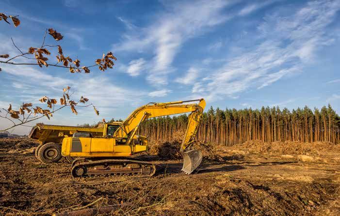
N O N E T L A N D T A K E B Y 2 0 5 0 ?
2
Science for Environment Policy This Future Brief is written and edited by the Science
Communication Unit, University of the West of England
Future brief: No net land take by 2050?
(UWE), Bristol
Email: sfep.editorial@uwe.ac.uk
Contents To cite this publication:
Science for Environment Policy (2016) No net land take by
2050? Future Brief 14. Produced for the European Commission
Introduction 3 DG Environment by the Science Communication Unit, UWE,
Bristol. Available at:
1. Monitoring land take 5
http://ec.europa.eu/science-environment-policy
2. How policy can drive change 7
3. Containing land take 9
Acknowledgements
4. Preventing land take with brownfield development 11 We wish to thank the scientific advisor, Stephan Bartke
5. Conclusion 13 (German Environment Agency and Helmholtz Centre for
Environmental Research – UFZ) for his input to this report.
References 14 Final responsibility for the content and accuracy of the report,
Further reading 16 however, lies solely with the author.
Images
Page 3: Berlin view, ©iStock.com/deimagine
Page 8: Excavator and dump truck on a new road construction, Poland,
©iStock.com/ewg3D
Page 10: Aerial view of suburban area and agricultural land in Germany
©iStock.com/cinoby
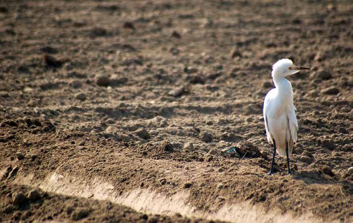
Page 12: Bird - Egret on brownfield, ©iStock.com/Baigdesigns
About Science for Environment Policy
Science for Environment Policy is a free news
and information service published by the European
Commission’s Directorate-General Environment,
which provides the latest environmental policy-
relevant research findings.
Future Briefs are a feature of the service,
introduced in 2011, which provide expert forecasts
of environmental policy issues on the horizon. In
addition to Future Briefs, Science for Environment
Policy also publishes a weekly News Alert which
is delivered by email to subscribers and provides
accessible summaries of key scientific studies.
http://ec.europa.eu/science-environment-policy
ISBN 978-92-79-45739-5
ISSN 2363-278X
DOI 10.2779/537195 Keep up-to-date
Subscribe to Science for Environment Policy’s
weekly News Alert by emailing:
sfep@uwe.ac.uk
The contents and views included in Science for Environment
Policy are based on independent research and do not necessarily Or sign up online at:
reflect the position of the European Commission.
http://ec.europa.eu/science-environment-policy
© European Union 2016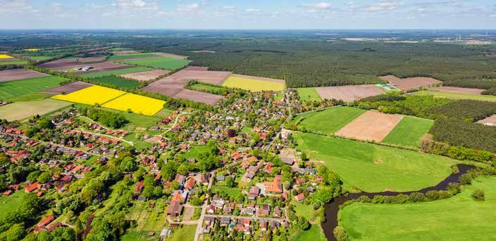
N O   N E T   L A N D   T A K E   B Y   2 0 5 0 ?
                                                                                                                     3

Introduction

How to halt land take
in the EU
Land take: increasing infrastructural and urban development means that ecosystem services of key
importance to human life are being lost. Of high concern is the amount of land being covered with
impervious materials, which halts natural soil processes. What measures can avoid, reduce or compensate
for land take?

Land and soil are limited natural resources. ‘Land’, can       Soil is also a major natural resource, which provides
be defined as the terrestrial bio-productive system that       several essential ecosystem services to humans: nutrient
comprises soil, vegetation, other biota, and the ecological    cycling, water purification, flood mitigation and climate
and hydrological processes that operate within the system      regulation, as well as fuel, food and drink. Information
(according to UNCCD Art 1e). It is fundamental for             about pedogenesis (soil formation) is rather scarce:
food and raw materials, for protecting biodiversity, for       the main challenge confronted by pedologists is the
storing carbon emissions, for filtering contaminants and       ability to describe the complete complexity of the soil
for recycling water, as well as hosting human development      system. Different soil formation processes operate at
and infrastructure. Used efficiently, it can provide these     vastly different timescales, ranging from milliseconds
key functions and ‘ecosystem services’ into the future.        (e.g. transport processes) to thousands of years (e.g.
                                                               weathering), so it is an extremely complex process.
However, demand for developed land continues to rise.          However, there are some recent models that are beginning
This is driven by new lifestyles that require more space per   to simulate such processes; for example, the SoilGen
capita, as well as by competition between municipalities       model calculates soil evolution over a multi-millennial
to attract new developments because of the assumed             timescale, up to 15 000 years (Opolot et al., 2015).
economic revenues.
N O   N E T   L A N D   T A K E   B Y   2 0 5 0 ?
 4

Well-functioning ecosystems on undeveloped land                for living in semi-detached or detached houses on the
directly support all human life, albeit in seemingly           urban outskirts and building out-of-town developments
indirect ways. Chemical weathering, as one example,            such as supermarkets and leisure centres (EEA, 2006).
is a key process for life on Earth. It is a process carried
out by soil microbes, lichens, fungi and bacteria that         Population growth can also drive land take, but built-
are found on weathered rock surfaces, in groundwater,          up areas are expanding more quickly than populations
among the roots of trees and plants, and other places          are growing. Urban sprawl often continues even where
where the ecosystem is functioning healthily. These            populations are decreasing. Since the mid-1950s, the
tiny organisms decompose inorganic nutrients, such as          total surface area of cities in the EU has increased by
potassium, magnesium, iron, copper and zinc, and make          78% while the population has grown by just 33% (EEA,
them available for uptake by other organisms including,        2006).
eventually, humans (Jackson, 2015).                            The enormous loss of soil functions and ecosystem
Active and large-scale cultivation has meant many soils in     services is one of the major environmental challenges
Europe have endured long-term agricultural stress, and         Europe is facing. To help address this global problem,
increasing infrastructural and agricultural development        the European Commission has proposed in the EU
on previously undeveloped land (‘land take’) means that        Environment Action Programme to 2020 (7th EAP) to
several services of key importance to human life are being     have policies in place by 2020 to achieve ‘no net land
lost. When the services provided by undeveloped land are       take’ by 2050 and has also set targets for reducing soil
lost, this is nearly irreversible (Ragnarsdóttir & Banwart,    erosion and the loss of soil organic matter:
2015) because the soil would take thousands of years, if          “By 2020, EU policies take into account their
not multiple millennia to recover, depending on the type.         direct and indirect impact on land use in the EU
We also lose the aesthetic value of the countryside and           and globally, and the rate of land take is on track
its value for recreation and mental health. And as well as        with an aim to achieve no net land take by 2050;
losing its value as a carbon sink, the developments that          soil erosion is reduced and the soil organic matter
replace it often drive up carbon emissions further because        increased, with remedial work on contaminated
they are largely dependent on private car use for access.         sites well underway.” (COM (2011) 571)

City centres often make relatively efficient use of land,      This Future Brief, produced in the context of the 2015
with high-rise buildings creating high density, a broad        International Year of Soil, focuses on the contribution
range of services provided locally and an established          that urban and rural land use planning can make to
transport infrastructure. However, recent trends have          achieve the 2050 goal.
included lower occupancy per household, a preference

     What is ‘land take’?

     Land take can be defined generally as the loss of undeveloped land to human-developed land. It can also be
     defined as the loss of agricultural, forest and other semi-natural and natural land to urban and other artificial
     land development. This includes areas sealed by construction and urban infrastructure as well as urban green
     areas and sport and leisure facilities (EEA, 2006).
     Since the 1950s it has largely been driven by urban sprawl. As well as a simple conversion of land from
     non-urban to urban use, sprawl is characterised by a decrease in urban density, a decentralisation of urban
     functions and the transformation of a compact urban form to an irregular, discontinuous and dispersed
     pattern (Siedentop and Fina, 2010).
N O N E T L A N D T A K E B Y 2 0 5 0 ?
5
1. Monitoring land take
It is widely reported that an area the size of Berlin, almost for the selected spots included in the survey (Decoville &
1000 km2 of agricultural or natural land, disappears Schneider, 2015).
every year in the EU to be converted into artificial areas
(European Commission, 2012). Researchers in Germany have concluded that the
absence of an adequate measurement of urban sprawl
However, the CORINE Land Cover (CLC) dataset used unintentionally contributes to undervaluing its costs and
to arrive at this figure underestimates the area of urban non-monetary consequences and restricts the ability of
fabric. The CLC project was built to map European land decision-makers to form planning strategies that support
cover and land use in a harmonised way based on satellite economically, ecologically and socially acceptable land
images. A minimum mapping unit (MMU) is used, so use patterns (Siedentop and Fina, 2010).
that structures under 25 hectares and linear features
under 100 m wide — such as transport infrastructure To address these limitations, the Copernicus Land
between urban areas — are not included in the analysis. Monitoring Service (http://land.copernicus.eu/) was set
up and became operational in 2015. Coordinated by
The same database is used to monitor changes in land use the European Environment Agency (EEA), the service
and land cover but only changes relevant to an area larger provides global, pan-European and local components.
than five hectares are taken into account. Cumulatively The pan-European component focuses on five specific
this can cause a significant underestimation. For example, land-cover characteristics, including the high definition
under this system only a third of all registered land use layers of the level of soil sealing by buildings, roads and
changes that took place in Germany between 2000 and pavements. One of the local components is the Urban
2006 are included. Atlas (UA), a high-resolution mapping of nearly 700
larger cities in the EU28. The minimum mapping unit
Researchers have concluded that while the level of in urban areas is 0.25 ha and 1 ha in rural areas. Linear
detail provided by the CLC project has allowed large- objects of a minimum width of 10m minimum are also
scale international comparisons and helped raise mapped. As with CLC, changes in the UA are analysed
awareness of the extent of landscape changes across between reference years.
the EU, it cannot provide a meaningful database for
local approaches (Decoville & Schneider, 2015). It can Despite waiting for a means to accurately measure the
also lead to a high error rate in terms of interpretations extent of land take, some individual member states have
(Batista et al., 2013). So while it can be useful for already set targets for reducing it. In Germany, the Federal
general comparisons and observing trends, it is not Government has set a goal of reducing the daily growth
ideal for measuring the evolution of land take within of the area used for human settlement and transport to
nations. Any figures based on the data should be 30 hectares per day by 2020, reduced from 129 hectares
considered a conservative estimate. a day in 2000. In Luxembourg, the National Plan for
sustainable development has set the objective to limit it
A complementary analysis is provided by the ‘land use to one hectare per day by 2020.
and land cover survey’ (LUCAS). It provides “harmonised
and comparable statistics on land use and land cover” But how can national and local governments reliably
across the 4.5 million km2 of the 28 countries of the EU assess their contribution to achieving the 2050 goal of
(Eurostat, 2015). For the years 2006, 2009 and 2012 a ‘no net land take’?
group of 750 investigators conducted surveys in more
than 270,000 sample spots and methodically recorded Swiss scientists recommend a ‘Weighted Urban
data on the cover and use of land. As the survey is based Proliferation’ tool to measure urban sprawl (Jaeger &
on sample points, it can only be used to assess the overall Schwick, 2014). They recommend starting with a clear
extent of artificial areas for a country by extrapolation. In definition of urban sprawl as follows.
reality, the LUCAS results only reflect land cover changesN O N E T L A N D T A K E B Y 2 0 5 0 ?
6
A landscape suffers from urban sprawl if it is permeated Siedentop and Fina (2010) present another ‘multiple
by urban development or solitary buildings and when indicator’ approach to measure three specific
land uptake per inhabitant or job is high. The more dimensions of urban sprawl — urban density,
area built over and the more dispersed the built-up urban land use patterns (for example, the irregular,
area, and the higher the land uptake per inhabitant or discontinuous and fragmented mosaic of sprawl), and
job (lower utilisation intensity in the built-up area), the the surface characteristics of land uses (for example the
higher the degree of urban sprawl (Jaeger & Schwick, loss of agricultural land to impervious surfaces). The
2014). approach is suitable for monitoring and evaluation at
a regional or national scale rather than across the EU.
The scientists developed a mathematical model to
measure not only the size of built-up areas, but how The contribution of the Copernicus service is also
widely buildings are dispersed and the number of expected to improve evaluation by allowing narrower
people and jobs that are accommodated. They used linear traffic structures and smaller areas of land take
the model to analyse maps at a scale of 1:25,000 and to be taken into account.
1:100,000 and to measure the progress of urban sprawl
for Switzerland over 67 years from 1935 to 2002.
They conclude that the method can be used to analyse
sprawl at a local, regional or national level. Software
and data are available to make this possible.
What does ‘no net land take’ mean?
Sealing agricultural land and open spaces should be avoided as far as possible and the
focus should be on building on land that has already been sealed. This might require greater
investment, for example to redevelop land previously used as an industrial site (including
decontamination). However, new houses still need to be built and the 2050 goal does not
aspire to reduce sealing of new land to zero.
When land is taken, the aspiration is to ensure this is no more than is compensated for
elsewhere. For example, unused land could be returned to cultivation or renaturalised so that
it can once again provide the ecosystem services of unsealed soils.N O N E T L A N D T A K E B Y 2 0 5 0 ?
7
2. How policy can drive change
In Germany the average living space per inhabitant Britain and Flanders have used a 60% target for new
has increased from 34.9m2 in 1991 to 46.5m2 in 2015 housing or urban development to be on brownfield land
(Destatis, 2015). A similar trend is occurring globally. (Decoville & Schneider, 2015).
Such an increase is not possible within the confines of
mature European city centres and it mostly occurs on National governments can also introduce novel regulatory
their periphery. Villages and towns surrounding a city interventions to limit urban sprawl and land take.
centre compete with each other for the revenue rewards For example, Denmark’s ‘Station Proximity Principle’
of attracting new inhabitants and new businesses. adopted in 1989 requires new offices over 1500m2 to be
located within 600m of a rail station. This has contributed
Researchers have identified the rural-urban fringe as being to Copenhagen’s efficient, compact urban form. The
particularly vulnerable to powerful spatial, economic and urban growth boundaries set by the Swiss Land Use Plan
social forces so it requires particularly innovative efforts in 1970 have been successful in promoting increased
to preserve it (Paül and McKenzie, 2013). Multiple building density and restricting most development to
studies forecast that urban expansion will continue at building zones (Gennaio et al., 2009).
the expense of farmland contraction. But while towns
and cities may be the draw for urban sprawl on their However, strong regional development policies are
periphery, they are often unable to control it because the needed to complement a national strategy. Building
planning jurisdiction falls outside their area. on agricultural land is often the most economically
competitive option due to its relatively low market
So what can be done to alter the forecast and move value and the fact that — unlike some brownfield sites
towards the 2050 goal? Jaeger and Schwick (2014) suggest — no risky decontamination is needed. Regional policy
that urban sprawl must be limited through social action can therefore be crucial for setting precise ceilings for
by introducing targets and limits designed to regulate the consumption of previously undeveloped land. This
the use of landscape as a common property resource. could be most effective if there is greater cooperation
As with water and air, if all potential users recognise the between regions — to reduce competition for investment
long-term value of land and the long-term consequences and, in some cases, to offset expansion in one area with
of uncontrolled land take, they may mutually agree to compensation in another.
collective coercion.
Some countries have experimented with ways to increase
Increased awareness of the common value of land the economic value to landowners of preserving agricultural
ecosystem services and of the long-term economic land. For example, in a transferable development rights
impacts of losing it is an achievable first goal. Science (TDR) market, landowners can sell their right to build.
can help provide the insights needed and they need to This can result in lower land consumption in areas where
be effectively communicated to the public and policy there is low demand and increased density where there
makers. is high demand. Menghini (2013) highlights the most
successful programme in the US so far where, in Maryland,
EU and national-level policy and target-setting can
provide a strategic direction. Six countries of the EU
have already set quantitative objectives, though in very
different ways. For example, Germany, Luxembourg and
Austria have defined the level of land take that should
not be exceeded. France has stipulated that the rate of ...in a transferable development
agricultural land take should be halved by 2020. And
rights (TDR) market, landowners
can sell their right to build. This can
result in lower land consumption in
areas where there is low demand
and increased density where there
is high demand.N O N E T L A N D T A K E B Y 2 0 5 0 ?
8
nearly 7,000 hectares of cultivated and uncultivated land In 1998, EU funding helped an agricultural park to be
was saved from development and farmers were able to sell established near Barcelona, covering 621 mostly family-
TDR as compensation for discontinuing some potential run farms. Researchers found that as well as such planning
development. procedures, successful farmland protection requires a
strategy to sustain the status of productive farmland.
In Bulgaria, the Czech Republic, Slovakia, Poland and the Paül and McKenzie (2013) found that, as long as it is
Lombardy Region of Italy, the conversion of agricultural close to a large agglomeration, peri-urban agriculture
soils requires a fee dependent on the quality of the soil, can be innovatively managed through Alternative Food
category of the settlement area and the possibility of Networks (AFNs). Instead of focusing on industrial-scale
irrigation. Polish law gives local authorities the option to production for export, farms on the urban-rural fringe
demand that when agricultural land is converted, valuable can help feed their nearest cities. This was found to work
topsoil is removed and used to increase the fertility of particularly well when farmers are actively involved, for
other soils or contribute to the reclamation of degraded example in selling direct to consumers.
land somewhere else (European Commission, 2012). In
all German regions, two Austrian provinces, Tuscany, and In conclusion, national targets can be useful in creating
in the autonomous Italian province of Bolzano/Bozen, broad awareness of the urgency of the situation. However,
land planning guidelines already take soil quality into as recommended in the European Commission’s Soil
account and help steer new developments towards less Sealing Guidelines (2012), goals to reduce soil sealing
valuable soils. The protection of soil functions in spatial and land use should be defined on a regional level. Local
planning is relatively new and depends on growing strategies should define how to reach the goals: therefore
awareness of the consequences of soil degradation federal states and municipalities are responsible for
(European Commission, 2012). implementing appropriate measures in practice.N O N E T L A N D T A K E B Y 2 0 5 0 ?
9
3. Containing land take
According to researchers from the EU-funded CircUse project, expansive development will weaken our ability to deal
with climate change, demographic change, peak soil, peak oil and the rising costs of infrastructure. The researchers
recommend a change in philosophy in how we use land, expressed as three actions: avoid, recycle and compensate.
Avoid: the conversion of now un-built open space or agricultural land into new developments
is to be avoided.
Recycle: areas with uses that were once active and now exhibit no viable use should be
recycled by either introducing new uses or through renaturation.
Compensate: compensation should be required when construction must take place on
previously un-built land. This can take the form of renaturation projects or de-sealing measures
in built areas, where soil sealing is no longer necessary.
Limiting soil sealing means preventing the conversion of green areas and the sealing of
their surface. Re-using already built-up areas such as brownfield sites can be included in this
concept. Targets have proved an effective tool for monitoring and spurring progress. Creating
incentives to rent unoccupied houses has also helped in limiting soil sealing.
Where soil sealing does occur, some member states have used mitigation measures to
maintain some soil functions and to reduce any significant direct or indirect negative effects on
the environment and human well-being. These include using permeable materials instead of
cement or asphalt where appropriate, supporting ‘green infrastructure’, and making wider use
of natural water harvesting systems.
Where mitigation has been regarded as insufficient, member states have considered
compensation measures. Although sealing cannot be exactly compensated for, the overall
capacity of soils to fulfil most of their functions can be sustained or restored. (EC, 2012)N O N E T L A N D T A K E B Y 2 0 5 0 ?
10
The EC's soil sealing guidelines highlight common that leaves larger green spaces undeveloped. So it would
elements of best practice, such as the integrated nature not abolish the need for planning control in green spaces.
of spatial planning. This means all relevant public
authorities are fully committed — not only planning and Floater et al. (2014) warn that leapfrog development can
environmental departments. In particular, municipalities, also inadvertently arise as a result of urban containment
counties and regions have to be involved. strategies. Urban containment is one of the best-known
planning instruments for managing urban sprawl.
A second common element is that specific regional The two main types are greenbelts and urban growth
approaches are developed, taking into account unused boundaries. While Gennaio et al. (2009) found the
resources at local level, for example a particularly large Swiss growth boundaries largely successful, in London
number of empty buildings or brownfield sites. Finally, and Seoul commuter towns have developed on the urban
best practice has shown the value of reviewing existing periphery, with workers travelling long distances into
financial policies for housing and for commercial and the city. Policies here have incentivised development to
infrastructure development. In this way, subsidies that ‘jump the greenbelt’. This may be partly explained by the
act as drivers for unsustainable land take and soil sealing dominant place of such cities in the British and Korean
can be identified and reduced. And the income received economies.
by local authorities from urbanisation fees and levies can
be reassessed. However, the EC’s soil sealing guidelines still recommend
greenbelts around major metropolitan areas and smaller
Altes (2009) considered whether taxes on building in green cities as an effective way to limit land take and soil sealing.
spaces could serve as a useful instrument for balancing The benefits include controlling the unrestricted sprawl
urban growth and the protection of the landscape. He of large built-up areas, preventing neighbouring towns
concluded that a simple tax on development does not from merging one into another, preserving the setting
distinguish between leapfrog development that divides and special character of historic towns and assisting in
up green areas and the clustering of urban development urban regeneration, by encouraging the recycling of
derelict and other urban land.N O N E T L A N D T A K E B Y 2 0 5 0 ?
11
4. Preventing land take with brownfield development
The European Environment Agency (EEA) has estimated Federal funds, tax incentives, grant schemes and technical
that there are as many as three million brownfield sites support programs have been crucial to success. Finance
across Europe. The Concerted Action of Brownfield is particularly important in the current economic climate
and Economic Regeneration Network (CABERNET) in which investors are cautious.
defined brownfields as sites which:
There is also a new generation of brownfields to consider
• have been affected by former uses of the site and as a result of the worldwide financial crisis — from
surrounding land; commerce, housing, infrastructure and tourism. In these
cases, contamination of soils should not pose serious
• are derelict and underused;
problems.
• may have real or perceived contamination problems;
The CABERNET project identified the three A-B-C
• are mainly in fully or partly developed urban areas; categories of brownfields. ‘A’ sites can be redeveloped in
• require intervention to bring them back to beneficial the free-market economy without the need for public
use (CABERNET 2006). funding. ‘B’ sites are ‘potential development’ sites which
require some form of public funding. These projects will
The Science for Environment Policy (2013) Thematic generate only marginal profit so risks are often shared
Issue on Brownfield Regeneration draws attention via public-private partnerships. Regeneration of the ‘C’
to the valuable opportunity presented by brownfield category of ‘non-developing’ sites would incur a financial
remediation and regeneration, not only to prevent the loss for the investor and requires public sector finance. It
loss of pristine countryside, but also to enhance urban includes reclaiming contaminated land or making sites
spaces and remediate sometimes contaminated soils. It structurally safe before planting woodlands, creating
highlights the key role that their reuse and redevelopment bodies of water or providing land for the grazing of
could play in achieving the ‘no net land take’ goal. livestock.
The EC's soil sealing guidelines recommend that even
temporarily converting them into urban greenspace and Investment in category ‘C’ regeneration can pay off in
recreation areas is beneficial. the longer term in terms of boosting the local economy
by making a location a more attractive place to live. A
Brownfield sites are often located within urban boundaries more direct pay-off is possible if the site becomes suitable
with good connections to local infrastructure, making for building (Doleželová et al., 2014).
them a competitive alternative to greenfield investments.
However, this competitiveness is often undermined by Pressure for quick results can create incentives for local
real or perceived contamination. governments to be involved in reclaiming category A
‘ready’ regeneration sites that would have been brought
In the US, the Environmental Protection Agency started back into use by private sector investment alone. However,
a brownfield initiative in 1994 to clean up environmental only modest adjustments to perceived costs and values
hazards and remove neighbourhood eyesores while, at may be required for the market to redevelop category B
the same time, creating jobs, providing housing and land (CABERNET, 2006). Meanwhile, category C sites
promoting general economic health in local communities remain underused despite the availability of investment.
of all sizes. The initiative blossomed into a major national
programme that has changed the way that contaminated While national planning policy can help ensure that new
property is perceived, addressed, and managed (Thornton developments are mainly built on brownfield land, as was
et al., 2007). the case in England, local governments are best placedN O N E T L A N D T A K E B Y 2 0 5 0 ?
12
to provide locally relevant incentives to encourage exercise with practitioners, they produced a model to
redevelopment of all categories of brownfield. These map social and environmental objectives against specific
might include subsidised insurance, development fees project delivery stages. The model can be used to signpost
waivers or property tax abatements to reduce risks for the steps required to translate project objectives into real
private investors. beneficial outcomes.
At the European level, the European Regional Bartke and Schwarze (2015) emphasised that land
Development Fund is the main source of financial management and in particular decisions between
support. Authorities in Member States can also set greenfield and brownfield development must trade-off
up revolving funds via the Joint European Support different stakeholder, societal and ecological demands.
for Sustainable Investment in City Areas (JESSICA). Balancing development and conservation goals is not
Developers obtain low-interest funds and the interest easy.
they pay flows back into the fund pool.
In the longer term, developers and planners need to
The results of a study by Atkinsons et al. (2014) suggest recognise that all new construction is essentially temporary
that the process of regenerating a site can also create social and we therefore need to plan for its second life. For
and environmental benefits. However, they warn against example, avoiding high risks — such as pollution — that
assuming that benefits will simply arise as a result of prevent second uses, using flexible design construction
completing a project. A disconnect often exists between techniques and new innovations such as building with
the laudable objectives of regeneration activity and the modular concrete that can be re-used in situ (Ramsden,
practices required to meet them. Through a workshop 2010).N O N E T L A N D T A K E B Y 2 0 5 0 ?
13
5. Conclusion
Land is the ultimate common resource as it provides By proposing their own national targets to the EU,
habitat for flora and fauna, is the basis for most human Member States can decide on the contribution they can
activities and supplies the resources for meeting most afford to make according to their level of development.
human needs. It is the space required for living, as well The authors of a study supporting potential land and soil
as natural space, cultural space, economic space, and targets under the 2015 Land Communication (Van Long
recreational space. et al., 2014) propose a framework of relevant indicators
and future research that could facilitate future target
Urban sprawl is a prime example of the tragedy of the setting.
commons (Jaeger and Schwick, 2014). The benefits of
using land go to a single citizen or commercial outlet For example, they recommend using indicators based on
while the detrimental effects are shared by society. a revised version of the CLC datasets, developed by the
Joint Research Council (Van Long et al., 2014). Their
Valuable farmland is built over, the surface of the ground accuracy has been improved by including data of higher
is sealed and most ecological functions of the soils are resolution such as the spatial distribution of artificially
destroyed. Infrastructure costs, noise, and the distance sealed areas. They recommend testing the feasibility of the
between home and work all increase while carbon pools, Weighted Urban Proliferation model for different types
open landscapes and biodiversity hotspots are lost. In of cities in the EU, following the example of Switzerland.
low-density built-up areas, energy use for transport is And to support land recycling, they recommend
an order of magnitude higher per person than in high- introducing a requirement on Member States to establish
density urban areas (Kenworthy et al., 1999). All efforts a system to record and maintain information on the
for sustainability will ultimately fail if land use is not extent of brownfield land in their territories.
organised in a sustainable way.
The EU, and other inter-country unions, could provide
A modelling exercise conducted by the Joint Research a strategic vision for their Member States as well as
Centre (Lavalle et al., 2013) shows that, in order to reach guidance, and facilitating the sharing of best practice.
no net land take by 2050, the average land consumed Regional and local government can also determine
by 2020 should be approximately 1.6 m2 per capita per more specific targets. For example, reducing land take
year. This average is lower than in two other scenarios: by a given percentage in a given timeframe; setting a
the Reference Scenario (driven by demographic and minimum utilisation density for new developments; and
economic trends) and the Linear Growth scenario setting limits for soil sealing.
(extrapolating previous trends in land use). The average
increase in land consumption per EU citizen for these
scenarios is estimated, respectively, at 2.2 and 1.9 m2
per capita per year. Moreover, land-use intensity trends
vary between Member States, which suggests detailed
assessment at a national level on how to contribute to the
EU-wide objective is required.N O N E T L A N D T A K E B Y 2 0 5 0 ?
14
References
Altes, W.K.K. (2009) Taxing land for urban containment: European Commission (2012) Guidelines on best practice to
Reflections on a Dutch debate. Land Use Policy (26): 233–241. limit, mitigate or compensate soil sealing. Publications Office
of the European Union: Luxembourg. Available from:
Atkinson, G., Doick, K.J., Burningham, K. and France, C. http://ec.europa.eu/environment/soil/pdf/guidelines/
(2014) Brownfield regeneration to green space: Delivery pub/soil_en.pdf
of project objectives for social and environmental gain.
Urban Forestry & Urban Greening (13): 586–594 Eurostat (2015) ‘Land cover and land use (LUCAS)
statistics’. Eurostat Article: data extracted in 2015. Available
Bartke, S. and Schwarze, R. (2015) No perfect tools: Trade- from: http://ec.europa.eu/eurostat/statistics-explained/
offs of sustainability principles and user requirements in index.php/Land_cover,_land_use_and_landscape
designing support tools for land-use decisions between
greenfields and brownfields. Journal of Environmental Floater, G., Rode, G., Friedel, B. and Robert, A. (2014)
Management (153): 11–24 Steering Urban Growth: Governance, Policy and Finance. The
New Climate Economy Cities Paper 02. LSE Cities, London
Batista e Silva, F., Lavalle, C. and Koomen, E. (2013) A School of Economics and Political Science: London.
procedure to obtain a refined European land use/cover
map. Journal of Land Use Science 8 (3): 255–283. Gennaio, M-P., Hersperger, A.M and Bürgi, M. (2009)
Containing urban sprawl – Evaluating effectiveness of
CABERNET (2006) Network Report: Sustainable urban growth boundaries set by the Swiss Land Use Plan.
Brownfield Regeneration. Available from: http://www. Land Use Policy (26): 224–232.
eugris.info/displayproject.asp?Projectid=4415
Jackson, T. A. (2015) Weathering, secondary mineral
Decoville, A. and Schneider, M. (2015) Can the 2050 genesis, and soil formation caused by lichens and mosses
zero land take objective of the EU be reliably monitored? growing on granitic gneiss in a boreal forest environment.
A comparative study. Journal of Land Use Science 2015: Geoderma 251-252 (August): 78–91.
1–19.
Jaeger, J.A.G. and Schwick, C. (2014) Improving
Destatis (2015) Federal Statistical Office the measurement of urban sprawl: Weighted Urban
Doleželová, L., Hadlaã, M., Kadlecová, M., Martinát, Proliferation (WUP) and its application to Switzerland.
S. and Polednik, M. (2014) Redevelopment potential Ecological Indicators 38: 294–308.
of brownfields: A-B-C classification and its practical Kenworthy, J.R., Laube, F.B. and Newman, P. (1999) An
application. Ekonomie 2 (XVII). International Sourcebook of Auto-mobile Dependence in cities,
EEA (2006) Urban Sprawl in Europe: The Ignored 1960–1990. University Press of Colorado: Boulder, CO.
Challenge. Report No 10/2006. Office for Official Lavalle, C., Barbosa, A.L., Mubareka, S., Jacobs-Crisioni,
Publications of the European Communities; Luxembourg. C., Baranzelli, C. and Castillo, C.P. (2013) Land use
Available from: http://www.eea.europa.eu/publications/ related indicators for resource efficiency: Part I Land Take
eea_report_2006_10 Assessment. An analytical framework for the assessment of
European Commission (2011) Roadmap to a Resource the land milestone proposed in the Roadmap for Resource
Efficient Europe, (COM/ 2011/0571). Communication Efficiency. JRC Scientific and Policy Reports. Publications
from the Commission to the European Parliament, the Office of the European Union: Luxembourg.
Council, the European Economic and Social Committee
and the Committee of Regions. Available from: http://
ec.europa.eu/environment/resource_efficiency/about/
roadmap/index_en.htmN O N E T L A N D T A K E B Y 2 0 5 0 ?
15
Menghini, G. (2013) ‘Transferable Development Rights Science for Environment Policy (2013) Thematic Issue 39:
(TDR) in Switzerland: Simulating a TDR Market Brownfield Regeneration. Science Communication Unit:
with Agent-Based Modeling’. Thesis No. 5707, École Bristol. Available from: http://ec.europa.eu/environment/
Polytechnique Fédérale de Lausanne: Lausanne. integration/research/newsalert/pdf/39si_en.pdf
Opolot, E., Yu, Y. Y. and Finke, P. A. (2015) Modeling soil Siedentrop, S. and Fina, S. (2010) Monitory urban sprawl
genesis at pedon and landscape scales: achievements and in Germany: towards a GIS-based measurement and
problems. Rates of soil forming processes and the role of assessment approach, Journal of Land Use Science, 5(2):
aeolian influx. Quaternary International 376 (July): 34–36. 73–104.
Paül, V. and McKenzie, F.H. (2013) Peri-urban farmland Thornton, G., Franz, M., Edwards, D., Pahlen, G. and
conservation and development of alternative food networks: Nathanail, P. (2007) The challenge of sustainability:
Insights from a case-study area in metropolitan Barcelona incentives for brownfield regeneration in Europe.
(Catalonia, Spain). Land Use Policy (30): 94–105. Environmental Science & Policy (10): 116–134.
Ragnarsdóttir, K. V. and Banwart, S. A. (eds) (2015) Soil: Van Long, L., Tan, A., Lockwood, S., Sarteel, M., Mudgal,
The Life Supporting Skin of Earth: A book on soil for secondary S., Zglobisz, N., Grebot, B., Schulp, N., Verburg, P.,
school students. University of Sheffield and University of Bruckner, M., de Schutter, L. and Giljum, S. (2014) Study
Iceland: Sheffield and Reykjavík. Available as an eBook from: supporting potential land targets under the 2014 Land
http://esdac.jrc.ec.europa.eu/projects/SoilTrec/Documents/ Communication, Final Report. Publications Office of the
SoilTrEC_SoilSchoolBook_FINAL.pdf European Union: Luxembourg. Available from: http://
bookshop.europa.eu/en/study-supporting-potential-
Ramsden, P. (2010) Re-using Brownfield Sites and Buildings. land-targets-under-the-2014-land-communication-
Report of the Regions for Economic Change Conference, pbKH0414979/
21 May 2010. Workshop Report. AcSS. Available from:
http://ec.europa.eu/regional_policy/archive/conferences/
sustainable-growth/doc/rfec_brownfield_en.pdf
Future Briefs are a feature of In-depth Reports are Science for Environment Policy
the service, introduced in 2011, a feature of the service, publishes a weekly News Alert
which provide expert forecasts introduced in 2012, which take a which is delivered by email
of environmental policy issues comprehensive look at the latest to subscribers and provides
on the horizon. science for key policy topics. accessible summaries of key
scientific studies.
Thematic Issues are special
editions of the News Alert, which
each focus on a key policy area.KH-BB-15-003-EN-N
N TO H EN E V T A LL UA EN DO FT A NK AE T UB RY A 2 20 05 00 0?
12
16
Further Reading
You may also be interested in reading the following publications from Science for Environment Policy.
News Alert articles
Potential for more efficient energy, land and phosphorus use by 2050
There is a large potential to improve the global efficiency of energy, land and phosphorus use, finds new research which
modelled the effects of four worldwide scenarios between 2010 and 2050. An ‘ambitious resource strategy’ could moderate
the increases in energy use (+25% globally instead of +80% in the baseline scenario), phosphorus use (+9% instead of
+40%) and arable land (-9% globally, instead of + 4%).
http://ec.europa.eu/environment/integration/research/newsalert/pdf/potential_for_more_efficient_energy_land_phosphorus_use_
by_2050_451na2_en.pdf
Soil management in China and the EU
Following rapid urbanisation, management of contaminated soil has become a political priority in China. In this study,
researchers reviewed the current system in China as compared to Europe and provide recommendations for the sustainable
management of soil.
http://ec.europa.eu/environment/integration/research/newsalert/pdf/soil_management_china_eu_447na4_en.pdf
Public participation in land use planning in Romania
Approximately 1000 km2 of agricultural or natural land is lost every year in the EU due to land-use change. When this occurs
close to residential areas, it can lead to conflict with local people. This study explored the views of local people in Romania,
and compared them to experts. The authors discuss similarities and differences, and say that participation, where both locals
and experts communicate, is key to developing effective land use policies.
http://ec.europa.eu/environment/integration/research/newsalert/pdf/public_participation_in_land_use_planning_in_Romania_440na4_
en.pdf
New map of soil loss by water erosion across Europe
Soil erosion is an important issue in Europe, with consequences for water quality, ecosystem services supply and crop
production. In this study, researchers enhanced an existing model to estimate soil loss and create an updated map of soil
erosion across the EU. The authors say the tool can simulate the effects of land use changes and management practices
and will support effective policy decisions.
http://ec.europa.eu/environment/integration/research/newsalert/pdf/new_map_of_soil_loss_by_water_erosion_across_
europe_439na1_en.pdf
Thematic Issues
Soil and water: a larger-scale perspective — November 2015
Land use changes over time have altered relations between soils and water cycles throughout the world. Soils have been
lost and degraded, and the closely interlinked processes of soils and water have become an urgent issue for European
policymakers. This Thematic Issue aims to provide a review of new research into the links between soil and water issues in
Europe, including a message that the soil-water links must be considered at their proper spatial scales.
http://ec.europa.eu/environment/integration/research/newsalert/pdf/soil_and_water_larger_scale_perspective_52si_en.pdf
Brownfield Regeneration – May 2013
Brownfield regeneration and land use planning are complex issues which encompass many different environmental, economic
and social dimensions. This Thematic Issue brings together quality research into brownfield regeneration, which highlights
insights and successful strategies from across Europe and beyond
http://ec.europa.eu/environment/integration/research/newsalert/pdf/39si_en.pdf
To view any of these in full, please visit: http://ec.europa.eu/science-environment-policy, and search according to publication date.You can also read