PIEDMONT TRIAD STRATEGIC OUTDOOR RECREATION PLAN - January 2022
←
→
Page content transcription
If your browser does not render page correctly, please read the page content below

PIEDMONT TRIAD
   STRATEGIC
   OUTDOOR
  RECREATION
     PLAN
     January 2022
Piedmont Triad Strategic Outdoor Recreation Plan

                                             TABLE OF CONTENTS
PIEDMONT TRIAD OUTDOOR RECREATION ADVISORY COUNCIL.....................................................................................1
STATE AND NATIONAL OUTDOOR RECREATION INDUSTRY OVERVIEW ..................................................2
PIEDMONT TRIAD OUTDOOR RECREATION INVENTORY ...............................................................................8
CONSERVATION AND STEWARDSHIP ................................................................................................................ 26
OUTDOOR RECREATION BUSINESSES, ACTIVITY SURVEY AND MUNICIPAL EXPENDITURES .......... 29
OUTDOOR RECREATION RECOMMENDATIONS & STRATEGIES ................................................................. 31
COUNTY AND MUNICIPAL OUTDOOR RECREATION PLANS ........................................................................ 39
OUTDOOR RECREATION MARKETING PRIORITIES ........................................................................................ 41

OUTDOOR RECREATION: Recreational activities undertaken for pleasure that generally
involve some level of intentional physical exertion and occur in nature-based environments
outdoors. (Source: US Bureau of Economic Analysis)

Photo Credit Cover: Top: Chris English - Tigermoth Creative; Middle Left: Hal Boyle – Triad
ECO Adventures; Middle Right and Bottom: Brianna Haferman – Piedmont Legacy Trails

Note: An executive summary of this document is available as a Story Map website at this link:
https://maps.ptrc.org/portal/apps/MapSeries/index.html?appid=1725361ba79e4992b807e44798
2d6abb

    Produced by the Piedmont Triad Regional Council with funding from the US Department of Commerce and
   Economic Development Administration and assistance from the Piedmont Triad Outdoor Recreation Advisory
                                                  Council

2022                                                                                                                                           i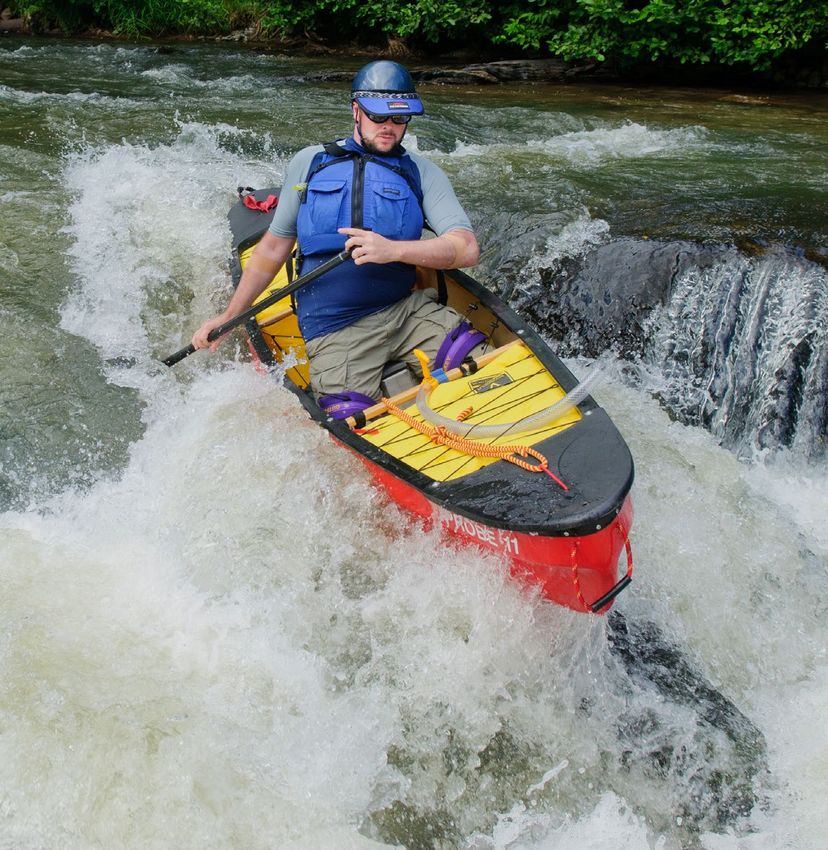
Piedmont Triad Strategic Outdoor Recreation Plan

PIEDMONT TRIAD OUTDOOR RECREATION ADVISORY COUNCIL
Hal Boyle                          Owner, Triad ECO Adventures
Mark & Kathy Bowman                Owners, 4B Farm and Campground
Paul Carter                        Owner, Yadkin River Adventures
David Craft                        Piedmont Legacy Trails, Guilford County
Jenny Edwards                      Former Program Manager, Dan River Basin Association
Brian Fannon                       Former River Keeper, Yadkin Riverkeeper
Jimmy Flythe                       Dir., Community & Government Relations, Duke Energy
Elizabeth Jernigan                 Planner, City of Greensboro
Chris Jordan                       Lands Program Coordinator, NC Wildlife Commission
Kelley King                        Superintendent, Haw River State Park
Matt Lawson                        Former Piedmont Trail Specialist, NC State Parks
Keith Martin                       Former Superintendent, Mayo River State Park
Edgar Miller                       Executive Director, Yadkin Riverkeeper
Palmer McIntyre                    Conservation Planner, Piedmont Land Conservancy
Tammy O’Kelley                     Former CEO, Randolph County TDA
Sam Parrott                        Three Rivers Land Trust
Tracey Pegram                      Assistant Director, High Point Parks & Recreation
Chris Phelps                       Executive Director, Davidson County Tourism
Mary Joan Pugh                     Trails/ National Heritage Coordinator, Randolph County
Smith Raynor                       State Trails Planner, NC State Parks
Mike Reardon                       Executive Director, Carolina Climbers Coalition
Robin Riddlebarger                 Superintendent, Hanging Rock State Park
Theresa Savery                     District Recreation Staff Office, Uwharrie National Forest
Mark Scott                         Former Ex. Director, Montgomery Co. Chamber of Commerce
Will Seeley                        Owner, Get Outdoors
Michael Spisak                     District Ranger, Uwharrie National Forest
Todd Tucker                        President, Surry County Economic Dev. Commission
Daniel White                       Director, Surry County Parks & Recreation Dept.
Matt Windsor                       Former Superintendent, Pilot Mountain State Park
Robin Yount                        Former Tourism Manager, Rockingham County TDA

STAFF:
Matthew Dolge                      Executive Director, Piedmont Triad Regional Council
Jesse Day                          Regional Planning Director, Piedmont Triad Regional Council
David Putnam                       Regional Economic Strategist, Piedmont Triad Regional Council
Malinda Ford                       GIS Manager, Piedmont Triad Regional Council
Alec Weide                         GIS Technician, Piedmont Triad Regional Council
Betty & David Huskins              Ridgetop Associates

COUNCIL VALUES
Accessibility                      Connectivity               Health and Wellness
Authenticity                       Conservation               Preservation
Capacity                           Diversity                  Stewardship
Collaboration                      Equity                     Sustainability

COUNCIL VISION
The Piedmont Triad becomes an exceptional outdoor experience.

COUNCIL MISSION
A collaboration of public and private partners for initiating, resourcing and sustaining exceptional outdoor
experiences to further economic development, education, health and wellness in the Piedmont Triad Region.

2022                                                                                                           1
Piedmont Triad Strategic Outdoor Recreation Plan

STATE AND NATIONAL OUTDOOR RECREATION
INDUSTRY OVERVIEW
INTRODUCTION
The Piedmont Triad Regional Development Corporation recognized the need to further develop the outdoor
recreation industry in the region in order to grow the economic impact of the industry and therefore create new job
opportunities as well as increasing tourism revenues in both urban and rural counties.

Federal, state and community organizations and business leaders in the industry were invited to participate in the
development of the Piedmont Triad Strategic Outdoor Recreation Plan.

The Outdoor Recreation Advisory Council was established to develop the plan and began their work in October of
2018. Much has changed since the initial meeting. The COVID-19 pandemic accelerated and also changed the way
residents and visitors work, live and recreate. Some trails saw their usage double or triple at the beginning of the
pandemic and the long-term impact to recreation habits and economic impacts are still unfolding. The Piedmont
Triad Strategic Outdoor Recreation Plan maps our current assets and is intended to provide a framework for local
outdoor recreation advocates to leverage public and private investment in the industry.

The Piedmont Triad Regional Council, in conjunction with the region’s Work Force Development Board and
partners, is working toward recruiting a more talented workforce to NC Triad region. National research indicates
that outdoor recreation ranks very high with the young, talented workers across the nation when choosing a place to
live, work and play. Therefore, it is critical for our region to support and promote growth in the outdoor recreation
industry.

OUTDOOR RECREATION NATIONAL ORGANIZATIONS RESEARCH & STATISTICS

The         Outdoor       Recreation
Roundtable (ORR) is America’s
leading     coalition   of    outdoor
recreation trade associations and
organizations working to promote the
growth of the outdoor recreation
economy and outdoor recreation
activities.
ORR members represent the
thousands of businesses that produce
vehicles, equipment, gear, apparel
and services for the 144 million
Americans who enjoy our national
parks, waterways, byways, trails and
outdoor spaces. The various outdoor
recreation business sectors produce a
combined $778 billion output for the
U.S. economy and support 5.2 million
direct jobs. They educate decision
makers, and the public, on balanced
policies that conserve public lands
and     waterways     and    enhance
infrastructure to improve the
experience and quality of life of
outdoor enthusiasts everywhere.
Their members include such
organizations as America Outdoors,
American Horse Council, American
Mountain Guides Association, American Sportfishing Association, American Trails, Archery Trade Association,

2022                                                                                                                    2
Piedmont Triad Strategic Outdoor Recreation Plan

Association of Marina Industries, Boat U.S (Boat Owners Association of the US), CHM Government Services, The
Corps Network, DEMA, Diving Equipment & Marketing, Inter-national Snowmobile Manufacturers, Marine Retailers
Association, Motorcycle Industry Council, National Forest Recreation Association, National Association of RV Parks
& Campgrounds, National Marine Manufacturers Association, National Park Hospitality Association, National
Shooting Sports Foundation and NIC, Inc.

This organization along with the
Outdoor Industry Association, led
the way to pass the Great American
Outdoors Act in 2020 that allocates
$9.5 billion for five years for
previously       neglected        park
maintenance. It also sets up $900m
per year to acquire land for
conservation       and      continued
maintenance. This was a sweeping,
long-awaited bill to continuously
fund national, state and local parks –
a major boon to conservation and
one of the few pieces of significant
legislation the government was able
to agree on in a divisive election
year.

The Outdoor Industry Association
(OIA) - The Outdoor Industry
Association is also a national,
membership-driven              trade
organization for the outdoor
industry. In collaboration with their members, they are a force for the industry in recreation and trade policy,
sustainable business innovation and increasing outdoor participation. The OIA was founded in 1989 by a group of 14
visionary outdoor industry pioneers who created the association to be a unified, collaborative effort to help guide the
industry. Today, OIA is the voice of the outdoor recreation industry, both locally and in Washington D.C., serving
more than 1,200 manufacturers, retailers, distributors, suppliers, sales representatives, nonprofits and outdoor
enthusiasts.

OIA issued the first Outdoor Recreation Economy Report more than a decade ago and has made significant
improvements since that time. Their third edition (2017) took a broader view of the growing industry and its shifting
demographics.

2022                                                                                                                 3
Piedmont Triad Strategic Outdoor Recreation Plan

US OUTDOOR RECREATION
ECONOMY
Highlights of the 2017 Outdoor Industry
Association’s (OIA) Outdoor Recreation
Economy Report are included here. It is the
largest, most comprehensive report of its kind
because there was 1) 70% increase in survey
responses from the previous study, 2) Results
for all 435 U.S. congressional districts in
addition to national, regional and state results,
and 3) Seven new activities were included for
the first time in the study.

Outdoor Recreation Drives Commerce
Every year, American consumers spend more
on outdoor recreation than they do on
pharmaceuticals and fuel combined. In fact,
the impact of outdoor recreation on America’s
economy is almost as big as that of hospital
care.
     • OUTDOOR                 RECREATION
        PRODUCTS including gear, apparel,
        footwear, equipment, services and
        vehicle purchases ($184.5 billion)
     • TRIP AND TRAVEL SPENDING
        including airfare, fuel, lodging,
        groceries, lift tickets, guides,
        lessons and more (702.3 billion)

Outdoor Recreation Creates Healthy
Economies - The outdoor recreation
economy generates $124.5 billion in federal,
state and local tax revenue each year.
Jobs and careers in the outdoor sector are
highly coveted. They attract active and
healthy workers whose lifestyles inspire and
uplift their neighbors. Beyond the industry
itself, outdoor recreation infrastructure has
proven an invaluable asset for economic
development offices and chambers of            FACT: The South Atlantic Region spends more on outdoor
commerce seeking to attract new employers.     recreation than any other region in the US.
Towns and cities that invest in their outdoor
assets attract employers and employees who value the work-life balance that outdoor access can provide.

Outdoor Recreation Creates Healthy Communities - Studies demonstrate that, in addition to economic
prosperity, outdoor recreation delivers personal and social benefits on which healthy, happy communities thrive.
Investment in outdoor recreation may also help ease some of our nation’s financial and social burdens.
A growing body of research suggests that investments in outdoor recreation infrastructure and programming could;
1) significantly reduce crime rates, 2) improve educational outcomes for elementary, secondary and post-secondary
students, including attention and test scores, retention and high school graduation rates and 3) lower long-term
individual and public health care costs by reducing stress and obesity rates, improving physical fitness and
strengthening social bonds with family and friends.

NORTH CAROLINA OUTDOOR RECREATION DATA AND TRENDS – North Carolina was the first
eastern state to establish an Office of Outdoor Recreation housed in the Economic Development Partnership of

2022                                                                                                                4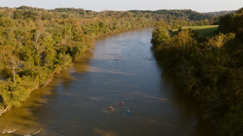
Piedmont Triad Strategic Outdoor Recreation Plan

North Carolina. The mission is “To Make NC the Eastern Headquarters of the Outdoor Recreation Economy.” and
the goals include:

1) To help businesses find, secure and intelligently utilize NC outdoor resources

In the North Carolina Outdoor Recreation Plan (2020-2025) developed by NC State Parks, it is stated that the
most popular activities in North Carolina are visiting a beach or lake, walking for pleasure, visiting parks and
historic sites, hiking on trails, freshwater fishing, viewing scenery, fishing from a boat, nature viewing and
swimming. In addition, at least 10 percent of residents participate in activities such as canoeing, picnicking, bird
watching, bicycling, and tennis. In addition when surveying recreation managers, the top 5 reported needs are 1)
unpaved trails for walking and hiking (59%) 2-4) paved trails for walking, hiking, skating or biking (52%), picnic
shelters (52%), multi-use fields (52%) and 5) splashpad/sprayground.

2022                                                                                                                   5
Piedmont Triad Strategic Outdoor Recreation Plan

US BUREAU OF ECONOMIC ANALYSIS 2019 NORTH CAROLINA OUTDOOR RECREATION DATA

The following data from the Bureau of Economic Analysis shows a snapshot of outdoor recreation economic impact
for 2019.

2022                                                                                                         6
Piedmont Triad Strategic Outdoor Recreation Plan

2022                                                      7
Piedmont Triad Strategic Outdoor Recreation Plan

PIEDMONT TRIAD OUTDOOR RECREATION INVENTORY
The Piedmont Triad is located in the part of the state that is referred to as the Piedmont plateau. It is a hilly region
and includes some of the North Carolina’s largest cities. Elevations in the Piedmont vary from 300 to nearly 3,000
feet above sea level. There are a few isolated mountain ranges (e.g. Sauratown and Uwharries), mostly on the
western and southern portion of the region. The Piedmont lies within the Southeastern mixed forests eco-region.

It is a 12- county region with approximately 1.7 million people. There are 63 municipalities that comprise the
Piedmont Triad Regional Council’s region.

There are nearly 169,000 acres of public land in the region, providing a sizeable footprint for growth in the outdoor
recreation industry. There are three resident river basins in the region: The Roanoke (Dan and Mayo), Cape Fear
(Deep and Haw River) and Yadkin/Pee-Dee (Mitchell, Fisher, Ararat, and Uwharrie).

The region is home to several nationally designated parks and trails. The Blue Ridge Parkway, the Overmountain
Victory National Historic Trail, Chinqua Penn Trail, Guilford Courthouse Military Park and the Uwharrie National
Forest and Uwharrie National Recreation Trail are all located in the region.

PIEDMONT TRIAD OUTDOOR RECREATION FOUNDATION INVENTORY

 Public Lands                                 Acres                                       Square Miles
 Federal                                      60,502                                      94.5
 State                                        57,928                                      90.5
 Local                                        28,796                                      334.61
 Private Easements                            21,562                                      33.7

 Total                                        168,789                                     553.31

2022                                                                                                                       8
Piedmont Triad Strategic Outdoor Recreation Plan

The Appendix includes a detailed listing of outdoor recreation assets. In addition, the Piedmont Triad Outdoor
Recreation Story Map provides detailed maps with attributes of facilities across the Piedmont Triad. The following
lists some highly utilized outdoor recreation assets by County. Due to GIS data and rounding errors, some totals
may not sync exactly.

PIEDMONT TRIAD OUTDOOR RECREATION FOUNDATION INVENTORY BY COUNTY

 County            Trail       Trail         Public        Acres of           Acres of   Public     Acres of
                   Mileage     Mileage       River         Lakes (With        Public     Parks      Preserved Land
                   (Land)      (Blueway)     Accesses*     accesses)          Parks                 (not parks)
 Alamance          69.6        37.6          16            2,190              1,922      50         3,048
 Caswell           35.2        9.5           1             271                17,839     5          2,406
 Davie             9.0         53.89         3             0                  304        14         5,270
 Davidson          15.0        59.86         3             8,595              1,440      33         6,879
 Forsyth           92.4        28.72         2             933                6,089      99         1,302
 Guilford         243.0      4.5            1              4,554              11,066     220        11,021
 Montgomery 122.0            26.59          5              5,847              42,703     3          7,240
 Randolph         91.0       13.4           2              2,667              12,205     31         7,561
 Rockingham       64.7       60.37          12             1,842              51,589     35         4,063
 Stokes           82.5       50.86          5              2,333              7,215      4          2,705
 Surry            110.5      96.03          18             0                  4,314      16         14,617
 Yadkin           7.9        51.39          4              145                296        7          1,967
*does not include boat ramps on lakes if not part of a river blueway trail.

NATIONAL PARKS, TRAILS AND FORESTS

Blue Ridge Parkway
The Blue Ridge Parkway was the first national rural parkway to be conceived, designed, and constructed for a
leisure-type driving experience. Its varied topography and numerous vista points offer easy public access to
spectacular views of central and southern Appalachian rural landscapes and forested mountains. It connects the
Shenandoah National Park in Virginia with Great Smoky Mountains National Park in North Carolina. Much of the
view shed seen from the Blue Ridge Parkway is of the George Washington and Jefferson National Forests in
Virginia and of the Pisgah and Nantahala National Forests in North Carolina.
The Parkway is the highest and longest continuous route in the Appalachian area. Along its 469-mile length, it
provides scenic access to crests and ridges of five major ranges within the central and southern Appalachian
Mountains, encompassing geographic and vegetative zones that range from 649 feet at James River in Virginia to
6,047 feet at Richland Balsam in North Carolina.
The Blue Ridge Parkway is located on the border of Surry County at Cumberland Knob, where construction of the
Parkway was started in 1935 as a part of President Roosevelt’s Civilian Conservation Corps mission. It was
therefore the first recreation area to be opened to the public and is still a favorite destination for both locals and
visitors. (Source: https://www.brpfoundation.org/explore-blue-ridge-parkway/)
Overmountain Victory National Historic Trail
This corridor highlights the Overmountain Men’s 330-mile hike through the backcountry of Appalachian Mountains
to confront British forces at Kings Mountain. There are several routes tracing the paths that the patriot militia took
as they mustered to Kings Mountain. One of those routes begins in Elkin, in Surry County. Of the 330-mile long
National Historic Trail, the 225 miles of trail that travel through North Carolina have been authorized as the state
trail.

2022                                                                                                                     9
Piedmont Triad Strategic Outdoor Recreation Plan Guilford Courthouse National Park There are 2 miles of natural surface hiking trails, with an interior paved road with limited vehicle traffic is 2.25 miles long, which includes a sidepath for bicycles and pedestrians. This park is a Revolutionary War battlefield that commemorates the Battle of Guilford Courthouse between Major General Nathanael Greene's militia and Continental army versus Lord Charles Earl Cornwallis British and Hessian army, on March 15, 1781. (Source: https://www.nps.gov/guco/self-guided-walking-tour.htm) Chinqua Penn National Trail This trail is 1.7 miles long meanders around the former Chinqua Penn Plantation between Reidsville and Wentworth in Rockingham County. The trail was created in 1997 by the NC State Upper Piedmont Research Station for the benefit of the public. Friends of Chinqua-Penn Walking Trail have partnered with the Research Station to care for the trail since 2010. Other nonprofits sharing in this effort are the Dan River Basin Association and the Rockingham County Naturalist Club. Generous grant support from the Reidsville Area Foundation has funded grading and gravel for the parking lot and trail improvements, as well as the solar-ventilated composting toilet at the trailhead. In June 2015, the Trail was selected to join America's National Trails System by the Department of the Interior that recognizes existing trails that link communities to recreational opportunities on public lands and in local parks across the nation. (Source: http://www.chinquapenntrail.org/) Uwharrie National Forest and Uwharrie National Recreation Trail There are approximately 52,000 acres of National Forest System lands in Montgomery, Randolph and Davidson Counties. The Uwharrie National Forest is the only National Forest in the Piedmont Region of North Carolina. The Uwharrie National Forest includes the Uwharrie Ranger District Office, located at 789 Biscoe Road, Troy, NC 27371. At the district office you can obtain information about the area, pick up brochures, camping information, trail passes, shooting range passes, and permits. You can also obtain a Senior Access Pass, Disabled Access Pass, District and Birkhead Mountains Wilderness maps, and USGS topographical maps. Primitive dispersed camping is allowed throughout the Forest, except in those areas that are posted "No Camping". These sites can be found along most of Forest Service roads and trails. Please remember when using these sites to be careful with campfires and carry out your trash and debris. Please leave your campsite in good clean condition so that others who follow you may also enjoy Uwharrie Trail (Credit: Brianna Haferman) the Forest. The Uwharrie National Forest provides hundreds of miles of trails for hiking, mountain biking, horseback riding and motorized vehicles. There are a total of 143 miles of trail and the Uwharrie National Recreation Trail is the longest at 25+ miles, a connection to the Birkhead Wilderness offers a 40+ mile hike. It offers the only public motorized trail system in the Piedmont Region of North Carolina known as the Badin Lake OHV Trail Complex. It is also the only public motorized trail system that allows all types and sizes of motorized vehicles to use. In addition to all of the trails that are available on the Uwharrie National Forest there are 5 developed campgrounds and 1 developed group campground. One specialized campground is Canebrake Horse Camp that people can camp with their horses at their campsite and ride directly onto the equestrian trails. Each campsite at Canebrake Horse Camp has electric hookup and there is a dump station and flush toilets and showers. There is also the large King’s Mountain Point Day Use Area that is directly on the east shores of Badin Lake (Narrows Reservoir) that provides 4 accessible fishing piers, 34 picnic sites, a picnic pavilion that can be reserved, horseshoe pits and a disc golf course. The Uwharrie National Forest provides great areas for motorized and non-motorized boating recreation too. People can canoe and kayak on the Uwharrie and Little Rivers using the access points managed by the North Carolina 2022 10
Piedmont Triad Strategic Outdoor Recreation Plan

Wildlife Resources Commission. Additionally, people can access Badin Lake with motorized and non-motorized
boats at Cove Boat Ramp and non-motorized boats can launch at King’s Mountain Point Day Use Area.
The Uwharrie National Forest is part of the 2 million acres of public lands managed in partnership with the North
Carolina Wildlife Resources Commission (NCWRC) for public hunting, trapping and fishing, and are designated as
Game Lands. In addition to the appropriate basic annual hunting license, a Game Lands Privilege license must be
obtained to hunt on the Uwharrie National Forest. Information concerning seasons, bag limits, and special Game
Lands Restrictions are found in the annual N.C. Inlands Fishing, Hunting and Trapping Regulations Digest,
available where licenses are sold. Additionally, the Uwharrie National Forest and the NCWRC work in partnership
to provide a safe target shooting facility known as the Flintlock Valley Shooting Range. This outdoor shooting range
has a 100-yard rifle range and a 25-yard pistol range that is universally accessible. This is the only location target
shooting is allowed on the Uwharrie National Forest.
The Birkhead Mountains Wilderness is approximately 5,160 acres and provides areas with limited human
management on the land. There are opportunities for more solitude in this area because you can only access it on
foot. Dispersed camping and hunting is allowed within the wilderness and it is further away from the heavy
recreation use of the Badin Lake Area so it is quite a bit quieter. Groups must be 10 or less within the wilderness
area. (Source: https://www.fs.usda.gov/recarea/nfsnc/recarea/?recid=48934)

NORTH CAROLINA STATE PARKS

Hanging Rock State Park
Since its creation as a 1930s
Civilian Conservation Corps
project, Hanging Rock State Park
has offered the best of a traditional
outdoor experience with 73-site
campground, picnic grounds,
stocked lake for swimming and
canoe rentals and more than 20
miles of hiking trails that climb
onto spectacular views and weave
alongside clear streams and
waterfalls. The peak is 2,579 feet
in elevation. There is also access
on the Dan River for paddling, 8.4
miles of mountain biking trails and
rock-climbing opportunities with
                                             Cooks Wall Hanging Rock State Park (Credit: Brianna Haferman)
permit. A complex of vacation
cabins is available for longer
visits. Free interpretive programs complement the education offerings of a park museum that explores the natural and
cultural history of the Sauratown Mountains.

A park expansion master plan is complete for the 750 acres of land that the State of North Carolina acquired north of
Hanging Rock State Park. This plan establishes a vision for the newly acquired land. The state held public
workshops that helped them create concepts for the Vade Mecum and Moore's Springs properties at Hanging Rock
State Park. Nine hundred (900) acres were added to the park in the fall of 2019 and will serve the park’s visitors
with a new access, plenty of parking, camping and a day use area. (Source: https://www.ncparks.gov/hanging-rock-
state-park/home)
Haw River State Park
Located in the northern Piedmont Triad region, picturesque terrain makes Haw River State Park the perfect place to
connect with nature. Housed within this natural setting is The Summit Environmental Education and Conference
Center, N.C. State Park’s first residential environmental education center. Along with environmental education
programming, The Summit Center offers conference center facilities for groups ranging in size from 10 to 180.
The more traditional side of Haw River State Park is found at the Iron Ore Belt Access. A picnic area is located
adjacent to the parking lot while a second picnic pad is found halfway along the Great Blue Heron Loop

2022                                                                                                                  11
Piedmont Triad Strategic Outdoor Recreation Plan trail. Additional picnic areas and trails will be brought online in the near future. (Source: https://www.ncparks.gov/haw-river-state-park/home ) Mayo River State Park Envisioned as a riverine park along the Mayo River corridor from Virginia to the Town of Mayodan in North Carolina, Mayo River State park is under development, having been designated in 2003. The Park offers basic state park amenities on the 400- acre site of the former Mayo Park, a historic and prized spot for community gatherings. The land holdings are 2,500 acres and include the Mayo Mountain access, Deshazo Mill access and Anglin Mill access. A Master plan has been completed in 2020 and includes development ideas for the existing access locations, but also other public access ideas for the land holdings that have not been activated for public use. The original centerpiece of the park is a restored pavilion-style picnic shelter designed by renowned architect Antonin Raymond and is flanked by picnic grounds, small fishing ponds and a growing network of hiking trails. Rangers offer free interpretive programs at the park and outreach programs at area locations can be arranged. Paddling opportunities on the mild whitewater Rapids on the Mayo River (Credit: Chris English, Tigermoth Creative) Mayo River are available from local outfitters.The Mayo River has still water as well as Class III rapids, therefore accommodating water sports from floating to paddling and more and is a unique opportunity for developing access for the Park. (Source: https://www.ncparks.gov/mayo-river-state-park/home) Pilot Mountain State Park Rising abruptly to elevations of over 2,000 feet, Pilot Mountain has been a navigational landmark for centuries, and is a recreational landmark as well, offering miles of trails, camping, climbing and spectacular scenery. Like the rocky escarpments in nearby Hanging Rock State Park, Pilot Mountain is a remnant of the ancient Sauratown Mountains. A quartzite monadnock, this rugged mountain rock has survived for millions of years while the elements have eroded surrounding peaks to a rolling plain. The top of Pilot Mountain is capped by two prominent pinnacles: (1) Big Pinnacle, with walls of bare rock and a rounded top covered by vegetation, rises 1,400 feet above the valley floor, the knob jutting skyward more than 200 feet from its base, Big Pinnacle is connected to (2) Little Pinnacle by a narrow saddle. Visitors have easy access to the top of Little Pinnacle where the view encompasses hundreds of square miles of the Piedmont and the nearby mountains of North Carolina and Virginia. The mountain summit remains the principal park area and is connected to the Yadkin River section by a 6.5-mile trail corridor. An extensive trail network is augmented by a bridle trail and a canoe trail on the Yadkin River. The Park has 49 family camping sites and also a riverside group camp with canoe-in access sites. Rock climbing and rappelling are allowed on portions of the park’s steep cliffs, and those cliffs perched around the mountain’s summit offer seemingly endless views of the Piedmont’s Sauratown and Blue Ridge Mountains. (Source: https://www.ncparks.gov/pilot-mountain-state-park/home) 2022 12
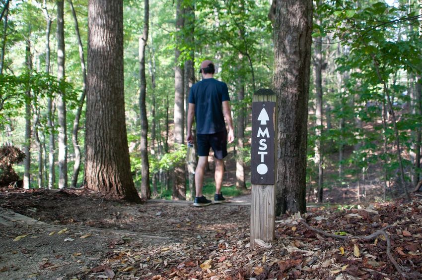
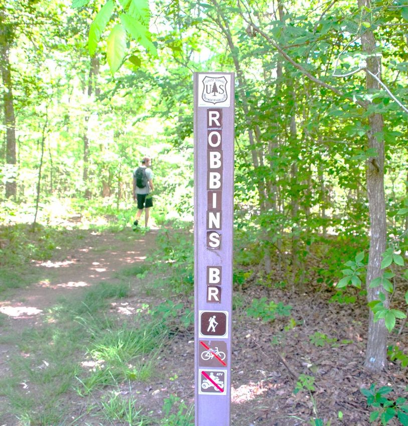
Piedmont Triad Strategic Outdoor Recreation Plan

E DESIGNATED TRAILS
The Piedmont Triad region includes
portions of four State Trails. State
Trails are components of the State
Parks System and offer opportunities
for regional connectivity and public
access to some of North Carolina’s
most significant natural, cultural and
scenic landscapes. These trails must
be authorized by the General
Assembly. The authorization offers
a general concept of the trail. Then,
State Parks provides overall trail
corridor planning and coordination.
Once planning is completed, the
actual construction, maintenance and
management of the trail segments is
accomplished through partnerships.
After a trail segment is actually
constructed, then the section sponsor,
typically a local government, will           Mountains to Sea Trail in Stokes County (Credit: Brianna Haferman)
apply for state trail designation. The
designation process outlines management and emergency response responsibilities for the segment. Once approved
by the Secretary of the North Carolina Department of Natural and Cultural Resources, the trail segment is then
officially part of the State Trail. Constructed trail is not part of the State Trail until the designation process is
completed. Partners in the Piedmont Triad region include county governments, local municipalities, National Park
Service, Friends of the Mountains to Sea Trail, Yadkin Riverkeeper, Randolph County Trails Advisory Council,
Sauratown Trails Association and the Elkin Valley Trails Association. Vigorous efforts are ongoing to complete each
of the State Trails in the region.

Dan River State Trail – The Dan River was designated as a State trail in 2021. Projects and promotions for this
newly designated State trail will be identified in future updates. Further information on the Dan River is available
below in the Piedmont Triad Watershed section.

Deep River State Trail - Deep River State Trail was
authorized in 2007. When complete, it will encompass both
a hiking/biking trail along the banks of the Deep River and a
blueway trail on the Deep River. The Deep River Task
Force, created in 2015 by the Randolph County Tourism
Development Authority, provided the essential momentum
for trail development. In 2019, trails in Randleman, Ramseur
and Franklinville were designated as official segments of the
Deep River State Trail. Planning and implementation
continues with several pending grants to construct land based
and water trail infrastructure.

Mountains to Sea State Trail
The Mountains-to-Sea State Trail, or the MST, is North
Carolina's flagship state trail. The notion of a trail extending across the width of North Carolina was first proposed
in 1977 by Howard Lee, who was the Secretary of the North Carolina Department of Natural Resources and
Community Development. In 2000, the MST became a state trail and a unit of the state parks system. In 2017, the
General Assembly authorized a major addition to the MST--the Coastal Crescent route that loops through
southeastern North Carolina.

2022                                                                                                                   13
Piedmont Triad Strategic Outdoor Recreation Plan

When completely constructed, the MST will be
about 1,400 miles long and reach from Clingmans
Dome on the Tennessee border to Jockeys Ridge
State Park on the Outer Banks. Currently, there are
659.5 miles of trail that are completed and
designated.

When it is complete, the MST will cross through
Surry, Stokes, Forsyth, Guilford, Rockingham and
Alamance Counties in the Piedmont Triad. Currently, there are designated segments in Surry, Stokes, Guilford and
Alamance Counties. The Friends of the MST organization provides information on the trail, sponsors most of the
task forces that build and maintain sections of trail and promotes through-hiking the trail by providing interim routes
that connect completed portions of the MST.

Segments of the MST in the Piedmont Triad

    Segment 6 – Elkin Valley             Segment 7 – The Sauratown          Segment 8 – Rivers, Railroads & Lakes

The Overmountain Victory State Trail was authorized in 2019. The Division of Parks and Recreation is
partnering with the National Park Service, Burke County and local sponsors to develop an off-road trail within the
historic Overmountain Victory Trail corridor. This corridor highlights the Overmountain Men’s 330-mile hike
through the backcountry of Appalachian Mountains to confront British forces at Kings Mountain. There are several
routes tracing the paths that the patriot militia took as they mustered to Kings Mountain. One of those routes begins
in Elkin, in Surry County. Of the 330-mile long National Historic Trail, the 225 miles of trail that travel through
North Carolina have been authorized as the state trail.

Yadkin River State Trail - Authorized in 1985, the Yadkin
River State Trail is considered completed. It is a blueway or
paddle trail. There are access sites along the 164-mile length
of the State Trail portion of the river between Kerr Scott Dam
in Wilkes County to the Uwharrie River in Montgomery
County. In the Piedmont Triad, the Yadkin flows through
Surry, Stokes, Forsyth, Davie, Davidson and Montgomery
Counties. The Yadkin Riverkeeper is an excellent source of
information about paddling the Yadkin River State Trail.
Even though it is completed, ongoing maintenance of the
waterway and accesses is essential. Additional accesses
would be an asset to this trail.

GREAT TRAILS STATE PLAN
The Great Trails State Plan will draw upon existing plans and new recommendations to identify a network of
shared-use paths and trails that connects every county in North Carolina, with a focus on connections between
population centers and North Carolina State Parks.

The primary outcome of this planning process is to develop a statewide trail map coupled with an action-oriented
network plan and 5-year implementation strategy. The planning process for the plan

2022                                                                                                                14
Piedmont Triad Strategic Outdoor Recreation Plan The Great Trails State Plan is being led by the N.C. Department of Transportation’s Integrated Mobility Division, in coordination with the NCDOT Transportation Planning Division and North Carolina State Parks. A draft plan was released in late 2020, with a final plan yet to be released. Executable Trails The Great Trails State Coalition collected information from communities about natural and paved trail projects that are ready for construction and design. These are shown on the right. There are 164 projects in 52 counties, representing an estimated $240 million of construction costs. NC DOT’s Great Trails State Plan identifies future projects in all 100 counties. 2022 15
Piedmont Triad Strategic Outdoor Recreation Plan

PIEDMONT TRIAD WATERSHEDS
The Piedmont Triad has three resident river basins within its twelve-county region: Cape Fear, Roanoke, and Yadkin-
Pee Dee Rivers. The Cape Fear and Yadkin-Pee Dee Rivers are the longest and largest river basins in North Carolina.
Both the Cape Fear and Roanoke Rivers originate in the Piedmont Triad. A more detailed description of the sub-
regional hydrography is that there are eight river sub-basins that offer different outdoor recreation opportunities. The
Deep and Haw River Sub basins of the Cape Fear River; the Upper Dan and Lower Dan River Sub-basins of the
Roanoke River; and the Yadkin River Headwaters, South Yadkin River, Yadkin River, Lake Tillery, Rocky River and
Pee Dee River Sub basins of the Yadkin-Pee Dee River. The total area of these river basins (and that covered within
this project) is 13,931 square miles, larger than the State of Maryland.

Upper Cape Fear River Basin
The Upper Cape Fear River Basin is
composed of two major drainages: The
Haw River and the Deep River contains
11 sub-basins. It drains approximately
3,135 square miles of the North
Carolina piedmont and includes
portions of 10 counties and 42
municipalities. It is the uppermost
portion of the Cape Fear River Basin,
the largest river basin in North
Carolina, and one of four river basins
that lies completely within the
state. According to the 2010 NC
NCDWR 303(d) list, the Upper Cape
Fear River and many of its tributaries
are listed as impaired for fecal
coliform,      turbidity,    ecological
community, pH, copper, nitrite-nitrate
nitrogen, zinc, low dissolved oxygen
and Chlorophyll a. The 2005 NCDWR
Cape Fear River Basin-Wide Water
Quality Plan associates most of these
impairments with urban or impervious
surface areas, construction sites, road
building, land clearing, and agriculture
and forestry operations.

2022                                                                                                                 16
Piedmont Triad Strategic Outdoor Recreation Plan

Yadkin-Pee Dee River Basin
The Yadkin-Pee Dee River Basin is the
second-largest river basin in North Carolina
after the Cape Fear River, covering twenty
counties and totaling 7,213 square miles
and 5,946 linear river miles. The river
basin covers a diverse landscape from Blue
Ridge Mountain headwaters to the
expansive Charlotte metropolitan area,
crossing much of the Piedmont region and
including parts of the unusual geology and
ecology      in    the    sandy    Uwharrie
Mountains. The topography, geology, and
land use throughout the Yadkin River basin
are diverse, presenting a patchwork of land
uses, aquatic habitats (including trout-
sensitive waters), and urban growth, and
challenging the development of a uniform
management strategy. Thirty-nine percent
(39%) of all rivers and streams, and thirty-
six percent (36%) of all lakes and reservoirs
within the Yadkin River basin are listed as
“impaired” by the NCDWR. The Yadkin
River is also known for its outstanding
resource waters, primarily found in the
Uwharrie National Forest in Montgomery
County and the headwater tributaries of
Wilkes and Surry Counties. The Fisher
River is a tributary to the Yadkin River.

Dan River Basin
The Dan River Basin is the headwaters
sub-basin of the Roanoke River, which
originates in the Appalachian foothills and
discharges to the Albemarle Sound at
Bertie and Martin Counties in North
Carolina (NC DWQ 2011). The Dan
River Basin occupies the 3,937 square
miles and 11,123 linear stream miles of
the headwaters for this large river basin.
The sub-basin has been separated into
three 8-digit Hydrologic Unit Code
(HUC) watersheds by the US Geologic
Survey: the Upper Dan River, the Lower
Dan River, and the Banister River (see
Figure 3). The US Army Corps of
Engineers (USACE) built and operates
Philpott Dam on the Smith River upstream
of Martinsville, VA. This impoundment
and its management have a profound
effect upon downstream water quality and
health, especially for river levels and temperatures that the stocked trout rely upon. The river basin has 706.5 stream
miles and 5,727 lake acres rated as Impaired by the NC DWQ and the Virginia Department of Environmental Quality
(VA DEQ); over 7% of the Dan River Basin’s water is impaired for human or ecological uses (NC DWQ 2012; VA
DEQ 2012).

2022                                                                                                                17
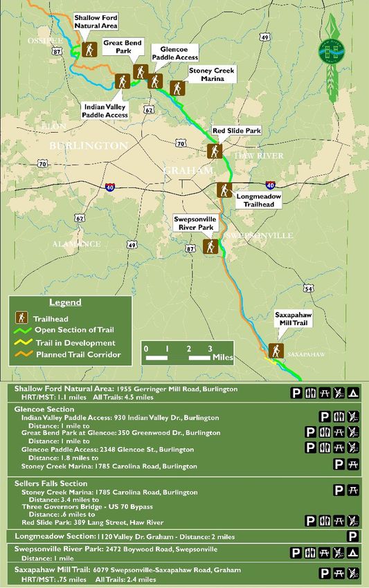
Piedmont Triad Strategic Outdoor Recreation Plan

FIVE MAJOR RIVERS IN THE PIEDMONT TRIAD REGION
Dan River
The Dan River flows 214 miles (344 km) flows through North Carolina and Virginia. It rises in Patrick County,
Virginia, and crosses the state border into Stokes County, North Carolina. It then flows into Rockingham County.
From there it goes back into Virginia. It reenters North Carolina near the border between Caswell County and
Rockingham County. It flows into northern Caswell County and then back into southern Virginia and finally
into Kerr Reservoir on the Roanoke River.

The river was named by William Byrd II in 1728 during an expedition to survey the Virginia border. A variant name
is "South Branch Roanoke River".

Meandering through the Piedmont Triad of North Carolina, the "Mighty" Dan River flows for roughly 53 miles
diagonally across Stokes County from northwest to southeast, then about 40 miles diagonally across Rockingham
County from southwest to northeast.

The Dan is a virtually free-flowing river with few
modern improvements-only a handful of easily portaged
dams. The flood plains are wide, the banks are high, and
the tree cover along the river corridors is almost
unbroken. Long a favorite of local paddlers, the Dan has
become increasingly popular with both novice and
experienced canoe enthusiasts for its leisurely pace,
beautiful scenery, and historic significance.

From Hanging Rock State Park Access to Draper
Landing in Eden, two improved access points for hand-
carried boats in Stokes County and six in Rockingham
County cover 39 river miles, and, if the paddler desires,   Draper Landing Access in Eden (Credit: Chris English,
continuing from Draper Landing to Abreu-Grogan Park         Tigermoth Creative)
in Danville, Virginia, adds an additional 21 miles.
Dan River Paddle Access Points
The above map shows the access points on the Dan and the Smith River that take paddlers through several counties
and two States. Visit the Dan River Basin Association website www.danriver.org for more detail on paddle access
locations, paddle difficulty and other river basin information.

2022                                                                                                                18
Piedmont Triad Strategic Outdoor Recreation Plan

Deep River
Deep River is a tributary of the Cape Fear River,
approximately 125 miles (200 km) long, in north
central North Carolina in the United States. Deep
River is a translation of the Indian name
Sapponah, "deep river".

Paddling is popular on the river. Deep River is
flanked by the Deep River State Trail and
several other parks and preservation areas
including Carbonton Dam Park, House in the
Horseshoe ( also known as Alston House)
Historic Site, Deep River Park and Deep River
Camelback Truss Bridge, Endor Iron Furnace,
White Pines Nature Preserve, Lockville Dam,
Canal and Powerhouse, and Mermaid Point.
The Cape Fear shiner, a critically endangered
minnow, inhabits the river.

Deep River rises in western Guilford County, east of Kernersville. It flows southeast past High
Point and Randleman, forming the Randleman Lake. It passes northeast of Asheboro, then flows east
to Franklinville then to Ramseur, then passing north of Sanford. The Rocky River enters the Deep River at the White
Pines Nature Preserve.[3] Deep River joins Haw River at Mermaid Point near Haywood, just below the Haw's
emergence from Jordan Lake, to form the Cape Fear River.

Deep River has 12 dams or relict dam structures and is the source river of the Randleman lake project that covers
3000 acres (12 km²) of property on the river near U.S. Route 220. The river crosses the Fall Line of North Carolina,
an area where rivers are quite rocky and have a moderately high gradient. This gradient was used to power mills
along the river to support the early textile industry in North Carolina. The river, popular with canoeists, was a center
of a great deal of activity during the American Revolution at places such as Franklinville and the House In The
Horseshoe.

The Lockville Dam, built of stone, is the only portion of the 19th-century Deep River lock and dam system that
remains today. Until recently, the Deep River was host to the Carbonton Dam, the largest dam on the river at 17 feet
(5.2 m) high and 270 feet (82 m) wide. In the fall of 2005, the dam was removed for the purpose of
creating environmental mitigation credit by Restoration Systems, LLC, a leading environmental mitigation company
in North Carolina. The project restored 10 miles (16 km) of the former impoundment around the House In The
Horseshoe to a free-flowing river.

Deep River Access Points
Deep River became a state trail in 2007 through special legislation in the General Assembly. The authorization did
not provide funding to implement the trail but did give priority for communities along the river who may want to
access recreation trail grants to construct and maintain trail in the corridor. Soon after, the City of Randleman and
the Town of Franklinville opened sections of trail along the Deep River.

NOTE: Deep River became a state trail in 2007 through special legislation in the General Assembly. The
authorization did not provide funding to implement the trail but did give priority for communities along the river
who may want to access recreation trail grants to construct and maintain trail in the corridor. Soon after, the City
of Randleman and the Town of Franklinville opened sections of trail along the Deep River. The Town of Ramseur
also secured a Clean Water Management Trust Fund grant to complete a detailed alignment of the trail in the Town
of Ramseur. In 2015, a Deep River Trail Task Force was formed by the Randolph County Tourism Development
Authority with local, regional and state government representatives, as well as recreation and trail advocates to
continue coordinating efforts for planning, design, construction and management of the Deep River Trail in the
county. A task force report was completed in 2016 that inventoried the status of trail development along the Deep
River and provided recommendations on key plans, designs and other actions to move trail development forward.

2022                                                                                                                  19
Piedmont Triad Strategic Outdoor Recreation Plan

Haw River
                                                     The Haw River is a tributary of the Cape Fear River,
                                                     approximately 110 mi (177 km) long, which is entirely
                                                     contained in north-central North Carolina. It was first
                                                     documented as the "Hau River" by John Lawson, an English
                                                     botanist, in his 1709 book "A New Voyage to Carolina." The
                                                     name        is    shortened       from      Saxapahaw,        from
                                                     the Catawban/sak'yápha:/, "piedmont, foothill", from /sak/,
                                                     "hill", plus /yápha:/, "step". The river gives its name to a small
                                                     town that formed on its banks.
                                                     The Haw rises in northeast Forsyth County, near the border
                                                     with Guilford County just north of Kernersville. The river flows
                                                     northeast, passing north of Oak Ridge and Summerfield into
                                                     southern Rockingham County, passing through Haw River State
                                                     Park, north of Greensboro.

                                                     The river then begins to flow southeast as it moves through the
                                                     corner of Guilford County into Alamance County. In Alamance
                                                     County, the Haw flows through Ossipee and passes north
                                                     of Burlington, and through the unincorporated community
                                                     of Carolina. It goes through the town of Haw River. It flows
                                                     south and is joined by Great Alamance
                                                     Creek at Swepsonville and continues on to Saxapahaw.

                                                   The river forms the southeast border of Alamance County, a
                                                   border shared by Orange County and Chatham County. The
course of the Haw River continues southeast in Chatham County as it flows just north of Pittsboro. Approximately
12 miles (19 km) southeast of the tip of Alamance County, the Haw flows into the Jordan Lake reservoir, which is
formed by the confluence of the Haw River and New Hope Creek. 4 miles (6.4 km) south of Jordan Lake dam, the
Haw River joins the Deep River to form the Cape Fear River.

The Haw River is home to many examples of local wildlife, including blue heron, beaver, deer, otter, bluegill bream,
and these are only a few of the wild animals living at the Haw River.

The river played a major role in the life of Native Americans in the area, including the Sissipahau Indians, and in the
development of the communities that were built on the river.

The river was first dammed in Saxapahaw in the 1850s and used for textile mills through the 19th and 20th
centuries, and was a major factor in helping Alamance County to rebuild its local economy following the
devastation of the American Civil War. Alamance Plaids, a popular textile during the 1800s, were developed near
the present-day community of Glencoe.

The Haw River became heavily polluted with chemicals used in the production of textiles during the 20th Century,
but the decline of industry in the United States has reduced pollution. However, the Haw is still in danger of
pollution from suburban nutrient runoff and sediment. Efforts are underway to improve the ecology of the Haw
River, but there is disagreement between various environmental groups, local governments, and economic interests
as to how to proceed. Recently, the newly revised Jordan Lake Rules have improved regulatory issues that affect
future pollution. Most sections of the Haw are clean by reports from the state Water Quality Section, securing it as a
recreational and water supply asset.

For over one hundred years, textile and other industries built the economy of North Carolina. Many located along
the Haw and other river basins, providing employment and centers for communities since the Civil War era. Today,
a few mills continue to operate near and on the Haw River, including Copland Mills in Burlington, NC. The Haw
also provides drinking water and recreational activities to a large portion of North Carolina, as 10% of the state's
population lives in the Haw River Watershed. The conservation of the Haw River is now the focus of several groups
and government agencies that are working to develop and preserve the Haw River.

2022                                                                                                                20
Piedmont Triad Strategic Outdoor Recreation Plan Traditional farming has been the backbone of the economy in the rural counties lining the Haw. Though farming is under pressure, it continues to thrive, providing poultry, beef, grain, and other products for American consumption, bolstering a main export of the state. Three trails have been developed through conservation efforts on the Haw River. The Haw River Trail is a conservation and recreation initiative formally undertaken by local governments and private groups in 2006. It provides both a land trail and paddle trail connecting Haw River State Park and Jordan Lake State Recreation Area. The trail is part of the North Carolina Mountains to Sea Trail. A second major trail that has been established by local governments is the Haw River Wine Trail. The Haw River Valley has become a renowned grape growing region. This trail was originally established with five wineries in Guilford and Alamance Counties. Currently, four wineries are open on the trail, and all four have produced award- winning wines. The State of North Carolina established the Haw River State Park on the Haw River in Guilford and Rockingham counties. There are also several city and county parks and golf courses located on the Haw, including Greensboro National Golf Club in Guilford County; Indian Valley Golf Course, Great Bend Park at Glencoe, Town and Country Park, The Challenge Golf Club, Quarry Hills Country Club, Swepsonville River Park, and Southwick Golf Course in Alamance County; and Robeson Creek Recreation Area and New Hope Overlook Campground located at the Jordan Lake State Recreation Area in Chatham County. The “Big Picture” for the Haw River Trail (HRT) corridor extends approximately 80 miles along the Haw River from Haw River State Park on the Rockingham-Guilford County line through Alamance County to Jordan Lake State Recreational Area in Chatham County. The HRT is a part of the state-wide Mountains-to-Sea Trail (MST) which allows hikers to travel across the state from Clingman’s Dome to Jockey’s Ridge on the NC coast. The long-range plan is to work with willing landowners to continue creating a corridor for the Haw River Trail, preserving the open space and viewsheds around the Haw River. 2022 21
Piedmont Triad Strategic Outdoor Recreation Plan

Mayo River
Beginning in Virginia as two small forks, the Mayo's confluence
is just below the North Carolina state line. It flows roughly 16
miles south to just below the town of Mayodan in Rockingham
County before joining the Dan River. A class III rapid on the
upper section offers quite a challenging run as paddlers dodge
large rocks dotting the rushing waters. As the river's descent
becomes more gradual, the float becomes a more leisurely paced
and scenic journey with just a hint here and there of faster
moving water. Paddlers need to exit the river north of Mayodan
at the bridge on Highway 220 Business.

Two hydroelectric dams and their canals located below the
bridge prevent paddlers from completing the entire run because
there is no safe portage. These dams were originally built to
generate power for two cotton mills-Mayo Mills in Mayodan
(later Washington Mills) and Avalon Mills. The Avalon mill
structure was destroyed by fire in 1911 and abandoned with
village houses moved to Mayodan by hitching them to horses
and rolling them on logs. Both cotton mills were established in
the 1890s by Colonel Frances Fries of Winston-Salem who with
his partners, including Washington Duke of the Duke tobacco
empire, envisioned hydroelectric possibilities for their textile
business venture due to the natural fall line of the river. They
were also responsible for building a railroad along the river's
bank. The dams and rail line are still in use today.

Several well-preserved fish weirs (fish traps) built by American
Indians can be spotted on the Mayo. Native settlements can be
traced back thousands of years. Fragments of tobacco pipes,
arrowheads and pottery have been found along the banks of the
river and its feeder streams.

Historical artifacts offer evidence that there were once American Indian tribes living on this land near the river.
Later, a plantation known as Shady Grove operated on the property owned by early settler Samuel Smith and his
descendants. A classical school, Shady Grove Academy, was incorporated on the site in 1825. Two gristmills were
built to serve settlers on both the east and west sides of the Mayo River. Several of the Smiths are buried in a family
cemetery that still exists today.

The site was operated as a community park from July 3, 1948 until the early 1970s. The original park owner, former
textile giant Washington Mills Company, commissioned internationally renowned architect Antonin Raymond, a
protégé of Frank Lloyd Wright, to design the park and its recreational buildings. Raymond's architectural design was
intended to blend with the densely wooded surroundings. After working in Japan for a number of years on projects
such as the famous Imperial Hotel, Raymond returned to the United States and opened a firm with partner Ladislav
Rado. The park's massive picnic shelter, historically renovated, reflects Raymond's Japanese-style architectural
influence. Unfortunately, a second park building by Raymond that served as a bathhouse for the former park had to
be demolished due to deterioration. However, there are new restroom facilities in similar architectural style. Some of
the original blue slate stones from the former bathhouse are incorporated into the new building's flooring.

Access Points
1) Anglin Mill Access - Next Access: 10 miles downstream to US 220 Access
Type: Hand Carry, Steps
Access is located on Old Anglin Loop & Mayo Beach Road (gravel road), and below the bridge on Anglin Mill
Road. This River Access is below the "stairsteps" and just above the "Boiling Hole", which is a Class 2 or Class 3
section of river, depending upon the water level. This is the "takeout" for upriver trips on either the South Mayo or

2022                                                                                                                 22
Piedmont Triad Strategic Outdoor Recreation Plan

the North Mayo. The Parking area can also be used to hike upriver to Fall Creek and Byrd's Ledge, located upriver
and part of the NC Mayo River State Park.

Yadkin/Pee Dee River
Rising from the foothills of western North Carolina and Virginia, the Yadkin/Pee Dee River courses some 430 miles
before entering the Winyah Bay and
Atlantic Ocean near Georgetown, South
Carolina. In its upper reaches where it is
known as the Yadkin River, this system
supplies drinking water to Winston-Salem,
High Point and other Piedmont
communities. Six large hydroelectric dams
punctuate 60 miles of the river in central
North Carolina. The river’s name changes
to the Pee Dee at its confluence with the
Uwharrie River just above the Duke
Energy Tillery Hydroelectric Project.
The Yadkin-Pee Dee River system
changes character along its path from the
high gradient foothills through the rocky
shoals of the Piedmont to the lower river’s
miles-wide floodplain forests, lush and
abundant wetlands, and numerous
Carolina bays. More than 100,000 acres of federally protected land lie adjacent to the river comprising the Uwharrie
National Forest, Pee Dee National Wildlife Refuge and Sandhills National Wildlife Refuge.
Migratory fish, including shad, striped bass, eel and sturgeon, ascend the river from the ocean to complete their
lifecycles. The robust redhorse, a rare fish that is the largest sucker species native to East Coast rivers, was first
discovered here in the 1860s. Many species of both endangered and common freshwater mussels can be found
feeding on organic matter flowing across the river’s bottom. Rounding out the river’s wildlife are black bear, bald
eagle and swallowtail kites that travel the river corridor and bring joy to those lucky enough to catch a fleeting
glimpse.
The Yadkin River, from its headwaters near Blowing Rock, flows east and then south across North Carolina’s
densely populated midsection. It travels 203 miles — passing farmland; draining the urban landscapes of Winston-
Salem, Statesville, Lexington and Salisbury; and fanning through seven man-made reservoirs before its name
changes to the Pee Dee River below Lake Tillery. The Pee Dee courses another 230 miles to the Atlantic, leaving
NC near the community of McFarlan and ending its journey at South Carolina’s Winyah Bay. The Yadkin Pee Dee
River Basin bisects NC, running north to south, neatly separating counties on its journey.
Major tributaries of the Yadkin Pee Dee River include the Mitchell, Fisher, Ararat, Uwharrie and Rocky rivers and
Dutchmans, Long and Abbott’s creeks. The uppermost reservoir in the basin is W. Kerr Scott Reservoir. Six
reservoirs farther downstream are known as the Yadkin chain lakes: High Rock, Tuckertown, Badin (Narrows),
Falls, Tillery and Blewett Falls. They were all built in the first half of the 20th century to power aluminum smelters
and electric utilities.

High Rock is the first and largest of the Yadkin chain lakes. Badin, the oldest in the chain, was built in 1917 just
below the gorge called “the Narrows” to power an aluminum plant in Badin. Badin Lake has been described as a
Bassmaster’s paradise, where largemouths lurk around the forested shoreline’s rocky points. Bald eagles visit Badin
and other reservoirs for fish below the dams’ turbines.

Forested land covers half of the basin, including the federal lands of the Pee Dee National Wildlife Refuge, the Blue
Ridge Parkway and the 50,000-acre Uwharrie National Forest, which lies completely within the basin. Since it
originates in the Blue Ridge and drains portions of the Piedmont, Sandhills and Coastal Plain, the Yadkin Pee Dee
River Basin contains a wide variety of habitat types, as well as many rare plants and animals. The basin’s rare
species inventory (including endangered, threatened, significantly rare or of special concern) includes 38 aquatic
animals. Two species are federally listed as endangered — the shortnose sturgeon, a migratory marine fish that once

2022                                                                                                                     23
You can also read