Closeburn Community Plan - Nith Valley LEAF Trust Appendix 3 - Dumfries and Galloway Council
←
→
Page content transcription
If your browser does not render page correctly, please read the page content below
Appendix 3

Nith Valley LEAF Trust

Closeburn Community Plan
Closeburn Community Plan

                                                                          2
ACTION POINTS
 • Retain care home
 • Extended GP opening hours
 • Expanding cottage hospital
 • Chiropody service
 • Growing the local shop
 • More housing to rent
 • More frequent local bus service
 • Traffic slowing
 • Better A76 contingency arrangements
 • Better maintenance of hedges, trees and paths
 • Admin facilities for small businesses
 • More activities and clubs in Closeburn

PROJECT OUTLINES
 • Voluntary Befriending Service
 • Installation of Emergency Medical Equipment
 • More sheltered housing
 • Internet Hub
 • Availability of Broadband in Rural Areas
 • Reintroduction of Thornhill Railway Station
 • Walking/ Cycling Path to Thornhill
 • Community Action Group
 • Gardening Service for Elderly Residents
 • Upgrade Closeburn Village Hall
 • Upgrade Football Pitch
 • Tourist Information Point (Inc. Walkers’ map)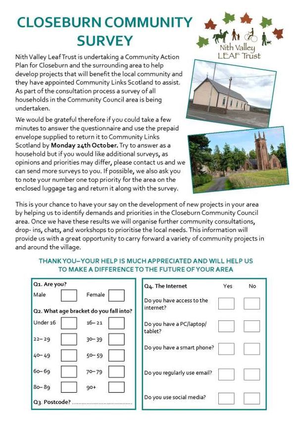
Closeburn Community Plan

                                                                                                                                                    3
CLOSEBURN COMMUNITY PLAN

Contents
1.0 Executive Summary .................................................................................................................... 4
2.0 Methodology.............................................................................................................................. 7
3.0 Background to Community Plan ................................................................................................ 8
   3.1 Population and Location ........................................................................................................ 8
   3.2 Business and Education ......................................................................................................... 8
   3.3 Community............................................................................................................................. 9
   3.4 Environment........................................................................................................................... 9
   3.5 Health and Emergency Services ............................................................................................. 9
4.0 Needs Analysis ......................................................................................................................... 11
   4.1 Defining Geographical Boundaries ...................................................................................... 11
   4.2 Population ............................................................................................................................ 12
   4.3 Scottish Index of Multiple Deprivation ................................................................................ 13
   4.4 Demographic Data ............................................................................................................... 21
   4.5 Nithsdale Local Area Profile ................................................................................................. 23
   5.1 National Policies ................................................................................................................... 24
   5.2 Local Policies ........................................................................................................................ 26
6.0 Closeburn Demand Analysis..................................................................................................... 28
   6.1 Household Survey Results .................................................................................................... 28
   6.2 Community Group Responses.............................................................................................. 36
   6.3 Local Business Response ...................................................................................................... 39
   6.4 Drop- In Consultation Responses ......................................................................................... 42
7.0 Action Points ............................................................................................................................ 48
8.0 Project Outlines........................................................................................................................ 57
9.0 Making It Happen ..................................................................................................................... 82
10.0 Appendices............................................................................................................................. 84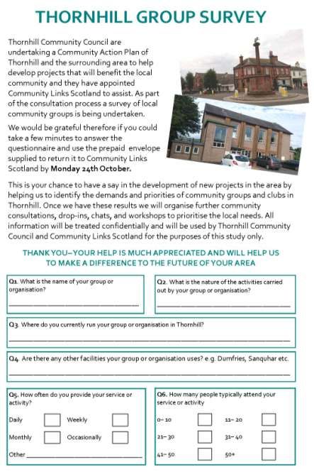
Closeburn Community Plan
4
1.0 EXECUTIVE SUMMARY
This community plan was commissioned by Nith Valley LEAF Trust with funding from
Local Energy Scotland. After a competitive tender process the project was assigned to
Community Links Scotland who have significant experience in producing community
plans working with Trusts, Community Development Trusts, and community groups.
Originally the brief was to develop a community plan for Thornhill and Closeburn
together however as work progressed it became clear that there was a need and
demand to produce two separate plans, one for each village. Thornhill, by virtue of its
larger population and status as a regional service centre, could have overshadowed
Closeburn in a joint plan and that is why the decision was made to produce two
community plans, with common themes between the two. This duplication is
particularly evident on issues relating to services and amenities which are used by
residents of both communities. As a result of the need to redress the balance in favour
of Closeburn the two communities have been provided with plans which not only
address shared issues affecting them both, but also unique issues specific to each
village as well. The two plans therefore have significant opportunity for joined up
working between the two community council areas.
In total 12 action points and 12 project outlines have been developed designed to
address to needs and demands identified by the residents of Closeburn throughout the
consultation process. These 24 ideas for the future enhancement of Closeburn have
been specifically designed to meet the needs identified through the research
undertaken and to tie into the various regional and national policies and strategies for
the area which aim to develop, support and build communities. The 12 action points
which have been identified for the community plan are:
Retain care home Better A76 contingency
Extended GP opening hours arrangements
Expanding cottage hospital Better maintenance of hedges,
Chiropody service trees and paths
Growing the local shop Admin facilities for small
More housing to rent businesses
More frequent local bus service More activities and clubs in
Traffic slowing Closeburn
These action points are recommendations, not fully fledged project outlines, and they
are designed to act as a first step in some of the potential work that could be
undertaken by the community council and the wider community in the months and
years going forward.
Closeburn Community Plan
5
The project outlines came from the community’s ideas which have the potential to be
developed into more workable, longer- terms projects. The project outlines have aims,
a brief proposal, and detail potential partners and funders. The 12 project outlines are:
Voluntary Befriending Service: To provide isolated individuals with social
contact and a link to the outside world and act as a gateway for other services
and valuable support.
Installation of Emergency Medical Equipment: To equip the local community
with a portable defibrillator especially designed for people with little or no
medical background.
More sheltered housing: To ensure that there is sufficient long- term provision
of sheltered housing in Closeburn to enable residents to remain in their
community.
Internet Hub: To build a new community internet hub in Closeburn, enabling
local people to access high speed internet and IT facilities within their
community.
Availability of Broadband in Rural Areas: To ensure residents within the
Thornhill and Closeburn Community Council Areas can access broadband in
their homes
Reintroduction of Thornhill Railway Station: To reintroduce Thornhill Railway
Station.
Walking/ Cycling Path to Thornhill: To create a safe walking and cycling route
between Thornhill and Closeburn
Community Action Group: To undertake a range of environmental projects and
activities that will contribute to the enhancement of Closeburn and the
surrounding area.
Gardening Service for Elderly Residents: To ensure that all residents in
Closeburn and the surrounding area have the means to maintain their gardens
Upgrade Closeburn Village Hall: To upgrade the existing village hall in Closeburn
in order to provide a better equipped, modern recreational space for a range of
services and activities.
Upgrade Football Pitch: To provide a high quality multi- use games area in
Closeburn.
Tourist Information Point (Inc. Walkers’ map): To provide visitors and tourists to
the area with a well equipped, informative first point of contact offering
information on local attractions and activities.
The extensive consultation work which has been carried out as part of the development
of this community plan has ensured that this finished product is comprehensive and
useful and can be put straight into use. We were able to speak to a great number of
residents who shared their aspirations and hopes for the future of Closeburn, not only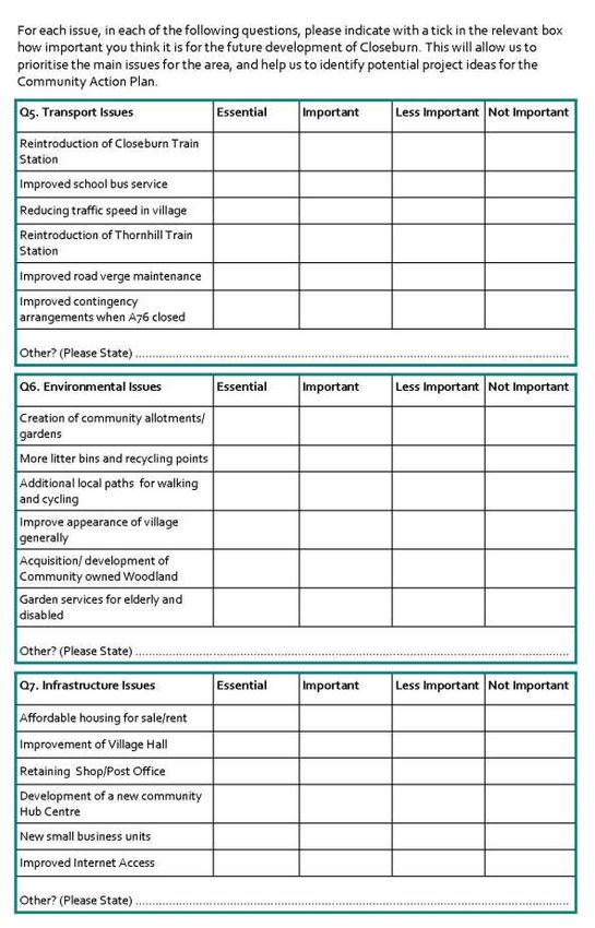
Closeburn Community Plan

                                                                                         6
have we been able to identify these aspirations, we have been able to work with the
community to understand the underlying issues and develop realistic solutions. The
work facilitated engagement with a wide range of community members and
stakeholders and gleaned from them a great depth of valuable knowledge which has
been analysed and synthesised to produce this community plan. This community plan
contains within it a range of workable ideas and project outlines which could be taken
forward by community groups and bodies, or by residents themselves, to ultimately
enhance the quality of local life or address specific issues identified by community
members. This document will support the development of Closeburn’s community
vision and provide the community council, Nith Valley LEAF Trust and the wider
community with a tool to assist future planning and development in the short, medium
and longer term.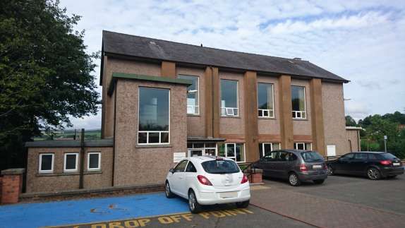
Closeburn Community Plan

                                                                                             7
2.0 METHODOLOGY
As part of the consultation process for this community plan a range of engagement
methods were used. The first consultation exercise undertaken was a survey of all
households in the community council area; this amounted to just under 400 surveys
being delivered in Closeburn Community Council area. Of these, 78 surveys were
returned giving us a response rate of 20%. In addition to the survey being delivered, we
also compiled an online version which was circulated by community members allowing
more community members to submit their responses. We also carried out consultation
work with S5 and S6 pupils at Wallace Hall Academy, asking them to complete the
same household survey, as a means of redressing the age bias evident in the returned
household surveys. In total 87 surveys were returned from school pupils, online
completions and those that were delivered.

Supplementing the survey work undertaken, additional primary consultation work was
carried out with community groups and local businesses from Closeburn and Thornhill.
Face to face meetings and discussions were had with 15 local businesses and 33 tailored
local business surveys were returned (some businesses had both a face to face meeting
and returned a survey). From local community groups 16 tailored surveys were
returned, and in addition to this a number of face to face discussions were had with
members of some groups including Closeburn Village Hall committee, Rotary Club,
Closeburn Youth Group, local arts groups and Thornhill Community Centre Committee.

The final piece of consultation work carried out was two drop- in events in Closeburn.
At these events we asked community members a series of in- depth questions about
their aspirations and hopes for the future of their community, building on residents’
responses to the previous stage of the consultation. Between both of these
consultation events held in December 2016 and January 2017 over 100 community
members in total were spoken to, given the drop-in nature of the events it is difficult to
determine the exact number of respondents. Analysis was carried out on the responses
to all elements of the consultation at each stage and, along with the needs analysis and
policy background which was developed throughout, used to inform the action points
and project outlines contained within the community plan.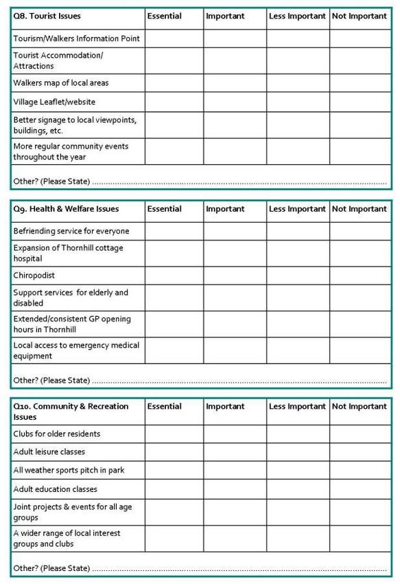
Closeburn Community Plan

                                                                                               8
    3.0 BACKGROUND TO COMMUNITY PLAN
    3.1 Population and Location
    Closeburn is a small village of around 270 people in Dumfries and Galloway, South West
    Scotland. The village is surrounded by agricultural land with a number of smaller
    settlements situated nearby, including Cample and Gatelawbridge to the north and
    Auldgirth to the south which lies just outside Closeburn’s community council area. The
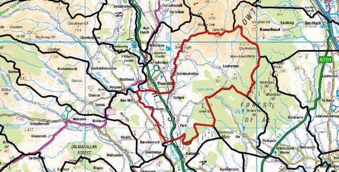
    Closeburn Community Council area is relatively large, extending as far north east as
    Gana Hill and is bounded by the Water of Ae to the east and the River Nith to the west.
    Closeburn lies on the main A76 road Dumfries to Kilmarnock and has a number of
    smaller minor roads leading off it providing excellent road access to both larger
    regional towns and nearby rural settlements. Around 2.5 miles north of Closeburn lies
    the larger village of Thornhill which offers a range of services and amenities for
    Closeburn residents. As such, Thornhill is often seen as a local hub in terms of drawing
    people across upper Nithsdale for work, leisure,
    healthcare and education. It is estimated that
    there are now approximately 115 houses in
    Closeburn with approximately a further 200
    across the community council area. The
    proportion of owner occupied housing in and
    around Closeburn village is around 60%,
                                                        Figure 3.1.1: Closeburn Village
    slightly lower than the national level, estimated
    to be around 62%.

    3.2 Business and Education
                                       Closeburn village is home to a number of small and
                                       medium sized businesses, mainly located at
                                       Closeburn Industrial Estate, with a number of
                                       additional businesses located in the more rural parts
                                       of the community council area, particularly farms.
                                       Although there are a number of businesses in the
                                       area, many residents do commute to larger
Figure 3.2.1: Closeburn Primary School
                                       settlements like Dumfries and Thornhill for work.
     Closeburn has its own primary school located about 1km to the east of the main village
     which is attended by children from across the community council area. Secondary
     school pupils must travel to nearby Wallace hall Academy in Thornhill which has a wide
     catchment area given the rural nature of the area.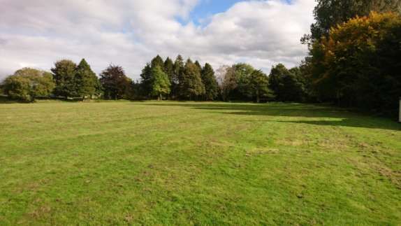
Closeburn Community Plan

                                                                                            9
3.3 Community
As mentioned above, Thornhill is home to the
majority of the community facilities in the area
given its larger size and relative proximity; however
Closeburn does have a number of community
amenities in its own right. The Closeburn Village
Hall accommodates a variety of activities on a
regular basis including dog training classes and Figure 3.3.1: Closeburn Village Hall
hosts a number of annual events each year
including the Gala Day, Christmas parties, and New Years’ Lunch. Furthermore, there is
Closeburn Parish Church, an attractive building located adjacent to the primary school,
east of the main village which is a significant feature in the local community. Closeburn
is also home to a few parks, playing fields and open spaces which can be used for sports
and community events throughout the year. Such events include the annual Closeburn
Gala Day which draws visitors from across the community council area and further
afield. Thornhill is however a major draw in terms of recreation and community
facilities with many Closeburn residents attending classes and clubs at the Thornhill
Community Centre, making use of Thornhill Library and visiting the many cafes, shops,
and pubs in the village.

3.4 Environment
                                              The community’s rural setting ensures
                                              that there is an abundance of
                                              picturesque scenery surrounding the
                                              village which undoubtedly adds to its
                                              unique charm. There are a number of
                                              walking paths around Closeburn and
  Figure 3.4.1: Closeburn Park
                                              further afield which enable residents and
visitors to explore some of the more rural parts of the large community council
including an area of the Southern Uplands to the east of the village. One such route
takes walkers through parts of the Forest of Ae and up to Queensberry hill, one of the
highest points in the region. The main park in the centre of the village is located
between Firmuir Avenue and Castle Crescent and contains a range of children’s play
equipment. Furthermore there is a large playing field situated behind Closeburn
Primary School which can be used for a variety of sports.

3.5 Health and Emergency Services
There are no health services in Closeburn; instead residents use the service available in
Thornhill. The area is served by a health centre and a small community hospital- one of
eight across Dumfries and Galloway, but the only one in the Dumfries and Upper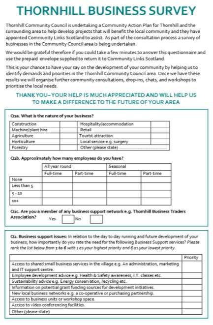
Closeburn Community Plan

                                                                                           10
Nithsdale area. The cottage hospital offers a 13 bedded unit accessible by local GPs and
consultants from Dumfries & Galloway Royal Infirmary. Furthermore the cottage
hospital provides assessment of adults, rehabilitation and palliative care for patients.
For patients in need of emergency or specialist treatment travel to Dumfries and
Galloway Royal Infirmary, which contains 337
staffed beds, and has a full range of
specialties, is necessary. Thornhill Ambulance
Station is also situated adjacent to the hospital
enabling residents to access the Scottish
Ambulance Service with an estimated
response time under 8 minutes, one of the
best response times in all of Dumfries and
Galloway. There is also a voluntary Fire Service
in Thornhill based on Kinnell Street, which has Figure 3.5.1: Thornhill Hospital
ten retained crew members based in the community. Recently Police Scotland have
proposed closing the police station located in Thornhill, a decision which has proven
controversial with local residents.
Closeburn Community Plan
11
4.0 NEEDS ANALYSIS
The following section provides baseline information on the demographics of the area.
The statistics have been derived from the most appropriate or available scale sources of
data:
Small Area Population Estimates 2015 at Datazone level
Scottish Index of Multiple Deprivation 2016 at Datazone level
Census Scotland 2011 at Locality and Output Area level
4.1 Defining Geographical Boundaries
The geographical boundaries relating to the statistics used in this report are illustrated
in the maps below which highlights the five datazones that comprise the areas covered
by Thornhill and Closeburn Community Councils and Closeburn Community Council
area.
Figure 4.1.1: Map
of datazones
covering Thornhill
& Closeburn;
Source: Statistics
ScotlandCloseburn Community Plan
12
Figure 4.1.2: Map of
Closeburn
Community Council
(Boundary in red)
area Source: D&G
Council
4.2 Population
Population estimates for 2015 are provided by the National Records of Scotland (NRS).
The information is available at datazone level for the datazones which cover Closeburn.
Population estimates are shown in Table 4.2.1 with local authority and national figures
included for comparison.
Table 4.2.1: Population Estimates for Study Area Datazones: 30 June 2015 Source: NRS
Closeburn Dumfries and Galloway Scotland 2015
Age Count % Count % Count %
0-4 68 3.92% 6,952 4.65% 291,174 5.42%
( 5-15 years) 209 12.05% 16,724 11.17 621,088 11.56%
Working Age ( 16 - 64) 1,081 62.34% 91,861 61.38% 3,539,508 65.88%
Pension Age ( 65+) 376 21.68% 34,125 22.80% 921,230 17.15%
All ages 1,734 100.00% 149,662 100.00% 5,373,000 100.00%
This table highlights that the total population of the area covered by datazones
S01007959, So1007960 and S01007961 is 2,295. This figure however is not an accurate
representation of Closeburn Community Council’s population as datazone boundaries
and community council boundaries do not match. This population figure is for the
datazone areas which best match the community council boundary and is given to offer
context to the following SIMD analysis which is given at datazone level.
The estimated population of the Closeburn Community Council area is 800. This figure
is taken from the Dumfries and Galloway website and is correct at time of reporting.
This population profile should be considered when identifying and delivering services
and activities locally.Closeburn Community Plan
13
4.3 Scottish Index of Multiple Deprivation
4.3.1 What is the SIMD?
The Scottish Index of Multiple Deprivation (SIMD) is the Scottish Government's official
tool for identifying those places in Scotland suffering from deprivation. It incorporates
several different aspects of deprivation, combining them into a single index. It divides
Scotland into 6,976 small areas, called datazones, each containing around 350
households. The Index provides a relative ranking for each datazone, from 1 (most
deprived) to 6,976 (least deprived). The Scottish Index of Multiple Deprivation 2016
data was released on 30 August 2016.
In the SIMD context, deprivation is defined as the range of problems that arise due to
lack of resources or opportunities, covering health, safety, education, employment,
housing and access to services, as well as financial aspects. The SIMD uses data relating
to multiple aspects of life in order to gain the fullest possible picture of deprivation
across Scotland. Seven different aspects are identified - the seven SIMD domains - and
data from these domains are combined to produce the index.
The SIMD is based on small areas known as datazones. Each datazone has on average
800 people living in it. Because they are population-based, datazones can vary hugely
in size. For example, in towns and cities where people live close together, datazones
can contain only a few streets, while in rural areas that are sparsely populated, they can
cover many square miles. The physical datazone boundaries changed in 2016, and the
type of people who live within each datazone has likely changed as well. The use of
data for such small areas helps to identify 'pockets' (or concentrations) of deprivation
that may be missed in analyses based on larger areas such as council wards or local
authorities.
The seven domains in SIMD 2016, used to measure the multiple aspects of deprivation,
are: Income; Employment; Health; Education, Skills, and Training; Housing; Geographic
Access; and Crime. As well as providing an overall rank for each datazone (from 1, the
most deprived, to 6,976, the least deprived); the SIMD also provides a rank for each
datazone within each of the seven domains. It is therefore possible to look at individual
aspects of deprivation for each area, as well as the overall level of deprivation. Each
domain is made up of several indicators.Closeburn Community Plan
14
4.3.2 Closeburn Overall SIMD
The Scottish Index of Multiple Deprivation (SIMD) is the Scottish Government's official tool for identifying those places in Scotland
suffering from deprivation. It incorporates several different aspects of deprivation, combining them into a single index. It divides Scotland
into 6,976 small areas, called datazones, each containing around 350 households. The Index provides a relative ranking for each datazone,
from 1 (most deprived) to 6,976 (least deprived). The Scottish Index of Multiple Deprivation 2016 data was released on 31st August 2016.
Best-fit
Working
Education, Skills
Age
Overall SIMD Income domain Employment Health domain and Training Housing domain Access domain SIMD Crime 2016
Population
2016 2016 domain 2016 2016 domain 2016 rank 2016 2016 rank
Total (men 16-64,
Population women 16-
(SAPE 60 SAPE
Datazone 2015) 2015) Rank % Rank % Rank % Rank % Rank % Rank % Rank % Rank %
S01007559 716 446 3,736 53.6 4,330 62.1 4,233 60.7 5,165 74.0 5,146 73.8 3,193 45.8 209 3.0 4,291 61.5
S01007565 981 626 3,131 44.9 3,598 51.6 3,713 53.2 3,879 55.6 4,567 65.5 3,650 52.3 575 8.2 1,016 14.6
S01007566 733 441 3,628 52.0 4,359 62.5 5,348 76.7 4,493 64.4 3,692 52.9 2,693 38.6 104 1.5 6,446 92.4
Table 4.3.1: Overall SIMD Rankings, Source; Scottish Government
This table highlights the low levels of multiple deprivation experienced within the Closeburn area. The overall ranking of the datazones
place them within the least deprived 56% and 47% in Scotland. Consideration of the ranks for the individual domains illustrates that the
areas generally score well; falling within the least deprived 8%- 48% of Scotland for all domains with the exception of Access for all three
datazones, Housing for one, and Crime for another. All three datazones fall within the most deprived 10% nationally for access highlighting
that the accessibility of services is a significant problem across the area. Datazone S01007566 falls within the most deprived 39% nationally
for Housing indicating that while not exceptionally deprived there is a scope for improvement. Datazone S0100756 falls within the most
deprived 15% nationally for crime indicating that the level of deprivation here is significant.Closeburn Community Plan
15
4.3.3 Closeburn Income Domain
The income domain identifies areas where there are concentrations of individuals and
families living on low incomes by looking at the numbers of people, adults and children,
who are receiving, or are dependent on, benefits related to income or tax credits.
Total Income domain 2016 Income Number of
Population domain 2016 Income Deprived
Datazone (SAPE 2015) rank % rate (%) People 2016
S01007559 716 4,330 62.1 7 50
S01007565 981 3,598 51.6 10 95
S01007566 733 4,359 62.5 7 50
Table 4.3.2: Income SIMD domain; Source: Scottish Government
The table above, highlights the low level of income deprivation with the datazones
falling between the least deprived 49% and 38% of all datazones nationally in that
domain. The rate of income deprivation in the area is between 7%- 10%, meaning just
under one tenth of the population is experiencing income deprivation. The total
estimated number of income deprived people in the three datazones is as high as 195.
4.3.4 Closeburn Employment Domain
The employment domain identifies the proportion of people from the resident working
age population who are unemployed or who are not in the labour market due to ill
health or disability.
Best-fit Working Age Employment domain Number of
Population (men 16- 2016 Employment Employment
64, women 16-60 domain 2016 Deprived
Datazone SAPE 2015) Rank % rate (%) People 2016
S01007559 446 4,233 60.7 7 30
S01007565 626 3,713 53.2 8 50
S01007566 441 5,348 76.7 4 20
Table 4.3.3: Employment SIMD Domain; Source: Scottish Government
This table highlights the low level of employment deprivation in Closeburn, evidenced
by the datazones ranking within the least deprived 47% to 24% nationally in that
domain. The estimated number of employment deprived working age people in the
area is 100 with the rate of employment deprivation between 4% and 8%.Closeburn Community Plan
16
4.3.5 Closeburn Health Domain
The health domain identifies areas with a higher than expected level of ill health or mortality for the age-sex profile of the population.
Hospital stays
related to Hospital stays Emergency Proportion of Proportion of
alcohol related to drug stays in population being live singleton
Comparative misuse: misuse: hospital: prescribed drugs for births of low
Health domain Illness Factor: standardised standardised standardised anxiety, depression or birth weight
2016 Standardised standardised ratio ratio ratio psychosis (%) (%)
mortality ratio ratio (DWP, (ISD, 2011- (ISD, 2011- (ISD, 2011-
(ISD, 2014- 15) (ISD, 2011- 14)
Datazone Rank % (ISD, 2011- 14) 2015) 2014) 2014) 2015)
S01007559 5,165 74.0 64 70 32 0 81 11 6
S01007565 3,879 55.6 64 85 100 35 83 17 0
S01007566 4,493 64.4 124 75 6 88 83 14 0
Table 4.3.4: Health SIMD Domain; Source: Scottish Government
The table above highlights the level of health deprivation in Closeburn area, with the datazones falling within the least deprived 44% and
35% in Scotland in this domain. Some key points to note from this data are:
The rate of observed deaths is lower than expected in two datazones but 24% higher than expected in S01007566.
The rate of observed recipients of health related benefits is between 15% and 30% lower than expected across the datazones.
The rate of observed hospital stays related to alcohol misuse is as expected for S01007565 but 94% lower than expected in another.
The rate of observed hospital stays related to drug misuse is zero in S01007559 and 65%- 12% lower than expected elsewhere.
The rate of observed emergency stays in hospital is 17% lower than expected for two datazones and 19% lower in the other.
Between 11%- 17% of the population are being prescribed drugs for anxiety, depression or psychosis.
The level of live singleton births of low birth weight is 0% in two datazones and 6% in the other.Closeburn Community Plan
17
4.3.6 Closeburn Education, Skills & Training Domain
The education domain includes indicators that measure both causes of education
deprivation (absenteeism and lack of progression to further and higher education) and
outcomes of education deprivation (such adults with a lack of qualifications).
Education, People aged 16-19
Skills and not in full time 17-21 year School Pupil
Training education, olds enrolling Attendance
Working age Attainment
domain 2016 employment or into higher (%)
people with of School
rank training (%) education (%) (SG,
no Leavers
(School Leavers (HESA 2012/13-
qualifications (SG, 2012-
Standardised 2012/13-2013/14, 2012/13 - 13- 2014- 2014/15)
Datazone Rank % Ratio (2011) DWP 2013 and 2014) 2014/15 ) 15)
S01007995 5,146 73.8 59 18 15 5.8 89
S01007565 4,567 65.5 94 4 13 5.7 89
S01007566 3,692 52.9 90 5 4 5.5 90
Table 4.3.5: Education, Skills and Training SIMD Domain; Source: Scottish Government
The table above shows that the datazones are within the least deprived 26%- 47% in
Scotland for Education. Across the datazones 27 16-19 year olds are not in education,
employment or training. Between 4%- 18% of people aged 16-19 across the datazones
are not in full- time education, employment or training, with between 4%- 15% of 17- 21
year olds enrolling into higher education across the datazones. Pupil attendance in the
area sits at around 90%.Closeburn Community Plan
18
4.3.7 Closeburn Housing Domain
The SIMD housing domain is intended to focus on the suitability and physical condition
of housing. It contains indicators that are based on the proportion of the household
population that experience overcrowding or are without central heating.
Percentage
Number of Number of of people in
people in Percentage of people in households
Housing domain households people in households without
rank 2016 that are households that without central central
Data Zone Rank % overcrowded are overcrowded heating heating
S01007995 3,193 45.8 64 9 21 4
S01007565 3,650 52.3 66 7 30 3
S01007566 2,693 38.6 67 9 28 4
Table 4.3.6: Housing SIMD Domain; Source: Scottish Government
The figures for the housing domain indicate that one datazone is within the most
deprived 40% nationally with another falling within the most deprived 46%. The other
datazone only just places in the least deprived half of datazones. It is very important to
recognise that the data uses data from the Census 2011 meaning it is now nearly 6
years old and therefore may not reflect the current situation.Closeburn Community Plan
19
4.3.8 Closeburn Access to Services Domain
The geographic access domain is intended to capture the financial cost, time and inconvenience of having to travel to access basic services
(e.g. post office, schools, GPs). It consists of two sub domains. One looks at the time it takes to drive to reach services and the other looks
at the time it takes to reach services by public transport.
Public Public Public
Geographic Drive time to Drive time to Drive time to Drive time to transport transport transport
Access domain Post Office retail centre
Drive time to Drive time to Primary Secondary travel time to travel time to travel time to
2016 GP 2016 Petrol Station 2016 School 2016 School 2016 2016 GP 2016 Post Office retail centre
Data Zone Rank % (mins) 2016 (mins) (mins) (mins) (mins) (mins) (mins) 2016 (mins) 2016 (mins)
S01007559 209 3.0 9.2 8.2 7.5 7.9 8.4 8.1 28.0 20.3 21.7
S01007565 575 8.2 7.1 6.4 2.3 4.2 8.7 7.3 22.2 11.7 18.0
S01007566 104 1.5 11.0 12.8 10.7 2.9 17.9 16.8 19.9 23.7 34.1
Table 4.3.7: Geographic Access SIMD Domain; Source: Scottish Government
The table above shows that the datazones are considered extremely deprived in terms of access to services; with all three falling within the
most deprived 10% nationally. Datazone S01007566 is particularly deprived ranking as the 104 th most deprived datazone in the county and
falling within the most 1.5% deprived. It is important to note that this domain only considers geographic access; it does not take into
consideration any other possible barriers to access of key services. From the above information we can see that these rural datazone are not
well placed to access GP surgeries, petrol stations, primary and secondary schools, and retail centres by both car and public transport.Closeburn Community Plan
20
4.3.9 Closeburn Crime Domain
The SIMD crime domain measures the rate of selected crime at small area level using
2014/15 recorded crime data. It is based on six indicators of broad crime types, chosen
partly on the basis of the relevance of their impact on the local neighbourhood and
partly on the availability of data. The six indicators are:
Recorded crimes of violence
Recorded sexual offences
Recorded domestic housebreaking
Recorded vandalism
Recorded drugs offences
Recorded common assault
SIMD Crimes
per 10,000
SIMD Crime 2016 SIMD Crime total
Data Zone Rank % 2016 count population
S01007559 4,291 61.5 11 154
S01007565 1,016 14.6 52 531
S01007566 6,446 92.4 3 41
Table 4.3.8: Crime SIMD Domain; Source: Scottish Government
This table shows that crime is a significant issue in one of the datazones covering
Closeburn, given that it is ranked in the most deprived 15% of datazones in Scotland for
this particular domain. On the other hand datazone S01007566 falls within the least
deprived 7% nationally, highlighting a marked difference between the two neighbouring
datazones. A total of 66 SIMD crimes were recorded across the datazones in the
2014/15 year.Closeburn Community Plan
21
4.4 Demographic Data
The data in this section is presented at Output area level for the Scottish Census 2011.
Output areas are created by grouping together postcodes; with a single output area
containing at least 50 people and 20 households but can contain more. The majority of
Closeburn village is covered by one output area (see figure 4.4.1), that output area has
been used to generate the report below which does not cover the more rural parts of
Closeburn Community Council.
Household Composition Closeburn D&G Scotland
Total number of households 67 67,980 2,372,777
% One person household aged 65+ 17.9 15.7 13.1
% One person household agedCloseburn Community Plan
22
% All persons 16 to 74: Employees- full- time 32.1 34.5 39.6
% All persons 16 to 74: Self- employed 5.7 11.1 7.5
% All persons 16 to 74: Unemployed 3.8 4.2 4.8
% All persons 16 to 74: FT student- employed 3.8 1.6 2.9
% All persons 16 to 74: FT student- unemployed 0.9 0.4 0.8
% All persons 16 to 74: Retired 35.8 19.5 14.9
% All persons 16 to 74: Student 3.8 3.2 5.5
% All persons 16 to 74: Looking after home or family 7.5 3.3 3.6
% All persons 16 to 74: Long- term sick or disabled 3.8 4.7 5.1
% All persons 16 to 74: Other 3.8 1.6 1.9
% All persons aged 16 to 74 unemployed: aged 16- 24 25.0 33.9 30.2
% All persons aged 16 to 74 unemployed: aged 50- 74 25.0 18.3 18.4
Table 4.4.1: Census data for Closeburn; Source: Census Scotland
*See appendix 10.5 for breakdown of qualification levels.
A few key points to note about Closeburn are:
• There is a higher proportion of socially rented accommodation in the area
compared to regional and national rates- almost three times the national rate
• There is a higher proportion of people with no qualifications in the area than
seen regionally and nationally.
• There is a higher proportion of people working part- time than seen regionally
and nationally, with a lower proportion of people working full- time.
• Significantly lower proportion of people with the highest level qualification than
regionally or nationally, almost ten percentage points lower.
Figure 4.4.1: Map of Closeburn Output Area: Source: Census ScotlandCloseburn Community Plan
23
4.5 Nithsdale Local Area Profile
The Nithsdale Local Area Profile produced by The Crichton Institute highlights that the
population of Dumfries and Galloway is projected to decline by 0.6% between the years
2010- 2020. This will be caused by a disproportionate level of out- migration of young
people aged 16- 20, while simultaneously there is a net in- migration of those in the
older age groups, this will likely be replicated in Nithsdale however reliable figures for
smaller areas are not available. This will also exacerbate the gap in the number of births
and deaths in Nithsdale, with far fewer births recorded than deaths.
The pattern of employment in Nithsdale is broadly similar to the regional average with
health/ social work and wholesale/ retail accounting for the largest proportions of
employment in the area, as they do across Dumfries and Galloway. The rate of
unemployment across Nithsdale was slightly higher than the regional figure at 4.4%
compared to 4.2%. These figures come from the number of people who are claiming
Jobseekers allowance. In addition to those defined as unemployed 13,440 people in
Nithsdale were economically inactive; 18% were economically inactive because they
had retired, nearly 2,100 were inactive because they were sick or disabled.
Of all the enterprises in Nithsdale almost 99% of them were classed as either small or
micro businesses, this is only slightly lower than the national proportions. The sector
with the most enterprises in Nithsdale is Agriculture, Forestry and Fishing; however the
share is slightly lower than what is seen at a regional level likely as a result of Nithsdale
containing Dumfries and Galloway’s largest urban area. The proportion of total
employment in accommodation and food service activities, which is indicative of that in
the tourism sector, was below the regional and national averages.
Within Nithsdale Thornhill Hospital is the only NHS hospital outside of Dumfries where
Dumfries and Galloway Royal Infirmary serves as the main acute services hospital for
the region. A 2012/ 2013 survey carried out by NHS Dumfries and Galloway found that
the greatest area of dissatisfaction across Nithsdale and Dumfries and Galloway more
widely was in services for older people. According to the Dumfries and Galloway Joint
Strategic Plan for Older People 2012- 2022 there are 12 care homes located in
Nithsdale, with one located in Thornhill itself, all of which are owned either by the
private or voluntary sectors. Across Nithsdale in the 2011/12 year 764 people were
receiving care at home with around 42% of over 65’s accessing Community Alarm and
Telecare Services highlighting the need for these types of services in the area.
Public transport in the area is limited meaning than many people in Nithsdale rely on
private transport to get to work. Within Nithsdale the lowest rates of private transport
use for work are seen in Kirkconnel and Sanquhar which are both served by their own
train stations.Closeburn Community Plan
24
5.0 POLICY ANALYSIS
5.1 National Policies
5.1.1 Scottish Government Purpose, Strategic Objectives and National Outcomes
Launched in 2007, the overriding purpose to which all the work of the Scottish
Government and its partners is aimed at, and which all projects should contribute
towards the achievement of, is;
“To focus the Government and public services on creating a more successful country,
with opportunities for all of Scotland to flourish, through increasing sustainable
economic growth.”
Closeburn Community Plan will contribute towards National Outcomes by developing a
comprehensive strategy for regeneration of the village by planning and co-ordinating
development of a range of projects. This Plan is comprehensive in its remit covering social,
economic and environmental regeneration and thematic projects covering housing,
environment, open space, infrastructure, services, transport, employment, and health.
5.1.2 Scottish Government Regeneration Strategy: Achieving a Sustainable Future
This strategy was launched in December 2011 and is the Scottish Government’s ‘vision
of a Scotland where our most disadvantaged communities are supported and where all
places are sustainable and promote well-being’.
Closeburn Community Plan will provide a means through which the local community are
able to contribute to the regeneration of the wider area. The broad remit of the
Community Plan means that it has the potential to contribute towards local regeneration
in myriad ways from supporting people to access better services; to improving existing
communal spaces; to the development of recreational areas; and ensuring people feel safe
and included in their communities.
5.1.3 Community Learning and Development Strategy
This Strategy establishes that Community Learning and Development capacity should
be targeted towards activities aimed at closing the opportunity gap, achieving social
justice and encouraging community regeneration.
Community regeneration is at the heart of the Closeburn Community Plan given the overt
focus on delivering improvements in provision of infrastructure, facilities and services. A
participative approach should be taken to implementation of Community Plan, enabling
local people to be more directly involved in local decision making and to increase
confidence and skills, and ensure the community- led regeneration of the area.Closeburn Community Plan
25
5.1.4 Scotland’s Economic Strategy
The purpose is ‘to make Scotland a more successful country, with opportunities for all
to flourish, through increasing sustainable economic growth’. This updated Strategy
focuses on two mutually supportive goals of increasing competitiveness and tackling
inequality.
Closeburn Community Plan will empower the local community to participate more in the
development of activities and services in the area, encouraging them to participate in
society and empowering them to access opportunities for their own development. The
participative approach to the project means that the Community Plan has been shaped by
and for the community, and the projects contained within offer opportunities for the
economic development of the area.
5.1.5 All Our Futures: Planning for a Scotland with an Ageing Population
Launched in 2007 this remains the lynch pin of Scottish Governments strategy to
enable the effective planning for the needs of an ageing population.
The older residents of Closeburn have been heavily involved with the Community Plan
throughout the consultation process, reflecting the current older demographic make- up of
the area. This community plan offers opportunities for the development of projects which
benefit older residents in particular, contributing to their integration in the wider
community and ensuring their needs are met across all aspects of community life.Closeburn Community Plan
26
5.2 Local Policies
5.2.1 Dumfries and Galloway Local Development Plan
The Local Development Plan (LDP) covers all of Dumfries and Galloway; it guides the
future use and development of land in towns, villages and the rural area. It also
indicates where development, including regeneration, should happen and where it
should not.
The Closeburn Community Plan offers opportunities for the sustainable regeneration of
the community and aligns with development work across the whole region by developing
opportunities for environmental improvement, recreation and social development in
Closeburn.
5.2.2 Dumfries and Galloway Single Outcome Agreement 2013-16
The Single Outcome Agreement (SOA) sets out a strategic ten year vision for Dumfries
and Galloway. The SOA wants to see work at pace, identifying and making service
improvements and achieving a significant shift towards preventing problems arising
rather than tackling them after they have happened.
This plan will contribute towards many priority outcomes; to provide better facilities for
recreation, education, employment and learning; to provide services and opportunities to
benefit all ages and to promote inclusion. Improvement of Closeburn, and the
development of its services and amenities, will encourage local residents to increase their
participation in community life.
5.2.3 Dumfries and Galloway Regional Economic Strategy 2014- 2020
The Vision for the Dumfries and Galloway regional Economic strategy is:
‘By 2020, Dumfries and Galloway will have a more diverse and resilient economy. One
which is capable of taking advantage of opportunities by combining an appropriately
skilled workforce and connected infrastructure to support more prosperous and inclusive
communities where every member of every community has equality of access to that
prosperity.’
Closeburn Community Plan will contribute towards the Dumfries and Galloway Regional
Economic Strategy primarily by empowering the community to take steps to diversify the
local economy through provision of new and enhanced services, amenities and activities.
5.2.4 Dumfries and Galloway Regional Tourism Strategy 2016- 2020
The Vision for the Dumfries and Galloway Regional Tourism Strategy is that by 2020
Dumfries and Galloway will be the destination of choice for quality, value and
memorable experiences delivered by skilled and passionate hosts.Closeburn Community Plan
27
Closeburn Community Plan can contribute particularly to the ‘Building our Capabilities’ theme by
growing the capacity of Closeburn and its community. The Community Plan offers options for
projects which could enhance appeal of the area for tourists and visitors.
5.2.5 Dumfries and Galloway Joint Strategic Plan for Older People 2012- 2022
The Strategic Plan celebrates the fact that many older people are living longer and
staying healthy for longer, while acknowledging that projections show that over the
next twenty years, there will be a steady increase in the number of frail older people,
people living with multiple long-term conditions and people with dementia. Most of
these people are likely to require some level of care and support.
Closeburn Community Plan has the potential to contribute significantly to this Strategic
Plan given the focus afforded to projects and actions benefitting older residents in
particular. This Community Plan promotes the integration of older people in community
life by developing opportunities to address the needs of that demographic. .
5.2.6 Dumfries and Galloway Draft Open Space Strategy 2014
The overall outcome of the Open Space Strategy is to maintain (or increase where
possible) reasonable quantity, accessibility and quality of publicly useable open space-
especially in relation to wider connectivity and multi- functionality.
Closeburn Community Plan will link with Dumfries and Galloway’s Open Space Strategy
given the Plan’s environmental themes. Open space around Closeburn is a key asset,
providing important opportunities for recreation and physical activity. The Community
Plan offers options for positively contributing to the enhancement and improvement of
these valuable community resources.
5.2.7 Nithsdale Health and Social Care Locality Plan 2016- 2019
This plan is about how Health and Social care in Nithsdale will be integrated as part of a
new Dumfries and Galloway Integration Authority. It sets out specific information,
where this is available, and identifies what is working well but also some of the main
challenges which need to be tackled.
This Health and Social Care Locality plan is of particular relevance to the Closeburn
Community Plan given the significant focus afforded to health and wellbeing focussed
projects and actions; an exceptionally important issue for the community.Closeburn Community Plan
28
6.0 CLOSEBURN DEMAND ANALYSIS
6.1 Household Survey Results
This report summarises residents’ responses to the consultation carried out by Nith
Valley LEAF Trust in Closeburn and the surrounding area. The information provided by
residents will be used to identify priorities within the community and will subsequently
inform Closeburn’s Community Plan. All percentages in the following section are
representative of the total number of returned questionnaires; therefore total
percentages may not always equal 100% depending on how many people chose to
complete particular questions.
6.1.1 Demographics
Male Female Total SAPE 2015
Under 16 1% 1% 2% 15%
16- 21 7% 1% 8% 7%
22- 29 1% 0% 2% 7%
30- 39 1% 5% 6% 9%
40- 49 2% 6% 8% 11%
50- 59 9% 15% 24% 21%
60- 69 14% 14% 28% 16%
70- 79 12% 3% 16% 8%
80- 89 2% 3% 6% 4%
90+ 0% 0% 0% 1%
Total 49% 48% 100%* 100%
*Some respondents did not disclose their sex therefore are not included in sex breakdown but are
included in the total.
The demographic breakdown of the responses from household surveys largely reflect
the demographic makeup of the village according to Small Area Population Estimates
for the year 2015 with some discrepancies. The most marked difference between the
respondent and population breakdowns is in the over representation of 60- 79 year
olds. While it is not possible to determine the exact reason for this, it is perhaps a result
of more free time among older residents allowing them to engage more fully in the
consultation process.
The overrepresentation of older residents in the survey, particularly between the ages
of 60- 79, has lead to a slight underrepresentation of younger people particularly under
16s and those between the ages of 22- 49. Despite the demographic differences, we
have tried where possible to present a balanced result with the views and opinions of all
age groups represented.
The most numerous age group who participated in the consultation were 60- 69 year
olds who made up just over a quarter of participants at 28%, followed by 70- 79 at 16%.Closeburn Community Plan
29
This reflects the village demographics as these are the most populous age groups. The
smallest age groups were under 16s and 22-29 with 2% each, this does not reflect the
demographic makeup of the village despite carrying out additional consultations with
Wallace Hall senior pupils. There were slightly more men participated in the
consultation than women with 49% and 48% of the total number of respondents
respectively, a number of respondents did not disclose their sex hence the percentages
do not add up to 100%.
6.1.2 Transport
Less Not
Essential Important
Important Important
Reintroduction of Closeburn Train Station 30% 40% 15% 10%
Improved school bus service 15% 45% 18% 8%
Reducing traffic speed in village 31% 31% 22% 9%
Reintroduction of Thornhill Train Station 26% 34% 25% 10%
Improved road verge maintenance 33% 34% 21% 5%
Improved contingency arrangements when 34% 39% 15% 8%
A76 closed
Transport issues scored well among respondents with improved contingency
arrangements for A76 closure and reintroduction of Closeburn Station being rated as
‘essential’ or ‘important’ by over 70% of respondents. Given that the A76 runs through
the centre of Closeburn and is the main route in and out of the village, it is no surprise
that its closure can have a massive effect on residents and their travel arrangements
and is a priority for the community going forward.
Closeburn is a very rural community and an overall improvement in public transport
would connect residents to key services in other nearby towns and villages, this is
particularly important given that Closeburn has minimal services itself. The importance
of an improvement in public transport would likely be a key priority for residents who
did not have access to a car and needed to travel further afield for key services such as
healthcare and shopping.
6.1.3 Environment
Less Not
Essential Important
Important Important
Creation of community allotments/ gardens 1% 30% 47% 15%
More litter bins and recycling points 18% 55% 18% 5%
Additional local paths for walking and cycling 26% 49% 17% 3%
Improve appearance of village generally 21% 53% 16% 6%
Acquisition/ development of Community 8% 30% 39% 17%
owned Woodland
Garden services for elderly and disabled 24% 54% 15% 5%Closeburn Community Plan
30
The environment was one of the more pressing areas of action for the community with
four of the six actions receiving high levels of support from over 70% of respondents.
This indicated that there is a good level of support in maintaining the natural
environment of this rural community to a high standard. The support was particularly
high for gardening services for the elderly and disabled, this is perhaps a reflection of
the older bias in the demographic makeup of respondents but nonetheless represent
real concerns among the community that will need to be addressed.
Two areas that were less supported by the community were creation of community
allotments and development of community owned woodland which were the only two
actions in the whole survey to receive ‘less important’ or ‘not important’ ratings from
over 55% the community, in light of this it may be that these two options are ones to be
considered after addressing more pressing community priorities.
6.1.4 Infrastructure
Less Not
Essential Important
Important Important
Affordable housing for sale/rent 31% 49% 14% 3%
Improvement of Village Hall 29% 45% 20% 2%
Retaining Shop/Post Office 54% 40% 1% 1%
Development of a new community Hub Centre 9% 39% 40% 6%
New small business units 14% 46% 28% 7%
Improved Internet Access 64% 22% 6% 2%
Opinions on the importance of infrastructural issues were quite varied with levels of
support ranging from 48% to 94%. The highest priority in this section was retaining the
post office which received the highest proportion of ‘essential’ and ‘important’ ratings
across the whole survey at 94%. Retaining the post office and shop for the community
is clearly a key priority for Closeburn and the Community Plan will look at ways of
ensuring it stays in the community and continues to meet the needs and demands of
the people who use it.
Improved internet access was another high scoring action at 86% support, likely due to
a number of more rural residents not having access to broadband currently and internet
access being unreliable all over the community council area. Improving the village hall,
building more houses and access to new small business units are all important
infrastructure projects for the community which residents are supportive of and would
contribute to the overall development of Closeburn in future.Closeburn Community Plan
31
6.1.5 Tourism
Less Not
Essential Important
Important Important
Tourism/Walkers Information Point 8% 46% 36% 5%
Tourist Accommodation/Attractions 9% 46% 34% 5%
Walkers map of local areas 15% 53% 24% 3%
Village Leaflet/website 16% 41% 33% 3%
Better signage to local viewpoints, buildings, 15% 53% 23% 3%
etc.
More regular community events throughout 16% 54% 23% 2%
the year
Tourism was the overall lowest scoring section of the survey however levels of support
were support were still relatively high. The two highest scoring options in this section
were a walkers’ map and better signage to local viewpoints suggesting that residents
are keen to make the most of the natural beauty that surrounds Closeburn.
Improvements such of these have been considered as part of the community plan and
would raise the village’s profile as a destination for tourists, bringing in visitors and
money to the area. Development of Closeburn as a destination for tourists to the area
could reap long term benefits for the community in terms of job creation and income
generation; these activities could then lead in the longer term to funding for other
community development projects. Improvements in provision for tourists will be a
crucial point to consider going forward.
6.1.6 Health & Welfare
Less Not
Essential Important
Important Important
Befriending service for everyone 18% 53% 18% 3%
Expansion of Thornhill cottage hospital 45% 38% 9% 3%
Chiropodist 23% 38% 24% 7%
Support services for elderly and disabled 51% 37% 8% 1%
Extended/consistent GP opening hours in 46% 39% 11% 1%
Thornhill
Local access to emergency medical equipment 48% 46% 1% 1%
Health and welfare was the most well received section of the survey with all six actions
receiving ‘essential’ or ‘important’ ratings from over 60% of respondents, and four of
those receiving support from over 80%. Access to healthcare is vital for any community
and is likely particularly prevalent in the mind of the community given the remoteness
of the village and the older population. These concerns are perhaps exemplified by the
exceptionally high level of support for access to emergency medical equipment at 94%,You can also read


