R.accumulate: Efficient computation of hydrologic parameters in GRASS - Fosdem
←
→
Page content transcription
If your browser does not render page correctly, please read the page content below

FOSDEM 2021                                                                  read

                r.accumulate: Efficient
              computation of hydrologic
                parameters in GRASS
                                        February
                                        February 2,
                                                 2, 2020
                                                     2020
                                        FOSDEM
                                         FOSDEM 20212021

                   Huidae
                   Huidae Cho,
                          Cho, Ph.D.,
                               Ph.D., GISP,
                                      GISP, PE
                                            PE (MD),
                                               (MD), M.ASCE,
                                                     M.ASCE, CFM
                                                             CFM
                        Institute
                        Institute for
                                  for Environmental
                                      Environmental and
                                                      and Spatial
                                                          Spatial Analysis
                                                                  Analysis
                                   University
                                    University of
                                               of North
                                                  North Georgia
                                                        Georgia
                                 GRASS
                                 GRASS GIS
                                       GIS Core
                                           Core Developer
                                                Developer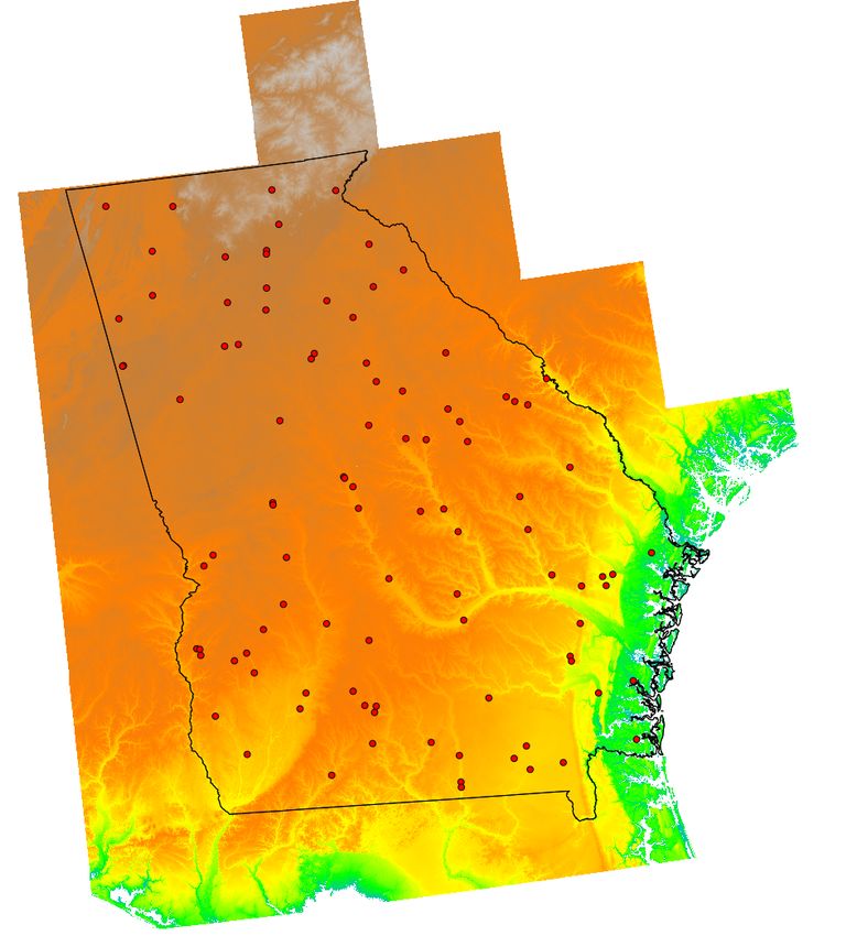
FOSDEM 2021                                                                                  read

                                                                Me
              Huidae Cho /hidɛ t͡ɕo/
              Teaching geospatial science and computing at the University of North Georgia
              GRASS GIS core developer (20 years)
              ArcGIS developer (12 years)
              Water resources engineer (10 years)
              https://github.com/HuidaeCho
              grass4u@gmail.com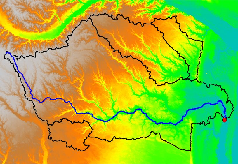
FOSDEM 2021                                                                                  read

                                                       Source code
              https://github.com/OSGeo/grass-addons/tree/master/grass7/raster/r.accumulate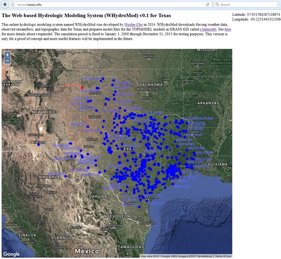
FOSDEM 2021                                                                    read

        Web-based hydrologic modeling system (WHydroMod)
              r.topmodel: A GRASS module for the Topography Model (TOPMODEL)
              USGS online data
              NCDC web API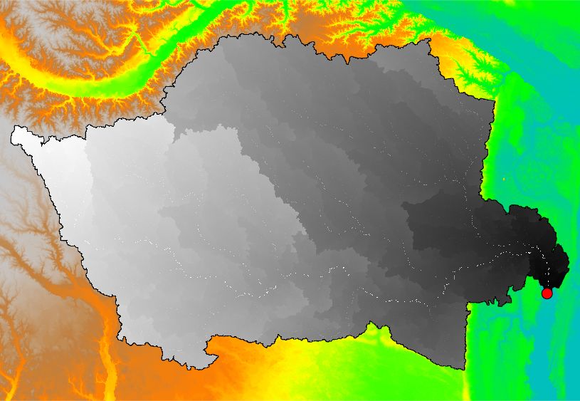
FOSDEM 2021                                                     read

                                          WHydroMod for Texas
              http://txmod.isnew.info
              Proof-of-concept implementation for Texas
              GNU Affero General Public License Version 3
              Transparent system to the user
              Open source stack
                    GRASS GIS
                    PostgreSQL
                    PyWPS
                    MapServer
                    OpenLayers
                    Apache
              Bing Maps API for base maps
FOSDEM 2021                         read

              Typical TOPMODELing
FOSDEM 2021                       read

              The WHydroMod way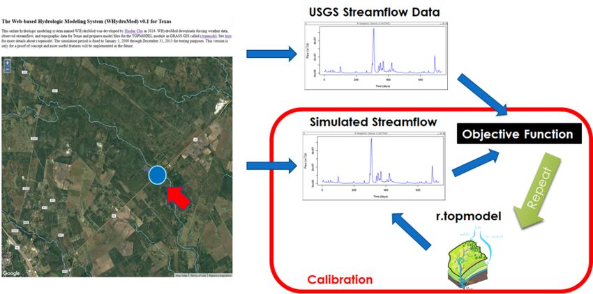
FOSDEM 2021               read

              Data flow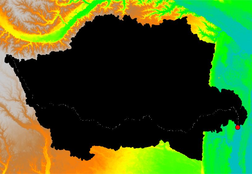
FOSDEM 2021                                                                                     read

                              Challenges
    Web users are impatient   But it takes minutes to download online data & process DEM

                                  Blue & red USGS gages
                                  Automate heavy data processing over night
                                  Allow the user to initiate new processing and share results
                                  Improve the performance of geospatial computation
FOSDEM 2021                                                         read

                                  Important hydrologic parameters
              Flow direction
              Flow accumulation
              Longest flow path
FOSDEM 2021 read
Flow direction
Figure 1: GRASS GIS drainage encodingFOSDEM 2021 read
Flow accumulation
A raster (think of a matrix with cell values) that downtraces rain drops following flow directions.FOSDEM 2021 read
Longest flow path
FP is the watercourse from one point to another.
−−→ −→ ∣ ∥−→ ∥ ∥−→ ∥
LFP ∈ { FP i ∣ ∥FP i ∥ ≥ ∥FP j ∥ ∀j ≠ i}
∣ ∥ ∥ ∥ ∥
Yes! LFP is the “longest” flow path.
There can be more than one in some case.FOSDEM 2021 read
Motivation
The current LFP algorithm
Peter Smith (1995) → the resolution of DEM was limited
grid-based → can take a long time
grid output → potentially invalid vector output
calculation of two flow length grids for each outlet
not for a large number of watersheds
Smith, P. N. H., 1995. Hydrologic data development system. Transportation Research Record: Journal of the
Transportation Research Board 1599, 118–127.FOSDEM 2021 read
Peter Smith’s methodFOSDEM 2021 read
Downstream flow length
Flow length starting from the outlet
FLi,j is the flow length from cell i to cell j .
0 i = 0 at the outlet
DFLi = {
FLi−1,i + DFLi−1 i ≥ 1
Note
0 at the outlet
high at a headwaterFOSDEM 2021 read
Upstream flow length
Flow length starting from a headwater
0 i = 0 at a headwater
UFLi = {
FLi−1,i + max(UFLi−1 ) i ≥ 1
Note
0 at a headwater
high at the outlet
taking the maximum at a confluenceFOSDEM 2021 read
DFL+UFL
+ =
DFL UFL DFL+UFL
Note
maximum DFL at the headwater on the LFP
maximum UFL at the outlet
both maximums are the same → LFL (longest flow length)
any DFL+UFL cells on the LFP have this maximum valueFOSDEM 2021 read
LFP
−−→
LFP defined by all the cells with a value of LFL
LFL = max(DFL + UFL)FOSDEM 2021 read
Typical procedure for multiple outletsFOSDEM 2021 read
Critical problem
Green arrows: flow directions, blue line: LFP
Hydrologically invalid!FOSDEM 2021 read
Other problems
Slow!
Esri’s Flow Length tool is limited.FOSDEM 2021 read
Divide-and-conquor approach
Purely vector-based approach
r.accumulate GRASS GIS addonFOSDEM 2021 read
Divide
Divide the problem into smaller pieces in a recursive way.
−−→ −−→ −→
LFPi ∈ {LFPj + FP ji ∀j ∈ UP}
where
UP = {Upstream neighbors of cell i}
0 ≤ ∥UP∥ ≤ 8
Define a function of j that returns the length of the longest flow path at cell i .
−−→ ∥ ∥−→ ∥ ∥−−→ ∥
⎧∥
∥LFPj ∥ + ∥FP ji ∥ = ∥LFPi ∥ if UP ≠ ∅
f (j) = ⎨ ∥ ∥ ∥ ∥ ∥ ∥
⎩
0 otherwise
Now, the problem becomes finding all arg max j∈UP
f (j) by traversing upstream cells starting from the outlet. The search
stops when UP = ∅.FOSDEM 2021 read
Conquor
Intuitively, the longest longest flow length
–
LFLmax = s ⋅ FAC√2
where s and FAC are the cell size and flow accumulation, respectively
Based on Hack’s law, the shorted longest flow length
−−−−
LFLmin = s√FAC
−−→
Between upstream neighbor cells i and j , cell i is on the LFP if LFL min,i > LFLmax,j .FOSDEM 2021 read
Stack overflow and solution
Depending on the watershed size, recursion can consume all stack memory and cause a stack overflow
Convert recursion to iteration using a heap-based stack
A single loop until the stack with upstream cells depletesFOSDEM 2021 read
Benchmark experiments: r.accumulate vs. Arc Hydro
Is paid software always better than open and free software?FOSDEM 2021 read
Data
National Elevation Dataset (NED) 1 arc-second
(approximately 30 meters)
27 NED maps
National Atlas of the United State state boundaries for
masking
Generated 100 outlets randomlyFOSDEM 2021 read
System specifications
CPU: Intel Xeon E5620 2.40 GHz
Memory: 48 GB
OS: Linux kernel version 4.4.14
GIS: GRASS development version 7.7.svn revision r74124FOSDEM 2021 read
Results and discussionsFOSDEM 2021 read
LFP geometries
Both methods produced almost identical LFPs except for some areas
Blue: r.accumulate, Red: Arc HydroFOSDEM 2021 read
Performance comparison with Arc HydroFOSDEM 2021 read
Efficient delineation of a massive number of subwatershedsFOSDEM 2021 read
Conclusions
The fewer raster operations, the faster!
The performance of r.accumulate is linearly growing with the subwatershed size.
While that of Arc Hydro exponentially growing.
The new approach is cost-efficient and can be used for interactive hydrologic modeling (e.g., web).FOSDEM 2021 read
References
Cho, H., 2020. A Recursive Algorithm for Calculating the Longest Flow Path and Its Iterative Implementation.
Environmental Modelling & Software 131, 104774. doi:10.1016/j.envsoft.2020.104774.
Smith, P. N. H., 1995. Hydrologic Data Development System. Transportation Research Record: Journal of the
Transportation Research Board 1599, 118–127. doi:10.3141/1599-15.
Hack, J. T., 1957. Studies of Longitudinal Stream Profiles in Virginia and Maryland. Geological Survey Professional
Paper 294-B, 45–97. https://pubs.usgs.gov/pp/0294b/report.pdf.You can also read