Information Infrastructure of Beijing Historical Space - Using Google Earth and Complete Map of Peking, Qianlong Period - Asanobu KITAMOTO, Yoko ...
←
→
Page content transcription
If your browser does not render page correctly, please read the page content below
Information Infrastructure of Beijing
Historical Space –
Using Google Earth and Complete
Map of Peking, Qianlong Period

Asanobu KITAMOTO, Yoko NISHIMURA
National Institute of Informatics
http://dsr.nii.ac.jp/
Outline   http://dsr.nii.ac.jp/beijing-maps/
                       1. Challenges
                       2. Geometric
                          correction
                       3. Rearrangement
                          of maps
                       4. Spatial visual
                          resources
                       5. Summary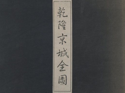
Contributions
1. A geometric correction method for the old
   map of a city – preservation of linear features.
2. Rearrangement of the map – the discovery of
   mis-arrangement in the original map.
3. Augmentation of the map – a multilingual
   gazetteer and old photographs.
4. Spatial visual resources – the usage of Geo-
   browsers in data management and publishing.
Complete Map of Peking,
Qianlong Period
                 • Made around 1750 –
                   the oldest map of
                   Beijing based on
                   measurement (1/650).
                 • Stored in National
                   Palace Museum, but
                   not open to the public.
                 • A potentially valuable
                   resource for people.
Problems and Challenges Huge size = W 13 m x H 14 m Many sheets = 203 sheets in total • The survey of the whole map, in terms of e.g. accuracy, was not feasible. • The map was not usable due to the difficulty of matching with the current (correct) map.
Solution and Requirement
Propose a geometric correction method
for geo-referencing the old map to the
current satellite image.
1. The method must preserve linear features
   relevant in cities = Delaunay triangulation
   (typical method) is inappropriate.
2. The software must work for a large scale
   problem = traditional GIS software does not
   work with 29 billion pixels on 203 sheets.
Line-Preserving Distance Weighting
Method
 A line is a set                 A “virtual” control
 of points                       point on a control line

   z p ( x) = ∑i wi zi / ∑i wi     z l ( x ) = ∑ k wk [(1 − t ) z i + tz j ] / ∑ k wk
Control Points
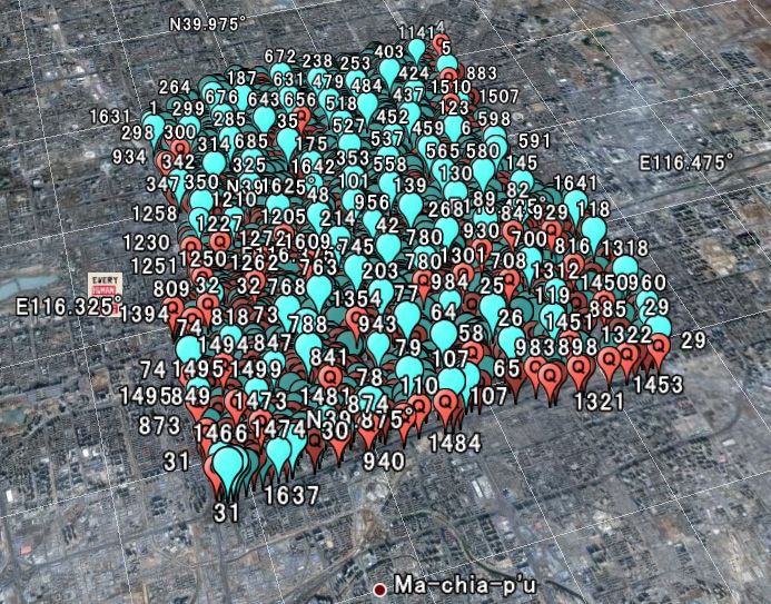
Palaces, intersections and hutongs present for 250 years.
• About 1800
points are
selected.
• Google Earth
helps to find
the current
location of
point features.
Red: old map; Cyan: current mapControl Lines
Streets present for 250 years + walls of inner and outer castle.
• About 500
lines are
selected.
• Endpoints
of control
lines are
selected
from control
points.Result was Confusing…
203 sheets were seamlessly connected.
However, ...
1. Some parts are too different from the current
map (especially in the west of outer castle).
2. Some regional features (such as temples) are
not connected across neighboring sheets.
3. Some features that should be located at the
current place are found in a wrong place.
Where is the error?Past Work • Hou (1988) – Errors in direction and scale are found in some areas. • Ihara (1997) – Neighborhood of Fayuan si cannot be matched with the current map. • Li (2004) – Mis-arrangement is present at pages 9,10,11 of line 14. The presence of error was known, but the accuracy of the whole map was unknown.
Rearrangement of Sheets
 Horizontal exchange of sheets between
 neighboring sheets and exchange of half-sheets
 within a sheet can solve all the inconsistencies.

 Mis-arrangement is present in 5 sheets.
Our Work
• Mis-arrangement is present not only in
  line 14, but also in line 15 and 16.
• The map is relatively accurate after
  correcting the mis-arrangement.
¾How the mis-arrangement occured?
¾Probably due to the restoration of the map.
  ¾Mis-arrangement is found within a sheet.
  ¾Mis-arrangement is found on fragmented parts.
Multilingual Gazetteer
• Digitize the
original gazetteer
in traditional
Chinese.
• Add Japanese,
simplified Chinese
and Pinyin for
multilingual usage.
Of 3600 places, 800 had errors; • Geo-reference
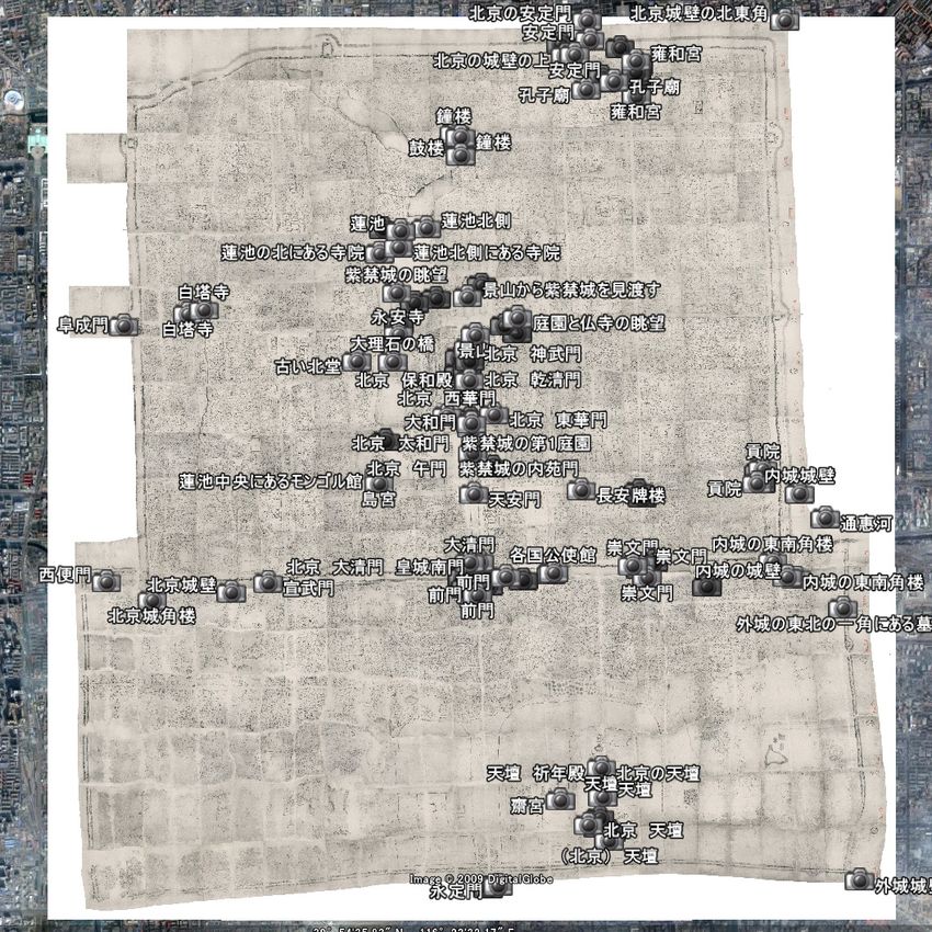
400 missing places were added. some place names.Old Photographs on the Old Map • Historical landscape of Beijing can be better studied by integrating many sources and analyze them together.
Spatial Visual Resources (SVR)
  Spatial Resources       Visual Resources
    •Map                     •Photograph
    •Statistics              •Painting
    •Gazetteer               •Drawing

          Spatial Visual Resources
 Maps + photographs = spatial info. is crucial.
Photo Albums of Beijing from Digital
Archive of Toyo Bunko Rare Books
1. Felice Beato, Album of Photographic
Views in China, 1860
2. Alfons von Mumm, Ein Tagebuch in
Bildern, 1902
3. Sanshichiro Yamamoto, Peking, 1906
4. Sagimaro Kojima, Views and Custom
of North China, 1909
Photographs of 100-150 years ago are especially
valuable for studying landscape.Geo-referencing Photographs • Geo-reference by place names, by spatial arrangements, by unique features, etc. • Interpretation of photographs is the key.
SVR is Worth 1000 Words
(Above)
Fucheng men
(Below) Chong
wen men

Houses and shops invaded into the street (     ).
Text tells the concept; SVR reveals the real scene.
SVR and Historical GIS

• GIS software has been used for the old map;
  geometric correction and data management.
• Geo-browsers (e.g. Google Earth) are now
  emerging as alternative tools.

       Historical GIS = the study of SVR?
Geo-Browser and GIS
Geo-Browser (Traditional) GIS
Browse and annotate Prepare and analyze
Free satellite images More choices (for charge)
Internet-friendly, designed Some are internet-friendly,
for sharing data. but not the main feature.
Also good for qualitative Mainly for quantitative
data data
Combine both tools for their strengths
toward a “wider” concept of historical GIS.Summary • A new geometric correction was proposed for the old map of cities to preserve linear features. • Mis-arrangement of Qianlong Map was revealed after surveying inconsistencies in the old map. • Multilingual gazetteer was created for easier access to place names. • Photographs and maps were integrated under the concept of spatial visual resources (SVR).
Future Work
• Improve the accuracy of the map by adding
  more control points and lines.
• Improve the geometric correction algorithm for
  better usage of control points and lines.
• Integrate textual information from old books.
• Extend the system for a participatory
  infrastructure to collect various historical
  information from many experts across domains.
Thank you for your attention!
• http://dsr.nii.ac.jp/beijing-maps/ -
  Digital Maps of Old Beijing
• http://dsr.nii.ac.jp/toyobunko/ - Digital
  Archives of Toyo Bunko Rare Books
• Special thanks to Toyo Bunko for the
  permission of digitizing rare books.
• The following members helped the project -
  Kinji Ono, Makiko Onishi, Yuko Tanaka, and
  Yoshitaka Maejima.
You can also read