Re-imagining Elizabeth Ave - People often say St. John's isn't good for active transportation because of - Happy City ...
←
→
Page content transcription
If your browser does not render page correctly, please read the page content below
Elizabeth Yeoman

Jane’s Walk 2021
Re-imagining Elizabeth Ave.

P
      eople often say St. John’s isn’t good for active transportation because of
      the hills but it is almost flat east-west. Elizabeth Avenue is a perfect
      example. It could be accessible, cyclable and walkable year round. This
Jane’s walk will look not just at the street itself and its history, but also at some
examples of what other cities have done and our own planning and engagement
processes have come up with over the past few years. We’ll explore what this
very ordinary street could be like if it focussed on people instead of cars.

Trees in Churchill Park on Elizabeth Avenue

Elizabeth Avenue feels like the opposite of the way we like to imagine St. John’s,
with its coloured houses spilling like rough cut jewels downhill to the great big
sea. Instead, this is a suburban sort of street of strip malls, post-war houses and

1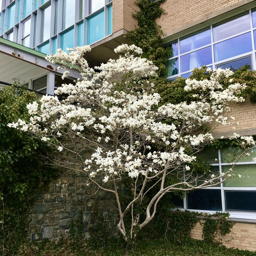
Elizabeth Yeoman

boxy brick buildings. It runs from one end to the other of an area of about 800
acres that was expropriated in 1944 by the Commission of Government to
develop affordable housing. This area is bounded roughly by the streets we know
today as Empire Avenue, Prince Philip Drive, Freshwater Road and Torbay Road.
Later that same year, construction of roads, services and houses began, with
Elizabeth Ave. (originally Elizabeth St.) as the main thoroughfare. The area now
includes the main campus of MUN, the Avalon Mall, the Churchill Park Garden
Suburb, Churchill Square and Rennie’s River Elementary School, as well as
various businesses, services, churches and a synagogue. Elizabeth Avenue
connects them all (except the mall, a little beyond its west end).

Why Elizabeth Avenue?
As we begin our walk, let’s talk about why we would want to imagine this street
as an accessible pedestrian and cyclist focussed one. It isn’t especially scenic; it
doesn’t have character like the downtown pedestrian area; and it is often seen as
a necessary vehicle route to keep traffic from overloading the Parkway. For
example, the MUN Area Traffic Study noted that it provides “additional vehicle
capacity to share the traffic load with Prince Philip Drive. Without it, Prince Philip
Drive traffic will continue to grow to levels that will exceed the capacity of the
intersections.” But let’s examine that assumption. There’s plenty of research to
show that the more you build infrastructure for vehicles, the more people will
drive. On the other hand, the more you make driving expensive and inconvenient
and other transportation modes easy to use, the more people will choose those
modes.

Meanwhile, Elizabeth Ave. is already full of pedestrians and cyclists (in non-
pandemic times). It has a school and a university as well as several seniors’
residences. If the street was better organized for walking, rolling and cycling, it
seems likely that the numbers of people using those modes would be higher than
those using the street as a vehicle route to somewhere else. While the street
might not be especially picturesque, it does have a large park, a campus, and
many trees, as well as a river trail and several footpaths connecting it to
Georgestown and the downtown. And Churchill Square and other shopping areas
along it have the potential to be much more lively, sociable and scenic than they
are right now if they were less car-centric.

2
Elizabeth Yeoman

       The intersection at Elizabeth and Westerland is typical. It could be almost any suburb
       in Canada. But it has potential!

Some Inspiration
A Dutch urban planner who was asked how he would go about moving a city
away from dependence on cars replied, “I would have started thirty years ago.”
Cities change mostly in small increments over time. But there have been much
more dramatic changes recently in Paris. (Yes, I am going to think big and
compare Elizabeth Avenue to the Champs Elysée!) The mayor of that city, Anne
Hidalgo, has said that personal car ownership is “archaic.” She introduced a
program called "Paris Respire" in which all cars are banned from certain areas on
the first Sunday of the month, and public transit and bicycle rentals are free that
day. Her council has also increased the cost of parking, banned diesel cars,
limited car access on many major streets and expanded green areas, sidewalks
and bike paths in areas that were previously used for driving and parking, and
converted parts of a highway along the River Seine into a park. Her 2020 mayoral
campaign focussed on making Paris a “15 minute city” in which people could do

3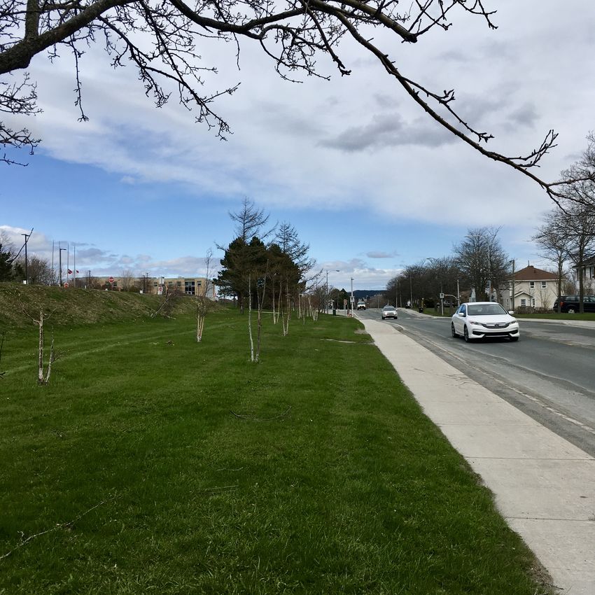
Elizabeth Yeoman

everything they needed to do within a fifteen minute walk or bike ride from home.
In January 2021, she announced a €250 million renovation of the Champs-
Élysées, in which space for vehicles will be reduced by half to make room for new
parks and pedestrian and cycling areas. By 2022 there will also be a ban on most
vehicle traffic crossing the city centre. Mayor Hidalgo explained these dramatic
changes as being necessary in response to “the urgency of both the health crisis
and the climate crisis we are facing.”

       Pink bike parked in a neighbourhood square. No cars in sight, just pedestrians and a
       bike. We could do this! (Photo: Rudy and Peter Skitterians from Pixabay )

Paris has made more dramatic progress than most cities but it isn’t an outlier.
Many cities, including some in Canada, have limited vehicle access in designated
areas to create more space for pedestrians and cyclists. In Toronto, for example,
several expressways and major streets are closed to vehicles and opened to
people using active transportation on selected week-ends. In addition, the Quiet
Streets program designated 65 km of streets as Shared Space in summer 2020.
Signs and temporary barricades encouraged slow, local vehicle access only so
the space could be shared by people walking, running, using mobility devices and
biking. The City is planning to do this again this summer. Even St. John’s opened
the fantastically successful pedestrian mall last summer on Water St. as well as

4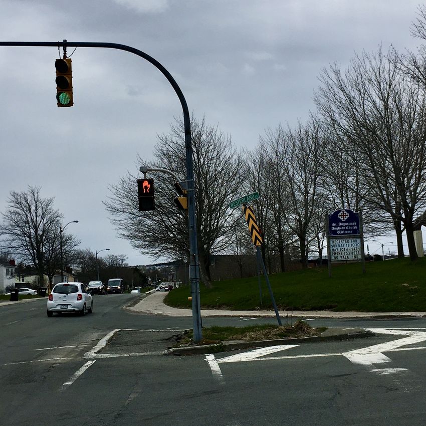
Elizabeth Yeoman

the less satisfactory sidewalk widening/bike lane pilots on Newtown Rd., Parade
St. and yes, Elizabeth Ave. We’ll discuss those too on this walk.

       Water St. pedestrian mall last summer, before warmer weather made it more popular
       and bicycles were banned. Elizabeth Ave. has much more space for separate cycling
       and pedestrian pathways.

So… inspired by these examples, I suggest that we could begin by piloting our
own version of Paris Respire on summer week-ends on Elizabeth Avenue with a
goal of eventually making it year round. The rest of this walk explores policies,
studies, recommendations and pilots relating to Elizabeth Ave. to see if there are
clues there about what people want and what might work.

Freshwater to Westerland
Let’s walk down Elizabeth Avenue and imagine it as a street that is closed to all
but local and disabled vehicle traffic and public transit, that has a very low speed
limit, and that is wide open for people to move around safely, efficiently and freely
using active transportation. We’ll start at the west end of the street where it
intersects with Freshwater Rd. and head east. This end of the street has some

5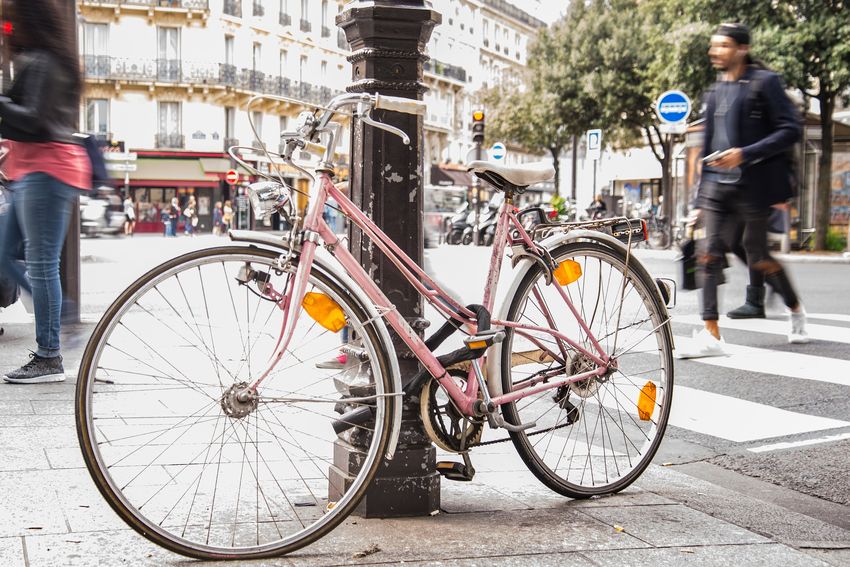
Elizabeth Yeoman
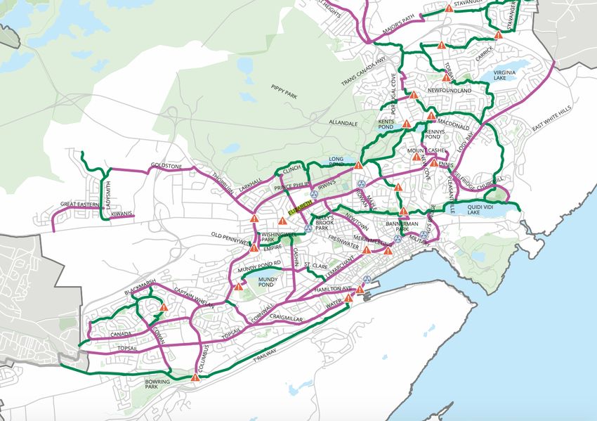
Bike St. John’s Master Plan map (p. 10) showing cycling path along Elizabeth Ave. with multi-
modal hubs on the west side of the campus and at Churchill Square. (Purple lines are on-
street cycling routes, green are routes through greenways, and the blue circles are multi-
modal hubs.)
nice mid-century houses with mature trees. Apart from the vehicle traffic, it’s fairly
quiet. It also has a pub and the first of several strip mall type developments, this
one featuring mainly legal and financial services and a hairstylist. Our first stop is
the intersection at Westerland Rd. and here we’ll take a look at some planning
proposals.
6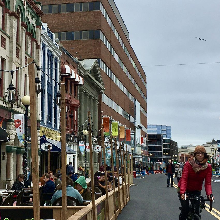
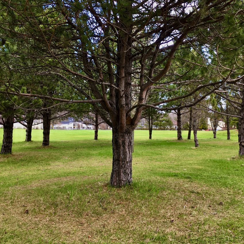
Elizabeth Yeoman

The Bike St. John’s Master Plan proposes a cycling corridor along Elizabeth
Avenue with multi-modal hubs here at Westerland Rd. and at Churchill Square.
These hubs are intended to connect bike routes and bus stops, and to provide
bike parking with secure lock-up. This gives people the option to combine
cycling, walking and using public transit. All city buses have bike racks so you
could, for example, take the bus uphill, park your bike at the Churchill Square hub
while you buy fish and fresh vegetables, fill a prescription and have a coffee with
friends, and then ride your bike downhill for the return journey. This would be part
of the solution to the challenge of St. John’s being a hilly city.

It’s also interesting to note that the MUN Area Traffic Study and the Churchill
Square re-imagining both propose bike paths as well, although they seem to be
more limited. The Traffic Study suggests a route between Freshwater and
Bonaventure along the south side of the campus. The Churchill Square proposal
shows one within the Square that seems to go nowhere but perhaps is intended
to connect to an eventual route along Elizabeth Ave.

One more thing to note at the intersection of Westerland is that the Traffic Study
proposes closing off this street altogether and adding a new road further west to
connect to Health Sciences and beyond. The study notes that Westerland Road
has both heavy vehicle traffic and large numbers of pedestrians with two of the
busiest crosswalks in the study area so doing this would definitely enhance
pedestrian safety and comfort.

Westerland to Bonaventure (MUN)
Our next stop is the MUN campus, where the magnolias are currently in flower.
The campus offers green park-like areas and pine groves along Elizabeth between
Westerland and Bonaventure, but also numerous parking lots. In 2019, the
university doubled the cost of a parking permit on campus but it is still far below
the average cost at other Canadian universities. Raising costs to closer to what
they are elsewhere would be one way of encouraging people to use other forms
of transportation.

The new MUN campus plan is still in development but the university states that
stakeholder consultations will help to find ways of protecting natural ecosystems;
promoting outdoor programs and spaces; improving safety and mobility on
streets, paths and trails; and balancing various modes of transportation (selected
from a slightly longer list for their relevance to the topic of this Jane’s Walk).

7
Elizabeth Yeoman

Limiting vehicle traffic to local, disabled and public transit on Elizabeth Ave.
would go a long way towards supporting all of these goals.

       Magnolia tree in bloom on campus.

       Newly planted birch trees on campus. This is where the proposed bike trail would run
       —hopefully there’s enough space for it. Imagine the beauty of cycling along a row of
       mature golden birch trees in fall.
8
Elizabeth Yeoman
Bonaventure to Portugal Cove Rd.
(Churchill Park and Churchill Square)
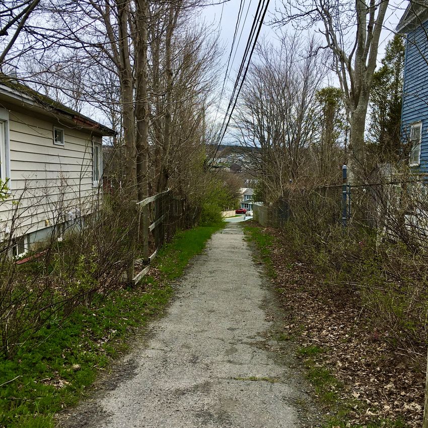
We are now in the heart of the Churchill Park neighbourhood. In the 1950s, when
this area was planned, pedestrians’ needs were still taken seriously and there are
several laneways giving easy pedestrian and cycling access to the area south of
Elizabeth Ave. and onwards to the city centre. It’s a small thing but these
laneways are significant. As the well-known heritage architect Robert Mellin put it:
“the spaces between buildings are perhaps more interesting than the buildings
themselves. The houses create wind-protected courtyards, and there is an
atmosphere of discovery and surprise when walking down these lanes…” (p. 61)
These lanes are both atmospheric and convenient, enhancing the pedestrian
experience of the neighbourhood. They could also be made wheelchair accessible
if they aren’t already.
Laneway from Elizabeth to Pinebud. Early May, when I took the photos for this walk, is
probably the least attractive time of year. I hope to go back in June and replace some
of the images with leafier ones.
9Elizabeth Yeoman
Mellin also points out that “St. John's residents are not used to thinking about
neighbourhoods planned in the 1940s and 1950s as historic, but the legacy of the
planning work for Churchill Park and the houses in this area designed by architect
Paul Meschjno just after Confederation are worthy of preservation.” (p. 56) Some
of these are right on Elizabeth Ave. or nearby, though others, sadly, have been
torn down or remodelled beyond recognition. As you walk along this stretch of
the street, keep your eye out for interesting mid-century houses and remember to
look at laneways and spaces between buildings too, to see how they relate to
each other.
Churchill Square is the commercial and social centre of this area. Public
engagement took place over the past year with a goal of taking “a holistic look at
this important area of the city; to re-imagine Churchill Square as a premiere public
space for all residents of St. John’s.” Some respondents pointed out that many
cities have beautiful public squares but St. John’s doesn’t. They saw this as an
opportunity to create one. People were excited about the potential of this project
but many were disappointed by the car-centric proposal that came out of it. All of
the groups consulted except the Churchill Square Business Association wanted
the Square to be more pedestrian oriented with more amenities (mobile vendors,
benches, tables, bike racks, lighting, etc.) and more space for socializing, more
trees, more effective year-round use of the outdoor space, better accessibility,
better connection to the park across the street and to transit. The most support in
the surveys was for outdoor seating areas, landscaping, and patios. Individual
commenters also supported all of these things and most expressed dismay at the
proposed plan. One commenter summed up the reaction of many with, “This is a
nicer parking lot, but still a parking lot.” The Business Association was alone in
placing most of their emphasis on parking (to be fair, they also said they would
like more trees).
There’s something happening behind these hoardings at Churchill Square. But will
there be trees?
10Elizabeth Yeoman
The Business Association’s response deserves further discussion. Why were they
the outlier? Almost certainly, the answer is that they believe they will lose
business if they lose parking. This has been a very hard year for many businesses
and their response is understandable. Yet, as one commenter, Josh Smee, noted:
“Research in city after city has consistently shown that businesses overestimate
the % of their customers who arrive by car and underestimate the % arriving on
foot, by bus, or by bike… You might lose some car-focused customers, sure, but
you could also gain some other ones.”
The survey found that 60% of respondents drove to the Square while 40%
walked or used active or public transit. 40% is already high for St. John’s but we
also need a fuller analysis of those figures. First, there is Josh’s point that if the
Square was re-designed for alternative forms of transportation it might attract
new customers. Second, research has shown that business revenues go up as
pedestrian safety and comfort improves. For example, a survey in Toronto
showed that customers who arrived on foot or by bicycle visited shops more
often than those who drove, and they also spent more per month. This finding
would not show up in the 40% figure for Churchill Square since respondents were
only asked how they arrived but not how often they visited or how much they
spent per visit. They may be contributing a significantly higher percentage of total
revenues. Commenters also asked how much of the parking space at the Square
was actually used by people shopping there. We don’t know the answer.
As we continue along Elizabeth Ave. from the Square, we pass another feature of
the street: the entrance to the Rennie’s River Trail, a pedestrian route that can be
taken south to downtown or north to the provincial government buildings, where it
also connects to other trails. The trail is misleadingly advertised as wheelchair
accessible but unfortunately it isn’t. The Bike Plan proposes to remedy that but
as yet there is no timeline or budget for the work to be done.
Sign indicating that the trail is wheelchair accessible but unfortunately it isn’t.
11Elizabeth Yeoman
View from the river trail with provincial government building in the background.
Portugal Cove Rd. to Torbay Rd.
Last summer, in response to the pandemic, the city announced that it would
create bike lanes and widen sidewalks to enable social distancing. It seemed like
a great initiative although in the end there was only a single pop-up bike lane
running for a few blocks along Elizabeth Ave. between Portugal Cove Rd. and
Torbay Rd. Despite its limitations, I did actually cycle up there from downtown a
couple of times just for the pleasure of riding on the street without fear, even if
only for a short distance. As cycling activist Robin Whitaker said, "I think we have
to welcome anything the city does to create space for active transportation.” But
we need more. Imagine how wonderful it would be if there was a lane-wide
cycling trail the whole length of Elizabeth Ave, maintained year round!
Meanwhile, the popularity of Piatto and Jumping Bean café at this end of
Elizabeth suggests that people want places where they can eat and socialize
without having to go downtown or to the mall. Could this be a sign that St. John’s
might yet become a fifteen minute city? Without the need for so much parking,
these venues could also have gardens and seating areas in front.
12Elizabeth Yeoman
Last summer’s bike lane. It didn’t go anywhere and I never did understand what
the occasional poles in the middle of the lane were for but it was still great to
ride safely away from the vehicles.
Jumping Bean: A great café. A garden and patio at the front instead of cars would be
possible if Elizabeth Ave. became a “Quiet Street.”
13Elizabeth Yeoman
I began this walk by talking about how hills are often seen as a challenge for
accessibility and active transportation in St. John’s, but how they don’t have to
be. Before we end our walk here at Torbay Rd. I want to mention another often
cited challenge: the weather. Summer is so short here, and even that season can
often be wet and windy. We need to find ways to live comfortably year round with
our weather. Here too, we can find inspiration in other cities. From Edmonton,
Alberta to Tromsø, Norway to Harbin, China, people celebrate the cold and snow.
They bundle up warmly and participate in all kinds of winter activities as well as
expecting to walk or cycle everywhere year round. We could do that here too.
We have started embracing winter with the Botanical Garden’s Merry and Bright
Winter Lights festival, the skating Loop downtown, and skiing and sliding at Pippy
Park. We could easily get to these venues from the centrally located Elizabeth
Ave. by active and public transportation if we were organized that way. We could
also comfortably do our daily commuting if we had clear sidewalks and less
vehicle traffic.
Transportation is a huge factor in climate change. We have to move away from
organizing our lives around private vehicles. Unlike some other changes we will
need to make, this one could actually increase our health and happiness if we do
it right. Elizabeth Ave. would be a great place to start.
Sliding with my grandson at Pippy Park, in walking distance of Elizabeth Ave.
14Elizabeth Yeoman References Articles CBC News. “MUN doubles cost of parking passes after students vote down U- Pass,” 27 March 2019. https://www.cbc.ca/news/canada/newfoundland-labrador/ mun-parking-pass-metrobus-u-pass-1.5073950 City of Toronto. “COVID-19: ActiveTO – Quiet Streets.” https://www.toronto.ca/ home/covid-19/covid-19-protect-yourself-others/covid-19-reduce-virus-spread/ covid-19-activeto/covid-19-activeto-quiet-streets/ Collier, Keith. “Churchill Park Garden Suburb.” Newfoundland and Labrador Heritage Web Site, 2011. https://www.heritage.nf.ca/articles/society/churchill- park.php Lavery, Irelyne. “Lake Shore Boulevard West closure to be included in this summer’s ActiveTO.” Toronto Star, April 7, 2021. https://www.toronto.com/news- story/10368661-lake-shore-boulevard-west-closure-to-be-included-in-this- summer-s-activeto/ Mellin, Robert. “The Destruction of Urban and Architectural Character in St. John's, Newfoundland,” 2003. https://dalspace.library.dal.ca/bitstream/handle/ 10222/70835/vol28_3_4_55_62.pdf?sequence=1&isAllowed=y O’Sullivan, Feargus. “Paris Will Ban Through Traffic in City Center.” Bloomberg CityLab, 13 May 2021. https://www.bloomberg.com/news/articles/2021-05-13/ new-paris-car-ban-will-target-through-traffic Peters, Adele. “Inside Paris Mayor Anne Hidalgo’s Ambitious Plans To Create The Post-Car City.” Fast Company, 4 April 2017. https://www.fastcompany.com/ 3069004/the-mayor-of-pariss-quest-to-get-rid-of-cars Toronto Centre for Active Transportation. “Backgrounder: The Economic Impacts of Active Transportation, October 2012. http://www.tcat.ca/wp-content/uploads/ 2014/10/Economic-Impacts-of-Active-Transportation-Backgrounder.pdf Wikipedia. “Anne Hidalgo.” https://en.wikipedia.org/wiki/Anne_Hidalgo Reports and Public Engagement Bike St. John’s Master Plan, June 2019. https://www.engagestjohns.ca/bike-st- johns-master-plan/widgets/25528/documents 15
Elizabeth Yeoman

City of St. John’s. Climate mitigation and adaptation, St. John’s, 4 November
2019. http://www.stjohns.ca/media-release/city-takes-action-climate-change

Engage St. John’s. “Re-imagine Churchill Square,” April 2021. https://
www.engagestjohns.ca/re-imagine-churchill-square

Engage St. John’s. Sidewalk Snowclearing public engagement, August 2020.
https://www.engagestjohns.ca/sidewalk-snow-clearing

MUN Area Traffic Study, 7 August 2017. http://www.stjohns.ca/publications/mun-
traffic-study-final-report

MUN St. John’s Campus Plan, January 2007. https://www.mun.ca/facman/
campus-master-plan/about/2007_SJC_Master_Plan_Optimized.pdf

MUN Campus Master Plan (ongoing). https://www.mun.ca/facman/campus-
master-plan/about/

Vision for the campus master plan. https://campusmasterplanmemorial.com/
vision.

16
You can also read