REIMAGINING LAUREL COMPREHENSIVE PLAN 2018 - FINAL PLAN

Page created by Eric Powers
 
CONTINUE READING
REIMAGINING LAUREL COMPREHENSIVE PLAN 2018 - FINAL PLAN
REIMAGINING LAUREL
COMPREHENSIVE PLAN   2018
      FINAL PLAN
REIMAGINING LAUREL COMPREHENSIVE PLAN 2018 - FINAL PLAN
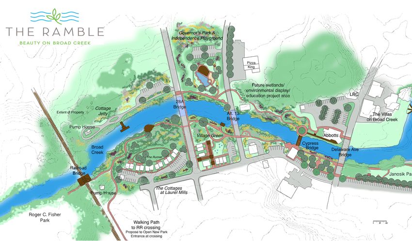
Participation                                                                                                    Table of Contents
                                                                                                                   1.      Introduction and Guiding Principles							 6
  MAYOR AND TOWN COUNCIL
John J. Shwed, Mayor                                                                                               2.      Demographics and Economic Conditions 						                                     12
Chris Calio, President of Council, Councilman at Large, Fourth Ward
Don Phillips, Councilman at Large, Second Ward                                                                     3.      Downtown Development District and Community Design 				                         20
Robin Fisher, Councilwoman, Second Ward
                                                                                                                   4.      Housing Choices 									33
Randy Lee, Councilman, First Ward
Jonathan Kellam, Councilman, Third Ward                                                                            5.      Historic and Cultural Resources 							40
Cheryl Martin, Councilwoman, Fourth Ward
                                                                                                                   6.      Economic Development 									48
  LAUREL PLANNING AND ZONING COMMISSION                                                                            7.      Environmental Sustainability 								60
Brent Boyce, Chairman                                                                                              8.      Transportation and Mobility 								77
Michelle Daisey, Board Member
Daniel Ash, Board Member                                                                                           9.      Infrastructure and Community Facilities 						                                  86
Randy Radish, Board Member
William Hearn, Board Member                                                                                        10.     Land Use and Annexation 								90
William Martin, Board Member
                                                                                                                   11.     Recommendations and Impementation 							98

  LAUREL PLAN ADVISORY TEAM                                                                                        12.     Intergovernmental Outreach and Acknowledgements 				                            104
Denise Brown                                         Matt Parker                                                   For a more detailed table of contents, including maps and charts, see next two pages.
Donald Dykes                                         Jeffrey and Laurie Roberts
Edward Lewandowski                                   Brian Shannon
Mike Mercer                                          Jamie Smith, Town Manager
Deborah Mitchell

Plan prepared, written and designed by
Cedar Creek Planning & Communications
Lee Ann Walling, AICP and LEED AP, with contributions
from Edward Lewandowski, University of Delaware Sea
Grant Program                                                                       This plan is funded
Key maps were prepared by Nicole Minni, GISP, Associate
                                                                                    through Delaware’s
Policy Scientist, Institute for Public Administration,
                                                                                    Neighborhood Building
University of Delaware.
                                                                                    Blocks Fund.

Cover photo credits                                              Opposite photo credits
Top left, Paula Shannon                                          Clockwise, from upper left: Ed Lewandowski, Lee
Top right, Edward Lewandowski                                    Ann Walling, Delaware State Archives, Lee Ann
Right, from Tidewater Park concept drawings by Earthscape        Walling, Laurel School District, Jamie Smith
Bottom left, Lee Ann Walling
REIMAGINING LAUREL COMPREHENSIVE PLAN 2018 - FINAL PLAN
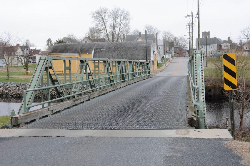
1. Introduction and Guiding Principles                                                                                                                                          8. Transportation and Mobility
A town at a critical crossroads 			                   6                                                                                                                         The road to a more complete and healthy community 77
Beyond a bedroom community 			                        6                                                                                                                         Sidewalks a priority for the town 			             77
                                                                                                                  6. Economic Development
Why we plan 			                                       7                                                                                                                         Poplar Street bridge and foot traffic 		          78
Public engagement                                    7                                                            Toward a focused, realistic jobs strategy 			         48      Replacement of bridges 			                        78
Survey 				                                          9                                                            A five-part strategy 					48                                  Truck traffic in downtown Laurel 			              80
The Guiding Principles 			                          10                                                            Fully activate Downtown Development District 			      49      Corridor preservation 				80
Fig. 1-1 Community Values - weighted averages       11                                                            Coordinate with Laurel Redevelopment Corporation 		   50      Salisbury/Wicomico MPO 			                        81
                                                                                                                  Implement Laurel’s Nature/Heritage Tourism Report 		  52      Transit in Laurel 				                            83
2. Demographics and Economic Conditions                                                                           Facilitate commercial development along US 13 			     54      Bicycle/Pedestrian plans 			                      83
An “invisible” population that is young and poor    12                                                            Incorporate Laurel’s new brand more thoroughly 		     59      Safe Routes to Schools				                        84
Racial Composition                                  14                                                            Fig. 6-1 Top employers in Laurel 			                  48      Laurel Airport 				84
Employment in Laurel                                14                                                            Fig. 6-2 Inflow-outflow job counts			                 49      Nanticoke Heritage Byway 			                      84
Position on population growth                 		    16                                                            Fig. 6-3 Downtown Development District 			            50      Fig. 8-1 Future traffic volumes 			               79
A long-term buildout                          17                                                                  Fig. 6-4 Local Economic Return - Indies vs. Chains 		 53      Fig. 8-2 Proposed truck route 			                 81
Fig. 2-1 Population 1960-2014			12                                                                                Fig. 6-5 Sample wages by industry, Sussex County 		   55      Fig. 8-3 Salisbury MD-DE Urbanized Areas 		       82
Fig. 2-2 Top 10 commuting destinations		      13                                                                  Fig. 6-6 Analysis areas - potential business park 		  56      Fig. 8-4 Nanticoke Heritage Byway 		              85
Fig. 2-3 Income and poverty			                13                                                                  Fig. 6-7 Potential business park analysis matrix		    57
Fig. 2-4 Laurel’s age bubble 			              13                                                                                                                                9. Infrastructure and Community Facilities
Fig. 2-5 Laurel racial composition 		         14
                                                                                                                  7. Environmental Sustainability                               Water and wastewater: Room to Grow 		             86
                                                                                                                  A focus on protecting Laurel’s greatest natural asset 		 60   Three new schools for Laurel 			                  88
Fig. 2-6 Industries and occupations 		        15
                                                                                                                  Laurel’s wastewater treatment plant 			                  62   Other community facilities 		                     89
Fig. 2-7 Inflow/outflow job counts 		         16          4. Housing Choices                                      Municipal Separate Storm Sewer System requirements 		    64   Fig. 9-1 Location of Laurel’s water wells 		      86
Fig. 2-8 Top employers in Laurel 		           17          Aging housing stock, affordability troubles		      33   New state onsite wastewater regulations 			              66   Fig. 9-2 Extension of wastewater in Laurel 		     87
Fig. 2-9 T-4 suburban tile description        17          Publicly subsidized housing 			                    36   Laurel’s stormwater retrofit project 			                 66
Fig. 2-10 What buildout will look like 		     18          Recession made large projects evaporate 		         37                                                                 10. Land Use and Annexation
                                                                                                                  Source water protection 				                             67
Fig. 2-11 Growth and annexation profile map		 19                                                                                                                                Annexation should focus on infill 		              90
                                                          Focus on rehabilitation and home ownership 		      38   Town should consider action on tree canopy 			           68
                                                          Laurel is an affordable town 			                   39                                                                 Review zoning within DDD			                       92
                                                                                                                  Parks and recreational needs 				                        74
3. Downtown Development District                          Fig. 4-1 Key housing comparisons 		                34   Repurposing of Dunbar Elementary School 			              76
                                                                                                                                                                                Additional residential opportunities 		           92
   and Community Design                                   Fig. 4-2 Publicly subsidized housing in Laurel     37   Fig. 7-1 Environmental features 				61
                                                                                                                                                                                The future of a business or industrial park 		    92
Revitalizing Laurel’s core 			                      20                                                                                                                          The essence of Laurel 				                        96
                                                                                                                  Fig. 7-2 Plant meets Chesapeake standards			             62
Category 1: Adjust zoning and permitted land uses   21                                                                                                                          Future Land Use designations 			                  96
                                                                                                                  Fig. 7-3 Nutrient baseline and goals for Laurel 		       63
Category 2: Bring The Ramble to life 		             25
                                                          5. Historic and Cultural Resources                                                                                    Fig. 10-1 Existing Land Use 			                   91
                                                                                                                  Fig. 7-4 Treatment plant waste load allocation 		        64
Category 3: Improve community housing 		            26    It all began at the wading place 			               40                                                                 Fig. 10-2 Annexation Areas 			                    93
                                                                                                                  Fig. 7-5 Impaired water bodies in and around Laurel 		   65
Category 4: Protect Broad Creek 			                 28    Laurel’s influence exceeded its size 			           40                                                                 Fig. 10-3 Laurel and the State Strategies 		      95
                                                                                                                  Fig. 7-6 Laurel source water protection areas 		         69
Community design beyond the DDD plan 		             31    Shipbuilding an early industry 			                 41                                                                 Fig. 10-4 Futue Land Use 			                      97
                                                                                                                  Fig. 7-7 Promoting ecological design in Laurel 		        71
Poplar Street pedestrian bridge 			                 31    Marvil left his mark on Laurel 			                 42   Fig. 7-8 Laurel’s flood zones 				                       72   11. Recommendations and Implementation
Library and Arts District 			                       31    Schooner vs. train, 1904				                       43   Fig. 7-9 Sea level rise scenarios 			                    73   Recommendations by Guiding Principle 		           98
US 13 corridor 				                                 31    Laurel’s Historic District 			                     45
                                                                                                                                                                                Implementation Plan and Timetable                 102
Fig. 3-1 Downtown Development District 		           21    DDD presents opportunity for preservation 		       45
Fig. 3-2 Zoning within DDD			                       22    Creation of Historic Advisory Board 		             47                                                                 12. Intergovernmental Outreach
Fig. 3-3 The Ramble plan 			                        24    Historic and cultural assets as tourism strategy   47                                                                 Coordination with state government and others		   104
                                                          Fig. 5-1 Laurel’s Historic District 		             46                                                                 Reports and studies referenced in this plan 		    105
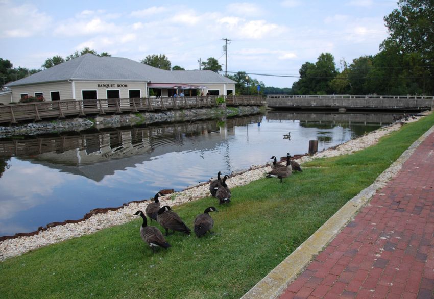
REIMAGINING LAUREL COMPREHENSIVE PLAN 2018 - FINAL PLAN
Introduction and
              guiding principles                                                                                      1          younger population that lives in Laurel’s subsidized housing complexes and relative-
                                                                                                                                 ly cheap rentals but works elsewhere. They are not invested in the town, present or
                                                                                                                                 future. Yet they are citizens, and their children are attending Laurel’s schools.

                                                                                                                                 These are challenges, but it shows community spirit, resolve and foresight to recog-
                                      A TOWN AT A CRITICAL CROSSROADS
                                                                                                                                 nize them and agree on a plan for moving forward. This plan lays out those challenges,
                                   Laurel is a town on the brink of reimagining itself. The choices that its leaders make in     as well as promising opportunities. It provides recommendations framed by guiding
                                   the coming months and next few years have the potential to transform it into a town           principles that were developed by citizens and leaders during a lengthy public engage-
                                   where more people will live, work and visit - with an attractive mix of housing choices,      ment process.
                                   small businesses and light manufacturing jobs, and a revitalized waterfront.
                                                                                                                                 Why we plan                                                                                   The Laurel Plan
                                   The potential for Laurel to be recognized as a launching pad for nature-based and
                                                                                                                                 A municipality in Delaware is required to update its comprehensive plan every 10
                                   heritage tourism is profound. Nestled in the Nanticoke watershed, it is waiting to be                                                                                                       Advisory Team,
                                                                                                                                 years, according to Title 22, Chapter 7, Section 702 of the Delaware Code. Laurel’s was
                                   discovered by birders, paddlers, cyclists, history buffs, people who hunt and fish, and
                                                                                                                                 last updated in 2011, but the town chose to revisit it early because of significant devel-    appointed by Town
                                    nature photographers.
                                                                                                                                 opments occurring within its borders.
                                                                                                                                                                                                                               Council, helped
                                                          Laurel is poised for a rebirth of its business district and Broad
                                                          Creek waterfront with its designation as a Downtown Devel-
                                                                                                                                 The code lays out specific elements that must be included in a town’s comprehensive           guide the plan’s
                                                                                                                                 plan (see State of Delaware Comprehensive Plan Checklist). The plan is reviewed by
                                                        opment District and the continued work of the Laurel Redevel-                                                                                                          development.
                                                                                                                                 the Office of State Planning Coordination and state agencies through the Preliminary
                                                         opment Corporation. The town needs to adopt a laser focus on
                                                                                                                                 Land Use Service. If the plan meets state requirements, it is certified by the Governor.
                                                        the Central Avenue and Market Street corridor. Also, the town
                                                       should aggressively address dilapidated properties that have been         More important than crossing off items on a checklist is ensuring that the plan is a
   Laurel’s brand was developed
                                                   vacant for years, as well as landlords who are chronic violators of the       living and readable document that represents the realities, as well as the vision, of
   with community input in
   2016 by Arnett, Muldrow         town’s codes. They pose a health and safety hazard to residents, as well as a deterrent       the Town of Laurel. It should not be steeped in jargon, but written in plain language.
   and Associates. Below,          to new investment and Laurel’s reputation as a haven for history.                             If necessary, this plan will define or explain terms that planners and agency staff may
   Laurel became a Downtown
                                                                                                                                 take for granted.
   Development District in 2016.   Laurel needs to grow and diversify its tax base.. But it is critical that town leaders take
                                   a long view. After all, it took decades for Laurel, once the most prosperous town in          The plan also must be realistic in its recommendations and implementation schedule.
                                   Delaware, to expereince these 21st-Century challenges. What apepars to be a quick fix         Laurel is a small, rural town with limited capacity for absorbing, prioritizing and execut-
                                   could damage the town’s character and severely strain town services and infrastruc-           ing a litany of recommendations. This plan groups recommendations by the Guiding
                                   ture. Likewise, the town should safeguard Broad Creek, its most valuable natural              Principles that will be discussed in the next section and focuses on how the town can
                                   assets, from development that threatens water quality and Laurel’s verdant riverside          reasonably implement them.
                                   tree canopy.
                                                                                                                                 Public engagement began in 2012
                                   Laurel’s municipal boundaries are somewhat confusing – especially along the U.S. 13
                                   corridor. The town should consider filling in those enclaves to ensure that the com-          The leaders and residents of Laurel have been engaged in thinking about the future
                                   mercial development it seeks along its highway corridor will actually locate within           of the town since discussions began in 2012 about how to protect water quality along
                                   town limits. It needs to address unsightly properties at gateways into the town.              Broad Creek in light of new federal water-quality standards. That discussion evolved
                                                                                                                                 into a vision for redevelopment along Broad Creek called The Ramble. The Ramble
                                   Beyond a bedroom community
                                                                                                                                 plan was unveiled at Laurel’s Public Library on September 18, 2014. It will be discussed
                                   Laurel is essentially functioning as a bedroom community. Remarkably, according to            later in this plan, but it is a vision for mixed-use redevelopment that includes a Village
                                   the U.S. Census, only 78 people both live and work in the town. There is an “invisible”       Green, waterfront cottages, a nature-based playground, a kayak launch, an outdoor

6 | REIMAGINE LAUREL COMPREHENSIVE PLAN                                                                                                                                                                                INTRODUCTION AND GUIDING PRINCIPLES | 7
REIMAGINING LAUREL COMPREHENSIVE PLAN 2018 - FINAL PLAN
wetlands education classroom and other features that make waterfront redevelop-            In October 2016, the town and Laurel Redevelopment Corporation held a workshop
                                     ment attractive while safeguarding water quality and avoiding the floodplain.              and tour in conjunction with the LRC’s Strong Neighborhoods Fund application.

                                     The Ramble plan is becoming a reality. Laurel’s Downtown Development District appli-       As the plan is written, key findings and concepts are being shared in blog posts on the
                                     cation process began in late 2014, building on that vision for Laurel’s central core and   Reimagine Laurel website.
                                     waterfront. The town is applying for a Strong Neighborhoods Fund grant to improve
                                     the blighted Old Town neighborhood immediately adjacent to The Ramble footprint.           All these efforts engaged town leaders, citizens, nonprofits and business owners in a
                                                                                                                                focused conversation about how their town should grow. They built on, corroborated
                                             Laurel’s planning team, which includes the University of Delaware’s Sustain-       and amplified each other. Laurel has articulated a very clear path for redevelopment
                                             able Coastal Communities program, secured Delaware Economic Develop-               and growth and how to accomplish it.
                                             ment Office (DEDO) resources for a “Better Block” community engagement
                                             effort that brought The Ramble to life for a day in September 2015. A “Re-         The survey
                                             imagine Laurel” website was launched to include information about The
                                                                                                                                The Laurel Plan Advisory Team developed a community survey that was launched on-
                                             Ramble, the Downtown Development District, the comprehensive plan, and
                                                                                                                                line via Survey Monkey on June 24, 2016. The 28-question survey was promoted on the
                                             other related initiatives.
                                                                                                                                Reimagine Laurel website, by the town in a press release and mailings, and by posters
                                             Ben Muldrow of Arnett, Muldrow and Associates was engaged to help the              and business cards distributed throughout the town.
                                             town develop and launch a new brand. Those DEDO resources also were used
                                                                                                                                The survey generated 355 responses. About 29 percent of the respondents lived within
                                             to engage Community Conservation Consultants to work with community
                                                                                                                                the town limits, another 41 percent lived outside the town but within the 19956 zip
                                             leaders on a strategy for making Laurel a “base camp” for nature and heritage
                                                                                                                                code, and 40 percent lived outside Laurel’s town limits and zip code.
                                             tourism in the Nanticoke region.
                                                                                                                                The respondents were presented with a set of values to rank, which led to the guiding
                                             In March 2016, the Laurel Town Council and Laurel Planning and Zoning
                                                                                                                                principles discussed below. The raw survey results for these weighted values are show     Above, posters and business
                                             Commission kicked off the comprehensive plan update. The Town Council
                                                                                                                                in Figure 1.1. They demonstrated a clear desire for the town to grow (63%) rather than    cards were distributed in
                                             appointed a Laurel Plan Advisory Team to help guide the efforts of the con-                                                                                                  an effort to promote the
                                                                                                                                to remain roughly the same size (37%). They indicated a clear preference for “more
                                             sultant, Cedar Creek Sustainable Planning Services. As of November 2016, the                                                                                                 community survey. Below left,
                                                                                                                                unique shopping within Laurel’s business district” (64%) over “familiar chain retail
                                             advisory team has met five times at the Laurel Public Library. The consultant                                                                                                a “wordle” featuring most
                                                                                                                                stores along U.S. 13” (36%).                                                              common responses from the
                                             used Orton Foundation’s Community Heart and Soul resources to guide the
 The Fall Ramble in September 2015                                                                                                                                                                                        comments portion of the survey.
                                             work and decision-making of the Advisory Team.                                     They were almost equally split over whether to focus on repairing and improving
 engaged the Laurel community in
 envisioning what a redeveloped                                                                                                 roads in town (53%) or on providing more opportunities to walk and bike safely (47%).
                                     The Plan Advisory Team developed an online survey that was launched in June 2016.
 Broad Creek waterfront would                                                                                                   They expressed a very strong preference for “filling in vacant areas and fixing up his-
 look and feel like.                 From those 355 responses and interviews conducted with town leaders, citizens and
                                                                                                                                toric properties” (81%) vs. “new single-family homes in new subdivisions” (19%).
                                     business owners, the Advisory Team developed and approved six Guiding Principles
                                     that would drive the comprehensive plan’s recommendations.

                                     In August 2016, 72 acres of Laurel’s downtown core were designated as a Downtown
                                     Development District.

                                     In September 2016, Conservation Community Consultants presented their nature/heri-
                                     tage tourism strategy to Town Council. Also that month, Town Council heard extensive
                                     recommendations for growing while protecting water quality along Broad Creek – the
                                     original topic that initiated all the public discussion and participation back in 2012.

8 | REIMAGINE LAUREL COMPREHENSIVE PLAN                                                                                                                                                                            INTRODUCTION AND GUIDING PRINCIPLES | 9
REIMAGINING LAUREL COMPREHENSIVE PLAN 2018 - FINAL PLAN
They also had the opportunity to open-endedly discuss what was most important to
                                 them about Laurel, what is the town’s biggest strength, what would they like to see
                                 happen in Laurel in the next 5-10 years, and what concerns them the most about Lau-
                                 rel today.

                                 A presentation on the survey results is available on the Reimagine Laurel website. So
                                 are complete survey results.

                                 The Guiding Principles
                                 On July 21, 2016, the Laurel Plan Advisory Team met at the Laurel Public Library to
                                 draft and approve a set of Guiding Principles. Any recommendations for the compre-
                                 hensive plan would be weighed against these principles.
   All recommendations in
                                    •      We will be a close-knit community that creates walkable streets, safe
   this plan will conform                  neighborhoods and attractive public places so that all our residents feel
   with the Guiding                        secure and confident about their town.

   Principles developed             •      We will improve the appearance of Laurel’s homes, commercial build-
                                           ings and properties to honor our history, build community pride and
   and adopted by the                      attract new residents and businesses.
                                                                                                                         A Laurel Plan Advisory Team meeting at the Public Library. Below, results from the community survey indicate what both
   Laurel Plan Advisory             •      We will attract a strategic mix of new small businesses, entrepreneurs,       residents and non-residents value about Laurel.
                                           small manufacturers and shopping that will provide quality employment
   Team.
                                           for our citizens and meet community needs.
                                    •      We recognize Broad Creek as our greatest natural asset and a focal
                                           point for recreation, relaxation, nature tourism and sustainable water-           Fig. 1-1
                                           front development.
                                    •      We will encourage home ownership and housing choices, via both
                                           restoration and new development compatible with Laurel’s community
                                           character, to attract new residents and raise the standard of living for
                                           all our citizens.
                                    •      We value our downtown as the heart of Laurel’s identity, history and
                                           commerce and are committed to redeveloping it as our hub for eco-
                                           nomic growth, tourism and small-town living.

                                 These principles reflect the town’s position on community character and on critical
                                 community development issues. More data will be provided to enforce these aspira-
                                 tional statements.

10 | REIMAGINE LAUREL COMPREHENSIVE PLAN                                                                                                                                                                           INTRODUCTION AND GUIDING PRINCIPLES | 11
REIMAGINING LAUREL COMPREHENSIVE PLAN 2018 - FINAL PLAN
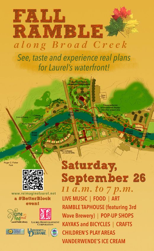
Demographics and economic
            conditions
                                    AN “INIVISBLE” POPULATION THAT IS YOUNG AND STRUGGLING
                                                                                                                      2           1
                                                                                                                                      TOP 10 COMMUTING DESTINATIONS
                                                                                                                                         Zip code
                                                                                                                                         19973 Seaford
                                                                                                                                                                    Count
                                                                                                                                                                    233
                                                                                                                                                                            Share
                                                                                                                                                                            13.3
                                                                                                                                                                                          INCOME AND POVERTY
                                                                                                                                                                                        Statistics
                                                                                                                                                                                        Median household income
                                                                                                                                                                                                                          Laurel Delaware
                                                                                                                                                                                                                           $33,387         $60,231
                                                                                                                                                                                        Poverty rate, last 12 months -
                                                                                                                                  2      19956 Laurel               137     7.8                                             24.7%             8.2%
                                  People may be surprised to learn that Laurel is a very young town, with a median age                                                                  all families
                                  of only 27.7, according to the U.S. Census 2010-2014 American Community Survey. The             3      21801 Salisbury, Md.       118     6.8         Poverty rate, last 12 months -
                                                                                                                                                                                                                            54.8%            23.3%
                                                                                                                                                                                        single female household head
                                  largest age cohort is under 5 years; it comprises 14.5 percent of the town’s population.
                                                                                                                                  4      19947 Georgetown           113     6.5
                                  This bubble is likely to pose a strain on Laurel’s school district in the near future, as the                                                         Receiving SNAP/Food stamps          42.6%            12.7%
                                  district is already near capacity with its three new schools.                                   5      19966 Millsboro            105     6.0         % Unemployed                        10.2%             8.5%
     Laurel has a                 These younger Laurel residents comprise an “invisible” population that mostly works             6      19901 Dover                76      4.4         % Rental                            43.9%           28.4%
     surprisingly young           outside the town limits. They live in one of Laurel’s four subsidized housing complexes,
                                                                                                                                  7      21804 Salisbury, Md.       75      4.3         % Vacant housing units               11.3%           17.6%
                                  or in the relatively cheap rentals that represent about 45 percent of Laurel’s housing.
     population; the                                                                                                              8      19720 New Castle           61      3.5
                                  In fact, only 78 people actually live and work                                                                                                        % Low-moderate income                 50%            37.8%
     median age is only           within the town limits—out of a workforce
                                                                                       POPULATION 1960-2014                       9      19904 Dover                51      2.9                                  All Census data are from the 2010-
     28. A large “bubble”         of 1,746. The top five work destinations for                                                                                                          Fig. 2.2     Fig. 2.3    2014 American Community Survey.
                                  Laurel residents by zip code are Seaford                                                        10     19975 Selbyville           46      2.6
     of young children                                                               Year       Population % Change
                                  19973 (13.3%), Laurel 19956 (7.8%), Salis-
                                                                                      1960       2,709           --
     comprises almost             bury 21801 (6.8%), Georgetown (6.5%) and
                                  Millsboro (6.0%). The average travel time to        1970       2,403           -11.3
     15% of the town’s            work is 28 minutes.                                                                                                                               Fig. 2.4
     population.                                                                      1980       3,052           +27.0
                                  With this daily exodus of workers, Laurel                                                                   14.5% of Laurel’s
                                  essentially functions as a bedroom commu-          1990     3,312           +8.5
                                                                                                                                              population is under
                                  nity— but not in the traditional suburban          2000     3,668           +10.5                           5 years old
                                  sense. This creates a dynamic where a large,
                                  younger segment of the population does             2010     3,708           +1.2
                                  not feel vested in the town or its future.
                                                                                     2014     3,842           +3.6
                                  They are relatively poor and isolated in their
                                  work and housing conditions. By the destina-
                                                                                                Fig. 2.1
                                  tions of their daily commute (see Figure 2.2),
                                  it appears likely that many are working in poultry processing operations. They have a
                                  lot of young children.

                                  If they are invisible, poor and not participating in community life, it becomes more
                                  unlikely that Laurel’s town and school taxpayers will support them and their children,
                                  or that they themselves will have the capacity to help Laurel lift itself from its challeng-
                                  ing demographics. Almost a quarter of Laurel’s families were below the poverty rate in
                                  2014, and almost 43 percent were receiving food stamps.

12 | REIMAGINE LAUREL COMPREHENSIVE PLAN                                                                                                                                                                DEMOGRAPHICS AND ECONOMIC CONDITIONS | 13
REIMAGINING LAUREL COMPREHENSIVE PLAN 2018 - FINAL PLAN
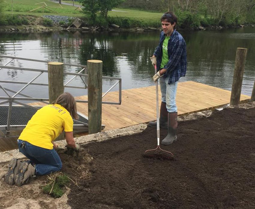
Almost half of Laurel’s population with a mortgage are spending more than 30 percent        Industries and occupations for Laurel age 16 and older (2010-2014)                      Fig. 2.6
                                  of their income on housing costs, an indicator that they are struggling to make ends
                                                                                                                                                                        Management,                                            Natural               Production,
                                  meet.                                                                                                                                 business,                                              resources,            transportation,
                                                                                                                                                                        science,                              Sales and        construction,         and material
                                  Out of 914 families in Laurel, 90 were earning between $100,000 and $149,999. No                                                      and arts            Service           office           and maintenance       moving
                                  family was earning more than $150,000, according to the Census data.                       Category                          Total    occupations         occupations       occupations      occupations           occupations
                                                                                                                             Civilian employed population      1,460    14.7%               26.9%             24.5%            8.8%                  25.0%
                                  Racial composition                                                                         16 years and over
                                                                                                                             Agriculture, forestry, fishing    21       0.0%                0.0%              0.0%             100.0%                0.0%
                                  Racially, Laurel has a minority white population. According to the 2010-2014 American      and hunting, and mining
                                  Community Survey, 43 percent of residents are white; 42 percent are African-Ameri-         Construction                      47       0.0%                0.0%              0.0%             100.0%                0.0%
                                  can; 11 percent are Hispanic/Latino; and 4 percent are other.                              Manufacturing                     227      0.0%                3.1%              0.0%             0.0%                  96.9%
                                                                                                                             Wholesale trade                   46       0.0%                0.0%              0.0%             73.9%                 26.1%
                                                                                                                             Retail trade                      363      0.0%                9.4%              70.2%            3.0%                  17.4%
                                                                                                                             Transportation and                35       0.0%                0.0%              0.0%             45.7%                 54.3%
                                                                                                                             warehousing, and utilities
                                                                                                                             Information                       0        -                   -                 -                -                     -
                                                                                                                             Finance and insurance, and        47       10.6%               14.9%             74.5%            0.0%                  0.0%
                                                                                                                             real estate and rental and
                                                                                                                             leasing
                                                                                                                             Professional, scientific,         61       0.0%                78.7%             0.0%             0.0%                  21.3%
                                                                                                                             and management, and
                                                                                                                             administrative and waste
                                                                                                                             management services
                                                                                                                             Educational services, and         340      43.5%               44.7%             11.8%            0.0%                  0.0%
                                                                                                                             health care and social
                                                                                                                             assistance
                                                                                                                             Arts, entertainment,              172      8.1%                69.8%             4.1%             0.0%                  18.0%
                                                                                                                             and recreation, and
                                                                                                         Fig. 2.5            accommodation and food
                                                                                                                             services
                                                                                                                             Other services, except public     66       53.0%               28.8%             18.2%            0.0%                  0.0%
                                                                                                                             administration
                                  Employment in Laurel                                                                       Public administration             35       37.1%               17.1%             25.7%            0.0%                  20.0%

                                  In 2014, there were 956 full-time primary jobs within Laurel’s town limits, according to
                                                                                                                             PERCENT IMPUTED
                                  the U.S. Census Bureau’s Center for Economic Studies. A primary job is defined as the       Industry                         11.1%    (X)                 (X)               (X)              (X)                   (X)
                                  job that earned an individual the most money.
                                                                                                                             Industries (left column) are based on the North American Industry Classification System (NAICS). Occupational codes (top row) are
                                  According to the center’s Longitudinal Employer-Household Dynamics Program, only           based on Standard Occupational Classification 2010. The smaller the sample, the higher the potential for error. Note: The numbers
                                  78 of those jobs are held by residents of Laurel. Every work day, 1,668 Laurel residents   for employed civilians in this chart (1,460) differs from the Center for Economic Studies table’s total of 1,746 (Fig. 2.6) because they
                                  leave the town limits to work somewhere else, and 878 workers come from outside            represent a five-year survey average (2010-2014), and the CES numbers are only for 2014.
                                  the town limits to work in Laurel.

                                  The three largest industry sectors within Laurel are health care and social assistance
                                  (14.9%), retail trade (14.7%), and manufacturing (14.5%). The detailed chart in Figure
                                  2.5 shows how residents of Laurel are employed, whether or not those jobs are in Lau-
                                  rel. The civilian employed population over 16 totals 1,460.

14 | REIMAGINE LAUREL COMPREHENSIVE PLAN                                                                                                                                                                              DEMOGRAPHICS AND ECONOMIC CONDITIONS | 15
REIMAGINING LAUREL COMPREHENSIVE PLAN 2018 - FINAL PLAN
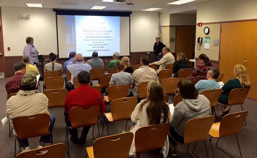
See Fig. 2.7 at left for a rough breakdown of Laurel’s largest employers. Laurel’s em-   Laurel needs to transform itself from a bedroom community with an invisible,
                                          ployment picture and economic development are discussed in Chapter Six.                  disengaged population to a truly complete community with engaged citizens                                     Fig. 2.8
                                                                                                                                   who work in town, own a business, or are actively retired and enjoying the rec-
                                                                                                                                   reational opportunities in and around Laurel.
               Fig. 2.7                                                                                                                                                                                                             Top employers in Laurel
                                                                                                                                   Planned, steady population growth that follows this plan and includes Laurel’s
                                                                                                                                                                                                                                      Employer                     No.
  Inflow/outflow job counts                                                                                                        central core, development of commercial parcels along US 13 and careful build-
                                                                                                                                                                                                                                1     Laurel school district       271
                                                                                                                                   out far from Laurel’s central core is preferable to reactive, “leap-frog” growth
                                                                                                                                                                                                                                2     Food Lion                    65
                        Count     Share                                                                                            that could strain town services.                                                             3     Town of Laurel               32
 Employed in Laurel        956     100%
                                                                                                                                                                                                                                4     D&C Auto Sales               32
 town limits                                                                                                                       A long-term buildout
 Employed in Laurel        878     91.8%                                                                                                                                                                                        5     Schwan’s Home Service        30
 but living outside                                                                                                                The University of Delaware Sustainable Coastal Communities Initiative, Office                6     US Postal Service            26
                                                                                                                                   of State Planning Coordination, and town leaders worked together in 2013-14                  7     Insurance Market             24
 Employed and living        78      8.2%
                                                                                                                                   to visualize how and where Laurel should grow. Innovative, hands-on mapping                  8     Health and Social Services   22
 in Laurel
                                                                                                                                                                                                                                      - Poplar St.
                                                                                                                                   techniques were used to define a study area and guide participants to suggest
                                                                                                                                                                                                                                9     M&T Bank                     22
 Workforce living in      1,746    100%                                                                                            where different types of growth should occur. The land-use modeling process
 Laurel                                                                                                                                                                                                                        Source: Delaware Economic
                                                                                                                                   used a set of 100-acre tiles or squares to describe the land uses of a particular
 Living in Laurel but     1,668    95.5%                                                                                                                                                                                       Development Office. This table lists
                                                                                                                                   area.                                                                                       only the top 9, as there are many
 employed outside
 Living and employed        78      4.5%
                                                                                                                                                                                                                               businesses cited with 20 employees.
                                                                                                                                   Each 100-acre square represents a community of varying land uses and housing
 in Laurel
                                                                                                                                   densities – either in existence today or as a possibility in the future. The com-
Source: Center for Economic Studies,                                                                                               munities represented include:
U.S. Census Bureau                        Position on population growth
                                                                                                                                   •   Rural Communities (a 100-acre farm or natural preserve; 5-20 acre farms
                                          Laurel’s leadership and citizens would like to see the town grow. Over the past              or agricultural business; or a rural village);
                                          decade growth has been slow. A large development that would have brought more
                                                                                                                                   •   Residential Communities (a suburban community of single-family and/or
                                          than 1,800 residential units to the northernmost section of town east of U.S. 13 fell
                                                                                                                                       multi-family homes, such as Suburban T4 depicted in Fig. 2.9 below);
                                          through during the recession.
                                                                                                                                   •   Mixed-Use Communities with both residential and non-residential prop-
                                          Because Laurel is skewed toward a younger population, the town should consider a             erties and
                                          growth strategy that includes pre-retirement and retirement-age adults, as well as       •   Non-residential Communities (Employment Centers such as business
                                          residents who can work from their home and choose to live a small-town life. These           parks, large schools and institutions, or government centers and regional
                                          could be people who enjoy outdoor pursuits, such as kayaking and birding and can             retail centers).
                                          take an active role in their community.

                                          These people are already finding their way to Laurel. They may be more interested in
                                          renovating an existing historic home than in purchasing a new home in a subdivision.
                                          The town is headed in that direction with its nature and heritage tourism economic
                                          development strategy and plans to revitalize the waterfront and central business dis-
                                          trict — including the development of a pocket neighborhood of cottages on Broad
                                          Creek.

                                                                                                                                   Fig. 2.9    Visualizing what the T4 suburban tile will look like built out, on the ground. Source: University of Delaware

16 | REIMAGINE LAUREL COMPREHENSIVE PLAN                                                                                                                                                                                  DEMOGRAPHICS AND ECONOMIC CONDITIONS | 17
REIMAGINING LAUREL COMPREHENSIVE PLAN 2018 - FINAL PLAN
Rural Communities are the least dense, at one dwelling unit             The University and Office of State Planning Coordination
 per 100 acres. The spectrum continues through low-densi-
 ty rural development to suburban to mixed use to com-
                                                                         agreed on a set of assumptions to generate the buildout
                                                                         table below. The “Growth and Annexation Scenario”
                                                                                                                                             Scenario Profile: Growth and Annexation
 mercial uses.                                                           matches the map at right. The map shows land-use types,             Laurel and Bethel Master Plan - Chesapeake Bay Watershed Implementation Plan (WIP)
                                                                         but is not a zoning map. The buildout scenarios do not
 After the town visualized and mapped Laurel’s future using              include the longer-term annexation areas depicted in the
 the 100-acre land-use tiles, the University generated a par-            2011 plan and shown on page 93.
 cel-based map. The map at right visualizes Laurel’s growth
 over a period of decades. The proposed annexation area is                                                                                      Lower Eastern Shore
 bounded with a red line.
                                                                                                                                                                                                                                                                                                                                                             ¬
                                                                                                                                                                                                                                                                                                                                                             «        9

                                                                      Fig. 2-10
What buildout will look like in Laurel study area
 Name                                     Base Build-Out Scenario           Future Land Use per town         Growth and Annexation
                                          (on the ground in 2014)           and county plans                 scenario
 Children                                 2,973                             4,888                            5,306
 Commercial floor area                    2,252,765 square feet             3,707,034 square feet            3,767,700 square feet
 Commercial daily vehicle travel          58,411 miles                      100,775 miles                    101,561 miles
 Commercial wastewater (gpd)              103,397                           155,764                          161,552
 Commercial water use (gpd)               129,246                           194,705                          201,940
 Dwelling units                           4,520                             8,240                            9,280
 Employees                                5,185                             7,929                            8,390
 Residential property taxes               $429,199                          $805,396                         $911,798
 Residential daily vehicle travel         45,200 miles                      82,400 miles                     92,800 miles
 Residential wastewater use (gpd)         1,275,997                         2,181,991                        2,453,994
 Residential water use (gpd)              1,275,997                         2,181,991                        2,453,994
 Residents                                11,532                            21,635                           24,050

 Fig. 2-10. This table forecasts buildout in the study area (Fig. 2-11) for three different scenarios. The Base Buildout Scenario reflects
 land-use conditions as they existed in 2014. The Future Land Use scenario is based on the comprehensive plans of Sussex County and
 the Town of Laurel. The Growth and Annexation Scenario represents a revised buildout based on the visioning exercise conducted
 with the University of Delaware and the Office of State Planning Coordination. It will be incorporated into the 2016 update of Laurel’s
 comprehensive plan. Source: University of Delaware                                                                                                                                      ¬
                                                                                                                                                                                         « 24

                                                                                                                                                                                                                                                                                                                                                                          ³
                                                                                                                                                                                                                                              Sources:

                                                                                                                                             Land Use Type             Municipal Boundaries                                                   Growth and Annexation Scenario - Developed by the Town of Laurel and UD, Sustainable Coastal Community Initiative
                                                                                                                                                                                                                                               (SCCI), 06/15.
                                                                                                                                                                                                                                              Municipal Boundaries - Office of State Planning Coordination (OMB), 05/15.

                                                                                                                                                                                                                Fig. 2-11
                                                                                                                                                                                                                                              Growth and Annexation area - defined by the Town of Laurel, August 2013.
                                                                                                                                                 T100A - Rural         Annexation Area                                                        Watershed Boundaries - U.S. Geological Survey.
                                                                                                                                                                                                                                              Roads - Delaware Department of Transportation, 11/14.

                                                                                                                                                 T20A - Rural          Watershed Boundaries                                                   Note: T his map is provided by the University of Delaware, Sustainable Coastal Community Initiative (SCCI) solely for
                                                                                                                                                                                                                                              display and reference purposes and is subject to change without notice. No claims, either real or assumed, as to the
                                                                                                                                                                                                                                              absolute accuracy or precision of any data contained herein are made by SCCI, nor will SCCI be held responsible for
                                                                                                                                                                                                                                              any use of this document for purposes other than which it was intended.
                                                                                                                                                 T5A - Rural           State of Delaware
                                                                                                                                                 T1 - Rural Village    Parcel Boundaries
                                                                                                                                                 T2 - SubUrban         Major Routes
                                                                                                                                                 T4 - SubUrban         Minor Roads
                                                                                                                                                                                                    FINAL - November 2015
                                                                                                                                                 T4 - SubUrban Mixed   Rivers and Streams
                                                                                                                                                                                                                                    Miles
                                                                                                                                                                                                0   0.2   0.4     0.8       1.2   1.6
                                                                                                                                                 T30K - Employment

18 | REIMAGINE LAUREL COMPREHENSIVE PLAN                                                                                                                                                                                                    DEMOGRAPHICS AND ECONOMIC CONDITIONS | 19
Downtown Development District
         and Community Design                                                                                     3
                                       REVITALIZING LAUREL’S CORE
                                    Laurel’s core business district and waterfront was designated as a Downtown Devel-
                                    opment District in August 2016. The 72-acre district includes the Market Street and
                                    Central Avenue corridor that includes two banks, many large historic homes, the
                                    public library, several parks, historic as well as storefront churches, and the Laurel-
                                    towne office park and other Laurel Redevelopment Corporation projects, such as
                                    Abbotts on Broad Creek and the Villas on Broad Creek.

                                    This district represents Laurel’s targeted redevelopment area, with a 30-year history
                                    of investment by the Laurel Redevelopment Corporation, several projects underway,
                                    and strategic acquisitions and investments planned. The town and LRC are seeking
                                    grants, such as Strong Neighborhoods Housing Fund, Neighborhood Building Blocks
                                    and DelDOT’s Transportation Alternatives Program to continue to transform this
     Detailed                       district.
     recommendations                It includes the Old Town neighborhood that was town’s original sector and is a focus
     for each chapter will          of community improvement and rehabilitation efforts. The DDD also includes the
                                    waterfront area envisioned for The Ramble, a planned mixed-use community that in-
     be included in the             cludes a village green, waterfront cottages, a nature-based playground, kayak launch          Fig 3.1
     Recommendations                and walking trails. Except for the parcels along the waterfront, the entire DDD is
                                    within Laurel’s historic district.
     section of the
                                    As specified in the Downtown Development District plan, the overall vision is to en-
     comprehensive plan.                                                                                                         Category 1: Adjust zoning and permitted land uses                                             Above, Laurel’s Downtown
                                    hance the commercial viability, walkability and livability of Laurel’s core. The following                                                                                                 Development District with inset
                                    key priorities will help Laurel achieve that vision:                                         After Laurel’s comprehensive plan was updated in 2011, the town adopted a new                 map of Laurel.
                                                                                                                                 zoning code. However, the Planning and Zoning Commission and town leadership
                                      •    Ensure that zoning and permitted land uses, as well as design standards, fur-         recognize that the town’s zoning code needs to be further revised and updated to
                                           ther the vision of a commercially viable, walkable and livable town core;             reflect best practices and changing priorities, especially in the downtown area.
                                      •    Bring The Ramble waterfront redevelopment initiative to life and attract busi-
                                           nesses that will further Laurel’s goals for sustainable economic development;         The mixed-use core of the DDD is zoned Town Center, which is a mixed-use category
                                                                                                                                 “historic and pedestrian in nature,” according to the town’s Zoning Ordinance. “It is
                                      •    Improve the condition of both owner-occupied and rental housing and encour-
                                                                                                                                 a district that is utilized for an intensive and traditional mixture of small-scale retail,
                                           age home ownership; and
                                                                                                                                 cultural, conference and meeting, lodging, business, personal service, financial, insti-
                                      •    Ensure that the town’s key natural asset, Broad Creek, is protected from pollu-       tutional, office, residential and governmental uses.”
                                           tion, erosion and uses that devalue it.
                                                                                                                                 The area that includes the proposed Ramble is zoned as a Marine Resources district,
                                    Each of these priorities has several supporting objectives.
                                                                                                                                 which also fits the planned land use for this area. This district “recognizes the unique
                                                                                                                                 role which Broad Creek and its waterfront areas have played in the formation,

20 | REIMAGINE LAUREL COMPREHENSIVE PLAN                                                                                                                                                          DOWNTOWN DEVELOPMENT DISTRICT AND COMMUNITY DESIGN | 21
growth and life of The Town of Laurel,” the town’s code states. The purpose is to pre-   The commercial district within the DDD includes some vacant storefronts and es-
                                  serve the view and tree canopy, buffer property and residents from flooding, protect     tablishments that do not maintain regular business hours. These buildings make the
                                  water quality, and control erosion along the shoreline.                                  area unattractive to passersby and contradict the stated purpose of the Town Cen-
                                                                                                                           ter district. These issues can be addressed in a revision of the town’s zoning code.
                                  One property within the Downtown Development District is zoned commercial (Pizza                                                                                                To view a story map of
                                  King). Medium-density residential zoning is south of the Town Center district. The       Building facades are in need of restoration and more attractive and consistent sig-
                                  uses allowed and not allowed within T-C and M-R zones need to be modified to ensure      nage. Over time, the town can adopt a vacancy treatment standard governing empty
                                                                                                                                                                                                                  vacant properties within
                                  that they do not present barriers to redevelopment or allow uses incompatible with       storefronts, consistent signage requirements, and require uses in these buildings      Laurel’s Downtown
                                  redevelopment goals.                                                                     to maintain regular business hours. An implementation schedule would give these
                                                                                                                           establishments time to adapt.
                                                                                                                                                                                                                  Development District, go
                                  For example, Town Center allows stand-alone bars and nightclubs; none presently ex-
                                                                                                                                                                                                                  to:
                                  ists within this zoning category. Permitted uses could be modified to allow brewpubs,    More immediately, however, the town needs to adopt measures that address prop-
                                  wine bars or similar establishments that serve meals.                                    erties that have been vacant for years, some more than a decade. Many are eyesores
                                                                                                                           that can also pose a public health and safety hazard, and deter new investment in
                                                                                                                                                                                                                  http://arcg.is/2dhfluH
                                  Other uses currently permitted within T-C, such as self-service laundries and amuse-     the town. The town also needs to adopt tougher measures against landlords who
                                  ment centers, should be reconsidered. Uses such as pocket neighborhoods and bed          are chronic violators of the town’s codes and view fines as the cost of doing busi-
                                  and breakfast establishments should be allowed as a special permitted use subject to     ness.
                                  adopted design and landscaping standards. The town should consider allowing but
                                  regulating short-term vacation rentals, such as Airbnb.                                  Reviewing zoning within the Downtown Development District

                                  The designer of The Ramble project, Dr. Jules Bruck of the University of Delaware,       With some adjustments to its zoning ordinance, the town would ensure that its code
                                  drafted landscape design standards for those parcels. They should be reviewed and        is conducive to achieving the goals of the Downtown Development District. Like the
                                  implemented along with building design standards that reflect the character of Lau-      rest of this comprehensive plan, recommendations for the DDD are scaled to the
                                  rel’s downtown and promote walkability. For example, metal buildings should not be       size and capacity of a town such as Laurel to implement them.
                                  permitted, and parking requirements should be revised to reduce paved surfaces.
                                                                                                                           After discussion with town leaders, a land-use attorney and the Office of State
                                                                                                                           Planning Coordination, this plan suggests the Town review zoning within the entire
                                                                                                                           Downtown District. Within the DDD, homes and business are mixed together and
                                                                                                                           depend on each other. Permitting and enncouraging additional uses such as bed and
                                                                                                                           breakfast establishments, home offices, accessory dwelling units, and low-impact
                                                                                                                           professional offices (for example, lawyers and small nonprofits) could lead to more
                                                                                                                           vitality within the downtown and rehabilitation of historic residential properties.

                                                                                                                           Permitted uses within the Marine Resources district should be reviewed to ensure
                                                                                                                           they are compatible with the stated purpose of the zone. Uses should not degrade
                                                                                                                           water quality, require excessive tree removal, aggravate erosion, or be incompatible
                                                                                                                           with the town’s Guiding Principles. Tree canopy requirements, green stormwter
                      Zoning categories: Town-Center T-C),
                      Marine-Resources (M-R), Commercial                                                                   infrastructure, and setbacks from the water should be considered.
                      (C-1) and medium density residential
                      (R-2)                                                                                                Market Street-Central Avenue Corridor

                                                                                                                           Market Street (Del. 24) is the main east-west corridor through town, and Central
                                              Fig. 3.2                                                                     Avenue is the main north-south corridor. Market Street is lined with two banks, a
                                                                                                                           few thriving businesses and a town park—but also with storefront churches, homes

22 | REIMAGINE LAUREL COMPREHENSIVE PLAN                                                                                                                                                 DOWNTOWN DEVELOPMENT DISTRICT AND COMMUNITY DESIGN | 23
in severe disrepair, and many vacant buildings that don’t invite walkers. Central Avenue     According to Placemakers, such communities “layer compatible land uses, public ame-
                                   is lined with large historic homes and churches, but also with abandoned properties,         nities, and utilities together at various scales and intensities. This variety of uses allows
                                   including a certified brownfield site, and rental units that occupy much of the Code         for people to live, work, play and shop in one place, which then becomes a destination
                                   Enforcement Unit’s time.                                                                     for people from other neighborhoods.”

                                   An aerial view reveals how much of the historic downtown has been lost due to                The Large Parcel Overlay District, like many overlays, can be problematic in that they
                                   demolition of commercial buildings and construction of parking lots. Losing any more         sit on top of another zone with requirements and permitted uses that are not uniform
                                   buildings will continue to erode the character of Laurel’s business and historic district.   to the underlying zoning category (e.g., Medium-Density Residential) throughout the
                                                                                                                                town. A Mixed-Use Zoning category would allow flexibility in lot size and coverage,
                                   Enhanced attention for this Historic Core Corridor, which is within the Downtown
                                                                                                                                density, uses and building styles for developments in other areas of Laurel beyond the
                                   Development District, should include a “carrot and stick” approach to improving
                                                                                                                                downtown. It would promote a human-scale walkable neighborhoods.
                                   commercial and residential properties, preserving historic homes, encouraging new
                                   businesses, and enhancing walkability. A memo detailing proposed ordinances and              Category 2: Bring The Ramble redevelopment project to life
                                   actions was provided to the Mayor and Council.
                                                                                                                                A robust public engagement effort gave birth to The Ramble. The University of Del-
                                   The need for a mixed-use zone beyond downtown                                                aware’s Sustainable Coastal Communities Initiative was asked to facilitate a commu-
                                                                                                                                nity visioning process focusing on the Broad Creek waterfront in Laurel’s downtown
                                   Reviewing the first draft of this plan indicated the need for the town to revise its
                                                                                                                                commercial district. UD initially became involved to lead a land use/growth scenario
                                   zoning code to include a mixed-use zone in addition to the downtown Town-Center
                                                                                                                                process and recommend nutrient reduction strategies to protect water quality in the
  Below, The Ramble plan evolved   category. This zone would permit a mix of residential and businesses uses beyond the
                                                                                                                                Broad Creek, a tidal tributary to the Chesapeake Bay. However, this effort took an
  from an intensive community      town center. Such a category would replace the town’s Large Parcel Overlay District
                                                                                                                                unusual twist when community leaders asked for help bringing people and jobs back
  engagement process.              and allow for “town-like” pedestrian-oriented development.
                                                                                                                                to downtown Laurel.

                                                                                                                                When asked to reimagine a viable waterfront area 20 years in the future, a stakehold-
                                                                                                                                er committee offered a grand vision, which included elements such as a pocket-style
                                                                                                                                neighborhood, mixed-use commercial development, a kayak launch, a children’s play
                                                                                                                                area, and a brewpub just to name a few, all of which might be found along a beautifully
                                                                                                                                landscaped riverwalk.                                                                   Design elements for the proposed
                                                                                                                                                                                                                                nature-based playground.
                                                                                                                                Subsequently, a unique partnership orchestrated by UD between the Laurel Redevel-
                                                                                                                                opment Corporation and Dr. Bruck, an assistant professor of landscape architecture
                                                                                                                                at the University of Delaware and her students resulted in a conceptual site plan and
                                                                                                                                artist renderings offered in a sustainable waterfront redevelopment proposal —The
                                                                                                                                Ramble.

                                                                                                                                This proposal featured green infrastructure that supported many of the design ele-
                                                                                                                                ments the stakeholder group had suggested for the available properties, 95 percent of
                                                                                                                                which are owned by the LRC or the town. The plan was enthusiastically endorsed by
                                                                                                                                the LRC, the Town council and the Laurel Chamber of Commerce as well as numerous
                                                                                                                                local business and civic organizations.

                                                                                                                                In September 2015, the community and visitors had a chance to plan and envision
                                                             Fig. 3.3                                                           what The Ramble would look, feel and taste like with an event patterned after the

24 | REIMAGINE LAUREL COMPREHENSIVE PLAN                                                                                                                                                           DOWNTOWN DEVELOPMENT DISTRICT AND COMMUNITY DESIGN | 25
“Better Block” approach— activating a vision for a block or site without waiting for     Also, Census statistics indicate that almost half of Laurel’s residents struggle with
                                     local planning efforts and approvals to occur.                                           housing affordability, spending 30 percent or more of their income on housing-re-
                                                                                                                              lated costs.
                                     In response to the community’s desire to add value to the economic development
                                     goals of The Ramble by attracting paddlers, cyclists, birders, and heritage tourists,    Some larger homes have been vacated as owners age and become unable to main-
                                     the planning team secured a $14,000 grant from DEDO Downtown Delaware to sup-            tain their properties. Many once grand Victorian-era homes have fallen into disre-
                                     port development of a nature-based and heritage tourism plan for Laurel. Delaware        pair, although a couple of homeowners already are planning significant renovations.
                                     Sea Grant also contributed $5,000 towards implementation of the final plan.
                                                                                                                              As one of its Downtown Development District incentives, Laurel proposed a com-          For an interactive web map
                                     A 1.5-day workshop was convened in November 2015 to seek input for this plan and         prehensive community improvement, housing rehabilitation and home ownership             that features the Old Town
                                     was attended by a stakeholder group comprised of community leaders, tourism pro-         initiative for the district. The Laurel Redevelopment Corporation agreed to fund a
                                     fessionals, state resource planners, conservationists, and business owners. The final    position that would bring the program to life in a user-friendly format, coordinating   Strong Neighborhoods
                                     plan was released during a May 2016 event celebrating Laurel’s natural resources         the various programs and make it seamless to the applicant.                             Focus area, go to:
                                     and ecotourism opportunities. This event also dedicated the new kayak launch, the
                                                                                                                              As an initial step, the LRC applied for and received a $500,000 Strong Neighbor-
                                     first constructed component of the proposed The Ramble design.
                                                                                                                              hoods Housing Fund grant that would partner with the town, Sussex County Habitat
                                                                                                                                                                                                                      http://arcg.is/2e3tvjL
                                     Two studies funded with matching grants from DNREC were completed: 1) a Phase            for Humanity, Milford Housing Development Corporation, and NCALL. The town will
                                     One environmental assessment of the entire proposed Ramble area; and 2) a feasi-         donate a vacant lot and part of a town parking lot for the construction of four new
                                     bility report proposing specific low-impact green stormwater infrastructure installa-    homes in the Old Town section adjacent to The Ramble. In addition, Habitat would
 Click to view the housing
 rehabilitation and home ownership   tions throughout The Ramble.                                                             purchase and rehabilitate several homes and perform a major rehabilitation of two
 program details.                                                                                                             other owner-occupied homes within Old Town. Neighborhood community improve-
                                     Community leaders and DNREC are actively pursuing funding for The Ramble’s               ment events would be planned.
                                     nature-based playground and proposed network of trails, including a link to Roger C.
                                     Fisher Park at The Ramble’s western end, as well as the stormwater installations. The    As mentioned, the LRC also has targeted several commercial properties in the area
                                     playground’s design was completed in November 2016.                                      it plans to acquire, clean up and offer for repurposed uses. Two of them are brown-
                                                                                                                              field sites.
                                     In addition, the Laurel Redevelopment Corporation wants to acquire at least two
                                     strategic parcels within The Ramble footprint: One, a former gas station, is already a
                                     certified brownfield; the other is mostly wetlands but covers a former town dump.
                                     The sites are eligible for up to $625,000 in state investigation and cleanup funds.

                                     The Ramble plan includes a pocket neighborhood of 12-13 camp-style cottages.
                                     The town has met with several developers in an effort to spur construction of this
                                     neighborhood. Another use, such as a brewpub, could also be appropriate.
                                                                                                                                                                                                                      Broad Creek, with Abbotts
                                     Category 3: Improve community housing and home ownership                                                                                                                         on Broad Creek in the
                                                                                                                                                                                                                      nackground and Canada
                                     Improvement of the Downtown Development District community must include a                                                                                                        geese in the foreground.
                                     focus on residential housing. As noted, one-third of Laurel’s housing dates to 1939                                                                                              Goose droppings have an
                                                                                                                                                                                                                      adverse affect on water
                                     or earlier, compared to 9.1 percent for the state and 6.6 percent for Sussex County.
                                                                                                                                                                                                                      quality and human health.
                                     Laurel’s DDD includes about 81 housing structures.

                                     Within the DDD and throughout town, about 45 percent of the residential units are
                                     rentals. The town aggressively inspects and enforces against building and town code
                                     violations, but aging structures and absentee landlords make their jobs difficult.

26 | REIMAGINE LAUREL COMPREHENSIVE PLAN                                                                                                                                                      DOWNTOWN DEVELOPMENT DISTRICT AND COMMUNITY DESIGN | 27
Beyond the Strong Neighborhoods Housing Fund, application the community impr-              Today, barely a remnant of industry remains. With the efforts of the Laurel Redevel-
                                   povement program funded by LRC will:                                                       opment Corporation, the waterfront has been cleared and cleaned up—with parks,
                                                                                                                              a restaurant, villas and office buildings replacing warehouses, a basket factory, and a
                                     •     Further assess the condition of rental and owner-occupied housing, including       tomato cannery.
                                           vacant properties, within Laurel’s Downtown Development District.
                                     •     Coordinate with all participating nonprofit programs to design a program that is   Rather than industry, Laurel is now looking to Broad Creek as a source of scenic views,
                                           easy for a variety of residents to access and participate in                       relaxation and low-impact tourism, such as kayaking and birding. Residents fish all
                                                                                                                              along the shoreline. The Ramble redevelopment project features Broad Creek while
                                     •     Apply for additional funding beyond the Strong Neighborhoods Housing Fund
                                                                                                                              avoiding its floodplain and protecting its water quality through green infrastructure
                                           (DSHA) to address related problems such as vacant and commercial properties
                                                                                                                              practices.
                                     •     Communicate in various ways, including door to door, with residents, homeown-
                                           ers and landlords within DDD                                                       The Ramble complements efforts to prevent nutrient pollution, such as nitrogen and
                                                                                                                              phosphorous from entering Broad Creek. As a tributary of the Nanticoke River, which
                                     •     Develop web portal for the program
                                                                                                                              flows into the Chesapeake Bay, Broad Creek is subject to federal limits on nitrogen and
                                     •     Develop informational and promotional materials, including in Spanish              phosphorous and is expected to meet these water quality goals by 2025. The town is
    Click to view the Broad
    Creek sustainability report.     •     Work with the town to identify a permanent administrative “home” for the           expected to maintain a baseline allocation of these pollutants that was established in
                                           program and hand it off                                                            2011, although the future of the Chesapeake Bay Program and requirements appears
                                   Other recommendations in this category include adopting an ordinance that address-         to be in flux.
                                   es the problems created mostly by absentee landlords. The town already requires
                                                                                                                              According to those requirements, if new development projects an increase in nitrogen
                                   a rental license and now prohibits subdividing single-family homes into rental units.
                                                                                                                              and/or phosphorous entering the watershed, that increase must be offset through
                                   Many jurisdictions require absentee landlords (e.g., living outside Sussex County) to
                                                                                                                              installation of best management practices - for example, constructed wetlands, filter
                                   have a local property management firm that can handle rentals, repairs, complaints
                                                                                                                              strips, minimizing paved and other man-made surfaces, and controlling Canada Geese
                                   and respond to enforcment actions.
                                                                                                                              droppings.
                                   Also, the town should ramp up enforcement against owner-occupied homes if those
                                                                                                                              In 2016, Cedar Creek Planning & Communications completed a detailed assessment of
                                   homes are vacant, derelict and/or create public safety or health issues. For whatever
                                                                                                                              steps Laurel can take to meet the water quality standards and still grow. The report
                                   reason —outright neglect, aging owners, lack of resources—these properties are eye-
                                                                                                                              was prepared for the University of Delaware’s Sustainable Coastal Communities Initia-
                                   sores that damage the town’s image.
                                                                                                                              tive with DNREC/EPA funding.
                                   To enhance affordability and encourage residents to stay in their homes, the town
                                                                                                                              Some of those steps include measures that can be taken within the Downtown Devel-
                                   should consider ordinances that would permit accessory dwelling units, conversions
                                                                                                                              opment District area. The report was released to the town in May 2016 and includes
                                   to bed and breakfasts and short-term rentals such as Air B&B.
                                                                                                                              eight pages of recommendations—many of which will be included in the final compre-
                                                                                                                              hensive plan recommendations in this document.
                                   Category 4: Protect Broad Creek from pollution, erosion and uses that devalue it
                                                                                                                              As mentioned earlier in this plan, permitted uses and requirements in the Marine
                                   Broad Creek is the focal point of Laurel’s proposed Downtown Development District.
                                                                                                                              Resources zoning district do not always align with the stated purpose of the district,
                                   It has been a magnet over the centuries - starting with the “Wading Place,” a fording
                                                                                                                              which is to preserve the view and tree canopy, buffer property and residents from
                                   point used by Nanticoke Indians, located between where Delaware and Central ave-
                                                                                                                              flooding, protect water quality, and prevent erosion along the shoreline.
                                   nues are today.
                                                                                                                              The Ramble, with its planned sustainable and low-impact practices, can be used as a
                                   Broad Creek carried shipments of cucumbers and cantaloupes down to the Nanticoke
                                                                                                                              “credit bank” to offset growth in other areas of Laurel. The cottages, when built, could
                                   River and out to Chesapeake Bay. In the 19th century along Broad Creek, shipbuilders
                                                                                                                              be models of sustainable design with a “net-zero” (or better) effect on water quality.
                                   were constructing three-masted schooners in Bethel, and canning and basket-making
                                   operations flourished in Laurel.

28 | REIMAGINE LAUREL COMPREHENSIVE PLAN                                                                                                                                                      DOWNTOWN DEVELOPMENT DISTRICT AND COMMUNITY DESIGN | 29
The cottages are a signature element of The Ramble and should be built to a level of
                                                                                                                               COMMUNITY DESIGN BEYOND THE DDD PLAN
                                 superior design.

                                 The footprint of any commercial or residential development within The Ramble and           Beyond the Downtown Development district plan, there are several key areas of com-
                                 the Marine Resources district should be built to minimize its impact within the riparian   munity-design focus that will be discussed throughout the plan, with accompanying
                                 area. In fact, the requirements of the Municipal Separate Storm Sewer Systems (MS4)        recommendations and implementation guidelines.
                                 program (see report, far left), a federal regulatory program that DNREC intends to
                                 implement in the southern portion of Delaware’s Chesapeake watershed, likely will          Poplar Street pedestrian bridge
                                 require low-impact development practices in the area.                                      The one-lane Poplar Street bridge is a center-bearing, swing span bridge with a Warren
                                                                                                                            pony truss superstructure, according to DelDOT. Constructed in 1915, the Poplar
                                 Green infrastructure and environmental studies
                                                                                                                            Street bridge is Delaware’s oldest movable highway bridge. It has been inoperable
                                 Besides the report detailing how Laurel can grow and meet water quality standards for      since 1975, although the turning mechanism remains in place. DelDOT is planning a
                                 Broad Creek, the Laurel Redevelopment Corporation also contracted with BrightFields        reconditioning of the bridge beginning in the fall of 2018.
                                 Inc. to conduct a Phase One Environmental Assessment of the proposed Ramble area.
                                                                                                                            There are no sidewalks approaching the bridge, and it appears dangerous to cross the
                                 The LRC also secured financial assistance from DNREC and hired ForeSight Associates
                                                                                                                            road or bridge on foot. With the Downtown Development District and Ramble project,
                                 to assess the feasibility of various green stormwater infracture techniques to manage
                                                                                                                            much more foot traffic is expected in the area as homes and businesses are rehabili-
                                 polluted runoff from The Ramble when it is built out. ForeSight recommended specific
                                                                                                                            tated or rebuilt and the proposed waterfront cottages are built immediately west of
                                 techniques for various sections of The Ramble and prepared a cost estimate for each
                                                                                                                            the bridge. The nature-based playground is planned for the northeeast side of the
                                 one.
                                                                                                                            bridge, and the new kayak launch is on the northwest side of the bridge.
                                 In short, the town and LRC are preparing for environmentally sustainable development
                                                                                                                            The Ramble plan calls for trails along the waterfront, as well as a pedestrian bridge
                                 along the Broad Creek waterfront.
                                                                                                                            spanning Broad Creek in the vicnity of the . To promote safe foot and bicycle traffic in
                                                                                                                            that neighborhood, a new pedestrian bridge and sidewalk approach would be desir-
                                                                                                                            able.

                                                                                                                            Library and Arts District                                                                  Laurel’s patchwork municipal
                                                                                                                                                                                                                       boundary along US 13.
                                                                                                                            Laurel’s library director has a vision for a small arts and information district in the
                                                                                                                            block around the library. The ambitious vision would include a small theater, public
                                                                                                                            art, galleries, studios and perhaps a culinary arts program. The alleyway between the
    The one-lane Poplar                                                                                                     library and a block of Market Street buildings, now a repository for garbage, would be
    Street bridge is dangerous
                                                                                                                            transformed into an outdoor reading room and internet space.
    to navigate by foot or
    bicycle. The immediate
                                                                                                                            This idea has captivated the Laurel Chamber of Commerce and many other commu-
    area around it is targeted
    for redevelopment.                                                                                                      nity leaders. its promise is the transformation of a blighted commercial district into
                                                                                                                            a thriving small-town arts center. Supporters will seek small grants for planning and
                                                                                                                            feasibility studies.

                                                                                                                            U.S. 13 Corridor
                                                                                                                            While it is difficult to think of a major highway corridor in terms of community design,
                                                                                                                            town leaders feel strongly that more revenue-producing businesses on U.S. 13 are
                                                                                                                            sorely needed. This plan draws a distinction between the types of development appro-

30 | REIMAGINE LAUREL COMPREHENSIVE PLAN                                                                                                                                                    DOWNTOWN DEVELOPMENT DISTRICT AND COMMUNITY DESIGN | 31
You can also read