Rights of Way & Permissive Routes Improvement Plan for Hillingdon 2011 2021
←
→
Page content transcription
If your browser does not render page correctly, please read the page content below

Rights of Way & Permissive Routes
 Improvement Plan for Hillingdon

          2011 – 2021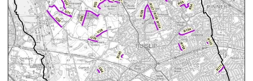
Executive Summary
The London Borough of Hillingdon Rights of Way Improvement Plan (ROWIP)
has been produced to meet the requirements of the Countryside and Rights of
Way Act 2000 (CROW Act). The ROWIP is required to contain an assessment
of the extent to which local Rights of Way meet the present and likely future
needs of the public for exercise and other forms of open air recreation, and
the accessibility of Rights of Way to those with sensory and mobility problems.

The Rights of Way Improvement Plan provides an opportunity to assess and
progress the service the Council provides. It is an opportunity to build on
statutory requirements and identify areas to improve the statutory and
permissive access networks in the borough.

The development of the plan was influenced by statutory government
guidance and consultation involving internal stakeholders and external
organisations. An online survey was conducted for the general public. The
ROWIP fits in with existing regional and local policies for promoting
sustainable, healthy and accessible travel and recreation.

From the consultation a statement of eight actions was identified. The actions
are based on the findings of an assessment of the Definitive Map and
Statement and consultation to provide an improved network of routes.

A review of the Rights of Way Improvement Plan will be carried after a five
year period in 2016.
Vision Statement
To enhance and promote the borough’s Rights of Way Network for the
purpose of providing exercise and open air recreation into the borough’s
green spaces and to access to local amenities.

The Rights of Way Improvement Plan aims to:

   ¾ Provide a Rights of Way network which is correctly signed, free from
     obstruction and easy to use.

   ¾ Develop the network to enable use by all, with regard to least restrictive
     access where possible.

   ¾ Promote the network to increase health and well being, recreational
     opportunities and as a means of accessing the natural and built
     environment.

   ¾ Help develop the network of access and permissive routes around the
     borough.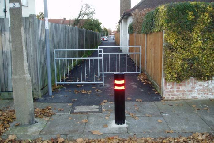
Contents

1.     Introduction                                  4

1.1    Hillingdon                                    4

1.2    Aim of the Rights of Way Improvement Plan     4

1.3    Legislative background                        5

2.     What are Public Rights of Way                 5

2.1    Categories of Rights of Way                   5

2.2    Private Rights ‘easements’                    6

2.3    List of Streets                               6

2.4    Legally Defined                               7

2.5    The Definitive Map and Statement              7

2.6    Amendments to the Definitive Map              8

3.     Hillingdon’s Rights of Way and Permissive     9
       Routes Network / Current Access Provision

3.1    Health Opportunities                          9

3.2    Public Rights of Way                          9

3.3    Public Bridleways                             10

3.4    Byway Open To All Traffic (BOAT)              10

3.5    Cycle Ways                                    10

3.6    Wider Network of Access                       11

3.7    Public Open Spaces                            13

3.8    Accessibility                                 13

3.9    Canal Towpath                                 14

3.10   Colne Valley Regional Park                    14

4.     Network Management                            16

4.1    Existing management of Public Rights of Way   16

                                     1
4.2   Local Performance Indicator (BVPI) 178               16

4.3   Inspections of Rights of Way                         16

4.4   Condition of the Network                             17

4.5   Enforcement and Protection                           19

4.6   Maintenance                                          19

5.    The Policy Framework & Rights of Way                 21
      Improvement Plan Links

5.1   Regional and Local Policies                          21

5.2   Local Implementation Plan                            22

5.3   Integration of the Rights of Way Improvement Plan    22
      In to the Local Implementation Plan

6.     Consultation and Survey Responses &                 22
       Assessing user needs

6.1   Information Gathering                                22

6.2   Consultation Feedback                                23

6.3   Summary                                              29

7.    Statement of Action                                  30

Action 1 - Regeneration of existing public rights of way   30

Action 2 – Maintenance schedules                           31

Action 3 – Least restrictive access                        32

Action 4 – Definitive Map and Statement                    33

Action 5 – Promotion of network                            34

Action 6 – Crime and anti-social behaviour                 35

Action 7 – Health Promotion                                36

Action 8 – Creation of new routes and links                37

                                       2
8.    Monitoring the ROWIP                                      38

8.1   Monitoring                                                38

8.2   Deliverability                                            38

List of Figures

Figure 1       Abstract from Hillingdon Definitive Map          7

Figure 2       Public Rights of Way with Walks and              15
               Trails in the borough

Figure 3     Problem routes highlighted by survey               18
             and consultation

List of Tables

Table 1      Breakdown of Rights of Way in the borough          10

Table 2      Designated Cycle Tracks remote from carriageways   11

Table 3      Regional and Local Plan links                      21

Table 4      Consultation List                                  23

Appendices

Appendix A The Policy Framework & Rights of Way                 39
           Improvement Plan Links

Appendix B Description of problem routes highlighted by         45
           survey and consultation

Bibliography                                                    48

                                       3
1.        INTRODUCTION

1.1       Hillingdon

Hillingdon is the second largest of London’s 33 boroughs in area, covering
approximately 115 kilometres (44.6 miles). Hillingdon forms a long narrow
strip on the western edge of London approximately 18 kilometres (11.1 miles)
from north to south and 6 kilometres (3.7 Miles) from west to east. The
London boroughs of Harrow, Ealing and Hounslow lie to the east of Hillingdon
and it is bounded on the north by Hertfordshire, on the west by
Buckinghamshire and Slough and to the south by Surrey.

Hillingdon varies from open country and housing development in the north to a
more heavily developed, urban structure in the centre and south. Whilst the
south of the borough is relatively flat, the north becomes increasingly hilly as
the land rises toward the Chilterns. The River Colne and the Grand Union
Canal run down the western perimeter of the borough and the river Pinn and
Yeading Valley also thread their way through the eastern side of the borough
and are all important areas for leisure and nature pursuits.

Hillingdon has over 5,000 acres of open countryside including lakes, fields,
rivers and woods. A large green belt in the borough is largely protected from
urban development. The majority of Hillingdon’s woodland lies within Ruislip
Woods National Nature Reserve. There are over 200 parks and open spaces
in the borough including parks, allotments, commons, recreation grounds,
playing fields, children’s play areas, and civic spaces.

1.2       Aim of the ROWIP

The Rights of Way Improvement Plan is the means by which local highway
authorities will identify the changes to be made, in respect of management
and improvements to the local public rights of way network, in order to attain
better provision for all users, including walkers, cyclists and horse riders.

This has been created through the following key stages:

      •   Carrying out an assessment of the Rights of Way network and current
          access provision - see section 3.

      •   Carrying out consultation with an established Council officer steering
          group, key organisations, neighbouring authorities and the general
          public - see section 6.

      •   Assess user needs and survey responses - see section 6.

      •   Developing statements of actions for improvements to the Rights of
          Way network - see section 7.

                                          4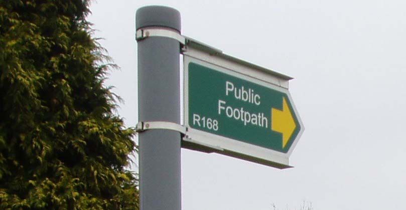
1.3       Legislative Background

Hillingdon Council has produced this Rights of Way Improvement
Plan (ROWIP) to meet the requirements of Section 60 of the Countryside
and Rights of Way Act 2000 (CROW) which requires each local highway
authority in England and Wales (excluding inner London Boroughs) to publish
a Rights of Way Improvement Plan.

The Authority has a duty to review the ROWIP within a ten year period and
then on a ten yearly cycle.

The statutory guidance requires that a Rights of Way Improvement Plan
must assess:

      •   The extent to which the local Rights of Way meet the present and
          likely future needs of the public.

      •   The opportunities provided by local Rights of Way for exercise and
          other forms of outdoor recreation and enjoyment of the authority’s
          area.

      •   The accessibility of local Rights of Way to blind and partially sighted
          people and others with mobility problems.

Following the assessment the plan sets out a statement of action the authority
proposes to take for securing an improved network of local rights of way.

2.        What are Public Rights of Way

2.1       Categories of Rights of Way

England contains a unique historic network of paths, approximately 118,000
miles, which are legally protected highway. The original purpose of Rights of
Way, as with roads today, was to provide links to settlements for access and
commerce, though many Rights of Way are now utilised for recreational
amenity.

Public Rights of Way are routes that allow the public a right of passage over
land, which can be privately or Council owned. Common Law states that users
can pass and re-pass along highways at all times. Footpaths, bridleways and
byways are all highways, differing from roads only in the type of traffic entitled
to use them and surface types. Most Public Rights of Way are publicly
maintainable. Once a Public Right Of Way has been established it will remain
maintainable at public expense until there is a legal order to either close,
divert or extinguish it as a Public Right Of Way.

Public Footpath        On which there is a right of way on foot only

Public Bridleway       On which there is a right of way on foot, on
                       horseback and leading a horse, with an additional

                                          5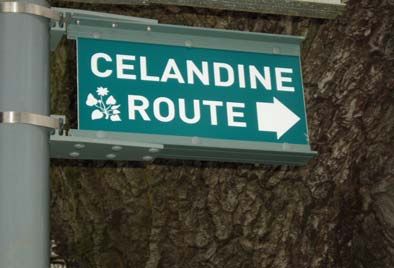
right for cyclists provided that they give way
                     to other users; in some cases also with a right to
                     lead or drive animals

Roads Used as        Highways mainly used by the public for the
Public Paths         purposes that footpaths or bridleways are used,
(RUPPS)              but which may or may not carry vehicular rights.
                     In some parts of the country RUPPs were
                     reclassified individually as byway, bridleway or
                     footpath and those remaining in 2006 became
                     restricted byways.

Restricted Byways A category created by CROW Act 2000 with
                  rights for all traffic except mechanically
                  propelled vehicles.

Byways Open to       Highways that are mainly used for the purposes
All Traffic          that footpaths and bridleways are used, but on
(BOATS)              which there is a right of way for all traffic.

Cycle Ways           A way over which there is a right of way on pedal cycles
                     (cycle ways are not a type of right of way that has to be
                     shown on a definitive map). These are established by an
                     Order under the Cycle Tracks Act 1984 and are separate
                     to those cycle routes provided at the side or within the
                     road.

2.2    Private Rights ‘easements’

Private rights are termed easements. For example, one landowner might have
a private right of access over a neighbour’s land and usually be mentioned in
the deeds of both properties. Such private rights do not apply to the public at
large, but only to those for whose benefit they have been granted. Some ways
can carry both public and private rights. For example, a farm access road may
also be a public bridleway, and a public footpath may also carry private
vehicular rights. Private rights must not be exercised in such a way as to
interfere with the rights of the public.

2.3    List of Streets

The list of streets is a statutory requirement the Council is required to keep
under the Highways Act 1980. This is held by the Highways Department. It
Record’s all highways that are publicly maintainable including Public
Rights of Way recorded on the definitive map and adopted paths which are
not on the Definitive Map and Statement.

2.4    Legally Defined

Public Rights of Way excluding Cycle Tracks are required by law, under the

                                        6
Wildlife and Countryside Act 1981 to be recorded on the Definitive Map and
Statement.

2.5    The Definitive Map and Statement

The first Definitive Map came into existence as a result of the National Parks
and Countryside Act 1949, which required all county councils in England and
Wales to carry out a survey of their area and produce a map showing
footpaths, bridleways and byways which were Public Rights of Way.

Definitive Maps and Statements are extremely important records of Public
Rights of Way, they provide conclusive evidence, at the relevant date of
the map, of the existence and status of the Public Rights of Way which are
shown on them. The Definitive Map and Statement for Hillingdon records all
Public Rights of Way within the borough, it is a living document as it is subject
to on-going changes as routes are added, changed or deleted.

Figure1       Example of an abstract from Hillingdon’s Definitive Map showing
footpath R154, Eastcote Road to Field End Road. The former RAF site is
currently being developed, this will include reconstruction of a new path. This
path as been highlighted by the Rights of Way Improvement Plan consultation
has having areas for concern by local residents.

The Wildlife and Countryside Act 1981 also requires the Highway Authority to
keep the Definitive Map and Statement under continuous review and ensure

                                        7
that the Rights of Way are adequately signposted, maintained and free from
obstruction.
2.6 Amendments to the Definitive Map
Changes can be made to the map most commonly by Modification Orders and
Public Path Orders.
Modification Orders may be made:
• To add a Right of Way where it is shown to exist but not recorded on
the Map.
• To alter the status of a Right of Way.
• To delete a Right of Way where it is shown to be included on the Map
in error.
• To record a width in the Definitive Statement.
The process is based on user / archive evidence. Before making an order the
authority must have evidence which shows the right of way has come into
being through presumed dedication following use over a period of time.
If Modification Orders are made they can be challenged and could lead to a
public enquiry.
Public Path Orders may be made:
• To create a Public Right of Way.
• To divert an existing Public Right of Way onto a new route.
• To extinguish an existing Public Right of Way.
Public Path Orders enable applicants to apply to make a permanent legal
change to a Public Rights of Way across their land. This is a public process
where anyone may object to the making of an order. The authorities will
process Public Path Orders in response to applications, or as authority
generated schemes.
If a new path is to be created the test is that it must appear to the authority
that there is a need for it and the authority must be satisfied it is expedient to
create it having regard to the extent to which it would add to the convenience
or enjoyment of a substantial section of the public or of local residents and the
effect the creation would have on the rights of those with an interest in the
land.
The tests for extinguishing a public path include that it is ‘not needed for public
use’.
8Statutory duties also include the requirement to keep a register of applications
made for modification orders, which must be available for viewing on the
internet.
3. Hillingdon’s Rights of Way and Permissive Routes Network /
Current Access Provision
3.1 Health Opportunities
The Rights of Way network plays an essential role in health and well-being.
It provides an opportunity to carry out daily exercise and organised activities.
The current Government recommendation for physical activity is 30 minutes of
moderate activity at least 5 days a week, walking as a low impact form of
exercise can help reduce the risk of disease and give benefits such as
building up energy levels and reducing stress.
The Walking the Way to Health Initiative and Change4Life Programme are
health initiatives championed by Natural England and the Department for
Health. The Healthy Walks Scheme is a nationally evaluated programme that
maintains high standards for healthy walks. Hillingdon has 12 routes around
the borough and gained accreditation for the walks in 2008.
The Walking the Way to Health Initiative and Change4Life Programme
highlight the importance of exercise and the Rights of Way network represents
a resource to encourage healthier lifestyles for both organised and informal
public exercise.
3.2 Public Rights of Way
The Public Rights of Way network in the borough as recorded on the
Definitive Map and Statement is approximately 112 km (69 miles) long and
contains 366 footpaths, 11 Bridleways and 10 BOATS (byway open to all
traffic). Hillingdon produced its Definitive Map and Statement in December
1964 as an amalgamation of the three Urban Districts of Hayes and
Harlington, Ruislip and Northwood, Yiewsley and West Drayton and former
borough of Uxbridge. Although consolidated into one Definitive Map and
Statement for Hillingdon the boroughs Rights of Way are split into four areas
comprising Ruislip / Northwood, Hayes / Harlington, Uxbridge and Yiewsley /
West Drayton. Each route is identified by a letter and number, for instance H8
in Hayes.
Hillingdon’s Rights of Way network encompasses both urban and rural routes.
Urban paths are in the main used for convenient short cuts to schools, shops,
public transport and other local amenities and are in the whole metalled
surfaces. Other public footpaths follow and cross through farmland, parks and
open spaces, woodland, nature reserves, golf courses, river banks and canal
towpaths and have differing surfaces. Rights of Way form a significant part of
the local access infrastructure in the sense, that they are a major recreational
resource and offer access into the boroughs countryside and surrounding
areas.
9Table 1 Breakdown of Rights of Way in the borough
Status Footpath Bridleway BOAT Total Total length
Number km
Ruislip / 180 7 3 190 33.74
Northwood (20.9 m)
Hayes / 71 0 4 75 14.89
Harlington (9.2 m)
Uxbridge 94 2 0 96 51.4
(31.9 m)
Yiewsley 21 2 3 26 11.59
(7.19 m)
3.3 Public Bridleways
Hillingdon has eleven bridleways of which eight are situated in Ruislip Woods
National Nature Reserve. These routes connect with permissive bridleways to
provide an extensive route through the differing woods which make up the
National Nature Reserve. Bridleways were originally designated as a right of
way for people on horse or foot, but the Countryside Act 1968 introduced
legislation to allow cyclists to use bridleways with the intention that cyclists
give way to horse riders and walkers.
3.4 Byway Open To All Traffic (BOAT)
The term Byway Open to All Traffic means a highway over which the public
have a right of way for vehicular and all other kinds of traffic but which is used
by the public mainly for the purposes of which bridleways and footpaths are
used. Hillingdon has ten BOATS and although they serve the purpose stated
above there are anomalies related to them, these being:
• Routes that stop at a ‘dead end’ for horse riding or cycling.
• Routes on a private road, which have been widened or surfaced, which
leads to a maintenance issue.
• Heavy goods vehicle use, which can lead to health and safety concerns
and maintenance issues.
The problems described will be investigated under Section 7, Statement of
Action, Action 4: Definitive Map and Statement.
3.5 Cycle Ways
Cycle ways have a two fold remit; “on highway” and “off highway”. Cycle ways
that are classified as falling in the “on highway” category can form part of the
carriageway or footway. They are usually designated as shared use for
pedestrians and cyclists when on the footway. On the carriageway cycle
facilities are commonly either advisory or mandatory cycle lanes.
10Cycle ways that are classified as falling in the “off highway” category can be
specifically designated for cyclists or shared use facilities with pedestrians.
This type of cycle track is created by means of a Cycle Track Order. Cycle
ways created utilising a Cycle Track Order have specific legal status, but are
not shown on the Definitive Map and Statement. Hillingdon has a total 2.55
km (1.6 miles) of Cycle Tracks remote from carriageways.
Table 2 Designated Cycle Tracks remote from carriageways
Start Finish Ward Length km
Station Road Peachey Lane Brunel 0.4
(0.2m)
Park Road A40 – Western Avenue Uxbridge 0.4
North (0.2m)
A40 – WesternAvenue Warren Road Ickenham 0.4
(0.2m)
Warren Road Milton Road Ickenham 0.5
(0.3m)
Shakespeare Avenue Shakespeare Avenue Barnhill 0.2
(0.1m)
Hill Lane Hill Lane West Ruislip 0.2
(0.1m)
Elmbridge Drive Fore Street Eastcote 0.15
(0.09m)
Bedwell Gardens Shepiston Lane Pinkwell 0.3
(0.18m)
3.6 Wider Network of Access - Permissive and Promoted Routes
Permissive paths are paths which the land owner permits the public to use,
with the intention that it should not be dedicated a Public Right of Way.
Because a permissive path is not a Public Right of Way, it is not subject to
Rights of Way law. Hillingdon’s permissive routes are usually located on local
authority owned land.
Hillingdon has a good network of permissive promoted routes of varying
lengths for walking, horse riding and cycling which complement the network of
definitive routes to make up the wider access network. Permissive paths,
particularly in Green Spaces, form an important and well used part of the
network. These routes are utilised for regional and local recreational use.
Permissive Bridleways in Hillingdon
Hillingdon has approximately 40.2km (25 miles) of permissive Bridleways;
they form an essential recreational resource for horse riders, cyclists and
walkers. They are located around the borough through woodland, farmland
and parkland, and also form links with South Buckinghamshire and
surrounding authorities.
11Hillingdon Trail
This is a 32.1km (20 miles) path through Hillingdon’s countryside from
Cranford to Harefield. The walk passes through Nature reserves, parks,
meadows, parks and open spaces, Grand Union Canal, Yeading Brook and
the River Pinn.
Celandine Route
A walk of 19.3km (12 miles) along the River Pinn from Pinner to the Grand Union
Canal at Cowley. The path follows the River Pinn and passes through meadows,
woodland and green spaces. The Celandine Route links Hillingdon to Harrow.
Willow Tree Wander
This is an 8km (5 miles) walk along a stretch of the Yeading Brook from North
Harrow station to Ickenham Station. The path passes through meadows and
open spaces. Willow Tree Wander links Hillingdon to Harrow.
Trails of Discovery
The Trails of Discovery are 5 different routes in the borough, with a combined
length of 18.5km (11 ½ miles). They are located in Harefield, Uxbridge,
Cowley, Hayes and Harlington and offer walks through woodland, canal side,
lakeside, Country Park and recreational parkland.
Ruislip Woods Walks
Ruislip Woods walks consists of 3 different routes, the Blue route, Red route
and White route. The routes take in Ancient woodland environments in Mad
Bess Wood and Park Wood and also the Ruislip Lido. The routes are around
1.6 km (1 mile) each in distance.
London Loop (London Outer Orbital Path)
The London Loop encircles Greater London. The total length reaches 150
miles and consists of 24 sections through London’s boroughs. Hillingdon has
3 sections which run through parkland, canal side and river side for
approximately 18.5 km (11 ½ miles).
Colne Valley Trail
The Colne Valley Trail is a shared use route designed for walkers, cyclists and
horse riders and is part of the Colne Valley Regional Park. The majority of the
trail in the borough passes along the Grand Union Canal and runs an
approximate length of 16 km (10 miles). Horses are only permitted on certain
parts of the trail.
Colne Valley Circular Routes
The Colne Circular routes are designed to encourage people to discover and
explore the countryside on their doorstep. 9 of the 20 promoted routes are
located wholly or partially within the London Borough of Hillingdon, these
range in length from 2 miles to 7 miles.
David Brough Cycle Trail
The trail is located in Bayhurst Wood and offers views of a wide range of wild
life; a full circuit of the trail is just over1.6km (1 mile) long.
12Harefield Church to Springwell Lock
This is a 8 km (5 miles) walk through fields and woodlands, alongside the
Grand Union Canal and offers local historical landmarks.
Ruislip Lido to Harefield Church
The walk takes in woodland and farmland and wanders through Mad Bess
Wood and Bayhurst Wood, the walk is approximately 6.4 km (4 miles) long.
Ickenham Marsh to Ruislip Lido
The walk passes through Ickenham Marsh Nature Reserve, meadows and
open space’s, the walk is 4.8 km (3 miles) long.
Cranford Park to Bulls Bridge
This walk offers riverside views and the chance to explore historical Cranford
Park House and church of St Dunstan in Cranford Park. The walk is 2 miles
long. (3.2km).
Dog Rose Ramble
This route starts and finishes in Ealing, approximately 4.8 km (3 miles) wander
through farmland and meadows alongside the Yeading Brook in Hillingdon.
Details of these routes can be obtained by visiting the Council website at
www.hillingdon.gov.uk.
3.7 Public Open Spaces
Across the borough, there are a range of town parks, open spaces, commons,
country parks, a National Nature Reserve at Ruislip Woods (NNR), and over
40 Sites of Importance for Nature Conservation (SINCs), all of which are open
to the public. Hillingdon has approximately 200 sites which form an important
part of the network of routes.
Some of Hillingdon’s green spaces are among the best in London with 14
sites holding Green Flag status (a national standard for parks and green
spaces across England).
3.8 Accessibility
Statutory guidance requires assessment of the accessibility of the local Rights
of Way for the blind or partially sighted and others with mobility problems this
includes those who use pushchairs.
Urban footpaths in the borough have in the past had tube barriers placed to
prevent illegal use by motorcycles; the same barriers can also prevent access
for disabled users. Where possible these barriers are being replaced with
DDA compliant barriers to allow equal access for all.
Relatively few rural footpaths and trails are very suitable for use by people
with mobility problems, sections rather than whole routes are user friendly.
The nature of the rural terrain and steps, stiles, bridges and gates will always
13be a barrier to some users, added to this is the inconvenience of footpaths
ending or starting on busy roads in the borough.
The majority of local green spaces, parks and country parks offer wheelchair
access and 3 routes have been promoted as wheelchair friendly routes, these
being:
• Hayes Botanical Gardens (the Norman Leddy memorial).
• Ruislip Lido – lakeside walks.
• Little Britain Lake – lakeside walks.
Hayes Botanical Gardens – Norman Leddy memorial
3.9 Canal Towpath
Hillingdon contains large sections of the Grand Union Canal on its Definitive
Map and Statement but canal towpaths are legally part of the canal. Towpaths
are generally owned by British Waterways who are normally responsible for
their upkeep and enforcement of their bylaws. The council has no direct
responsibility for the maintenance or improvement of canal towpaths, but is
committed to working with British Waterways to promote use of the canal
routes.
3.10 Colne Valley Regional Park
The Colne Valley Regional Park is a large area to the west of London and
contains approximately 270km of Rights of Way, offering local residents
further opportunities to explore their local countryside. Hillingdon Council is
committed to working with the Colne Valley partnership to ensure residents
can benefit from a co-ordinated network of Rights of Way that are joined up
across administrative boundaries.
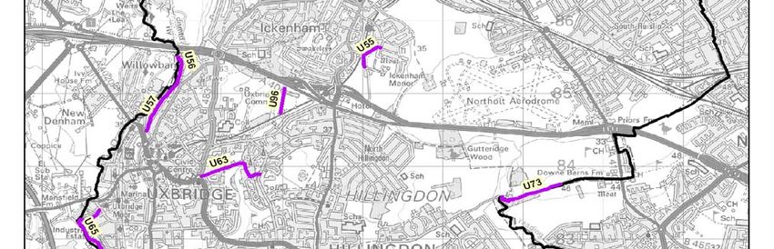
14Figure 2 Public Rights of Way with Walks and Trails in the borough
154. Network Management
4.1 Existing management of Public Rights of Way
Management of the statutory public rights of way network and permissive
networks is carried out by the Highways and Green Spaces services of the
Environment and Consumer Protection Group. Statutory Rights of Way duties
are co-ordinated by the Rights of Way Officer in Street Scene Maintenance
and permissive networks to the Green Spaces Team. The Rights of Way
Officer and the Green Spaces Team, work together to achieve an enjoyable
recreational experience for users of statutory and permissive routes.
4.2 Local Performance Indicator (formally BVPI 178)
Best Value Performance Indicators were previously used to measure
performance against national key performance indicators set by the Audit
Commission. Ex Best Value Performance Indicator 178 relates to a minimum
5% sample of the public rights of way network. The government has now
removed BV178 from national performance indicators but Hillingdon Council
will continue to use ex BV 178 as performance indicator to monitor Public
Rights of Way.
The methodology developed requires the assessment of a randomly selected
sample of routes from the Definitive Map to determine the percentage that are
easy to use.
‘Easy to use’ means:
• Signposted or waymarked where they leave the road in accordance
with the authority’s duty under s.27 of the Countryside Act 1968.
• Free from unlawful obstructions and other interference, (including
overhanging vegetation and fences) to the public’s right of passage.
• Surface and lawful barriers (e.g. stiles, gates) in good repair and to a
standard necessary to enable the public to use the way without undue
inconvenience.
4.3 Inspections of Rights of Way
Public footpath inspections are carried out at least once a year to assess the
condition of the paths and to help plan maintenance schedules and identify
defects. These are accompanied by a reactive inspection service where users
who encounter problems contact the Council via the contact centre and the
issue addressed.
The Hillingdon branch of the Ramblers Association carry out annual footpath
inspections and forward their findings to the Council, both positive and
negative.
164.4 Condition of the Network
The Countryside and Rights Of Way Act 2000 (CROW) highlighted the
growing importance of Rights of Way both in legislation and as a national high
profile subject. Recognising this, Hillingdon employed a dedicated Rights of
Way Officer in 2003.
Surveying authorities will often find problems within their Definitive Map and
Statement which have developed over time for example through development,
lost routes, lack of management and routes incorrectly recorded. The
Hillingdon Ramblers last annual survey (early 2008) identified the most
extensive problem with the Rights of Way network was with the signage,
which was missing or dilapidated; at that time it affected around 50% of the
network. About 9% of the network was affect by blockages or inadequate
stiles. Legal and physical blockage problems have been identified which have
led to problems being highlighted and routes re-opened but further anomalies
in the DM&S remain to be cleared.
Outstanding Definitive Map works as of 25/03/2009:
• 2 applications for Public Path Orders to divert and extinguish routes for
the purposes of development at footpaths R154, U39 and U40.
• 2 applications for a Definitive Map Modification Order to add a route to
the DM&S.
• 4 Legal Event Orders to modify the DM&S (Legal events modify the
DM&S to show the outcome of Public Path Orders and Definitive Map
Modification Orders).
• 6 temporary diversion orders for the purposes of development, utility
installation and improvement works.
• 5 temporary closures for the purpose of utility installation.
Figure 3 highlights key problem routes that have issues ranging from man
made and natural obstructions, uneven surfaces, worn surfaces, muddy
surfaces and erosion of surfaces. Appendix B: Description of problem routes
highlighted by survey and consultation gives a description of the problems on
these routes.
17Figure 3 Problem routes highlighted by survey and consultation
184.5 Enforcement and Protection
The Council has a legal duty under the Highways Act 1980 to assert and
protect the rights of the public to use and enjoy Public Rights of Way. There
are various provisions contained mainly within the Highways Act 1980 which
deal with obstructions and disturbance to the highway.
Enforcement follows a process of written letters which highlight the problems
and actions required, if no response is forthcoming, legal notices can be
served on offenders and this could ultimately lead to prosecution.
The Council will always strive to solve problems through negotiation; this can
help to promote good practice and relations between Council Officers and
landowners who have property next to footpaths or footpaths running through
their land.
4.6 Maintenance
Maintenance standards for the network are based on the ex Best Value
Performance Indicator (BVPI) 178.
Signposting and Waymarking
Highway authorities have a duty to signpost all statutory Footpaths,
Bridleways and Byways Open to All Traffic where they leave a metalled road
and the status of the route must be given on the sign. Waymarkers are added
to the route to assist the user where deemed necessary.
Permissive routes are signed and waymarked in a similar fashion as statutory
footpaths.
Statutory signage for footpath R168
19Surfaces
The Council has a responsibility for the maintenance of Public Rights of Way
which includes the surface and surface vegetation that causes an obstruction.
Surface type varies with tarmac and artificial stone path (ASP) the most
prominent surface type in urban areas. Rural paths and bridleways are
predominantly natural surfaces to fit into the rural surroundings but can be
surfaced with scalpings or hogging materials.
Landowners can also surface PROW but the surface must be safe and
suitable and they must obtain permission from the Council before carrying out
any works.
Vegetation Management
Where vegetation or trees overhang or encroach onto the highway the
responsibility lies with the owner or occupier of the land to ensure that it does
not cause a danger or obstruction to users of the highway.
The Council is responsible for cutting surface vegetation other than crops on
PROW with environmentally sensitive chemical control being applied to the
surfaces in urban areas to suppress weeds and unwanted vegetation.
Management of vegetation on statutory and permissive footpaths is
undertaken by contractors and volunteers. The Council also utilises Blue Sky
Development & Regeneration (who provide ex-offenders with employment to
reduce re-offending crime in the community) and utilises the Community
Payback Scheme to carry out clearance works.
Gates, Stiles and Structures
A highway authority may allow the erection of stiles or gates by the owner of
the land to prevent animals from escaping from their land, A British Standard,
BS5709 has been introduced; it covers the provision of gates and stiles and
recommends specifications for structures.
Public Rights of Way can suffer from illegal use by motorbikes. To address
health and safety issues the Council can install anti-motorcycle barriers to
eradicate this problem but this does not allow for the needs of disabled users
under the Disability Discrimination Act 1995. The design and placement of
barriers or Kissing gates allows for access by disabled mobility scooters but
this can be difficult and not always possible depending on the width of the
footpath, therefore assessments are made on the individual footpath.
20Barriers placed at footpath R174, Cranley Drive, Ruislip
5. The Policy Framework – Rights of Way Improvement Plan Links
5.1 Regional and Local Policies
Regional and local policies support the promotion of health, accessibility,
safety and sustainable forms of transport other than the car. The Rights of
Way Improvement Plan is complementary to these policies and can further
help to achieve shared aims and objectives set in the regional and local plans
below, Identifying and linking these plans will help with funding bids and
possible joint working with potential partners. A summary of these plans and
strategies can be seen in Table 3 below, the ROWIP will co-exist and
contribute to these plans.
Table 3 Regional and Local Plan links
Regional Plans
Walking Plan for London
London Plan
Mayors Transport Policy
Local Plans
Hillingdon Community Strategy
Hillingdon Community Safety Strategy
Hillingdon Unitary Development Plan (UDP) - Saved Policies 2007. (The plan
is due to be replaced by Local Development Frameworks)
Hillingdon Green Spaces Strategy & Joint Bridleways Strategy
Walking the way to Health Initiative & Change4Life Programme
Safer Routes to School Initiative
Disability Discrimination Act (DDA) 2005
Colne Valley Regional Park Action Plan 2009-12
21Appendix A: The Policy Framework – Rights of Way Improvement Plan Links
gives a more in-depth look into the regional and local plans.
5.2 Local Implementation Plan
Hillingdon’s Local Implementation Plan (LIP) sets out how the Council
proposes to implement the Mayor's Transport Strategy (MTS) and provides
details on projects, proposals and programmes through to 2010-2011. In the
LIP Hillingdon has presented a range of transport policies, initiatives and
projects and reflects Council’s commitment to improving transport in the
borough and ensuring that Hillingdon remains an attractive place in which to
live and work. The LIP has been prepared in accordance with the Guidance
issued by Transport for London. The approved LIP is a statutory document,
legally binding on the Council and the Mayor of London.
5.3 Integration of the Rights of Way Improvement Plan into the Local
Implementation Plan
The Government expects that each ROWIP will be incorporated into local
transport planning and in the case of London Boroughs, Local Implementation
Plans when they are next reviewed. The plan contains an assessment of the
current Rights of Way network and how it is likely to meet current and future
needs. It aims to identify improvements which will provide a better local
network for walkers, equestrians, cyclists and people with mobility problems
following a consultation process.
This can be achieved by incorporating the aims of the ROWIP to contribute to
the shared aims and objectives of the LIP. The ROWIP can contribute to the
following objectives of the LIP:
• Increasing sustainable travel
• Improving air quality
• Encourage active travel, especially to schools
• Provide safer roads especially for walkers and cyclists
• Reduce crime and anti-social behaviour
6. Consultation and Survey Responses / Assessing User Needs
6.1 Information Gathering
The process for developing the ROWIP included an assessment of the
Definitive Map and Statement and wider network of access.
To gain a representative sample of users of the Rights of Way network and
the population of the borough in general to assess how the network meets the
user’s needs and demands the following methods were used:
• An online questionnaire for the general public (also available in paper
format) promoted through Hillingdon People which circulates to the
whole of the borough.
22• Consultation / meetings with the established Council Officers Steering
Group, representing various departments and groups.
• Consultation / survey with external key groups who have an interest in
Rights of Way.
• Consultation with highway authorities adjoining Hillingdon.
Table 4 Consultation List
London Borough of Hillingdon – Steering Group
Transport Policy and Planning - Planning and Community
Services - (Local Implementation Plan)
Joint Commissioning - Adult Social Care, Health and Housing.
(Physically and Visually Impaired)
Transport Policy and Planning - Planning and Community
Services - (Walking and Cycling)
Transport Policy and Planning - Planning and Community
Services - (Safer Routes to School)
Adult Social Care, Health and Housing - Healthy Hillingdon -
(Walking for Health)
Community Safety Team - Planning and Community Services -
(Community Safety)
Green Spaces Team - Environment and Consumer protection
- (Green Spaces Strategy)
Key Organisations
Ramblers Association -Hillingdon and District Group
Hillingdon Equestrian Advisory committee (HEAC)
Hillingdon Cycle Users Group - London Cycling Campaign
Open Spaces Society - Hillingdon Branch
Groundwork Thames Valley - Colne Valley
General public
Neighbouring Authorities
London Borough of Ealing
London Borough of Harrow
London borough of Hounslow
Spelthorne District Council
Slough Borough Council
Three Rivers District Council
South Bucks District Council
236.2 Consultation Feedback
General Public
A range of issues were highlighted by the consultation process with has
provided information about the borough’s Rights of Way and how they are
used.
The survey showed that the public used both urban and rural footpaths and
bridleways and utilised permissive routes. The main use of Rights of Way was
for the following:
• For recreation / leisure.
• To access open space / parks.
• To access shops / local amenities.
• For exercise / health reasons.
• To get to / from work.
• For business.
Usage of the network varied most popularly between 5 and 7 and 1 and 2
times a week with up to 1 hour the most popular time span.
Problems highlighted by the general public survey were:
• Fly tipping/ litter / dog mess.
• Vegetation encroachment.
• Surface condition.
• Signposts / waymarking.
• Illegal motor cycle use.
• Access to footpaths and bridleways.
• Other type of user.
• Number and design of gates, stiles and barriers.
The survey asked which aspects of the network were important to improve,
the following list was prioritised:
• Litter / dog fouling / graffiti.
• Obstructions / overgrown vegetation.
• Surface improvements.
• Signs / waymarking.
• Gates / stiles / barriers – accessibility.
• Awareness of rights of way.
• Personal safety.
• Lighting.
• Conflict with other users.
Further comments included:
• Providing information leaflets.
• Introduce litter cleansing programme.
• Vegetation management control programme.
24• Promotion of Rights of Way through the Council website.
• Gating of alleyways.
Individual footpath issues were identified, these included:
• Unclear and blocked paths near Newyears Green.
• Overgrown vegetation at Clack Lane.
• Poor surface and lighting through RAF Eastcote.
From the individual footpath issues raised above, Newyears Green has six
footpaths. Footpaths U40 and U49 are currently undergoing an application for
diversion due to planning permission being granted to West London
Composting LTD. Footpath U38 St Leonard’s farm, blockages on the path
route have been identified and works are ongoing with the land owner to clear
the route. Clack Lane has undergone vegetation clearance works and is now
clear. Footpath R154 through the former RAF Eastcote, the site is now being
developed for housing with the footpath due to be upgrading as part of the
development. The footpath receives vegetation maintenance and the lighting
columns have had tree growth cleared back to increase lighting.
Other issues were raised which were not strictly Rights of Way issues but
were forwarded to the appropriate Council department where applicable.
Key Organisations and Steering Group
Key organisations with an interest in Hillingdon’s Rights of Way network were
consulted to establish:
• The current frequency and for what purpose you make use of rights of
Way in Hillingdon.
• Whether or not the network of Rights of Way meets your current needs.
• Whether or not you find them easy to use and what particular
difficulties, if any, that you encounter.
• What improvement to the network which you would like to see.
Walkers
Healthy Hillingdon - Walking and Health
The new National Change4Life programme highlights the importance of
walking and cycling to the cultural shift in lifestyle that is needed to address
increases in obesity and other health problems related to physical inactivity.
In terms of cost to the NHS alone the Chief Medical Officer has estimated that
the increase in obesity is already costing the NHS £4.2 billion a year. The
CMO further suggests that the wider cost to the economy of decreasing
25physical activity in terms of quality of life, morbidly and mortality is significantly
higher.
The goal for activity promotion is creation of a sustainable culture in the UK in
which adults and children understand the health risks of inactivity and value
resources like walks and walking as part of their everyday lifestyle.
In relation to objective developing a sustainable ‘active culture’ the long-term
maintenance and development of Rights of Way in Hillingdon is extremely
important. The need to enhance current levels of use of Rights of Way
suggests that the focus of the ROWIP can help to develop community
awareness of, appreciation and confidence in using existing routes, in addition
to physical management of the links between routes, communities and
facilities (shops, work, schools, leisure, friends etc).
Rights of Way are important for a whole range of quality of life issues that are
now being promoted in the National Change4life programme. Achieving the
vision of the Change4Life programme, of a sustainable culture, suggests the
need to develop partnerships within Council departments to integrate use of
Rights of Way with wider Council active community engagement initiatives.
The Hillingdon branches of the Ramblers Association and Open Spaces
Society
The Ramblers organise an extensive programme of led leisure walks of
varying distances which make use of the various Rights of Way in the
borough. Most of the walks take place in the north of the borough to access
rural areas and the National Nature Reserve.
The Ramblers have highlighted areas for access improvement such as links
into Minet Country Park from the Grand Union Canal but identified the most
extensive problems of the network as being:
• Signage which is missing or dilapidated.
• Blockages in various forms.
• Problems with stiles and furniture.
The Open Spaces Society
The Open Spaces Society identified a broad spectrum of ideals which relate
to Public Rights of Way, their management and the legal requirements
surrounding them. The following were listed:
• Existing PROW should be brought back into use with correct signage
and agreements (where required) over surface maintenance. We have
a problem with clay soil in Hillingdon and this can be a problem on
Bridleways where use by other recreational uses can cause problems
for walkers.
• Look to join up existing paths / open spaces / parks to create good
circular walks.
• Ensure that urban short cuts are maintained and due process adhered
to with regard to footpath closures / safety concerns.
26• Ensure that all planning decisions that could affect rights of way have
timely input from local interest groups (ie OSS / Ramblers + ROW
Officer) and this information is included in the reports to the planning
committees.
• Coordinate action with any new cycle paths to ensure that all uses of
land / paths can be safely accommodated and sufficient space is
available to both uses.
Cyclists
Hillingdon Cycle Users Group
Hillingdon Cycle Users Group acknowledges an extensive network of
bridleways for use by cyclists but highlight up-grading these surfaces as a
priority area, thus allowing easier access for cyclists. Another area of interest
to users is the upgrading of footpaths where possible to duel use between
roads and links across parks and green spaces to encourage cycle use and
off road safe cycling.
Horse Riders
Hillingdon Equestrian Advisory Committee (HEAC)
The majority of use of public rights of way for horse riding is for leisure
purposes, with riders coming from a wide range of age and abilities. Horse
riding as an activity is taken up for a number of reasons including parents
introducing young children and people enjoying early retirement.
While Hillingdon’s network of statutory and permissive bridleways compares
favourably with a number of London boroughs, the horse riders feel the
network can benefit form the following improvements:
• The network is disjointed and needs the creation of safe routes to link
the bridleways.
• Increased surface and vegetation maintenance of the bridleways.
• Whilst there is good access and parking to some bridleways often
riders with transport are denied access due to barrier restrictions to
combat illegal use of car parks.
• Lack of signage which can lead to confrontation with land owners and
recreational users, therefore re-signage of the bridleway network.
• Lack of finance.
Groundwork Thames Valley – Colne Valley
Groundwork highlighted their aspirations which were relevant the Rights of
Way Improvement Plan. These being:
27• The creation of 2 new circular routes along public Rights of Way in the
north of the borough to promote as part of a series of walks within the
Colne Valley Park.
• Continued promotion of Colne Valley Park walks within Hillingdon.
• Disabled access where possible.
• Possible addition of links into the borough from neighbouring counties
Disabled access – Physically and Visually Impaired
The general public consultation response informed us that regular problems
encountered were:
• Surface maintenance
• Control of vegetation
• Height of kerbs
• Barriers
All make use more difficult for the less mobile, elderly, visually impaired,
mobility scooter users and parents with pushchairs.
Disablement Association Hillingdon (DASH) in response to the survey
commented that the surfaces of Rights of Way or cycle routes are very
important to disabled users and they would like to see tarmac surfaces where
possible. DASH also identified the use of radar key gates so wheelchair users
can access Rights of Way whilst stopping illegal use by motorbikes.
Community Safety
Community Safety Team – Anti- Social Behaviour
The importance of having safer communities has been identified by the
Hillingdon Community Safety Strategy document which sets out the key
priorities for the Council. The Hillingdon Community Safety Partnership, which
comprises the Local Authority, Police, Primary Care Trust, London Fire
brigade and London Probation Service, has been in operation following the
introduction of the Crime and Disorder Act 1998. The document promotes
community safety and projects and methods to reduce crime in problem
areas.
Crime and anti-social behaviour can be an issue on Rights of Way and
alleygating is the preferred way of dealing with anti social behaviour in
privately owned access paths but Public Rights of Way or adopted highway
are not so easy to deal with due to the complex criteria required.
Neighbouring Authorities
The Countryside and Rights of Way Act 2000 requires the Council to consult
with each adjoining highway authority to establish existing links and potential
opportunities to development further links between the borough’s or counties.
28The Council has good working relationships with its neighbouring authorities,
when dealing with cross boundary path issues. The consultation highlighted
already existing links and the Council will look to establish further links with
regard to any specific proposals highlighted by Hillingdon or neighbouring
boroughs.
6.3 Summary
The main elements to be addressed in the development of the Rights of Way
Improvement Plan were how is the current network utilised, what problems
exist and what improvements users would like to see.
The borough contains a network of statutory and permissive routes and trails
but the network is disjointed in places, due mainly to development. With a
considerable network already in place, user needs point to revitalising and
upgrading with additional opportunities taken to further develop and enhance
opportunities for disabled users and user groups where possible. Many of the
concerns raised by the consultation were maintenance issues such as
vegetation, lack of litter collection and physical improvement to the network,
missing signage and information and promotion of Rights of Way.
From the consultation, a set of actions have been identified to be carried out
over a 10 year period.
Small scale Improvements, including limited resurfacing and new signage, can
be addressed using the council’s existing Public Rights of Way budget. More
extensive improvements, including development of the existing network, are
beyond present resources, and will require additional funding to be secured
through the Local Implementation Plan proposals or through other funding
opportunities.
297. Statement of Action
The action plan provides the main focus for the Rights of Way Improvement
Plan and has been compiled based on the survey of the network, comments
made and recommendations received. The ROWIP and the proposed
statement of actions are short and long term objectives detailing how they will
secure an improved network over the next 10 years.
Key
Estimated costs:
£ Less than £5000
££ Between £5000 and £20,000
£££ more than £20,000
Action 1 - Regeneration of existing Public Rights of Way
Action 1 is to prioritise existing problem routes by carrying out physical
improvement works, removing blockages, hazards, updating furniture and
removing trip hazards.
Action / TimescaleEstimated Partnerships Linked Plan
objective Cost /
Funding
Action 1. Regeneration of existing public rights of way
1.1 Re-open 1-2 years £ Highways, DDA 1995
blocked routes Existing revenue Green Spaces,
budget Street Scene
Enforcement
Team & land
owners
1.2 Furniture – 2 years ££ Highways & DDA 1995
replacing gates Existing revenue Green Spaces &
and stiles budget, land owners
External
opportunities
1.3 1-10 years £££ Highways, Hillingdon Local
Reconstruction / Existing revenue Green Spaces, Implementation
physical budget, Local Council Plan,
improvement Implementation departments & DDA 1995,
works to Plan funding, land owners Green Spaces
identified routes. Chrysalis Strategy & Joint
Programme, Bridleways
Section 106 Strategy
agreement,
Groundwork
Partnership /
funding
opportunities
1.4 Ensure Ongoing Existing revenue Highways & DDA 1995,
statutory & budget Green Spaces Green Spaces
permissive Strategy & Joint
30routes are Bridleways
correctly signed Strategy
Action 2 – Maintenance Schedules
Action 2 aims to review and improve current maintenance schedules. This
includes vegetation management of rural routes, which has been a reactive
service rather than a pro-active service and litter and cleansing of urban
routes which has been identified has a major concern from the survey.
Action / Timescale
Estimated Partnerships Linked Plan
objective Cost /
Funding
Action 2. Maintenance schedules
2.1 Introduce Complete £££ Highways, Green Spaces
planned joint Existing revenue Green Spaces, Strategy & Joint
programme of budget current Bridleways
maintenance for Source best contractors & Strategy
vegetation value options external
control for partnership
statutory and opportunities
permissive
routes
2.2 Introduce 1-3 years then £££ Highways, Hillingdon
litter & path review Funding needed Waste and Community
cleansing Community Strategy
schedule for Services (Street
urban Public Cleansing) &
Rights of Way Investigate
support from
community
based projects
such as
Community
Payback
31Action 3 – Least Restrictive Access
Action 3 relates to the Countryside Rights of Way Act 2000 requiring ROWIPS
to assess accessibility of local Rights of Way to the principles of least
restrictive access and adhere to the Disability Discrimination Act 1995 (DDA).
Action / Timescale Estimated Partnerships Linked Plan
objective Cost /
Funding
Action 3. Least restrictive access
3.1 Review 1-3 years Officer time Highways & DDA 1995,
statutory & Green Spaces Hillingdon
permissive Community
routes and trails Strategy &
in terms of least Green Spaces
restrictive Strategy
access.
3.2 Identify 1-10 years as £££ Highways, Hillingdon Local
opportunities to funding Existing revenue Planning Implementation
improve or becomes budget, Local Department, Plan,
create routes available Implementation Green Spaces, Hillingdon UDP,
with an Plan funding, Joint DDA 1995,
emphasis on Chrysalis Commissioning Hillingdon
improvement for Programme, (physically & Community
the mobility or Section 106 visually Strategy&
visually impaired agreement, impaired) & Green Spaces
Groundwork, DASH & MAB Strategy
Partnership /
funding
opportunities
3.3 Continued 1-10 years as ££ Green Spaces & Hillingdon Local
access into funding Existing revenue Highways Implementation
parks & open becomes budget, Local Plan,
spaces that available Implementation DDA 1995,
ensure least Plan funding Hillingdon
restrictive Chrysalis Community
access by Programme, Strategy &
reasonable Section 106 Green Spaces
means in the agreement, Strategy
borough Groundwork
Partnership /
funding
opportunities
3.4 Continue 1-10 years Existing revenue Highways, DDA 1995 &
policy of budget Green Spaces & Hillingdon
balancing user Community Community
needs with Safety Team Safety Strategy
issues of anti- (Anti Social
social behaviour Behaviour)
3.5 Continue 1-10 years Existing revenue Highways, DDA 1995 &
annual survey of budget Public lighting, Hillingdon
statutory routes Street Scene Community
to identify Enforcement Safety Strategy
surface defects / Team &
improvements, Community
vegetation / Safety Team
obstructions and (Anti Social
32You can also read