Road Management Plan Version 5 - June 2021 - City of Melbourne
←
→
Page content transcription
If your browser does not render page correctly, please read the page content below
Road Management Plan

Version 5
June 2021
Contents
Executive Summary ...................................................................................................................................... 4
Introduction.................................................................................................................................................... 4
    Background .............................................................................................................................................. 4
    Key Stakeholders ..................................................................................................................................... 5
    Obligations of Road Users ....................................................................................................................... 5
    The Act ..................................................................................................................................................... 6
    Availability of RMP ................................................................................................................................... 6
    Codes of Practice ..................................................................................................................................... 7
    City of Melbourne Strategic Direction ...................................................................................................... 7
    Definitions ................................................................................................................................................ 7
Register of Public Roads............................................................................................................................... 8
    Register Content ...................................................................................................................................... 8
    Data Source ............................................................................................................................................. 8
    Road Hierarchy ........................................................................................................................................ 9
    Partnerships ............................................................................................................................................. 9
    Private Roads........................................................................................................................................... 9
Road Asset Register ................................................................................................................................... 10
    Asset Management System ................................................................................................................... 10
    Road Asset Register .............................................................................................................................. 10
    Clarification of Register Content ............................................................................................................ 10
    Pavement Management System ............................................................................................................ 11
Road Renewal Programme and Maintenance Standards .......................................................................... 11
    Council’s Duty of Care ........................................................................................................................... 11
    Renewal Programme ............................................................................................................................. 11
    Reactive Response Processes .............................................................................................................. 12
    Customer Service Request System ....................................................................................................... 12
    Responding to Customer Service Requests .......................................................................................... 12
Audit and Review of RMP ........................................................................................................................... 12
    Audit of RMP .......................................................................................................................................... 12
    Review of RMP ...................................................................................................................................... 12
    Amendment of RMP ............................................................................................................................... 12
    Force Majeure ........................................................................................................................................ 13

                                                                                                                                                                 2
References .................................................................................................................................................. 13
Technical References ............................................................................................................................ 13
City of Melbourne Documents................................................................................................................ 13
Appendix 1 .................................................................................................................................................. 14
City of Melbourne Municipal Map........................................................................................................... 14
Appendix 2: Standards of Maintenance ...................................................................................................... 15
Summary of Road Maintenance Categories and Road Asset Inspection Frequencies......................... 15
Table 1: Proactive Road Asset Inspection Frequencies for Assets in Road Reserve (including
footpaths but excluding bridges) ....................................................................................................... 15
Table 2: Standards of Maintenance and Response Times............................................................... 15
Response Times and Intervention Levels – Pavement Marking ........................................................... 21
Appendix 3: Summary of Maintenance Standards for Bridges ............................................................... 22
Bridge Maintenance ............................................................................................................................... 22
Table 3: List of Bridges that City of Melbourne is responsible for maintaining ................................. 22
3Executive Summary
The Melbourne City Council (Council) has developed its Road Management Plan (RMP) to meet the
legislative requirements of the Road Management Act 2004 (the Act) and the strategic directions
adopted by the Council. The Council is the road authority for municipal roads. The RMP applies to
municipal roads only.
The following table shows when the versions of the RMP were adopted by Council.
RMP Version Date Approved Reference
Version 1 August 2004
Version 2 February 2010 (approved under delegation)
Version 3 July 2015 (approved under delegation)
Version 4 July 2017 (approved under delegation) DM#1106799191
Version 5 June 2021 (approved by Council) DM#14004764v6v2
The RMP identifies responsibilities, maintenance standards and inspection regimes required to manage civil
liability as well as demonstrate that the Council, as the road authority, is responsibly managing all the road
assets under its control.
Reference is also made to other key Council policies and strategies and consideration is given to these to
ensure that the RMP is consistent with the adopted strategic directions.
Details of the management of the road and road related infrastructure for which Council is the relevant road
authority are included in the RMP with appropriate inspection, intervention standards and repair timelines
designed to balance reasonable standards with community expectations and financial affordability.
The RMP is seen as a dynamic document and, in line with Council’s policy on continuous improvement, the
plan will be audited regularly as well as being formally reviewed every four years to ensure that the Council can
continue to demonstrate that it is responsibly managing its road assets.
Introduction
Background
In order to facilitate the provision of its services to the community, the Council manages an extensive range of
community assets. One of the most significant groups of these assets, with regard to the difficulty and expense
of managing, are road assets.
The Council is responsible for approximately;
250 kilometres of local roads, along with associated footpath, kerb & channel and drainage.
23 vehicular and pedestrian bridges, refer Appendix 3.
In addition Council is responsible for footpaths located adjacent to arterial roads.
4These assets have an approximate replacement value of $1,331 million. The Council needs to set aside
considerable funding in its annual budget just to meet the depreciation of these assets.
It is important to note that a safe and efficient road network depends heavily upon successfully managing two
main components:
Routine maintenance – repairing day to day wear and tear issues like potholes, cracking, uplifts
around trees, failing service trenches/installations etc.
Renewal/rehabilitation – rehabilitating assets to meet serviceability standards.
This plan is primarily directed towards the routine maintenance described above.
Generally, routine maintenance is funded through Council’s operational budget while renewal/rehabilitation is
funded through Council’s capital works budget.
Key Stakeholders
Key stakeholders who are users of the road network and/or are affected by it include:
The community in general.
Residents and businesses.
Pedestrians.
Users of a range of miscellaneous smaller, lightweight vehicles such as pedal cyclists, motorised
buggies, wheel chairs, prams, etc.
Vehicle users using motorised vehicles such as trucks, buses, commercial vehicles, cars and motor
cycles.
Tourists and visitors to the area.
Utility agencies that utilise the road reserve for their infrastructure.
State and Federal governments through their road agencies.
Emergency agencies.
Traffic and transport managers.
Construction and maintenance contractors.
Council.
Obligations of Road Users
The Act and the Road Safety Act 1986 outline the obligations of road users to behave in a safe manner, as
follows:
A person who drives a motor vehicle on a highway must drive in a safe manner having regard to all the relevant
factors, including (without limiting the generality) the:
physical characteristics of the road
prevailing weather conditions
5 level of visibility
condition of any vehicle the person is driving or riding on the highway
prevailing traffic conditions
relevant road laws and advisory signs
physical and mental condition of the driver or road user.
A road user other than a person driving a motor vehicle must use a highway in a safe manner having regard to
all the relevant factors.
A road user must:
take reasonable care to avoid any conduct that may endanger the safety or welfare of other road
users
take reasonable care to avoid any conduct that may damage road infrastructure and non-road
infrastructure on the road reserve
take reasonable care to avoid conduct that may harm the environment of the road reserve.
The Act
Following the High Court decision that changed the common law governing civil liability for road management
(nonfeasance defence), the State Government initiated a review of the State's road management legislation.
As a result, the Act was introduced to establish a legislative framework to allow each road authority to determine
its own appropriate RMP.
The purpose of the RMP is to identify responsibilities, reasonable maintenance standards and inspection
regimes required to manage public roads based on policy and operational objectives having regard to available
resources. The RMP is the basis for demonstrating that the Council is responsibly managing all of the road
assets under its control.
The Act states that a RMP:
may set relevant standards or policies in relation to the discharge of duties in the performance of road
management functions
may include details of the management system that a road authority proposes to implement in the
discharge of its duty to inspect, maintain and repair public roads for which the road authority is the
coordinating road authority or the responsible road authority
may specify the relevant policies and priorities adopted by the road authority
must include any matters that a relevant Code of Practice specifies should be included in a road
management plan.
For Council, the RMP is part of a total asset management strategy that covers all Council assets.
Availability of RMP
6The RMP may be viewed on Council’s website1.
Codes of Practice
An important element of the Act is the development of Codes of Practice.
The Act states that the main purposes of Codes of Practice are to provide practical guidance:
By setting out benchmarks of good practice in relation to the performance of road management
functions by road authorities and the conduct of works managers, infrastructure managers and
providers of public transport.
By clarifying or determining how the operational responsibility for different parts or elements of a road
reserve is to be allocated between road authorities.
To road authorities in determining how to allocate resources, develop policies, set priorities and make
road management plans.
In the performance of road management functions.
The RMP has been developed to meet the requirements of various Codes of Practice.
The Act states that compliance with a relevant Code of Practice will be admissible as evidence of performance
of that function or compliance with the relevant duty.
City of Melbourne Strategic Direction
The purposes of the RMP are consistent with the direction outlined in two of the Council’s key strategies,
namely the relevant Council Plan and Transport Strategy.
The relevant Transport Strategy outlines a range of direct actions that the Council will take to deliver integrated
transport outcomes. The responsible management of road assets is seen as playing a vital role in the
implementation of these strategies. The RMP has been developed to meet the legislative requirements of the
Act and the strategic directions adopted by the Council.
Definitions
Generally, the definitions contained in the Act have been adopted in this document. Other definitions, specific
to the Council or not listed in the Act, are set out below.
Term Definition
Road The general term for the land between property boundaries used for vehicle or
pedestrian movement
Defect Means a localised failure or damage to an asset or component, for example a
pothole in a road surface
Maintenance The activities necessary for retaining an asset at a condition at which it meets
its acceptable service outcomes
Council Melbourne City Council
1
http://www.melbourne.vic.gov.au
7Infrastructure and A branch of the Infrastructure and Design Division at the City of Melbourne
Assets Branch
Pavement The structural part of the roadway (not footpath), generally made up of crushed
rock, stabilised soil or asphalt
SMEC Snowy Mountains Engineering Corporation, provider of the system which is
utilised by the Council as its road inventory and pavement management
system
Subgrade The natural ground on which the road pavement sits
Road Categories Is a rating given to each Street Segment to reflect its priority for maintenance
of civil infrastructure. Pedestrian use and civic profile are the primary criteria
applied for selecting the rating
There are four ratings: A, B, C and D
Inspection frequencies The frequency of road asset inspections as tabled in Appendix 2
Tree Plot The area within a tree plot and tree plot surround is not considered a trafficable
area for pedestrians.
For those tree plots where hard services have been applied, it is reasonable to
expect that pedestrians will walk or stand on these surfaces, particularly in
times of high traffic volume. This is not their intended purpose. It is reasonable
to expect that some heaving will occur within a certain radius of large trees
trunks or tree roots and that pedestrians should in turn be in a position to expect
such
Register of Public Roads
Register Content
Under section 19 of the Act, Council “...must keep a register of public roads specifying the roads in respect of
which it is the coordinating authority”. The register comprises a listing of road names which describes those
roads or part of roads which are Council’s responsibility. A map of the municipality is also a complementary
component of the Register of public roads as it shows each road’s precise location.
The Council’s register also includes a listing of some non-road areas such as bike paths, open space and
carparks.
Appendix 1 shows a copy of the Council’s municipal map which indicates the boundary of the municipality, but
does not include all the roads on the register of public roads.
The Register of public roads may be viewed on Council’s website 2
Data Source
The information used to compile the register has been obtained from Council records such as copies of the
Government Gazette, Parish Maps, Crown lithographs, subdivision plans, construction plans, written
agreements with government departments or private individuals, etc. For some of the older roads and
2
http://www.melbourne.vic.gov.au
8laneways, no written records were available and decisions about responsibility had to be made based on history
or management practice.
Road Hierarchy
A large proportion of the roads within the municipality have a unique nature due to the enormous daily influx of
road users in the form of pedestrians, public transport users and private motorists.
While the maintenance standards and intervention levels are mostly the same for all Council roads, a street
maintenance category is nominated for frequency of inspection for maintenance activities to reflect its usage
profile. Traffic and pedestrian use and civic profile are the primary criteria applied for selecting the four category
ratings: A, B, C and D.
The four road categories and associated inspection frequencies are specified in Appendix 2.
A separate listing of all road segments (a road may be broken up into several segments and these may have
different inspection categories) may be viewed along with this RMP and the Register of the Public Roads on
Council’s website3.
Partnerships
Although the road register is meant to define primary responsibility, the map supporting the Council’s Register
of Public Roads will show all roads and the responsible authority for management of these roads. Any “other
State Road Authority” roads located on non-Council land will be noted as such.
The Council may also have agreements with neighbouring municipalities where a boundary road may be
maintained by either authority. This agreement must be identified in the Register of Public Roads. Presently,
the Council has no agreements with neighbouring councils.
The Codes of Practice mentioned in Section 2.6 clarify demarcations of responsibility between councils and
relevant state government departments and between councils and utilities. Due to the unique nature of a capital
city municipality in the state, the Council has in place an arrangement pursuant to Section 15 of the Act with
the relevant state government departments that specifies the Council responsibility for median strips, traffic
islands, road trees, irrigation systems, etc. in arterial road reserves. This agreement must be reviewed by the
parties every two years and can be terminated by either party with six months prior written notice to the other
party. In addition, the relevant state government department has accepted responsibility for management and
maintenance of all traffic signals and associated line-marking at all signalised installations in the municipality
on both arterial and municipal roads, and also for maintenance of fairway line-marking and separators on
arterial and local roads.
Private Roads
A number of roads in the municipality are defined as private roads and are not managed by the Council. They
are defined as “municipal roads” under the Act but Council does not consider they are required for general
public use, nor are they included in the Council’s Register of Public Roads.
The Council is not responsible for private roads and will not inspect or maintain them.
3
http://www.melbourne.vic.gov.au
9Road Asset Register
Asset Management System
Information on Council’s assets is held in its asset management system. The information is considered “core
data” which means this data has the highest level of integrity and any data held in Council’s asset management
system is treated as the official system of record on assets.
In the provision of routine maintenance services information is required to be collected in order to maintain the
currency and accuracy of Council’s asset management system when the following actions occur:
asset inspections
customer service request responses
maintenance works on assets
new assets installations
assets modification or removal.
Road Asset Register
The Road Asset Register is a key element of Council’s overall asset management system that enables it to
comply with the evidentiary provisions of the Road Management Act and maintain records of displacements or
other matters requiring repair or maintenance that are found on inspection or reported to Council, together with
the details of proposed and completed repair and maintenance works.
The Road asset Register forms part of an integrated asset management system, which includes:
GIS system, which contains spatial data.
Data register (Asset Master), which contains attribute data and works management data.
Customer service request system, which records all complaints associated with a particular asset.
Document management system, which contains Asset related documentation, such as plans,
manuals etc.
A snapshot of this data is maintained in a spreadsheet, which is available for public access via
Council’s website.
Clarification of Register Content
It should be noted that not all of the Council’s road assets are located on Council roads. In some cases assets,
such as signs, might be owned by the Council but located on roads under the management of other responsible
road authorities.
Infrastructure associated with the services of other authorities is also located within the road reserve, but is not
Council’s responsibility. These include services provided by water, power and telecommunications utilities, as
well as tram and train authorities. Under the Road Management Act, these respective utilities/authorities are
responsible for maintaining their infrastructure.
10The Council has identified that the portion of private property driveway crossings, where pedestrians walk, is
part of the footpath, and so the Council’s responsibility. The portion of driveway crossings which do not form
part of the footpath (for example where they cross nature strips), are the responsibility of the property owner.
Where Council determines that a driveway crossing which is the responsibility of the property owner is not in a
safe condition they may serve a notice on the property owner to have defects repaired.
Private building intrusions into footpaths and roadways, such as pavement lights (glass bricks in metal frames
surrounded by masonry supports which provide natural lighting to building basements) and cellar access
hatches, are the responsibility of the abutting property owner.
Property stormwater drains constructed within the road reserve from the property boundary to a discharge
outlet in the kerb or into a Council drain are the responsibility of the property owner to maintain.
Some road assets which also form part of public transport infrastructure (for example level crossings and tram
reserves) are the responsibility of the relevant public transport operators in accordance with the infrastructure
leases with the relevant government department.
The Council may be required to jointly manage safety risks at level crossings and road/rail bridges through the
establishment of safety interface agreements with rail infrastructure managers.
Pavement Management System
Council has managed its key road assets by adopting the SMEC Pavement Management and Road Inventory
System which has been in place for a number of years. The system was originally designed as an inventory,
condition summary and budget planning tool for road pavements only but it has the capability to act as an asset
register for footpath and kerb and channel as well.
The SMEC system sources base data from Council's Asset Management System for modelling purposes. This
includes calculating the Pavement Condition Index (PCI), a composite index based on a number of pavement
performance parameters for each pavement section. The outputs of SMEC such as the PCI are then re-
imported back into Council's Asset Management System.
The Council undertakes a complete condition survey of all road and footpath assets on a nominal four year
cycle for updating of the data in the Pavement Management System.
Road Renewal Programme and Maintenance Standards
Council’s Duty of Care
In order to meet its duty of care to road users and the community, Council responsibly manage the road assets
under its control. A safe, efficient and effective road network that meets reasonable community expectations
can only be achieved if Council has in place a targeted road renewal program (capital works program) and
appropriate maintenance standards.
Renewal Programme
Based on the considerations stated in Section 4 of the RMP, the Council has adopted a long term road asset
renewal programme. The list is monitored to take into account any changed conditions that may alter the
11prioritised listing of projects before a final programme is approved by the Council as part of its annual budget
process.
Reactive Response Processes
Hazards or defects which are reported to Council shall be assessed to determine the level of risk and timeframe
in which the defect is to be repaired. For non emergency or high risk defect the repair time is four weeks.
Any reported hazard which poses an immediate threat to the public and their property and is considered high
risk and an emergency will have temporary measures implemented within four hours from the time of
notification. The intention is to reduce the risk to the public and property to a reasonable and acceptable level
until such time as more permanent repairs can be completed. The hazard or defect is required to be fully
rectified within four weeks unless otherwise agreed by Council.
Examples of high risk or emergency hazards include a tree that has fallen across the road, a sink hole or
significant road infrastructure damage resulting from a traffic accident or fire.
Customer Service Request System
Council has a Customer Contact Management System that is used to monitor and report on customer requests
to ensure that all requests are investigated and actioned to the required standards and within specified
timelines. The customer contact management system is also linked to Council’s asset management system.
The service provider for the relevant civil infrastructure contract is responsible for ensuring that actions recorded
in the asset management system are responded to and properly managed.
Responding to Customer Service Requests
When Council receives a report of a potential defect by a member of the public or other third parties Council
will undertake an initial inspection of the location within seven days.
Audit and Review of RMP
Audit of RMP
An annual internal audit will be conducted to review compliance with the RMP in relation to specified procedures
and maintenance standards, in addition to regular reviews of contract performance relating to compliance with
appropriate Key Performance Indicators in relation to the RMP.
Review of RMP
A formal review of the RMP will be conducted every 4 years, in accordance with regulation 301 of the Road
Management (General) Regulations 2005.
Amendment of RMP
12Unless required as a result of a significant change in budget allocations for road and footpath maintenance,
this RMP will not be amended during the life of the plan.
Any revision of the plan would be subject to the consultation and approval processes as detailed in section 54
of the Act.
Force Majeure
The Council will make every endeavour to meet all aspects of its RMP. However, in the event of natural
disasters and events but not limited to, fires, floods, pandemics as well as human factors, but not limited to lack
of the Council staff or suitably qualified contractors, because of Section 83 of the Victorian Wrongs Act 1958,
the Council reserves the right to suspend compliance with its Plan.
In the event that the Chief Executive Officer of the Council, has to, pursuant to Section 83 of the said Act,
consider the limited financial resources of the Council and its other conflicting priorities, meaning Council’s Plan
cannot be met, they will write to the Council’s Officer in charge of its Plan and inform them that some, or all of
the timeframes and responses in the Council’s Plan are to be suspended.
Once the events beyond the control of the Council have abated, or if the events have partly abated, the
Council’s Chief Executive Officer will write to the Council’s Officer responsible for Council’s Plan and inform
them which parts of the Council’s Plan are to be reactivated and when.
References
Technical References
Integrated Asset Management Guidelines for Road Networks (AP-R202) 2002, Austroads Inc.
International Infrastructure Management Manual (IIMM) 2006, IPWEA.
Road Safety Act 1986.
Transport Integration Act 2010.
Local Government Act 1989.
VicRoads Standard Specification Section 750 – Routine Maintenance.
The Act – Codes of Practice (subject to any agreements that may be in place).
City of Melbourne Documents
Relevant Council Plan.
Current Transport Strategy.
Current Civil Infrastructure Services (CIS) Contract.
Risk Register.
Section 15 Arrangement with VicRoads.
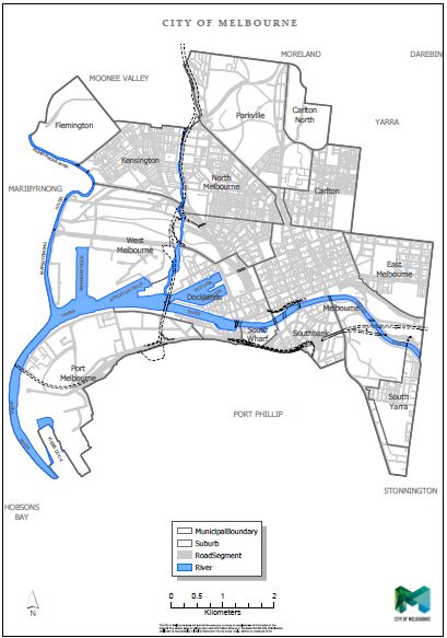
13Appendix 1
City of Melbourne Municipal Map
14Appendix 2: Standards of Maintenance
Summary of Road Maintenance Categories and Road Asset Inspection Frequencies
Table 1: Proactive Road Asset Inspection Frequencies for Assets in Road Reserve (including footpaths but excluding
bridges)
Road Category Road Hierarchy Description Minimum Inspection Frequency
A Premium Roads and Public Realm Areas 2 Monthly
B Arterials 4 Monthly
B Major Local 4 Monthly
C Minor Local (CBD) 6 Monthly
D Laneways, Right of Way and Residential 12 Monthly
Table 2: Standards of Maintenance and Response Times
Asset Category Description of Defect or Hazard Intervention Standard
(Maximum Target Response time to reduce
risk/ repair defect is 4 Weeks)
Road, Footpath and Shared Level discontinuity (edge steeper than 1:1) Over 20mm level difference
Zone Segmental Pavement
Road, Footpath and Shared Level discontinuity (edge slope 1:4 to 1:1) Over 20mm level difference.
Zone Segmental Pavement
Road, Footpath and Shared Mounding or Heaving caused by uplifted area of Over 100mm gap under 1.2m straightedge
Zone Segmental Pavement pavement.
Road, Footpath and Shared Uneven surface grade caused by sunken area of Over 50mm gap under 1.2m straightedge
Zone Segmental Pavement pavement.Asset Category Description of Defect or Hazard Intervention Standard
(Maximum Target Response time to reduce
risk/ repair defect is 4 Weeks)
Road, Footpath and Shared Loose paver unit Unstable Paver
Zone Segmental Pavement
Road, Footpath and Shared Missing paver unit Missing
Zone Segmental Pavement
Road, Footpath and Shared Gaps between pitchers and / or adjacent assets (including Over 40mm depth
Zone Segmental Pavement service covers and walls) caused by loss of grout.
Road, Footpath and Shared Gaps between paver units and / or adjacent assets Over 40mm depth
Zone Segmental Pavement (including service covers and walls) caused by loss of
grout.
Asphalt Road and Footpath Pavement breakout -potholes / digouts / edge breaks Over 50mm depth with a diameter greater
Pavement than 200mm.
Asphalt Road and Footpath Pavement deformation– rutting / depressions / shoving Over 40mm gap under a 1.2m straightedge
Pavement transverse or under a 3m straightedge
longitudinal
Asphalt Road and Footpath Mounding or Heaving caused by uplifted area of Over 100mm gap under 1.2m straightedge
Pavement pavement.
Asphalt Road and Footpath Surface distress – crocodile cracking / flushing 3mm wide cracks and over 1m 2
Pavement
Asphalt Road and Footpath Pavement cracking – block cracks, longitudinal, 3mm wide cracks and over 1m 2
Pavement transverse
Bluestone and Precast Level difference between adjacent kerbstones. Over 20mm level difference.
Concrete Kerb
Bluestone and Precast Level difference between uplifted / sunken kerbstones and Over 20mm level difference
Concrete Kerb Footpath.
Bluestone and Precast Uplifted or sunken kerbstones. Over 50mm gap under 1.2m straightedge
Concrete Kerb
16Asset Category Description of Defect or Hazard Intervention Standard
(Maximum Target Response time to reduce
risk/ repair defect is 4 Weeks)
Bluestone and Precast Displaced laterally Over 50mm gap under 1.2m straightedge
Concrete Kerb
Bluestone and Precast Broken or chipped Thickness of missing or loose part over
Concrete Kerb 50mm
Bluestone and Precast Tilted. Over 1:15 slope in top surface (laterally)
Concrete Kerb
Bluestone and Precast Missing. Missing
Concrete Kerb
Bluestone and Precast Broken, dislodged or missing render infill at property Thickness of missing or loose part of render
Concrete Kerb stormwater outlet. infill over 30mm
Bluestone and Precast Loose. Unstable kerbstone
Concrete Kerb
Bluestone and Precast Level difference between adjacent channel sections. Over 20mm level difference
Concrete Channel
Bluestone and Precast Level difference between uplifted / sunken channel Over 20mm level difference
Concrete Channel sections and roadway.
Bluestone and Precast Uplifted or sunken channel sections. Over 30mm gap under 1.2m straightedge
Concrete Channel
Bluestone and Precast Displaced laterally Over 30mm gap under 1.2m straightedge
Concrete Channel
Bluestone and Precast Broken or chipped Thickness of missing or loose part over
Concrete Channel 50mm
Bluestone and Precast Missing. Missing
Concrete Channel
Bluestone and Precast Pooling of water in channel locally. Over 30mm gap under 1.2m straightedge
Concrete Channel
17Asset Category Description of Defect or Hazard Intervention Standard
(Maximum Target Response time to reduce
risk/ repair defect is 4 Weeks)
Tree Plot and Tree Plot Granitic sand infill level below footpath level in Road More than 40mm
Surrounds within Footpaths Maintenance Category A and B Road Segments
Tree Plot and Tree Plot Granitic sand infill level below footpath level in Road More than 40mm
Surrounds within Footpaths Maintenance Category C and D Road Segments
Tree Plot and Tree Plot Permeable surface infill level below footpath level in Road More than 40mm
Surrounds within Footpaths Maintenance Category A and B Road Segments
Tree Plot and Tree Plot Permeable surface infill level below footpath level in Road More than 40mm
Surrounds within Footpaths Maintenance Category C and D Road Segments
Tree Plot and Tree Plot Granitic sand infill level below road level in Road More than 40mm
Surrounds within Roads Maintenance Category A B, C & D Segments
Vegetation and Trees Overgrown vegetation and trees on Council Roads and Maintain Roadway height clearance > 4.5m
VicRoads Roads
Vegetation and Trees Overgrown vegetation and trees on Council Roads and Maintain Footpath clearance > 2.5m
VicRoads Roads
Vegetation and Trees Overgrown vegetation and trees across footpath Remove encroachment of vegetation on
footpath > 250mm
Vegetation and Trees Overgrown vegetation and trees across shared path Remove encroachment of vegetation on
shared path > 500mm
Vegetation and Trees Overgrown vegetation and trees across Council Roads Roadway lateral clearanceAsset Category Description of Defect or Hazard Intervention Standard
(Maximum Target Response time to reduce
risk/ repair defect is 4 Weeks)
Vegetation and Trees Overgrown vegetation and trees obstructing Council street No foliage touching light fitting and no foliage
lighting within a cone (60 degrees wide) below the
light
Vegetation and Trees Fallen tree limb obstructing pedestrian/ cyclist traffic Remove obstruction
Vegetation and Trees Fallen tree limb obstructing vehicular traffic Remove obstruction
Traffic Sign and Sign Support Loose sign and/ or sign support Repair any component that is not firmly
fastened
Traffic Sign and Sign Support Misaligned sign and/ or sign support Sign face is more than 20 degrees from
correct alignment as required by Council’s
design standards.
Traffic Sign and sign support Missing sign and/ or sign support Any missing component
Traffic Sign Sign face bent by impact or other applied force Departure from flat surface when measured
as gap under a straightedge placed on sign
face to be not more than 30mm
Traffic Sign Sign face curved Departure from flat surface when measured
as gap under a straightedge placed on sign
face to be not more than 30mm
Traffic Sign Metal sign board creased Previous efforts to straighten bent sign have
resulted in unsightly distortion of sign face.
Traffic Sign Degraded sign face (other than reflectivity) Not easily readable in the circumstances that
the sign is intended to be read. Sign is faded
or damaged such that >20% of the sign is
illegible from a distance of 15 meters.
Traffic Sign Defaced with graffiti, paint, sticker or other applied Any amount
material
Traffic Sign Sign face dirty Visible deposit of accumulated dirt
19Asset Category Description of Defect or Hazard Intervention Standard
(Maximum Target Response time to reduce
risk/ repair defect is 4 Weeks)
Traffic Sign Support Bent or otherwise damaged Any component bent out of alignment by
more than 10 degrees. Any damage that has
caused significant structural weakness.
Traffic Sign Support Corroded/rusty More than 20% of surface affected
Traffic Sign and Sign Support Pedestrian hazard Any Sign or Sign Support or parts thereof that
present an immediate and significant hazard
to pedestrians due to height, location, sharp
edges etc.
Drainage Pit Grates and Pit Displaced component Laterally or vertically displaced by more than
Lids 20mm.
Drainage Pit Grates and Pit Damage Bent or broken to extent that structural
Lids integrity is materially affected or any part is
more that 20mm out of alignment.
Drainage Pit Grates and Pit Missing component Any missing component.
Lids
Drainage Pit Grates and Pit Rust / corrosion When a part has rusted or corroded to the
Lids extent that the thickness of remaining metal
at any point has reduced to less than 75% of
original thickness.
Drainage Pit Grates and Pit Uneven trafficable surface When a component forms part of a surface
Lids where pedestrians are expected to walk is
lower or higher than adjacent surfaces by
more than 20mm.
Drainage Pit Grates and Pit Hazard to persons or property Any Drainage Pit component that is a
Lids potential immediate and significant hazard to
pedestrians, cyclists or vehicular traffic.
20Note: While the maximum target resolution time to repair defects is four weeks there may be occasions when this time is reduced due to the nature,
size and location of the defect including the assessment of associated risks at the time of assessment.
Response Times and Intervention Levels – Pavement Marking
Pavement marking includes all line marking, road marking and raised pavement markers for roads designated as under the Council responsibility
but excludes traffic signal and pedestrian crossing line marking maintenance (as per VicRoads Agreement with Council) as well as parking bay and
footpath markings.
The Service Provider is responsible for Pavement Marking maintenance and shall ensure that the Council’s Target Service Level is maintained. The
Council’s required service level for Pavement Marking is specified below.
Line-marking and road-marking condition shall be determined from the retro-reflectivity performance of the glass beads in the line-marking and
road-marking.
For line-marking and road-marking the average level of retro-reflectivity over the City is to be not less than 150 millicandela/square metre/lux
(mcd/m2/lx) and the minimum acceptable reflectivity is 120 mcd/m2/lx.
For raised reflective pavement markers (RRPMs) the minimum acceptable condition is when wear or damage has reduced the reflective surface
by 30 per cent.
If the Service Provider is notified of a Pavement Marking that is below the minimum standards specified above, the Pavement Marking shall be
renewed within a period that is appropriate for the level of risk to the public. This period shall not exceed 4 weeks.
21Appendix 3: Summary of Maintenance Standards for Bridges
Bridge Maintenance
Currently the Council has total responsibility for 23 bridges (road and pedestrian) located throughout the city as
listed below.
Table 3: List of Bridges that City of Melbourne is responsible for maintaining
Bridge Number Asset Number Asset Description
1 1073775 Bridge - Arden Street Bridge
2 1073776 Bridge - Macaulay Road Bridge
3 1073777 Bridge - Morell Bridge
4 1073778 Bridge - Princes Bridge
5 1073779 Bridge - Queens Bridge
6 1073780 Bridge - Sims Street Bridge
7 1073781 Bridge - Stock Subway Bridge
8 1073782 Bridge - Stock Bridge
9 Bridge - Evan Walker Bridge (formerly Southbank
1073783 Pedestrian)
10 1073784 Bridge - The Avenue Ped. Underpass
11 1073785 Bridge - Sandridge Foot Bridge
12 1073786 Bridge - Birrarung Marr Foot Bridge
13 Bridge - Docklands - Collins to Spencer to Stadium Dr
1282465 Bridge (July 07)
14 1282466 Bridge - Latrobe Street Bridge
15 1282467 Bridge - Webb Bridge
16 1282468 Bridge - Yarra's Edge Promenade Pedestrian Access Ramp
17 1375195 Bridge - Manningham Street Foot Bridge
18 1449246 Bridge - Sims St Footbridge North
19 1449247 Bridge - Sims Street Foot Bridge South
20 1498894 Bridge - 717 Bourke Street Pedestrian Bridge
21 1527877 Bridge - Seafarers Bridge
22 Bridge - Jim Stynes Bridge (Charles Grimes Bridge
1579827 Underpass)
23 1598059 Bridge - Alexandra Avenue Bicycle Path Ramp
The above list may be altered as new bridges are constructed and added to the Council’s asset responsibility.
The 3 levels of inspections are as specified in the applicable Bridge Manual as follows:
Level 1: Routine inspections, twice yearly with a maximum interval of 6 months.
Level 2: Periodical inspections, maximum 2 year interval.
Level 3: Structural inspections/investigations when a problem is detected in a Level 2 inspection.You can also read