Robotics During a Pandemic: The 2020 NSF CPS Virtual Challenge - SoilScope, Mars Edition
←
→
Page content transcription
If your browser does not render page correctly, please read the page content below
Robotics During a Pandemic: The 2020 NSF CPS Virtual Challenge –
SoilScope, Mars Edition
Darwin Mick, K. Srikar Siddarth, Swastik Nandan, Harish Anand, Stephen A. Rees, Jnaneshwar Das
Abstract— Remote sample recovery is a rapidly evolving and compete without the time-consuming process of setting
application of Small Unmanned Aircraft Systems (sUAS) for up the software and hardware themselves, which is typical
planetary sciences and space exploration. Development of cyber- in a robotics competition. The need for a remote testbed
physical systems (CPS) for autonomous deployment and recov-
ery of sensor probes for sample caching is already in progress has already been recognized and implemented in a physical
arXiv:2103.08684v1 [cs.RO] 15 Mar 2021
with NASA’s MARS 2020 mission. To challenge student teams setting [8]. However, OpenUAV is completely virtual and
to develop autonomy for sample recovery settings, the 2020 NSF effective without access to hardware.
CPS Challenge was positioned around the launch of the MARS
2020 rover and sUAS duo. This paper discusses perception and
trajectory planning for sample recovery by sUAS in a simulation
environment. Out of a total of five teams that participated,
the results of the top two teams have been discussed. The
OpenUAV cloud simulation framework deployed on the Cyber-
Physical Systems Virtual Organization (CPS-VO) allowed the
teams to work remotely over a month during the COVID-
19 pandemic to develop and simulate autonomous exploration
algorithms. Remote simulation enabled teams across the globe
to collaborate in experiments. The two teams approached the
task of probe search, probe recovery, and landing on a moving
target differently. This paper is a summary of teams’ insights
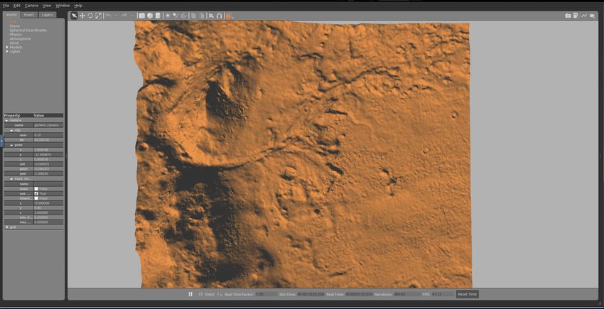
and lessons learned, as they chose from a wide range of Fig. 1: The Martian Jezero Crater competition site shown
perception sensors and algorithms. in the Gazebo simulator within the OpenUAV CPS-VO
Web page: https://cps-vo.org/group/CPSchallenge framework.
I. I NTRODUCTION
Inspired by the Mars Perseverance Rover and the Mars
Small Unpiloted Aircraft Systems (sUAS) are gaining pop- Helicopter Ingenuity, the new challenge involves a simulated
ularity in agricultural and environmental applications. sUAS Martian environment, where teams seek to autonomously
are used for vegetation mapping, crop stress monitoring, and retrieve and deploy a soil probe using an sUAS and then
fruit counting through a suite of onboard sensors [1, 2]. return the sUAS to a moving rover. Studies have already
Furthermore, sUAS have been effectively used in missions to been conducted showing the efficacy of operating an sUAS
retrieve physical samples for ex-situ analysis. For instance, on the surface of Mars for scouting purposes, and Ingenuity
they have been used for the aerial collection of water samples will test them in practice this year [9, 10]. Furthermore,
and aerobiological sampling in agricultural fields [3, 4]. retrieving and testing a diverse set of Mars soil samples is
The NSF-sponsored 2020 CPS Challenge is motivated by one of Perseverance’s main science goals [11]. Therefore,
the plethora of applications of sUAS [5, 6]. The original soil sampling and retrieval are of interest to the scientific
intention was to create an entirely autonomous system with community, and using an sUAS to retrieve samples is not
sUAS to deploy and retrieve a soil probe that could measure only feasible but could also allow for samples to be retrieved
the Sonoran Desert’s various soil properties. However, during from locations that are hazardous for rover traversal. A future
the COVID-19 pandemic, building and testing of the hard- Mars mission where an sUAS is responsible for critical
ware became infeasible. The competition moved to a virtual path science goals, such as probe retrieval, is highly likely,
environment to adapt to these new challenges and changed and this challenge lays the groundwork for three autonomy
its scope to follow the Mars 2020 theme. solutions to this specific problem:
OpenUAV, a web-based robotics simulation software that • Autonomously navigate to a search location to search
enables students and researchers to run robotic simulations for, detect, descend upon, and pick up the soil probe.
on the cloud, provided easy access to sUAS algorithm • Autonomously navigate to a drop location, descend, and
development and experiments, despite the pandemic [7]. detach the soil probe.
It also allowed students from various countries to interact • Autonomously return to and land on a moving rover.
Authors are with the School of Earth and Space Exploration, Tempe, In this work, we present two sUAS methods that can
Arizona dpmick, snandan3, hanand4, jdas5@asu.edu, Stephen is a staff at autonomously retrieve and deploy a lightweight probe, then
Vanderbilt University, Nashville, Tennessee stephen.a.rees@vanderbilt.edu,
and Srikar is with the Dept. of ECE, National Institute of Technology land on a moving rover. We also discuss the unique chal-
Karnataka, India kodihallisrikarsiddarth.181ec218@nitk.edu.in lenges of hosting a competition during a pandemic and how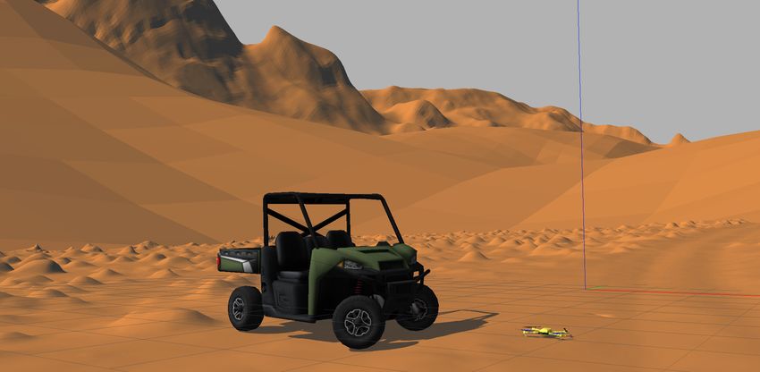
it affected the participating teams.                              ROS package that acts as the liaison between PX4, QGC,
   This paper follows the methodologies of two different          and ROS.
teams, and the structure is as follows. In section II, we de-        Using software in the loop (SITL), PX4 and MAVROS
scribe the simulation environment, followed by a description      reduce the gap between simulation and real testing. The
of our solutions in section III. We discuss simulation results    software controlling the real sUAS runs in two parts, the
in section IV, followed by a discussion of the pandemic’s         higher-level functionalities run on an Intel NUC and the flight
impact on the results in section V. Finally, conclusions and      controller on the Pixhawk Autopilot. During the simulation,
future work are in section VI.                                    the PX4 SITL takes the role of the Pixhawk Autopilot.

              II. C OMPETITION D ESCRIPTION                       D. Reproducibilty
A. Competition Phases                                               All participant’s code and container environments are
                                                                  available on the CPS-VO page, where any future teams and
   1) Phase 1: The first phase of the competition was
                                                                  experts can redo the experiments and improve upon the
structured for two weeks and targeted visual servoing of
                                                                  participant’s submissions [6].
an sUAS with a sensor probe for autonomous recovery.
This was followed by autonomous deployment of the probe
at a specified location. For this phase, a terrain mapped
with a multi-rotor sUAS with an onboard MicaSense RED
Edge MX camera was used. The 3D mesh was inserted in
all OpenUAV container environments, along with a custom
sUAS model and sensor probe.
   2) Phase 2: The second phase of the competition built
upon Phase 1 and involved a significantly larger site based
on a Jezero Crater MARS 2020 site mesh model acquired in
Spring 2020. This phase requires the sUAS to land on the
trunk of the rover while the rover is in motion.
                                                                  Fig. 2: The architecture of OpenUAV involves a dockerized
B. System Description                                             Lubuntu desktop environment containing robotics software
                                                                  like Gazebo, Unity, ROS, and PX4. Nginx redirects the web
   A combination of two 2.1 GHz 16 core processors, two
                                                                  requests to the corresponding docker container.
NVIDIA GeForce RTX 2080ti, 2 TB SSD, and 10 TB HDD
forms our server’s hardware framework. A total of 107
containers were created during the CPS Challenge period [7].                          III. M ETHODOLOGY
A simulation session consists of a Lubuntu desktop equipped
with widely used robotics software, that is accessible through       The purpose of the NSF CPS 2020 challenge has been to
a web URL. By utilizing VirtualGL, any 3D rendering calls         let contestants explore from a range of perception sensors and
by the applications directly go to the GPU, and hence,            develop innovative strategies for trajectory planning and state
the rendering looks smoother. Fig. 2 shows the OpenUAV            estimation. State estimation of sUAS is a unique challenge
platform’s architecture that enabled a virtual competition        due to the aircraft’s persistent pitch angle while searching
during the pandemic. Further details on the architecture and      for probes. Moreover, the jerks due to aggressive change of
implementation can be found on the OpenUAV paper [7].             modes result in noisy state estimation. A robust strategy is
                                                                  needed to incorporate the inaccuracy in the sensory readings
C. Software                                                       and detect probes.
   1) ROS and Gazebo: ROS is a framework used to easily
communicate between the robot and ROS nodes through
ROS messages [12]. Gazebo is a simulator that comes with
a physics engine [13]. Together, they make the basic frame-
work of the robotic simulation. The MAVlink communication
protocol allows communication between the UAV model in
the simulation with the code written by the user.
   2) PX4, MAVROS, and QGC: PX4 is an open-source
flight control software for aerial, ground, and sea vehicles
[14]. PX4 enables low-level rate control and higher-level ve-
locity and position control of the UAV. It also provides sensor   Fig. 3: The simulated environment containing the Mars
support, flight logging, and the state estimator. QGround-        Jezero world, the rover, and the sUAS.
Control is a remote flight planning and tracking software
that enables the teams to control the vehicles as they would         Due to the competition requirements, all teams followed
normally do in an outdoor field experiment. MAVROS is a           the same general guidelines to solve this problem. Each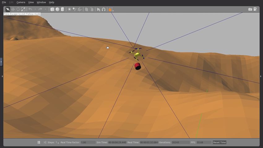
team’s methodology begins with a search pattern to find the      location of the rover to better precision. When the sUAS
probe. Each team uses a different object detection algorithm     hovers above the rover, it detects the rover using the ‘You
to detect the probe. Once the probe is detected, the sUAS        Only Look Once’ (YOLO) object detection algorithm im-
autonomously descend to pick up the probe and it is then         plemented through the darknet package [17]. As the sUAS
carried to a known destination for deployment. Finally, the      descends, it uses a fiducial marker placed on the rover’s trunk
teams autonomously return the sUAS to the moving rover           to refine the sUAS’s trajectory, thus landing successfully into
and land in the trunk.                                           the trunk.
                                                                    This technique uses the feature tracking odometry from
A. Team Drone Trekkers (Team 1)
                                                                 a popular SLAM package, RTAB-map, which uses stereo
   Team 1’s solution for probe detection involves shape and      vision. To estimate the location of the rover, a Kalman Filter
color recognition. The team uses a master controller to switch   is used to combine the odometry-based coordinate tracking
between sUAS modes to accomplish different tasks (Alg.           and the GPS location of the rover. The filtered location
1). Terrain relative navigation is implemented using a sonar.    is published as a ROS message that is used by the sUAS
The sUAS follows a lawnmower-pattern to search for the           to follow and land on the moving rover. A challenge to
probe [15]. Then, using a standard digital image processing      this approach is that RTAB-map will fail due to a lack of
algorithm of overlaying two HSV images to extract contours,      trackable features. This often occurs at places with smoother
the sUAS detects the probe as a red circle with the largest      terrain textures. Due to lack of features, the terrain loses
area. Following that, the sUAS uses velocity control to          sufficient detail to generate points for RTAB-map. Therefore,
descend upon the probe, where a Gazebo plug-in attaches          when the rover travels to regions with a dearth of features,
the probe model to the sUAS, as seen in Fig. 4. At this point,   the Kalman Filter stops working, and the sUAS is unable to
the sUAS takes the probe to a predetermined drop location,       follow the rover. However, this problem should not happen
where it descends and detaches the probe.                        in the real world, as there are plenty of features to track
                                                                 in a desert landscape. Therefore, this solution should work
 Algorithm 1: Team 1’s Control Loop                              in general, but given the online-environment constraints, its
  while node OFFBOARDCONTROL has not shut                        success is limited to specific types of terrains.
   down do
     if mode is PROBE then
         fly to destination();
         pattern();
         hover();
         descent();
         attach();
         mode ←− DROP ;
     else
         if mode is DROP then
             fly to destination();
             pattern();                                          Fig. 4: Team 1 using color and shape recognition to detect
             detach();                                           the red probe with their sUAS. The sUAS is in the process
             mode ←− ROVER;                                      of using velocity control to descend onto, and pick up the
         else                                                    probe.
             if mode is ROVER then
                 Rover location ←− Kalman filter();
                 pattern(Rover Location);                        B. Team Planet Porters (Team 2)
                 detach();                                          The algorithm involves the detection and localization of
                 mode ←− END                                     the probe using an image processing technique. The team
             else                                                makes use of a square-spiral search pattern to look for the
                 hover();                                        probe. Once detected, it tracks various red-colored contours
                 continue;                                       using RGB to HSV conversion and tracks the one with
                                                                 maximum area. Once the camera starts providing feedback,
      Shut down node OFFBOARDCONTROL
                                                                 a precise set-point control loop is applied to bring the sUAS
                                                                 closer to the probe using the centroid of the contour [18].
   Next, the sUAS navigates to the rover while the rover         The sUAS docks with the probe only when it gets closer
starts to move forward. The sUAS navigates to the estimated      than 0.6 meters and when the inclination is less than 30°.
location of the rover. The location estimate is accomplished     The sUAS is in position control mode during this time.
by combining the GPS location of the rover and the odometry         After the probe is retrieved, the sUAS carries the probe to
of the rover. The odometry is found by tracking feature points   the drop zone to deploy it. The sUAS advantageously uses
generated using RTAB-map [16]. This technique refines the        the pitch angle during its flight. Eight sonars are installed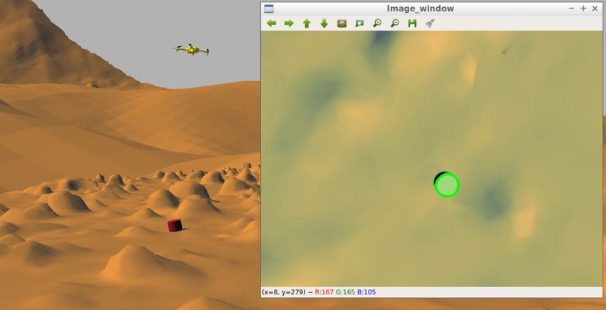
in different directions on the horizontal plane of the sUAS,                            IV. E XPERIMENTS
which is capable of detecting undulating terrestrial obstacles
on its course of flight (Fig. 5). This helps the sUAS detect          In this section we, discuss the results of the simulated
any upcoming terrain hills easily because of its forward tilt      trials for both methodologies. Each team manually ran 20
angle. When any sonar senses an obstruction nearby, the            trials to determine the efficacy of their approach. Each trial
sUAS instantly increases its altitude, without altering the        was separated into three steps:
horizontal velocity, to avoid collision with the surface. After      1) Maneuvering to and retrieving the soil probe.
deploying the probe the sUAS switches to velocity control            2) Deploying the soil probe.
mode. A velocity limiter is then applied to prevent the sUAS         3) Returning to and landing the sUAS in the rover.
from becoming unstable.                                               To determine the efficacy of the methodologies approaches
                                                                   and to compare the approaches of the teams, two key metrics
 Algorithm 2: Team 2’s PID Controller used when                    are defined:
 the sUAS switches to velocity control mode in order
                                                                     1) The time taken to complete each step.
 to land on the moving rover.
                                                                     2) The consistency between trials, measured by the stan-
  time interval ←− 0.05; // specifies the rate,                         dard deviation of the sUAS’s positions at the same time
                            // at which the loop should run             in different runs of the simulation, and the standard
  kp ←− 0.5;                // the proportional gain                    deviation of time to complete the task.
  ki ←− 0.000005;           // the integral gain
  kd ←− 0.4;                // the differential gain                  The graphical representation of these steps can be seen in
  error←− rover position - sUAS position;                          Figure 6. Here, the averaged flight path from the 20 trials
  while error ≤ 0.2 do                                             is graphed. The start of flight and beginning of each step is
      previous error ←− error;                                     indicated for clarity. High levels of consistency between the
      error ←− rover position - sUAS position;                     two teams are observed when the trajectory of the flight is
      integral error ←− integral error +                           projected in the x-y plane. This is a reasonable observation
       error*time interval;                                        since the teams are moving to the same positions to search
      differential error ←− (error -                               for and deploy the probes. However, there is a significant
       previous error)/time interval;                              difference in the flight of the two teams when the sUAS’s
      sUAS velocity ←− sUAS velocity + kp*error +                  global z-coordinate, or altitude, is taken into account. This is
       ki*integral error + kd*differential error;                  likely because each team implemented unique and different
      sleep(time interval);                                        methods for terrain relative navigation. In addition to this,
                                                                   each team also has a different method for descending onto
                                                                   the rover.
                                                                      Differences between each team’s sUAS-position can be
                                                                   seen explicitly in Figure 7. The mean position and the
                                                                   standard deviation of the position are graphed for each team.
                                                                   Through these graphs, we can determine that Team 2 built
                                                                   a more consistent algorithm with respect to the position of
                                                                   the flight at the same time for each simulation. During the
                                                                   first step, the two teams remained highly consistent. This is
                                                                   a logical result considering that the sUAS started from the
                                                                   same location and looked for the probe, which was always
                                                                   in the same location. It is not until the beginning of the third
                                                                   step that we start to see major delineations in the trajectory
Fig. 5: Team 2 using an array of sonar sensors to detect           of flight between the two teams.
and avoid the terrain while lifting the sample probe.                 The standard deviation of the trajectory of flight for both
                                                                   teams increases in step 3. This is a reasonable observation
   After dropping the probe, the sUAS tracks the rover with        since, at this stage, the sUAS is required to land on a moving
its GPS coordinates. The solution now applies a PID control        rover. This part of the mission adds uncertainty to the flight.
algorithm that controls the sUAS’s velocity by using the           In this scenario, the second team’s flight has a lower standard
relative displacement between the sUAS and the rover as            deviation. The second team’s flight is more likely to end in
input (Alg. 2). Kp is linearly proportional to the system’s        the same location through each episode, thus decreasing their
response. Ki eliminates the steady-state error, and Kd helps       final standard deviation. The difference between the team’s
the error converge faster by reducing the overshoot. The           trajectory of flight is most prominent in the z-direction.
rover’s trunk is painted red so that the rover’s presence can be      In addition to this, Figure 7 also highlights key information
confirmed visually [19]. The sUAS lowers its altitude linearly     about the time elapsed in the flight between teams. Although
as it gets close to the rover and decides to land when it is       Team 2 is more consistent, Team 1 performs the steps much
less than 0.3 meters above the rover’s trunk.                      faster. If the teams start at the same time, Team 1 moves to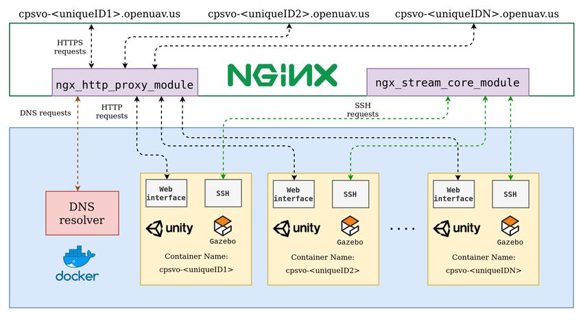
Robit
Fig. 6: Average trajectories from both teams in 2D and 3D space. Trajectories shown are the average of 20 runs for each
team. The location where each step starts is marked.

Step 2 faster than Team 2. These differences are tabulated      flyable hardware. This was not possible due to the COVID-
in Table I.                                                     19 pandemic. However, the OpenUAV platform enabled this
                                                                competition to continue in a meaningful way.
                 Mean Time (s)    Standard Deviation (s)           As shown above, both teams were able to implement a
        Step   Team 1    Team 2   Team 1      Team 2            complex methodology to approach the problem. The simu-
                                                                lation framework allowed for intricate autonomy solutions
          1     50.05     93.34   0.971        4.154            while allowing other, less experienced competitors to learn
          2     97.70    163.56   12.01        2.253            the basics of the ROS and Gazebo framework. Therefore,
          3    125.59    228.85   12.76        12.20            continuing education on Cyber-Physical Systems at all skill
                                                                levels throughout the pandemic. Moreover, the differences
TABLE I: Time comparisons between each team, separated          in the team’s approaches highlight the versatility of the
for each step of the run.                                       container environment. Practically, what can be implemented
                                                                and tested in real-life can also be implemented on the
   It is observed that Team 1 completes each step faster. The
                                                                container.
average time to complete the entire trial for Team 1 was
                                                                   This is true despite the challenges faced while using
2742.0 seconds, while it took 3942.0 seconds for Team2.
                                                                RTAB-Map. Feature tracking is possible in regions of the
Furthermore, the teams are able to run these episodes at a
                                                                simulation where the terrain had detailed features. In other
similar level of consistency. Team 1 completes Step 1 with
                                                                regions, where the terrain lacks useful features, tracking be-
a much lower standard deviation than Team 2. On the other
                                                                comes challenging. Hence, the problem is with the simulated
hand, Team 2 completes step 2 more consistently. Finally, the
                                                                environment, not with the OpenUAV platform.
standard deviation for step three is similar for both teams.
Therefore, Team 1 will always be faster than Team 2, and           Furthermore, the OpenUAV platform enabled certain ben-
both teams are equally consistent in the time domain.           efits that would not have been possible under normal cir-
   Based on the metrics defined above, Team 2 follows a         cumstances. For example, the winning team competed from
better methodology. This is due to the overall consistency      India, whereas Team 1 competed from the United States.
of the team’s method. Even though Team 1 completed              This collaboration would not have been normally possible
their tasks much faster, Team 2 could do so more reliably.      for logistical reasons. Plus, the platform enabled team mem-
Given the Mars 2020 use-case that drives these methods’         bers to work together on the same container from differ-
development, reliability is a more important metric than the    ent locations. This created a comfortable environment for
time taken.                                                     mentorship, where more experienced team members could
                                                                easily walk through complex code and methodologies with
                      V. D ISCUSSION                            less experienced members.
   Under normal circumstances, this competition would have         Competition participants were also all enthusiastic about
taken place outdoors, and software would have been tested on    participating in the competition. Most internship, REU op-
Fig. 7: Standard deviation in position for each axis. The start of each step is marked, and shows Team 1’s algorithm
completing the steps faster than Team 2. However, this also shows lower deviation in position for Team 2.
portunities, and other in-person sUAS competitions were Tools addressed in this paper can continue to be used for sim-
canceled due to the pandemic. Using the OpenUAV platform, ulation and extended collaboration even after the pandemic.
it was trivial to modify the original CPS challenge’s scope Containerization and OpenUAV can also significantly lower
to move online. Thus, providing students a place to continue the barrier for entry into robotics, as students do not need to
to learn applied skills in a structured environment. This level have local access to the computing infrastructure necessary
of resilience allowed for meaningful work and continued to run complex simulations.
education to take place while most other programs had to As part of the NSF-sponsored competition, we performed
be stopped. and analyzed two potential methodologies for probe recovery
The most considerable downside to an online environment on Mars. Given the goals of Mars 2020, these methods can
is that the teams could not build physical sUASs and fly them be an essential proxy for actual mission settings. Moreover,
to test their algorithms. There is much to be learned by com- with the correct soil probe, these algorithms are directly ap-
paring simulation results to a real application, especially for plicable to Earth and can be reused for terrestrial exploration
aspiring engineers. However, by removing the competition’s associated with geological and ecological studies.
hardware aspect, the teams had a more in-depth and thorough Future work can branch in two different directions. The
experience with the software side. This helped develop next step is to build sUASs and test the algorithms as initially
valuable software skills in students who would not have been intended in the hardware path. The tested algorithms can
exposed to them otherwise. Now, when the pandemic is over, then be directly used to deploy and retrieve soil probes on
competitors will be better overall engineers because they will Earth. In the software path, the simulation and platform can
know how to program their physical systems. Plus, lessons continue to be refined. Now that Mars 2020 has landed on
learned during this competition about robotic control will Mars, more data and scans of the simulated environment
inform future physical designs. will become available. Thus, the simulated environment can
continue to be enhanced, and more accurate algorithms can
VI. C ONCLUSIONS AND F UTURE W ORK be developed.
In this paper, we presented the methodologies and results VII. ACKNOWLEDGEMENTS
of a virtual robotics challenge. We demonstrated how com- We gratefully acknowledge NSF grant CNS-1521617 for this
work.
petitions such as these could effectively continue in a vir-
tual environment. Furthermore, we have demonstrated how
education in Cyber-Physical Systems can continue virtually.R EFERENCES Robotics and Automation (ICRA), 2015 IEEE Inter-
[1] J. Das et al. “Devices, systems, and methods for national Conference on. May 2015.
automated monitoring enabling precision agriculture”. [15] Stefan Williams, Gamini Dissanayake, and Hugh
In: 2015 IEEE International Conference on Automa- Durrant-Whyte. “Towards terrain-aided navigation for
tion Science and Engineering (CASE). Aug. 2015, underwater robotics”. In: Advanced Robotics 15.5
pp. 462–469. (2001), pp. 533–549.
[2] Suproteem Sarkar et al. “Towards autonomous phy- [16] Mathieu Labbé and François Michaud. “RTAB-Map as
topathology: Outcomes and challenges of citrus green- an open-source lidar and visual simultaneous localiza-
ing disease detection through close-range remote sens- tion and mapping library for large-scale and long-term
ing”. In: IEEE International Conference on Robotics online operation”. In: Journal of Field Robotics 36.2
and Automation. IEEE. 2016, pp. 5143–5148. (2019), pp. 416–446.
[3] John-Paul Ore et al. “Autonomous Aerial Water Sam- [17] Joseph Redmon. Darknet: Open Source Neural Net-
pling”. In: Journal of Field Robotics 32.8 (2015), works in C. http://pjreddie.com/darknet/.
pp. 1095–1113. ISSN: 1556-4967. DOI: 10.1002/ 2013–2016.
rob.21591. URL: http://dx.doi.org/10. [18] Geoff Fink et al. “Experimental validation of dynamic
1002/rob.21591. visual servoing for a quadrotor using a virtual cam-
[4] David G Schmale Iii, Benjamin R Dingus, and Charles era”. In: 2015 International conference on unmanned
Reinholtz. “Development and application of an au- aircraft systems (ICUAS). IEEE. 2015, pp. 1231–1240.
tonomous unmanned aerial vehicle for precise aer- [19] Davide Falanga et al. “Vision-based autonomous
obiological sampling above agricultural fields”. In: quadrotor landing on a moving platform”. In: 2017
Journal of Field Robotics 25.3 (2008), pp. 133–147. IEEE International Symposium on Safety, Security and
[5] CPS-VO. 2020 NSF Student CPS Challenge. URL: Rescue Robotics (SSRR). IEEE. 2017, pp. 200–207.
https : / / cps - vo . org / group /
CPSchallenge (visited on 10/28/2020).
[6] Cyber-Physical Systems Virtual Organization. Cyber-
Physical Systems Virtual Organization. URL: https:
//cps-vo.org.
[7] Harish Anand et al. “The OpenUAV Swarm Sim-
ulation Testbed: a Collaborative Design Studio for
Field Robotics”. In: arXiv preprint arXiv:1910.00739
(2019).
[8] Wolfgang Fink et al. “Robotic test bed for autonomous
surface exploration of Titan, Mars, and other planetary
bodies”. In: 2011 Aerospace Conference. IEEE. 2011,
pp. 1–11.
[9] Havard Fjaer Grip et al. “Flight Dynamics of Mars
Helicopter”. In: (2017).
[10] Bob Balaram et al. “Mars helicopter technology
demonstrator”. In: 2018 AIAA Atmospheric Flight
Mechanics Conference. 2018, p. 0023.
[11] JF Mustard et al. “Report of the Mars 2020 science
definition team”. In: Mars Explor. Progr. Anal. Gr 150
(2013), pp. 1–154.
[12] Morgan Quigley et al. “ROS: an open-source Robot
Operating System”. In: ICRA workshop on open
source software. Vol. 3. 3.2. Kobe, Japan. 2009, p. 5.
[13] Nathan Koenig and Andrew Howard. “Design and
use paradigms for gazebo, an open-source multi-robot
simulator”. In: 2004 IEEE/RSJ International Confer-
ence on Intelligent Robots and Systems (IROS)(IEEE
Cat. No. 04CH37566). Vol. 3. IEEE. 2004, pp. 2149–
2154.
[14] L. Meier, D. Honegger, and M. Pollefeys. “PX4:
A Node-Based Multithreaded Open Source Robotics
Framework for Deeply Embedded Platforms”. In:You can also read