Site investigations - Star of the South
←
→
Page content transcription
If your browser does not render page correctly, please read the page content below
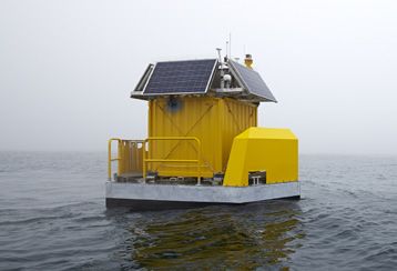
Site investigations

Detailed site investigations are underway out at sea and on land, as we plan for
Australia’s first offshore wind project.
These investigations involve collecting information about local conditions out in the field. Findings are being
used for project planning, engineering, design and environmental assessments.

  Harnessing Gippsland’s offshore wind
  The Star of the South project would harness strong
  offshore winds in Bass Strait to power Victorian homes.
  An offshore wind industry in Gippsland would mean
  thousands of jobs during construction and hundreds of
  ongoing local jobs once it’s up and running.

Offshore investigations
In March 2019, the Australian Government approved an exploration licence to undertake site investigations at
sea. We’re carrying out studies and collecting data in and around our 496 km2 licence area in Bass Strait using
local vessels.

Wind and wave monitoring
We’ve been studying wind and wave
conditions off the Gippsland coast to
confirm the project’s feasibility and inform
its design. Our detection and measurement
devices, called floating LiDARS, were installed
in November 2019 and are collecting data over
several years. Findings will help us determine the
type and number of turbines suitable for this site.
Early indications show the wind is generally strong,
particularly on hot days and in the late afternoon
and evening.
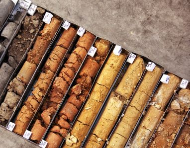
Seabed studies
Initial geophysical investigations took place in March 2020, using soundwave equipment
that can collect data up to 80 m below the seabed. This study involved mapping the
seafloor, measuring water depths and identifying any buried infrastructure such as cables.
These early studies show that seabed conditions are good for building an offshore wind project.
Further seabed studies, including geotechnical investigations, will take place over the coming years.
Geotechnical investigations involve taking a small shallow core sample of the seabed sediment and studying
it to understand its composition and strength. Findings are used to determine the type of turbine foundation
required.
Geophysical Geotechnical
investigations investigations
Boomer
Receive array
Multi-beam
echosounder
Sub-bottom
profilier
Magnetometer Side-scan
sonar
Gradiometer Sea floor
Grab sampling
Cone
penetration
Geological strata tests/
Vibro-cores
Boreholes/
Cone penetration tests
Diagrams not to scale
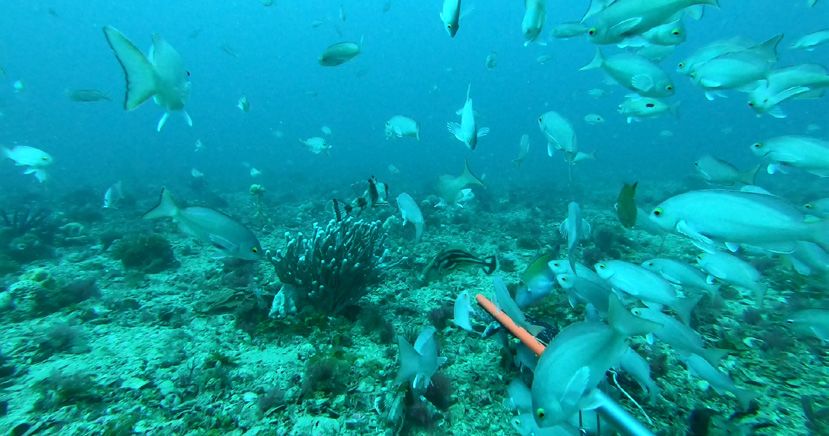
Marine and bird life monitoring
Our world-class marine survey program is collecting important environmental data on
the underwater world. Findings will help us understand the ecological significance of the
proposed project area for key local and migratory species. We’re partnering with some of
Australia’s leading scientists and research agencies including CSIRO and Monash, Deakin and
Curtin universities.
Marine mammals
Whales, dolphins and seals are being monitored by air, by boat, and with underwater sound recorders called
marine hydrophones, placed on the seafloor. The recorders pick up calls from up to 20 km away and can
identify different species and behaviours. We’ve also fitted seals from local colonies with GPS tags so we can
track their movements.
Marine
hydrophones
Wave
noise
Ship noise
Biological
sound
Marine
hydrophone
Humpback whale Diagram not to scale and is an impression only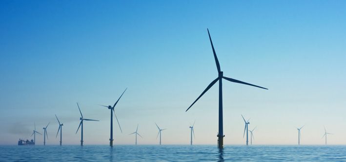
School of perch

Fish                                                                                                      Octopus
We’re investigating the different types and numbers of fish in the study
area using a range of survey methods. Scientific net surveys use traditional
commercial fishing boats and gear to see what a typical catch looks like
in different seasons. We used underwater cameras to film fish in 130
locations during summer and winter. Monitoring for white sharks is also
underway in and around the project area.

Birds                                                       Marine environment
Seabirds and shorebirds are monitored from the              Plants and organisms on the seafloor have
air, by boat and along the coastline. We also survey        been surveyed by underwater video at
colonies on nearby islands and have installed sound         80 sites. Around 200 samples of sand,
monitors to understand population numbers. Some             sediment and other materials from the
birds are fitted with GPS tags so we can track              seafloor have also been taken for analysis.
their movements and pin-point foraging areas and
migration routes.

Black-faced cormorant        Surveys on Ninety Mile Beach   Reef and colourful invertebrates   Starfish
                                                            from just outside the project
                                                            area 35 m underwater

Coastal processes
We’re collecting data on currents and natural sediment movement. Two wave and current
monitors are placed on the seabed along the coastline. Findings will help us determine
if installing turbines out at sea could have any effect on the nearshore and coastal
environment.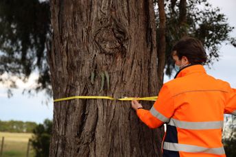
Onshore studies
We’re conducting site investigations on land, from the coast to the Latrobe Valley, to inform our transmission
system design.

Soil testing
We completed initial soil testing
and geotechnical investigations
in early 2020 to understand
local ground and groundwater
conditions. Findings are being used
to inform the design of our transmission
system. Further soil testing is planned as design work
continues.

                                                                           Flora and fauna surveys
                                                                           Ecologists and zoologists started
                                                                           detailed flora and fauna surveys
                                                                           in 2020 to collect data on the
                                                                           existing environment. These studies
Soil testing results tell us about the types of soil, water and rock
                                                                           will continue across different seasons,
underground
                                                                           focusing along the project’s transmission route.
                                                                           The flora surveys involve recording the amount, type
Heritage surveys                                                           and quality of native vegetation.
Archaeologists and                                                         The fauna surveys identify if the area is used by
representatives of the                                                     native animals. Information is collected using a range
Gunaikurnai Land and Waters                                                of different survey methods such as remote sensing
Aboriginal Corporation                                                     cameras, hair tubes, searching for droppings, playing
(GLaWAC) will survey the project’s                                         recorded animal calls and listening for responses and
transmission route to investigate for                                      visual searches.
evidence of Aboriginal cultural heritage and historic
                                                                           Findings will help us understand important locations
heritage features. This work helps ensure that areas
                                                                           for biodiversity and habitat so that these areas can
of heritage value are identified and protected.
                                                                           be avoided where possible and impacts minimised.

   Get involved
   We’re keen to hear from you as we continue investigating the Star of the South project. There’ll be
   several times and ways you can get involved as we develop and assess the project. We’ll consult with
   stakeholders and local communities to seek feedback and collect local knowledge.

More information                              starofthesouth.com.au             Star of the South
To find out more about the Star of the        1800 340 340                      Star of the South Project
South project and register for updates:       info@starofthesouth.com.au        Interpreter service: 13 14 50        MARCH 2021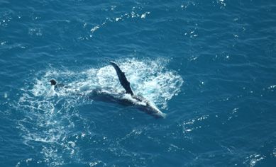
You can also read