"Stay afloat" flood awareneSS Campaign - Maryland ...
←
→
Page content transcription
If your browser does not render page correctly, please read the page content below

“Stay Afloat”
Flood Awareness Campaign
S H FLOOD   !
           F L A     ING ! !
            WARN

                             NOAA Weather Radios
A NOAA weather radio (or all-hazard radio) is a great way to stay informed about the
changing conditions around you. The radios can be programmed to alert you and your
family about possible threatening conditions where you live. NOAA weather radios are
especially good to have around when you are asleep and unable to hear important
messages that might be broadcast on TVs and radios. They are another way to be sure
you and your family stay safe - every household should have one!
We should
Great idea! turn around.
HIGH
WATER
SAFETY1
Avoid Driving Through Flood Waters
Driving through flood water is dangerous! Sometimes there can be a current that
can carry your car downstream. Other times the water might keep you from seeing
a damaged road underneath. The majority of flood-related fatalities in Indiana occur
in vehicles. Be sure to tell your friends and family about the dangers of driving
through flood waters!PROPANE
Toxic Flood Waters
Flood waters can contain very dangergous and poisonous chemicals. Things
such as propane tanks, gasoline cans and paint cans can float downstream and
often times leak into flood waters. These types of products are not only toxic but
can also be highly explosive - so be cautious! If you see something like a propane
tank floating in the flood waters report it to your local Emergency Management
Agency or law enforcement agency. Contaminated flood water can make you
very sick if it is ingested. Certainly never play in flood waters!EASY
W N C S O E D X R U N O F F M
A B O A T B O S A R O O C A A
T S O I A C J I D M N D E Z P
C I F X V T K O I X Z A R J K
H P L A N I S K O T U M Q U A
O P O C R K W S X N M S B C O
U Z O D S A F E T Y K J I Y N
M S D P O Y P Z O R S P E T S
Q H Z N T D X B O F F A L X T
P E L W K C A R Z J O E O L R
D L J A O N Z I N D I A N A E
A T K T O Z O D R F O M L K A
L E V E E C A G K I J C B E M
S R F R N K J E U K S J Y Y X
T O X Z V U I C A Z T R Z A D
M A R Y L A N D P L E A R N E
Y F E M A N T D Q Y G I C S A
N C B T O Z W A R N I N G O I
I G T Q E M R F S P O X T K J
U H P O N D B E Z B C R E S T
FIND THE WORDS LISTED BELOW IN THE PUZZLE ABOVE.
WORDS CAN BE FOUND UP AND DOWN OR ACROSS. GOOD LUCK!
BOAT FLOOD PLAN SAFETY
BRIDGE LAKE PETS SHELTER
CAR LEARN POND STREAM
CREST LEVEE RADIO WARNING
DAM MAP RAIN WATCH
FEMA MARYLAND RUNOFF WATERPizza Salon & Spa supermarket
BUY1GET1
Hair & Nail
Special
Storm Drains
Storm drains can be very dangerous during flooding events and even heavy
rainfall events. Storm drains are often found in parking lots and along curbs
in neighborhoods and residential areas. The swirling water can create suction
as it moves toward the drain. If you are not careful the suction could pull you
toward the drain and under water where you might drown. Children should
avoid playing around storm drains to prevent injuries and drowning.NOW ALL WE NEED ARE EXTRA
CLOTHES AND RAIN GEAR - LIKE HATS
AND BOOTS FOR EVERYONE!
MARYLAND MAPS
WATER WATER WATER WATER
ADDRESS
WATER WATER WATER WATER
WATER WATER WATER WATER
WATER WATER WATER WATER
WATER WATER WATER WATER
BOOK
BATTERIES
M
A
T
C
H
E
S
ANTI-BACTERIAL
MARYLAND HAND WASH F
V MI
R
NO WATER NEEDED! E X
U
G E
G D
IT
IE
CHICKEN S
20
20
20
20
ica
Amer
tes of
ca
meri0
d Sta
A2
Unite
s of
0 Unit
ed State
20 FIRST AID KIT
20
20
220 20 States o
f Am erica
United
20
Family Disaster Kit
Every family should have a family disaster kit in their house. Kits should
include things like a first aid kit, ID for each family member, a battery-
operated radio with extra batteries, a 3-day supply of water for each
person in the house, canned goods and manual can opener, matches,
a map of the area in case evacuation is needed, hand sanitizer, a flashlight,
other items that might be needed on a daily basis as well as extra clothes and
rubber boots. Keep items stored together to make finding them easy in case
you need them!CAN YOU MAKE IT THROUGH THE MAZE TO GET OUT OF THE
FLOODPLAIN AND UP ONTO HIGHER GROUND BEFORE THE FLOOD??
START
FINISH
CONGRATULATIONS - YOU DID IT!PROPANE
PLAYGROUND
GASOLINE
Avoid Playing in Flood Waters
Playing in flood waters can be very dangerous! You might not be able to see how
deep the water is where you are playing. There are also toxic chemicals and
substances in flood waters. Things like garbage, gasoline, propane, raw sewage,
e-coli and industrial chemicals could be lurking in the flood waters; those types
of things can make you very sick if you ingest them. Be sure to play safe by avoiding
flood waters!Wow, son, that
rain is really coming
down over there!
*The National Weather
Service has issued
a flood watch...*
We should go
home and keep
an eye on
things!
Flood Watch
The National Weather Service issues flood watches and flash flood watches.
A flood watch means that heavy rain or water drainage may cause flooding
in some areas. A flood watch means that flooding may begin about 6 hours
after heavy rains have ended. If you hear a flood watch or flash flood watch
being issued be sure to monitor your area for flooding and take extra
precautions while you are outdoors or traveling. Low-lying areas are usually
the first to flood. Stay informed and aware!“A Flood Warning still remains in
effect from the National Weather Service...”
CENTRAL HIGH SCHOOL
**OPEN**
SHELTER LOCATION
FOR FLOOD
EVACUEES
Flood Warning
The National Weather Service issues flood warnings and flash flood warnings.
A flood warning means that flooding will occur very soon or it is already
occurring at the time the warning is issued. A flood warning is usually issued
when a river or other water body first begins to exceed its flood stage. If you
live in an area that frequently floods be sure to know the safest escape routes.
If flooding is significant you may want to evacuate and seek shelter elsewhere;
often times churches and schools open up for those who are displaced from
their homes during disasters. Your county’s emergency management office
can provide shelter information.MAKE YOUR WAY THROUGH THE MAZE TO FIND THE FAMILY DISASTER KIT!
START
GREAT JOB!
FAMILY
DISASTER
KITI should turn around!
Avoid Walking Through Flood Waters
Even walking through flood waters is dangerous! It only takes 6 inches of
moving water to knock an adult off balance! If you trip in the flood waters
you might be pulled downstream by the current or towards a storm drain.
If you see flood waters in your path you should stop, turn around and find
another way to get where you are going. By knowing the dangers of flood
waters you can help protect yourself and others!DANGER!
HAZARDOUS RECIRCULATING
CURRENTS BELOW THIS DAM
CAN TRAP AND DROWN A VICTIM
DON’T PLAY, SWIM
OR BOAT ANYWHERE
NEAR LOW HEAD DAMS!
DROP MAY LOOK
SMALL, BUT DON’T
DANGEROUS
BE FOOLED!
RECIRCULATING
HYDRAULIC
FLOWING WATER
LOW HEAD
DAM
RIVER BED/BOTTOM
[CROSS-SECTION OF A LOW HEAD DAM]
Low Head Dams
Low head dams are very dangerous! They are used to help control water
levels and flow along rivers. It is important to know what low head dams look
like from upstream. Although the drop they produce may not seem like
a large one, it is the turbulent hydraulic beneath the water that is what makes
these dams so dangerous. Once you get trapped in the underwater current it
is difficult to escape. Don’t play, swim or boat near low head dams; look for
signs (like the one above) to help locate these dams. Educating yourself about
how to locate a low head dam will decrease your risk of possibly drowning as a
result of coming into contact with one.WATER WATER WATER WATER
WATER WA R WATER WATER
WATER WATER TEWATER WATER
WATER WATER WATER WATER
WATER WATER WATER WATER
PET
WATER WATER WATER WATER
WATER WA R WATER WATER
WATER WATER TEWATER WATER
WATER WATER WATER WATER
WATER WATER WATER WATER
FOOD
Pets
Don’t forget about your pets! Be sure you have plenty of food and water for
each pet in your household as a part of your preparedness plan and kit. Keep
your pet’s cage or carrier in an easily accessible area in case you need to leave
your house very quickly. Pets can easily be forgotten about when planning
what to do during a disaster, so be sure to keep them in mind!ADVANCED FLOOD CROSSWORD PUZZLE
USE THE CLUES BELOW ALONG WITH THE GLOSSARY OF TERMS PROVIDED IN THIS WORKBOOK TO COMPLETE THE CROSSWORD PUZZLE.
GOOD LUCK! 1 2
3
4
5 6 7
8 9
10 11
12
13
14
15
16 17
18
19
20
21 22 23
24 25
26
27 28 29
30
ACROSS
1 Working to lessen the risk by lowering its chances of occuring or by reducing
its effects if it does occur.
3 The point at which overflow of the natural banks of a stream begins to cause DOWN
damage in the reach in which the elevation is measured (flood _____). 2 A stream that contributes its water to another stream or body of water.
4 National Flood Insurance Program. 3 An emergency _____ provides a safe overflow of floodwaters.
6 100-year flood. 5 Flash Flood Warning.
8 A flood _____ is the lowland which borders a river and is usually dry but can 7 Spillway: an outlet pipe or channel serving to _____ water from a dam,
be subject to flooding. ditch, gutter or basin.
10 Often referred to as a ‘basin’. 9 Flood _____ provides coverage through the NFIP.
14 The science dealing with the properties, distribution and circulation of 11 A flood _____ is issued by the NWS to provide follow-up information
water on and below the earth’s surface and in the atmosphere. on river flooding.
15 An accumulation of broken river ice caught in a narrow channel of the 12 A ____ front forces warm air to rise, condense and form rain.
water body. 13 _____ flood: A flood which follows within a few hours of heavy or
17 A flood____ can be found adjacent to a floodplain and is the channel of a excessive rainfall, dam or levee failure or the sudden release of water
watercourse. impounded by an ice jam.
18 Flood _____: generally issued for flooding that is expected to occur at least 16 _____ is responsible for issuing hazardous weather products.
6 hours after heavy rains have ended. 17 A flood _____ is issued when a river first exceeds its flood stage.
19 The wearing away of land by the flow of water. 20 Synonymous with ‘flood peak’.
22 Surface water resulting from rainfall or snowmelt that flows overland to streams. 21 Federal Emergency Management Agency.
24 A compacted embankment built alongside a river for the purpose of preventing 23 A temporary overflow of lands not normally covered by water.
high water from flooding the adjoining land. 25 The elimination of potential flood damages to houses or other types
26 Water discharge is usually measured in _____ feet per second. of structures by acquiring them and removing them.
27 Flash Flood Watch. 29 The _____ Forecast Center defines areas by hydrologic boudaries
28 Erosion caused by rapidly flowing water. and watersheds.
30 A man-made earth structure constructed for the purpose of impounding water.Base Flood/100-Year Flood – A flood having a 1% chance of being equaled Flood Watch – High flow or overflow of water from a river is possible in the
or exceeded in any given year. This flood is sometimes called the 1% or 100- given time period. It can also apply to heavy runoff or drainage of water into
year flood. low-lying areas. These watches are generally issued for flooding that is
expected to occur at least 6 hours after heavy rains have ended.
Buyout – The elimination of potential flood damages to houses or other
types of structures by acquiring them and removing them. Floodplain – The lowland which borders a river, usually dry but subject to
flooding. Also, the portion of a river valley which has been inundated by the
Cold Front – The forward edge of a mass of cold air intruding into an area of river during historic floods.
warmer air. The cold front forces the warmer air rise, where its moisture
cools, condenses and forms rain. Floodway – The channel of a watercourse and portion of the adjacent
floodplain that is needed to convey the base or 100-year flood event without
Crest – The highest value of the stage or discharge attained by a flood; increasing flood levels by more than one foot and without increasing
synonymous with Flood Peak, thus peak stage or peak discharge. velocities of flood water.
Discharge – The amount of water that passes a specific point on a Hydrology – The science dealing with the properties, distribution, and
watercourse over a given period of time. Rates of discharge are usually circulation of water on and below the earth's surface and in the atmosphere.
measured in cubic feet per second (C.F.S.)
Ice Jam – An accumulation of broken river ice caught in a narrow channel of
Embankment – A man-made earth structure constructed for the purpose of the water body, frequently producing local flooding.
impounding water.
Levee – As defined by the US Army Corp of Engineers (USACE), a levee is a
Emergency Spillway – An outflow from a detention/retention facility that compacted embankment built alongside a river for the purpose of preventing
provides for the safe overflow of floodwaters from large storms that exceed high water from flooding the adjoining land.
the capacity of the outlet.
Mitigation - Working to lessen risk by lowering its chances of occurring or by
Erosion – The wearing away of land by the flow of water. reducing its effect if it does occur.
FEMA (Federal Emergency Management Agency) – The federal agency National Flood Insurance Program (NFIP) – A federal program that
responsible for providing leadership and support to reduce the loss of life and allows property owners to purchase insurance protection against losses due
property and to protect our institutions from all types of hazards. to flooding. In order to participate in this program, local communities must
agree to implement and enforce measures that reduce future flood risks in
Flash Flood – A flood which follows within a few (usually less than six) special flood hazard areas.
hours of heavy or excessive rainfall, dam or levee failure, or the sudden
release of water impounded by an ice jam. National Weather Service (NWS) – One of six scientific agencies that
make up the National Oceanic and Atmospheric Administration (NOAA) of the
Flash Flood Warning (FFW) – A warning issued by the National Weather US government. NWS is responsible for issuing hazardous weather products
Service (NWS) to warn of flash flooding that is imminent or occurring. such as watches, warnings and advisories in order to protect the public.
Flash Flood Watch (FFA) – A statement issued by the National Weather River Forecast Center (RFC) – A division of the National Weather Service
Service (NWS) which alerts communities to the possibility of flash flooding in (NWS) which provides river forecasts for rivers within its area of
specified areas. responsibility; there are 13 RFCs in the United States. Their areas are defined
by hydrologic boundaries and watersheds.
Flood – A flood is commonly interpreted as the temporary overflow of lands
not normally covered by water, but which are used or usable by man when Runoff – Surface water resulting from rainfall or snowmelt that flows
not covered by water. overland to streams.
Flood Insurance – The insurance coverage provided through the National Scour – Erosion caused by rapidly flowing water.
Flood Insurance Program (NFIP).
Spillway – An outlet pipe or channel serving to discharge water from a dam,
Flood Stage – The stage at which overflow of the natural banks of a stream ditch, gutter or basin.
begins to cause damage in the reach in which the elevation is measured.
Tributary – A stream that contributes its water to another stream or body of
Flood Statement – A statement issued by the National Weather Service water.
(NWS) which provides follow-up information on river flooding.
Watershed – An area from which water drains into a lake, stream or other
Flood Warning – A warning issued by the NWS to warn of river flooding body of water. A watershed is also often referred to as a basin.
which is imminent or occurring. A flood warning is issued when a river first
exceeds its flood stage, and it may be reissued if a new river forecast for a
forecast point is significantly higher than a previous forecast.UNSCRAMBLE THE FLOOD-RELATED WORDS. THEN MATCH THE HIGHLIGHTED LETTER FROM
EACH WORD WITH THE CORRECT NUMBERED BOX AT THE BOTTOM TO SPELL OUT THE MESSAGE.
1 YOLDOAWF
2 ADM
3 LALMEUBR
4 NNARWGI
5 YSETFA
6 EALVTEE
7 CHATW
8 TFAEOSRC
9 RANEL
10 S S A R I D E T
11 SAFLH OFODL
12 LAODFPIONL
3 6 11 12 1 8 2
9 7 4 10 5STOP CENTRAL SCHO
OL CORPORAT
ION 14
22 ft.
21 ft.
20 ft.
19 ft.
18 ft.
17 ft.
16 ft.
15 ft.
USGS 14 ft.
13 ft.
12 ft.
11 ft.
10 ft.
9 ft.
8 ft.
Flood Monitoring
The National Weather Service uses information from the U.S. Geological Survey
streamgages to help issue flood watches and warnings. A streamgage is a small
building that sits beside a river or stream. Instruments inside the streamgage
measure how high the water gets. The instruments send this water level data up
to a satellite in space, then the data comes back down to earth and into computers
where the National Weather Service or anyone else can use the Internet to look
at it. The streamgages also provide information about how much water is flowing
down the river. This information is important for engineers to know so that they
can design buildings that do not get flooded and bridges that are high enough so
you can safely drive across them during a flood.ADVANCED
M Y G F E M A R O O D F B X C K I M A P
I E A O K I T D E H L A F Y T W A T C H
T O H R G C E H O M N M P O U U K Y I U
I N S B O A T N P I X I Z W R B T O O R
G Q O P E R A C B N I L D Y K E J G H A
A D I S A S T E R D P Y X O F V C A N O
T B N F I I X O P I N P A A L M K A S N
E X U M B R E L L A M L S Q O Z J X S E
T E L E V I S I O N E A Z S O P M K N T
O F F L O O D P L A I N T O C R E S T O
Z P Y S T O G H Q T N O P A E W A T E D
P R E O D I S A S T E R K I T O L O O D
T O M A R Y L A N D T O R Q A L E V E E
S S T R E A M E B B Q H O I W U F F A Y
R A B K I B T H R U N O F F A F X S R Z
A A F S P N O O I T S N Y M R L O H X W
I T D J F L O O D Q O A N I N A Y E E A
M J K I L I K H G R W B E C I S K L J T
K O S M O T B C E D K C L X N H R T A E
E O I Y X L S H O P N H U M G F O E Z R
F L C L R X T O S A E Z V K P L K R U Y
P N E L T A L S R Z R U O A M O Y E K D
O C J A E F M U X E O I Y E R O S I O N
N B A W V I S I M B S P V M G D B Y C V
D A M P U N C K Y S T C N E O O K X I P
O Z U C I B D E C X A O U B R P N H Z L
O S T A Y A F L O A T K P E M G I G S E
X E D B K Y T A O D M N V Q I C A O M A
R A I N P I U K X S A B K C U Y Z G C R
U Z B C V X D E L E V A T E M X Q S E N
FIND THE WORDS LISTED BELOW IN THE PUZZLE ABOVE.
WORDS CAN BE FOUND UP, DOWN, STRAIGHT ACROSS OR DIAGONALLY. GOOD LUCK!
BOAT EROSION ICE JAM POND STAY AFLOAT
BRIDGE FAMILY PLAN INSURANCE RADIO STREAM
CAR FEMA LAKE RAIN TELEVISION
CREST FLASH FLOOD LEARN RESCUE UMBRELLA
DAM FLOOD LEVEE RIVER GAGE WARNING
DISASTER FLOODPLAIN MAP RUNOFF WATCH
DISASTER KIT FLOODWAY MARYLAND SAFETY WATER
ELEVATE FORECAST MITIGATE SHELTER WEATHERSTRE
FLOO
L
F
FLOODPL IN
OO
A
L
F
M
OOD
DWAY
DWAY
CHANNEL
PLAIN
A
Floodways and Floodplains
Floodways and floodplains are usually the first places to flood when water levels
rise. Homes and businesses should NOT be built in floodplains and may never be
built in floodways; however it is ok to have parks and recreation areas in floodplains.
Homes that are close to the floodplain that are elevated are at a lower risk for flood
damage. Homes built on higher elevations away from rivers and streams are also
less likely to flood. If you already live in or near a floodplain be sure you have flood
insurance for your home; if you are planning to build a home avoid floodprone
areas like floodplains.CONNECT THE SHAPES
1/17
16 2
3
15
14
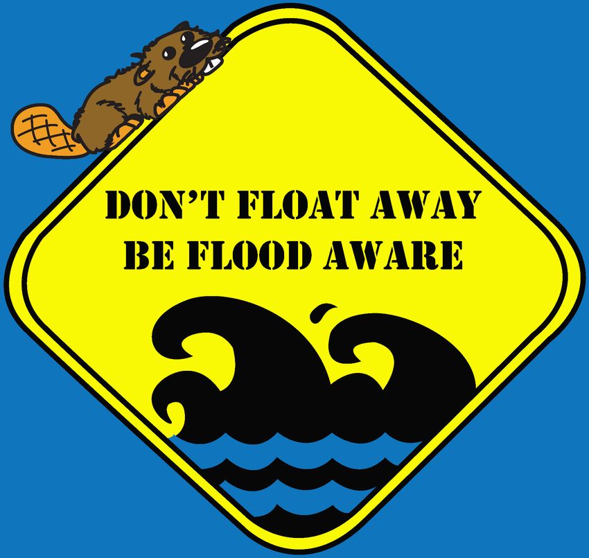
don’t float away 4
be flood aware 5
14
15
13 13 25 26
10 27
16
9 22 6
12 21 28
12 11
6 24 23 20
8
5
18 29
3 17
7 19
4
2 7
11 1 2 4 6 8
1 3 5 7 9
2 4
1 3 5
8
10
9
CONNECT LIKE-SHAPES IN NUMBERED ORDER TO REVEAL THE “STAY AFLOAT” CAMPAIGN LOGO.
HAVE FUN!Family Disaster Kit
The following items are recommendations aboutwhat you should have in your family disaster kit.
Don’t forget you can photocopy and complete the Red Cross’ Emergency Contact Card on the
last page of this booklet for each member of your family! Keep it with you in your wallet, purse or backpack!
Food & Water (Store water in clean, plastic containers):
- 1 gallon of drinking water per person, per day for at - Non-parishable food items like protein bars,
least 3 days (consider extra water for a more long-term kit) canned meats, crackers, peanut butter, etc.
- Extra water for cooking and sanitary needs - Food and water for pets (if applicable)
- Baby formula and food (if applicable)
First Aid Kit:
ES
- Latex gloves - Antibiotic ointment ERI
TT
- Scissors - Sunscreen BA
- Tweezers - Prescription medication supplies
- Petroleum jelly - Over-the-counter pain reliever
- Sterile dressing - Anti-diarrhea medication
- Band aids - Antacid
- Thermometer - Laxitives
- Soap or hydrogen peroxide
Other Items:
- Wrench to shut off gas and water - Matches in a waterproof case
- Can opener (manual) - Blankets
- Eating utensils - Important documents in a waterproof case
- Paper cups, plates and towels (i.e. birth certificates, social security cards, deeds,
- Flashlight with extra batteries (avoid candles bonds, etc.)
as an open flame may cause an explosion if - Chlorine bleach (9 drops of water to 1 drop of bleach
there is a gas leak) is a usable disinfectant; 16 drops of regular (no
- Battery powered or hand-crank radio scents, color safe, or cleaners) bleach per gallon of
(preferably a NOAA Weather Radio) water to make non-commercial water drinkable)
- Local maps - Cash (keep small bills in case there is no power
- Dust masks for each member of the family and ATMs are not operational)
- Plastic sheeting - Clothes (strong shoes, long sleeve shirt, jeans, extra
- Duct tape socks, etc.)
- Garbage bags - Entertainment for kids (if applicable)
- Fire extinguisher - Extra baby supplies like diapers (if applicable)
- Shampoo, soap, deodorant - Toilet paper
- Toothbrush and toothpaste - Sanitary products
KEEP YOUR KIT HANDY IN SOMETHING
LIKE A BACKPACK OR TOTE AND PUT IT
SOMEPLACE THAT IS EASILY ACCESSIBLE WATER WATER WATER WATER
WATER WA ER WATER WATER
BY THE WHOLE FAMILY AND CAN BE WATER WATER T WATER WATER
WATER WATER WATER WATER
FIRST AID KIT REACHED QUICKLY. KEEP AN EYE ON ANY WATER WATER WATER WATER
EXPIRATION DATES ON ITEMS IN YOUR
KIT AND REPLACE THEM IF NEEDED!START
START
WORD SCRAMBLE
1. FLOODWAY
2. DAM
3. UMBRELLA
4. WARNING
5. SAFETY
6. ELEVATE
GREAT JOB! 7. WATCH
8. FORECAST
FAMILY
PREPAREDNESS
KIT
9. LEARN
10. DISASTER
11. FLASH FLOOD
12. FLOODPLAIN
SECRET PHRASE: BE FLOOD AWARE
FINISH
1/17
CROSSWORD PUZZLE 16 2
ANSWER
ACROSS DOWN
1. FFA 1. FFW 3
2. WATCH 2. WATERSHED 15
3. TRIBUTARY 3. CREST
PAGE
4. BASE FLOOD 4. BUYOUT
5. DISCHARGE 5. COLD 14
don’t float away 4
6. STATEMENT
6. STAGE
7. SPILLWAY 7. FLASH
be flood aware 5
8. MITIGATION 8. WAY 13 13
14
15
25 26
9. FEMA 9. EMBANKMENT 10
9
16
22
27
6
10. EROSION 10. NFIP 12
12
11
24
21 28
6 8 23 20
11. WARNING 11. RIVER 5
18 29
17
12. HYDROLOGY 12. NWS 4
3 7 19
13. PLAIN 13. FLOOD 11 1
2
2 4 6 8
7
9
14. DISCHARGE 14. INSURANCE 1 3 5 7
15. RUNOFF 15. ICE JAM 1
2
3
4
5
16. LEVEE 8
10
17. SCOUR
9
ADVANCED WORD SEARCH
EASY WORD SEARCHVisit www.redcross.org for more information American Red Cross
Poison Control Center: 1-800-222-1222 Emergency Contact Card
Family Doctor:
Directions:
Ambulance: call 9-1-1 or
Fire Dept.: call 9-1-1 or 1. Make a copy of this card for each
Police: call 9-1-1 or household member.
Important Phone Numbers 2. Cut out the card along the dotted
lines.
FOLD
Emergency Contact Card 3. Write in the contact information for
each household member, such as
work, school and cell phone numbers.
If you need additional space, use the
back side of the card.
Name:
3. Fold the card so it fits in your
Home Address: pocket, wallet or purse.
FOLD
4. Carry your card with you so it is
Household Members available in the event of a disaster or
Contact Information other emergency when you will want to
contact each other.
For more information on creating a
family disaster plan and a disaster
supplies kit, as well as other valuable
disaster preparedness information,
visit
www.redcross.org.
FOLD
Out-of-town contact:
Family meeting place outside the neighborhood:
4/2005Special thanks to the
Indiana Department of Homeland Security
for allowing the use and modification of this bookletYou can also read