The Clear Water Musketeers - Champlain Company - Guide for Mister Porthos' Musketeers
←
→
Page content transcription
If your browser does not render page correctly, please read the page content below
The Clear Water
                          Musketeers
                           Champlain Company

Guide for Mister
Porthos' Musketeers                The Basin Grade
Guide for Mister Porthos' Musketeers
The Basin Grade

                                    Aramis
                                                        Athos

              Porthos                                                          D’Artagnan

The four musketeers were featured in a story written by Alexandre Dumas in 1844, namely Porthos,
Aramis, Athos and d'Artagnan. They lived in the seventeenth century, from 1610 to 1670.

Name:
School:
Class: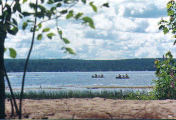
All for Water and Water for All!
The Clear Water Musketeers' motto

The Clear Water Musketeers are in charge of water       There are three other grades of the Clear Water
protection in their community. They are proud of        Musketeer training program:
their mission; they realize that water is their life-
line, that it must be protected and saved. In order     • Mister Aramis' Musketeers will discover the secret
to become a Clear Water Musketeer, students               relationships between organisms living in the
must complete the four levels of the Clear Water          aquatic ecosystem.
Musketeer training program.                               THE AQUATIC ECOSYSTEM GRADE

Porthos was renowned for his great strength. He         • Mister Athos' musketeers will have ample oppor-
became a big land owner and did not hesitate to           tunity to learn how various forms of human activi-
travel mile upon mile with his companions to              ty affect the quality of water.
defend a worthy cause. Mister Porthos' muske-             THE WATER USAGE GRADE
teers will learn all about the land through which
the rivers flow. THE BASIN GRADE                        • Mister d'Artagnan's musketeers will learn how to
                                                          assess water quality and find solutions to water
                                                          pollution problems.
                                                          THE WATER TREATMENT GRADE

                                    In this Guide for Mister Porthos'
                                    Musketeers, young musketeers
                                  AQUALINE and RIVERO will help you
                                      prepare for your Basin Grade
                                          Mission. Good Luck!

                                                                                                          3
Water, Essential to Life on Earth
                                                                                  Dinosaurs drank the same
The Clear Water Musketeers know that water                                            water as you drink.
is the most precious commodity on earth.                                            Unbelievable, but true!
Water occupies 70% of Earth's surface,                                             That is because water is
                                                                                 continually recycled on land,
but a mere 2.5% of it is fresh water, the
                                                                                     in the seas and in the
salt-free water that we can drink.                                                atmosphere. This natural
Oceans were formed 4 billion years ago                                              phenomenon is called
and life forms started to appear in water                                       the “water cycle”. Our ever so
3.8 billion years ago. Water is an essen-                                      precious water is at risk of being
                                                                                 contaminated at every step
tial element of life. All living beings con-
                                                                                  of the water cycle. That is
tain water, from the smallest vegetable                                            why we must protect it.
or animal cell to the giant sequoias and
great whales.

The Water Cycle
Water is a small molecule composed of hydrogen           on the season. This eventually replenishes the water
and oxygen (H20). Water molecules all look the           supply in our numerous lakes and rivers.
same and form a transparent liquid that trickles
onto the earth and ends up in the oceans. The sun,       The rain water that falls onto the ground runs down-
which warms the water, causes it to evaporate;           hill and forms ditches, brooks, rivers and lakes.
water molecules then cling together in the atmos-        Every body of water in southern Quebec eventually
phere to form clouds. In Canada, clouds travel           flows into the St. Lawrence River, and finally into the
from the Pacific Ocean in the west to the Atlantic       Atlantic Ocean. Part of the water infiltrates the soil
              Ocean in the east. Over the Province       and creates an underground water supply. We
              of Quebec, these clouds are trans-         depend upon this source of potable water to fill our
             formed into water or snow, depending        wells. Plants absorb this water through their roots.

                                                         When the water contained in plants reaches the
                 Our bodies are 60% water. If you        leaves, it evaporates and returns to the atmos-
              pinch your skin gently, you will be able   phere. The water from the soil also evaporates.
                to tell whether your skin is properly    This phenomenon is called evapotranspiration. We
                hydrated or dry. To ensure that the      also perspire and return water to the atmosphere in
                 tissues in your organs receive an
               adequate supply of water, you should
                                                         the form of urine. That is why it is so important to
                      drink five glasses a day.          continually replace our water loss by drinking clean
                                                         water. It is also important that the waste water from
                                                         our homes be treated.
Exercise 1: Diagram - The Water Cycle
Grades 1 and 2                       Grades 3 and 4                          Grades 5 and 6
Drops of Water                       Water Runoff                            Water Travel
Draw a rain cloud, rain falling, a   Draw a mountain, a river, a lake, the   Draw a city at the foot of a mountain
lake, the sun, a tree and a child    sun, the clouds, rain, underground      with rain, water streaming, a river,
swimming. Draw a drop of water in    water, a plant, an animal and a child   underground water, evapotranspira-
every element that contains water.   drinking water. Then draw a blue        tion, two sources of clean water and
                                     line with arrows showing the            the disposal of waste water. Draw
                                     water runoff.                           arrows to show the direction in
                                                                             which the water travels, using a
                                                                             blue line for clean water and
                                                                             brown for polluted water.

                                                                                                                5
Missisquoi Bay Basin
The rain water that falls on the ground runs down As water flows and runs off on the basin floor, it is
the slopes and creates rivulets. Water always flows used for various human activities. The water can be
from the highest level of the ground toward the bot- polluted by each of those water uses and also nat-
tom level, from upstream to downstream. In other urally, by vegetation and animals. Water thus
words, the water flows from the mountain toward becomes more and more polluted on its way from
the valley of the basin. the source to the mouth of the river.
The basin is the surface of the ground through
which the water runs off into a river or a lake. The
following drawing shows the basin area and human
activity that takes place therein.
WASTE
WATER
POTABLE
WATER
6Missisquoi Bay and the Tributaries
Missisquoi Bay is one of the largest bays on Lake
Champlain, the greatest part of which is in the
United States. All of the water from Lake Champlain
flows into the Richelieu River, located in the
Province of Quebec, and eventually into the St.
Lawrence River near the municipality of Sorel-Tracy.
Missisquoi Bay covers an area of 75 sq. km. (East-
West width of 6 km by North-South length of 12
km). Its average depth is barely 2.8 m and its
greatest depth is 4.5 m.
Tourism became a big industry in the 20th century
since Missisquoi Bay leant itself to many outdoor
activities. Fishing was very popular, given the great
variety of fish that could be caught there. Village
dwellers as well as visitors could enjoy sailing, row-
ing and power boating, swimming, using the beau-
Photo credit: Municipalité de Venise-en-Québec tiful beaches, bird-watching, and even horse racing
on ice!
Two centuries ago, Lake Champlain played an
important role in the development of the northeast- Unfortunately, development led to water pollution.
ern part of North America. Champlain's ships had During the last twenty years, steps have been
come up the St. Lawrence River, entered the taken to clean up the water and new agricultural
Richelieu River to finally reach Lake Champlain in practices have been introduced. This has led to an
1609. Missisquoi Bay was colonized later, in the improvement in water quality. Unfortunately, the
early 1800s. But it had been familiar territory to Bay waters are still not free of contamination from
the Amerindians 5,000 years ago! The region's phosphorus and blue-green algae, which is why
mild climate was well-suited for agriculture but the action must be taken to reduce pollution in the
swampy terrain limited its potential as a mixed basin.
farming site at the beginning of the 19th century.
7The Missisquoi Bay basin encompasses the area
into which flow the Pike River, Rock River and the
To identify the right and
Missisquoi River. The map that follows illustrates the left bank of a stream, you
the boundaries of the basin. The arrows indicate must look downstream. The right
the direction in which the water flows. The network bank is then to your right.
made up of brooks and rivers that pour into To determine the direction in which
Missisquoi Bay is called the hydrographic network. the river flows, just follow a branch
floating on the water.
Three tributaries flow into Missisquoi Bay: on the
Quebec side, the Pike River, and on the U.S. side,
in Vermont, the Missisquoi and Rock Rivers. The
map also shows the boundaries of each municipal-
ity. You will notice that these streams run through The speed at which streams flow varies according
municipalities and even the border between to the seasons. Flow is calculated in cubic metres
Quebec and the State of Vermont, in the United of water per second. During summer, the flow is
States. Because, as neighbours, we share the slower. The water is then at its lowest level.
same water, we must agree on its use and its pro- Flooding occurs mostly in spring, when the snow
tection. We have to avoid polluting it because melts, or in autumn when there are heavy rainfalls.
everyone needs pure, clean water. Streams then overflow into the floodplain where
excess water spreads out. The floodplains, river
banks and river beds must be protected.
Exercise 2: Missisquoi Bay Basin
Grades 1 and 2 Grades 5 and 6
Colour Missisquoi Bay and the rivers pink and the bound- Imagine that you throw a bottle containing a message in
aries of Missisquoi Bay basin red. a stream. Mark with an X the place from which the bot-
tle is thrown. Using the letters S, M, R and L, show the
Grades 3 and 4 source and the mouth of the stream, its right and left
banks. Trace your bottle's journey to Missisquoi Bay. List
Colour the boundaries of Missisquoi Bay basin in red, and the municipalities through which the bottle will pass.
Pike, Missisquoi and Rock Rivers using different colours. What is the message in your bottle?
Mark your municipality with an X and colour its boundaries.
828
Missisquoi Bay Basin Map
25
27
24
Boundaries of Missisquoi
Bay Basin 26
10 Municipality Boundaries 23
Canada - USA Border
8 Direction of the current
9 11
21
7 12
22
16
6
5 13
3 15
14
2 19
1 4
Québec
20
17 18
C
F
D E G
B
Lake Champlain
Vermont
QUÉBEC
A
MUNICIPALITIES
1 Saint-Georges-de
Clarenceville
2 Venise-en-Québec
3 Saint-Pierre-de-
Vérone-à-Pike-River
4 Saint-Armand
5 Stanbridge-Station
6 Saint-Sébastien
7 Notre-Dame-de-Stanbridge 16 Dunham SOME VERMONT
8 Saint-Alexandre 17 Frelighsburg MUNICIPALITIES
9 Sainte-Sabine 18 Abercorn A Swanton
10 Farnham 19 Sutton B Highgate
11 Cowansville 20 Canton de Potton C Franklin
12 Saint-Ignace-de-Stanbridge 21 Bolton-Est 25 Stukely-Sud D Berkshire
13 Bedford 22 Bolton-Ouest 26 Austin E Richford
14 Canton de Bedford 23 Saint-Étienne-de-Bolton 27 Canton d'Orford F Jay
15 Stanbridge-East 24 Eastman 28 Bonsecours G Troy
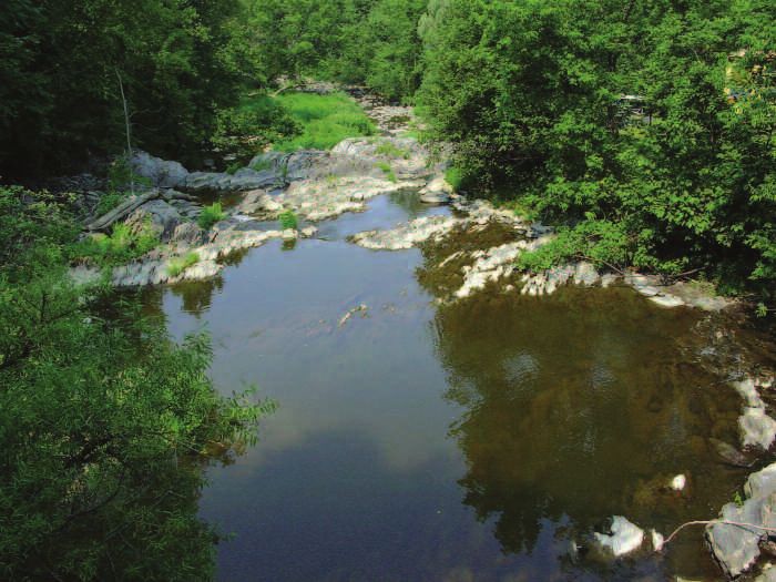
9at a rate of approximately 1 m3/sec. It is made
rather attractive by small rapids. As the water runs
off into Rock River, soil particles fall into the water
to give it a brownish colour and cover its bed with
sediment.
The Pike River has its source in Lake Carmi in the
United States and its length is approximately 55
km. It crosses the border at Frelighsburg, passes
through Bedford and flows into Missisquoi Bay via
Saint-Pierre-de-Véronne à-Pike-River. The Pike Photo credt: Christine Caron
River crosses forested lands as well as agricultural
and urban areas. By the time it flows into the Bay The Missisquoi River is the largest tributary and its
its waters are contaminated. Its wetlands, on the length is approximately 100 km. In Quebec, it
other hand, are full of a rich array of flora and receives the waters of the North Missisquoi River as
fauna. well as those of Sutton River that run through
mountainous and forested regions. It flows at an
average rate of 50 m3/sec. Its water quality is good
in Quebec, but it becomes increasingly contami-
nated as it flows into the Bay, due to the fact that it
crosses an extensive agricultural region.
One cubic meter is somewhat
larger than the space occupied by
your desk and chair. Check with a tape
measure: one meter in height by one
meter in length by one meter in width.
One cubic meter of water equals
The Rock River, 15 km in length, is the Pike River's to 1000 litres.
smallest tributary. It starts in Vermont, crosses the
municipality of Saint-Armand, Quebec, and flows
back into the United States and into the Bay. It flows
10Land Use
As we have seen, human activity as well as other Various forms of human activity take place within
natural elements such as aquatic plants, algae and the Missisquoi Bay area. Land is used for four main
animals, contribute to the contamination of waters. purposes:
Contaminants can occur in the form of fecal matter,
soil particles, phosphorous fertilizers, toxic prod- 1- municipal and residential use
ucts, etc. Every waterway within the hydrographic
network contributes to water contamination, which 2- agriculture and forestry
becomes progressively worse as water flows from 3- industry and commerce
its source to its mouth. The entire basin is con- 4- recreation and tourism
taminated by the various forms of land use.
Water is used directly or indirectly in each of these
spheres of activity. It can be contaminated through
any of these uses, as will be demonstrated in
Exercise 3, dealing with land use.
As it reaches the Bay, the water is filled with everything it has gathered
on its way through the basin. The pollutants contained in tributaries, from their source
to their mouth, determine the quality of water and sediment in Missisquoi Bay.
Exercise 3: Users of Basin Territory
Grades 1 and 2 Grades 3 and 4 Grades 5 and 6
In the rectangle of the four uses of Write down in the rectangle of the List at least three ways of using
the territory, draw a pool, a restau- four uses of the territory one way water and three pollutants for each
rant table, a boat and a cow drinking of using water and one pollutant. of the four uses of water in the
water. territory shown.
111- Municipal and Residential Use 2- Agriculture and Forestry
The area surrounding the basin is made up of
forest and fields, orchards, vineyards, market
vegetable gardens, etc. Agricultural uses
include the cultivation of land or raising
cattle. Forest use can include wood
cutting, maple syrup production, the
gathering of mushrooms, hiking, and
conservation of wild animal habitats, etc.
Water can be polluted by all of these water
uses: manure, waste materials left after the sawing
of wood, dirty waste water, and fertilizers.
Twenty-eight (28) municipalities are located in the
Basin area. These municipalities use the territory for
the building of homes, and for such community
services as streets, aqueducts, drains, city hall,
schools, libraries, arenas, etc. Water is used for
drinking, to clean streets, to make ice, to
water lawns. Every time we use water,
there is a danger of polluting it. Water can
also be contaminated by the incorrect
use of river banks: dumping of garbage
and debris, erosion, use of fertilizers near
the river banks, and washing the car.
Municipal and Residential Use Agriculture and Forestry
123- Industry and Commerce 4- Recreation and Tourism
Recreational activities are naturally most
appealing, but they often lead to a deteriora-
tion in water quality. Water can be used for
swimming or boating. Water courses are
also attractive for the fish they produce and
for the walking trails near their banks. Again,
water pollution can occur in different ways as a
result of recreation or tourism, mostly due to
throwing rubbish into the water instead of plac-
ing it in a garbage or recycling bin, and from
boats that leak motor oil or gas.
There are few large indus-
tries in the basin area, but it does include gravel
and sand pits, manufacturing facilities and
agri-food industries. Commercial establish-
ments abound in the form of restaurants,
garages, food stores, specialty bou-
tiques, etc. Industrial and commercial
buildings use up large quantities of water
in the transformation of their products or
to power equipment. As a result, they pro-
duce pollutants such as dirty oil, dirty waste
water, debris that has fallen into the water, and rust
from pipes.
Industry and Commerce Recreation and Tourism
13Glossary
Tributary Potable
A water course that flows into another or into a lake. Fit to drink.
Upstream Runoff
Toward the mountain or the place where the stream Overflow of rainfall or melted snow not absorbed by
takes its source. soil, as it rushes downhill.
Downstream Sediment
Toward the valley or in the direction of the water flow. Solid fragments of organic or inorganic material that
Basin come from the weathering of rock and accumulate on
The land area through which water runs on its way to a the bottom of a body of water.
stream or a lake. Source
Embankment/bank The point of origin of a stream or river.
The naturally occurring edge of a stream, escarpment.
High water mark
Highest level of a stream or a lake.
Blue-green algae Books… Internet Sites…
Bacteria that multiply in water to produce a blue-green
layer that can emit toxic substances. and Places to Discover
Flow
The rate of movement of a volume of water over time.
BOOKS
Waste water Water Champs: Water Quality in the Champlain
Water that has become unclean though use for residen- Drainage Basin, Adirondack Park Institute, inc.
tial, industrial and commercial purposes. Healthy Water, Healthy People, Testing Kit Manual, The
Mouth of a stream Watercourse International Project WET. Montana State
The point at which water leaves a stream to flow into University.
another body of water.
Erosion INTERNET SITES
The wearing away of land surfaces through the action of Lake Champlain Basin Program:
rainfall, running water, wind, waves and water current. www.lcbp.org
Low water mark Lake Champlain Basin Atlas:
Lowest water level in a stream or lake. www.lcbp.org/Atlas/HTML/intro.htm
Evapotranspiration Quebec's Waters - A Resource to be Protected:
Phenomenon caused by water vapour being ejected www.mddep.gouv.qc.ca/eau/inter_en.html
into the atmosphere through the soil or vegetation.
Hydrographic PLACES
Relating to a network of lakes and bodies of water in a The Biosphere - My Planet at Play:
given area. www.biosphere.ec.gc.ca
Bed ECHO at the Leahy Center for Lake Champlain
The bottom of a stream or a lake. (Lake Aquarium and Science Center in Burlington, VT)
Molecule www.echovermont.org
A small particle made up of chemical elements and atoms. Lake Champlain Maritime Museum in Vergennes, VT
www.lcmm.org
14Your Mission as one of Porthos' Musketeers
With the assistance of your teacher, your parents and your friends, explore the area where you live and
find a water course near your home. Make a rough drawing of it in a notebook, showing the direction of
the current, its source (upstream) and its mouth (downstream), the left and right banks. Based on your
observations, list the different ways water is used (minimum of twenty) and the various steps that can be
taken to protect the water. Why don't you ask the people around what they do to save water and to avoid
polluting it. Once your mission report has been accomplished, you will be admitted to Champlain
Company as one of Mister Porthos' Musketeers. You will be eligible to take the oath along with the other
musketeers in your company.
Mission Report
The Musketeer's Oath
We are Mister Porthos' Musketeers of Clear Water and we have successfully
completed the Basin Grade. We undertake to protect with honour and pride the
quality of water and its preservation. We are the new guardians of the Missisquoi
Bay Basin.
ALL FOR WATER AND WATER FOR ALL!
15Production
Corporation Bassin Versant Baie Missisquoi - 2006
Porthos the Musketeer served the king
and queen of France. Clear Water Musketeers
work toward the protection of the environment
and nature. One must be thoroughly familiar
with the basin area to properly fulfill one's
mission as water protector. Let us take pride
in belonging to the Missisquoi Bay basin area.
Production Team:
Research and Text: Isabelle Grégoire and Chantal d'Auteuil
Illustrations: Le Bipède Graphique
Graphics: Ekorce creative workshop
Printing: Caractéra
Translation : James McLean
Funding:
Lake Champlain Basin Program, Education and Outreach Committee
Brome-Missisquoi Rural Pact ProgramYou can also read