Surveying & Mapping with UAVs - Commercial UAV Expo
←
→
Page content transcription
If your browser does not render page correctly, please read the page content below
Surveying & Mapping
with UAVs
By Jeremiah Karpowicz

Thiswww.expouav.com
     report is brought
to you by:

   Oct 31 - Nov 2, 2016
   Las Vegas

www.expouav.com
                          1
SURVEYING & MAPPING WITH UAVs
Woolpert
Reducing costs
and simplifying the
image-capturing
process
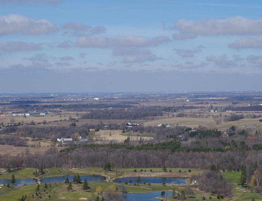
By Jeremiah Karpowicz IT’S EASY TO SEE WHY surveying and mapping professionals have taken such a keen inter-
est in unmanned aerial vehicle (UAV) technology. Gathering info from the sky has been an
approach that’s been utilized for a long time now, but the costs associated with traditional
manned aircraft makes the endeavor extremely expensive. UAVs offer a cost effective
alternative with far more flexibility in terms of being able to get into the air quickly and
without as much logistical support.
What’s more, UAVs can improve data collection accuracy and efficiency, optimize a workflow
while also enabling the production of cost effective turnkey DSM’s and orthos whenever
they’re needed. Simply put, UAVs can make it far easier to gather the info needed to create
maps by reducing costs and simplifying the image-capturing process.
However, right now the application of drones in the field is very much a niche endeavor, and
that is mostly due to FAA restrictions. Most of the people doing UAV-based mapping are do-
“UAVs can improve
ing things that would have been on the fringe of what was already being done, because that’s
the only work that can be done by professionals, even if they’ve received their 333 Exemption.
data collection Those limitations are something that Lewis Graham, President and Chief Technical Officer of
GeoCue Corporation, has run up against.
accuracy and
efficiency, “What I’m seeing is a lot of hype about drones, but people are really groping to find the sweet
spot for existing work in terms of when it makes sense to use a drone versus manned aircraft,”
optimize a Graham said. “If you’re looking at 10,000 acres of cornfields, a drone doesn’t make sense, and
those details are sorting themselves out.”
workflow while
also enabling the It’s not just the regulations that are impacting the industry, as the technology has changed the
conversation around service needs. Not too long ago it was extremely expensive to get hold of
production of cost imagery, but there are so many inexpensive and even free options that the onus has shifted to
effective turnkey sorting out details around processing and analyzing. Will professionals with years of experience
change the way they operate? How will this impact experienced and innovative service providers?
DSM’s and orthos
whenever they’re The combination of technology tools that drones enable is clearly the biggest selling point. UAVs
can be utilized along with photogrammetry, point cloud and conversion of point cloud data, to re-
needed. ” define service offerings. Before that can fully happen though, FAA regulations need to be sorted out.
2
SURVEYING & MAPPING WITH UAVs

“The 333 Exemptions        FAA implications in the short and long term
 have given people          THE IMPLICATION THAT DRONES are currently only a niche application in surveying and
 a glimpse of               mapping is almost completely due to the restrictions that the FAA has placed on the
 how these tools            technology. Jeff Lovin, Senior Vice President and Director of Government Solutions at
                            Woolpert, mentioned that his company was the first surveying & mapping firm to get a
 can supplement
                            333 Exemption, but the impact of that early exemption has been somewhat hampered by
 processes and              the evolving FAA regulations.
 procedures they’re
                            “Even with our 333 Exemption, the regulations are still pretty restrictive and not very practical,”
 already using while        Lovin said. “For example, we can fly at 200ft with no problem because of our COA (Certificate
                            of Waiver or Authorization), but our system is optimized to fly at 400ft. That’s only 2x the
 also creating new          height, but it’s actually 4x the images and flybys, so it makes that cost prohibitive. And not
 opportunities.     ”       being able to fly over non-participants and near highways is very problematic.”

                            These restrictions have slowed the use of drones for many companies, although the technolo-
                            gy is there for UAVs to become a huge part of their business. Nonetheless, the 333 Exemptions
                            have given people a glimpse of how these tools can supplement processes and procedures
                            they’re already using while also creating new opportunities. Eric Andelin brings 35 years expe-
                            rience to the mapping profession, and has worked with individuals and organizations to help
                            them apply for and receive 333 Exemptions.

                            “If the FAA continues to work openly and make it easier for people to fly UAVs, then we’ll start
                            to see things move from the fringe toward projects we’re currently doing within the capacity
                            that UAVs can operate,” Andelin said. “Time and distance are the big problems right now.”

                            Those things have made drone operation in this field very restrictive. With those limitations
                            removed, many already see the impact UAVs can have for large design projects and the DOT
                            market, which includes highways, railroads, etc. The restrictions have caused many profession-
                            als to shift their focus toward figuring out how drones can be used most effectively when the
                            legal limitations are lifted.

                            As frustrating as these barriers might be, there is a set path to seeing them eased or even elimi-
                            nated, which will begin when Part 107 from the FAA comes out this year. While that ruling won’t
                            go far as some might like, it’s an important milestone and will go a long way toward easing the
                            regulations that are currently stopping surveyors from taking full advantage of UAV capabilities.

                                                                                                                         GeoCue

    www.expouav.com

    Oct 31 - Nov 2, 2016
    Las Vegas

                                                                                                                              3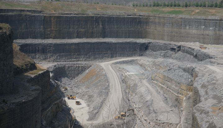
SURVEYING & MAPPING WITH UAVs

“The much lower                      Ripple effects and ROI
 costs have                           WITH RESTRICTIONS LIMITING how drones can be utilized, many have struggled to see a
 democratized the                     return on their UAV investment, while others are already leery around the implications of
 technology and                       the technology. The much lower costs have democratized the technology and allow many
                                      more people access to surveying tools. Because of this, drones have the chance to change
 allow many more
                                      the term of “mapping” or surveying” and broaden them in a powerful manner.
 people access to
                                      “It’s a monetarily inverted market, and you seldom ever see that,” Graham said. “It’s the really
 surveying tools.                     cheap stuff that’s dominating out there, and that’s very unusual. If you look back at technolo-
 Because of this,                     gy like digital cameras and laser scanners you’ll see it was the opposite. You had high-end sys-
                                      tems and it would filter down, but not always. We still don’t have low-cost LIDAR, for example.
 drones have                          The drones are the opposite though. When we introduced LIDAR into mapping, there were
 the chance to                        only three viable players for airborne LIDAR, but on the drone side it’s just the opposite. There
                                      are hundreds of companies offering hardware and solutions.”
 change the term
 of “mapping” or                                                                                                                 GeoCue

 surveying” and
 broaden them in a
 powerful manner.                ”

                                      This “race to the bottom” means something different to everyone in the ecosystem, but it’s
                                      especially apparent for companies that have been around. Traditional photogrammetry
                                      companies are going to have a very hard time selling expensive software and equipment into
                                      this future market. The software has developed to a point that the work is simply easier to do,
                                      which further opens it up.

                                      It’s a topic that has created a ripple effect which can be seen throughout the industry. UAVs
        The commercial                might not always do the actual data capture, but they’re changing the way people think
                                      about how they can approach that work. The technology itself is getting people to think
         UAV event for:
                                      about how it can be utilized in innovative and unexpected ways.

                                      “We’ve developed our own camera system in a pod that sits underneath a Cessna 182,” Lovin
    Surveying             Civil
    & Mapping        Infrastructure
                                      mentioned. “Being in this pod allows us to swap in amongst aircrafts. We don’t own a 182
                                      yet, but this system collects 1cm and 2cm ultra-high resolution imagery just like a UAV. It’s
       www.expouav.com                manned aircraft rules though, so we can fly as high and long as we need. I have to say I never
                                      thought how popular it would be, but it’s become its own niche. We’re taking a lot of leads
      Mining          Construction
   & Aggregates
                                      and opportunities that would have otherwise been related to UAV in this area, and it’s allowed
                                      us to differentiate the approach we’re able to take in the air.”

   Process, Power      Precision
                                      That different approach can be the main factor in whether or not someone sees a positive
      & Utilities     Agriculture     ROI. As amazing as it is to explore the new opportunities that drones directly create, examples
                                      like these are proof that just as much focus needs to be placed on the indirect ones.

          Law Enforcement/
         Emergency Response/
          Search and Rescue                                                                                                               4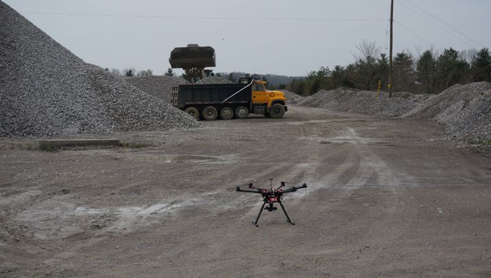
SURVEYING & MAPPING WITH UAVs

“I’m most excited                        Moving BLOS and onto other horizons
 about the fact that                      CURRENTLY, LEGAL RESTRICTIONS prevent operators from flying beyond visual line-of-
 we’re completely                         sight (BLOS), which means they’re limited to flying in close proximity. That severely limits
 disrupting the                           the sort of things surveys are used to mapping and what they want to be able to map.

 industry in the                          “BLOS is something that really makes UAVs a niche for us, because that impacts the cost when
                                          we can only fly within half a mile of the bay station,” Lovin mentioned. “One of the most rele-
 same way Uber has                        vant applications for UAVs is going to be across utility corridors like gas lines. Using helicopters
 changed the way                          for that kind of work is really expensive, but when we can only fly in line-of-sight, you have to
                                          have so much more survey control. You have to land and take off, land and take off. Most of
 people get around,                       the time, that defeats the whole economy of the UAV.”
 and the way PayPal
                                                                                                                                        GeoCue

 changed the way
 people looked at
 payments.          ”

                                          The need to open up regulations is imperative, but it’s not where the conversation ends. While
                                          most are anxious to simply have the opportunity to take advantage of current drone tech-
                                          nology, there are still plenty of developments on the horizon. Being able to look at a 3D map
                                          and identify a place you want to inspect with a drone by programming it into your autopilot
                                          is something being actively worked on right now. Further developments to automation are
                                          going to see progress toward the ability to automatically extract data out of imagery, whether
                                          that’s extracting 3D features, land cover, pavement, etc. That sort of capability has been long
                                          coveted by professionals and we’ll soon be able to see a huge leap forward in both automat-
                                          ed process and automated feature extraction which will be driven solely by UAV.

                                          Rather than spending weeks to capture a small amount of info and process it in a few days, op-
                                          erators can now capture a much larger set of data in a single day and take weeks to process and
                                          analyze it. That sort of change is indicative of what sort of changes are just over the horizon.

  About the Author:                       “I’m most excited about the fact that we’re completely disrupting the industry in the same
  Jeremiah Karpowicz is the Executive     way Uber has changed the way people get around, and the way PayPal changed the way
  Editor for Commercial UAV News.         people looked at payments,” Andelin concluded. “We’re changing a technology to focus on
  He has created articles, videos,        ease of use, and it’s all being driven by technology that’s been around. The whole imagery-
  newsletters, ebooks and plenty          as-point-clouds has been around. I remember talking about that 20 years ago. We just didn’t
  more for various communities as a
  contributor and editor. He has also
                                          have the processing power to do it. Now we do. Things like logistics of aircraft can be laid out
  worked as the Executive Editor for      with paper and pencil, but if you’ve got the right app you can redirect vehicles all day long.
  ProVideo Coalition where he was first   The technology has caught up to where we’ve seen it going for awhile now, and it’s changed
  introduced to UAV technology.           the way we think about our approach.”

                                                                                                                                             5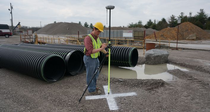
Experts Interviewed for this Report

                                          Eric Andelin CP, GISP., brings 32 years’ experience to the mapping profession. Eric’s
                                          Geospatial background includes: Survey, Aerial Photography, Photogrammetry, GIS
                                          and Laser Scanning. In 2013 Eric began working with Unmanned Aircraft Systems
                                          (UAS) as a platform for aerial mapping acquisition and again after assisting multiple
                                          large engineering surveying companies and a few startups with UAS integration,
                   ERIC ANDELIN           decided to open his own UAS based aerial mapping company, Vertical Information
                   President & CEO        Services, Inc., (VERTX).
                 Vertical Information
                Services, Inc. (VERTX)

                                          Lewis is the President and Chief Technical Officer of GeoCue Corporation, a com-
                                          pany whose focus is geospatial workflow management, particularly for LIDAR data
                                          processing. He is also the managing director of QCoherent Software LLC (a GeoCue
                                          company), a company that builds LIDAR data processing tools for the ArcGIS envi-
                                          ronment. Lewis currently serves as the Division Director for the ASPRS LIDAR Division
                  LEWIS GRAHAM            and Chair of the LAS Working Group. Prior to founding GeoCue, Lewis was the CEO
                   President/CTO          of Z/I Imaging, a company that created hardware and software for precision airborne
                   GeoCue Group           photogrammetric mapping.

                                          As director of Woolpert’s geospatial group, Mr. Lovin is responsible for overseeing the
                                          operations of nearly 230 staff members across the firm. With experience in photo-
                                          grammetry, surveying and remote sensing, Mr. Lovin brings a high level of expertise
                                          to firmwide initiatives that support client needs at national and international levels.
                                          As director, Mr. Lovin is responsible for his group’s growth as well as technological
                JEFF S. LOVIN CP, PS
                                          advancements that create opportunities for the firm and subsequently provide the
              Senior Vice President and   highest level of client service.
               Director of Government
                      Solutions
                      Woolpert

                                                                                                                                  6
The commercial UAV event for:

            Surveying   Civil Infrastructure      Mining      Construction   Process, Power    Law Enforcement/      Precision
            & Mapping                          & Aggregates                     & Utilities   Emergency Response/   Agriculture
                                                                                               Search and Rescue

        About Commercial UAV Expo
        Commercial UAV Expo is a conference and exhibition exclusively focused on the
        commercial sUAS (small Unmanned AerialSystems) market for:
        •   Surveying & Mapping
        •   Civil Infrastructure
        •   Process, Power & Utilities
        •   Mining & Aggregates
        •   Construction
        •   Law Enforcement, Security & Emergency Response, Search & Rescue
        •   Precision Agriculture

        In the Conference Program, UAV industry experts share key insights into the issues large
        enterprise asset owners face when implementing UAS, including systems selection and
        integration; developing enterprise workflows, guidelines and policies; data management
        and integration; and legal, safety and regulatory considerations. Plenary sessions and panels
        cover topics of interest to all end-users regardless of industry while breakout sessions focus
        on UAV technology, applications and opportunities in the vertical markets listed above.

        The international Exhibition includes airframe manufacturers, component suppliers, software
        suppliers and service companies.

        Produced by

Oct 31 - Nov 2, 2016
Las Vegas
       www.expouav.com

                                                                                                                                  7
You can also read