U.S. Geological Survey Natural Hazards Science Strategy-Promoting the Safety, Security, and Economic Well-Being of the Nation - Circular 1383-F
←
→
Page content transcription
If your browser does not render page correctly, please read the page content below
U.S. Geological Survey Natural Hazards Science Strategy—
Promoting the Safety, Security, and Economic Well-Being
of the Nation

Circular 1383–F

U.S. Department of the Interior
U.S. Geological Survey

Cover. Clockwise left to right:
The Denali Fault, Alaska, displaced the ground surface by more than 6 meters on November 4, 2002, in a M 7.9 earthquake.
The U.S. Geological Survey (USGS) monitors and studies earthquakes in the United States and around the world,
providing warnings and other information to support mitigation and response. Photograph by Peter Haeussler, USGS.
Hurricane Katrina damaged and destroyed houses on Dauphin Island, Alabama, August 31, 2005. The USGS assesses
coastal hazard vulnerability, including the severe beach erosion shown here. Photograph by USGS.
Electric power grids are vulnerable to changing space-weather conditions. The USGS maintains a network of magnetic
observatories that are essential for real-time, space-weather situational awareness.
A roof moved into the ocean in Fagasa, American Samoa, during the tsunami that hit the island on Sept. 29, 2009. USGS
researchers work to increase the understanding of tsunami processes and provide the National Oceanic and
Atmospheric Administration (NOAA) with real-time earthquake information to create tsunami warnings. Photograph by
Bruce Jaffe, USGS.
June 2008 flood at Cedar Rapids, Iowa. USGS streamgages and on-site observations by USGS field staff provide critical
data to flood forecasts made by NOAA. Photograph by Don Becker, USGS.
Landslides threaten human activities and a marine sanctuary along the coastline at Big Sur, California. The USGS works
with the California Department of Transportation to understand landslide issues along this part of the California coast.
Photograph by Mark Reid, USGS.
The Blue Marble. Image by NASA Goddard Space Flight Center.
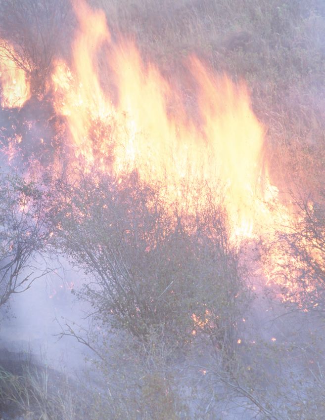
Background. Front cover: Grass fire in eastern Washington, 2000. The USGS contributes data and information to national efforts to
understand the causes and consequences of wildland fires. Photograph by Gary Wilson, Natural Resources
Conservation Service, U.S. Department of Agriculture.
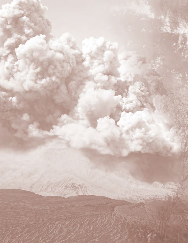
Back cover: Eruption of Okmok Volcano, Aleutian Islands, Alaska, Aug. 2, 2008. The USGS monitors volcanoes and
provides warnings to the National Weather Service, the Federal Aviation Administration, and the airline industry
because even remote eruptions can affect aviation worldwide. Photograph by Janet Schaefer, Alaska Division of
Geological and Geophysical Surveys.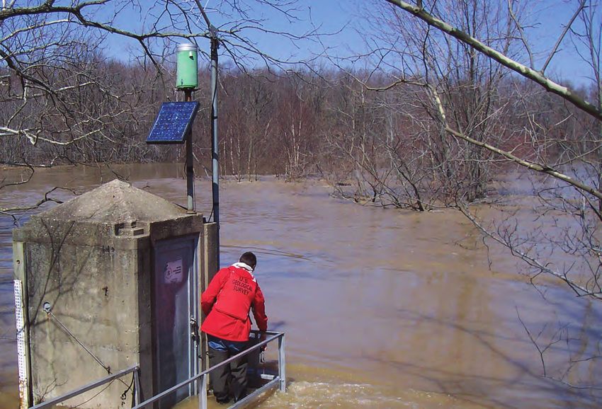
U.S. Geological Survey Natural Hazards
Science Strategy—Promoting the Safety,
Security, and Economic Well-Being
of the Nation

By Robert R. Holmes, Jr., Lucile M. Jones, Jeffery C. Eidenshink,
Jonathan W. Godt, Stephen H. Kirby, Jeffrey J. Love, Christina A. Neal,
Nathaniel G. Plant, Michael L. Plunkett, Craig S. Weaver, Anne Wein, and
Suzanne C. Perry

Circular 1383–F

U.S. Department of the Interior
U.S. Geological Survey
U.S. Department of the Interior
KEN SALAZAR, Secretary

U.S. Geological Survey
Marcia K. McNutt, Director

U.S. Geological Survey, Reston, Virginia: 2013

For more information on the USGS—the Federal source for science about the Earth, its natural and living
resources, natural hazards, and the environment, visit http://www.usgs.gov or call 1–888–ASK–USGS.
For an overview of USGS information products, including maps, imagery, and publications,
visit http://www.usgs.gov/pubprod

Any use of trade, product, or firm names is for descriptive purposes only and does not imply endorsement by the
U.S. Government.

Although this report is in the public domain, permission must be secured from the individual copyright owners to
reproduce any copyrighted materials contained within this report.

Suggested citation:
Holmes, R.R., Jr., Jones, L.M., Eidenshink, J.C., Godt, J.W., Kirby, S.H., Love, J.J., Neal, C.A., Plant, N.G., Plunkett,
M.L., Weaver, C.S., Wein, Anne, and Perry, S.C., 2013, U.S. Geological Survey natural hazards science strategy—
Promoting the safety, security, and economic well-being of the Nation: U.S. Geological Survey Circular 1383–F, 79 p.

ISBN 978-1-4113-3542-4
iii

Foreword
In 2007, the U.S. Geological Survey (USGS) published a Bureau Science Strategy Facing Tomorrow’s
Challenges—U.S. Geological Survey Science in the Decade 2007–2017. It provided a view of the future,
establishing science goals that reflected the USGS’s fundamental mission in areas of societal impact such
as energy and minerals, climate and land use change, ecosystems, natural hazards, environmental health,
and water. Intended to inform long-term program planning, the strategy emphasizes how USGS science
can make substantial contributions to the well-being of the Nation and the world.
In 2010, I realigned the USGS management and budget structure, changing it from a structure associated
with scientific disciplines—Geography, Geology, Biology and Hydrology—to an issue-based organization
along the lines of the Science Strategy. My aim was to align our management structure with our mis-
sion, our science priorities, our metrics for success, and our budget. An added benefit was that the USGS
immediately appeared relevant to more Americans, and it became easier for those outside the agency to
navigate our organizational structure to find where within the USGS they would find the solution to their
problem. External partners rarely approached us with a problem in “geology,” but they might need help
with an issue in climate change or energy research.
The new organization is focused on seven science mission areas:
     • Climate and Land Use Change
     • Core Science Systems
     • Ecosystems
     • Energy and Minerals
     • Environmental Health
     • Natural Hazards
     • Water
The scope of each of these new mission areas is broader than the science directions outlined in the USGS
Science Strategy and together cover the scope of USGS science activities.
In 2010, I also commissioned seven Science Strategy Planning Teams (SSPTs) to draft science strategies
for each USGS mission area. Although the existing Bureau Science Strategy could be a starting point for
this exercise, the SSPTs had to go well beyond the scope of the existing document. What is of value and
enduring from the work of the programs that existed under the former science disciplines needed to be
reframed and reinterpreted under the new organization of the science mission areas. In addition, new
opportunities for research directions have emerged in the five years since the Bureau Science Strategy
was drafted, and exciting possibilities for cooperating and collaborating in new ways are enabled by the
new mission focus of the organization.
Scientists from across the Bureau were selected for these SSPTs for their experience in strategic plan-
ning, broad range of experience and expertise, and knowledge of stakeholder needs and relationships.
Each SSPT was charged with developing a long-term (10-year) science strategy that encompasses the
portfolio of USGS science in the respective mission area. Each science strategy will reinforce others
because scientific knowledge inherently has significance to multiple issues. Leadership of the USGS and
the Department of the Interior will use the science vision and priorities developed in these strategies
for program guidance, implementation planning, accountability reporting, and resource allocation. These
strategies will guide science and technology investment and workforce and human capital strategies.
They will inform our partners regarding opportunities for communication, collaboration, and coordination.
The USGS has taken a significant step toward demonstrating that we are ready to collaborate on the most
pressing natural science issues of our day and the future. I believe a leadership aligned to support these
issue-based science directions and equipped with the guidance provided in these new science strategies
in the capable hands of our scientists will create a new era for USGS of which we can all be proud.
                                                                             Marcia McNutt
                                                                             Director
iv

     Contents

     Foreword.........................................................................................................................................................iii
     Executive Summary........................................................................................................................................1
          Mission and Roles.................................................................................................................................1
          Priority Goals and Actions....................................................................................................................1
                Goal 1: Enhanced Observations.................................................................................................2
                       Core Responsibilities that Must be Sustained................................................................2
                       Strategic Actions for the Future........................................................................................2
                Goal 2: Fundamental Understanding of Hazards and Impacts..............................................2
                       Core Responsibilities that Must be Sustained................................................................2
                       Strategic Actions for the Future........................................................................................3
                Goal 3: Improved Assessment Products and Services..........................................................3
                       Core Responsibilities that Must be Sustained................................................................3
                       Strategic Actions for the Future........................................................................................3
                Goal 4: Effective Situational Awareness...................................................................................3
                       Core Responsibilities that Must be Sustained................................................................3
                       Strategic Actions for the Future........................................................................................4
          A Vision of the Future............................................................................................................................4
          Opportunities and Challenges.............................................................................................................4
     Introduction.....................................................................................................................................................7
          Mission Statement.................................................................................................................................7
          The USGS Role in Hazard Science.....................................................................................................7
          Natural Hazards Science Strategy Planning Process.....................................................................8
          Hazards Mission Priority Goals and Actions.....................................................................................8
     Goal 1: Enhanced Observations.................................................................................................................12
          Core Responsibilities...........................................................................................................................12
          Strategic Actions.................................................................................................................................13
     Goal 2: Fundamental Understanding of Hazards and Impacts..............................................................18
          Core Responsibilities...........................................................................................................................18
          Strategic Actions.................................................................................................................................20
     Goal 3: Improved Assessment Products and Services..........................................................................25
          Core Responsibilities...........................................................................................................................25
          Strategic Actions.................................................................................................................................25
     Goal 4: Effective Situational Awareness...................................................................................................32
          Core Responsibilities...........................................................................................................................32
          Strategic Actions.................................................................................................................................32
     A Vision of the Future...................................................................................................................................38
          A Safer Nation Thanks to USGS Hazards Science........................................................................38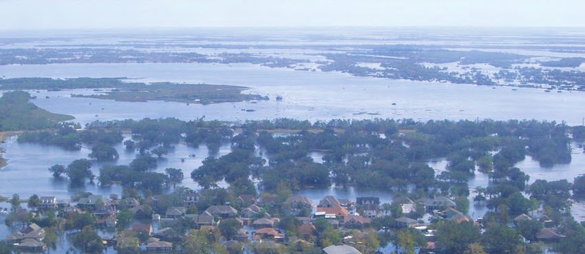
v

     A Vision of USGS Hazard Science Successes of the Future........................................................38
          Floods ..........................................................................................................................................38
          Wildfires.......................................................................................................................................38
          Earthquakes.................................................................................................................................39
          Coastal Hazards..........................................................................................................................39
          Volcanoes.....................................................................................................................................39
          Geomagnetic Storms..................................................................................................................39
          Landslides....................................................................................................................................39
          Tsunamis.......................................................................................................................................40
          Multihazard Assessment...........................................................................................................40
Opportunities and Challenges....................................................................................................................41
Planning and Interconnections Across the USGS Mission Areas.......................................................48
     Introduction..........................................................................................................................................48
     Water and Hazards..............................................................................................................................48
     Climate and Land Use Change and Hazards...................................................................................50
     Energy and Minerals and Hazards....................................................................................................51
     Environmental Health and Hazards..................................................................................................51
     Ecosystems and Hazards...................................................................................................................51
     Core Science Systems and Hazards................................................................................................52
Selected References....................................................................................................................................53
Definitions......................................................................................................................................................57
Appendix 1. Hazard Science in the USGS................................................................................................60
     Earthquake Hazards Program............................................................................................................60
     Global Seismographic Network........................................................................................................60
     Geomagnetism Program.....................................................................................................................61
     Tsunami Investigations.......................................................................................................................61
     Landslide Science...............................................................................................................................62
     Floods ...................................................................................................................................................62
     Hazard, Vulnerability, and Risk Study, and Decision Support......................................................63
     Volcano Hazards..................................................................................................................................63
Appendix 2. The Domestic Value of USGS International Efforts in Hazard Science.........................65
Appendix 3. Hazards Science Strategy Planning Team: Composition, Charge,
        Philosophy, and Process................................................................................................................66
     Selection Approach and Criteria for Strategic Actions................................................................68
Appendix 4. Listening Sessions..................................................................................................................69
     Meetings with USGS Leadership......................................................................................................70
Appendix 5. Disaster Relief Act of 1974....................................................................................................71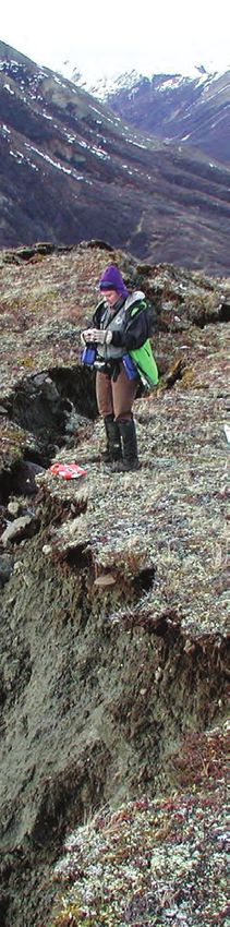
vi

     Figures

        1.   Cartoon showing four goals with communication throughout..............................................9
        2.   Map of 169 young volcanoes in the United States, and photograph of eruption
             in progress, Redoubt volcano, Alaska, 2009............................................................................14
        3.   Photograph showing tsunami wave inundating a coastal town in Japan on
             March 11, 2011.............................................................................................................................15
        4.   Photographs showing coastal forest drowned by subsidence caused by the 1700
             earthquake, and tsunami deposits for the 1700 and earlier prehistoric tsunamis............15
        5.   Map showing distribution of ANSS backbone stations shown on the National
             Seismic Hazard Map where hot colors represent areas of higher hazard........................16
        6.   Map showing ShakeMap for the 2011 magnitude 5.8 earthquake in Virginia,
             which caused widespread damage and evacuations...........................................................16
        7.   Schematic of the Sun, the solar dynamo, the solar wind, and the Earth’s
             magnetosphere............................................................................................................................19
        8.   Diagram showing examples of flood indicators potentially providing evidence of
             flood magnitude and frequency................................................................................................20
        9.   Stratigraphic sequence of three sandy flood deposits separated by rockfall and
             colluvium high along the canyon margin flanking Spring Creek in the Black Hills of
             South Dakota................................................................................................................................20
       10.   Map of Alaska showing historically active volcanoes and large earthquakes................21
       11.   Photographs of the USGS debris-flow flume during an experiment to examine
             entrainment, or the process by which debris flows grow in size, velocity, and
             potential impact...........................................................................................................................22
       12.   Example of earthquake forecasting.........................................................................................23
       14.   Perspective views of a three-dimensional geological model of Mount Rainier
             indicating relative degree of hydrothermal alteration, and results of three-
             dimensional slope-stability analysis.........................................................................................24
       13.   Photograph of Mount Ranier, Washington, and communities in the Tacoma area..........24
       15.   Map showing postfire debris-flow hazards map for part of the area burned by the
             2009 Station fire, showing potential volume of material expected from drainage
             basins and where that material will travel..............................................................................29
       16.   Photograph of damage from debris flows generated from hillsides burned by the
             2009 Station fire............................................................................................................................29
       17.   Screenshot from a prototype HAZUS flood analysis Web service displaying
             flood loss estimates for different river stage levels at a given site.....................................30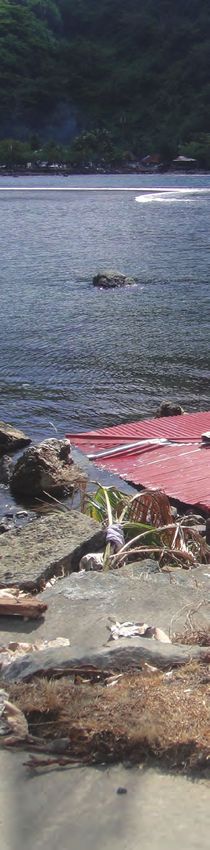
vii

 18.   Map showing recent damaging hurricanes assessed by the USGS include Ivan
       (landfall near Gulf Shores, Alabama, on Sept. 16, 2004), Katrina (landfall at
       Plaquemines Parish, Louisiana, on Aug. 29, 2005), and Ike (landfall near
       Galveston, Texas, on Sept. 13, 2008).........................................................................................31
 19.   Before and after photographs of Hurricane Ike coastal impacts.......................................31
 20.   Map showing assessment of inundation potential near Galveston, Texas for
       Hurricane Ike................................................................................................................................31
 21.   Photograph of Rapid Deployment Streamgage installed on the Minnesota
       River at Granite Falls, Minnesota..............................................................................................34
 22.   Landsat 5 satellite image of the Wallow North Fire in east-central Arizona.....................35
 23.   Screenshot of the U.S. Geological Survey’s Volcano Hazards Program
       Web page......................................................................................................................................36
 24.   Photograph of the public views Mount St. Helens from Johnston Ridge on
       October 1, 2004.............................................................................................................................37
 25.   Photograph of explosive activity at Mount St. Helens, October 1, 2004.............................37
 26.   Model of an atmospheric river storm.......................................................................................42
 27.   Lidar image revealing an intricate pattern of surface ruptures along the
       Borrego fault following the April 4, 2010, El Mayor–Cucapah earthquake
       (M 7.2) in Baja California, Mexico.............................................................................................43
 28.   InSAR interferogram of Mount Peulik, a stratovolcano located about
       550 kilometers southwest of Anchorage, Alaska...................................................................43
 29.   Image of 10-day burn probability perimeters derived from the FSPro analysis................44
 30.   Photographs of Kīlauea, the largest stationary source of SO2 in the
       United States................................................................................................................................46
 31.   Photograph of installation of the Deadhorse, Prudhoe Bay, Alaska observatory,
       January 2010.................................................................................................................................48
 32.   Photograph of the island of Kasatochi, before and after eruption in 2008........................49
1–1.   Map showing locations of USGS geomagnetic observatories............................................61
1–2.   Panoramic view of the San Juan, Puerto Rico geomagnetic observatory........................61
1–3.   Pie diagram showing approximate U.S. Geological Survey appropriated and
       reimbursable hazard funding levels.........................................................................................64
viii

       Tables

          1.     USGS assessment products in current use............................................................................26
          2.     Examples of USGS Products for warnings and situational awareness.............................33
        D–1.     Stakeholder sessions..................................................................................................................69

         Highlights
         Role of USGS in Federal Government......................................................................................10
         NVEWS: Living Safely With Active Volcanoes.......................................................................14
         A Tale of Two Giant Earthquakes and Their Tsunamis.........................................................15
         U.S. National Seismic Hazard Maps: From USGS Science to a More
                 Resilient Nation.............................................................................................................16
         Magnetic Storms and Space Weather....................................................................................19
         Ancient Floods Provide New Information...............................................................................20
         Alaska: A Geohazards Natural Laboratory for the Nation...................................................21
         Examining the Controls on Debris-Flow Initiation, Mobility, and Magnitude....................22
         Today’s Chance of an Earthquake: Real-Time Forecasts from the
                 Advanced National Seismic System..........................................................................23
         Using Aerogeophysical Mapping and 3D Analysis to Define Collapse-Prone
                 Areas of Volcanoes.......................................................................................................24
         Postfire Debris Flow...................................................................................................................29
         Using and Improving Hazus-MH..............................................................................................30
         U.S. Geological Survey Role in Assessing Hurricane Impacts...........................................31
         Value of Rapid Deployment Streamgages For Floods...........................................................34
         Imagery for Emergency Response: the USGS Hazards Data Distribution System..........35
         USGS Hazard Web Pages: Popular and Highly Rated..........................................................36
         Continuing Lessons in Managing Volcano Hazards: Mount St. Helens,
                 Washington....................................................................................................................37
         MHDP Scenarios for Building Networks and Doing Research...........................................42
         Lidar and InSAR: Powerful Tools for Assessments and Forecasts....................................43
         LANDFIRE: Geospatial Information for Strategic and Tactical Wildfire Planning...........44
         Volcanic Gas and Human Health: New Partnerships to Address
                 Emerging Hazards.........................................................................................................46
         Magnetic Orientation for Directional Drilling.........................................................................48
         Hazardous Events and Ecosystem Dynamics........................................................................49
ix Abbreviations ANSS Advanced National Seismic System CDC Centers for Disease Control and Prevention CSS Core Science Systems DHS Department of Homeland Security EROS Earth Resources Observation and Science Center FEMA Federal Emergency Management Agency GPS global positioning satellites GSN Global Seismic Network H-SSPT Natural Hazards Science Strategy Planning Team HDDS Hazards Data Distribution System HREC Hazard Response Executive Committee MHDP Multi-Hazards Demonstration Project NASA National Aeronautics and Space Administration NEHRP National Earthquake Hazard Reduction Program NEIC National Earthquake Information Center NHMA Natural Hazards Mission Area NISAC National Infrastructure Simulation and Analysis Center NOAA National Oceanic and Aeronautics Administration NSF National Science Foundation NSIP National Streamflow Information System NVEWS National Volcano Early Warning System SAFRR Science Application for Risk Reduction Project USACE Army Corps of Engineers USAID United States Agency for International Development USFS United States Forest Service USGS United States Geological Survey WMA Water Mission Area
Photographs at right:
         Flooding in Coralville, Iowa, June 2008.
             Photographs by Don Becker, USGS.

 Top: Hydrographer repairing instrumentation on
   the Big Muddy River at Murphysboro, Illinois.
Bottom: Hydrographer determining outside stage
    for the Skillet Fork near Wayne City, Illinois.
           Photographs by Robert Holmes, USGS.
U.S. Geological Survey Natural Hazards Science
Strategy—Promoting the Safety, Security, and
Economic Well-Being of the Nation
By Robert R. Holmes, Jr., Lucile M. Jones, Jeffery C. Eidenshink, Jonathan W. Godt, Stephen H. Kirby,
Jeffrey J. Love, Christina A. Neal, Nathaniel G. Plant, Michael L. Plunkett, Craig S. Weaver, Anne Wein,
and Suzanne C. Perry
Executive Summary
Mission and Roles The USGS has critical statutory and nonstatutory roles regard-
ing floods, earthquakes, tsunamis, landslides, coastal erosion,
The mission of the U.S. Geological Survey (USGS) in volcanic eruptions, wildfires, and magnetic storms—the haz-
natural hazards is to develop and apply hazard science to help ards considered in this plan. There are numerous other hazards
protect the safety, security, and economic well-being of the of societal importance that are considered either only periph-
Nation. The costs and consequences of natural hazards can be erally or not at all in this Strategy because they are either in
enormous, and each year more people and infrastructure are at another of the USGS strategic science plans (such as drought)
risk. USGS scientific research—founded on detailed observa- or not in the overall mission of the USGS (such as tornados).
tions and improved understanding of the responsible physical
processes—can help to understand and reduce natural hazard
risks and to make and effectively communicate reliable state- Priority Goals and Actions
ments about hazard characteristics, such as frequency, magni-
tude, extent, onset, consequences, and where possible, the time The USGS conducts hazard research to inform a broad
of future events. range of planning and response activities at individual, local,
To accomplish its broad hazard mission, the USGS State, national, and international levels. A sustainable society
maintains an expert workforce of scientists and technicians requires a responsive government to reduce the loss of life and
in the earth sciences, hydrology, biology, geography, social disruption caused by natural hazards. People who are poten-
and behavioral sciences, and other fields, and engages coop- tially affected by natural hazards need robust assessments to
eratively with numerous agencies, research institutions, and prepare for hazardous events, and they need information about
organizations in the public and private sectors, across the updated hazards for situational awareness during times of
Nation and around the world. The scientific expertise required crisis. To meet these needs, scientists, in turn, require funda-
to accomplish the USGS mission in natural hazards includes a mental understanding of natural processes and observations of
wide range of disciplines that this report refers to, in aggre- natural events. Thus, the H–SSPT developed four overarching
gate, as hazard science.
and interrelated goals regarding observations, understanding,
In October 2010, the Natural Hazards Science Strategy
assessments, and situational awareness. To accomplish each
Planning Team (H–SSPT) was charged with developing a
goal, this Strategy identifies core responsibilities and strategic
long-term (10-year) Science Strategy for the USGS mis-
sion in natural hazards. This report fulfills that charge, with actions. Core responsibilities are activities that the USGS must
a document hereinafter referred to as the Strategy, to provide continue in order to uphold its mission. In many cases, these
scientific observations, analyses, and research that are critical are mandated activities that help to protect lives and assets,
for the Nation to become more resilient to natural hazards. or strengths developed as a consequence of long-standing
Science provides the information that decisionmakers need to national need. Strategic actions are high-value, priority efforts
determine whether risk management activities are worthwhile. that go beyond the core responsibilities and will reduce
Moreover, as the agency with the perspective of geologic time, uncertainties about hazards, improve communication, and thus
the USGS is uniquely positioned to extend the collective expe- enhance the ability to provide accurate, effective assessments
rience of society to prepare for events outside current memory. and situational awareness.2 USGS Natural Hazards Science Strategy—Promoting the Safety, Security, and Economic Well-Being of the Nation
We provide a prioritization philosophy, to be applied • Collect the ephemeral data during hazardous events
through the collaborative efforts of the USGS Executive that will support future research to reduce loss.
Leadership Team, Program Coordinators, and Science Centers,
to accomplish prioritization effectively. For each goal, this • Develop long-term chronologies, with associated mag-
Strategy identifies key strategic actions that were synthesized nitudes, of hazardous events from both historical and
from hundreds of suggestions provided by USGS hazards paleohazard studies.
stakeholders within the past year (2011). Given the spectrum
• Distribute this information to the wide range of users
of hazards under consideration in this report, along with the
through a variety of data portals.
broad administrative controls for funding USGS hazards sci-
ence, this report does not prioritize the strategic actions.
The first and highest priority is to maintain the basic Strategic Actions for the Future
and applied research, observations, and communication
efforts such as assessments and warnings that form the core • Enhance the existing monitoring networks to provide
responsibilities. These are areas of USGS activity that must reliable operation, ensure full interoperability with
be safeguarded in times of decreased funding. Given suffi- other agencies that rely on uninterrupted data flow
cient funding to support the core responsibilities, the strategic from the USGS, and improve early warning.
actions indicate areas of advancement that will have great-
est impact on improved understanding and on the efficacy of • Improve the use of monitoring information through
assessments and situational awareness. better near-real-time delivery, new tools for use of
The H-SSPT recommends that strategic actions be priori- data, and the merger of existing, critical datasets.
tized based on the degree to which the strategic action does the
• Take advantage of rapidly changing technology, recog-
following:
nizing that the ability to monitor effectively depends
• Helps meet USGS core responsibilities (particularly on the technology used and the ability to adapt to
statutory responsibilities). changes.
• In a larger context, helps the Federal Government to • Improve overall data quality standards governing
meet its responsibilities in the hazards arena. quality assurance, metadata, additions, curation, and
• Is important for risk reduction, protecting human timeliness.
health, the economy, or national security. • Expand observations of geologic setting, including
• Addresses a large gap in hazards science understanding geological mapping and geophysical data acquisition,
and reduces uncertainty. as these observations are essential to understanding
the frequency, physical mechanisms, and impacts of
• Enhances areas where the USGS has a unique role and events.
expertise.
• Improve data collection during and after hazardous
• Holds a high potential for investment return in the form events to protect public safety and gather critical,
of improved assessments and awareness. ephemeral information.
• Use geological and historical methods to expand
Goal 1: Enhanced Observations hazard chronology and magnitude distribution studies
needed to define probabilities of occurrence.
The USGS acquires comprehensive observations impor-
tant to natural hazards to improve fundamental understanding,
assessments, and situational awareness.
Goal 2: Fundamental Understanding of Hazards
Core Responsibilities that Must be Sustained and Impacts
The USGS advances and applies fundamental under-
• Operate monitoring networks for earthquakes, stream-
standing of natural hazards to improve assessments and situ-
flow, volcanic activity and geomagnetic storms, and
produce datasets of observations and near-real-time ational awareness.
products.
Core Responsibilities that Must be Sustained
• Conduct surveys, such as geological mapping and
acquisition of geophysical data, to enable a bet- • Increase understanding of the underlying physical
ter understanding of hazardous processes including processes that produce the hazard and determine where
sources and impacts. and under what conditions hazards occur.Executive Summary 3
• Uphold the tradition of innovation in instrumentation, • Inform the public about natural hazards to promote
measurement and experimental techniques. risk-wise behavior by publishing assessments and
providing assessment tools using USGS scientific
• Foster USGS scientific expertise to provide expert information.
advice as needed in crisis and noncrisis situations.
• Publish results with peer review and distribute to Strategic Actions for the Future
appropriate audiences through relevant mechanisms.
• Improve the formulation of assessments, in particular,
• Support innovation and creativity in the conduct of our by ensuring there is a process to update assessments
science. with the most current understanding, methodology, and
observations.
Strategic Actions for the Future • Create and distribute effective multimedia assessments
• Promote targeted research on physical hazard initiation developed through partnerships with users, social and
processes, because limited understanding about these behavioral researchers, and educators.
processes limits the ability to make accurate predic- • Develop multihazard assessments to compare the rela-
tions. tive risk of multiple hazards or assess the combined
• Promote research on extreme events, which are the risk of multiple hazards.
rare, potentially catastrophic events with the greatest • Balance investments in hazard, vulnerability and risk
societal consequences. assessment to ensure that the USGS improves the accu-
• Promote research about natural hazard vulnerability, racy, resolution, and timeliness of hazard assessments
risk estimation, and communication. while engaging with other entities who make use of the
hazard information.
• Encourage interchange of ideas in research about the
role of fluids in physical processes, because this broad • Develop event and disaster scenarios and other stra-
topic of investigation is essential to understanding a tegic assessments to incorporate research results into
multitude of hazards phenomena. decision-making processes.
• Promote research in the triggering and interaction of • Evaluate the accuracy, use, validity and effectiveness
multiple hazard processes, which frequently happen in of assessments, working with social and behavioral
nature and have distinct probabilities of occurrence and scientists and assessment users, in order to improve
potential impacts. future assessments and demonstrate the value of USGS
assessments.
Goal 3: Improved Assessment Products and
Goal 4: Effective Situational Awareness
Services
The USGS provides situational awareness to improve
The USGS develops assessments of natural hazards,
emergency response, inform the public, and minimize societal
vulnerability and risk to inform decisions that can mitigate
disruption.
adverse consequences.
Core Responsibilities that Must be Sustained
Core Responsibilities that Must be Sustained
• Collect the data and conduct analyses to inform warn-
• Create hazard assessments used to inform decision ings by the USGS or others of impending crises.
making, based on fundamental understanding of natu-
ral hazards. • Issue warnings and advisories of impending potential
hazardous events and their termination.
• Evaluate the assessments using observations made at
national and regional scales and over long time periods • Provide timely information to other agencies, emer-
to capture significant and infrequent events. gency managers, the media, and the public about
hazardous events as they occur.
• Develop new assessment tools to improve the scien-
tific foundation of assessments as new understanding • Invest appropriate resources in hazard education during
evolves. crisis as well as noncrisis times.4 USGS Natural Hazards Science Strategy—Promoting the Safety, Security, and Economic Well-Being of the Nation
Strategic Actions for the Future • Operates a robust, comprehensive network of instru-
ments that monitor hazardous conditions.
• Develop and provide training for the next generation of
tools for rapid event detection and response, which will • Leads the Nation in hazards science because of its
require targeted partnerships to define the products and diverse, expert staff.
delivery mechanisms that most effectively put USGS
• Creates easily understood assessments that are rou-
information into the hands of decisionmakers.
tinely used to reduce risk.
• Improve data systems critical to situational aware-
• Employs newly developed software tools that bring
ness responsibilities, a need that includes making
together data and understanding to better manage
monitoring networks that are more robust, expanding
natural disasters and shares these tools with emergency
monitoring coverage as needed, and delivering infor-
managers.
mation in usable formats.
• Implement 24x7 operations for critical USGS moni-
toring efforts in order to maximize USGS ability Opportunities and Challenges
to inform partner agencies, respond to hazards, and
deliver expertise when it is needed. Although this Strategy addresses the scientific needs and
opportunities of the USGS mission in natural hazards, the
• Improve provision of scientific expertise for decisions newly formed USGS Natural Hazards Mission Area (NHMA)
and assessments during rapidly changing situations. can address important programmatic and policy issues that fall
This necessitates training of scientific staff in media outside this report’s structure of four goals, with associated
response. core responsibilities and action items. Under its umbrella, the
NHMA can help to accomplish the following:
• Improve internal hazards coordination, which is con-
ducted across the Bureau and over many regions and • Maintain USGS leadership in hazard science through
includes data, research, and geospatial support activi- effective workforce planning.
ties. • Address neglected and emerging natural hazard prob-
• Evaluate warning and response products to improve lems and ensure that hazards lacking programs in the
their accuracy, timeliness, and communication, and USGS have proper advocacy, support, and input.
demonstrate the value of the USGS hazard investment • Coordinate and facilitate international, interagency, and
in observations and fundamental understanding. cross-Mission Area collaborations that are essential to
• Involve the whole community in the evaluation of the fulfillment of the USGS mission in natural hazards and
response products so as to increase the reach of the are crucial during hazard crises.
products. • Collaboratively develop hazard communication prod-
ucts that engage the public’s interest in natural disas-
ters to boost public awareness of USGS hazards efforts
A Vision of the Future and risk-wise behavior.
If these core responsibilities are upheld, and these • Engage hazard expertise when it can assist with
strategic actions are taken, the USGS will move closer to human-caused events such as the Deepwater Horizon
the H-SSPT vision of the future, where the Nation will be oil spill and provide critical evaluations of predictions.
more resilient because of USGS hazards science. That vision
includes a USGS that does the following:
Hurricane Isaac leaves flooded homes in his wake near
the community of Braithwaite, Louisiana, Sept. 4, 2012.
Photograph by Brady Couvillion, USGS.Executive Summary 5 USGS Hazard Science Makes a Difference U.S. Geological Survey (USGS) hazard programs have a long history of science, service, and products that reduce the impacts of hazardous events: Trans-Alaska [Oil] Pipeline The USGS contributed design inputs to the Trans-Alaska [Oil] Pipeline that help to ensure the pipeline’s thermal stability and resistance to strong ground motion and fault offsets during earthquakes. The pipeline design has resulted in success- ful thermal performance—avoiding surrounding permafrost melting—since it was completed in 1977; and demonstrated successful mechanical performance during the 2002 M7.9 Denali earthquake, which ruptured the Denali Fault right under the pipeline,. Both cases demonstrate the value of science-based hazard intervention and mitigation (Fuis and Wald, 2003; available at http://pubs.usgs.gov/fs/2003/fs014-03/). USGS Provides Critical Data During 2011 Floods The Mississippi River Basin experienced “epic” flooding as a result of sustained rainfall in the upper part of the Basin through late spring and early summer 2011. For the first time since 1937, the Birds Point/New Madrid floodway was oper- ated to reduce upstream flooding. Boat-mounted hydroacoustic instruments deployed by USGS scientists were used to determine the flow rates coming through the floodway for operational decisions by the U.S. Army Corps of Engineers, as well as detailed three-dimensional water velocity vectors, which were measured in the nearby Mississippi River before and after activation of the floodway to ensure that commercial barge traffic could move safely along the river. Working Group on California Earthquake Probabilities: Uniform California Earthquake Rupture Forecast Since 1988, the USGS has led the science of time-dependent earthquake forecasting. The USGS works closely with the Cal- ifornia Earthquake Authority to assess insurance rates by calculating the probability of damaging earthquakes throughout the State. USGS scientists, working with colleagues in the California Geological Survey, the Southern California Earthquake Center, and others continually seek ways to evaluate and develop the best available science for probabilistic forecasts, which provide a bridge between cutting-edge research and a practical application for public safety. This work continues to set trends in hazard assessments in the United States and around the world (http://www.wgcep.org/). The Vital USGS Streamgage Network and Online Web Interface The USGS has a network of some 7,800 near-real-time streamgages and more than 4,000 of these form a major backbone of the National Weather Service’s (NWS) flood forecasting operation, as evidenced by the following quote from a NWS hydrologist from the Southeastern United States: “The USGS work has been and continues to be crucial to the NWS ability to provide accurate river forecasts and warnings to inform State agencies, Dam Operators, Emergency Operations Centers, Emergency Managers and the public across Georgia and Florida” (Joel Lanier, Senior Service Hydrologist, NWS Tallahas- see, Florida, written commun., 2011; http://waterdata.usgs.gov/nwis/rt). Reducing Global Volcanic Risk The Volcano Disaster Assistance Program (VDAP) is a global volcanic risk mitigation activity cofunded by the U.S. Agency for International Development and the USGS. VDAP volcanologists work with local scientists to provide training, equip- ment, and consultation in order to build capacity and minimize loss. Since 1986, VDAP has responded to dozens of volcanic crises around the world, saving thousands of lives and returning with valuable lessons to reduce risk in the United States. One of the most important success stories was the accurate forecast of the cataclysmic 1991 eruption of Mount Pinatubo in the Philippines. VDAP’s rapid response to the initial unrest and timely warning of the impending eruption led to a suc- cessful evacuation of Clark Air Base, its valuable aircraft, and thousands of residents from densely populated, nearby com- munities (http://vulcan.wr.usgs.gov/Vdap/framework.html, http://vulcan.wr.usgs.gov/Vdap/framework.html, http://pubs.usgs. gov/fs/1997/fs113-97/, and http://pubs.usgs.gov/fs064-97/). Coastal Processes In collaboration with the National Oceanic and Atmospheric Administration (NOAA) and the U.S. Army Corps of Engineers (USACE), the USGS is predicting the likely interactions between storm forcing (for example, surge and waves) and coastal topography (beaches, berms, and dunes) during hurricanes in near-real-time. This information provides a powerful short- term tool to emergency responders and communities to identify areas of greatest likely damage.
6   USGS Natural Hazards Science Strategy—Promoting the Safety, Security, and Economic Well-Being of the Nation

  USGS Hazard Science Makes a Difference—Continued
  Volcanic Ash Hazards, Impacts, and Preparing the Nation for Ash-Fall Events
  Drifting ash clouds and ash fall from volcanic eruptions can have far reaching impacts. USGS scientists have worked
  closely with NOAA, university, and international partners to understand and explain the effects of volcanic ash on people,
  infrastructure, and ecosystems. A new USGS ash cloud dispersion and ash fall forecast tool, Ash3D, will help warn down-
  wind communities and infrastructure of expected ash fall severity. In addition, USGS leadership, in improving the complex
  global system of ash-cloud warnings for aviation, has made significant contributions to safe and efficient air travel in the
  United States and around the world (http://volcanoes.usgs.gov/ash/index.html; and Neal and Guffanti, 2010, http://pubs.
  usgs.gov/fs/2010/3116/).

  Geomagnetism Leadership
  The USGS provides international leadership in obtaining integrated real-time domestic and global geomagnetic-field
  monitoring, as well as leadership in the development and production of geomagnetic-storm intensity indices. USGS and
  Intermagnet observatories are critical ground-based assets in coordinated monitoring of space weather, which can
  have very damaging impacts to the infrastructure and activities of our modern, technologically based society. The same
  observatories also support forecasts and warnings provided by NOAA, the U.S. Air Force, and space-weather agencies
  in Europe and Japan (Love and others, 2008, http://pubs.usgs.gov/fs/2007/3092/; and Love and Finn, 2011, http://dx.doi.
  org/10.1029/2011SW000684).

  Living with Landslides
  Landslides occur in all 50 states and cause fatalities and damage nearly every year. The Landslide Handbook—A Guide to
  Understanding Landslides, published in collaboration with the Geological Survey of Canada, is a valuable guide for land-
  slide hazard education. The richly illustrated guidebook discusses the nature of landslides, why and where they occur,
  potential impacts, and what can be done to mitigate these impacts. It has been translated into Mandarin Chinese, Spanish,
  Portuguese, and Japanese with support from the World Bank, China Geological Survey, and Japan Landslide Society. It
  received the 2011 Geological Society of America Burwell Jr. Award (Highland and Bobrowsky, 2008, http://pubs.usgs.gov/
  circ/1325/).

  Contributions to Burned Area Emergency Response
  After a wildfire there potentially are major impacts to water quality, endangered species, cultural resources, and the threat
  of introduction or spread of invasive species. In many areas, wildfires also increase the likelihood of floods and debris
  flows for the next several storm seasons. USGS burn severity characterizations, derived from satellite imagery, have
  become a primary tool used by Department of Interior and United States Forest Service Burned Area Emergency Response
  Teams to assess the impacts of a wildfire and rapidly develop a mitigation plan to protect communities, water, and ecosys-
  tems from subsequent harmful impacts.

  Community Exposure to Tsunami Hazards for Emergency Managers
  USGS investigations of the variations in community exposure to tsunami hazards in Oregon, Washington and Hawai`i
  have been put to many and varied uses: education materials, comprehensive land use and mitigation planning, tabletop
  and functional exercises, vulnerability assessment workshops, mapping prioritization, and recommendations for national
  policy on tsunami preparedness. The wide use owes credit to agency partnerships, user engagement, varied communica-
  tion methods, and guidance from social and behavioral science research, which provided both community vulnerability
  attributes and insight into how to frame the information for decisionmakers (Oregon: Wood, 2007, http://pubs.usgs.gov/
  sir/2007/5283/; Washington: Wood and Soulard, 2008, http://pubs.usgs.gov/sir/2008/5004/; Hawai`i: Wood and others, 2007,
  http://pubs.usgs.gov/sir/2007/5208/).

  A Scenario that Inspires Earthquake Preparedness
  A southern San Andreas earthquake scenario developed by the USGS Multi-Hazards Demonstration Project became the
  basis of the Great Southern California ShakeOut, comprising the largest-ever statewide exercise of emergency respond-
  ers (“Golden Guardian,” led by the Office of Homeland Security), and the largest public drill ever attempted in the United
  States, with more than 5 million participants. Exercise planners heavily used the scenario, with help from USGS scientists,
  who customized scenario results for individual counties and cities. The USGS also supplied inspiration and organization for
  the inaugural ShakeOut drill, which has now spawned annual events in many states and countries.
You can also read