UAV/S in GIS
Brookhaven College
1st Flight Operation &
Evolving Plans

Summer and Fall 2016
←
→
Page content transcription
If your browser does not render page correctly, please read the page content below
UAV/S in GIS Brookhaven College 1st Flight Operation & Evolving Plans Summer and Fall 2016
Can we fly the campus?
• July 2016 Used COTS $2000
  UAS
   ▫ DJI Phantom 3 Pro
   ▫ 12 mp camera
• This is turn-key; everything is
  integrated
  ▫   Sensor and lens
  ▫   Gimbal and mount
  ▫   Flight control and positioning
  ▫   Remote Control
Resources Needed
• To Fly
▫ Aviation Consultant (licensed pilot, liaison to local
controllers/airports)
▫ UAS
▫ Mission Planning app
▫ Viewing device (tablet)
• To have accuracy
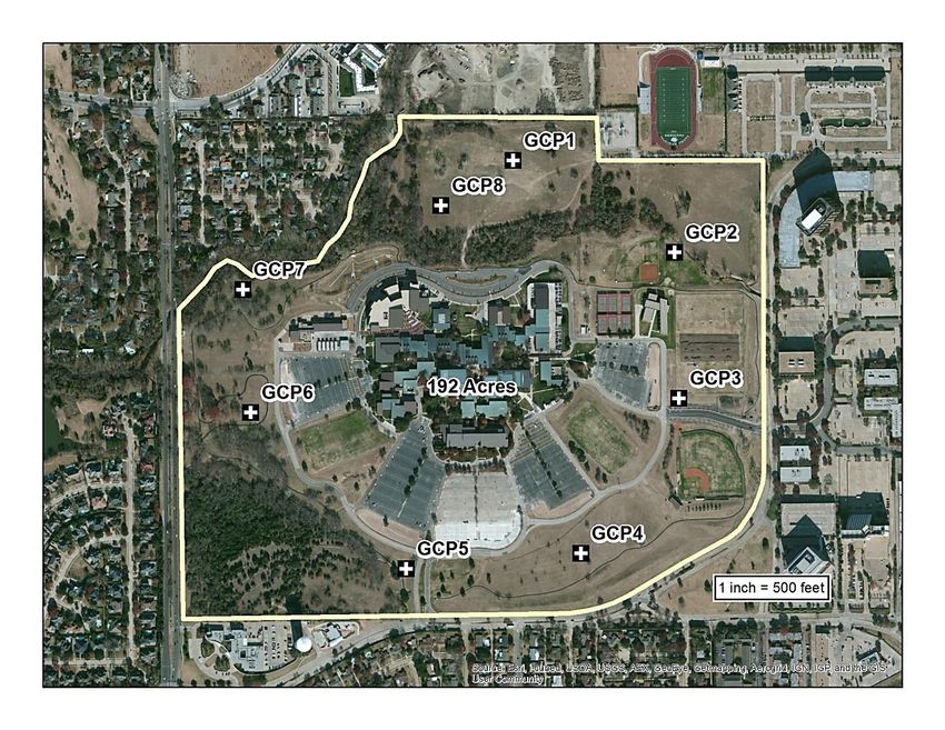
▫ AOI with group control points
• To result in useful data
▫ Solid computing capability
▫ Image Processing capability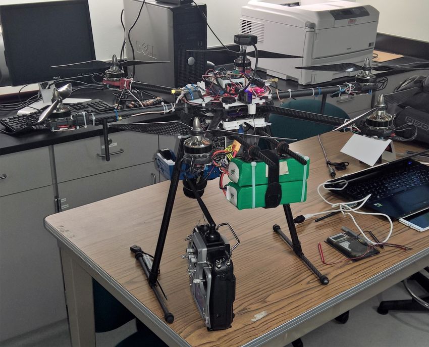
How we spent 3 days.
• Day 1 – Ground Control Points (GCPs)
 ▫ Create the targets
 ▫ Place the targets
 ▫ Capture location coordinates for targets
• Day 2 – Flying and Photography
 ▫ Visually plan the missions
 ▫ Flight operations and team
• Day 3 – Processing imagery
 ▫ Create data products
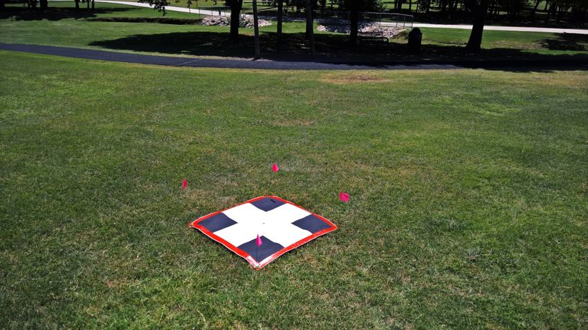
Targets are fast, easy and cheap
  Sq. Meter
  Reinforced Edges
  Staked
  Flagged
  Coordinates Captured

                         Plotter
                         GPS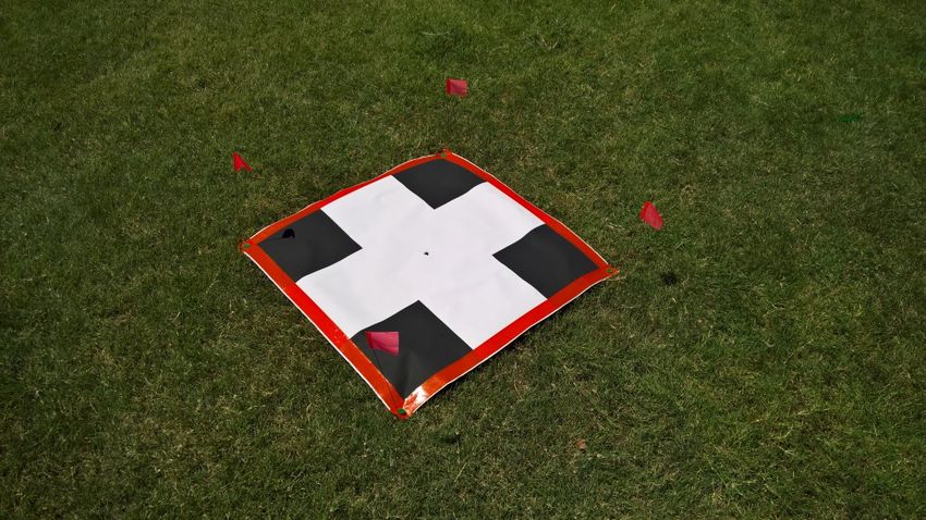
The GCPs
           4 hours to plot and
           prep targets

           8 hours to place and
           capture

           1 hour to pick them up
           later
Mission Planning
Map Pilot for DJI
$10 app on the Apple
Store

Easy to use

Plan Flight area
relative to telemetry
    ▫ Battery life,
    ▫ Elevation,
    ▫ Wind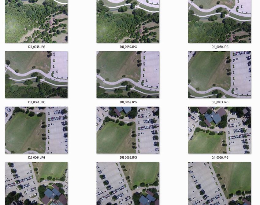
The Actual Flight
1.   Plan Mission / set the ‘fence’ (area of interest)
2.   Check telemetry
3.   UAS take off
4.   Eyes on / monitor flight
5.   Autonomous image capture
6.   UAS returns to start / land
7.   Replace battery & check equipment
8.   Move to new location
                     Repeat it all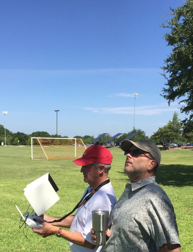
How did we cover the campus?
•   7 missions
•   400 feet elevation
•   Yielded 650 images
•   5 member team
    ▫ PIC – pilot in command
    ▫ PAC – pilot at controls
    ▫ VO – visual observer (3)
Image processing
•   Esri’s Drone2Map
•   3-hour process to stitch together 650 photos
•   Result is a 192 acre orthomosaic
•   2.25” pixel resolution
•   Search ‘BHC UAV’ in
    ArcGIS Online
Recent Changes / August 29, 2016 • Part 107 – Remote Pilot License • Required for using drones in business • Age 16 or above • Drivers license • Pass a TSA background • Cost $150.00 • Pass an online knowledge test (40% pass rate)
New Operating Limits
• Must maintain line of sight
• Approval required to fly in any airspace other
  than class ‘G’
• Flight ceiling of 400’ above structure or terrain
• No flight at night
• No payload for delivery
• No operation from a moving vehicle
New Operating Limits (continued)
• License renewal every 24 months
• No operation of more than 1 drone
• No flight over people unless participating or
  under cover
• 55 lb. loaded weight limit

• Waivers available for most every limitation
Coming Soon from the FAA
• NEXTGEN airspace plan
• Defined drone air routes
• 2nd and 3rd tier license options
Next Steps at BHC
• DIY / BYO
    ▫ Hexacopter (Fall 2016)
    ▫ Marine vessel (Fall 2017)
•   Active courses with UAS technology
•   Small robotics (air, land and sea)
•   Pre-engineering skills
•   Spring 2017 Festival
•   More course content throughout
Fall 2016 GIS Course • Refining and Enhancing ▫ COTS vs. BYO/DIY ▫ SOP Development ▫ Additional missions ▫ Data Processing
$3000 BYO UAS
                                                                        Aggregate
Function             Item No                   Quantity       Unit Cost Price               Weight(g)
24 MP Sensor         SOA5100BK                            1      $598.00      $598.00                   399
Gimbal               Airy-LE-0203                         1      $599.00      $599.00                   550
Camera Trigger       Seagull #MAP2                        1       $42.00       $42.00                    12
Camera Cable         Seagull Sony S2                      1       $16.00       $16.00                     0
Frame                Flame Wheel 550 (F550)               1       $48.00       $48.00                    478
Flight Controller    9387000081-0                         1      $191.00       $191.00                   312
2nd GPS (primary)    572000003-0                          1       $30.00       $30.00                     35
Motors x6            9536000005-0                         8       $36.86      $294.88                    558
ESC x6               DYS - XS30A                          6       $16.99       $101.94                    52
Pull Propeller       LP10047SF (APC 10x4.7)               2        $3.06            $6.12                36
Push Propeller       LP10047SFP (APC 10x4.7)              2        $3.06         $6.12                   36
2.4ghz transmitter   Radiolink-Acc-AT9-R9D                1      $119.00       $119.00                    0
                     UP120AC DUO AC/DC
Charger              Charger - 120W                       1       $99.00       $99.00                     0
Landing Gear         PFG-CGCRLG                           1      $200.00      $200.00                   320
Battery              912700004-0                          8       $43.68       $349.44                  1286
Media card           IM1RR4698                            2       $43.99        $87.98                     0
                                                                             $2,788.48                  4074
Student built UAV
Class-developed SOP
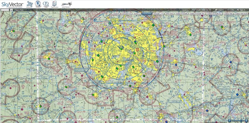
Skyvector.com for planning
D2M
Experience
reveals ease of
use
Practice Datasets

https://www.sensefly.com/drones/example-datasets.html

https://cloud.pix4d.com/download/
Fall 2016 GISC1391 Special Topics in GIS (UAV and GIS)
Resources to get started
Find your own resources - Search online for ‘ArcGIS UAV’

2014 article explaining the broad application of UAV in GIS.
http://www.esri.com/esri-news/arcuser/spring-2014/uav-and-gis-an-emerging-dynamic-duo

Some common initial questions:
https://geonet.esri.com/thread/162697#comment-580358

   1) What are the requirements for the UAV camera and GPS/INS system?
   2) What metadata is required to process still UAV images? Does it have to be FMV military
      standard?
   3) Is the new application going to be integrated with Mosaic Dataset/ Image Service/ ArcGIS
      Desktop and ArcGIS Runtime?
   4) Can I do the following with the new UAV mapping application?
           a. Create orthorectiefied image?
           b. Measure a height?
           c. Other functionalities?
   5) According to the video, the point cloud can be produced from images. What is the output of the
      process? Is it LAS dataset? Is there any automatic algorithms for change detection and feature
      detection/others?
   6) What are the time frames for the app release?

What’s new regarding developing rules and regulations over the use of UAV?
http://geospatial-solutions.com/category/technology/uasuav/

How in-demand are UAVs in GIS?
http://mappingstats.maps.arcgis.com/apps/MapJournal/index.html?appid=a58b39a0b284418cb56e23f
67f0fad6f#map

UAV flight planning tool
http://www.arcgis.com/apps/Viewer/index.html?appid=021e985e6e2d42a694db71ce4ba54312#!

DroneMapper solution
https://dronemapper.com/guidelines

DroneMapper examples
https://dronemapper.com/blog

More Examples, Uses and Case Studies
https://www.gislounge.com/using-unmanned-aerial-systems-uas-for-remote-sensing-of-archaeological-
sites/
Fall 2016 GISC1391 Special Topics in GIS (UAV and GIS) Learn More: This information (these links) found at: http://voices.nationalgeographic.com/2014/03/05/so-you- want-to-shoot-aerial-photography-using-drones/ Drone & Pilot sUAV Logbook Kike Calvo´s Drone Collections Drone / UAV Dictionary: Includes 300 Commercial UAV Applications Cool stuff for Drone and Unmanned Vehicle enthusiasts Drone Entrepreneurship: 30 Businesses You Can Start Small Unmanned Aircraft: Theory and Practice Introduction to Unmanned Systems: Air, Ground, Sea & Space UAV Fundamentals Executive Course How to Start an Unmanned Aircraft Vehicle (UAV) Business Course on DVD Small UAV Construction Getting Started with Hobby Quadcopters and Drones: Learn about, buy and fly these amazing aerial vehicles Military Robots and Drones: A Reference Handbook (Contemporary World Issues) The Media Source Presents Drones: Are They Watching You? Magazine Introduction to Unmanned Aircraft Systems Drone Pilot (Cool Careers) Fly by Wire Aircraft: Fighters, Drones, and Airliners Introduction to Remote Sensing, Fifth Edition
Thank you
J. Scott Sires
  Geospatial Technology Program
  Professor & Coordinator
  Brookhaven College
  Mathematics & Sciences Division
  3939 Valley View Lane
  Bldg. H, H-115
  Farmers Branch, Texas, 75244
  972-860-4362

ssires@dcccd.edu
www.brookhavencollege.edu/
www.dcccd.edu/gis
You can also read