USING RECREATIONAL UAVS (DRONES) FOR STEM ACTIVITIES AND SCIENCE FAIR PROJECTS - Education Committee Federation of Earth Science Information ...
←
→
Page content transcription
If your browser does not render page correctly, please read the page content below
USING RECREATIONAL UAVS (DRONES) FOR
           STEM ACTIVITIES
      AND SCIENCE FAIR PROJECTS
Education Committee
Federation of Earth Science Information Partners

                                Presenter: Shelley Olds, UNAVCO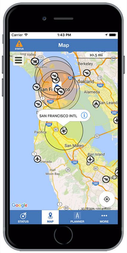
ABOUT ESIP - THE FEDERATION FOR EARTH SCIENCE INFORMATION PARTNERS

                                 ESIP is an open, networked community that
                                 brings together science, remotely sensed data
                                    and information technology practitioners.

ESIP EDUCATION
Curriculum developers, instructors,
evaluators, and educators
who promote the use of Earth Science
data for learning
UAVS 4 STEM:
                                                       TWO WEBINARS AND WORKSHOPS

Webinar 1: March 2, 2016              Webinar 2: April 26, 2016         Workshop: July 19, 2016 Chapel Hill, NC
       UAVs 4 STEM                      Plan, Fly, Review:                       Test and Refine STEM
                                     Documenting Drone Data                       Learning Activities
 Learn about real-world uses of
 drone technology for science       Get organized so you can learn         Fifteen successful applicants will receive
 and humanitarian efforts. Find     something from every UAV flight.       a drone and a $200 stipend to test and
 out how you and your               Learn best practices for               refine activity ideas, and then use them
 students can use recreational      documenting your flights, images,      with youth in the fall. The workshop will
 drones for STEM learning.          and science data.                      prepare attendees to facilitate drone-
                                                                           based STEM learning in clubs,
NSTA Regional Workshops: Denver STEM Forum, Minneapolis, MN;               classrooms, or science fair activities.
Portland, OR; Columbus, OH
  Using Recreational UAVs (Drones) for STEM Activities and Science Fair
  Engage students in STEM using the “it” toy of the year: Unmanned Aerial Vehicles (UAVs or drones)!
  Try free teacher-developed activities for STEM learning.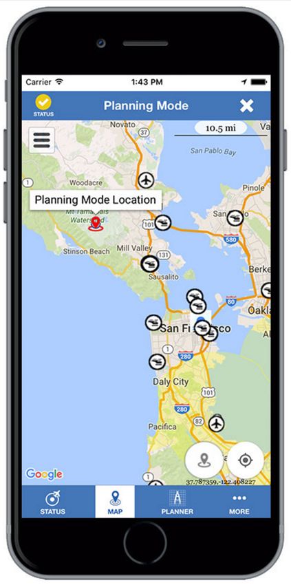
Recreational drones
     ❏ weigh less than a half pound
❏ do not need to be registered with the
 Federal Aviation Administration (FAA)
     ❏ usually cost less than $100    AKA …
     ❏ can be considered as “toys”        ● Unmanned Aerial Vehicles or UAVs
                                          ● Unmanned Aircraft Systems or UASs
        ❏ Must be within sight
                                             ● Quadcopters / Quadrocopters
                                               ● Multi-rotors / Helicopters
                                                  ● Fixed-wing drones
                                                   ● Aerial robotics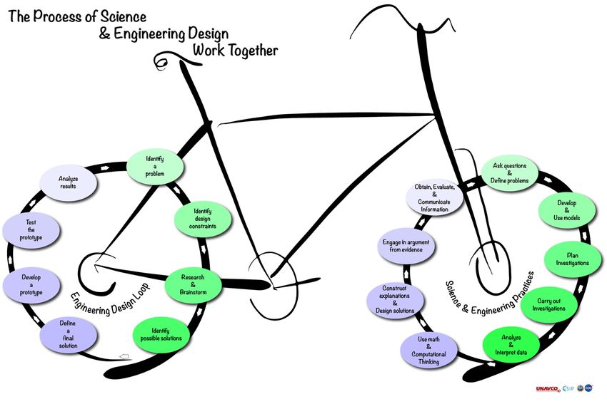
ESIP Education UAV GOALS
• Downloadable e-book of STEM activities
  using recreational drones
• Cadre of educators to facilitate activities
  & data management strategies
• Opportunities for follow-on data
  explorations with ESIP members
Survey Results:    How to use them
                  to collect images or
   Teacher             other data
  Interest in             (84%)

 Using Drones     How professionals
                  are using them in
                    various fields
                         (71%)
                  In after-school clubs
                          (84%)

                   In science classes /
                         sessions
                          (61%)           ?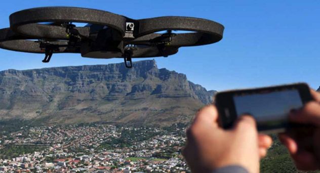
ACTIVITIES WE ARE
                                                     AND
                                               ARE NOT DOING
Our main goal: help educators facilitate STEM learning.

As we can’t cover everything about drones, we made a conscious decision to !

omit:
                     Ø Teaching people how to fly drones
                          (lots of resources for flying already exist)

                     Ø Flying drones for commercial profit or a business
                           (these activities require special licenses)

                     Ø Building and / or coding drones
                          (great activities, but out of our scope)
DRONES & STEM
                                    CONNECTIONS
q Experiencenew perspectives and new challenges : Merges science,
 technology, and data science !

q Build
      critical thinking skills by asking questions, brainstorming ideas,
 planning & carrying out investigations, analyzing & explaining the data !

q Work    in a team: each person has a role !

q Provide hands on experiences about science and reproducibility of
 results - translates to abstract thinking !

                                        q How have you convinced your administration?   ?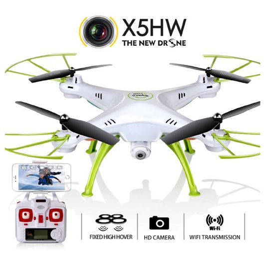
SAFETY & CIVILITY
                                                  FIRST!
üAvoid   wind. !                                            üFollow  the Golden
                                                             Rule when choosing
üDevelop    skill by practicing at low altitudes. [Waist-    a location to fly.!
 height]!
                                                            üConsider   if you would
üFly only in safe places: set and observe boundaries         (or could be
 that keep you and your drone clear of traffic and other     concerned about
 hazards. !                                                  seeing a drone in
                                                             particular situations!
üBe alert! Don’t let enthusiasm overcome common
 sense.!                                                    üIf the site of a drone
                                                             is likely to disturb
üWhenever  you perceive potential dangers, stop and          people or wildlife,
 change the situation.!                                      don’t fly there. !
B4U FLY SMARTPHONE APP : FAA APP
                                    HTTP://KNOWBEFOREYOUFLY.ORG/

Know Before You Fly
     Free for
  iOS & Android.
Check for specific restrictions in
parks, near sensitive facilities, and
places where you might disturb
wildlife.
BEFORE GOING OUTSIDE: ASK
QUESTIONS -> MAKE A PLAN
NGSS: Ask questions and define
problems
Pick a question that you want to try
answering with your drone.
NGSS: Developing and using models
Draw a diagram illustrating your
hypothesis.
NGSS: Planning and carrying out
investigations.
What do you want to accomplish this
flight session?BEFORE GOING OUTSIDE:
ASK QUESTIONS -> MAKE A PLAN
NGSS: Ask questions and define Where do you plan to fly?
problems
Pick a question that you want to try
What equipment do you need?
answering with your drone.
• Safety glasses,
NGSS: Developing and using models
• Drone(s),
Draw a diagram illustrating your • Extra batteries,
hypothesis. • Repair kit,
NGSS: Planning and carrying out • Hand-held camera, other sensors,
investigations. • Science notebook / Log-book, etc.
What do you want to accomplish this Science Teams:
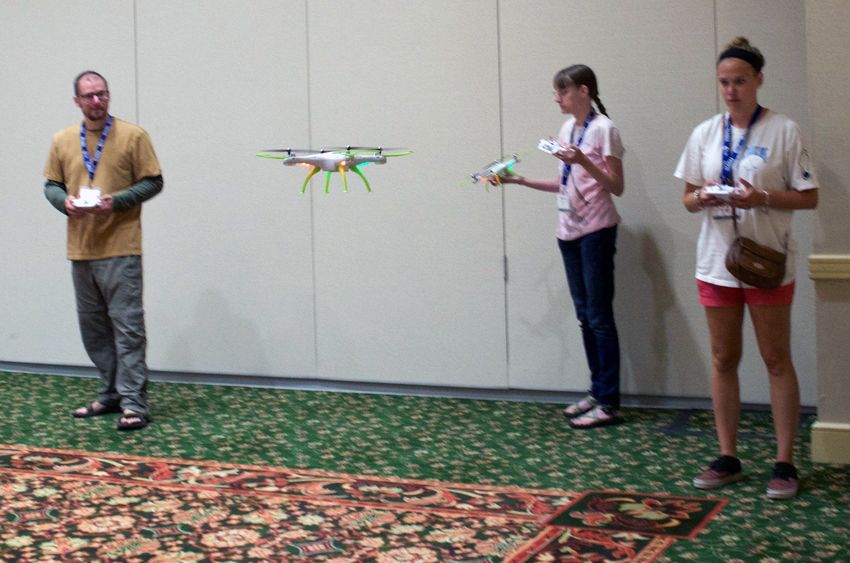
flight session? pilot / spotter / data recorderPLANNING: THE SCIENCE / FLIGHT
TEAM & ROLES
Data Recorder Roles: Spotter/Safety Lead Roles: Pilot Roles:
Pre-flight Pre-flight Pre-flight
• Calls out pre-flight • Describes weather data • Checks the drone
checklist items • Checks surroundings for • Checks instruments/
• Completes the Flight obstacles & hazards sensors
Datasheet In-flight In-flight
In-flight • Keeps drone in site • Flies the drone - follows
• Reads out investigation • Scans surroundings investigation
instructions • (optional) Reads off data instructions from Data
• Fills in data collected to recorder Recorder
• Keeps drone in site &
during flight Post-flight
lands safely
Post-flight • Retrieve the drone. Post-flight
• Calls out post-flight • Turns off drone, etc.
checklistPRE-FLIGHT CHECKLIST:
BEFORE EVERY FLIGHT
Data Recorder: Read this checklist aloud, Pilot:
asking for the confirm / data from Spotter & ❏ Drone checks:
Pilot. Spin your props - secured? Check for loose
parts. Battery is charged & connected. (opt)
Spotter/Safety Lead: Payload secured?
❏ Weather conditions of flying area: ❏ Transmitter checks:
(Cloud Cover (%), Temperature, wind Battery is charged, Joy-sticks work.
direction, speed, variability, humidity
❏ Instrument checks:
(optional))
Camera: Connected to power? SD card inserted?
❏ Hazards present? (yes/no/describe) Sufficient storage available?
❏ Takeoff/landing area established? Other sensors & equipment: Power on? memory
card inserted? Sensor working? Secured to
drone? Meter-circle in place?
Science focused checklist: TBD by the
Everyone:
investigation
❏Step back 5x5 for safetyBEFORE YOU FLY
SAFETY - STEP BACK 5X5 FOR SAFETY
❏ STOP
❏ Put your drone down.
❏ Take 5 steps back. Instructor: Data
❏ Look around for 5 scribe - see anything?
Spotter- see anything?
seconds. Pilot - See anything?
❏ Look behind you too!
Stop to address
❏ IDENTIFY & ASSESS
hazards, MAKE
anything you
CHANGES if needed , see.
SAFELY – complete Instructor: Team,
your flight
start your flight!FLIGHT DATA SHEET
Session Number: Flight Number:
Date: Time of takeoff:
Instructor: Names: Pilot / Spotter / Data recorder:
Location: Address/City/State , football field, Goal for this flight:
south playground etc.) Battery number /
Describe your site - Flat/slope? trees - shrubs Flight duration:
GPS location (optional): lat, long, elevation File names / Folder name of images/video
taken from ground / in-flight.
Drone & transmitter information: Make /
model / battery type & number Observations:
Weather conditions: Cloud Cover (%), How did flight end? (Crash/soft/etc)
Temperature, wind direction, speed, variability, Flight path / altitude description:
sun direction, humidity (optional)
Potential dangers and plan for handling each.Time to Fly! https://www.youtube.com/watch?v=S1afHu8phlc
Sample Activity Idea: [Drone-only experiment, testing   Sample Data Table
physical properties]
 What payload can my
 UAV carry?                                                                 UAV only
                                                                                         UAV +
                                                                                       Payload #1
                                                                                                      UAV +
                                                                                                    Payload #2

 Materials: Set of washers or bolts                             Mass
              String
                                                              Ability to
              Balance, or a food or                            launch
                                                             (good, fair,
            postal scale                                      poor, fail)

                                                              Ability to
 Can your drone carry and fly with                            maneuver
 a small sensor that measure                                 (good, fair,
                                                              poor, fail)
 environmental conditions such as                             Payload
 temperature, air pressure, and                                mass

 location?
FLIGHT SESSION DATA SCIENCE DATA
How high can my drone fly?
How high can my drone fly?
Collecting Data: Drone cameras can generate
                 lots of data
        For Example:
        Static images:
         1 drone
         1 image per minute
         5 minutes of flight
       X
         20 flights
        100 images

        Using old math notation
Collecting Data: from video
Static images: Video:
1 drone 1 drone
1 image/min 5 minutes of flight (x 60 sec)
5 minutes of flight 24 frames per second
X 20 flights X 20 flights
100 images 144,000 images!A 3D VIEW FROM A DRONE The Challenge: Design and conduct an experiment to make a 3- dimensional image. Ex: an outcrop to study the rocks and view where vegetation is growing on the outcrop.
WHAT’S THE FIELD OF VIEW?
PLANNING THE OVERLAP OF PHOTOS

 NSTA sign
PHOTOSYNTH AND 123D AUTODESK

These are 3D models!!
3D NEW ZEALAND

SEAN RG BARBERIE
GEODETIC IMAGING … GEODESY W/ GPS
TIME TO FLY!
Data scribe:                    Pilot:
  1.   Call off take out list     1.     Announce out loud – “CLEAR PROPS”.
  2.   Start a stopwatch          2.     Make sure the throttle (left stick) is all the way down.
       (app)
  3.   Take notes                 3.     Turn on the transmitter.
  4.   Keep an eye on the         4.     Back away 3 or 4 steps (or to a safe distance).
       drone too
                                  5.     Bind & calibrate drone
Spotter:
  1.   Move around so you         6.     Take test photo and video
       can always see the
                                  7.     Announce out loud – “TAKE OFF”.
       drone.
  2.   Continually scan the       8.     Launch drone
       flight and ground
                                  9.     Keep facing the quadcopter the entire time.
       areas for potential
       hazards.                   10. Maintain a safe altitude when flying over buildings / obstacles
                                  11. Keep a direct line of sight at all times when flying
Thank you for
attending!
education @ unavco.org
olds @ unavco.orgYou can also read