Volume 51 Number 1 Autumn 2021 - Adelaide Bushwalkers
←
→
Page content transcription
If your browser does not render page correctly, please read the page content below
Volume 51
                                              Volume 51 Number
                                                        Number 11 Autumn
                                                                  Autumn 2021
                                                                         2021

adelaidebushwalkers.orgTandanya Autumn 2021                                     1
2 Tandanya Autumn 2021

Contents

Cape Jarvis to Victor Harbor                                                                                                                              4
by Lee Marling

75th Anniversary
                                                                                                                                                         12

Statistics, Log Books and Trail Monitors in South Australia                                                                                              14

by Lorraine Thomas

Ten Day Tasmanian South West Cape Loop                                                                                                                   17
by Mal Watt

Expedition Gammon Ranges                                                                                                                                 25

by Don Rusby and Edward Burgess

Citizen Science in the Vulkathunha-Gammon Ranges                                                                                                         30
National Park
by Ray Hickman

n

                    www.adelaidebushwalkers.org • gohiking@adelaidebushwalkers.org

                                   Close off date for next issue: 5th of May 2021
                                                             © 2021 Adelaide Bushwalkers Inc.
                       Material in this newsletter may not be copied or reproduced without written permission of Adelaide Bushwalkers Inc.
        Articles published in this magazine are the work of their authors and do not necessarily reflect the policies and views of Adelaide Bushwalkers Inc.

                                           Tandanya Autumn 2021                                                                                                3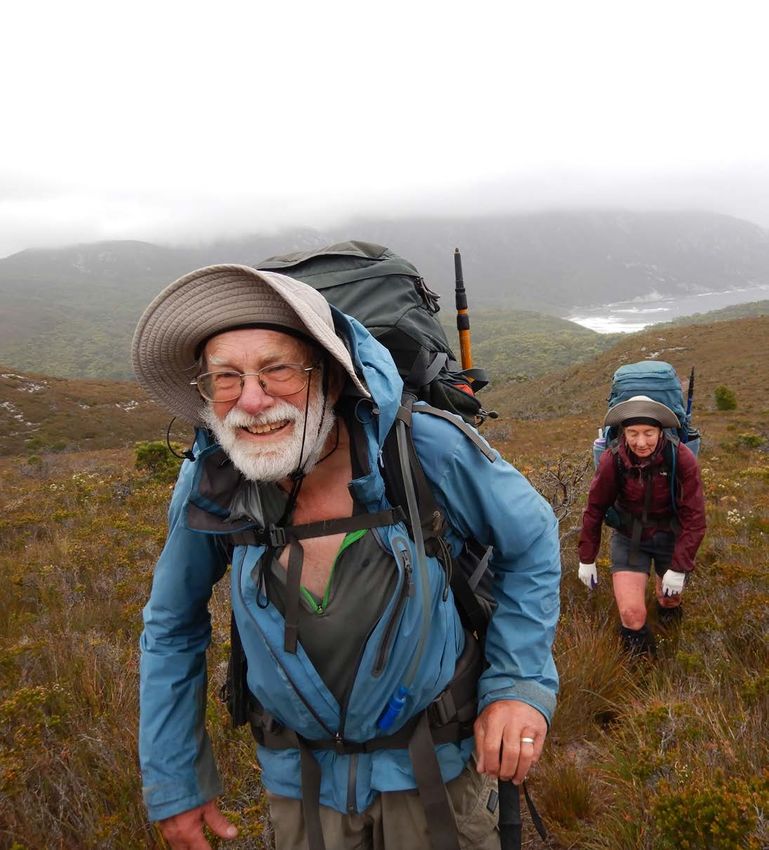
Cape Jarvis to Victor
Harbor
  by Lee Marling

T
        he route from Cape Jervis to     hole where a gentle rain fell through
        Victor Harbour is one of the     the evening. Over the next couple
        most beautiful coastal walks     of days we were reminded why Deep
in SA. It traverses Deep Creek and       Creek has its name: a number of
Newland Head conservation parks          steep ascents and descents to climb!
as well as the magnificent Waitpinga     The walk finished along the Wait-
Cliffs.                                  pinga Cliffs with Rosetta Head in the
                                         distance.
It takes you across the wild Tunk-
alilla and Waitpinga beaches and         This walk can be done by public
a number of small isolated coves.        transport from Adelaide to Cape
Wildlife is regularly encountered,       Jervis and then Victor Harbour back
Kangaroos, birds and reptiles.           to Adelaide.
Eleven club members set off on a
warm but fortunately windy Saturday
morning and lunched at Blowhole
Beach. We camped at Eagle Water-

 4                                     Tandanya Autumn 2021
Photo essay- Cape Jarvis to Victor Harbor walk

             Tandanya Autumn 2021           5
Photo essay- Cape Jarvis to Victor Harbor walk

6              Tandanya Autumn 2021
Tandanya Autumn 2021 7
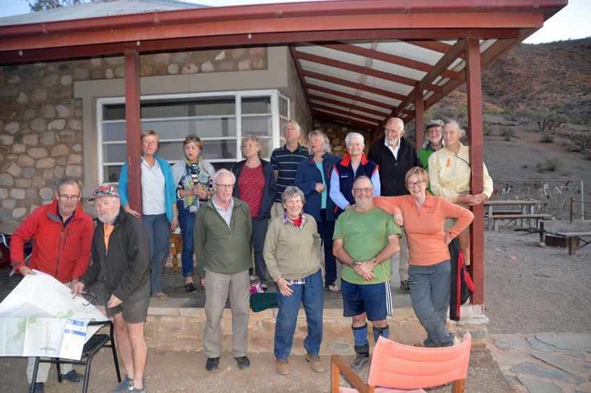
Photo essay- Cape Jarvis to Victor Harbor walk
8              Tandanya Autumn 2021
Tandanya Autumn 2021 9
ABW Club information

     The club meets at the North Adelaide Community Centre, 176 Tynte Street,
     North Adelaide on the first Wednesday of each month at 7.30pm (February to November)

     Annual subscription fees
     Category                                  Normal             Student
     Prospective Membership                    $60                 $30
     Full Membership                           $60                 $30
     Associate Membership                      $10                 $10
     Family membership is no longer available for new members

     Contact details

     Email: gohiking@adelaidebushwalkers.org             Web: www.adelaidebushwalkers.org

     Post: PO Box 434, North Adelaide, SA, 5006

     Banking Details

     Bank: Bank SA BSB: 105900 Account: 950 866 540 Account name: Adelaide Bushwalkers
     Inc.

     Membership queries

     Contact the Membership Secretary: Sofia Oliver- 0409 098 169
     or via email through gohiking@adelaidebushwalkers.org
     For privacy reasons, the names and contact details of other office bearers are no longer
     published in the magazine. Please use the contact details above.

10                 Tandanya Autumn 2021
f r e e !
No w
The reason for this is that cash is infrequently used and is difficult
to manage. In addition the fees typically amount to about $300
per annum, which is considered insignificant.
An expo to celebrate the start of You can secure a place on a Cost
the South Australian bushwalking specific guided walk by registering Free vehicle entry to national
season. With the arrival of cooler online, or just arrive on the day park for expo visitors
autumn weather, hiking is an ideal and choose a guided walk to join. Free entry to expo
outdoor activity. South Australia’s (Details and tickets for the dozen Guided Walks: $5 on the day to
bushwalking clubs and Walking SA walks will be published in March participate, or secure a place
are coming together to celebrate 2021.) on your chosen guided walk by
the occasion with a unique day in purchasing a ticket online from
Belair National Park. NEW: Bushwalking equipment and March 2021
experience demonstration stage Guided Walks
Expo of walking tours, walking Location There are guided hikes ranging
destinations, outdoor retailers, from 45mins to 3 hours, including
walking clubs, free entry. 9am to Main Oval, Belair National Park child-friendly and Accessible
2pm. When options.
Guided hikes ranging from 45mins
to 3 hours, including child- 9am to 2:00pm, Sunday 11th April Guided Walks depart the expo site
friendly and Accessible options. 2021 every 10 minutes from 9:20am to
Guided Walks will depart every 10 12:20pm.
minutes from 9:20am to 12:20pm. Walks are $5 per person
Tandanya Autumn 2021 11Please refer to the ABW website for up to date information on
the clubs 75th anniversary activities
12 Tandanya Autumn 2021ABW MEMBERS Tandanya Autumn 2021 13
Statistics, Log
                                                                        “can do” attitude. In particular,
                                                                        this was borne out by Diana
                                                                        Patterson, the first woman to
                                                                        lead an Antarctic Expedition.

 Books and Trail
                                                                        In her book, “The Ice Beneath
                                                                        my Feet: My Year in Antarctica”.
                                                                        She attributed her drive and

 Monitors in
                                                                        passion for the environment to
                                                                        her early years with “Us Hikers”
                                                                        in the late sixties.

 South Australia
                                                                        Other notable entries are from
                                                                        Warren     Bonython,      Adrian
                                                                        Heard, John and Monica
                                                                        Chapman all of whom have
                                                                        written books on the area so if
 by Lorraine Thomas                                                     you dig deep enough into these

S
                                                                        logbooks you can unearth a
     cattered         throughout    and these statistic clearly show    great deal and I have met, via
      our state there are trail     that there are more visitors in     email, so many interesting
      monitors on trails and        high rainfall years. This peaked    people who have contributed so
Summit Logbooks on peaks and        in 1990 and the numbers have        much to hiking in this state, it
they provide us with a wealth of    fallen away since and Michael       is quite humbling.
information. For example they       asks if this is due to the
show how many walkers are           aspirations of hikers who now       Sometimes the information
using the trails which, in turn,    may prefer the shorter walks        is recorded in exercise books
will validate trail improvements    and a comfortable bed.              held in practical waterproof
and infra structure measures.                                           containers that are custom
These statistics are also useful                                        made or in old “ammo” boxes
when      governments      review                                       and sometimes it is just scraps
policy such as Pastoral Act late                                        of paper in an old Vegemite
last year and can assist local                                          jar. Not practical, as the old
entities in land management                                             tin lids rust through and the
and regulation.                                                         documents are lost forever. An
                                                                        ABW (Adelaide Bushwalkers)
As far back as the late 80’s to                                         group       salvaged        such
the present in the North Tusk                                           documents from Mt Stuart in
Hill log there are many regular                                         2014 and now photocopied and
entries from the Scientific                                             can be viewed on the website
Expedition       Group     (SEG)                                        (thanks to Jeremy).
monitoring      the   biological,
botanical       and      rainfall                                       An old tablet tin containing logs
information. This information                                           for Kankana Peak was found in
can be viewed on the link           “Us-Hikers” are well represented    May 2020, 500M below Iralbo
below.                              in the Vulkathunha Gammons          Peak by Dr Mark Lethbridge
https://www.communitywebs.org/      logbooks      throughout      the   of “Echoknowledge”. The last
ScientificExpeditionGroup/main.     sixties,   seventies,    eighties   entry was 2006, this may have
php?pid=14                          and nineties and this group         been removed on purpose by
The Rover Rock Hole log led         consisted of secondary school       some “purists” who believe
to an article being published       boys and girls plus scout           Logbooks and cairns desecrate
in     Tandanya,       Summer       groups. These consistent trips      the pristine wilderness or it
edition, 2018, by Mike Round.       perhaps opened up extended          could have made its way down
Mike compared the number            hiking for girls who prior to the   by not being secured properly.
of    parties,   (rather   than     60’s were treated differently       What a chance find after 14
individuals), entered in the log    to boys. The aim was to build       years! This log is now held in
to the rainfall over the years      confidence and to inspire these     ABW archives.
                                    young men and women with a
14                              Tandanya Autumn 2021
of ABW. The State Library of
The problem with statistic South Australia (SLSA) holds
collection is that it is variable an old log from Rover Rock Hole
because trail counters include and is available on Microfiche
walkers plus bikes and horses (18th May 1970 to 11 May
and log book entries depend 1998 (microfilm D7431(L),
on whether the hiker actually State Library of S.A.)
makes an entry. It has been
suggested (from decades of As the caretakers of these items
asking) that only about half of change there is potential for
the hikers make entries and this history to be lost over time
this is because many don’t and it is the general consensus
write up subsequent visits, visiting a summit mostly to
or they don’t see the logbook, say “I’ve been here” and then
there is no pen or they just random responsible people
don’t bother. collect them when full or
damaged and archive them in
In my view, if we are to pursue various locations unbeknown
statistics we need to persuade to the hikers who left their
hikers to make entries in the precious comments and who
logbooks. Anecdotal evidence often revisit the location and try
shows that the number of to find their old entry. To locate
extended hikes are diminishing these books requires calling on
in the Northern Flinders which old memories if you know who
could mean that people just to contact in the first place,
don’t know of the myriad of ABW have many logbooks (11)
places to do extended walks. placed on summits throughout that it would be wise to have
One such log entry requested the Flinders Ranges and they them stored in one location
that a list of all the summit maintain them and archive the such as the SLSA where they
logs be listed inside the front old ones within the club. can be put on microfilm (or
cover so they could plan more digitized) and be accessible
walks. I hope that person reads From other sources I believe to the general public. SLSA
this article because the list is Arkaroola may hold old logs will only take logbooks in
at the end! from Freeling Heights, A reasonable condition and
some responsible body has to
There is a protocol for filling in hand over the rights of that
the logbooks but this is often document. The CEO of Walking
ignored as there has been a SA has agreed to facilitate the
lot of graffiti and vandalism collection of logbooks to hand
of these historic records. An on to SLSA. In the meantime
example of this involves the it would appear that Adelaide
Mt Brown logbook where Bushwalkers have the most
signed pages were torn out to logbooks in place and presently
light a fire. In addition, pages have their own archives with
were missing from an entry digital copies of these plus
made in the late seventies by others on their website.
Fos Williams (coach) and the
entire Port Adelaide football Not only are logbooks
Club, someone had selfishly member of Walking Trails historical documents but
souvenired the signatures. Fos Support Group holds the together with the numbers
was born in Quorn and for logs from the Quorn area, from various trail counters
training he ran his team up Angorigina Station may have they show trends in the
to Mt Brown and back before old logbooks from Patawarta numbers visiting an area on
there was even a walking trail. Hill and sometimes these which we can base our policy
books are handed to the local and plans to “Keep More
These logbooks or containers park ranger and occasionally People Walking More Often”.
are installed by various groups they find their way to the care
Tandanya Autumn 2021 15Trail counters are installed by LOGBOOK LOCATIONS
various councils, trail builders
Please notify ABW or Walking SA if these logbooks are full or damaged in
and the Department of any way and every effort will be made to replace them. Taking a spare pen or
Environment and Water (DEW) pencil to the location may be prudent.
and they monitor numbers for
their own purposes but they POMPEY PILLAR* GR 54 J 264240E 65 08648N
PATAWARTA HILL* GR54 J 281715E 65 72716N
also pass this information
MT FALKLAND * GR 54 J 264513E 65 49458N
on to Walking SA who have KANKANA PEAK* GR54 J 265108E 6542353N
seen a statewide trend that PT BONNEY* GR 54 J 274389E 6502868N
walking numbers have more MT ABRUPT* GR54 J 264838E 6516308N
than doubled since the Covid BARLOO* GR 54 J 266198E 6539352N
MT HAYWARD* GR54 J 268008E 6534283N
19 initial “lock down”. The MT HACK* GR54J 289401E 6593556N
challenge now is to keep this CLEFT PEAK* GR 54 J 319128E 6627298N
trend going and next time you McKINLAY BLUFF* GR 54 J 320698E 6623548N
bag a peak, look for a logbook NORTH TUSK HILL GR 54 J 311582 E 6629173N
ROVER ROCK HOLE GR 54J 318297E 6628706N
and make an entry, that small
CENTRE HILL GR54 J 316566E 6628349N
deed may be very important OCTOPUS HILL GR 54J 316525E 6624848N
in the future (courtesy Jeremy MT HOPELESS GR 54 J 371795E 6713656N
Carter) FREELING HEIGHTS GR 54 J 344865E 6664306N
TEE-JUNCTION WATERHOLE GR54 J 348880E 6667905N
MT BROWN GR 54 H 218905E 6399526N
DUTCHMANS STERN GR 53 H 779170E 6420250N
WARREN GORGE GR 54 H 218495E 6434801N
DEVILS PEAK GR 53 H 781318 6409580N
EDMUND HILL GR 54 J 347923E 6668704N
MT TILLEY GR 54 J 283705E 6584321N
Logbook Protocol MOCATOONA HILL GR 54 J 285325E 6601155N
MT STUART GR 54 J 272209E 65877362N
The aim of the logbook is to provide a
permanent record of visits and observations
in the area. *Denotes ABW logbooks
Please enter:
Date and weather conditions.
ARCHIVED LOGBOOKS
Water availability ie condition of
waterholes, springs, tank levels etc. Currently held at Adelaide Bushwalkers:
Where you are from (ie club, family, PATAWARTA HILL, 18.5.87 - 17.07.97
friends or school, town) and the number in PATAWARTA HILL, 14.6.99 - 15 7 09
your party. MOUNT BROWN, Pre Oct. 1989 - 9.03.01
MOUNT ALECK, 7.06.86 - 19.08.13
Where you have travelled from and where
you are travelling to.
POMPEYS PILLAR, 8.06.86 - 1`5.09.01
MOUNT FALKLAND, 19.05. 84 - 2.06.08
Any notable animals, birds, flowers weeds CLEFT PEAK, July 1990 - June 2015
or pests that you noticed during that day. KANKANA PEAK 1964-2006
Each member of the party can then sign Currently held at The State Library of South Australia (State Library of SA
their name and make a short comment.
Be mindful of not writing up your complete ROVER ROCK HOLE available on Microfiche (18th May 1970 to 11 May1998
diary and filling up the book or using (microfilm D7431(L), State Library of S.A.)
obscene language.
Logbooks are an archival historical
document.
Secure carefully back into watertight
container.
16 Tandanya Autumn 2021Ten Day Tasmanian South West
Cape Loop Trip Leader: Trevor
Jones, accompanied
by Pam and David
by Mal Watt Duffield, John Glover
and Mal Watt.
David and Pam Duffield
with Window Pane Bay
behind
F
ive of ABW made their open borders between the two at 8am rather than 2:30pm.
way to Hobart and all states. Sigh, no relaxed Sunday
arrived by Saturday breakfast at a Hobart cafe!
The walk started and finished
16th January 2021 (and
at the Melaleuca remote However, this allowed us to be
Australian Open tennis
airstrip in the South West a day ahead of schedule, as
players landed in Adelaide for
National Park. On Saturday the original plan had our first
an exhibition match). We were
we received advice from Par night at Melaleuca, but now
hiking during Covid-19 snap
Avion (for the flight) that due we would have plenty of time
travel restrictions – fortunate
to forecast windy conditions to walk the easy four hours to
to have a direct flight by
they had rescheduled our our first camp at New Harbour
Jetstar on the Adelaide-
Sunday flight to leave earlier on the south coast.
Hobart route, and for the
Tandanya Autumn 2021 17Walk leader Trevor Jones
So, on Sunday we made our our packs, left some food flowing nearby. There are no
way to the Cambridge airfield, containers in the shelter facilities – any ad hoc “seats”
were weighed in, and paid for storeroom, and headed off or “tables” at the camping
stove fuel (to be collected at wearing full rain gear and locations have been made
Melaleuca). warm layers at 10am. After from flotsam and jetsam.
about six kilometres the
We five plus another person We were all very damp and
turnoff to New Harbour was
were in one plane, and our cold, so all disappeared into
reached, with no indication
luggage spread across planes our tents for the rest of the
other than a light pad off to
- four planes in total flying day and night, looking for as
the right. We had a rest and
out together. The other person many warm dry clothes to
took off a layer. Up until then
was a Meetup chap leading a put on as we had. A common
it had been easy (occasionally
diminished group along the entertainment for us when
slippery) boardwalks, but now
south coast track – most had snuggled into the tents was
it was the typical eroded path,
to pull out because of a recent watching the occasional leech
generally flowing with water
Covid-19 cluster in Brisbane. trying to get through the inner
due to the constant drizzle.
(and of course making sure
Departure was on time at Some gusts in the exposed
none entered with you).
8am and landed just after sections; a few small creeks
9am. Flying along the coast to step over and a couple of The next morning‘s weather
meant we could see Bruny small ascents. at New Harbour was still
Island and the south coast drizzling rain and gusty, with
After about three and
cliffs with streamers coming the ocean roaring nearby. We
half hours of hiking we
of the waves indicating the found out later that there was
came across the Walkers
blustery conditions. The pilots 20mm of rain at the airstrip
Registration logbook (with
kept in communications with today.
nifty waterproof pages) at New
each other to determine the
Harbour – the most recent After breakfast in our tents
conditions being experienced.
walkers were here January (or outside in wet gear), we
Glad I put on warm clothes
9th. We waded the shallow headed off after donning our
as the flight was cold. It was
creek outlet on the beach damp clothes from yesterday.
a bumpy ride, happy when
and traversed the beach for a About two and half hours later
we gently touched down.
while until locating a brackish we arrived at Hidden Bay,
Unloading and reloading
creek, with a sheltered and giving up on the idea of the
quickly, all the pilots were
spacious camping area. All side trip to Mount Melaleuca
keen to get back in the air
the camp sites we used along due to the poor weather.
before the weather worsened.
the coast were in the sheltered The track was good with a
We collected our stove fuel forest edge next to the beach, lot of work by Parks. From
from the pilots, sorted out all with a fresh water creek New Harbour it is through
18 Tandanya Autumn 2021The climb up from Wilsons Bight
rainforest then to ridges Overall a fairly easy walk a few metres away. He was
exposed to the elements. The where “navigation” is not getting ready to do a hasty
Hidden Bay campsite is not required. pack-up, but the water did not
so nice or as large as New reach that level again. Possibly
The Hidden Bay to Ketchem
Harbour, although Hidden Bay Mal was at a greater risk being
section was too exposed to
has a nice beach and a large slightly lower in the camping
stop for lunch, so we delayed
tannin-stained creek flowing area.
lunch until setting up camp at
well.
Ketchem Bay. A mother and Anyway, the weather had
We continued on the improved daughter came in from Wilson cleared, though still blustery,
track that goes from Hidden Bight just after dropping our and departure was at a
Bay to Ketchem Bay; great packs at Ketchem – they had relaxed 9am as it was to be
views on this section looking spent yesterday in their tent a short day. An easy ascent
back to Hidden Bay and later due to the rain. The weather up the track through the
to Ketchem Bay. It is very calmed very occasionally after forest and soon we stopped
exposed to weather – we were our arrival at Ketchem, but at a creek with a “wash down
constantly buffeted trying to overall, we spent the rest of station” (scrubbing brushes
keep balance. Overall today the Monday in our tents. and creek water) to limit the
there was not much mud spread of phytophera, for
The next morning (our third
due to Parks improvements those heading west (like us).
day), John was awake about
– mostly walking on white We then ascended through
6:30 am and saw a rogue
rubble, except within the relatively open forest on an
wave come up to the edge of
pretty rainforest section after obvious track. Some sections
the camp – this was due to
(I think) New Harbour, where of the track were almost
the high tide and the blustery
some care was required on overgrown, so pushing scrub
conditions. The wave covered
the narrow “ledge” track and out of the way was required
the sandy sitting area just
around the tree obstacles. at times, but not much mud
Tandanya Autumn 2021 19Just before the Wilson
Bight camp we passed a
small waterfall (source of
drinking water) and heaved
up the wooden steps to the
campground – which takes
maybe five tents at the most,
however it is sheltered and
grassy.
At the camp, the sun was out,
and we hung out our wet gear
to dry. It was also nice finally
eating in the sun together
rather than solo in our tents
out of the rain. It was a
Murgab Creek crossing
relaxing afternoon exploring
the beach area, snoozing,
reading and eating.
On the way off Wilson Bight
to deal with. Overall, this on our fourth day, there was
section of the track has been a dead seal tangled in ropes
less maintained than up near the entrance to the forest
to Ketchem Bay. The track and a live seal further away.
meandered near the cliffs at The track started with a very
times, so gave us some limited steep but short (25 minutes)
coastal views through the climb up from the beach
trees. through rain forest (rope in
place). Some more ascending
Eventually the track opened to then the track followed the top
flowering scrub with views of of the South West Cape Range
Wilson Bight, and followed by so is largely just grasses, no
a steep straight forest descent significant scrub, but still
to the beach. But the real much easier walking on a pad
challenge then comes to get than not.
around the rocky headlands at
sea level. Chapman writes it is a six to
nine hour day for the traverse
from Wilson Bight to Window
Pane Bay, so we took twelve.
Some time was invested in
hunting for the pad (or just
Wading the edge of Horshoe Inlet saying, darn, let’s just get
across to that ridge, it’s bound
The tide had been receding
to have a pad), as well as
since we left camp two and
taking a steady pace to keep
a half hours ago, but we still
the group together. Finding
had challenges getting around
the pad in poor visibility would
the rocky headlands at Wilson
be an issue. On a fine day, you
Bight (there are two sections
may still need to hunt around
that I recall). Much careful
for it, and use navigation skills
clambering as far from waves
to just aim for where you
as possible and watching
expect the track to be.
the timing of the waves got
us all around okay, but not The day included a couple of
completely dry! notable high points - Mount
Karamu and later (at 4pm)
20 Tandanya Autumn 2021Looking back to Stephens Bay
the highest point on South camp, then sit around and relatively easy walk for most
West Cape Range. The weather have dinner before complete of it varying as usual between
was clear, providing great darkness. open scrubland pad, and the
views along the coast and melaleuca forests with leaf
What is the best thing after
across to the jagged outline litter covered pads down to
a 12 hour walking day? Well
of the Western Arthurs. The and up from rainforest creek
chocolate for sure, but what
only water we found was sections.
else? A rest day of course!
collected from a tiny tarn
So day five was just that and The pad was easy to follow
– it was novel not having
fortunately a fine day at a except on one open hillside
tannin stained water for a
very nice campsite - best so (but found quickly continuing
change. From the range we
far, except for having to cross straight on), the other was
could see the peninsular of
the slippery rocky creek to about half a kilometre from
the South West Cape, but
the beach. The author did the rocky point just before
we just waved to it. Later
some clothes rinsing and descending to the coast near
was spotted a pair, I believe,
body rinsing, walked to the Noyhener – it appears to be
of Tasmanian Purplestars -
more sheltered far south west a track junction - the way we
Isophysis tasmanica and as
end of the beach for a swim, went was taped, but through
well the group was watched
and Trevor went exploring fallen tree obstacles, but came
over by a scattering of white
and the others did similar easily to the steep jagged
quartz “megalithic” rocks
housekeeping and relaxing rocks running into the water.
brilliant in the afternoon sun
activities. Some catlike like The other pad (to the right) we
as we started the long slow
creature was lurking near the speculated continued through
meandering descent off the
campsite at dinner time, but the forest and came out onto
range.
was too hard to see clearly. the beach further on avoiding
The exit to the beach at the coastal rocks – this turns
After a nice day at lovely
Window Pane Bay is down a out to be the case.
Window Pane Bay it was off
very steep sand “cliff” assisted
for a five hour trek to lovely We then faced the challenge of
by a long rope in place. The
Noyhener Beach for our sixth clambering on the jagged and
forest camp requires crossing
day out. Overnight had been a slippery rocks, sometimes
a rocky bottomed creek twice,
overcast and warm and so was timing the waves to move on
so we ended the day again
the morning sitting around – at one point we had to climb
with wet boots and socks etc.
at the agreed breakfast back up and descend again
We were all very tired by the
area. But it was cold on the to the ocean level as it was
8pm arrival but able to setup
exposed hills and ridges. A all water and no rocks at that
Tandanya Autumn 2021 21point. Anyway, after some time
we all got around with only
John taking a dunking when
exploring ahead for us for a
route.
The forest at Noyhener Beach
has two sheltered campsites,
and grows to the edge of a
high sand bank on Murgab
The highest point on Creek, access is a short wade
SW Cape Range across the sandy bottomed
shallow creek and up a chain
and wooden ladder.
The weather had brought
rain part way through the
walk today, but the sun came
out just as we left the rocks
and onto the beach. The
Noyhener/Murgab camp is
nice and sheltered. There is
a big “table” made of a large
Timing the waves at
wooden cable bobbin with
Wilsons Bight ad hoc bench seats in the
middle of the open area – very
convenient. There is a second
camping area further into the
forest, with a steep bank down
to the creek for water. There
is another Walker’s logbook
here recording that recently
some day trippers visited
from Spain Bay. Trevor and
Mal explored the sand dunes
and walked west to the rocky
point but the tide prevented
Alfresco dining at
Nohenyer Beach
further progress – jokingly,
Mal discouraged Trevor from
swimming out to Sugarloaf
Rock a mere 4km away, but
looks much closer! The group
finished the day with a relaxed
dinner sitting around the
cable table.
The walk plan included a night
at Spain Bay. The following
day, Trevor, John and Mal
continued on to there, while Looking back to Ketchem Bay
Obsticle-trail between New
Harbour and Ketchem Pam and David settled in at
Noyhener for our return.
We found an easy route across
the sand at the back of the
north headland, taking only
A 20 minute video of this trip can be seen at
22 Tandanya Autumn 2021about fifteen minutes to
cross over the headland to
Stephens Bay and coming
out at the large aboriginal
midden complex beside a
flowing soak. A few photos
were taken at the midden –
no surprise there would be
a dependable water source
there – it looks like a spring
feed outlet. We then walked
north along the long beach at
Stephens Bay (the middens
full of abalone shells etc
continue for up to half a
kilometre) and stopped for
a rest at the steps into the
forest for the final track to
Spain Bay. A creek flows Camping at Spain Bay
there, and we filled bottles
again. The track from there
is easy to follow across low not overly concerned about us, volunteers arrived and set up
heath but it has some muddy went sniffing around the tents at the second camp which was
sections, taking about 30 looking for an easy meal. further into the forest.
minutes to cross to Spain The following day (our eighth) From Noyhener Beach the
Bay. The bay has a lovely Trevor proposed a morning route is about 13km to
(again) long beach with walk (4.3 km return) to Sunset Horseshoe Inlet, just next to
narrow line of solid forest Hill for some views. We again the Port Davey track. Sadly,
along the edge. went past the little headland you have to cross both the
There were already some to the northern beach and South West Cape Range and
tents in the camp site. We then scrub explored up the the Pasco Range! So, we got
three set up tents, had south end of the Sunset Hill away early expecting a longish
lunch, got water, and rested. ridge into the mist. We took day, putting on shoes, socks
After resting we set off on some photos but waited and gators after crossing the
a 4km return walk east awhile and the mist cleared creek to the beach – why start
along the bay and did scrub to a sunny day with great wet! The exit track is up the
exploration to the top of a hill views of Spain Bay, the next dune beside the creek.
there. Note to readers: I have door Hannant Inlet and the
We managed to lose the pad
decided on the phrase “scrub entrance to Bathurst Harbour,
not long after, at the top of
exploration” rather than and a few islands. It was a
a hill, and found a pad after
“bush bashing”, pass it on! nice return walk at low tide
some scrubby descent. As an
back along the beaches, and
Later a volunteer group of indication of pad visibility, we
we left Trevor to have a short
four people returned to camp lost the pad and came down
swim or a swim without shorts
- they are removing marram the South Cape Range on one
– only he knows.
grass, and (I think) sea spur north of the spur with a
spurge. They have been doing We packed up camp and next pad – the up/down pads are
volunteer work for twenty encountered the volunteer very obvious when seen from
years. This time they were group who had moved on and the other side of the valley
helicoptered into Spain Bay dropped packs at the midden/ but not obvious when on top
landing on the beach and will soak and were exploring where they are less eroded.
spend ten days in the SW the headland coast between The track up the Pascoe range
Cape area gradually walking Stephens Bay and Noyhener was equally very visible across
back to Melaleuca the way Beach. We arrived back at the the valley while on the South
we have come. Later as a Noyhener camp mid-afternoon West Cape Range, and not too
reminder to be careful with with Pam and David waiting hard to follow.
food, a bandicoot that was at the cable table. Later the
Upon nearing Horseshoe Inlet
Tandanya Autumn 2021 23after about six hours it was back to a heavily marked exit in with day visitors who were
hard to locate any pad so we we encountered on walking all wearing facemasks, and
just pushed into and along around the inlet. we were all handed facemasks
the forest edge and on the by the volunteer caretaker -
After several hours, and
grassy water edges when we someone had decided both
nearing the airstrip, there
could, and in the water at Cambridge and Melaleuca
is a solid metal foot bridge
other times. Note that high were airports. Along with our
over Melaleuca Creek– older
tide pretty well covers all of luggage, we all went on
editions of Chapman’s may
the exposed areas between
not mention it – the creek
the Horseshoe Inlet low tide
edge and the forest of the
Horseshoe Inlet – try and get
there at low tide if looking to
camp or to get onto the Port
Davey Track. Trevor got us
there at low-tide fortunately
(he did well with all the tide
planning).
At Horseshoe Creek we
stripped down to modesty
and as well kept on shoes for
the short swim across the
creek (shoes in case of sharp
branches etc) - we put our
clothes into the backpack
and the pack into a large
garbage bag and tied it shut was very energetic, and we Above: Group photo at Port Davey
and this worked well to float were appreciative of the easy Track sign at Melaleuca
the backpacks across, though crossing. Upon arrival at
a twin engine plane taking
Trevor had a nifty waterproof Melaleuca we collected our
about an hour in calm but
backpack that floated nicely stored food, and set up camp
overcast skies. This time we
on its own. The water was not in the trees behind the two
flew inland, to the right of (and
as cold as any of us expected, hikers huts. The sea water
lower than) the West Portal of
nor fortunately was the air as edge of the Melaleuca Lagoon
the Western Arthurs and could
we “dried” and dressed. is just down the slope a bit
just glimpse Federation Peak
and on a nice day would be an
We had a lot of trouble in the distance to the right.
excellent swimming spot – it
finding the camping area at
was very useful for rinsing all On arrival at Cambridge we
Horsehoe Inlet – in the end
the mud off shoes and gaters. made our various ways to
we established an ad hoc
Hobart accommodation, hot
camping spot I reckon about We tried to have a group
showers and cleaner clothes,
100m before we later found dinner at the picnic table, but
and met again in the evening
what looked like a more used rain interrupted our plans.
for a nice dinner down at
camping area amongst the
Back to civilization on day Salamanica.
Melaleuca forest.
eleven. We had a scheduled
The next day, another
Our final hiking day was flight out at 10am from
adventure started for Trevor,
a very pleasant (not) hike Melaleuca, and the weather
Mal and John before flying
along the muddy Port Davey was much nicer this time.
back to Adelaide – while Pam
Track for about four and a We packed up and waited in
and David enjoyed the cafes
half hours including a lunch the museum for our flight.
and sights of Hobart - but that
break. As the Horseshoe There we met a woman who
is another story.
Inlet was at high tide, we was counting the parrots and
went through the forest to the had just released some, and
nearby larger camping area she (not the birds) was also
which had an exit track to the flying back with us. Just
Port Davey track, rather than before 10am, two planes flew
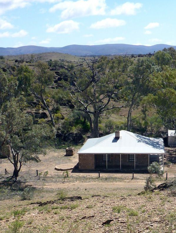
24 Tandanya Autumn 2021Expedition Gammon
Ranges August 30 - September 6, 2020
The expedition adventurers
by Don Rusby and Edward Burgess (Leader) at the well-equipped walker’s
hut near the historic Grindells
E
Hut
ach year the Wednesday We had sixteen members in
Walkers hold a week long the group with 8 Wednesday living goat in the entire week
bushwalk / camp which walkers and 8 other ABW that I was there. The rains
is open to all club members. walker. This presented a came but three weeks after we
There is no overnight walking minor problem due to the left and not enough to make
but the scenery and activities differing strengths in each much difference.
are great. group. I decided that the
group could be split up
2020 was the year that I with different experienced
decided that it was time leaders for different sections.
to return to the Gammon People could also have rest
Ranges after a long hiatus days provided they did not
caused largely by diabetes and wonder off. I also decided
the start of arthritis. Originally that although the hut only
fate was against me because catered for eight people, that
of the Corvid19 virus and our all facilities would be shared
original booking of Grindell’s by the campers as well.
Hut for April was cancelled
and money refunded. Once Day 1 31st August written
bookings opened again, I I had never seen the Gammon by Edward
booked the hut for August/ Ranges so dry. Even trees All sixteen members of the
September and crossed that I thought would outlast party went on a walk to
my fingers for this time. any drought were dead and Monarch Mine along a Royal
Fortunately this time was a there were very few living Geographical Society of S.A.
goer. animals and lots of carcasses trail. This is a circular walk
of dead kangaroos and goats. across the barren mountain
Fortunately, I did not see one tops to the Monarch Mine. We
Tandanya Autumn 2021 25Mt McKinlay Bluff Don Rusby on Red Hill 26 Tandanya Autumn 2021
had many beautiful views of        Hill and the real Red Hill
McKinlay Bluff, Mt John            finishing at the shelter/
Roberts and even Cleft Peak        water tank that our club had
and the Blue Range. We             installed in 2019 using part
began the walk at 9AM. After       of a bequest from our former
two hours of steady minor          Patron, the late Warren
climbing we reached the top        Bonython. From there, those
and Monarch Mine.                  of us who still had some
                                   life in our legs, pushed on
Here we rested for “11’s”.         up Italowie Creek towards
Next was our sharp                 Wildflower Waterhole. We
descent towards beautiful          then returned to the 4WD
Weetootla Gorge. As we were        track back to the start of
descending into the beautiful      today’s walk. Another nice
Weetootla Gorge, the track         cool sunny day of walking
gave way under the feet of         with the usual sitting round
one of our party. He had           the campfire after dinner.
received some serious cuts
and abrasions and sprains.         Day 3 2nd September written
I was worried for him but          by Don (and Edward)
being a true bushwalker and        With balmy weather, it got
after 30 minutes of first aid      down to 15C overnight. On
by other members he was            Wednesday we had a day
able to push on although at        off from walking. Today
a much slower pace.                was the 4WD tour to Sillers
                                   Lookout What a difference
We found water in Weetootla        a day makes. After a
Spring and had lunch at the        deserved sleep in, we drove
water’s edge. Surprisingly,        to Arkaroola, arriving at
there was heaps of bird life       10AM and enjoyed an early
but no animal life (except         lunch and drinks at their
ants). The remainder of            restaurant.
the day’s walk was along
Balcanoona Creek back to           The 4WD truck/troop carrier
the hut along an extremely         returned to Arkaroola from
old and disused 4WD track.         its first trip about an hour
I allowed people to forge          late. Eight of us boarded
ahead while I stayed back          it at about 12.45pm to set
and walked with our injured.       off for Sillers Lookout along
There is nothing worse             the Ridge Top Tour. It was
than being injured and left        only a round trip along a
behind. We returned to the         so called 4WD track but
hut at about 4pm. A special        the whole trip took about
shower awaiting our injured.       6 hours with three major
                                   stops and afternoon tea
Day 2 1st September written        with lamingtons atop Sillers
by Don                             Lookout.
It got down to -2C last night
but my sleeping bag kept me         It was a fun afternoon being
snug and warm.                     thrown around in the back
Our Tuesday walk had us            of the truck whilst going up,
head up onto the Gibber            down and around some of         Warwick can’t resist attempting
Plain then a climb up and          the craziest 4WD tracks we      a challenging climb
down both Edward’s Red             have ever been on. We drove

                                Tandanya Autumn 2021                                           27
back from lookout in fast Suddenly the vegetation
fading light. With the help cleared away and we arrived
of the full moon we arrived above a 30 metre high
back at Arkaroola at 7pm. We vertical dry waterfall. We had
arrived back at the campsite to scramble around rocks
at about 8pm. Few of us had which was interesting and
tea that night and there was scary indeed. Once we were
no campfire. It was straight at the bottom of the waterfall,
to bed after a long but we were able to follow the
fantastic day. dry creek bed out onto the
As the 4WD could only plain and back to the camp.
take 8 people, others in our Another very long and tiring
group did an 8km circular but interesting day.
walk from Arkaroola Village
through the Mawson Valley Day 5 4th September written
to the Pinnacles and back by Don
along Spriggina Ridge. As Today, Edward (leader)
luck would have it, they went off to investigate some
arrived back at Arkaroola local mines. The rest of us
about ten minutes after we drove to Loch Ness Well
started the Ridge Top Tour. where we parked our cars.
Roger Kempson led today.
Day 4 3rd September written We walked up the top end of
by Don Balcanoona Creek deep into
Today we walked across the Blue Range.
Illinawortina Pound to
an interesting creek that We were walking towards
gorges through the nearby Bunyip Chasm looking for
hills towards Wurtupa Loop stray bunyips. I had heard
Track. We followed this of Bunyip Chasm before
dry creek bed up the valley and I was finally getting
for a couple of hours until there. Our leader had told
lunchtime. After lunch, the adventurous ones of
the majority of the group our group not to climb up
retraced their steps back the gorge at the end due to
to Grindells Hut. Six of us some deaths while climbing
continued up the creek, then into it (in other words it
over a sharp hill and into a is a dangerous climb). We
parallel gorge for the return reached the first waterfall
journey. This creek was where most of us stopped for
much smaller and scrubbier lunch. Four of us climbed
so we had to stay on the up and through it to the
slopes above vegetation. impenentrable area which if I
was younger, I would say was
“do-able” We then returned
to the start of the chasm, ate
lunch and caught up to the
others on the return journey.
The Chasm is very similar to
Stanley Chasm in the West
McDonald Ranges out from
The challenging climb Alice Springs butmuch more
short of Bunyip Chasm difficult to walk through.
(Edward) Although I have
made many trips into the
28 Tandanya Autumn 2021West of Grindells Hut Lunch on the first day in Weetootla
Gorge
Gammon Ranges, I have only go with the other 3, I decided
ever climbed to the end of the that I didn’t a long and hard
Bunyip Chasm twice. The first uphill climb on the last day!
time, I was young and stupid I think that I made good
and the second time, I freaked choice as we returned to the
out halfway while descending hut at 2pm. The mountaineers
the chasm. I had to close returned after dusk at 6pm.
my eyes and follow verbal The river walk was very pretty
directions from below and put and topped off a great week
my faith in other people. of walking in the Gammon
Ranges.
Day 6 5th September written Camp ground near Grindells Hut
by Don Day 7 6th September written
On the Saturday we divided by Edward
into 2 groups for our final Early on Saturday, we all said
walks of the trip. Three our goodbyes and headed
walkers decided to do a big off in the different cars back
walk to the top of McKinlay home. Some drove all of the
Bluff and the others, a way while others spent a night
reasonably flat and straight in Quorn and other places.
forward 12km return walk I would like to thank the 16
past “Hells Gap” following people who were on the walk.
the the Balcanoona Creek We all blended with each
through Weetootrla Gorge to other perfectly and we all Third ABW water tank below Red Hill
the Wetootla Camp Ground. had a fantastic week of the
Whilst I would have loved to Gammons. To those who had
been there before,
I am sure that
it brought back
great memories.
For those who
were there for the
first time, I hope
that you now
consider yourself
a GAMMONITE.
(Gods own
country).
Roger Kempson in Illinawortina Pound
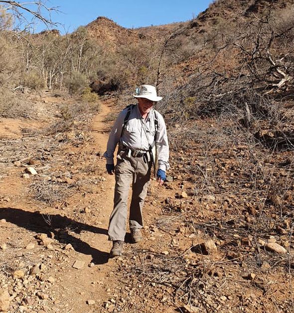
Tandanya Autumn 2021 29Citizen Science in the
Citizen Science in the
Vulkathunha-Gammon
Vulkathunha-Gammon
Ranges National Park
Ranges National Park
by Ray Hickman
T
his item reports on the park headquarters at The Friends group has
an environmental Balcanoona. The third, directed nearly all its efforts
monitoring project Nepouie, is located on the towards regular monitoring
being conducted in the nearby Wooltana pastoral of the existing populations
Vulkathunha-Gammon lease about 8 km north-east but is likely to be involved
Ranges National Park by of Balcanoona. Nepouie is in assessing alternative
members of the Park’s not accessible to the public sites, and then monitoring
Friends group. Early and the Friends group at those sites, if they are
reports on this project have visits that spring through established.
appeared in the Autumn, arrangement with the
2017 and Summer, 2019 pastoralist.
issues of Tandanya. It is
a Citizen Science project Weetootla, Yuwanhinya
that sees Friends group and Nepouie springs
members working under are the only known sites
the guidance, and with where Wirti Udla Varri
the support, of scientific is definitely surviving
professionals including today and, consequently,
Mr Robert Brandle, Senior there is concern about
Conservation Ecologist, the possibility of the
DEW. fish becoming extinct.
Actions that have been
The main focus for the recommended to protect
monitoring is a set of three against this include:
permanent springs, and
their associated wetlands, 1. investigation of other
all of which are habitat for sites in the northern
the nationally endangered flinders where additional
fish Mogurnda clivicola. populations of the fish
might be successfully
The common name for the established;
fish is ‘Flinders Ranges
Gudgeon’ and the local
Adnyamathanha people call 2. regular monitoring of
it Wirti Udla Varri. Two the existing populations
of the springs, Weetootla to assess the quality
and Yuwanhinya, are and extent of habitat,
along with fish numbers
located inside the park
and signs of disease.
about 9 km north-west of
30 Tandanya Autumn 2021Elements of the
monitoring program:
(Fish numbers, sizes and
signs of disease)
This involves physically
catching fish and the group
does this in accord with a
scientific permit. The length
of each fish is measured
Water quality
measurements:
The parameters being
measured are temperature,
and recorded. This indicates pH, electrical conductivity,
the number of different dissolved oxygen, calcium
generations that make up and nitrate concentrations.
the population and gives Water quality is an obvious
some idea of the timing of criterion to be used when
breeding events. The fish are deciding on the choice of
also inspected for tumors an alternative site(s). The
on their body surface. It fish is known to tolerate
has been reported that large fluctuations in water
10% or more of the Wirti quality but survival of a
Udla Varri population had single generation does not
these surface tumors. The guarantee long term viability
proportion observed so far of a population where water
in this monitoring project is quality is relatively poor.
much less than this. authoritative investigators.
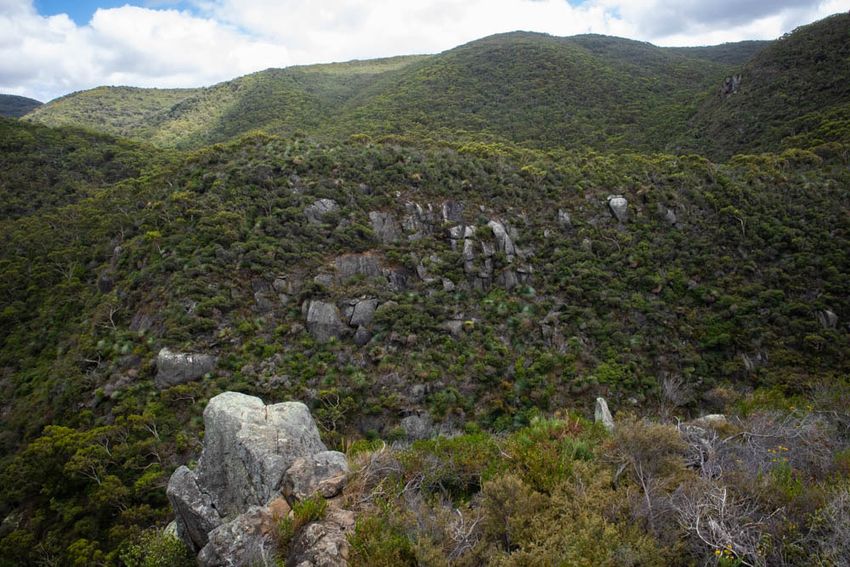
Tandanya Autumn 2021 31Google Earth
The image from Google earth
above shows where the springs
are located in relation to the Park
headquarters at Balcanoona and
the Grindell Hut campground.
The Google earth image below
shows approximate locations for
the 10 monitoring sites.
The photo above is of monitoring site W3 which
remained in the condition shown throughout 2018
and 2019 when rainfall at nearby Arkaroola was the
lowest since records commenced in 1938.
Google Earth
32 Tandanya Autumn 2021habitat is currently in
good condition.
Of these three monitoring
elements the first two
require only an interest
in doing the work and
sufficient physical fitness
to be on foot, out in the
open, for 6 or so hours.
Any training required
can be done on site. The
walking is mostly on
flat ground on marked
walking trails, with Petrogale Xanthopus
distance covered being
about 6 km or less. The
third element listed does
Feral cats are rarely seen
require sound knowledge
but they are present in
of plants and animals.
the monitoring area as the
Infra-red activated
Friends group president Dr adjacent photograph of a dead
cameras have recently been
Martin Caon is shown here cat at Nepouie spring proves.
with the simple equipment acquired for use in monitoring
The infra-red activated
used. native and feral animals in
cameras should provide a
the terrain adjacent to the
better indication of feral cat
Spring condition: there is wetlands. The most highly
numbers.
more than just water quality visible native is the Yellow-
that contributes to a good footed Rock wallaby (Petrogale
Other monitoring activities:
habitat for a fish as vulnerable xanthopus).(image above right)
Locations of Native Orange or
as Wirti Udla Varri. An It inhabits the high, rocky
Iga trees (Capparis mitchelli)
important factor contributing ground near the springs with
are being mapped by gps. The
to its survival is likely to be individuals often seen in the
trees can occur singly or in
the cover provided by both creekline.
groves separate from other
aquatic plants growing in the tree species. When they are in
pools in which the fish live, groves there may be little or no
and terrestrial plants growing undergrowth and
nearby. Should this cover this is attributed
diminish significantly, for an to past use of
extended period, survival of that location
the fish will be threatened. as aboriginal
Alternative sites will need campsites.
to provide similar cover for
the fish relocated there. To About the
assist in identifying suitable Friends Group:
alternative sites one member Friends of
of the Friends group, Ms Vulkathunha-
Nicki de Preu, an experienced Gammon Ranges
conservation ecologist, has National Park is
combined the group’s water an incorporated
quality measurements body having about 60
for Weetootla spring with members. It visits the Park
estimates of soil erosion, total at least twice a year for a
vegetation cover, reed presence stay of 6-8 days each time.
in pools and degree of Environmental monitoring
grazing. These estimates were is one of three activities in
combined to provide an index which members can choose
indicating that the Weetootla
Tandanya Autumn 2021 33to engage. There is also
work being done to restore
and enhance the surrounds
of the Park Headquarters
at Balcanoona through
revegetation plantings
and habitat enhancement.
Another project involves
refurbishment of
Oocaboolina outstation
which is located about 30
km west of Balcanoona on
the Copley road.
The group has been
successful in obtaining grant
money to support all three
of these projects. All projects
are well supported by the
ranger staff at Balcanoona.
Members involved in the
monitoring and/or the
Balcanoona work are based
in the comfortable, and well-
equipped, shearing quarters
at Balcanoona. Those
working at Oocaboolina are
based on site there. Facilities
at Oocaboolina are limited
but this has not affected the
enthusiasm of participants
in that project.
More details about the
Friends group, and its
activities, is available at
www.rayh.id.au/vulkathunha
Oocaboolina, photo Graeme Oats
34 Tandanya Autumn 2021Tandanya Autumn 2021 35
36 Tandanya Autumn 2021
You can also read