Ward Area Profile Westgate - Spring 2013
←
→
Page content transcription
If your browser does not render page correctly, please read the page content below
Ward Area Profile

   Westgate
    Spring 2013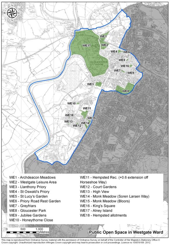
Ward Area Profile: Westgate

CONTENTS
Section A: Overview

Ward Councillors
Summary
S.W.O.T

Appendix 1: Technical Information

Section B: Physical Character

Location
Historical development
Character of the area
Hierarchy of routes

Section C: Demographics

Population
Age
Ethnicity
Gender
Housing
Energy efficiency of stock

Section D: Community

Healthcare
Libraries
Places of worship
Community facilities
Education facilities
Leisure facilities
Community groups and services

Section E: Deprivation

Deprivation table
Deprivation map
Headlines
Health and wellbeing
Crime
Car ownership

Section F: Economics

Employment
Unemployment
Average household income

                                    1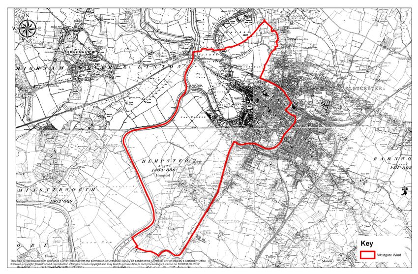
Ward Area Profile: Westgate
Educational achievement
Retail, services and facilities
Public transport
Cycle ways
Congestion
Section G: Land Use Issues
Public open space
Green infrastructure
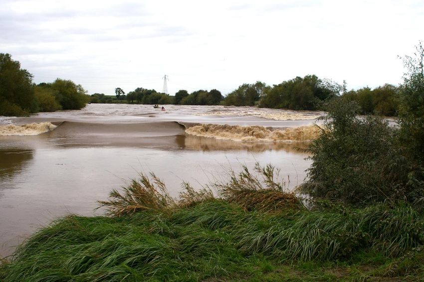
Water
Sustainability
Conservation
Section H: Previously Identified Issues
2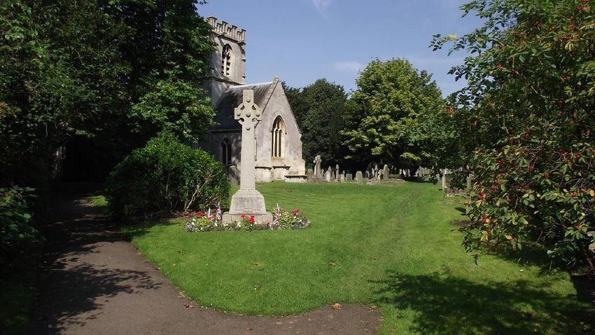
Ward Area Profile: Westgate

Section A:Overview
Ward Councillors

Cllr Pam Tracey - CON
50 Henry Road
Gloucester
GL1 3DY
Pam.Tracey@gloucestershire.gov.uk

Cllr Paul Toleman - CON
4 Upper Rea
Hempsted
Gloucester
GL2 5LR
Paul.Toleman@gloucester.gov.uk

Summary

Westgate ward is located to the north west of the city and includes two distinct parts; the city
centre and Hempsted. The city centre forms the historic core for Gloucester with Roman
occupation commencing in AD 65 – 70. The basic layout of the city centre, with the „gate‟
streets, was laid out at this time and is present to this day. Over time the city centre grew and
was influenced by the Anglo-Saxons, Normans and Tudors to name but a few. This includes
the Docks, which have been in existence since 1390 but only started to grow rapidly from 1827
following the completion of the Gloucester to Berkeley Canal.

Today the city centre forms for commercial centre for Gloucester. The „gate‟ streets (particularly
Eastgate Street) is characterised by a high proportion of retail units and is home to many high
street names as Debenhams and Marks and Spencer. The city centre is also home to some the
city‟s most significant tourist attractions, including the cathedral, museums and the Docks.

Westgate Street and the wider Blackfriars area are now establishing themselves as the
creative/cultural quarter, including for example the Arts and Craft Centre, Treasure Seekers and
Quays Creative and Blackfriars Inn.

Residential uses are an important component of the city centre, particularly at the periphery of
the main „gate‟ streets but also above shops in the commercial core and, more recently, in the
Docks. The former technical college (known as GlosCAT) has also been granted planning
permission for 254 new residential units.

There are a number issues specific to the city centre, including for example the lack of a high
quality hotel or, at the other end of the spectrum, a youth hostel. There has been a lack of
investment in new modern retail floorspace the city centre for around 30 years and as a result of
the stock of retail units is limited which in turn affects both multiple and independent retailer
representation, which again are less than would be expected for a city the size of Gloucester. In
addition, the evening and night-time economy is limited and skewed towards night clubs and
bars. Recent surveys show the environmental quality (e.g. paving, street furniture etc) to be a
particular issue with shoppers.

                                                    3
Ward Area Profile: Westgate

A key opportunity however relates to the regeneration areas that exist in the city centre.
Perhaps the most important of these is the Kings Quarter area, which will provide a significant
number of new retail units as well as other uses such as restaurants and cafes. The Council
has signed a developer partner, Stanhope, and a clear timetable to delivery is in place. As
mentioned above, Greater Greyfriars already has planning permission for a residential-led
scheme. The other major regeneration area is Greater Blackfriars, which is longer term but will
fill an important void between the city centre and Gloucester Docks/Quays and reconnect the
city centre with the riverside.

It is unsurprising the city centre does not have any issues with the availability of the community
facilities.

Hempsted also has a long history, with occupation of recorded in the Domesday book. The
area grew as a village and was originally part of Stroud District, being absorbed into Gloucester
City in 1967. Since then Hempsted has gradually grown and now forms part of the wider built
up area of the city.

Hempsted Village and the recently developed areas around Monk Meadow are almost entirely
residential. There are however important areas of employment along Secunda Way (South
West Bypass) as well as a sizeable Sainsburys and Marston‟s pub. There are no designated
local centres in Hempsted but a small shop/post office is located in the original Hempsted
Village.

Given the pleasant living environment in and around Hempsted it‟s unsurprising it has been and
is subject to development pressure. Other issues include a lack of local health care facilities in
walking distance, insufficient capacity at the primary school to accommodate new pupils and
peak time parking issues.

Hempsted has a good quality community hall and community spirit.

                                                     4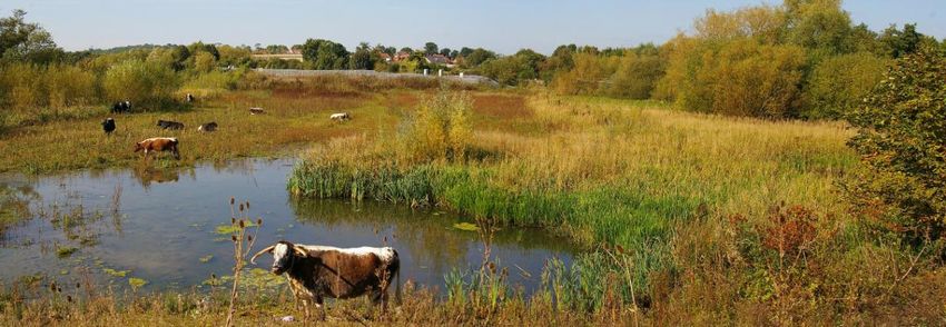
Ward Area Profile: Westgate

S.W.O.T

City Centre
Strengths                                       Weaknesses
      Compact and easily navigable city             Lack of a high quality hotel or youth
      centre.                                       hostel.
      Wide range of high street stores, with        Lack of significant investment in new retail
      good representation from national             floorspace (and other town centre uses).
      multiple retailers.                           Limited range of small, independent
      Good levels of „churn‟ (reuse of vacated      stores.
      retail premises).                             Gaps in retail provision e.g. fashion
      Historic and cultural assets, including       stores.
      Gloucester Cathedral, The Guildhall,          Poor public perception of environment
      Blackfriars Priority, Gloucester Dock and     and range of offer.
      a large number of scheduled monuments         Limited range of restaurants and other
      and Listed buildings.                         evening and night time economy facilities.
      Solid number and range of community           Lack of certain cultural facilities, such as a
      facilities open to all members of the         theatre
      community.                                    Located in the top 10% wards in the
      New residential development helping to        county for the number of benefit
      populate the city centre and support          claimants.
      shops, services and facilities.               Image and perception.
      Gloucester Quays Designer Outlet as an        Poor quality of certain areas of the city
      attractor of people to the city.              centre
      Centrally located bus/rail interchange.       Poor quality bus station, providing an
      Stable/reducing vacancy rates (though         unwelcoming gateway to the city.
      recent increase).                             Some unwelcoming, poor quality surface
      Successful themed and other markets.          car parks.
      Successful festivals throughout the year,     Lack of coach parking in appropriate
      for example the Gloucester Festival, Tall     locations.
      Ships Festival and Medieval days.             Limited numbers of people living in the
                                                    city centre.
                                                    Lack of modern, high quality office
                                                    accommodation.
                                                    Lack of connectivity and integration
                                                    between the city centre and the waterfront
                                                    and Alney Island.
                                                    Full potential of historic and cultural
                                                    assets not realised.
                                                    Some poor quality routes into, out of and
                                                    around the city centre.
                                                    Poor quality developments detracting
                                                    from the historic character.
Opportunities                                   Threats
      Identification of good levels of future       Inappropriate out-of-centre retail
      retail floorspace requirements.               proposals adversely impacting on the
      Provision of a wider mix of housing           vitality and viability of the city centre and
      tenures.                                      investment interest in key city centre

                                                    5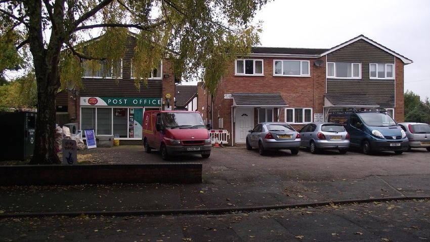
Ward Area Profile: Westgate

      Historic and cultural assets, including             schemes.
      Gloucester Cathedral, Blackfriars                   Changing structure of shopping habits
      Priority, Gloucester Dock and a large               (e.g. internet shopping) and the effect this
      number of scheduled monuments and                   will have on the high street.
      Listed buildings. Superb cultural and               Ongoing use/expansion of Hempsted
      historic base to build upon.                        Landfill.
      Significant brownfield development                  Increasingly dated paving in the „gate‟
      opportunities which, through                        streets.
      redevelopment, can have a positive
      impact on the city centre and the city
      more widely and address many of the
      identified weaknesses and threats.
      Specific opportunities include King‟s
      Quarter, Greater Blackfriars and the
      wider Gloucester Docks/Quays area,
      Reconnect the city centre with The
      Quay, River Severn and Alney Island.
      Making more of the city‟s major
      attractions e.g. historic assets such as
      the Cathedral and priories, Gloucester
      Quays, etc.

Hempsted

Strengths                                           Weaknesses
    Difficult as there is little published              Whilst having overall a very good supply
    evidence to draw on – Hempsted has                  of the community facilities open to all,
    probably got much lower numbers of                  there is a lack of facilities in an easily
    claimants, deprivation etc – but the figures        accessible location for those living in new
    don‟t go down to that level of detail.              housing developments to the west of
    Setting within landscape.                           Secunda Way.
    Conservation area and character of the              Lack of community shops, services and
    older part of the village.                          facilities in walking distance, though
                                                        located fairly close to Sainsburys at
                                                        Gloucester Quays and the city centre.
                                                        Lack of healthcare facilities in walking
                                                        distance.
                                                        Local primary school at capacity.
                                                        Parking issues at peak times (school
                                                        drop-off and pick-up times).
Opportunities                                       Threats
   Qualitative improvements to public open              Loss of „village‟ character through large
   space.                                               scale development proposals.
   Increased school capacity linked with new
   housing developments.
   Subject to satisfactory remediation of flood
   risk issues, the return of the city‟s football
   club to the Sudmeadow Road site.
   Re-use through the creation of an events
   space of Llanthony Priory.

                                                      6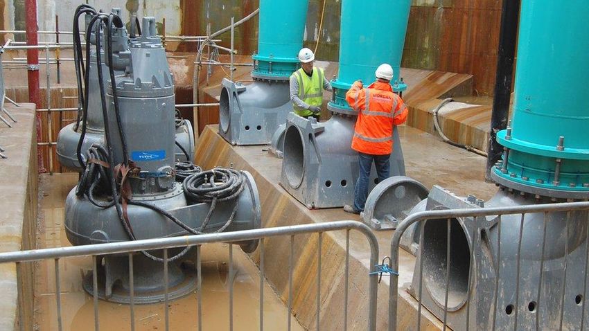
Ward Area Profile: Westgate
Appendix 1: Technical Information
Section B: Physical Character
Location
Westgate is the largest of all wards in Gloucester in terms of its size. The western boundary
follows the route of the River Severn and to the eastern boundary, the Gloucester Sharpness
Canal. The ward includes all of the City Centre and incorporates St Oswalds Retail Park to the
north.
The ward is made up of two quite distinct areas; the City Centre and Hempsted. For ease of
reference, where the information is available and relevant, information provided as part of this
profile has been split by these two areas.
Hempsted Village was originally part of the Stroud District but was absorbed into the
administrative area of the City of Gloucester in 1967.
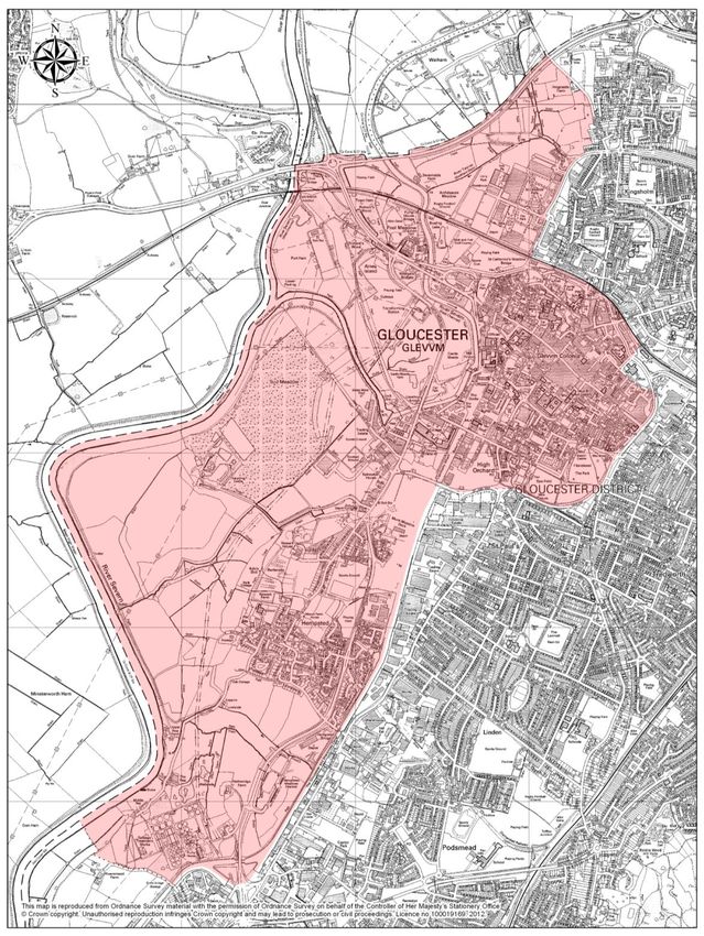
The location of Westgate ward in the context of the rest of Gloucester is illustrated by figure 1
below, with a more detailed plan provided as figure 2.
7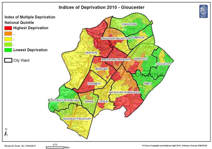
Ward Area Profile: Westgate

Figure 1: Westgate ward in the context of Gloucester City
Source: Gloucester City Council

                                               8
Ward Area Profile: Westgate
Figure 2: Westgate ward area
Source: Gloucester City Council
9Ward Area Profile: Westgate
Historical development
City centre
The name Gloucester is derived from the first syllable of the Roman name Glevum, combined
with the suffix “-cester”, indicating a Roman fortress. The City Centre forms the historic core of
Gloucester and the basic layout of the town centre reflects the lines of the Roman city walls,
later used by both Saxons and Normans until largely demolished in the Civil War of the mid-17th
century.
The principal features of the historical development of the City Centre Conservation Area are as
follows:
Roman
Roman occupation commences in AD 48 when a Roman fortress was constructed at
Kingsholme, taking advantage of the lowest bridging point of the River Severn; In AD 65-70
Kingsholme was abandoned and a new settlement or colonia established on the site of the
present city centre; The cross plan of streets were laid out; with Northgate Street and
Southgate Street still largely aligned along the Roman layout; The forum and basilica lay
alongside Southgate Street; A suburb developed on land to the west, reclaimed from the river;
During the 4th and 5th centuries the site was gradually abandoned.
Anglo-Saxon and Norman
In the 7th century Gloucester formed part of the territory of the Hwicce – an Anglo-Saxon sub
kingdom of Mercia; In 679 the Christian king of the Hwicce, Osric, founded a minster which was
rebuilt in 823; New streets laid out in the 9th century, many of which remain; the town walls
were refortified; Queen Aethelfleda founded a priory in about 900; After the Norman invasion, a
castle was built close to the river, and Gloucester grows due to the market and mint; Abbey of
St Peter, which stood on the old Minster site, refounded by William in 1072 – this became one of
the principle Benedictine centres in England.
Medieval
Henry III was crowned in St Peter‟s Abbey in 1216; Greyfriars was established in 1231,
Blackfriars in 1239 and Whitefriars in about 1268. Gloucester‟s urban layout during the medieval
period was largely characterised by these various ecclesiastical groups who owned building
complexes, individual churches and secular properties. Long, thin burgage plots were laid out
along the principal streets, to promote development. Westgate Street closest to the Abbey)
contained the market, several churches and the mint.
Southgate Street contained the fish and corn markets. Eastgate Street was the Jewish Quarter
until the Jews were expelled in 1275. Northgate Street contained another market and was lined
with shops. St Peter‟s Abbey was rebuilt and extended in the 14th century. Until c1300 the Cross
was surrounded by a huddle of tiny buildings on very narrow frontages, but after this date sites
were redeveloped to form larger plots, of which the New Inn in Northgate Street (c1450) is the
most obvious survivor.
Tudor and Jacobean
10Ward Area Profile: Westgate
The Dissolution of the monasteries saw most of the powerful ecclesiastical landowners removed
from the city and their properties re-distributed. Gloucester became notable for its markets and
manufacturing. The Bluecoat School built in 1566 in Eastgate Street. Gloucester became a
significant administrative centre, helped by improvements to Gloucester quay. In 1643 the Civil
War resulted in the demolition of the suburbs to the south; Gloucester declined in the late 17th
century as the textile industry became less important although new industries, such as metal
working, developed.
Georgian
Gloucester prospered as roads improved and river borne trade through Bristol increased.
Quayside facing the river Severn an important part of the city‟s economy. City centre were roads
widened and the East Gate was demolished in 1778 and the remaining gates in 1781. New
markets were built off Eastgate Street and Southgate Street in 1786. Existing buildings refronted
in fashionable brick. A new gaol was built on site of Norman castle in 1788.
Regency:
New spa developed to south of the city centre after 1814, providing a short lived impetus (it was
closed in the 1830s) to building of new shops in the city centre; Gloucester and Berkeley Canal
opened in 1827, which meant that by 1900 Gloucester had become one of the largest and most
profitable ports in the country; Gloucester Docks – first basin constructed in 1812, with
warehouses being built from 1826 onwards; Grain and timber the most important imports.
Victorian
Between 1840 and 1900 the Docks continued to expand and to provide Gloucester with its
principal source of income; Birmingham and Gloucester railway arrived in 1840; Volume of
canal borne traffic peaked in about 1850, but decreased rapidly after the railways developed,
providing links to Birmingham, Swindon and Bristol; 1849 – St Michael‟s Cross demolished and
rebuilt to one side; 1855 – Eastgate Street market rebuilt; 1860s – development of Gloucester
Wagon Works; 1872 – completion of the Schools for Science and Art in Brunswick Road –
public library and Price Memorial Hall (later the museum) added on either side soon after; The
middle classes moved out of the city centre and new residential suburbs developed outside the
historic core; In the late 19th century banks, offices and larger stores moved into the city centre;
1890s – new Guildhall built in Eastgate Street, on site of the Bluecoat School.
The Docks
The first record of a quay at Gloucester is noted in 1390 although it is known that a quay beside
the River Severn had been in existence since Saxon times. The early quay was sited on the
river to the north of Westgate Street. In 1580 Queen Elizabeth granted Gloucester formal status
as a port, thus allowing direct trade with foreign ports. A year later a custom house was opened,
probably on a site near the junction of Quay Street and The Quay. By the middle of the 18th
century Gloucester was a relatively well-used inland port (600 boats berthed at Gloucester in
1780) but the passage up the tidal River Severn, especially for seagoing vessels, was
treacherous and an impediment to further expansion of trade. The development of the docks is
closely connected with the construction of the Gloucester to Berkeley Canal which, eventually,
enabled boats to travel by canal from Sharpness on the Severn estuary to Gloucester. Though
the docks began to function after c.1812, it was not until the much delayed completion of the
canal in 1827 that the docks began to rapidly expand. Trade was largely in grain or timber
shipped into the port from Ireland, North Europe, the Mediterranean and the Black Sea, often
11Ward Area Profile: Westgate
transshipped and carried on to the Midlands via the Severn and the canal network. Fifteen tall
brick quayside warehouses were built between 1827 and 1873, the majority of which survive
relatively intact.
Key dates (1793-1874)
1793 Act of Parliament for the Gloucester & Berkeley Canal passed.
1794 Work begins on the main basin at Gloucester. Llanthony Road constructed
replacing Severn Street, an old route from Southgate Street to the River Severn.
1799 Gloucester Lock completed between main basin and River Severn. Main basin is
ready for use.
1800 Original capital investment in canal runs out with only eight of the intended
seventeen miles having been completed.
1812 Main basin opened to vessels, but only from the River Severn as the canal is not
complete. A horse tramroad is opened from Gloucester to Cheltenham.
1814 Shipbuilding yard opened in the basin; timber yards and a rope walk beside basin
1818 Graving dock built; land adjoining the basin let to merchants; Canal Company lay
sidings on east side of main basin connected to the tramroad.
1817 Work resumes on the canal under the supervision of Thomas Telford who agrees
that the route should be shortened to enter the Severn at Sharpness.
1820 Canal completed to junction with Stroudwater Canal at Saul.
1824 Canal Company constructs a quay on the east side of the basin.
1825 Completion of the Barge Arm.
1827 Canal completed from Sharpness on the Severn Estuary to Gloucester bringing a
huge boost to trade.
1827 North Warehouse, the first of several large warehouses, is completed.
1827-1873 Construction of a further 14 grain warehouses.
1837 Baker‟s Quay comes into use, mainly for timber storage.
1840 Dock at Baker‟s Quay for the Birmingham and Gloucester railway company. A year
later the railway company forms a connection between tramroad and its station on the
opposite side of the city.
1844 Tramroad adopted to carry railway as well as tramroad wagons between the docks
and the station.
1845 Custom Office built in Commercial Road to supervise trade with foreign ports.
1847 Construction of Britannia Quay between barge arm and Llanthony Bridge.
1848 Midland Railway complete a branch line to the docks by way of High Orchard.
1849 Mariners‟ Chapel built. Opening of Victoria Dock.
1850 City Flour Mill built in Commercial Road.
1851 Commercial development of west bank including widening of canal and
construction of Llanthony Quay.
1853 Great Western Railway completes their branch line to Llanthony Quays.
1861 Bridge over the canal in Llanthony Road replaced by an iron structure to carry
railway lines.
1874 Sharpness Docks opened.
12Ward Area Profile: Westgate
During the course of the next 100 years, activity in Gloucester docks declined but new buildings
related to manufacturing as opposed to storage were built just below Llanthony Bridge along
Baker‟s Quay e.g. Foster‟s Oil and Cake Mill (1862, 1890) and Downing‟s Malthouse extension
(1899). As ships grew in size towards the end of the 19th century, a new dock was built at
Sharpness to accommodate them. Warehouses were built at Sharpness and traffic on the canal
gradually changed to a predominance of barges and lighters towed by tugs. By the 1920s other
ports on the Severn such as Portishead and Avonmouth had taken most of Gloucester‟s corn
trade. The need for handling and storing goods at Gloucester slowly declined. Small coasters
and barge traffic continued to visit the docks until the 1970s.
By the 1980s cargoes were only being handled to the south of Llanthony Bridge and the decline
in barge traffic was becoming offset by an increase in pleasure craft. The historic warehouses
were becoming derelict (an application to demolish North Warehouse was refused in 1980) or
were in use as builders‟ merchants or other land related businesses.
After developments in the city that, in retrospect, are now seen to have harmed its historic
fabric, the regeneration of the docks has been the city‟s major conservation success of the late
20th century. The North Warehouse was refurbished in 1986 to house the City Council Offices
and The National Waterways Museum opened in Llanthony Warehouse in 1988.
Hempsted
Hempsted‟s name means „high homestead‟ (from the Old English heah-hamsteade). Domesday
Book records that the manor of Hempsted was held by Edric Lang, a thegn of Earl Harold, at the
13Ward Area Profile: Westgate
time of the Norman Conquest, after which it formed part of the extensive west of England
estates of William FitzOsbern, Earl of Hereford. A later Earl of Hereford gave the manor to
Llanthony Priory in 1141. Llanthony held the manor until the Dissolution, when, in 1545, the
Crown sold it to the Atkyns family, from whom it passed to the Lysons family in 1721;
coincidentally, Hempsted manor has been owned by two of Gloucestershire‟s most celebrated
early antiquaries: Sir Robert Atkyns, the author of the first history of Gloucestershire, who was
given the manor at his marriage in 1669, and the Revd Daniel Lysons who (assisted by his
brother, the pioneering archaeologist Samuel Lysons) wrote the Magna Brittannia (1806–22) an
unfinished county-by-county history of the British Isles.
Silvanus Lysons (who died in 1731) bequeathed Manor Farm and 25ha of land to the charitable
trust that still bears his name. Having sold land in 1979 and 1986, the charity still owns the
Manor Farm farmhouse along with some 12 hectares of land in the village, has recently funded
the building of a new church hall, and provides scholarships for Hempsted pupils attending the
King‟s School Gloucester, amongst other charitable works.
An historic plan of Westgate ward, produced in 1902, is provided as figure 3 below.
Figure 3: Westgate ward, Circa 1902
Source: Gloucester City Council
Character of the area
Given the size of the ward and number of different uses, its character is unsurprisingly varied. The city
centre is the historic core of the city which is focussed around the four „gate‟ streets (Northgate Street,
Eastgate Street, Southgate Street and Westgate Street). This area represents the retail and commercial
core of the city centre.
14Ward Area Profile: Westgate
Gloucester is a city that has existed for around 2,000 years and in this context there are a large
number of beautiful historic buildings and street patterns, including for example Gloucester
Cathedral, Blackfriars Priory and 66 Westgate Street.
The city centre however did not escape large scale redevelopment‟s through the 1960‟s and
1970‟s, which meant that significant areas of the historic city were bulldozed and replaced with
modern buildings of the time. The blueprint for this redevelopment was set out in the Jellicoe
Plan of 1961. Whilst not entirely realised, the plan lead to what we now see in the city centre,
including for example, new housing in and around Archdeacon Street and St Mary‟s Square to
the south of the cathedral, and new retail development in and around the „gate‟ streets, now
known as Kings Walk shopping centre and the Eastgate shopping centre.
15Ward Area Profile: Westgate
To the south of the city centre proper, lies Gloucester Docks, characterised by 18th century
warehouses set around two main dock areas. Since the 1980‟s most warehouses have now
been converted to residential and office uses (including for example Gloucester City Council
offices) though there are still some working docks industries, including Tommy Nielsen and
Company, which are a traditional ship builders and renovators.
To the periphery of the „gate‟ streets, lie areas primarily characterised by more traditional inner
city housing. The area to the south of the city centre is heavily Regency in style, with 3 - 4
storey town houses.
To the very north of the ward lies the former „Cattle Market‟, which ceased trading in the late
1990‟s. The area has since been redeveloped and is largely dominated by the St Oswald‟s
Retail Park. To the rear of the retail park is the hugely successful St Oswald‟s Extra Care
Village as well as a significant amount of new residential development.
To the west of the city centre is Alney Island. This area is located within the River Severn
floodplain and is therefore subject to significant flood risk. The area has very limited
development, including an electricity substation and rugby pitches. Alney Island acts as an
important recreational facility for walking and such.
16Ward Area Profile: Westgate
Hempsted is located to the south west of the city centre. Originally being part of Stroud District,
Hempsted is quite distinct in in character. The old part of the village is centred around the
church, school and shop at Hempsted Lane/St Swithuns Road. There are a large number of
different building styles, reflecting ongoing development over many centuries – with the majority
taking place in the twentieth century. Most recently, significant new housing development has
been provided between Secunda Way and the Gloucester Sharpness Canal.
17Ward Area Profile: Westgate
To the southern tip of the ward is located the Netheridge Sewage Treatment Works. This facility
processes waste for the whole of the city as well as areas beyond.
Hierarchy of routes
The main retail area of the city centre is pedestrianised in order to create a pleasant shopping
environment. The city centre is surrounded by the „inner relief road‟ (including Bruton Way,
Gouda Way, The Quay and Trier Way). The A417 (Over Causeway) provides the primary road
access into the city from the north-west. The South West Bypass, located to the west of the city
centre and west of Hempsted, provides the primary access between the north and the south of
the city (Quedgeley, Hardwicke).
Vehicular routes in and around Hempsted, with the exception of the South West Bypass, are
minor and reflect the residential nature of the area.
18Ward Area Profile: Westgate
Section C: Demographics
Population
The population of Westgate in 2011 was 6,607 according to Census figures, representing 5.43%
of the population of Gloucester. Westgate is one lowest populated wards in the city.
Figure 4: Population by ward for Gloucester
Source: Census 2011
Ward Total Population % of Population
Abbey 9,495 7.80
Barnwood 10,317 8.48
Barton and
10,953 9.00
Tredworth
Elmbridge 5,776 4.75
Grange 5,839 4.80
Hucclecote 8,826 7.25
Kingsholm and
7,411 6.09
Wotton
Longlevens 9,532 7.83
Matson and
10,277 8.45
Robinswood
Moreland 10,253 8.43
Podsmead 2,994 2.46
Quedgeley
10,421 8.56
Fieldcourt
Quedgeley Severn
7,098 5.83
Vale
Tuffley 5,889 4.84
Westgate 6,607 5.43
Total 121,688 100.00
Age
Figure 5 below shows the age profile of Westgate ward. Generally the profile of the age groups
is consistent with those in other wards across the city. It is notable however that Westgate
tends to have lower numbers of young people up to the age of 19. There are however much
higher numbers of people between the ages of 20 and 34 compared to the other wards,
particularly age groups 20 – 24 and 25 – 29, which are the highest figures in the whole of the
city.
19Ward Area Profile: Westgate
Figure 5: Age Profile of Westgate ward
Source: ONS 2010 ward population estimates for England and Wales, mid-2010
20Ward Area Profile: Westgate
Ethnicity
Figure 6 below displays the ethnic make-up of the city in 2006 and demonstrates that, at this
time, the population of Westgate ward consisted of 85.6% White British and 14.4% Ethnic
Minority Groups (EMG). This represents the second largest percentage of EMG of wards in
Gloucester, behind Barton and Tredworth.
Figure 6: Ethnic composition by ward in Gloucester City.
Source: Gloucestershire County Council - Ethnicity in Gloucestershire 2006
Gender
Figure 7 below shows the age profile of Westgate ward by sex. It shows broadly comparable
figures across most age groups. There is however a notable difference in age ranges 30 – 34
through to 50 – 54 which shows significantly more males than females.
21Ward Area Profile: Westgate
Figure 7: Age profile by gender for Westgate ward
Source: ONS 2010 Mid-year Estimate
Housing
Housing tenure
Figures 8 and 9 below show the residential status for all wards in Gloucester, taken from the
2011 Census. It shows that Westgate differs from the other wards in the City in that it has
broadly comparable numbers of people living in owner-occupied properties (41%), social rented
properties (19%) and private rented properties (38%).
Figure 8: Tenure split by ward in Gloucester
Source: 2011 Census
Total Owned Private Rented
Ward Social Rented %
Occupied % %
Abbey 84 4 12
Barnwood 74 13 11
Barton and Tredworth 55 12 32
Elmbridge 85 6 9
Grange 83 5 12
Hucclecote 85 3 11
Kingsholm and Wotton 48 16 34
Longlevens 88 2 9
22Ward Area Profile: Westgate
Matson and Robinswood 53 38 8
Moreland 62 14 23
Podsmead 48 42 9
Quedgeley Fieldcourt 69 11 19
Quedgeley Severn Vale 76 4 20
Tuffley 68 24 7
Westgate 41 19 38
Figure 9: Residential status for all wards, Gloucester City
Source: 2011 Census
Other communities
Westgate is home to an established travelling showpeople community to the north west of the
ward, principally at Pool Meadow and Fairview. The majority of residents live in static caravans,
tourer caravans and chalets. The most recent caravan count (January 2012) identified a total of
60 residential units (static caravans, tourer caravans, chalets).
23Ward Area Profile: Westgate
Property Size
Westgate has the lowest percentage of houses and bungalows at 40% compared to the
average for Gloucester at 83%. In turn, Westgate has the highest percentage of flats at 57%
compared to the district average of 16%. Westgate has the highest percentage of shared
ownership properties at 3%.
Figure 10: Property type by ward
Source: Census 2011
House or Bungalow Flat Caravan or Mobile Home Shared Dwelling
% % % %
Longlevens 96 3 0 0
Abbey 95 5 0 0
Elmbridge 93 6 0 0
Hucclecote 92 7 1 0
Barnwood 92 8 0 0
Grange 92 6 3 0
Tuffley 91 9 0 0
Quedgeley
Severn Vale 91 9 0 0
Quedgeley
Fieldcourt 89 9 2 0
Moreland 86 13 0 1
Barton and
Tredworth 80 20 0 1
Podsmead 78 22 0 0
Matson and
Robinswood 77 23 0 0
Kingsholm
and Wotton 52 47 0 1
Westgate 40 57 1 3
Gloucester 83 16 0 0
South West 81 18 1 0
England 78 21 0 0
24Ward Area Profile: Westgate
Number of Bedrooms
Westgate has the highest percentage of one bedroom properties of the all the wards in
Gloucester with 38%. There is an average percentage of two bedroom properties and the
lowest percentage of three bedroom properties.
Figure 11: Bedroom profile of housing by ward
Source: Census 2011
1 Bedroom 2 Bedrooms 3 Bedrooms 4 Bedrooms 5 + Bedrooms
% % % % %
Abbey 5 22 42 28 3
Barnwood 6 16 46 26 6
Barton and
Tredworth 15 32 42 8 3
Elmbridge 3 18 57 18 4
Grange 4 35 54 5 1
Hucclecote 5 25 49 19 2
Kingsholm
and Wotton 26 32 25 11 5
Longlevens 5 20 51 22 3
Matson and
Robinswood 15 30 46 8 2
Moreland 9 26 52 9 4
Podsmead 20 23 46 7 4
Quedgeley
Fieldcourt 7 33 38 19 3
Quedgeley
Severn Vale 8 30 39 21 2
Tuffley 9 27 48 13 3
Westgate 38 29 19 9 5
Gloucester 11 27 43 15 3
South West 11 27 40 16 5
England 12 28 41 14 5
25Ward Area Profile: Westgate
Energy efficiency of stock
Heat loss
Thermal imaging of the City shows that for the city centre, much of the property in the main
commercial area along the gate streets is of low thermal efficiency. This is not particularly
surprising when considering this is also the historic core of the city and is therefore
characterized by older properties. There are however also low thermal efficiencies at some of
the newer properties to the west of the cathedral and at the lower end of Westgate Street,
towards the river.
For Hempsted, most properties are of a moderate thermal efficiency, though are clusters of
buildings with low thermal efficiency in the fairly new residential developments between the
south west bypass and the Gloucester Sharpness Canal.
Fuel poverty
A household is deemed to be in Fuel Poverty if they spend more than 10% of their income of
heating their home; the table below shows the percentage of households who are defined as
being in fuel poverty. Westgate has the third highest number of households in the local
authority dealing with fuel poverty.
Figure 12: % of properties in fuel poverty by ward
Source: Fuel Poverty Indicators – Centre for Sustainable Energy
Ward On Full Income (Equivalised)
Longlevens 4.0%
Abbey 4.1%
Hucclecote 4.1%
Quedgeley Severn Vale 4.1%
Elmbridge 4.8%
Tuffley 4.9%
Grange 5.0%
Quedgeley Fieldcourt 5.0%
Barnwood 5.2%
Podsmead 5.5%
Matson and Robinswood 5.7%
Kingsholm and Wotton 6.3%
Westgate 7.0%
Moreland 7.2%
Barton and Tredworth 8.9%
Total 5.5%
26Ward Area Profile: Westgate
Section D: Community
Healthcare
In Westgate ward there are thirteen health care facilities as set out below. This is a highest
number of any ward in the city and unsurprising when considering it includes the city centre.
Surgery Type Address
Hadwen Medical Practice Doctor St Michael‟s Surgery, St Michael‟s Square
St Michael‟s Surgery Doctor St Michael‟s Square
Gloucester Health
Doctor Eastgate House, Eastgate Street, Gloucester
Access Centre
Gloucester City Health Doctor /
The Park, Gloucester
Centre Dentist
The College Yard Surgery, Mount Street,
Dr Miller HJ & Partners Doctor
Westgate
Clarence House Dental
Dentist 22 Clarence Street, Gloucester
Health Centre
Eastgate Dental Centre Dentist 2nd floor, Eastgate House, Eastgate Street
Roger Moore Dental
Dentist 2 Three Cocks Lane, Westgate Street
Practice
Gloucestershire Dental
Dentist 2 Kimbrose Way, Gloucester
Access Centres
Gloucestershire PCT
Dentist Montpellier, Gloucester
Dental Service
The Annadale Dental
Dentist 105 Eastgate Street
Surgery
Apsley House Dental
Dentist 2 Spa Road
Practice
The Flying Dentist Dentist 15 Midsummer Walk
Libraries
The central library for Gloucester is located in Westgate ward, in the city centre at Brunswick
Road. It has the most comprehensive range of materials and facilities of all the libraries in the
city. Given its location, the library is easily accessible by all modes of public and private
transport. It is open every day of the week excluding Sundays, with late evening opening until
7pm every day except Wednesday and Friday. More information can be found on the
Gloucestershire County Council website at http://www.gloucestershire.gov.uk/libraries.
Places of worship
In Westgate ward there are twenty places of worship, as set out below.
Place of worship Type Address
Seventh Day Adventist Cromwell Street GL1 1RE
27Ward Area Profile: Westgate
Church
Brunswick Baptist Church Southgate Street GL1 2DR
St Mary de Lode St Marys Square Gloucester GL1 2QT
Christ Church Brunswick Road GL1 1JS
Mariners Church The Docks GL2 2EH
St Mary de Crypt Southgate Street GL1 1TP
St Swithun‟s Church Hempsted, GL2 5LW
Gloucester Cathedral College Green Gloucester GL1 2LR
The Cathedral College Green Gloucester
Feig
GL1 2LR
St Mary‟s Congregational St Marys Street off Archdeacon Street
Church Gloucester GL1 2QS
Gloucester Prison Chapel Barrack Square The Quay GL1 2JG
Living Word Fellowship
Church (Eglise La Parole 146 Southgate Street Gloucester GL1 2EX
Vivante)
Southgate Evangelical
Albion Hall 146 Southgate Street GL1 2DR
Church
Park Street Mission Park Street GL1 2DA
Religious Society of
Greyfriars Southgate Street GL1 1TS
Friends, Quakers
St John‟s Methodist
Northgate Street GL1 2AN
Church
St John‟s Northgate
Northgate Street GL1 2AN
Methodist Church
Christ Faith Tabernacle GL1 Leisure Centre GL1 1DT
The Salvation Army 150 Eastgate Street GL1 1QU
United Reformed Church Park Road GL1 1LS
Community facilities
The information below has been drawn from the Gloucester City Community Facilities Audit
(2012), which covers the following main community facility types: education facility; community
centre; village halls/scout hut; children‟s centre; place of worship and associated hall; social
club‟ sports club; cultural facility (e.g. libraries, museum meeting room); and other. It does not
include public houses, though it is acknowledged that these can make an important contribution
to community provision in an area.
In total in Westgate ward, there are currently 13 community facilities that are open to all
members of the community. These are as follows:
28Ward Area Profile: Westgate
Name Address Contact
Gloucester Library Brunswick Road, Gloucester, GL1 0845 230 5420
1HT
Gloucester 12 College Street, Gloucester, GL1 01452 528095
Cathedral 2LX
King‟s School Pitt Street, Gloucester, GL1 2BG 01452 337337
The Guildhall 23 Eastgate Street, Gloucester, GL1 01452 503050
1NS
Gloucester Museum Brunswick Road, Gloucester, GL1 01452 396131
1HP
Gloucestershire Llanthony Road, Gloucester, GL2 0845 155 2020
College 5JQ
St Mary de Crypt Southgate Street, Gloucester 01452 422 829
Brunswick Baptist 28 Southgate Street, Gloucester, 01452 502993
Church GL1 2DR
GL1 Leisure Centre Bruton Way, Gloucester, GL1 1DT 0845 643 4203
Hempsted Village 126 Hempsted Lane, Gloucester, 01452 502063
Hall GL2 5JU
Salvation Army 150 Eastgate Street, GL1 1QU 01452 311332
Church
The Warehouse 1 Parliament Street Gloucester GL1 01452 302 351
Climbing Centre 1HY
Lyson‟s Hall St Swithuns Road, Hempsted, 01452 501881
Gloucester, GL2 5LH
Blackfriars Priory Ladybellegate Street, Gloucester, 01452 396386
GL1 2HN
Unsurprisingly, the vast majority of these are located in the city centre, with the exception of
Hempsted Village Hall and the Lyson‟s Hall.
The recognised calculation for assessing the provision of community facilities is 0.44 facilities
per 1,000 population. Figures 13 and 14 show the overall calculation for all wards in
Gloucester.
Figure 13: Community Facility Audit Results by Gloucester Ward
Source: Gloucester Community Facilities Audit 2012
29Ward Area Profile: Westgate
The calculation for Westgate shows that the ward has a community provision figure of 2.180
facilities per 1,000 population, which is well over the 0.44 facilities target). It is worth pointing
out however that many of the facilities identified above are of city-wide importance and in this
sense skew the figures somewhat.
Figure 14: Community facilities against recommended standard by ward
Source: Gloucester Community Facilities Audit 2012
30Ward Area Profile: Westgate
It is worth noting that, whilst the ward is overall well catered for in terms of community facilities,
there is a lack of provision in the new developments to the east of Secunda Way, which is
physically separated from Hempsted Village proper by the same road.
Education facilities
There are two schools in Westgate ward (though others located in close proximity to Westgate
but in adjoining wards):
School Type Address
The Kings School
Secondary School All? Pitt Street Gloucester, GL1 2BG
(Independent)
Hempsted Primary Saint Swithun‟s Road Hempsted, Gloucester
Primary
School GL2 5LH
In addition, the Westgate is home to Gloucestershire College (or GlosCol), located to the south
of Gloucester Docks adjacent to the Gloucester Sharpness Canal. Gloucestershire College
offers a wide range of courses from A Levels and GCSEs, through to vocational qualifications
such as construction and building services, as well HNDs, NVQs and degree level qualifications.
The catchment of the college tends to be focused on the county.
Leisure facilities
Westgate covers the city centre and is therefore the focus for a significant proportion of the
leisure facilities in the city. This includes for example the Cineworld cinema at the Peel Centre
(shortly to move to Gloucester Quays), the Gloucester Climbing Centre (Parliament Street),
museums including the British Waterways museum, Folk Museum and Gloucester City
31Ward Area Profile: Westgate
Museum. Other major tourist attractions include Gloucester cathedral and other historic assets
such as Blackfriars Priory.
Quality overnight accommodation is something that has long been identified as a gap in
provision for the city centre. As part of the ongoing regeneration programme, the provision of a
high quality hotel is a strong aspiration. The city also doesn‟t have a youth hostel.
Gloucester City AFC was forced to leave its home ground at Sudmeadow Road in Hempsted
following the 2007 floods. Since this time, the club has played at the Abbey Business Stadium
in Cheltenham.
More recently, a planning application has been submitted to Gloucester City Council for the
redevelopment of the Sudmeadow Road site to provide a new football ground and other
employment uses. There are however issues in relation to flood risk that are currently being
addressed.
Community groups and services
Given the ward also includes the city centre, there are a wide range of groups covering both a
more localised function and those that provide services for the wider city or county. These are
summarized below:
Local Group Contact
City Centre Community Barry Leach, Chair
Partnership PO Box 3155, Gloucester, GL1 9AA
Hempsted Residents
Richard Trelfa, Chair
Association
Brunswick Square Residents
Marilyn Champion, Chair
Association
Wider Group Contact
St Michael‟s Tower, The Cross, Eastgate Street, Gloucester,
Civic Trust
GL1 1PD
Gloucestershire Association of
Voluntary and Community 75 – 81 Eastgate Street, Gloucester, GL1 1PN
Associations (GAVCA)
Young Gloucestershire Greyfriars House, Greyfriars, Gloucester, GL1 1TS
Gloucestershire Emergency
Accommodation Resource 159 Southgate Street, Gloucester, GL1 1XE
(GEAR) Project
Gloucestershire Rural
Community House, 15 College Green, Gloucester, GL1 2LZ
Community Council (GRCC)
Gloucester Law Centre Third Floor, 75 – 81 Eastgate Street, Gloucester, GL1 1PN
The Family Haven 31 Spa Road, Gloucester, GL1 1UY
Citizen‟s Advice Bureau 75 – 81 Eastgate Street, Gloucester, GL1 1PN
32Ward Area Profile: Westgate
Gloucestershire Domestic
Violence Support and Advocacy N/A
Project (GDVSAP)
Gloucestershire Race Equality
15 Brunswick Road, Gloucester, GL1 1HG
Council (GlosREC)
33Ward Area Profile: Westgate
Section E: Deprivation
Deprivation table
Looking more specifically, figure 15 below sets out information in relation to a large number of
different variables with a comparison and rating against the County average. A few key
variables are discussed in more detail below.
Figure 15: Westgate deprivation indicators
Source: Maiden Research Team, Gloucestershire County Council
Source MAIDeN Number Hot, Warm
or Cool
Health
Weekly tobacco spend £s CACI 2006 24472 Hot
Weekly alcohol spend £s CACI 2006 22586 Warm
Accident Admissions 2012 350 Cool
Social work assessments 2011 10 Warm
Mental health assessments 2011 60 Hot
Children and Young People
Accident Admissions of under 5‟s 2012 10 Cool
Accident Admissions of under 17‟s 2012 40 Cool
Children in need 2011 80 Hot
Crime victims under 20 years old 2010-11 65 Hot
Lone parent benefit claimants August 2008 51 Warm
Key stage 4 - Pupils not achieving 5+ A*-C grades inc English * 25 Warm
maths
Free School Meals - Pupils eligible 2012 110 Warm
English as an additional language – pupils of school whose first 500 Cool
language is known.
Crime
Victims of crime (all) 2010-11 715 Hot
Anti Social Behaviour Incidents recorded by the Police 2010-11 2220 Hot
Theft victims 2010-11 205 Cool
Violence victims 2010-11 235 Hot
Burglary victims 2010-11 135 Hot
Hate Crime/incidents 2010-11 105 Hot
Serious and Fatal Road Traffic Collisions 2007-10 30 Warm
Criminal damage victims 2010-11 110 Hot
Arson recorded by Fire and Rescue 2008-11 90 Hot
Economy
Mean household income 2007 £k* 29402 Warm
Working-age benefit claimants Aug 2008 821 Hot
Incapacity Benefit claimants 2008 440 Hot
Lone parent benefit claimants Aug 2008 51 Warm
Carer claimants Aug 2008 14 Cool
Disabled claimants Aug 2008 33 Warm
Households with broadband internet 2008* 1800 Cool
34Ward Area Profile: Westgate
Notes
HOT indicates that this locality is amongst the „top 10%‟ (or „bottom 10% marked with*)
of localities in Gloucestershire
WARM indicates that this locality is in the next 25% of localities in Gloucestershire
The rate compares what is happening in the locality to the Gloucestershire „norm‟ - a
rate of 1 shows that the locality is the same and the wider norm; a rate of 2 would show
that the locality has a double the norm; a rate of 0.5 would show that the locality has half
of the wider norm.
Deprivation map
Figure 16 below graphically represents indices of deprivation by ward as of 2010. The index of
multiple deprivation combines a number of different indicators that are designed to cover a
range of economic, social and housing issues, which are combined to provide a single overall
deprivation score for small areas, called „super output areas‟. This information is illustrated on
the graphic below and is provided by ward. Westgate can be found to the north west of the
graphic.
The information shows that there are areas with significant levels of deprivation in the City
Centre and further north of the ward, around St Oswalds Retail Park. It further shows that other
areas of the ward, including Hempsted, have medium levels of deprivation.
Figure 16: Indices of Multiple Deprivation (by Super Output Area) showed by ward.
Source: Maiden Research Team, Gloucestershire County Council
35Ward Area Profile: Westgate
Headlines
Westgate is amongst the top 10% of localities in Gloucestershire for a number of
different crime statistics, including antisocial behaviour incidents, violence, burglary and
criminal damage. A large proportion of the antisocial behaviour and violence is linked to
alcohol use although at a public consultation with users of the night time economy in
November 2012, 71% of those asked reported feeling safe or very safe. There are
however lower frequencies of serious and fatal road traffic collisions.
Westgate is amongst the top 10% of localities in Gloucestershire for the number of
working age benefit claimants, job seeker claimants and incapacity benefit claimants.
In 2001, 1104 households in Westgate ward did not have a car. This equates to 49.1%
of households (compared to 25.1% for Gloucester City and 18.7% for Gloucestershire).
This can partly be attributed to higher levels of deprivation but also that Westgate
includes the city centre, which provides excellent sustainable transport links. (Source:
ONS 2001 Census).
In 2001, 353 households in Westgate did not have central heating. This equates to
15.7% of households (compared to 11.1% for Gloucester City and 7.3% for
Gloucestershire). (Source: ONS 2001 Census).
In 2004, 853 people in Westgate were claiming housing benefit. This equates to 21% of
the population (compared to 7% for Gloucester City and 5% for Gloucestershire).
(Source: Maiden Project).
Health and wellbeing
The following maps are taken from “Gloucester Healthy Living – Gloucester Area Health Profile
2009-2010 NHS Gloucestershire”.
36Ward Area Profile: Westgate
Figure 17 Gloucester Existing Health Problems
The map above shows existing health issues, such as people with angina, those that have
suffered a heart attack, new cases of diabetes, high blood pressure and high cholesterol. For
Westgate, the map shows particular issues to the north of the ward, to the northern part of the
city centre and St Oswalds.
37Ward Area Profile: Westgate
Figure 18 Gloucester Future Health Problems
The map above shows potential future health problems in the city. This is created by taking into
account the indicators for potential ill-health. These indicators include: high numbers of smokers
and obese people, diet (few people eating sufficient amounts of fruit and vegetables), and
where the consumption of both fast food and sugary drinks is above average For Westgate, the
map shows issues arising within the wider ward, including Hempsted.
Other headlines:
Good access to formal and informal public open spaces, but less than the recommended
standard of playing pitches.
Shortage of allotments in the ward.
Car ownership
Figure 19 below shows percentages of households without a car by Super Output Area in
Gloucester. It shows concentrations of such households to the east of the ward (between
18.7% and 37.4% of households without a car) to the southern half of the city centre and further
west towards Alney Island. Low levels of car ownership in the city centre are not surprising
given that it is also the location of the bus station, railway station and the Gloucester Car Club.
38Ward Area Profile: Westgate
Car ownership levels in Hempsted are much higher (6.3% to 12.4% of households without a
car), which is again unsurprising given the fact it‟s located further away from the city centre and
also somewhat separate from the rest of the city.
Figure 19: Percentage of household without a car, Gloucester City, by Local Super Output Area
Source: 2001 Census
39Ward Area Profile: Westgate
Section G: Economics
Employment
The city centre is home to a wide variety of uses that provide significant employment, for
example retail, office, leisure and tourism. There are several major national employers including
Ecclesiastical Insurance and Pro Insurance as well as smaller independent businesses, located
throughout the ward.
Notably, the city centre includes offices for important public sector employers including
Gloucester City Council, Gloucestershire County Council and the Land Registry.
Gloucestershire Royal Hospital is also located in close proximity, being just to the north west of
the ward.
Westgate Street and the wider Blackfriars area is becoming established as a creative/cultural
quarter, including for example the Arts and Craft Centre, Treasure Seekers and Quays Creative
and Blackfriars Inn.
Towards Hempsted, Secunda Way (the South West Bypass) forms an important employment
route, including industrial, business parks and one off employment developments. These
companies tend to be heavier industrial type uses.
Also located in Hempsted, the Netheridge Sewage Treatment Works and Hempsted Landfill are
also an important local employer.
Unemployment
Figure 20 below show the claimant count by ward in Gloucester as of December 2012. It shows
that Westgate had the highest number of claimants in the city at that time. Westgate is in the
highest 10% of wards in the county for benefit claimants. This is a longstanding trend.
Figure 20: Analysis of claimant count by Gloucester City ward, December 2012
Source: Maiden Research Team, Gloucestershire County Council
40Ward Area Profile: Westgate
The claimant rate of 8.4 for Westgate is consistent with the annual averages for 2012, as
demonstrated by the table below. There were however increases during the spring months, and
decreasing in November and December. This is not surprising given the seasonal nature of
some forms of employment.
Figure 21: Average annual claimant counts by ward
Source: Maiden Research Team, Gloucestershire County Council
Average household income
Figure 22 below illustrates the average household income for all wards on Gloucester. For
Westgate it shows a figure of £20,596, which is the lowest in the city and well below the County
and national averages.
Figure 22: Average household income
Source: PAYCHECK date; CACI
Ratio of average gross
Estimated Average
Area income to the UK
Gross Income
average
Abbey £46,635 1.27
Barnwood £52,600 1.44
Barton and Tredworth £28,583 0.78
41Ward Area Profile: Westgate
Elmbridge £44,540 1.22
Grange £32,648 0.89
Hucclecote £33,926 0.93
Kingsholm and £39,819 1.09
Wotton
Longlevens £38,071 1.04
Matson and £32,648 0.89
Robinswood
Moreland £32,648 0.89
Podsmead £26,035 0.71
Quedgeley Fieldcourt £41,823 1.14
Quedgeley Severn £46,635 1.27
Vale
Tuffley £26,035 0.71
Westgate £20,596 0.56
Gloucester £33,926 0.93
Gloucestershire £45,126 1.23
UK £36,614 1.00
Educational achievement
In 2010/11, 50% of pupils living in the ward achieved of 5 or more GCSEs grades A*-C including
English and maths. This is below the UK national average of 58.2%.
72% of pupils achieved 5 or more GCSEs grades A*-C. This is above the UK national average
is 68.4%.
Figure 23 below demonstrates that there are levels of education, skills and training deprivation
in Westgate ward in the city centre and further north at St Oswalds. In contrast, Hempsted does
not have such issues.
42Ward Area Profile: Westgate
Figure 23: Education, skills and training deprivation by Gloucester ward, 2010
Source: Maiden Research Team, Gloucestershire County Council
Retail, services and facilities
Westgate ward includes the main city centre, focussed the „gate‟ streets; Northgate, Southgate,
Westgate and Eastgate Streets. The City Centre offers a range of different retailing including
popular high street stores and independent stores. It has however lacked any significant retail
investment since the 1970‟s and as such has a limited number of stores available, which in turn
has restricted representation. The centre also has a smaller representation from smaller
boutique style stores than would normally be expected for a city of its size. One of the key
mechanisms for delivering this will be the redevelopment of the Kings Quarter area (including
Kings Square and the Bus Station) for a retail-led regeneration project. This is a key
regeneration objective for the City Council and progress is currently being made with partners to
realise this within the next 5 years.
The city centre also represents the historic core of the city, and has a number of significant
heritage assets, including Gloucester Cathedral, Gloucester Docks and Blackfriars Priory. Such
assets also act as a significant tourist attraction and in a recent poll by Which Magazine,
Gloucester Cathedral was voted the joint second most popular tourist attraction in the country
with the Houses of Parliament.
43Ward Area Profile: Westgate
Within Westgate there are also a number of out-of-centre retail facilities. Gloucester Quays
Outlet Centre is located to the south of Gloucester Docks and incorporates the reuse of listed
and other historic buildings as well as significant new build, to provide 20,000 sq m of outlet
shopping floorspace, as well bars, cafes and restaurants. More recently, planning permission
has been granted for a new 10 screen cinema as well as additional restaurants. Major
environmental improvements have been made between to the route between Gloucester Quays
and the City Centre, with the aim of improvement the flow of people between the two.
Other, more traditional out of centre retail parks are located at the Peel Centre, to the south of
Gloucester Quays, St Oswalds Retail Park and Westgate Retail Park, both located to the north
west of the city centre. Both offer a range of different retailers, from DIY and hardware, through
the electronics and homeware.
Hempsted, to the south of the ward, has a post office and small convenience store/newsagents
that provides for the local day-to-day needs of the area.
44Ward Area Profile: Westgate
In additional to the above, there are two large supermarkets located within the Westgate area.
Tesco is located at St Oswalds Retail Park and has recently been granted planning permission
for a significant extension. Sainsbury‟s represents the area‟s newest store and is located within
the Gloucester Quays regeneration area. There is also a large ASDA in close proximity to the
city centre, off Bruton Way, but located just outside of Westgate ward.
Public transport
The city centre is home to the bus and rail interchange and access to public transport is
therefore superb. The bus station and adjacent Clarence Street acts as the start and end point
for a large number of services to Gloucester and beyond. The bus station is however
unwelcoming and in need of redevelopment. This will be addressed through the future Kings
Quarter redevelopment. Route Numbers 14, 14A and 113 run north-south from the city centre,
through Hempsted and to Quedgeley beyond.
45You can also read