West Coast Civil Defence Emergency Management Group Plan - Version 1.0 November 2016
←
→
Page content transcription
If your browser does not render page correctly, please read the page content below
West Coast Civil Defence
Emergency Management
      Group Plan
      Version 1.0 November 2016

                                  1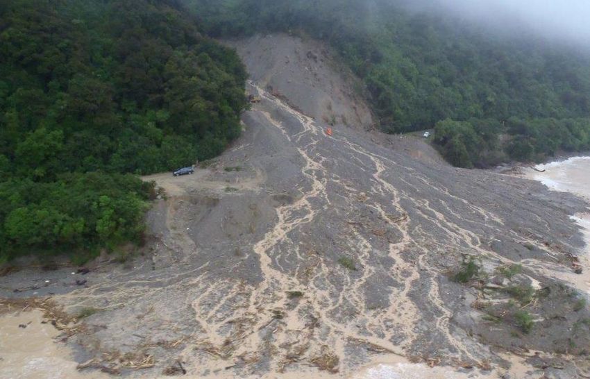
FOREWORD
FROM THE CHAIRMAN
Chairman Tony Kokshoorn
Joint Standing Committee
This is the third generation Group Plan for the West Coast
Changes made through the review include an update to
Civil Defence Emergency Management (CDEM) Group.
the hazard scape and change of priorities in the risk
Over the life of the last Group Plan a strong focus was on
profile; risk reduction reflecting more of a consistent
growing the understanding of the hazards and risks faced
regional approach; alignment of welfare management
by communities in the Region with much of the focus of
responsibilities to the national mandate on welfare
the regions emergency management fraternity being on
delivery; and updated administrative arrangements
response capability, growing the volunteer cadre and
reflecting the new entity of Civil Defence West Coast.
creating community response plans.
This Group Plan is a strategic document that outlines our
During that time an emphasis was placed on further
visions and goals for CDEM and how we will achieve them,
nurturing the already strong relationships developed
and how we will measure our performance. It seeks to:
across and within the Group at all levels, including the
emergency management, local government, and partner
agency sectors – this focus will continue under this Group
Plan. The principles of the Group of consistency, Strengthen relationships between agencies
accountability, best practice and support, have been, and involved in CDEM;
will continue to be the foundation of the West Coast
Group. Encourage cooperative planning and action
between the across the roles and functions of
One of the strengths of the West Coast CDEM Group is
hazard and emergency management and within
that of the experience that members of the Group have
local communities; and,
gained over recent times in responding to and recovering
from events that have occurred within the region e.g
Provide information on the hazards and risks in
floods and windstorms . This has been achieved through a
the CDEM Group, and document the principles of
planned and cooperative approach aligned to the Groups
operation within which agencies involved in
principles of operation. It is this level of cooperation and
CDEM agree to cooperate.
mutual support that will continue to assist communities to
prepare for, respond to and recover from emergencies
when it counts.
Over the life of this Group Plan there will be a strong focus APPROVAL
on the development of community resilience to ensure The West Coast Civil Defence Emergency Management
that, should the worst happen, we are all in a position to Group Plan is approved by the West Coast Civil Defence
respond to events and recover as quickly as possible. Emergency Management Group Joint Standing Committee
th
with effect from 15 November 2016 and replaces the Plan
th
Whilst this Plan addresses the statutory requirements of approved on 13 September 2010.
the Group, the day-to-day workings are detailed in the
CDEM Work Plan of the Group and the Annual Plans of The Plan will remain in effect until reviewed by the Group
members. The Coordinating Executive Group oversees the and either amended, revoked, replaced or left unchanged.
th
coordinated implementation of this Plan and the Work The review will begin no later than 30 September 2021.
Plan on behalf of the Group with the Joint Standing
Committee providing the governance and accountability
to the community.
th
Date 15 November 2016
2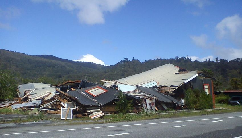
PLAN STRUCTURE

SECTION 1        Outlines the plan purpose, audience and structure and Plan development process.
Introduction     Provides an introduction to the West Coast CDEM Group, vision and goals.
                 Explains how the Group goals align with the National CDEM Plan and Strategy.

SECTION 2        Outlines the context for the West Coast CDEM Group area; a summary of the natural,
                 social, built and natural environments.
Risk Profile
                 The hazards that could impact on the CDEM Group, likelihood, and consequences.

SECTION 3        Frameworks, processes, and responsibilities to achieve long term risk reduction.
Reduction        The principles for risk reduction within the West Coast CDEM Group.
                 Risk reduction objectives and the methods by which they will be achieved.

SECTION 4        The capabilities and resources of CDEM agencies and stakeholder organisations.
Readiness        An overview of community readiness (awareness and preparedness).
                 Objectives and methods for improving readiness.

SECTION 5        The CDEM Group’s response principles, objectives, priorities, information flows and the
                 organisational framework that will be used in responding to emergencies.
Response
                 Response roles, functions, responsibilities, and relationships.
                 Processes for emergency escalation and declaring states of emergency.

SECTION 6        The planning arrangements, frameworks, structures, responsibilities and processes for
                 helping the community to recover from an emergency.
Recovery
                 The transition from response to recovery, and the Recovery Managers role.
                 Financial arrangements and the recovery exit strategy.

SECTION 7        The basis for monitoring and evaluation of the CDEM Group Plan.
Monitoring and   The method of measuring achievement of objectives for Plan reviews
Evaluation       Legislative compliance monitoring.

SECTION 8        Management and governance of the provision of CDEM on the West Coast.
Management and   Roles and responsibilities of the CDEM Group, CEG members, and the Group Emergency
Governance       Management Office.
                 Key appointments and Group funding arrangements.

                                              i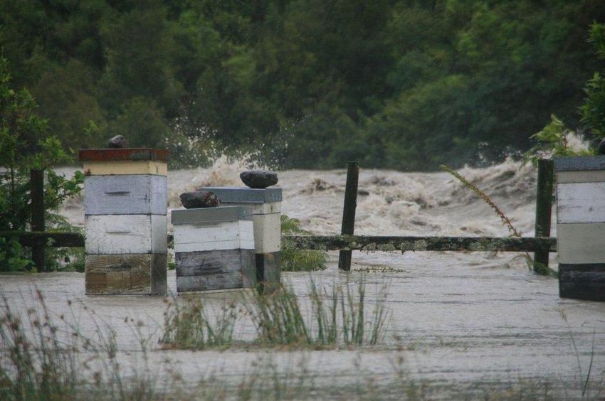
TABLE OF CONTENTS

PLAN STRUCTURE ...................................................................................................................................................... 2
TABLE OF CONTENTS ................................................................................................................................................. ii
GLOSSARY OF TERMS ................................................................................................................................................ v
KEY APPOINTMENTS ................................................................................................................................................ vi

1. INTRODUCTION .................................................................................................................................................... 1
        1.1 Plan Development and Approval...........................................................................................................1
        1.2 Composition and area of the CDEM Group ...........................................................................................1
        1.3 Plan Context ..........................................................................................................................................2
        1.4 Vision and Goals ....................................................................................................................................4

2. RISK PROFILE ......................................................................................................................................................... 7
          2.1 Introduction to the Risk Profile .............................................................................................................7
          2.2 CDEM Group Environment ....................................................................................................................7
          2.3 CDEM Group Hazardscape ..................................................................................................................12
          2.4 Risk Analysis and Evaluation................................................................................................................16

3. REDUCTION ......................................................................................................................................................... 19
        3.1 Introduction to Reduction ...................................................................................................................19
        3.2 Statutory and Policy Framework .........................................................................................................19
        3.3 Reduction Principles ............................................................................................................................19
        3.4 Focus for Reduction.............................................................................................................................19
        3.5 Objectives ..............................................................................................................................................1

4. READINESS .......................................................................................................................................................... 23
         4.1 Introduction to Readiness ...................................................................................................................24
         4.2 Focus for Readiness .............................................................................................................................24
         4.3 Objectives ............................................................................................................................................24
         4.4 Community Readiness .........................................................................................................................25
         4.5 Group Readiness: Staff Capacity and Capability..................................................................................26
         4.6 CDEM Group Readiness .......................................................................................................................27
         4.7 Group Readiness: Plans and Procedures .............................................................................................28
         4.8 Warnings .............................................................................................................................................29
         4.8.1 National Warning System .................................................................................................................29

5. RESPONSE ........................................................................................................................................................... 32
        5.1 Introduction to Response ....................................................................................................................32
        5.2 Response Principles .............................................................................................................................32
        5.3 Objectives ............................................................................................................................................32
        5.4 Levels of Response ..............................................................................................................................33
        5.5 CDEM Emegency Coordination Centres ..............................................................................................34
        5.6 Other Agency Roles and Responsibilities ............................................................................................35
        5.7 Emergency Communication Systems ..................................................................................................35
        5.8 Other Response Functions and Processes ...........................................................................................36

6. RECOVERY ........................................................................................................................................................... 39
        6.1 Introduction to Recovery ....................................................................................................................39
        6.2 Transition from Response to Recovery ...............................................................................................39
        6.3 Objectives ............................................................................................................................................39
        6.4 Structure and Staffing Requirements ..................................................................................................39
        6.5 Recovery Processes .............................................................................................................................41
        6.6 Recovery Methods and Tools ..............................................................................................................42

                                                                                      ii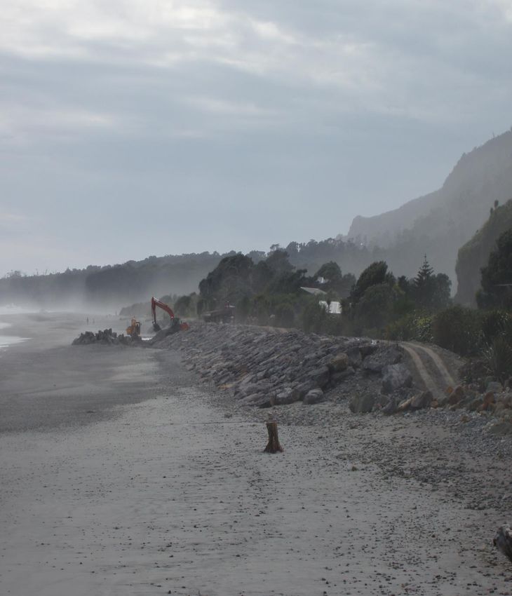
7. MONITORING AND EVALUATION ........................................................................................................................ 43
        7.1 Introduction ........................................................................................................................................44
        7.2 Summary of the Objectives and Tasks ................................................................................................44
        7.3 Biannual Work Programme .................................................................................................................46
        7.4 Monitoring/Evaluation Process ...........................................................................................................46

8. MANAGEMENT AND GOVERNANCE .................................................................................................................... 48
       8.1 Structure and Members of the CDEM Group:Joint Standing Committee ...........................................48
       8.2 Powers, Obligations, and Functions ....................................................................................................48
       8.3 Members of the Coordinating Executive Group..................................................................................48
       8.4 Administering Arrangements ..............................................................................................................49
       8.5 Delegated Authorities, Functions, and              Powers ..............................................................................50
       8.6 Financial Arrangements.......................................................................................................................51
       8.7 Cooperation with other CDEM Groups ...............................................................................................52

APPENDICES ............................................................................................................................................................ 55
       Appendix 1: CDEM Group Membership ....................................................................................................55
       Appendix 2: Group Plans and Standard Operating Procedures ................................................................55
       Appendix 3: Delegations ...........................................................................................................................56

                                                                                      iii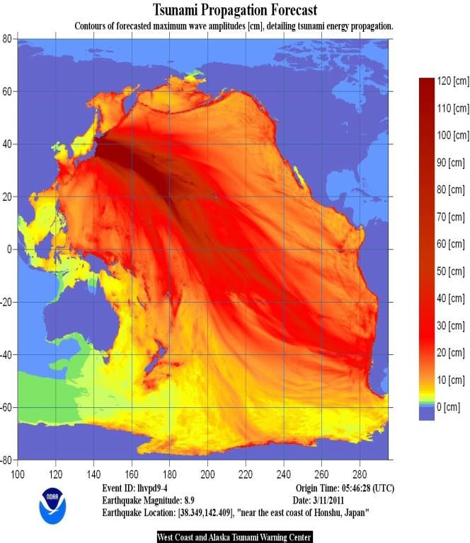
Record Of Amendments

Date Amended           Amendment        Page Reference

                                   iv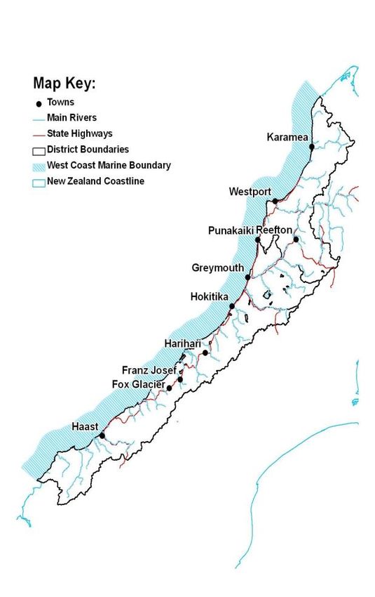
v
Glossary of Terms
Commonly used terms and abbreviations found throughout
the Plan.
4Rs: Four areas of emergency management: Reduction, epidemic, failure of or disruption to an emergency
Readiness, Response, and Recovery. service or an lifeline utility, or actual or imminent
attack or warlike act; and 2. Causes or may cause
The Act: The Civil Defence Emergency Management Act
loss of life or injury or illness or distress or in any
2002.
way endangers the safety of the public or property
CDEM Group: Civil Defence Emergency Management in New Zealand or any part of New Zealand, and 3.
Group established under section 12 of the Act. Unless Cannot be dealt with by emergency services, or
otherwise stated in the Plan, the Group refers to the West otherwise requires a significant and coordinated
Coast CDEM Group which is a joint standing committee response under the Act.
with membership comprising the Mayoral representatives
Emergency Services: The New Zealand Police, New
from the Buller, Grey and Westland Districts, and the
Zealand Fire Service, National Rural Fire Authority,
Chairperson of the West Coast Regional Council.
rural fire authorities, hospital, and health
CEG: Coordinating Executive Group established under authorities.
section 20 of the Act whose functions include providing GECC/EOC: Group Emergency Coordination
advice to the CDEM Group and any sub-groups of the Centre/Emergency Operations Centre: An
CDEM Group; coordinating and overseeing as appropriate
established facility where the response to an event
the implementation of decisions of the Group by the Group
may be managed and supported.
CDEM Office or by individual members; and overseeing the
implementation, development, maintenance, monitoring, Lead Agency: The organisation with the legislative
and evaluation of this Plan. authority; or because of its expertise and resources,
agreed authority; primarily responsible for the
CIMS: Coordinated Incident Management System is the
control of an incident or emergency.
nationally agreed and recognised response mechanism for
interagency response to provide command, control, and Lifeline Utility: An entity named in or described in
coordination of incidents, emergencies, and disasters. section 1 of the Act.
Declaration: A Declaration allows the Controller and others Local Authority: Means a Regional Council or
access to statutory powers with the purpose to grant District Council.
people the necessary authority to protect life and property MCDEM: Ministry of Civil Defence and Emergency
in extraordinary emergency events. The rationale for Management. MCDEM provides the leadership,
declaring a state of emergency is: strategic guidance, national coordination, and the
an emergency event has occurred or may occur; facilitation for activities across the CDEM sector and
the safety of the public or property is endangered; across all 4Rs.
loss of life, injury, illness, or distress may be caused; or,
Regional Significance: Due to the magnitude or
usual services are inadequate to deal with the
geographic spread of the incident i.e. an Alpine Fault
emergency.
Earthquake, one or more local EOCs has been
Emergency: As defined under the Act: 1. Is the result of any activated to manage the emergency, which now
happening, whether natural or otherwise, including, requires GECC coordination or critical resources; or
without limitation, any explosion, earthquake, eruption, a warning of a significant event that will have a
tsunami, land movement, flood, storm, tornado, cyclone, regional impact has been received; or Coordinated
serious fire, leakage or spillage of any dangerous gas or assistance is required to support an adjoining CDEM
substance, technological failure, infestation, plague, Group.
v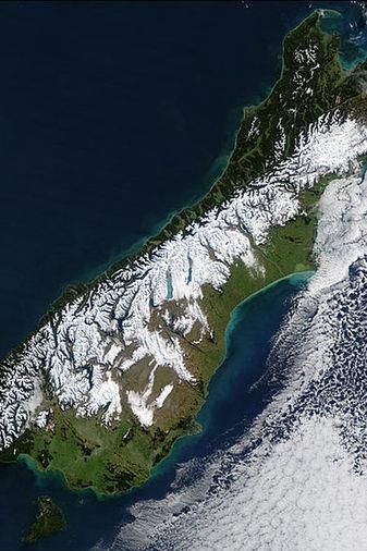
vi

Key Appointments

Group Controllers:           Chris Raine
                             Chris Pullen
                             Mike Meehan
                             John Canning

Group Recovery Manager:       Rob Daniel
                              Chris Pullen

Group Lifeline Coordinator    Rob Daniel

Group Welfare Manager         Claire Brown

Local Controllers:

Buller District Council
Local Controllers:           Bob Dickson
                             Chris Coll
                             Craig Scanlon

Grey District Council
Local Controllers:           Allan Wilson
                             Steven May
                             Doug Griffen

Westland District Council
Local Controllers:           Tanya Winter
                             Chris Pullen
                             Mark Davies

                                             vi
vii
PART 1
INTRODUCTION
This is the Civil Defence Emergency Management (CDEM)
Group Plan for the West Coast Region
vii1. Introduction
The Civil Defence Emergency Management (CDEM) Act 2002 (the Act) required the establishment of CDEM Groups –
made up of local authorities within the region working in partnership with emergency services, lifeline utilities, and
others to deliver CDEM at the local level.
Every CDEM Group is required to prepare a plan to describe the Group’s CDEM arrangements and how these
arrangements build on the national framework for CDEM in New Zealand. This Plan has been developed in line with the
Directors Guideline on CDEM Group Plan Review to assist in obtaining national consistency across Group Plans.
This Plan has been developed in consultation with the emergency management sector, been made available for public
submission, and submitted to the Minister of Civil Defence for comment prior to approval by the West Coast CDEM
Group.
1.1 Plan Development and Approval
This CDEM Group Plan is the third edition for the West
Coast CDEM Group. It has been developed in consultation
with the Coordinating Executive Group (CEG) and other
key agencies.
The Draft Plan was publicly notified in May 2016 and the
final revised Plan was approved by the West Coast CDEM
Group in November 2016 taking effect from that time. The
Plan will remain in effect for five years from the date of
approval until reviewed by the Group and either amended,
revoked, replaced or left unchanged.
1.2 Composition and area of the CDEM Group
The West Coast CDEM Group comprises the three
territorial authorities and the Regional Council of the
West Coast region. These are:
Grey District Council;
Westland District Council; and the,
West Coast Regional Council.
Buller District Council
The landward boundaries of Buller, Grey, and Westland
District Councils and the seaward boundary of Regional
Council constitute the boundary of the CDEM Group. The
Figure 1: West Coast CDEM Group Area
seaward boundary of the CDEM Group is the Regional
Councils 12 nautical mile boundary.
11.3 Plan Context
1.3.1 Statutory Requirements
This Plan is a statutory requirement of the CDEM Act 2002 (section 48). The Act requires that Group plans must not be
inconsistent with the National CDEM Strategy (2007) and the National CDEM Plan. Figure 2 shows the CDEM
framework and the relationship between the plans.
Figure 2: The New Zealand CDEM Framework
1.3.1.1.The CDEM Act
Below is the intent of the Act.
(a) improve and promote the sustainable (d) require local authorities to co-ordinate, through
management of hazards (as that term is defined in regional groups, planning, programmes, and
this Act) in a way that contributes to the social, activities related to civil defence emergency
economic, cultural, and environmental well-being management across the areas of reduction,
and safety of the public and also to the protection readiness, response, and recovery, and encourage
of property; and co-operation and joint action within those regional
groups; and
(b) encourage and enable communities to achieve
acceptable levels of risk (as that term is defined in (e) provide a basis for the integration of national
this Act), including, without limitation,— and local civil defence emergency management
planning and activity through the alignment of local
(i) identifying, assessing, and managing risks; and planning with a national strategy and national plan;
and
(ii) consulting and communicating about risks; and
(f) encourage the co-ordination of emergency
(iii) identifying and implementing cost-effective risk management, planning, and activities related to
reduction; and civil defence emergency management across the
wide range of agencies and organisations
(iv) monitoring and reviewing the process; and preventing or managing emergencies under this Act
and the Acts listed in section 17(3).
(c) provide for planning and preparation for
emergencies and for response and recovery in the
event of an emergency; and
21.3.2 The 4R’s Principles
The Act requires that an integrated risk management approach be taken when dealing with hazards. This integrated
approach is often described by the four areas of activity, known as the ‘4Rs’.
Reduction: Identifying and analysing long term risks to human life and property from
hazards; taking steps to eliminate these risks if practicable, or reducing the magnitude of
their impact and the likelihood of their occurring.
Readiness: Developing operational systems and capabilities before a civil defence
emergency happens; including self-help and response programmes for the general public,
and specific programmes for emergency services, lifelines utilities, and other agencies.
Response: Actions taken immediately before, during or after a civil defence emergency to
save lives and protect property, and to help communities recover.
Recovery: The coordinated efforts and processes to bring about the immediate, medium-
term, and long-term holistic regeneration of a community following a civil defence
emergency.
Local authorities and the regional council work together in a number of areas on behalf of their communities in some
specific areas e.g RMA planning,river control and bullding consenting as examples.These are all functions of CDEM in
the area of risk reduction.
A typical example for readiness is community response planning, occuring across West Coast communities where
CDEM agencies determine and prioritise local hazards , risks and consequencies, with communities, create an
integrated readiness /response system with community volunteers and emergency response agencies and formulate
local response and recovery plans .
1.3.3 Plan Purpose
The broad purpose of this Plan is to enable the effective and efficient management of those regionally significant
hazards and risks for which a coordinated and integrated approach is required by agencies in support of people and
communities throughout the region. The Plan sets out a strategic direction, Group objectives, and a framework for
continuous improvement.
The CDEM Plan seeks to:
Strengthen relationships between agencies involved in CDEM;
Encourage cooperative planning and action between the across the roles and functions of hazard and emergency
management and within local communities; and,
Provide information on the hazards and risks in the CDEM Group, and document the principles of operation within
which agencies involved in CDEM agree to cooperate.
31.4 Vision and Goals
1.4.1 National CDEM Goals
CDEM Groups are the mechanism by which the Crown can achieve its own visions, goals, and objectives (refer Table 1).
Careful consideration has been undertaken to ensure that the Group’s direction supports these national goals.
1.4.2 West Coast Group Vision and Goals
The vision of the West Coast CDEM Group reflects the national vision and is:
‘To build a resilient and safer West Coast with
communities understanding and managing their hazards and risk.’
The goals of the Group set out what the Group would like to achieve, encapsulating the Vision above, and assisting with
directing work streams in CDEM on the West Coast. The goals for the region are drawn from the national goals and are:
1. Increasing community awareness, understanding, preparedness, and participation in civil defence emergency
management.
2. Reducing the risks from hazards in the region.
3. Enhancing the region’s ability to respond to emergencies.
4. Enhancing the region’s ability to recover from emergencies.
Civil defence training at Franz Josef
41.4.3 How this Plan supports the National Plan Goals
Table 1 demonstrates the linkages between the actions of the Group and the goals and objectives described at a
national level.
CDEM Goals National CDEM Objectives West Coast CDEM Group Objective
1a) Increasing the level of community awareness Increase level of business and community
and understanding of the risks from hazards. awareness through public education and
Readiness 1b) Improving individual, community, and consultation
1. Increasing community business preparedness.
Improve community participation and
awareness, 1c) Improving community participation in CDEM. preparedness through community-based
understanding
1d) Encouraging and enabling wider community planning.
preparedness and
participation in hazard risk management
participation in CDEM
decisions.
2a) Improving the coordination, promotion, and Improve the understanding of the hazardscape
accessibility of CDEM research. of the West Coast and the associated risks and
Reduction 2b) Developing a comprehensive understanding of consequences.
2. Reducing the risks from New Zealand’s hazardscape.
Work towards the long-term, strategic
hazards 2c) Encouraging all CDEM stakeholders to reduce
reduction of risks from hazards through
the risks from hazards to acceptable levels. collaborative planning with stakeholders.
2d) Improving the coordination of government
policy relevant to CDEM.
3a) Promoting continuing and coordinated Continue to increase the profile and delivery
professional development in CDEM, capability of CDEM on the West Coast.
Response 3b) Enhancing the ability of CDEM Groups to Enhance professional development for all
3. Enhancing capability to prepare for and manage civil defence emergency management personnel through
manage civil defence emergencies. training, exercises, and learning from other
emergencies 3c) Enhancing the ability of emergency services to CDEM Groups in line with the CDEM
prepare for and manage civil defence Competency Framework.
emergencies. Strengthen the coordination and cooperation
3d) Enhancing the ability of lifeline utilities to amongst all relevant sectors in planning for and
prepare for and manage civil defence responding to an emergency
emergencies. Develop and maintain appropriate
3e) Enhancing the ability of government agencies documentation to describe key activities,
to prepare for and manage civil defence functional responses, and protocols in support
emergencies. of the CDEM Group Plan between all member
local authority and partner organisations.
3d) Improving the ability of government to
manage an event of national significance. Provide effective warning systems to enable
agencies and the community to respond rapidly
to a potential event.
Establish and maintain effective and resilient
inter-agency communication systems
Recovery 4a) Implementing effective recovery planning and Strengthen recovery capability and capacity
activities in communities and across the social, across all agencies and the wider community
4. Enhancing capability to economic, natural, and built environments.
recover from civil
4b) Enhancing the ability of agencies to manage
defence emergencies
the recovery process.
Table 1: Relationship of the National Strategy and Plan to the West Coast CDEM Plan
5PART 2
RISK PROFILE
Developing a clear understanding of the vulnerabilities and
consequences of hazards within the region is fundamental to
the context of the CDEM Group.
62. RISK PROFILE
2.1 Introduction to the Risk Profile
This Section provides a risk management context for Power W et al Review of tsunami Risk facing
the West Coast CDEM Group. Developing a clear New Zealand (2015) GNS Science Consultancy
understanding of the vulnerabilities and consequences Report 2015/38
of hazards within the Group is fundamental to guiding
Robinson T. R. and Davies T. R. H(2013) Potential
the level of activity and effort applied across the 4Rs.
geomorphic consequences of a future great (Mw =
This Section therefore provides the foundation upon
8.0+) Alpine Fault earthquake, South Island, New
which CDEM reduction, readiness, response, and
Zealand. Natural Hazards and Earth System Sciences
recovery activities are built. New studies on tsunami
risk and land sliding have also been added.
The risk profile provides a context for the CDEM
This Section is also supported by additional material
Group – a snapshot of the people, the land, the
which is not contained within the Plan. This material
buildings/infrastructure, and the economy. These
includes the risk analysis information developed for the
elements are commonly referred to as the social,
third CDEM Group Plan and the 2006 Lifeline Reports
natural, built, and economic environments. The
and Grey Recovery plan 2012 based on the effects of
combination of these environments helps the CDEM
an Alpine Fault Earthquake:
Group to develop an understanding about the
Hazards Register of the West Coast Region (2010).
specific combination of factors that either cteate risks
West Coast Regional Council.
from.or that support resilience to hazards within the
Dewhirst, R., Elms, D., & McCahon, I. (2006). West West Coast. Each environment may include the
Coast Engineering Lifelines Group Study: Alpine following components:
Fault Earthquake Scenario. West Coast Regional
Council.
1. Social environment: the population total
Dewhirst, R., Elms, D., & McCahon, I. (2006). Buller and distribution, social structures,
District Council Lifelines Study: Alpine Fault vulnerable groups, ethnic diversity, and
Earthquake Scenario. Buller District Council. tangata whenua.
Dewhirst, R., Elms, D., & McCahon, I. (2006). 2. Built environment: residential,
Westland District Council Lifelines Study: Alpine commercial, key lifeline utilities, and
Fault Earthquake Scenario. Westland District industrial and agricultural infrastructure.
Council.
3. Economic environment: the regional
Dewhirst, R., Elms, D., & McCahon, I. (2007). Grey economy, growth, employment income,
District Lifelines Utlity Plan: Communities and tourism and resources.
Council. Alpine Fault Earthquake Scenario &
4. Natural environment: the geography,
Lifelines Vulnerability Assessment. Grey District
geology, topography, ecosystems, and
Council.
climate.
2.2 CDEM Group Environment
2.2.1 Social Environment
General Population
The West Coast region had a usually resident population of 32,148 people at the 2013 Census, making it the least
populous region in New Zealand with less than 1% of the Country’s population. Between the 2006 and 2013 censuses,
the population increased by 2.6%, or 822 people. The West Coast also has the lowest population density of any region
in New Zealand at 1.4 people per square kilometre compared to the national average of 16.
7The region is rural in nature due to its small and widely dispersed
population. There are three main urban areas on the West Coast;
Westport, Greymouth, and Hokitika which provide the primary service
infrastructure in each of the districts.
The region’s largest ethnic group is European/New Zealander making up
91% of the total population, Maori 10.5% and Asian and Pacific peoples
making up 3%.
The regional age demographic information is also based on 2013 Census
data and is specific to the West Coast region. The West Coast has 16.1%
of its population aged 65 years and over. This is compared to the national
average of 14.3%.
The median income on the West Coast is $26,900, compared to the
national median of $28,500 for the rest of the Country.
Vulnerable Groups for CDEM emergencies include;
Mäori
Pacific Islanders
other ethnic communities where English is not spoken or is a second language
remote / isolated communities
the aged and/or infirm, including those within aged care facilities
people with special health needs, including those within disability residential facilities
Children and young people
Low income households
Medically and chemically dependent
People with sensory or physical impairment
Tourists, freedom campers , unpredictable in area or location
New residents unfamilier with the West Coast climate
During summer at any one time there can be over 10,000 tourists on the West Coast. In Franz Josef there can be 4000
tourists overnight with a residential population of 400. At any time there can be many freedom campers along the
West Coast who may have limited access to hazard warnings, driving on unfamiliar roads and English is a second
language for communication.
2.2.2 Built Environment
Number of dwellings District Occupied Unoccupied % Occupied
There are approximately 13,793 occupied dwellings and Buller 4,611 954 83%
Grey 5,460 969 85%
2,793 (17%) unoccupied dwellings on the West Coast. Westland 3,732 870 81%
Total 13,793 2,793 83%
The main base hospital is in Greymouth with smaller hospital facilities at Reefton , Westport and medical centres at
Hokitika,Whataroa,Franz Josef and Haast.The resource lists of medically dependent households and vulnerable clients
are held by the West Coast District Health Board . The list of Civil Defence Centres which may serve a welfare function
are held by each local authority CDEM organisation.
8Lifeline Infrastructure Broad band technology is limited outside the main
Each of the Territorial Authorities of the region is towns.The Rural Broadband initiative is being rolled
responsible for delivering lifeline services in varying out across parts of the West Coast with fibreoptic
degrees to their local communities. These services include cabling being laid along State highways.
local road networks, potable water supplies, and
sewerage and wastewater services. Detail on the extent of It is highly likely that cellular and landline technology
the service and the location of infrastructure is maintained will be lost folllowing a major earthquake affecting the
by each Territorial Authority. West Coast.
There is a West Coast Lifelines Utility Group comprising There are also a number of VHF radio and HF networks
representatives from local authorities, energy, utilised throughout the region by agencies to provide
telecommunications, railways, fuel transport, Westland backup to telephone and cellular systems. Some CDEM
Milk Products which meets three monthly to strengthen community response areas utilise UHF/VHF simplex
resilience actions along the West Coast. In addition a radios within their local communities back to their local
study to identify lifeline assets, pinch points, Civil Defence Centre.
interdependencies and priority areas is planned for within
the lifetime of this plan. Energy
Estimates for electricity demand for the region predict
Telecommunications a slow increase in demand over the next ten years,
Telecommunications network providers in the region following an initial reduction due to closure of the
include Spark, 2 Degrees and Vodafone. Globe Mine at Reefton and the Holcim Cement Plant at
Westport . Peak demand on the West Coast is currently
65% percent of households on the West Coast 50 MW and the 2015 Transpower annual planning
have access to the internet, compared with document predicts 80MW demand by 2030.
72.8% of households throughout New Zealand.
Existing West Coast generation totals 29 MW, (small
On the West Coast, 68.4% of households have hydro schemes at Lake Brunner and South Westland)
access to a cell phone, compared with 79.3% of means just under half of the electricity used on the
households for New Zealand as a whole. West Coast is imported from outside of the region.
Significant parts of the West Coast do not have access to
cell phone coverage due to topography e.g south of Fox HOUSEHOLD ACCESS TO PHONES, INTERNET AND FAX MACHINES ON THE
Glacier to Makarora, parts of the Coast Road between WEST COAST, 2013 CENSUS
Greymouth and Westport and in many areas cellular WEST COAST (%) NEW ZEALAND (%)
coverage can be poor reducing the ability to make NO ACCESS 3.1 1.5
calls.The only satisfactory cellphone coverage is in the CELL PHONE 68.4 79.3
main towns of Westport, Greymouth and Hokitika. As a TELEPHONE 79.9 81.1
result West Coast residents are reliant on landline FAX MACHINE 12.1 13.8
infrastructure to make calls. INTERNET 65.0 72.8
NOTE: HOUSEHOLDS CAN ACCESS MORE THAN ONE TYPE OF
TELECOMMUNICATION DEVICE; THEREFORE PERCENTAGES DO NOT ADD UP
TO 100.
9Transport Food
The State Highway system is critical to the West Coast. For Food and other ‘fast moving consumer goods’ are
the majority of the region there is the only road to get trucked into the region on a just-in-time logistical
from one town to another (State Highway 6 – Haast to approach, similar to fuel. This also applies to other
Westport and inland to Murchison). Links to other regions stocks such as hardware required for making repairs
are crucial for the West Coast from both an economic and following a major event.
Lifelines Utilities perspective. The importance of the State
Highway links east via State Highway 73 and Arthur’s Pass, 2.2.3 Economic Environment
and via State Highway 7 and Lewis Pass; to the north via Business
State Highway 6 and Hope Saddle; and to the south via
In the last ten years the West Coast which had
State Highway 6 and the Haast Pass are critical to retaining
emerged as one of the country’s fastest growing
access to the region. A number of bridges carry
regional economies, has had a downturn in the world
telecommunication cabling and in some cases water
commodity prices which have impacted on minerals
pipes & electricity . The frequent rain events that impact
extraction coal and gold and agriculture (dairying), but
the coast will at times induce flooding and slips along
tourism continues to thrive. The performance of the
parts of the network.
regional economy has more or less matched the
national economy despite the well-publicised
There is a rail link from the West Coast linking the three
downturn.
main urban areas with the Midland rail line. The Alpine
Fault crosses the Midland rail line at Inchbonnie. The
Minerals extraction: Mining on the West Coast is
region has two airports in Westport and Hokitika providing
dominated by coal production in Buller and a limited
daily flights to Wellington and Christchurch respectively
amount of gold mining. The large reserves of high
(runway lengths of 1280m and 1314m respectively). An
quality coal and gold give the West Coast industry a
airport in Greymouth can accommodate smaller aircraft
competitive advantage. Coal mining is now not
(runway length of 1091m). These airports can undertake
regarded to be the key contributor to future economic
night flights.Two river ports in Westport and Greymouth
opportunities for the region owing to the slump in
provide sea access but are particular in the type of vessel
world coal prices. In 2014 Buller had the strongest
they can accommodate due to the challenges presented
reliance in mining with 9.5% of the district employment
by being river ports. Jackson Bay south of Haast has a
involved in the mining industry, Grey district has had a
deep water port and wharf specifically useful for larger
downturn in mining employment in recent years with
ships i.e cruise liners and cargo vessels.
now only a small number employed at the Solid Energy
and Roa Coal opencast mines.
Fuel
Fuel for the region is trucked in via State Highway 73 and
Agriculture: Dairy farming is the leader in this sector
State Highway 6. There is no bulk storage on the West
and has experienced rapid growth over the last ten
Coast other than that which is held by service stations and
years. Over this time, the increase and expansion in
private users. A Fuel Storage Report was undertaken in
dairy herds on the West Coast has occurred faster than
2008 to identify fuel storage locations, the primary routes
any other region in New Zealand. Westland Milk
of transport in, and also investigated alternative methods
Products processes milk products for almost all of the
for bringing fuel into the West Coast should normal
dairy farming community and is located in Hokitika. It is
transport routes be disrupted. This fuel study is being
a significant employer with approximately 400 people
updated in 2016 to determine locations of rural fuel sites.
employed.
There are also limited oil lubricants and gas supplies on
the West Coast .These are shipped by road from
To Tourism: The tourism sector and its related industries
Christchurch or Wanaka (South Westland).Service stations
play an increasingly important role in the West Coast
at Westport, Reefton and Greymouth have alternative
economy. Tourism numbers are growing with the
power supplies.e.g. generator capability. Local CDEM
percentage of international visitors increasing. The
SOPS indicate which agencies will get priority access to
most popular destination is the Glacier Country
fuel duing a fuel crises or emergency.
encompassing Franz Josef and Fox Glaciers (600,000
10visitors per annum) and the South Westland World the distance from the source to the sea seldom
Heritage Area. With the increasing popularity of cycling, exceeding 50km.
the West Coast Wilderness Trail is also becoming a
significant attraction. The second most visited area is The region includes a series of mountain ranges,
Punakaiki. Approximately 84% of the region is under the notably the Southern Alps which the Alpine Fault runs
administration of the Department of Conservation, who beneath. The mountain ranges provide a natural buffer
have area offices and depots throughout the West Coast to weather systems traveling west to east which aid in
11.2% of Westland district jobs are supported by tourism. producing higher than average rain fall on the western
side.
Impact of hazards on the economic environment
A major event will have a significant impact on the Climate
economic environment of the West Coast. For example, The region has a comparatively mild climate with
the effects of major flooding or an Alpine Fault earthquake average summer and winter temperatures. By national
are likely to result in access to various communities being and international standards, the West Coast receives a
cut for possibly significant lengths of time. This will result generous and reliable rainfall. Near the main divide,
in considerable economic impacts to the industries rainfall exceeds 8,000mm annually (with the Cropp
described above and may seriously threaten their viability. catchment receiving 13,000mm), reducing to 2,000mm
nearer the coast (with the mid-upper Grey Valley
2.2.4 Natural Environment having the lowest rainfall in the region). Rainfall also
decreases towards the north of the region.
Geography
The West Coast makes up 8% of New Zealand’s total land A low pressure area to the east of the South Island may
2
area (23,000 km) with approximately 0.8% of the promote an easterly airflow over the region. On these
country’s population living within the region. The region is occasions, particularly in winter, strong cold easterly
long and narrow situated between the Southern Alps on winds may descend down major river valleys. Climate
the east and the Tasman Sea in the west. The region change may accentuate rainfall events in future years.
extends over 600 kilometers between Karamea in the
north and Jacksons Bay in the south, further than the
distance between Auckland and Wellington. The West
Coast has over 600 kilometers of coastline susceptible to
erosion.
The West Coast is composed of a variety of rock types of
variable age. The old resistant granites and gneisses form
the bulk of the mountainous terrain to the north of
Greymouth. Younger schists and greywackes form the
alpine sequences to the east. Sedimentary rocks
throughout the region comprise sandstones, siltstones,
limestones and mudstones. These form scenic attractions
including the pancake rocks, limestone caves and karst
landscapes. Slope stability problems occur on a wide
variety of formations throughout the region. Failures may
be induced by intense rainfall or earthquakes, or a
combination of both.
Each of the three main urban areas, Westport, Greymouth,
and Hokitika are situated on the banks of major river
systems. Many smaller settlements are also situated on
river flat areas and or along the coastline. On the western
side of the Alps, rivers and streams are steeply graded with The Alpine Fault from space
112.2.5 Implications for the West Coast CDEM Group Environment
Implications of the West Coast’s regional profile for civil defence emergency management include;
A large geographical area with a dispersed population subject to a wide range of hazards.
Numerous rural communities that have the potential to become quickly isolated in an emergency because of their
remoteness and geography (State Highway 6 - Westland).
The vulnerability of some of the regions infrastructure (roads, power, and telecommunications) may impact on the
regions ability to recovery quickly following an event. The reliance on the State Highway network in particular for
the import and export of goods to and from the West Coast is a major implication should routes be severed for
extended periods of time.
Urban areas are situated near or adjacent to river systems.
An increasing elderly population.
Significant transient populations, particularly throughout Westland as a result of the tourism industry.
2.3 CDEM Group Hazardscape
Tornadoes
2.3.1 Natural Hazards
Tornadoes are relatively frequent occurrences affecting
The CDEM Group area is subject to many natural hazards
the entire region, although most reports have been
including meteorological hazards, earthquake, tsunami,
concentrated around the main coastal settlements. By
coastal erosion, and landslide. The most significant natural
international standards tornadoes on the West Coast
hazards to affect the West Coast and their consequences
are small scale, short duration events, although they
are described below.
have caused significant damage historically. The high
number of tornado reports from such a small and
Severe Storms
dispersed population base indicates that the West
Severe storms pose a risk in that they bring both intense
Coast is one of the most at risk regions in the country.
rainfall and wind, and increase the risk of landslides,
coastal erosion and flooding due to storm surges. Strong
Tornadoes are usually associated with thunderstorms
winds are commonly associated with storms that produce
arriving from a westerly aspect. The March 2005
flood events (i.e. westerly storms), and thus occur several
tornado in the Greymouth urban area resulted in
times a year. Although strong winds can occur from any
significant damage through the town. The
direction, the very strongest are from the South East. The
consequences of tornadoes are severe damage to
Easter Cyclone Ita event in 2014 resulted in wind damage
property and infrastructure, and possible injury and
throughout the region from downed trees, damaged and
death.
destroyed buildings.
Earthquake
River flooding
The West Coast is one of the most seismically active
Rainfall can result in river flooding and stormwater system
regions in the country with numerous active faults
overload. Flooding is the most common occurring natural
especially in the Paparoa Tectonic Zone and the South
hazard on the West Coast and has caused the most
Westland Shear Zone/Fiordland. However, the West
damage of all hazards. Telemetered river level recorders
Coast is dominated by the Alpine Fault, which extends
and high altitude rain gauges operate in the major
for nearly 500km through the entire region and beyond
catchments, providing an early flood warning system.
from Milford Sound to the Marlborough Sounds. It is
There is no seasonal trend for flooding, therefore flood
one of the world’s major active faults, comparable in
events can be expected at any time of the year and at any
size to the San Andreas Fault in California and the
location throughout the region. River flooding has resulted
Anatolian Fault in Turkey. None of the West Coast
in some river control systems developed throughout the
regions settlements are located far from the Alpine
region. The main rivers of concern in the region include
Fault or other active faults (Franz Josef township is
the Grey, Buller, Karamea, and Waiho Rivers.
located directly on the fault), and most of these
12settlements are at risk from other natural hazards
associated with large magnitude earthquakes including
liquefaction, tsunami, seiches, landslides, and ground
surface rupture.
Highly destructive earthquakes in 1929 (Murchison M7.8)
and 1968 (Inangahua M7.1) were centred on local faults in
the Paparoa Tectonic Zone independent from the Alpine
Fault. Ruptures of the Alpine Fault will cause catastrophic
earthquake damage along the fault and probably much
further afield. Recent research by GNS indicates that the
Alpine fault is a regular mover and averages a major
earthquake every 250-300 years. The last great
earthquake was 299 years ago. There is a high probability
that the Alpine Fault will rupture in the next 50-100 years.
The consequences to the built environment become
progressively more severe towards MM10, and it is
anticipated that the human health and safety, social, and
economic damage expected would mirror the damage to
the built environment. Image showing Tsunami wave propogation forecast
Tsunami nothing for those of local source.
The West Coast coastline is vulnerable to tsunami hazard,
however recent research has been undertaken to The impacts of tsunami events vary widely depending
ascertain what this risk may entail. (Power 2015).This risk on the type and size of the event, local topography,
is anticipated to be lower on the West Coast compared to and in the case of human life and safety, the time of
other North Island regions.Small tsunami have been day. Should a wave be generated which is large enough
recorded in 1868, 1877, 2009 and 2010 on the West to have an impact, typical consequences include the
Coast. All low lying coastal margins are potentially at risk loss of life and injuries from debris, and the
from both local and distant source tsunami. Tsunami accompanying social consequences and damage to
hazard potentially poses a threat to the region as most of infrastructure, particularly buildings near the coast and
the region’s population, assets, and economic and along river banks near the coast, and to transportation
infrastructural bases are located in the coastal zone and coastal utilities. There are also likely economic
(particularly in the major urban areas of Greymouth, impacts to local business and industries, along with
Westport, and Hokitika which are located on low-lying damage to coastal ecosystems and changes to local
river delta mouths). Much of the region’s remaining coastal processes.
population live in smaller settlements in similar
coastal/river mouth environments. Landslides
Much of the West Coast is prone to landslides
Distant source tsunami are most likely going to be (Robinson 2015). Landslide hazards are highly
refracted tsunami waves generated by large earthquakes dependent upon the type and slope of the terrain, the
in South America as experienced as a result of the Chilean land use and vegetation cover, climate, and
earthquake on 27 March 2010. Recent earthquake activity susceptibility to seismic events. Landslides cause
near Samoa and Vanuatu in 2009 resulted in the second damage by direct impact and burial, landslide dams,
highest sea gauge level readings on the West Coast for all and slides falling into water bodies causing seiches. All
of New Zealand. However, in all of these instances, only of these events have been recorded in the Region.
relatively small increases in wave heights resulted. The Many of the regions settlements are partly located on,
warning time for tsunami is highly variable ranging with or at the base of unstable slopes e.g. Little Wanganui,
more than 10 hours for those of distant source to almost Granity-Hector, Punakaiki, Greymouth, Otira, Hokitika,
Blackball, Dobson, Reefton, and Franz Josef.
13The consequences of landslides are generally localised in 2.3.2 Technological hazards
scale, and relate mainly to damage to infrastructure Lifeline utilities failure
including roads, railways, farm infrastructure, and
Lifelines utilities are the essential infrastructure and
occasionally buildings. There have been 13 people killed by
services that support our communities. The hazards
earthquake and rainfall induced land slips since 1929,
associated with lifeline utilities failure are related to
therefore the potential for loss of life and injury, and
the inability of communities and organisations to carry
property and asset damage is high.
out ‘normal’ daily activities.
Coastal erosion
Lifeline utilities are commonly categorised as:
Coastal erosion is a long-term phenomenon affecting most
Energy: electricity supply and distribution, and fuel
of the region’s 600km coastline. Coastal erosion can be a
supply.
gradual process it can usually be planned for and effects
minimal. However, there are periods when coastal erosion Telecommunications: telephone land and cell
is more rapid and severe than normal and significant networks, radio, and televisions services.
damage can occur. The Regional Council has established Transportation: road and rail networks, airports
two coastal protection schemes at Punakaiki and Okuru. and ports.
The major centres of Greymouth, Westport, Hokitika, as Civil services: water supply, wastewater
well as Punakaiki have all been affected to varying reticulation, and stormwater networks.
degrees, as well numerous smaller coastal settlements
such as Granity and Rapahoe. Traditionally Hokitika and Within the region, lifeline utilities failure can either be
Punakaiki have had the most assets affected from severe a result of direct systems failure, or a consequence of a
coastal erosion phases. large-scale natural hazard event. The Regional Lifelines
Project 2006, based on the effects of a major Alpine
As the region’s population and asset base is located in the Fault Earthquake, found that lifelines utilities
coastal zone, the potential for localised damage to throughout the region are at serious risk of disruption.
infrastructure to occur from coastal erosion exists. The Project also found that there are
However, this is largely offset by the gradual nature of the interdependencies between lifelines utility ; one lifeline
hazard. Coastal erosion is not a hazard that presents a risk depending upon another. The lifelines utilities that are
to life and is unlikely to result in a CDEM response. most depended on by other lifelines utilities are fuel,
road networks, power, and communications.
Rural fire
Most regional fire studies in New Zealand place the West Electricity failure
Coast in a low hazard class because of the regions ample The West Coast is dependent on power for the
rainfall, high humidity, and relative lack of strong winds provision of essential services and maintenance of
during dry periods. However, some synoptic conditions everyday lifestyles. While some power is generated on
can lead to long dry spells that may lead to significant fire the Coast, the bulk is bought from the national grid and
danger. Consequently, scrub and bush fires may pose therefore transported into the region by wooden,
significant problems in some years. concrete pole structures and steel towers. The critical
consequences of electricity failure include impacts to
A wildfire threat analysis has been completed. Areas that health care in homes and hospitals where power is
are considered to be of a higher risk are around the critical, such as dialysis and surgery, inability to cook
Charleston and Whitecliff areas due to vegetation type. food and loss of perishable food stocks and the impact
The Okarito area is also considered to be of a higher risk to other lifeline services that rely on power such as
for the same reason. The slopes above Waimangaroa and water and fuel supplies, and sewage treatment. There
Granity are also at risk. would also be economic impacts on business and
industry such as farming and mining.
The consequences of rural fires are normally to
vegetation, infrastructure, conservation (habitat, natural The primary cause of large-scale system failure is most
character, and amenity values), and occasionally buildings likely to be as a result of an Alpine Fault or other large
rather than a direct threat to human life and safety on the scale earthquake centred in the region. Storm and
West Coast. flood events also present considerable risk to the
14You can also read