Who Owns the City? The privatisation of public land in Manchester - Greater Manchester Housing Action
←
→
Page content transcription
If your browser does not render page correctly, please read the page content below
Who Owns
                             the City?
                                 The privatisation of public land
                                                  in Manchester

Dr Tom Gillespie | University of Manchester and Dr Jonathan Silver | University of Sheffield

             Research conducted in partnership with Greater Manchester Housing Action

                                    Supported by the University of Manchester and ESRC
Executive Summary
Manchester is a city with historically high levels of public land ownership - the City Council owned
57.9% of land within its local authority boundaries in 1982. The city is currently experiencing a housing
crisis characterised by a shortage of affordable and social housing. In this context, there are growing
concerns amongst researchers, journalists and civil society groups that public land has been allocated
to private developers to build unaffordable apartments. However, there is a deficit of publicly accessible
information on which sites have been allocated and on what terms.
This report investigates the privatisation of public land in central Manchester. Our focus is on land
owned by Manchester City Council (hereafter ‘the Council’), and we pay particular attention to the
central wards of Piccadilly and Ancoats & Beswick that have experienced significant transformation
in recent years. Our aim is to establish whether public land ownership and use is transparent, whether
public land disposals have been good value for the public, and what type of city is being built using public
resources.
The authors obtained data on public land disposals from the Council using freedom of information
requests. We combined this with data from the UK Land Registry to identify who particular plots of
land have been allocated to. This data collection process has enabled us to highlight three major issues
regarding public land privatisation in Manchester.
The first issue is the lack of transparency around public land ownership and use in Manchester. There
is currently a lack of publicly available data on Council land disposals. In our view, information on how
public land is being allocated and on what terms should be freely and easily accessible to the public.
Greater transparency will enable public debate and democratic accountability around how Manchester’s
public resources should be used.
The second issue is the question of whether the Council is doing all it can to get value for money for
the public when disposing of its land assets. The available data suggests that the Council is leasing out
central urban land to developers at prices significantly below what the Council itself has paid for city
centre land. In some cases, it appears that the Council leased out prime plots of land to developers for
free (or for a nominal amount of £1). In our view, this raises important questions about the process
by which Council land is valued and allocated to private developers. We recognise that there may be
mitigating factors that explain why this Council land has a lower price. However, in the interests of
transparency and accountability, we invite the Council to explain to the public the valuation process in
relation to the land disposals highlighted in this report.
The third issue is the character of urban development that is enabled by public land privatisation. As
with other cities, Manchester is facing a housing crisis and a climate emergency, and there is a shortage of
both affordable and social housing and public green space in the city centre. Public land is an important
resource that could be used to address these social and environmental problems. However, the available
data suggests that public land is often leased out to developers in order to build luxury apartments
that are unaffordable to the majority of Manchester’s residents. In our view, greater transparency and
accountability over public land ownership and use will enable a much-needed public debate about the
future of urban planning and land use in the city.
Finally, the report suggests that the recently launched Liverpool Land Commission provides a model
for a more open, transparent and participatory approach to managing public land. We recommend that
a similar approach be adopted in Greater Manchester. In the city of Manchester, we call for a publicly
accessible website with records of all Council land disposals and ward-level public land audits led by
local councillors.

1
Contents
Executive Summary                                                    1
1.    Introduction                                                   3
2.    A brief history of public land in Manchester                   3
3.    Methods and data                                               4
4.    Case study: public land disposal and residential development in
      Ancoats and New Islington                                       6
5.    Other notable public land disposals in central Manchester     12
6.    Conclusions                                                   15
7.    Author contact details                                        16
8.    Acknowledgements                                              16
9.    Endnotes                                                      17
10.   References                                                    18

                                                                      2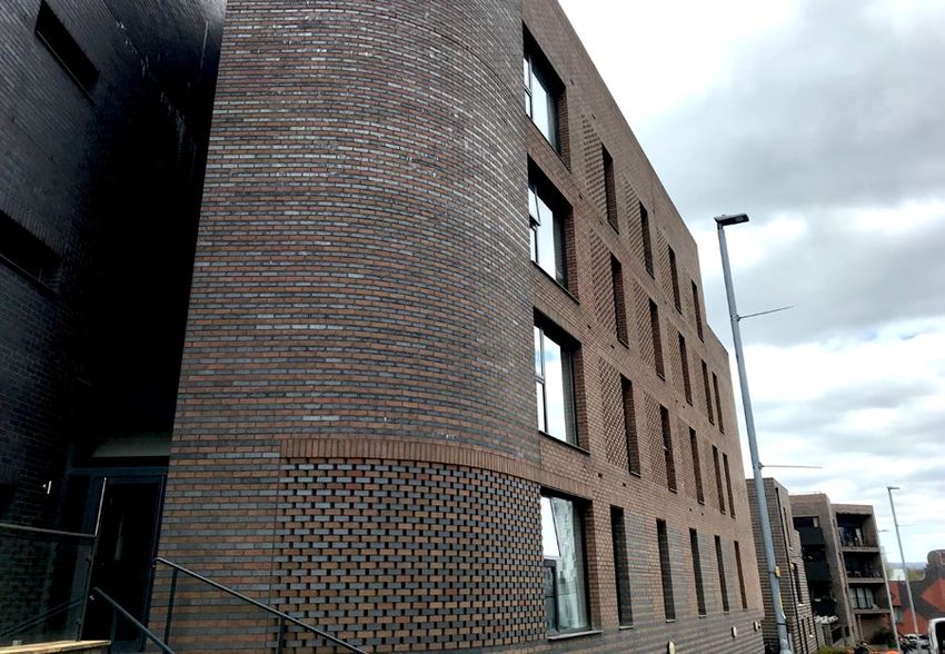
1.     Introduction
This report investigates the privatisation of public land in central Manchester. Our focus is on land
owned by Manchester City Council (hereafter ‘the Council’), and we pay particular attention to the
central wards of Piccadilly and Ancoats & Beswick that have experienced significant transformation
in recent years. Our aim is to establish whether public land ownership and use is transparent, whether
Council land disposals have been good value for the public, and what type of city is being built using
public resources.
First, we outline a brief history of public land in Manchester. Second, we provide an overview of the
methods and data used to understand public land disposals in central Manchester. We also discuss
the methodological challenges faced in researching public land privatisation and argue that there is a
lack of transparency around public land disposals in Manchester. Third, we use an in-depth focus on
the neighbourhood of Ancoats and New Islington to examine in detail what land has been disposed of,
the terms of these disposals and how this land has subsequently been redeveloped. Next, we discuss
some notable examples of public land disposal that fall outside our case study area of Ancoats and New
Islington. The report concludes by calling for greater transparency and democratic accountability to
ensure that the city’s public land assets are used to address social and environmental needs.

2.     A brief history of public land in Manchester
From the mid-19th century, Manchester City Council began to acquire land in order to create urban
parks and provide essential infrastructure in the rapidly growing industrial city. The scale and pace
of land acquisition increased dramatically in the early 20th century as the Council sought to address
urban poverty by clearing Victorian slums and building large public housing estates in both central
and peripheral areas. Council landholdings more than trebled during the interwar period from 1778.3
hectares in 1919 to 5594.7 hectares in 1939i. Public land acquisitions continued to exceed disposals all the
way until the 1970s, when the total amount of Council-owned land began to decline for the first time.
This was partly a reflection of a local shift in Council priorities away from slum clearance and public
housing construction. However, it was also a response to growing pressure from the Margaret Thatcher-
led central government to privatise local authority land holdingsii.
In his book The New Enclosure, Brett Christophers describes the privatisation of public land in the UK
as the single biggest privatisation of the neoliberal period that followed Thatcher’s election in 1979.
During this period, central government argued that public land ownership was inefficient and employed
a combination of incentives, targets and funding cuts to compel local authorities to sell supposedly
‘surplus’ land to the private sector. As a result, 10% of Britain’s total land mass has been privatised since
the 1970s, equivalent to land worth £400bniii.
This massive transfer of land from public to private ownership has been justified as a means to enable
economic growth, house building and employment creation. However, Christophers argues that public
land privatisation in Britain has had a range of negative social impacts, including: a lack of value for
money for the public; a lack of affordable housing provision; the speculative hoarding of land by the
private sector; the displacement of public housing tenants; and the growing centrality of unproductive
landlordism and rent extraction to the UK economy. In addition, he argues that there has been a lack of
transparency and public debate around this privatisation processiv.
A peer-reviewed research paper found that Manchester City Council owned 6762.3 hectares of land
within its local authority boundaries in 1982 – equivalent to 57.9% of the total area of the cityv. At the
beginning of the neoliberal period, therefore, Manchester City Council owned over half the land in the
city. However, there is a lack of publicly-available information on what has subsequently happened to
this land.

3
Since the 1980s, the Council has partnered with large property developers to redevelop central
Manchester, with a particular focus on building blocks of private apartments for young professionals
in post-industrial areas such as Ancoats and Castlefieldvi. These apartment blocks typically contain
no affordable or social housing and are increasingly built as an asset for international financial actors
such as pension funds and private equity companiesvii. The outcome has been the emergence of what
Folkman et al. call ‘a kind of parallel, private new town in the central city’ surrounded by deprived urban
neighbourhoodsviii.
Manchester is currently experiencing a housing crisis characterised by a shortage of affordable and
social housing; there were 98,898 Greater Manchester households on the housing waiting list in 2019
(an increase of 98% since 1997)ix. In this context, there are growing concerns amongst researchers,
journalists and civil society groups that public land has been allocated to private developers to build
unaffordable apartmentsx. However, there is a deficit of publicly accessible information on which sites
have been allocated and on what terms. This research seeks to address this deficit.
3. Methods and data
3.1 Publicly available data
Data on Council land disposals in Manchester is not easily accessible to the public. A spreadsheet of
Council land assets is available on the Council’s websitexi. Greater Manchester Combined Authority
(GMCA) created an online map of council land and building assets in 2015 as part of an initiative to map
infrastructure across the city-regionxii. However, the Manchester City Council area contains very little
data compared to other local authority areas (see figure 1). When we asked why this was the case, the
GMCA mapping team replied that they had requested this data several years ago, but local authorities
were under no obligation to provide data. It is not clear why the Council did not participate in this
GMODIN
regional initiative to make data on public landholdings more accessible todata.the public. As a result, details
MappingGM An open map of relevant public and private infrastructure
of the Council’s land assets are currently not available in an easily accessible map format. In terms of View the map »
disposals, the spreadsheet on the Council’s website does detail whether particular plots have been leased
out and what purpose theyThe are being used for. However, there is no information on who plots have been
Greater Manchester Open Data Infrastructure Map (GMODIN) makes use of existing local, regional and national
datasets on a variety of topics — from open public sector and environmental assets to energy utility networks.
leased to and on what terms. As this information is not publicly available, we decided to request it from
Learn more » (/about/)
GMODIN
the Council under UK freedom of information legislation.
MappingGM An open map of relevant public and private infrastructure data.
UPDATE 25/03/19: GMCA releases new Ecosystem Services opportunity layer
View the map » Greater Manchester Combined Authority has produced a new map showing ecosystem services opportunity areas across the whole of Greater Manchester. This dataset
is the rst city region-wide ecosystem services opportunity assessment.
You can access the Ecosystem Services opportunity layer in the ‘Environment and Ecology’ layer theme.
The Greater Manchester Open Data Infrastructure Map (GMODIN) makes use of existing local, regional and national
datasets on a variety of topics — from open public sector and environmental assets to energy utility networks.
Suggest a change Contact the team
We are always on the lookout for new and useful data. If you would like to see If you have any queries, comments or updates to make regarding the map,
Learn more » (/about/) any particular data visualised, please let us know via Twitter then you can get in touch with our mapping team via email
(https://twitter.com/mappinggm) or via email (mailto:mapping@greatermanchester-ca.gov.uk) or via Twitter
(mailto:mapping@greatermanchester-ca.gov.uk). (https://twitter.com/MappingGM).
UPDATE 25/03/19: GMCA releases new Ecosystem Services opportunity layer
Greater Manchester Combined Authority has produced a new map showing ecosystem services opportunity areas across the whole of Greater Manchester. This dataset
is the rst city region-wide ecosystem services opportunity assessment.
Funded by:
You can access the Ecosystem Services opportunity layer in the ‘Environment and Ecology’ layer theme.
(http://www.gov.uk/government/organisations/cabinet-
Suggest a change Contact
o�ce)the team
We are always on the lookout for new and useful data. If you would like to see If you have any queries, comments or updates to make regarding the map,
any particular data visualised, please let us know via Twitter then you can get in touch with our mapping team via email Manchester City Council Area
(https://twitter.com/mappinggm) or via email Developed by:
(mailto:mapping@greatermanchester-ca.gov.uk) or via Twitter
(mailto:mapping@greatermanchester-ca.gov.uk). (https://twitter.com/MappingGM).
Funded by:
(http://www.salford.gov.uk/) Figure 1
(https://www.greatermanchester-ca.gov.uk/)
(http://www.gov.uk/government/organisations/cabinet-
o�ce)
GMCA’s online map of council land and
building assets in Greater Manchester,
Developed by:
with very little data for the Manchester
City Council area Open Street
3 km
Map
2 mi
Source: https://mappinggm.org.uk/gmodin/© Crown copyright & database rights 2021 OS (Ordnance Survey) 100037229 (/about/terms-of-use.jsp)
(http://www.salford.gov.uk/)
(https://www.greatermanchester-ca.gov.uk/)
Open Street
Map 4
© Crown copyright & database rights 2021 OS (Ordnance Survey) 100037229 (/about/terms-of-use.jsp)
3.2 Freedom of information requests and Land Registry data
The authors began by submitting a freedom of information (FOI) request to Manchester City Council
asking them for the details of all Council-owned land or property in the central wards of Cheetham,
Miles Platting & Newton Health, Ancoats & Beswick, Ardwick, Hulme, Deansgate and Piccadilly that
has been disposed of (either as a leasehold or freehold) or transferred to another body or joint vehicle
incorporating the Council between 2009-2019 (the period corresponding to the post-2008 financial
crisis era). The data we received from the Council gave information on 36 freehold and 298 leasehold
Council land disposalsxiii.
These were distributed across the wards as follows:
Freehold: Ancoats and Beswick (6 disposals), Ardwick (5), Cheetham (4), Deansgate (2), Hulme (1),
Miles Platting (5) and Piccadilly (13).
Leasehold: Ancoats and Beswick (49 disposals), Ardwick (67), Cheetham (39), Deansgate (48), Hulme
(35), Miles Platting (17) and Piccadilly (43).
Of the Leasehold disposals we found 174 out of 298 to be long leases (99 years and above), distributed
across the wards as follows: Ancoats and Beswick (40 disposals) Ardwick (36), Cheetham (29), Deansgate
(17), Hulme (18), Miles Platting (4) and Piccadilly (30).
We calculated that the total price paid for freehold land was £9,026,779.70 and the total ‘premium’ for
leasehold land was £33,444,287.47. This is a total of £42,471,067.17 of Council income generated over the
period 2009-2019.
We cross-referenced the Council data with title deeds for specific properties obtained from the UK Land
Registry website. Accessing these title deeds required a fee of £3 per property. This enabled us to identify
who specific plots of Council land had been leased to.
Next, given the large amount of data, we narrowed our geographical focus down to the Piccadilly and
Ancoats & Beswick wards of central Manchester (see figure 2). We decided to focus on these wards
                                                        Harpurhey

                                                                      Miles Platting
                                    Cheetham                         & Newton Heath

                                                         Ancoats & Beswick           Clayton
                                           Piccadilly                              & Openshaw
                          Deansgate

                                                         Ardwick
                                 Hulme
                                                                                             Gorton
                                                                                          & Abbey Hey

                                                                             Longsight
                                 Moss Side
                                                          Rusholme

                    Whalley Range

      Chorlton                            Fallowfield                           Levenshulme

Figure 2
The central Manchester wards of Piccadilly and Ancoats & Beswick
Source: https://www.manchester.gov.uk/directory_record/285527/all_wards (Adapted by Authors)

5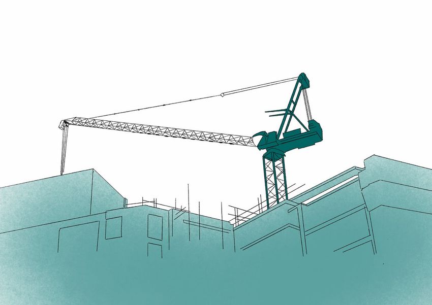
because this is where, according to Silver’s research on housing financialisation in Manchester, a large
amount of city centre apartments have been built without on-site affordable housing provision since
2009xiv. In addition, these wards are the location of major urban regeneration initiatives such as the
Northern Gateway (now rebranded as Victoria North) project. Within this area, 28 sites were selected
on the grounds that residential development had either already occurred or was planned for the near
future.
Having narrowed our geographical focus, we submitted another FOI request asking whether the Council
received any rental income in addition to the premium paid for these 28 leases. The Council responded
that all the sites were leased out at a ‘Peppercorn Ground Rent (Effectively £0 Rent)’. This confirmed
that the Council wasn’t receiving any rental income in addition to the premiums paid at the beginning
of each lease, despite the fact that some of these leasehold agreements extended up to 999 years.
Finally, we submitted a FOI request to the Council for data on land disposals from 1999- 2008 in order
to broaden the historical scope of our investigation to include the Cardroom Estate regeneration project
(discussed below). We became aware that the datasets we were given in response to our FOI requests
appear to be incomplete, and that various sites that were leased by the Council to private developers
were not included. For example, the 1999-2008 data did not include land incorporating the Cardroom
Estate. It is not clear why these sites were not included.
This data collection process has enabled us to identify some concerning issues with public land disposals
in Piccadilly and Ancoats & Beswick. These are discussed in sections 4 and 5 below.

4. Case study: public land disposal and residential
development in Ancoats and New Islington
4.1 Introduction
Here we focus on Ancoats and New Islington, a post-industrial neighbourhood within the ward of
Ancoats & Beswick that is located to the east of Manchester’s city centre (see figure 3).

                                        GREEN QUARTER

                                              N.O.M.A
                   BLACKFRIARS
                     G R E E N G AT E                   A N C O AT S

                                                                                   Manchester City Centre
                                                 NORTHERN     NEW ISLINGTON
                                                  QUARTER
                                                                                   Ancoats & New Islington
                     SPINNINGFIELDS                                                Case Study
                          D E A N S G AT E

                       CASTLEFIELD

Figure 3
The Ancoats and New Islington case study area
Source: Authors

                                                                                                             6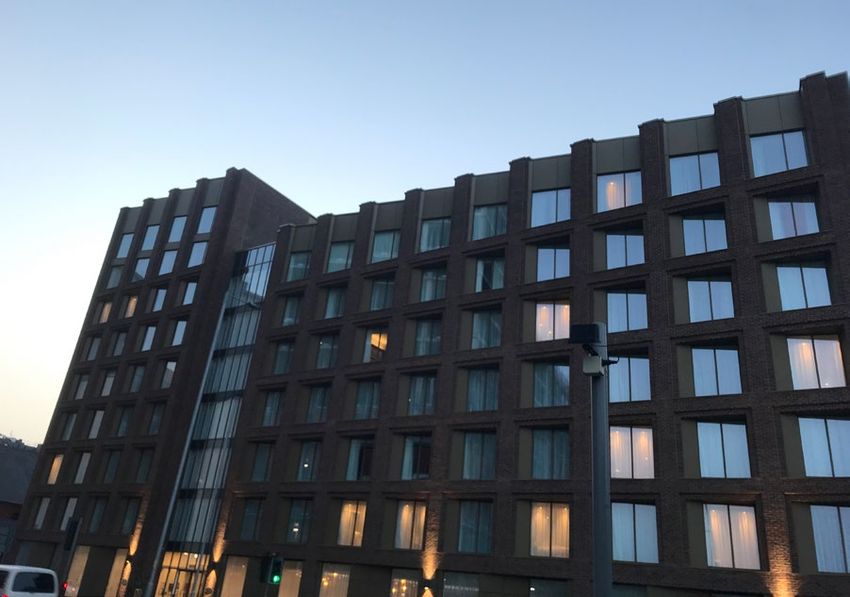
Over the last 30 years, Ancoats and New Islington has experienced a high number of public land
disposals by the Council, often in partnership with other public sector bodies. This neighbourhood is
currently undergoing a process of dramatic redevelopment. Due to soaring land values and a shortage
of undeveloped sites in the city centre, high-rise residential development has begun to spread to the
areas surrounding the inner-ring road. As such, this neighbourhood provides a good insight into the
relationship between public land disposals and private residential development in central Manchesterxv.

4.2 A brief history of public land disposal in Ancoats and New Islington
Ancoats and New Islington emerged as a busy industrial area in the 19th century. During this period,
land in the area was privately owned by wealthy landlords and was leased for industrial activities such
as textile production, in addition to slum housing to accommodate the city’s growing working-class
population. However, the area experienced a significant reduction in employment and residential
population during the 20th century due to post-industrial economic decline and slum clearance policies.
The Council directly acquired some land in the area during the post-war period in order to build
public housing estates such as the Cardroom Estate. In addition, the North West Development Agency
undertook a series of Compulsory Purchase Orders (CPOs) in the 1990s. This land was then transferred
to the Council via the Homes and Community Agency post-2010.

       A N C O AT S
                                                                       Land designated for Urban Splash from
                                                                       2002 onwards

                                                                       Land disposals 2014-2020 (primarily to
                                                                       ADUG)

                  NEW ISLINGTON
                                                                       Land acquired by Council in 2017

                                                              Figure 4
                                                              Significant public land disposals in Ancoats
                                                              and New Islington 2002-2020
                                                              Source: Authors

We identify two waves of significant public land disposal in the case study area.
The first wave concerns the redevelopment of the Cardroom Estate beginning in 2002 as part of New
Labour’s Millennium Communities regeneration initiative (see yellow shaded area in figure 4). Built in
the 1970s, the council estate suffered from under-investment and stigmatisation, and half of the homes
were empty at the time of its demolition in the mid-2000s. 25 acres of public land were remediated at
significant public cost (through English Partnerships) and preferential development rights given to the
local developer Urban Splash, who built houses and apartments for sale and rent. Example prices are
£350,000 for a two-bedroom apartment and £499,500 for a three-bedroom townhousexvi. The land was
not transferred wholesale to Urban Splash, but it seems on a plot by plot basis once each development
was completed. However, after the company failed to undertake development for a number of years the

7
Council regained development control over some of the land. This reduced Urban Splash’s development
rights to an area that we estimate is around 16.5 acres in size (including the Marina now managed by
Plumlife and considered private). There is a lack of public information around how much, if anything,
Urban Splash paid Manchester City Council for the various plots of land. In addition, for reasons that
are unclear, the Council’s response to our FOI request for data on public land disposals between 1999-
2008 did not contain information on New Islington.
The second wave concerns disposal of several sites to private developers between 2014-2020 (see the
blue shaded areas in figure 4) The single biggest beneficiary has been the Manchester Life company -
a public-private partnership between the Council and Abu Dhabi United Group (ADUG), the private
equity company owned by Mansour bin Zayed Al Nahyan, Deputy Prime Minister of the United Arab
Emiratesxvii. Following the takeover of Manchester City Football Club by ADUG in 2008, the Manchester
Life partnership was established in 2014 so that ADUG could invest in urban development in Manchester
via the Jersey-based off-shore company Loom Holdings Ltdxviii. Public land for Manchester Life
developments is typically transferred to ADUG via Loom Holdings on long leases of up to 999 years. This
includes the reallocation of Cardroom Estate land recovered by the Council from Urban Splash. Other
beneficiaries of this second wave of land disposal include local developers McCauls, Northern Group
and UK Land & Property. Manchester Life have built private apartments for sale and rent in Ancoats
and New Islington. Prices in Manchester Life’s One Vesta Street development range from £190,000 for
a one-bedroom apartment to £690,000 for a four-bedroom townhousexix.
We also highlight the disposal of 4.5 acres of
undeveloped land south of the Ashton Canal to the
UK developer General Projects for a total of £2.38
million (£528,000 per acre). This land has provided
vital green space for the ever-increasing numbers
of residents in the area, particularly during the
COVID-19 pandemic, and has become known as
‘New Islington Green’ to those who use it. Despite
opposition from the local community, General
Projects have received planning permission from
the Council to develop this land into an office
campusxx.
In addition to these two waves of disposal, we
highlight the purchase of the former Central Retail
Park site by the Council in 2017 (see the turquoise
shaded area in figure 4). The long-term plan for
this site is a mixed-use development of office space
and apartments, possibly to be built in partnership
with ADUGxxi. This raises questions about whether
this recently acquired public land will be disposed
of in future. In the meantime, the Council planned
to use the site as a carpark, provoking successful
opposition from local campaigners who are calling
for the land to be used as much-needed public
green space insteadxxii. The Council reportedly paid
£37,038,000 for this 10.5 acre site: a price of over
£3.5million per acrexxiii. Although we recognise that
land values can vary from site to site due to various
factors, this provides a useful baseline land value for
the area against which we can assess Council land
disposals for public value for money.

                                                                                                     8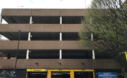
4.3 Key findings on public land disposal and residential development in
    Ancoats and New Islington
4.3.1 The terms of disposal and public value for money
The first wave of development in the area was primarily related to the preferential development rights
given to Urban Splash from 2002, incorporating 25 acres of land in Ancoats and New Islington. We found
in our data analysis that the Council has allocated at least another 15.75 acres of land to private developers
for housing development since 2009. The average price per acre paid for this land is £388,769, bringing
a total income to the Council of £6,123,166.
This average price of £388,769 per acre contrasts with the 2017 purchase of land by the Council at a
price of over £3.5 million per acre at the Central Retail Park site. Although we recognise land prices can
vary from site to site, these transactions suggest that the Council could be paying over nine times more
than it is receiving in income for land in the same neighbourhood.
If we widen our scope beyond housing development and include the land disposal for the planned office
development at New Islington Green, we find that an estimated 20.25 acres have been disposed of for
an average price per acre of £419,909. This indicates that the Council has achieved higher returns when
disposing of the New Islington Green land. However, this average price of £419,909 per acre is still over
eight times lower than the amount paid by the Council for the Central Retail Park (see figure 5).

                                                                                                       Central Retail Park
                                                                                                       bought by MCC for over
               Gr                                                                        St            £3.5 million per acre
                    ea
                         tA                                                        ill
                                                                               M
                              nc                                          ld                           ‘New Islington Green’
                                   oa                                 O
                                        ts                                                             sold by MCC for
                                             St
                                                  re                                                   £528,000 per acre
                                                       et

                                                                 St
                                                      o     re
                                                   St                                         Figure 5
                                                                                              Comparing land bought by
                                                                                              Manchester City Council at
                                                                                              Central Retail Park vs land
                                                                                              sold by Manchester City
                                                                                              Council at New Islington
                                                                                              Green
                                                                                              Source: Authors

In some cases, according to the Council-supplied data, it appears that public land in Ancoats and New
Islington has been transferred to developers for free. For example, ‘The Point’, McCauls’ waterfront
development of 117 luxury apartments and houses, is built on Council land that was leased out for 999
years for a total payment of £0 (zero pounds) (see figure 6).

9
Figure 6
Photo of the Point development
Source: Authors
4.3.2 The character of residential development on privatised public land
We estimate that 1,996 apartments have been built on these 15.75 acres of privatised public land since
2014 (See figure 7). This is in addition to over 400 units built by Urban Splash on the 25 acres disposed by
the Council prior to 2014. Based on a conservative estimated average market value of £200,000 per unit,
we suggest that the total development value on this land may now exceed £400million. The industry
standard ‘Operating Margin’ (for developers) is 15-20% of total development valuexxiv, suggesting these
schemes may have generated £80million of profit. This amount dwarfs the £6,123,166 recouped in land
sales by the Council.
Urban Splash claim that 31% of housing at New Islington is now ‘affordable’, including a shared
ownership scheme with the Great Places Housing Groupxxv. However, is not clear what criteria Urban
Splash uses to define affordability. Furthermore, media reports suggest that the area is exempt from the
Council’s policy that all new developments should include at least 20% affordable housing as the land
deal predates this policyxxvi. Based on field observations, we estimate that Urban Splash built a total of
37 social rented homes on Piercy Street and Islington Square. This housing was replacement housing for
tenants from the Cardroom Estate that expressed a desire to stay in the area. Overall, we estimate a loss
of 163 social housing unitsxxvii.
Despite the Council’s own requirement for 20% affordable provision, none of the other developments
on public land discussed in this report contain any social or affordable housing. In addition, none of
these developments involved a financial contribution to social and affordable housing provision as
is commonly required by local authorities under Section 106 of the Town and Country Planning Act
1990xxviii. As such, public land disposals in Ancoats and New Islington have done very little to address the
lack of affordable and social housing in central Manchester.
104.3.3 The Council’s relationship with Abu Dhabi United Group
As the single largest beneficiary of public land disposals and the single biggest developer of residential
units in Ancoats and New Islington (see figure 7), Manchester Life is set to make large profits from the
disposal of Council land in order to construct high value apartments and houses. In our view, this raises
important questions about the relationship between the Council and ADUG, and who benefits from this
partnership.
The Council confirmed in a 2019 Sunday Times investigation that it receives none of the rental income
from Manchester Life’s property portfolio, but that it does stand to make money through ‘longer-term
profit sharing arrangements’ xxix. In addition, we cannot find any publicly available information on
whether the Council has received income from the sale of Manchester Life properties. In our view, it is
in the public interest for the Council to disclose any profit-sharing arrangements with ADUG.
In addition, the same article quoted other developers being ‘furious’ about the access that ADUG has
enjoyed to public land in Manchester:
“This is a sweetheart deal between the council and Abu Dhabi,” said one (developer).
“They get the land without any fair competition process, they can build apartment blocks,
and when the blocks start earning millions the council gets no rental income. They don’t
even have to make section 106 payments, like lots of other developers. The whole thing
stinks” xxx.
If true, this raises important questions about the process by which public land is allocated to developers,
whether a fair and open competitive tendering process is followed, and the transparency of this process
to councillors and members of the public.
Total Land in Total housing units
Developer Total Price Paid Total Acres Price per Acre
Hectares built on land
To be confirmed by To be confirmed by To be confirmed by
Urban Splash 400 TBC
Council Council Council
ADUG 4.234 £4,821,280 1465 10.462214 £460,828
McCauls 0.93 £0 169 2.29803 £0
Northern Group 0.39 £1,280,000 176 0.96369 £1,328,228
UK Land + Property 0.5 £0 126 1.2355 £0
Figure 7
The key developers who have benefited from public land disposals in Ancoats and New Islington
Source: Authors
In addition to the land discussed above, there are various sites that have already been disposed of by the
Council that aren’t currently being developed. Some of these sites are likely to be developed in the future
by Manchester Life as part of the planned redevelopment of the Poland Street area on the northern edge
of Ancoats, including part of what is currently used as a green space (Prussia Park/Ancoats Green)xxxi. As
such, the disposal of public land for private residential development is an ongoing process in Ancoats
and New Islington and should be subjected to scrutiny by local councillors and the public.
115. Other notable public land disposals in central Manchester
In this section we discuss some notable examples of public land disposal that fall outside our case study
area of Ancoats and New Islington. These examples indicate that the issues identified in section 4 are
not isolated to one ward of the city.
5.1 The Oxygen development
Figure 8
Photo of Oxygen Tower
Source: Authors
‘Oxygen’ is a £82million 32-storey apartment block currently under construction on Store Street in
the Piccadilly ward. It features 381 apartments and townhouses (including eight penthouses), a gym, a
cinema room, a 25-metre swimming pool and a ‘5-star spa’ xxxii.
According to Council and Land Registry data, the Council disposed of a land holding in August 2016 that
matches the address of the Oxygen site. The land was leased for 960 years to Store Street Developments
(a company registered at the address of the Property Alliance Group) for a total of £1 (one pound).
As with many private residential developments on public land in central Manchester, no affordable or
social housing provision is included in the development.
In our view, this case raises questions about why the Council appear to have transferred public land to a
developer for £1 so that they can build a scheme without affordable housing provision on-site. We make
an estimate that, given a rental price of £1000 per month per unit, £4.77 billion of rental income (at
today’s prices) will be generated over the course of the 960 year lease (!).
125.2 The Hampton by Hilton Hotel Figure 9 Photo of Hampton Hotel Source: Authors 47 Rochdale Road in the Piccadilly Ward is the site of a new Hampton by Hilton Hotelxxxiii. According to Council and Land Registry data, in November 2017 the Council appears to have leased land at 47 Rochdale Road for 250 years to the Hilton Corporation for a total of £1 (one pound). Demand for hotels has been growing in Manchester for a number of years, and it is understandable that the Council wants to support the growth of this sector. However, in our view this disposal of (some or all) of the land for £1 to a corporation with estimated assets of $14 billion raises further questions about how the Council values its land assets. 13
5.3 City centre car parks
Various public land plots in the city centre are currently being used as car parks. This provides a revenue
stream to the Council. However, city centre car parking is likely to be phased out in the next few years if
the Council is serious about its commitments to addressing the climate emergency, illegal air pollution
levels and the need to shift to a pedestrian/cycle-friendly city centre.
Not including car parks within already developed sites, we found that city centre public land being used
for car parks amounts to: 3.447 Hectares/8.5 acres/34,470 sqm.

                C E N T R A L R E TA I L     NORTHERN
                     DISTRICT                 QUARTER

SPINNINGFIELDS

                       C H I N AT O W N
  D E A N S G AT E

                                   G AY V I L L AG E

                                                        Figure 10
                                                        Map showing location of Council-
                                                        owned car parks in the city centre
                                                        Source: Authors

The intentions of the Council for the future use of these sites is unclear. Given the urgent need to shift
away from Manchester being a car-centric city, our view is that there should be an open public discussion
about how these sites can be better used to address social and environmental needs in the future.
The Northern Quarter car park on Church Street (Piccadilly ward) sits on a site of 7,740sqm in the
heart of the fashionable Northern Quarter. This is a neighbourhood that has experienced rising rents,
gentrification and the displacement of independent cultural enterprises in recent years. What should
the future of the site be? Affordable and social housing? Public green space? Affordable live/work studios
and galleries for artists? Alternatively, should the Council sell this prime land in order to generate much-
needed revenue in the context of the severe funding cuts imposed by central government over the last
decade? We estimate that this land could be worth up to £10 million (based on the amount paid by the
Council for land at the former Central Retail Park). Although we have our own views on this question,
we argue that there is an urgent need for an open public debate around how Council-owned land can be
best used to address social and economic needs in the city.
                                                                              G
                                                                                  re
                                                                                       at
                                                                                            An
                                                                                                 co
                                                                                                      at
                                                                                                           s
                                                                                                               St

                                                                                                                    Figure 11
                                                                                                                    Photo and Location of
                                                                                                                    the Church Street car
                                                                                                                    park in the Northern
                                                                                   St
                                                                                 n

                                                                                                                    Quarter
                                                                              to
                                                                             w
                                                                            Ne

                                                                                                                    Source: Authors

                                                                                                                                            14
6. Conclusions The research discussed in this report highlights three major issues regarding public land privation in Manchester. The first issue is the lack of transparency around public land ownership and use in the city. Data on the Council’s land assets is not available to the public in an easily accessible format (such as an online map). In addition, there is a lack of publicly available data on Council land disposals. The authors of this report have managed to piece together a limited picture of public land privatisation in the city centre using methods such as FOI requests and Land Registry title deeds. However, the collection and analysis of this data is challenging, time-consuming, expensive and requires a degree of research expertise. Public resources such as land are the common wealth of the citizens of Manchester. In our view, information on how public land is being allocated and on what terms should be freely and easily accessible to the public (and to the city councillors who represent them). Greater transparency will enable public debate and democratic accountability around how Manchester’s public resources are used. The second issue is the question of whether the Council is doing all it can to get value for money for the public when disposing of its land assets. Urban land is an extremely valuable resource. In the context of ongoing cuts to local authority funding due to austerity policies, it is important that the Council generates as much revenue as possible from any public land disposals. However, the available data suggests that the Council may be paying nine times more for land in Ancoats and New Islington than it has received in revenue for land for private residential development in the same neighbourhood. We also identified several examples of prime city centre land apparently being transferred to developers for free (or for a nominal amount of £1). Although we recognise that various factors will affect the value of a parcel of land, in our view these findings raise a series of important questions about the process by which Council land is valued and allocated to private developers: Is there a fair, competitive and open tendering process? What is the process by which land is valued and prices are determined, and is the future value of a development considered? Who decides the terms, such as the duration and conditions, of lease agreements? How was the £42 million+ of income raised from public land disposals used, and how was this decided? Finally, in our view the Council should declare any profit-sharing agreements made with developers. In the interests of transparency and accountability, we invite the Council to publicly address these questions in relation to the land disposals highlighted in the report. 15
The third issue is the character of urban development that is enabled by public land privatisation in
Manchester. As with other cities, Manchester is facing a housing crisis and a climate emergency and
there is a shortage of both affordable and social housing and public green space in the city centre. Public
land is an important resource that could be used to address these social and environmental problems.
However, the available data suggests that public land is often leased out to developers in order to build
luxury apartments that are unaffordable to the majority of Manchester’s residents. In some cases, public
land privatisation has led to the demolition of social housing (such as the Cardroom Estate) and the loss
of public green space (such as New Islington Green). In our view, greater transparency and accountability
over public land ownership and use will enable a much-needed public debate about the future of urban
planning and land use in the city.
How best to achieve greater transparency and accountability over public land ownership and use in
Manchester? One possible model can be found in Manchester’s neighbour Liverpool, where the Metro
Mayor Steve Rotheram has recently launched a Land Commission comprised of representatives of the
public, private and voluntary sectors and academia. According to Rotherham, the role of the Commission
is to develop ‘radical recommendations for how we can make the best use of publicly-owned land to make
this the fairest and most socially inclusive city region in the country’ xxxiv. This example demonstrates
that a more open, transparent and participatory approach to managing public land is possible.
Following Liverpool’s example, the Greater Manchester Independent Inequalities Commission has
recommended the establishment of a Land Commission to look at the relationship between land
ownership and inequality in the city regionxxxv. This recommendation was subsequently adopted by
Andy Burnham in his manifesto for the 2021 Greater Manchester mayoral electionxxxvi. We welcome this
pledge and call for the establishment of a Greater Manchester Land Commission with participation
from civil society groups, such as climate and housing justice campaigns, by the end of 2021.
In the city of Manchester we suggest two ways forward. Firstly, we call for a publicly accessible website
with records of all Council land disposals in order to improve transparency. Furthermore, we encourage
local councillors to initiate community audits of public land assets in their own wards. These community
audits can form the basis of a democratic decision-making process about the future of this precious
resource.

7.     Author contact details
Tom Gillespie                                        Jonathan Silver
Hallsworth Research Fellow                           Senior Research Fellow
Global Development Institute                         Urban Institute
and Manchester Urban Institute                       University of Sheffield
Arthur Lewis Building                                ICOSS
University of Manchester                             219 Portobello
Oxford Road                                          Broomhall
Manchester                                           Sheffield
M13 9PL                                              S1 4DP
thomas.gillespie@manchester.ac.uk                    j.silver@sheffield.ac.uk

8.     Acknowledgements
We are grateful to Stuart Hodkinson, Diana Mitlin, Kevin Ward and the participants of a workshop on
‘Researching and contesting public land privatisation’ for providing feedback on an earlier version of
this report. The views expressed in this report are those of the authors, and we take full responsibility
for any errors. The production of this report was funded by a University of Manchester and ESRC Impact
Accelerator Account grant.

                                                                                                        16
9. Endnotes
i One hectare is equivalent to 1.5 football pitches
ii Kivell, P. T., & McKay, I. (1988). Public ownership of urban land. Transactions of the Institute of British Geographers, 165-
178.
iii Christophers, B. (2018). The new enclosure: The appropriation of public land in neoliberal Britain. London: Verso.
iv Christophers, B. (2018). The new enclosure: The appropriation of public land in neoliberal Britain. London: Verso.
v Kivell, P. T., & McKay, I. (1988). Public ownership of urban land. Transactions of the Institute of British Geographers, 165-
178.
vi Hodson, M., McMeekin, A., Froud, J., & Moran, M. (2020). State-rescaling and re-designing the material city-region:
Tensions of disruption and continuity in articulating the future of Greater Manchester. Urban Studies, 57(1), 198-217.
vii Silver, J. (2018). From Homes to Assets: Housing Financialization in Greater Manchester. Working Paper.
viii Folkman, P., Froud, J., Johal, S., Tomaney, J., & Williams, K. (2016). MANCHESTER TRANSFORMED: why we need a
reset of city region policy. CRESC Public Interest Report, p.6.
ix Bower, C. (2020) Social housing is key to alleviating the housing crisis, so why are we not building it? The Meteor.
August 13 2020: https://themeteor.org/2020/08/13/social-housing-is-key-to-alleviating-the-housing-crisis-so-why-are-
we-not-building-it/ (accessed 20 October 2020).
x https://themeteor.org/2017/08/01/manchesters-property-investment-boom-funded-through-tax-dodging-offshore-
companies-unethical-international-investment/
xi https://www.manchester.gov.uk/open/downloads/download/142/local_authority_land_2020
xii https://mappinggm.org.uk/gmodin/
xiii ‘Freehold’ denotes a permanent transfer of ownership whereas ‘leasehold’ denotes a transfer for a fixed period of time
only.
xiv Silver, J. (2018). From Homes to Assets: Housing Financialization in Greater Manchester. Working Paper.
xv This case study does not attempt to provide a comprehensive account of all public land disposals in the Ancoats &
Beswick ward. We do note other significant public land disposals in this ward, such as the transfer of land around
Manchester City FC’s Etihad Stadium to the Abu Dhabi United Group, some of which is being developed into a £300
million entertainment arena.
xvi https://www.urbansplash.co.uk/regeneration/projects/new-islington
xvii http://mcrlife.co.uk/
xviii http://mcrlife.co.uk/about-manchester-life/
xix http://mcrlife.co.uk/one-vesta-street/availability-one-vesta-street/
xx https://www.business-live.co.uk/economic-development/office-campus-plans-east-manchester-19482221
xxi https://www.placenorthwest.co.uk/news/central-retail-park-earmarked-for-1m-sq-ft-office-scheme/
xxii https://tribunemag.co.uk/2021/02/manchesters-fight-for-the-city
xxiii https://www.manchestereveningnews.co.uk/news/greater-manchester-news/council-paid-37m-former-
ancoats-17064841
xxiv https://www.london.gov.uk/sites/default/files/app17_savills_residential_development_margin.pdf
xxv https://www.urbansplash.co.uk/resources/urban-splash-completes-latest-phase-at-new-islington
xxvi https://www.manchestereveningnews.co.uk/news/greater-manchester-news/new-islington-manchester-urban-
splash-17849046
xxvii There were a further 18 ‘affordable’ terraced and semi-detached homes in ‘The Guts’ in New Islington.
xxviii Silver, J. (2018). From Homes to Assets: Housing Financialization in Greater Manchester. Working Paper; Silver, J. and
Goulding, R (2019). From Homes to Assets: Housing Financialization in Greater Manchester 2018-19. Working Paper.
xxix https://www.thetimes.co.uk/article/manchester-the-city-that-sold-out-to-abu-dhabi-9mwx7nfck
xxx https://www.thetimes.co.uk/article/manchester-the-city-that-sold-out-to-abu-dhabi-9mwx7nfck
xxxi http://mcrlife.co.uk/manchester-city-council-manchester-life-and-great-places-today-launched-a-community-
consultation/
xxxii https://oxygenmanchester.com/
xxxiii https://www.hilton.com/en/hotels/mannqhx-hampton-manchester-northern-quarter/
xxxiv https://www.liverpoolcityregion-ca.gov.uk/steve-rotheram-launches-englands-first-land-commission-focused-on-
community-wealth-building/
xxxv https://greatermanchester-ca.gov.uk/media/4337/gmca_independent-inequalities-commission_v15.pdf
xxxvi https://andyformayor.co.uk/wp-content/uploads/2021/04/Andy-Burnham-Manisfesto-v2.1-002.pdf
1710. References
Bower, C. (2020) Social housing is key to alleviating the housing crisis, so why are we not building it?
The Meteor. August 13 2020: https://themeteor.org/2020/08/13/social-housing-is-key-to-alleviating-the-
housing-crisis-so-why-are-we-not-building-it/ (accessed 20 October 2020).
Christophers, B. (2018). The new enclosure: The appropriation of public land in neoliberal Britain. London:
Verso.
Folkman, P., Froud, J., Johal, S., Tomaney, J., & Williams, K. (2016). MANCHESTER TRANSFORMED:
why we need a reset of city region policy. CRESC Public Interest Report.
Hodson, M., McMeekin, A., Froud, J., & Moran, M. (2020). State-rescaling and re-designing the
material city-region: Tensions of disruption and continuity in articulating the future of Greater
Manchester. Urban Studies, 57(1), 198-217.
Kivell, P. T., & McKay, I. (1988). Public ownership of urban land. Transactions of the Institute of British
Geographers, 165-178.
Silver, J. (2018). From Homes to Assets: Housing Financialization in Greater Manchester. Working Paper.
Silver, J. and Goulding, R (2019). From Homes to Assets: Housing Financialization in Greater Manchester
2018-19. Working Paper.
18Report design & illustration by Glen Cutwerk | glencutwerk.com
You can also read