2021 California Forests: Targeted Headwaters Resilience Implementation and Monitoring
←
→
Page content transcription
If your browser does not render page correctly, please read the page content below
2021 California Forests:
Targeted Headwaters Resilience
Implementation and Monitoring
2021 RFP APPENDIX

OVERVIEW
This RFP Appendix contains summaries of specific project needs and ideas to guide applicants when
developing proposals and provides insight into the current needs expressed by regional land and wildlife
managers. Applicants may choose to develop one or more of the recommendations found in the project
descriptions below, or simply use these summaries to prompt other proposal ideas that align with goals
for NFWF’s 2021 Targeted Headwaters Resilience RFP. Applicants are not required to propose projects
that respond to RFP Appendix, however the items below do indicate clear priorities for some of the key
forest resilience areas. Note, not all areas detailed in the RFP have projects described in this appendix.
Priority projects in this appendix include project needs for 1) Headwaters Protection and Improvements
on the Inyo National Forest, 2) Transportation Infrastructure and Aquatic Organism Passage
Improvements on USFS Lands, and 3) Fuels Management Project Monitoring and Species Response.

Questions about potential project proposals should be directed to NFWF Program Manager, Jim Bond.

Headwaters Protection and Improvements on the Inyo National Forest
NFWF, with Los Angeles Department of Power and Water and the Inyo National Forest, seek to invest in
projects to help preserve and protect the Owens River watershed, source water for millions of people in
                                            the Los Angeles area. The projects identified below are
                                            priority projects for the Inyo National Forest and Los
                                            Angeles Department of Water and Power (LADWP) and will
                                            improve forest health, reduce the incidence of
                                            catastrophic fire, protect LADWP infrastructure, and
                                            improve forest carbon capture.

                                              Prescribed Fire in Casa Diablo Area
                                              This project will focus on prescribed burning in the Casa
                                              Diablo area (northeast of Tom’s Place, CA) for the
                                              protection of the Owens River and Crowley Lake. Project
                                              will restore the Casa Diablo area to its natural range of
                                              variation (NRV) and aid to reduce risks from catastrophic
                                              fire, protect soils, and improve habitat and watershed
                                              function. The Inyo NF is seeking to establish the treatment
                                              of up to 1500 acres per year, as part of a 7-to-15-year
                                              prescribed fire burn cycle. Project implementors will utilize
                                              tree well/jackpot techniques to restore a Jeffrey Pine
                                              ecosystem. Additional information for this project can be
                                              found here.
Bishop and Pine Creek watersheds Fuels Reduction
This project will focus on fuels reduction within approximately 210 acres of forest in the Bishop and Pine
Creek watersheds to improve watershed health and function, wildlife habitat, and scenic qualities, as
well as protect cultural resources and visitor safety near popular recreation areas and developed
recreation sites. The Inyo National Forest has designated treatment units throughout these drainages
and both mechanical treatments and prescribed fire may be utilized. Additional information for this
project can be found here.
June Mountain Ski Area Vegetation Management and June Loop Hazard Fuels Removal
This project will focus on hazardous fuels reduction and community protection around the community
of June Lake, CA and will help increase watershed resilience in Rush Creek in the Mono Lake basin.
Activity will focus on the restoration of white bark pine and meadow and aspen vegetation ecosystems
through thinning, fuels reduction, and establishment of defensible space around facilities. Terrain is
steep with loose soils which makes operations more difficult and expensive and will likely include the
need to utilize helicopter logging techniques. June Mountain area vegetation management activity has
been active since 2016 and invested parties include Inyo National Forest, LADWP, Mammoth Mountain
Ski Area, Cal Trout, Pacific Gas and Electric, and NFWF. Additional information for this project can be
found here.
Buttermilk Area Recreational Use Planning and Improvements
The Buttermilk area is a popular recreational destination and rock-climbing spot within the Inyo National
Forest, and occurs within the broader Owens River watershed. However, dispersed recreation activities
and heavy public use are having a detrimental effect on watershed health and increasing the risk of
wildfire that could impact water quality and water delivery facilities. This project would work with the
Inyo National Forest to develop use management strategies and implement improvements for area trails
and other public access facilities to mitigate impacts and help protect both healthy watershed
conditions and public land visitor experience. Contact Jim Bond for additional information.
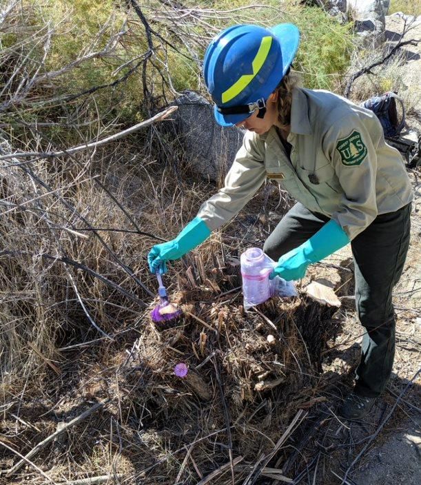
Forest-wide Invasive Plant Management
The priority focuses on the removal of invasive vegetation
throughout the Inyo National Forest, but with particular
preference toward addressing tamarisk, and protection of the
Oak Creek, Baxter Creek, and Cottonwood Creek watersheds, as
well as the Mono Lake shoreline and associated feeder streams.
Tamarisk removal will help provide benefits for both water
quality and quantity, and improve in-stream habitat conditions,
riparian vegetation, and overall watershed function. Removal
techniques would include hand removal, chainsaws, as well as
herbicide applications. Additional information for this project
can be found here.
2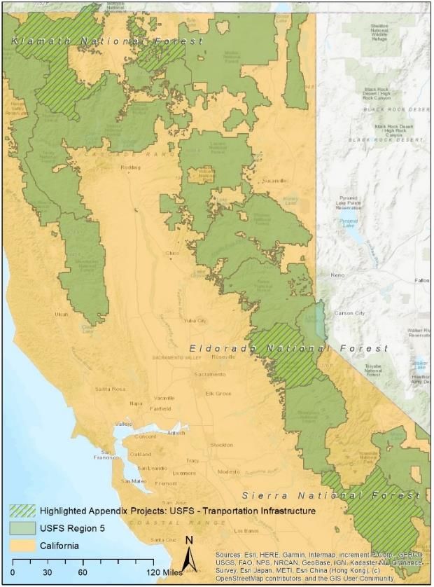
Transportation Infrastructure and Aquatic
Organism Passage Improvements on USFS Lands
The US Forest Service is seeking partnership assistance to
address transportation infrastructure repairs and aquatic
organism passage improvements on Forest Service-lands
throughout Region 5 (California). In particular, the following
projects were brought forward as high priority considerations
for potential applicants. Project needs are listed by the
National Forest where they would occur.

Eldorado National Forest
Wilson Meadow Road Crossing
This project seeks to replace an undersized vented ford road
crossing at the top of Wilson Ranch Meadow, a 90-acre
meadow on the Eldorado National Forest in the headwaters of
the South Fork American River. Wilson Ranch is important
habitat for salmonids, and special status species including
southern long-toed salamander and willow flycatcher. The
undersized road crossing concentrates stream flow causing
significant downstream erosion, channel incision, and
degraded meadow floodplain habitat. The project will replace the current crossing with a series of seven
culverts to spread flows and stabilize the downstream meadow floodplain to prevent future
degradation. The current vented ford road crossing is the fundamental cause of degradation and
erosion, replacing it will improve water quality and restore habitat and connectivity within the
watershed that is critical for species facing impacts from climate change. Additionally, the project is
located upstream of Ice House Reservoir, operated by the Sacramento Municipal Utilities District, and
preventing further erosion in the meadow will lower sediment delivery to the reservoir.

This project is a discreet part of a larger restoration effort to restore Wilson Ranch meadow, which has
been identified as the highest priority meadow restoration site (of 40 surveyed meadows) in the
Eldorado National Forest. The project is expected to be shovel-ready by December 2021. This project
qualifies for a NEPA Categorical Exclusion, with the final documentation filed in July 2021. Additional
information, including a map and intermediate designs for the replacement road crossing, can be found
here.

King Fire Significant Erosion and Potential Erosion Sites Project – Supplement
The King Fire Significant Erosion and Potential Erosion Sites (KFSEPES) Project is a large-scale project on
the Eldorado National Forest that was initiated in 2019. The purpose of the KFSEPES Project is to fix
select priority SEPES on the Eldorado National Forest that were identified on haul routes associated with
timber sales implemented under the King Fire Restoration Project (KFRP) Record of Decision of
September 2015. The KFRP decision included 91 miles of road reconstruction and 169 miles of road
maintenance on permanent roads, however, additional damage was sustained following a 2016/2017
winter characterized by a series of atmospheric rivers that caused widespread flooding across the state
and additional storm events in the winter of 2017/2018.

                                                                                                           3
This project will complete a portion of the original KFSEPES Project proposal specific to Forest Service
Roads (FSR) 11N80 and 12N34. Priority needs include design and implementation work that is expected
to include road drainage replacement and improvements, road reconditioning, debris removal,
excavation and embankment reconstruction of the fill slope, and slope protection.

SEPES were identified as required by Central Valley Regional Water Quality Control Board (CVRWQCB)
Order R5/2017-0061 (Waste Discharges Requirement General Order for Discharges Related to
Timberland Management Activities for Non-Federal and Federal Lands) and are defined in the General
Order (Attachment A, pg. 2; and Information Sheet, pg. 16). The determination of which SEPES to
include in the KFSEPES Project was based mainly upon current and potential future impacts to water
quality (i.e. the amount of sediment transported to streams), with preference given to perennial and
intermittent streams. The roads selected were also determined to be the most important for access
across the Forest (particularly for fire fighters and other emergency personnel), and in many cases are
the only routes into large areas of the forest.

The identified road repairs and improvements fall under a Categorical Exclusion for which a “case file
and Decision Memo are not required: FSH 1909.15, section 32.12, “(4) Repair and maintenance of roads,
trails, and landline boundaries.” 36 CFR 220.6(d)(4). A review by an interdisciplinary team was
completed to validate that there would be “no extraordinary circumstances.” The project also qualified
for a Categorical Exemption under the California Environmental Quality Act (CEQA). Additional
information for this project can be found here.

Klamath National Forest

Kelly Gulch/Tiger Fork Stream Crossing Improvement
Klamath National Forest seeks to replace the existing culverts at the Kelly Gulch and Tiger Fork crossings
with an open bottomless arch culvert to allow unrestricted passage of Coho salmon and steelhead trout.
These improvements will restore access to 0.4 miles of habitat necessary for all life stages of trout and
SONCC Coho salmon upstream of the Kelly Gulch crossing, and an additional 0.06 miles of habitat
upstream of the Tiger Fork crossing.

                                                    Replacing the culverts at each crossing with an open
                                                    bottomless arch culvert will increase the amount of
                                                    accessible spawning, rearing and refugia habitat for
                                                    salmon and trout in the Kelly Gulch and Sugar Creek
                                                    systems and aid in the recovery of Coho salmon
                                                    populations in the North Fork Salmon River and Scott
                                                    River watersheds, respectively. These improvements
                                                    will also allow for sediment and debris to move
                                                    naturally through the systems during high flow
                                                    events, greatly reducing the possibility of blockage
                                                    and subsequent crossing/road failure. The Kelly
                                                    Gulch crossing is located on Forest Service Road
                                                    #40N39, and provides important access into the area
                                                    for cooperators, fire suppression activity, resource
                                                    protection, and public recreation. Additional
                                                    information for this project can be found here.

                                                                                                           4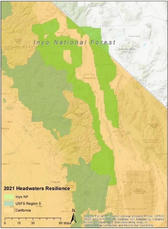
Elk Creek Road Storm Proofing
The project seeks to improve the road prism through construction of rolling dips, installation of culverts,
and the placement of surface aggregate. On Forest Service road 15N75 at mileposts 0.98, 1.30, and 1.36,
40-foot long 36-inch diameter culverts will need to be installed and necessitate excavations of
approximately 4-foot depth and 8-foot width. At milepost 1.67, two 48-inch diameter culverts will need
to be installed with lengths of 40-foot at the lower section and 60-foot for the upper section. These
culvert installations necessitate excavations of 20-foot depths and 10-foot widths. At milepost 1.75, a
60-foot long 48-inch diameter culvert will need to be installed and necessitate excavation of 20-foot
depth and 11-foot width. The rolling dips to be constructed at each site require excavations of 2-foot
depth x 18-foot width x 50-foot length. An additional six inches of surface aggregate will need to be
placed on the road surface at all sites. Additional information includes the West Side Fire Recovery
Project and Final EIS.

Lovers Road Decommissioning
Klamath National Forest seeks decommission of 3.11 miles of roads to prevent failure and sediment
delivery to streams during floods. Work will remove road fills and culverts from stream crossings,
outslope road surfaces, and remove unstable fills. This project is a requirement of the North Coast
Regional Water Board as a condition for enrolling the Lovers Canyon Project under the Waiver of Waste
Discharge Requirements. The project would treat 16 legacy sediment discharge sites that are at high risk
of failing during floods. The primary benefit is a reduction in fine sediment in downstream salmon
habitat. Work through this project will complement a 319(h) grant proposal to complete all remaining
sediment control work in the watershed. Improvements will aid de-listing from EPA’s Section 303(d) list
of impaired waters. Additional information includes a location map and Lovers Canyon Project EA.

Sierra National Forest
Duff Creek Aquatic Organism Passage
Sierra National Forest seeks to construct an AOP
(Aquatic Organism Passage), with a bottomless
arch culvert (pipe to be provided and delivered by
the Forest Service). Other work includes
constructing stream simulation, paved approaches
to the AOP, and object marker installation. The
project also includes the demolition and removal
of the existing steel culvert, dewatering and
erosion control.

In 2015 The Duff Creek AOP was awarded and a Notice to Proceed Issued (NTP). Submittals were
approved for the Bottomless arch culvert and it was delivered. Shortly thereafter a forest closure and
stop work order was issued due to fire severity. A stop work order was issued by the CO. After delays
the project was unable to commence and has been on pause since. Hazard tree removal may need to be
incorporated into the project plans to help prepare the project site. The forest paid for the bottomless
arch culvert material and it is stored on the Bass Lake Ranger District. Additional information for this
project can be found here.

                                                                                                          5
Fuels Management Project Monitoring and Species Response
Conversations with key regional forest management stakeholders have identified an array of important
potential regional fuels monitoring concepts and needs/goals to advance understanding and assessment
of forest/fuels management projects and their impacts/effectiveness for at-risk species (e.g. northern
spotted owl, California spotted owl, fisher, etc).

                                              Camera/Acoustic Monitoring – Associated to
                                              existing/pending fuels work
                                              Establish a grid of prospective long-term monitoring
                                              locations to assess the status of wildlife species
                                              distinguishable from camera/acoustic monitoring stations
                                              and monitor changes in population and species
                                              distribution. The methodology employed should allow for
                                              statistically robust calculations to understand the mean
                                              expected local abundance across the surveyed area, and
                                              one or more measure of detection probability for
                                              specified species across all sites and surveys. Survey
                                              locations are recommended to be integrated with the
                                              California Department of Forestry and Fire Protection
Forest Resource Assessment Program (FRAP) GIS and existing camera and acoustic networks, and
monitoring locations should target areas with pending or existing fuels work as identified by FRAP. The
stationary sample locations could be augmented with CSO and NSO surveys conducted to support the
NEPA or CEQA permitting. For reference of similar methodology concepts: Furnas, B. J., R. H. Landers, R.
L. Callas, and S. M. Matthews. 2017, and Estimating population size of fishers (Pekania pennanti) using
camera stations and auxiliary data on home range size. Ecosphere 8(3):e01747. 10.1002/ecs2.1747A

Effect of Fuels Treatments on Forest Prey Base
For forest predators such as spotted owls and mustelids, the extent (e.g., % of area) and intensity (e.g.,
degree of habitat change) of fuels treatments are useful metrics for quantifying potential impacts on
prey and foraging. Understanding the relationship between the planned habitat changes in foraging
habitats and any anticipated changes to the prey base would be useful to project planners. Monitoring
project would design methodology to evaluate prey species and associated habitat before and after
fuels treatment or fuel break construction, in comparison
to control areas, while accounting for variability across
sampling sites and local forest conditions. Project would
potentially have value for both short-term, site specific
effects (There is an immediate need for these kinds of
information for some species, such as Coastal Marten),
and could be coupled with meta-analysis given the
abundance of published papers on forest thinning, small
mammal and bird responses to habitat changes, etc. to
generate general regional guidelines and/or
recommendations for forest managers. Project design
would necessarily be at the appropriate scale to account
for prey occupancy, density, and/or movement within the
landscape, not just within treated area(s).

                                                                                                             6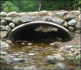
Use existing high resolution wildlife GPS data to examine landscape pattern effects on wildlife for
optimization of fuel treatment locations
Multiple years of GPS data exists for species like spotted owls, fisher, and marten, over various
landscapes in CA and OR. Combining these data and using them to examine effects of different
landscape patterns on demography and/or occupancy of various species, would help land managers
optimize placement, timing, and size of various types of fuels treatments. Taking a landscape scale
approach to identifying fire risk (and thus fuels treatment needs), and how the needed treatment may
affect wildlife if implemented in various areas and configurations, will allow the planning of landscape
treatments in a way to meet multiple objectives. This effort would focus on compiling, collating and
examining relationships between existing wildlife GPS data and available vegetation data from multiple
sources, and should not require any new data collection.

Marrying fuels vegetation and wildlife habitat metrics to inform fuel treatment design optimization
While significant study has looked at the effectiveness of fuels treatments in modifying fire behavior and
shaping post-fire vegetation outcomes, scientific understanding is much less clear on both (1) effects of
fuels treatment on wildlife habitat for sensitive species; and (2) extent to which vegetation must/can be
modified to successfully modify fire behavior while minimizing effects to wildlife habitat. This is largely
because vegetation metrics used to describe wildlife habitat suitability, wildlife habitat selection, and
wildlife habitat – demographic linkages are different than vegetation metrics used to describe fuels
inputs to fire risk projections and fire behavior models. In the former, analysis typically relies largely on
satellite derived metrics of canopy cover, vegetation type, and tree size (frequently from eVeg, CWHR,
and GNN), while the latter often relies on satellite, modeled, or field metrics of fuel type, fuel profile,
ladder fuels, canopy base height, and canopy bulk density. Because the two sets of metrics do not
coincide, it is very challenging to design fuels treatments, and model their projected effects on both fire
behavior and wildlife habitat simultaneously, which is necessary to optimally design treatments to
balance multiple short and long term objectives. Broad scale monitoring efforts have examined
tradeoffs and co-benefits of fuels treatments on species occupancy over time for some species at the
rangewide scale. The broad geographic range and resolution of utilized data often necessitates the
model include certain assumptions of how fuels treatments affect both species habitat and fire severity.
With new fine-scale data coming online (like the CA Forest Observatory, LiDAR and SilviaTerra), there
may be an excellent opportunity to integrate this additional data and refine generalized model results.
Addressing this question to improve existing models for at least one of the region’s key species of
interest would be highly valuable to the USFS and regional land managers.

Assessing effects of different types of fuels treatments across ownerships using existing long-term
population information:
Using existing long-term and broad scale population/demographic information, assess the effects at the
landscape scale of different types, configurations, intensities, patterns, and timing of fuels treatments
on one or multiple wildlife species across multiple land ownerships. Assessments of fuels treatments in
general (combined categories of many different types of work) at small scales (the scale of a few to tens
of individuals) and over short time periods (one to a few years post treatment), exist and answer some
preliminary questions. However, landscape scale siting, design, and pace of implementation of broad
networks of fuels reduction management across multiple ownerships necessitate information at broader
scales and, at the same time, with more specificity to inform optimal design, timing, and pattern to meet
multiple objectives.

                                                                                                            7
You can also read