Community Emergency Plan
  Upper Squamish Valley
←
→
Page content transcription
If your browser does not render page correctly, please read the page content below
Community Emergency Plan Upper Squamish Valley
Table of Contents

Key definitions .............................................................................................................................................. 3
Introduction ................................................................................................................................................. 4
Community Overview ................................................................................................................................... 5
   Demographics .......................................................................................................................................... 5
   Land Use ................................................................................................................................................... 5
   Critical infrastructure............................................................................................................................... 6
   Response Capabilities .............................................................................................................................. 6
Hazard, Risk and Evacuation ........................................................................................................................ 7
   Evacuation Routes ................................................................................................................................... 7
   Flood ........................................................................................................................................................ 9
   Debris Flow/Landslide ........................................................................................................................... 10
   Interface Fire .......................................................................................................................................... 11
   Severe Storm (All Seasons) .................................................................................................................... 12
   Earthquake ............................................................................................................................................. 13
   Community Map – Upper Squamish Valley .......................................................................................... 15
Community Action Plan .............................................................................................................................. 16

                                                                                                                                                                 2
Key definitions
Emergency An event that requires prompt coordination of actions to protect
the health, safety or welfare of people, or to limit damage to
property or the environment.
Hazard A potentially damaging physical event, phenomenon or human
activity that may cause the loss of life or injury, property damage,
social and economic disruption or environmental degradation.
Resilience Resilience is the capacity to adapt; by persevering, recuperating or
changing to reach and maintain an acceptable level of functioning.
Disaster resilience is built through empowering organizations,
communities and society to share responsibility for keeping
hazards from becoming disasters.
Risk The combination of the likelihood and the consequence of a
specified hazard event happening.
Vulnerability Physical, social, economic and environmental factors or processes,
that increase the susceptibility of a community to negative
impacts from hazards. It is also a measure of how well prepared
and equipped a community is to minimize impacts and cope with
hazards.
3Community Emergency Plan
Upper Squamish Valley
2017
Introduction
The SLRD Emergency Management Program provides emergency management services to the
~5,000 SLRD residents in the four Electoral Areas and partners closely with member
municipalities. In addition to the Emergency Management Program, the SLRD funds and/or
operates select Emergency Services in the region including:
• 9-1-1 Services
• Diking and drainage in Electoral Area D
• Fire and Rescue Services
• Wildfire Fuel Management Program.
Major emergencies and disasters are on the increase in Canada and worldwide. Disaster effects
may be direct (e.g. damage to house, loss of income) or indirect (e.g. increased insurance
premiums, reduced air quality due to smoke from wildfires elsewhere).
A number of communities in the SLRD are geographically isolated from traditional first
responder organizations such as fire, police and emergency medical services. Communications
and other infrastructure may be limited or prone to outages. The effect of this geographical
separation is that communities will likely lead their own response, making community
knowledge, preparation and skill building a vital aspect of emergency preparedness and
increasing the resilience of these communities to adverse events.
The purpose of a Community Risk Assessment (CRA) is to guide practical steps in preparedness,
response, recovery and mitigation that reduce both the likelihood of emergencies and the
consequences when disaster cannot be avoided. Risk information also informs community
residents, business owners, and institution managers of the hazards to expect and how best to
prepare for them. Further, A CRA provides a platform from which to advance community-level
emergency management and evacuation policy and planning.
A Community Action Plan (CAP) provides a blueprint for communities to increase their
resilience through increasing skills, knowledge and connectedness – benefiting the community
before a major emergency, during response and through the recovery process.
4Community Overview
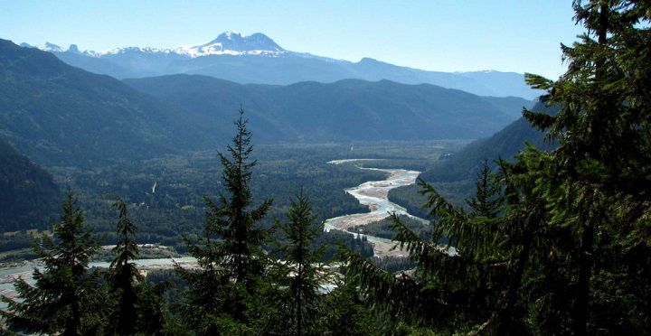
The Upper Squamish Valley (USV) is a rural residential farming and recreational property area
located ~30 kilometers north of the District of Squamish, between the Tantalus Mountain
Range and Cloudburst Mountain. It extends from the Squamish Nation reserve at past the one
lane Pilchuk bridge to the beginning of the Tree farm (TFL 38) where the paved road becomes a
gravel forest services road. The mile markers on the road are measured from Squamish
downtown with Pilchuck Creek at mile 16 and the FSR (forest service road) starting at mile 22.
Although it all looks like wilderness, almost all the land between these two points is privately
owned. The USV has a strong sense of community and good community networks. The Ashlu
Creek Foundation was formed in 2009 to “develop amenities for the social welfare, civic
improvement, and the improvement of quality of life of the Upper Squamish Valley” (The Ashlu
Creek Foundation Constitution, 2009), and emergency preparedness is an aspect of this remit.
The community of ~167 fulltime residents is spread out along the Squamish Valley Road and
Squamish River, with most development on low lying floodplain land. Camp Summit and the
Queen of Peace Monastery are also located in the USV. Camp Summit has a capacity of 180
people, caters for youth summer camps and is a year-round outdoor education centre that
hosts schools, corporate retreats and other associated activities. The Monastery is a retreat
environment with a variable population depending on visitors.
Squamish Valley Road, the only paved access road, is regularly inundated at points and has
been washed out by historical flood events. Flood is the most present hazard in the area, and all
new housing development in the floodplain area requires raised foundations and/or earthworks
to raise foundations and hence mitigate flood risk. However, debris flows, severe storms,
interface fire and earthquake all present moderate risk hazards to the community that may
have high impact primary and secondary effects (e.g. earthquake affecting land stability causes
flood). The community also has the potential to become isolated due to the effects of any of
these hazards.
Demographics
Mainly full time residents with some recreational property owners. Camp Summit and the
Queen of Peace Monastery host groups of up to 200 people.
Land Use
Single family homes and recreational cabins
5Critical infrastructure
Drinking Water Independent water supply per household from well, tank or
stream filtration.
Sanitary/Waste Water Septic tank or field.
Treatment
Electrical Power Systems BC Hydro supply available to all residences
Gas Heating Systems No
Communications Landline, internet access. Unreliable or no cellphone reception
Response Capabilities
Structural fire No structural fire service.
Wildland interface fire Crews dispatched from Pemberton. Some local
residents have taken S-100 training.
Medical Nearest BCAS base is Squamish
Police Nearest RCMP detachment in Squamish
Evacuation Opportunity for evacuation notitraining from
SLRD staff.
Communication Landline and internet access available, subject
to any infrastructure impacts. Cellphone
service either unavailable or unreliable.
6Hazard, Risk and Evacuation
UPPER SQUAMISH VALLEY HAZARD PROFILE
Debris Flow/ Severe Storm/ Hazardous
Flood Interface Fire Earthquake
Landslide Utility failure Material
KEY:*
HIGH RISK
MODERATE RISK
LOW RISK
UNLIKELY
*Note that risk does not equal impact. A low risk event may still occur with high impact.
The risk assessment examines the high and moderate risk hazards.
Evacuation Routes
Evacuation would be south along the Squamish Valley Road towards the District of Squamish at
the direction of first responders. The recommended evacuation route will also be printed on
the official evacuation notice delivered by first responders and/or published on the SLRD
website. No obvious feasible vehicular alternatives.
While water assisted evacuation is conceivable, it is improbable due to the likely hazardous
river conditions that would most often accompany the reason for evacuation. If evacuation by
road is not possible and sheltering in place is unsafe, then helicopter-assisted evacuation would
become necessary, with the Squamish or Whistler as the transfer point.
Community Muster Point: the Ashlu Foundation shipping container, located at 2200
Drummond Road on higher ground.
The Muster Point will be used if evacuation by bus or RCMP escort due to road conditions, or to
receive additional information or supplies (e.g. bottled water) before evacuating.
7Types of Evacuation
Evacuation
Alert This is the time to get ready to leave, putting together ‘grab
and go’ bags with essential supplies, papers and
prescriptions, and making any other arrangements to leave
the property with all household members and pets.
Residents may self-evacuate (voluntary) during this time,
particularly if they have mobility issues or health conditions
that may make it difficult to evacuate quickly. This is also
the time to move livestock to safer areas.
Evacuation
Order Mandatory evacuation occurs when a population is ordered
to leave a defined area according to a formal written
document that outlines the impact area and why an
evacuation is necessary.
Shelter-in
-Place Essentially, an instruction to the public to stay inside for
safety reasons. It may also mean “seal the room”, i.e. take
steps to stop outside smoke or other contaminants from
entering the room.
Evacuation
Rescind Formal notification that it is safe to return to the evacuated
area. The affected area may still be under an Evacuation
Alert under further notice, if the hazard still presents a
threat.
8Flood
The Squamish River system is subject to frequent flooding with the majority of development
and the only access road located in the floodplain. Extreme precipitation events have occurred
on at least five occasions since 1980 (KWL, 2015). Climate change may be increasing the risk of
flooding and the SLRD has commissioned a study to update the floodplain mapping including
climate change and debris flood/flow considerations. Flooding may originate from the
Squamish River, from feeder creeks and streams, from direct torrential rainfall or a combination
these sources. In terms of stream flow, the flood risk comes from both bank overtopping and an
outburst flood scenario, where a collection of woody debris and rocks become lodged in one
area by high flows, forming a barrier. The water pooling behind the barrier can rapidly cause
flooding of properties nearby, but the greater hazard is from the volume of water and debris
released suddenly when the temporary dam gives way.
EVACUATION PROTOCOL:
Evacuate if directed by first responders (imminent threat, tactical evacuation), and/or if an
evacuation order is issued by the SLRD due to conditions being assessed as dangerous enough
to warrant an evacuation of identified properties. First responders and the SLRD will take a
conservative approach in assessing flood risk evacuation trigger points, to ensure resident
safety.
Evacuation Alert Trigger Points:
An evacuation alert would be triggered by Environment Canada, the River Forecast Centre
forecasting conditions that trigger a flood watch, and/or onsite observation of those conditions.
Evacuation Order Trigger Points:
Evacuate if heavy/torrential rainfall is occurring, and ANY of the following are observed:
• A flood warning is issued by the River Forecast Centre
• Sudden lack of flow in creeks during wet weather
• Landslides occurring in the general area, or sounds of landslides occurring
• Forecast rainfall is occurring, and stream full conditions are occurring or close to
occurring.
BC Hydro Daisy Lake Dam
In December 1980 extreme inflow into Daisy Lake Dam reservoir led to water level rising to
within 45 cm of the dam crest. Upper Squamish Valley and most of Brackendale were
evacuated. Flood frequency was estimated to be from 1 in 30 to 1 in 90 Annual Exceedance
Probability (AEP, equivalent to 30-year to 90-year return period) (KWL, 2015)
9The inhabited areas of the USV are located downstream of the BC Hydro Daisy Lake dam. BC
Hydro has an emergency notification protocol in the unlikely event of a dam failure. Should a
dam failure occur, Paradise Valley residents in low-lying areas should immediately follow the
instructions of first responders and evacuate to higher ground, well away from the Cheakamus
River. Residents in low-lying areas of the USV are strongly encouraged to sign up for the SLRD
Alert notification system, as this is the fastest way to receive evacuation instructions related to
an imminent dam failure.
Debris Flow/Landslide
With the changing climate the USV landslide risk may also be changing, and updated floodplain
mapping should offer new data to assess this associated risk. Historically, the Squamish River
has become temporarily impounded by debris flows from Mt Cayley seven or eight times over
~7,000 years with the last event occurring in 1955 (Brooks & Hickin, 1991). While flood is still
the likely direct hazard of a debris flow on the community, evacuation protocol and trigger
points are included here for completeness, and to provide an understanding of the factors that
preceed a debris flow or landslide event.
EVACUATION PROTOCOL:
Evacuate if directed by first responders (imminent threat, tactical evacuation), and/or if an
evacuation order is issued by the SLRD due to conditions being assessed as dangerous enough
to warrant an evacuation of identified properties. First responders and the SLRD will take a
conservative approach in assessing debris flow evacuation trigger points, to ensure resident
safety. Evacuation will apply to all identified properties at risk, which may result in a partial for
full evacuation of the affected community. Evacuation route is preferably via Squamish Valley
Road towards Squamish but if the community is isolated by blocked /impassable roads, then
helicopter assisted evacuation would be used with Squamish and Whistler as transfer points.
Trigger points for evacuation are taken from the BC Forest Service Wet Weather Safety
Guidelines (rainfall and snow melt), provincial experts and conditions at the time.
Evacuation Alert Trigger Points:
• Rainfall event forecast of 25 – 45mm or more in less than 24 hours
• Rainfall event forecast of 25 – 45mm or more in less than 24 hours, plus snow melt
calculations (see table #1 below)
• Cumulative rainfall of 40mm or more over >5 days, with additional continued rain
forecast and/or snow melt calculations (see table #1 below).
Snow Melt Soil Moisture Input
Snow melt is an important factor in determining the total soil moisture input. The following
tables provide guidance as to the amount of snow melt that must be added to the
10precipitation forecast or recorded in a rain gauge in applicable situations. Snow melt must be
considered at or above the slope where the melt event is occurring.
Table #1: 24 Hour Snowmelt additions during rain-on-snow events
Average Open Area Forested Area
temperatur Wind* Wind*
e Low Moderate High Low Moderate High
0.5-2.0˚C 3mm 10mm 25mm 1mm 5mm 11mm
2.1 – 5.0˚C 15mm 35mm 75mm 5mm 10mm 25mm
5.1-10.0˚C 25mm 70mm 120mm 10mm 28mm 40mm
10.1-15˚C 35mm 95mm 160mm 15mm 40mm 60mm
*Low Wind (30km/hr): Small trees sway, maps/paper difficult to hold
still.
High Wind (>20km/hr, gusts >40km/hr): Whole trees in motion, clouds moving rapidly, rain
blowing sideways.
Tactical Evacuation Trigger Points
Heavy rainfall is occurring, and ANY of the following are observed:
• Sudden muddy water in creeks (especially in gullies)
• Sudden lack of flow in creeks during wet weather
• Cracks appearing in the soil
• Small (anything ≥1m x 1m) sloughs of soil occurring
• Landslides occurring in the general area, or sounds of landslides occurring
• Blocked culverts
• Forecast rainfall is occurring, and stream full conditions are occurring or close to
occurring.
• Thunderstorm or heavy rainfall event not forecast, generating torrential downpours
and/or observed debris activity in the affected slide areas.
• Cumulative rainfall of 45mm over >5 days or more, with additional continued rain
forecast, plus additional snow melt calculations from table #1 (above).
Interface Fire
The USV community are located in a semi-wooded environment with a mix of deciduous and
evergreen trees near development. While not in a heavily forested environment, drier summers
11are resulting in conditions that increase the interface fire risk.
During the summer of 2015, a wildfire of note burned in the vicinity of USV. The Elaho Fire
extended over 12,000 hectares and burned for almost two months before being assessed as
100% contained.
Potential ignition of an interface fire includes a lightning or human caused forest fire, a
structural fire in the community that spreads to the wildland area, and ignition relating to a
vehicle collision or sparking that spreads.
The consequences of an Interface Fire event have the potential to be severe depending on
ignition point, dryness, and wind conditions.
Evacuation Protocol:
At the Evacuation Alert stage:
• Residents with mobility or chronic health issues may choose to voluntarily evacuate to
ensure their safety and continuity of care. If they choose to stay at this time, they should
contact the SLRD Emergency Program staff to discuss their situation and/or make
arrangements with a neighbor if they do not have a vehicle, and their primary
healthcare provider if evacuation is medically complicated (e.g. dialysis, oxygen tanks).
• All other residents should make preparations to leave, ensuring that they have a plan for
the safe evacuation of all people and pets, gather essential documents, medicines and
necessities of food, clothing and other items.
At the Evacuation Order or Tactical Evacuation stage:
• At the direction of BC Wildfire Service, RCMP or other authorized first responders,
residents will evacuate according to the evacuation route directions given.
• All residents must leave, ensuring that all people and pets in their household safely
evacuate, and taking the previously gathered essential documents, medicines,
necessities of food, clothing and other items. If these items have not been gathered in
advance, there may be no time to take anything at the time of evacuation.
• Emergency Support Services (ESS) will be provided to those evacuated, including
emergency accommodation if required.
Severe Storm (All Seasons)
The community may become temporarily isolated by a severe winter snow storm or summer
storm with high winds that down trees and potentially knock out power lines nearby. Winter
heating is a concern, especially for vulnerable residents. Extended power outages presents
health and safety risks including food spoilage, shortage and inability to store medications
12requiring refrigeration (e.g. insulin). Downed landlines would leave the community without 9-1-
1 service. Blocked access of Squamish Valley Road compromises community access to
emergency health services.
EVACUATION PROTOCOL:
Shelter in place until downed power lines are confirmed by first responders or BC Hydro as no
longer hazardous. If emergency assistance is required, call 9-1-1 (if able). If a storm related
evacuation is required, follow the instructions of first responders and official information from
the SLRD. In the event of evacuation, Emergency Support Services (ESS) will be provided to
those evacuated, including emergency accommodation if required.
Residents who are vulnerable due to health conditions should discuss a plan in advance with
their primary healthcare provider. This may include voluntary self-evacuation when a severe
storm event is forecast, access to a back up power supply, and additional supplies of medication
or an emergency prescription.
Earthquake
Depending on epicentre, type, and severity, a full range of impacts are possible for USV.
Isolation is a significant possibility due to the fragility of the road surface even if structural
damage is minimal in the community. Floodplains are more likely to experience ground
liquefaction. Depending on time of year, interface fire may result from an earthquake-caused
electrical fire, endangering the wider community. Damage to waste water treatment and
drinking water systems would create public health concerns and may result in extended
evacuation. Damage to communications infrastructure in the wider area may compromise
communication to external response agencies.
EVACUATION PROTOCOL:
Remain in the ‘Stop/Cover/Hold’ position until shaking stops. If you are able, shelter in place
until downed power lines are confirmed by first responders or BC Hydro as no longer
hazardous. If you feel your house is unsafe, exit the building immediately. If emergency
assistance is required, call 9-1-1 (if able). If an earthquake related general evacuation is
required, follow the instructions of first responders and official information from the SLRD.
Through Rapid Damage Assessment by trained teams, individual residences may be assessed as
unsafe, in which case evacuation will be required. Emergency Support Services (ESS) will be
provided to those evacuated, including emergency accommodation, food and clothing if
required.
13SLRD ALERT.
Be in the know, not in the dark.
Free emergency notification service
direct from the SLRD to you.
Text, voice message and email options
Sign up: http://www.slrd.bc.ca/SLRDAlert
14Community Map – Upper Squamish Valley
R
FS
hl u
Valle y ish
F SR
As
k
S q u am
ee
Cr
r st
bu
ud
lo
C
A shlu
Cr
Lewis
eek
Lake
Hensman
Drummond
Upper
Wall
Creek
Rd
St
ck
Rd
Squamish hu
ill c
Valley P
Olsen
Lynn
Rd
Rd
DeBoer
Lane
Magee Rd
Doghaven
Lane
Ma gee
Lane SLRD -
Area D es Cr
e ek
Clou dbur st
Cr
Rust ad
Sq
Rd N
by u
Val am i s
aw le y h
M Rd
Rustad
Rd S
h Ri ver
m is
S qua
To Sq
u
ek
amish
Z enith C r e
ek
Cr e
Zenith Lake
ta l us
Tan
ek
re
tC
Hu
Stream s
Upper Squamish Valley
±
and Surroundings
1:40,000
0 195 390 780
Met ers Street Centreline
15Community Action Plan
The SLRD will work with community representatives every three (3) years to review, assess and
update the Community Action Plan.
Historical Actions
• Through the Ashlu Creek Foundation, community members have taken the S-100 Basic
Fire Suppression and Safety course.
• The community has established a shipping container with some equipment for
emergency use
• Basic fire suppression equipment is now owned by the community through the
Foundation.
• Through their community website, USV promotes FireSmarting properties to reduce
interface fire risk.
• Independent water and waste treatment system may be a protective element in the
event of damaged infrastructure in neighbouring communities.
Current and Future Potential Actions by the Community
• Establish a Neighbourhood Emergency Team (NET) with members who have completed
a criminal record check (free for volunteers and required in order to be placed in many
volunteer roles during response). The SLRD can support the NET through training in
basic emergency preparedness, evacuation notification, recovery considerations and
other relevant topics that facilitate a two-way knowledge exchange of local government
emergency processes and community capacity building. The SLRD can also connect
communities to funding when it is available (e.g. FireSmart) and may sponsor a training
session by an external provider for multiple communities if budget is available and there
is sufficient demand. NET team members would be utilised in a disaster response as
qualified volunteers under the direction of the relevant agency. The size of the NET, its
organization and the level of training is at the discretion of the community and is
independent of the SLRD.
NET team members may be progressively trained in:
o First Aid and simple triage
o Evacuation Processes
o Radio Communication
o Locating victims and resources
o BC Wildfire S-100 Basic Fire Suppression and Safety
• Work to achieve official FireSmart Community status
• Work with the SLRD to develop a basic Disaster Recovery Plan
16• Identify vulnerable residents and develop a plan with them for their continued safety in
the event of a major emergency (EMBC resources available to assist planning)
• Identify and document skilled individuals in the community (e.g. doctors, nurses,
electricians, engineers).
• Practice evacuation notification with the delivery of emergency preparedness public
information resources to each house (these resources available through the SLRD)
• Campaign to get all residents signed up to the SLRD Alert emergency mass notification
system for direct communication by email, text and landline from SLRD to residents and
their nominated emergency contacts.
Looking for more information to make your community
Disaster Resilient?
SLRD www.slrd.bc.ca/services/emergency-management
GENERAL http://www2.gov.bc.ca/gov/content/safety/emergency-
preparedness- response-recovery
ANIMALS http://www.cdart.org/beprepared.htm
COMMERCIAL
LIVESTOCK https://www.slrd.bc.ca/inside-slrd/reports/commercial-
livestock-relocation-guide
FIRE SMART www.firesmartcanada.ca
17You can also read


