96: Dunsmore and Feldon - National Character Area profile: Natural England publications
←
→
Page content transcription
If your browser does not render page correctly, please read the page content below
National Character      96: Dunsmore and Feldon
      Area profile:                                                                        Supporting documents

                                                                               Key facts       Landscape          Analysis
                        Introduction & Summary   Description   Opportunities
                                                                               and data        change

  www.naturalengland.org.uk

                                                                                                     1
National Character                 96: Dunsmore and Feldon
      Area profile:                                                                                                                             Supporting documents

                                                                                                                                 Key facts          Landscape          Analysis
                                   Introduction & Summary         Description                   Opportunities
                                                                                                                                 and data           change

   Introduction                                                                          National Character Areas map

   As part of Natural England’s responsibilities as set out in the Natural Environment
   White Paper1, Biodiversity 20202 and the European Landscape Convention3, we
   are revising profiles for England’s 159 National Character Areas (NCAs). These are
   areas that share similar landscape characteristics, and which follow natural lines
   in the landscape rather than administrative boundaries, making them a good
   decision-making framework for the natural environment.

   NCA profiles are guidance documents which can help communities to inform
   their decision-making about the places that they live in and care for. The
   information they contain will support the planning of conservation initiatives at a
   landscape scale, inform the delivery of Nature Improvement Areas and encourage
   broader partnership working through Local Nature Partnerships. The profiles will
   also help to inform choices about how land is managed and can change.

   Each profile includes a description of the natural and cultural features that shape
   our landscapes, how the landscape has changed over time, the current key
   drivers for ongoing change, and a broad analysis of each area’s characteristics
   and ecosystem services. Statements of Environmental Opportunity (SEOs) are
   suggested, which draw on this integrated information. The SEOs offer guidance
   on the critical issues, which could help to achieve sustainable growth and a more
   secure environmental future.
                                                                                         1
                                                                                           The Natural Choice: Securing the Value of Nature, Defra
   NCA profiles are working documents which draw on current evidence and                 (2011; URL: www.official-documents.gov.uk/document/cm80/8082/8082.pdf)
   knowledge. We will aim to refresh and update them periodically as new
                                                                                         2
                                                                                           Biodiversity 2020: A Strategy for England’s Wildlife and Ecosystem Services, Defra
                                                                                         (2011; URL:
   information becomes available to us.
                                                                                         www.defra.gov.uk/publications/files/pb13583-biodiversity-strategy-2020-111111.pdf)
                                                                                         3
                                                                                           European Landscape Convention, Council of Europe
   We would like to hear how useful the NCA profiles are to you. You can contact the     (2000; URL: http://conventions.coe.int/Treaty/en/Treaties/Html/176.htm)
   NCA team by emailing ncaprofiles@naturalengland.org.uk

                                                                                                                                                            2
National Character 96: Dunsmore and Feldon
Area profile: Supporting documents
Key facts Landscape Analysis
Introduction & Summary Description Opportunities
and data change
Summary
Dunsmore and Feldon is predominantly a rural, agricultural landscape, crossed by and comprises most of the south-eastern part of Warwickshire. It is a rural
numerous small rivers and tributaries and varying between a more open character landscape strongly influenced by post-medieval enclosures of former strip
in the Feldon area and a wooded character in Dunsmore. The name Feldon fields, heavy clay soil and frequent small, compact villages. This NCA is
refers to the old English term feld meaning ‘open cleared land’ and expresses the drained by the rivers Avon and Leam flowing in a south-westerly direction.
contrast, in medieval times, with the more wooded Arden area to the north-west. Flood meadows, characterised by great burnet and meadow foxtail, occur
The area is mainly within Warwickshire, with the southern boundary delineated on the regularly flooded alluvial soils. There is an important water resource
by the steep limestone escarpment of the Cotswolds, and the northern boundary at Draycote Reservoir which has the capacity to provide drinking water and
by the Leicestershire Vales. To the west lie the well-wooded pastures of Arden, recreation for the local area.
together with the Severn and Avon Vales, while the undulating pastures and low
hills of the Northamptonshire Uplands form the eastern border. Coventry, which sits on the
border of Dunsmore and
It is an important food producing area and the agricultural expanse of Feldon and Arden, exerts a
National Character Area 96 94
large arable fields, improved pasture and small villages forms a transitional huge influence, especially Dunsmore & Feldon
Leicestershire
Vales
landscape between the surrounding National Character Areas (NCAs). The land in the north of the area. The Note: In most instances, the NCA boundary is not
precisely mapped and should be considered as a
zone of transition between NCAs.
to the north comprises the wedge-shaped area of low ridges and valleys lying other main settlements in
between Leamington Spa, Coventry and Rugby, and is known as Dunsmore. Dunsmore and Feldon are 97
Arden
This still retains a character of historic heathland and woodlands such as the Rugby and Leamington Spa.
Princethorpe Woodlands which are the most important cluster of ancient Seven per cent of this area is
woodlands in Warwickshire and an outstanding example of a large area of classed as urban. To the south,
semi-natural habitat. The woods sometimes create a sense of confinement the area becomes more rural
in the generally open landscape. The fringes of the plateaux are all similar in and undulating as it merges
95
Northamptonshire
Uplands
character but have open views framed by low hills and settlements. into the Cotswolds in the 106
Severn &
Avon Vales
neighbouring NCA. One per
NCA 96 boundary 89
In the south the landform becomes more undulating with low hill tops, clay cent of this area falls within the Other NCA boundary
Area outside NCA 96
Area of Outstanding
vales, sparse woodland and hedgerows, now largely denuded of the large Cotswolds Area of Outstanding Cotswolds Natural Beauty
0 10km
107
Cotswolds
elm trees that once grew in abundance. This area is known as the Feldon Natural Beauty.
Reproduced by permission of Ordnance Survey on behalf of HMSO.
c Crown copyright and database right 2013. All rights reserved.
Natural England OS licence number 100022021
Click map to enlarge; click again to reduce.
3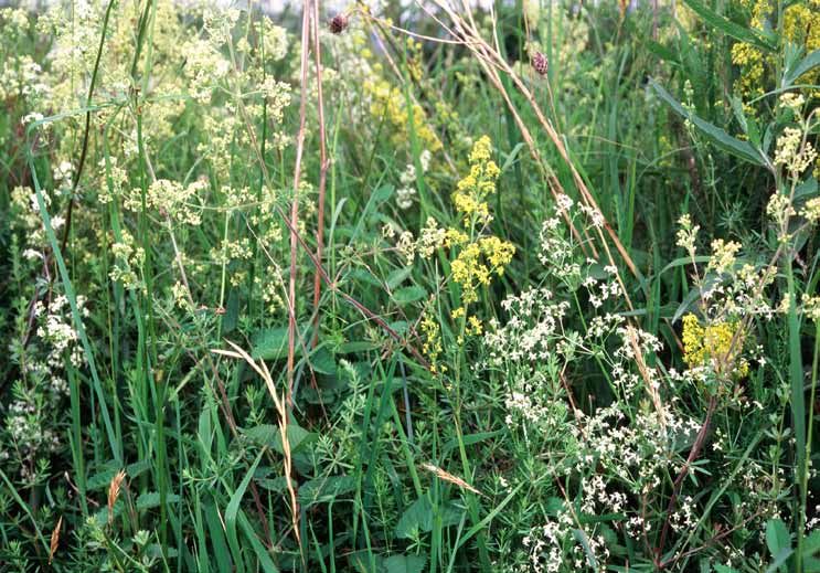
National Character                96: Dunsmore and Feldon
      Area profile:                                                                                                                                 Supporting documents

                                                                                                                                   Key facts             Landscape            Analysis
                                  Introduction & Summary        Description                    Opportunities
                                                                                                                                   and data              change

   The historic character of this area is very important, in particular its ancient
   woodlands, enclosed fields, veteran trees, landscaped parklands and areas
   of archaeological interest, including deserted villages and numerous sites of
   remnant ridge and furrow. The Fosse Way Roman military road passes through
   the area and has influenced patterns of settlement in this NCA. Earthwork
   remains of medieval settlements and associated field systems at Radwell, Tysoe
   and Napton on the Hill are three of the most coherent medieval township
   landscapes in existence in England.

   The area is facing key challenges around how to protect and enhance its assets and
   recreational resource while accommodating the pressure for sustainable modern
   growth and development and the needs of the communities who live there.

                                                                                        Settlement is more nucleated around the plateau fringes, typically comprising loose clusters
                                                                                        of dwellings in brick.

                                                                                                                                                                 4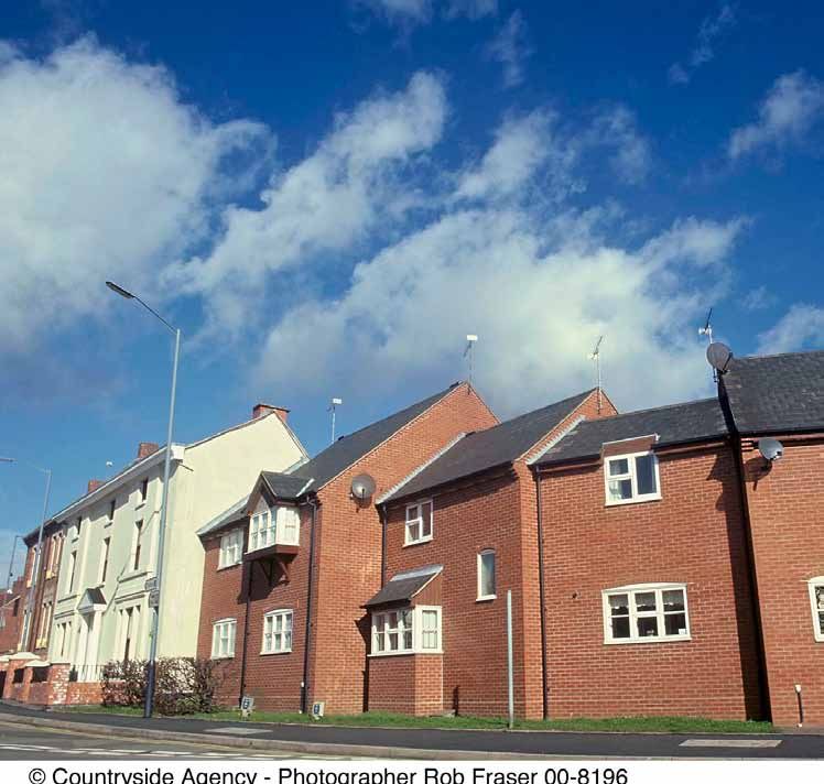
National Character                 96: Dunsmore and Feldon
      Area profile:                                                                                                                                    Supporting documents

                                                                                                                                      Key facts             Landscape            Analysis
                                   Introduction & Summary         Description                    Opportunities
                                                                                                                                      and data              change

   Statements of Environmental Opportunity
   SEO 1: Protect and appropriately manage the historic character, settlement pattern
   and features of Dunsmore and Feldon, in particular its areas of archaeological and
   heritage interest, including the deserted settlements and ridge-and-furrow sites,
   ancient woodlands, veteran trees, farmsteads, country houses and landscaped
   parklands, and enhance the educational, access and recreational experience for
   urban and rural communities.

   SEO 2: Protect and appropriately manage Draycote Reservoir and the important
   network of natural and manmade rivers, streams, ponds, canals and other
   wetland habitats for their important role in water provision and water quality, for
   the species they support and for their contribution to recreation, sense of place
   and geodiversity.

   SEO 3: Protect and manage the mosaic of habitats including woodlands,
   hedgerows and heathlands, particularly ancient and semi-natural woodlands,
   together with sustainable management of agricultural land, and new planting
   of woodland and heathland, where appropriate, to ensure continued provision
   of food, to extend the timber and biomass resource and to contribute to
   pollination, biodiversity and carbon storage, and for the benefits to soil and water
   management.

   SEO 4: Protect and manage the landscape character, high tranquillity levels
   and the historic settlement character to enhance sense of place and of history
   and to promote recreational opportunities; and ensure that new development
   is sensitively located and designed, integrate green infrastructure links into         In this area it will be beneficial to work with conservation groups, landowners and local
                                                                                          authorities to bring woodlands into active, sensitive management. This will help to restore
   development, encourage new woodland planting to soften urban fringe
                                                                                          and enhance biodiversity, retain the wooded character and potentially increase biomass.
   developments and promote recreational assets such as the National Cycle Routes.

                                                                                                                                                                    5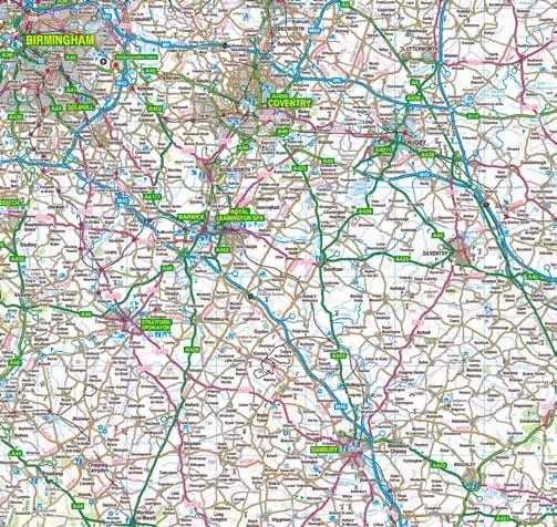
National Character               96: Dunsmore and Feldon
      Area profile:                                                                                                                              Supporting documents

                                                                                                                                  Key facts           Landscape            Analysis
                                 Introduction & Summary        Description                    Opportunities
                                                                                                                                  and data            change

   Description
   Physical and functional links to other National Character
   Areas
   This is a transitional National Character Area (NCA), moving from the wooded
   landscape of Arden in the north to the more agricultural and market garden
   lands of the Severn and Avon Vales in the south-west. It is mainly bordered by
   rural and agricultural landscape, although there are some large urban areas in
   neighbouring NCAs. To the west and on the border of Dunsmore and Feldon lie
   the city of Coventry and the well-wooded landscape of Arden. To the north and
   north-east lie the open agricultural lands of the Mease/Sence Lowlands and
   the Leicestershire Vales. To the east are the undulating pastures and low hills
   of the Northamptonshire Uplands. To the south-west of the area and linked by
   the M40 are the Severn and Avon vales, and on the southern edge the area is
   defined by the steep escarpment of the Cotswolds Area of Outstanding Natural
   Beauty, with Edge Hill, which is the highest point in this NCA, being a prominent
   landmark.

   The Fosse Way Roman road which joins Lincoln to Exeter cuts through the area,        Leamington Spa with Ford Foundry Works and part of River Avon and Grand Union Canal.
   dividing it in half from the north to a south-westerly direction and linking it
   with several NCAs such as the Leicestershire Vales, the Cotswolds and Severn        Gloucestershire. The Avon joins the Severn at Tewkesbury in the Severn and
   and Avon Vales.                                                                     Avon Vales NCA. Draycote Reservoir provides drinking water for communities
                                                                                       in the Arden NCA as well as within Dunsmore and Feldon.
   The Avon catchment drains into the River Severn and Bristol Channel via
   the River Avon and its tributaries (for example, the Leam and the Sowe),            Across the area some long views are possible but tend to be curtailed by the
   thereby functionally and ecologically linking several NCAs in the counties          flat landform, hedgerows and hedgerow trees. The best views across this NCA
   of Northamptonshire, Leicestershire, Warwickshire, Worcestershire and               into Arden in the north and the Cotswolds in the south are from Edge Hill.

                                                                                                                                                              6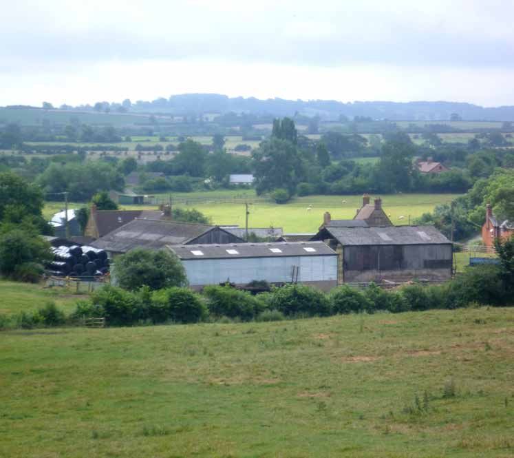
National Character              96: Dunsmore and Feldon
      Area profile:                                                                                                                             Supporting documents

                                                                                                                               Key facts             Landscape           Analysis
                                Introduction & Summary        Description                 Opportunities
                                                                                                                               and data              change

   Several motorways in the area provide transportation corridors through the
   landscape, such as the M40 which connects Arden with Dunsmore and Feldon
   and beyond through the Northamptonshire Uplands, the Chilterns and on into
   London. The Grand Union Canal follows a similar route. The M45 starts in this
   area and travels through the Northamptonshire Uplands to join the M1 and
   through into the Northamptonshire Vales.

   Long-distance walking routes, such as the Millennium Way, link from north
   to south across this area into Arden NCA and the Cotswolds NCA. There are
   networks of rights of way linking the urban areas of Coventry and Rugby into
   this more rural area.

   Distinct areas
   ■■ Dunsmore

   ■■ Feldon

                                                                                   Draycote Reservoir provides local drinking water and is a valuable recreational and
                                                                                   biodiversity resource.

                                                                                                                                                              7
National Character                 96: Dunsmore and Feldon
      Area profile:                                                                                                                                          Supporting documents

                                                                                                                                              Key facts            Landscape                Analysis
                                   Introduction & Summary           Description                       Opportunities
                                                                                                                                              and data             change

     Key characteristics                                                                         on the Hill.
                                                                                              ■■ Predominantly nucleated settlement pattern with a low density of isolated
     ■■ The sense of a predominantly quiet, rural landscape is heightened by its close           farmsteads and some field barns sitting within a landscape of piecemeal and
        proximity to several urban areas, with a gently undulating landscape of low              planned enclosure of the open fields which extended from the villages over
        hills, heathland plateaux and clay vales separated by the occasional upstanding          large parts of this area. Many villages have recently expanded but the traditional
        escarpment.                                                                              buildings, constructed of red brick or Lias limestone, still retain their blue brick or
     ■■ The underlying lower Lias clays and Mercia mudstones are similar throughout              ironstone details.
        Dunsmore and Feldon but the Quaternary ‘superficial’ deposits are what mark           ■■ The busy roads and large industrial units on the outskirts of the main settlements
        the change in character between Dunsmore and Feldon.                                     of Leamington Spa, Coventry and Rugby exert an urban influence on the
     ■■ Light sandy soils associated with the west (Dunsmore) supporting mixed                   surrounding area.
        farming and some intensive arable with fertile alkaline soils to the east (Feldon)    ■■ Limestone quarrying for the cement industry was formerly a feature in the centre
        supporting grazed pasture.                                                               and south of the area, and disused quarries are now prominent elements in the
     ■■ Generally low woodland cover across the area, although there are areas of well-          landscape. The rock exposures and spoil heaps are of geological importance, as
        wooded character and ancient woodlands, especially in the north, providing               well as having interesting limestone grassland communities.
        habitats for bluebells, molluscs and fritillary butterflies; these woodlands are
        linked with landscaped parklands and hedgerow trees.
     ■■ Remnants of the formerly extensive Dunsmore Heath, preserving characteristic
        heathland archaeology, can still be found in woodland clearings. Natural
        regeneration on sand and gravel soils also occurs along roadside verges,
        although bracken is often abundant.
     ■■ Narrow, meandering river valleys with pollarded willows, streamside alders and
        patches of scrub supporting dipper, kingfisher, otter and Atlantic stream crayfish.
     ■■ Canals, including the Grand Union Canal, and Draycote Reservoir provide
        important riparian habitats and a well-used recreational resource.
     ■■ Mainly large fields, with regular or rectilinear shapes, although some smaller         The busy roads and large industrial units on      Narrow, meandering river valley habitats
        fields also feature. Numerous areas of remnant ridge-and-furrow and earthwork          the outskirts of the main settlements exert       support species such as the dipper.
        remains of medieval settlements as found at Lower Tysoe, Radwell and Napton            an urban influence on the surrounding area.

                                                                                                                                                                           8
National Character                96: Dunsmore and Feldon
      Area profile:                                                                                                                               Supporting documents

                                                                                                                                  Key facts            Landscape            Analysis
                                  Introduction & Summary         Description                  Opportunities
                                                                                                                                  and data             change

   Dunsmore and Feldon today
   The geology of the area imposes a strong character on the landscape today.
   Dunsmore owes its character to an extensive spread of Pleistocene gravel
   overlying the Jurassic and Triassic mudstone and limestone bedrock. The
   underlying mudstones created poorly drained soils. However, it is perhaps
   glacial outwash gravels derived from the Anglian ice sheet which have had
   the greater effect. These gravels are so infertile that for centuries this was an
   area of poor heathland, remnants of which survive today. Both the litter from
   the heath species and the impeded drainage allowed iron to be mobilised,
   resulting in widespread induration of the gravels with iron oxides, adding to the
   problems of poor drainage. This resistant soil is, in some measure, responsible
   for the escarpment which defines the margins of the Dunsmore Plateau, which
   rises to 120 m above sea level. Feldon is dominated by a succession of clays and
   limestone-rich strata, all dipping to the south-east, which produce a landscape
   of undulating clay vales separated by the occasional upstanding escarpment,
   notably that of the Penarth Group (including the White Lias). The spine of
   Feldon is attributable to the outcrop of the hard porcellanous limestone of
   the White Lias (the Langport Member of the Lilstock Formation). This produces
   an escarpment, stretching from the Stour Valley in the south to the River
   Leam, which commonly rises some 40 m above the adjacent lowlands. In the             The large-scale Rugby Cement works are a dominant feature in the north-eastern corner of
   south-east, the gently undulating, often poorly drained, clay lowlands are           this NCA. Much of the raw materials come from the interbedded limestones and mudstones
                                                                                        of the Blue Lias Formation found in the area.
   formed dominantly by interbedded limestones and mudstones of the Blue
   Lias Formation which have provided the raw material for the large-scale Rugby
   cement industry.                                                                    High Cross plateau within the Leicestershire Vales. The landcover is primarily
                                                                                       agricultural with extensive arable and improved pasture. The Lower Lias clays
   Light sandy soils are characteristic of much of the area of Dunsmore with heavier   which underlie the bulk of Feldon produce fertile alkaline soils. Such soils are well
   neutral clay loams around the tributaries of the Avon and Leam. Heavy clay soils    suited to the mixed farming and pasture grassland management which has long
   lie within a broad vale bounded to the north-east by the rising ground of the       supported the tradition of corn production and stock rearing in the area.

                                                                                                                                                               9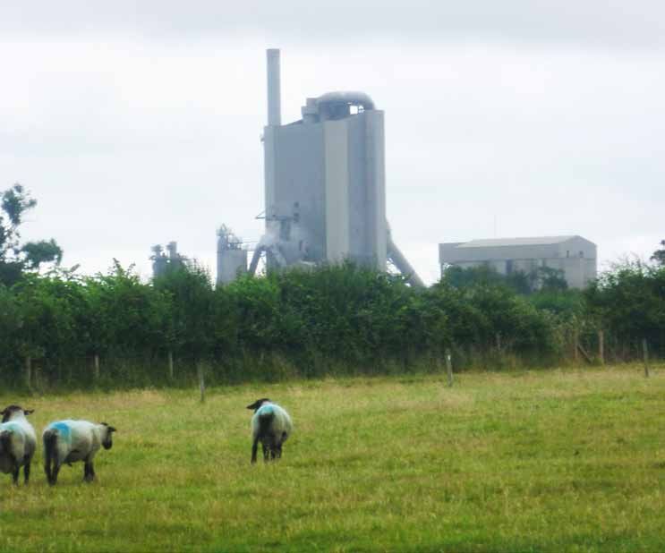
National Character                 96: Dunsmore and Feldon
      Area profile:                                                                                                                              Supporting documents

                                                                                                                                  Key facts          Landscape          Analysis
                                   Introduction & Summary         Description                    Opportunities
                                                                                                                                  and data           change

   Dunsmore is primarily a planned landscape of large fields and small villages; the      The southern Feldon area is predominantly an open landscape and is sparsely
   predominant pattern is piecemeal enclosure of the formerly extensive common            wooded, although woodland is more frequent in the Lias limestone area and
   arable fields. Ridge and furrow, reflecting the former dominance of open field         especially on the western flank and occasional steep scarps. The hedgerows are
   arable cultivation, survives in numerous places and is especially important in         now largely denuded of the large elm trees which once grew in abundance but
   areas such as Lower Tysoe and Radwell, below Edge Hill, and further to the north-      were lost as a result of Dutch elm disease.
   east around Napton on the Hill. In these areas the extensive surviving patterns
   give a real impression of the former nature and extent of the medieval townships.      The area is drained by the rivers Avon and Leam flowing in a general south-
   Many of the remaining limestone exposures and spoil heaps of the quarrying             westerly direction. The river valleys have a poorly defined flood plain and there
   areas in central Feldon have developed limestone grassland communities of high         is often intensively managed arable land up to the river’s edge. The Leam Valley
   diversity and nature conservation value. These areas support rare varieties of fly,    is wider and has a broad spread of terrace gravels stretching upstream to just
   bee, wasp, beetle and butterfly.                                                       beyond the junction with the Itchen. During the winter months the River Leam
                                                                                          is pumped at Eathorpe to provide water for Draycote Reservoir. The reservoir
   Woodlands are frequent in the north of the area, mostly of oak and birch on the        provides drinking water for the communities within the NCA; it is named after
   acid sandy soils, becoming more diverse on the more neutral clay soils. Ancient        the nearby hamlet of Draycote and provides a valuable recreational resource for
   woodlands have survived extensively, especially in the western part, and are           fishing, walking, cycling, windsurfing and sailing. It also supports varied birdlife
   associated with the glacial plateaux. Dominated by oak and birch, often with           with dunlin, yellow wagtail and wheatear all being spotted there. A good example
   an acidic or neutral ground flora, the latter typically host extensive populations     of species-rich hay meadows and pasture can also be found nearby at Draycote
   of bluebells. Ash, holly, hazel and aspen are locally abundant, as is alder on         Meadows Site of Special Scientific Interest (SSSI) nature reserve. It contains plants
   wetter sites. Small-leaved lime and wild service can also be found. Bracken is         typical of unimproved grasslands, such as green winged orchid, lady’s bedstraw,
   abundant on the sandy soils. Neutral marshland species, such as sedges and             adder’s tongue, moonwort and 20 species of grasses.
   rushes, occur in clearings on the clays. The Princethorpe Woodlands include at
   least 24 sites of wildlife interest. Of these there are 20 woodlands covering 618 ha   Settlement of the plateau farmlands is sparse, comprising scattered farmsteads
   and representing more than 10 per cent of the whole of Warwickshire’s ancient          and isolated red brick-built barns, reflecting the late enclosure from heathland
   woodland. The local Biodiversity Action Plan for Warwickshire, Coventry and            and waste. Isolated field barns are a particular feature. Settlement is more
   Solihull identifies the Princethorpe Woodlands as “the most important cluster of       nucleated around the plateau fringes, typically comprising loose clusters of
   ancient woodlands in Warwickshire” and “an outstanding example of a large area         dwellings in brick. Many of the villages, such as Ryton-on-Dunsmore, Wolston and
   of semi-natural habitat”. The woodlands alone are home to 34 of the 35 butterfly       Long Lawford, have expanded considerably with the addition of much modern
   species found in Warwickshire and are important for dormouse, wood white               residential development. The parkland landscape in the north of the area and in
   butterfly, dingy skipper butterfly and small-leaved lime.                              western Feldon has a scattered settlement pattern of farmsteads and groups of

                                                                                                                                                            10
National Character 96: Dunsmore and Feldon
Area profile: Supporting documents
Key facts Landscape Analysis
Introduction & Summary Description Opportunities
and data change
estate cottages as well as a number of large country houses and mansions. Red
brick and limestone are the main building materials of the small nucleated villages.
Limestone is common towards the south, near the Jurassic limestone escarpment
of the Cotswolds. In contrast, red brick buildings with blue brick edging and tile
roofs are a feature of many villages in the west and centre of Feldon. Buildings
in the central part of the area make use of Liassic limestones, often of distinctive
bluish-grey hue in contrast to the yellows of the Jurassic stone, with ironstone
edging conspicuous in areas such as Shipston. Reddish-brown ironstone is the
main building material near the western fringe of the Northamptonshire Uplands.
A distinctive feature of Leamington Spa are the many buildings of Regency style,
in terraces or crescents, with white-painted stucco facades, doorways framed by
two columns, elegant wrought-iron balconies and bow windows.
From the villages a relatively small number of roads radiate out in straight and
regular fashion. One of the straightest roads, running through the middle of this
NCA, is the Fosse Way, a Roman road that is still in use. The area is intersected by
four motorways; the M45, M6 and M69 are mainly confined to the north of the
area, while the M40 cuts through the more rural south. The Grand Union, Oxford
and Coventry canals run through the area. The Grand Union Canal links London
to Birmingham. Commercial traffic on the canal, including the movement of
aggregates from this NCA, finally ceased in the 1990s and leisure traffic took over. A distinctive feature of Leamington Spa are the many buildings of Regency style,
It is now an important recreational resource for the area along with Draycote in terraces or crescents, with white painted stucco facades, elegant wrought-iron
balconies and bow windows.
Reservoir and the Millennium Way, the 160-kilometre long-distance trail which
runs through the area.
This NCA is steeped in history; this is evident in the landscape today, from the
The urban and industrial development of the southern fringe of Coventry falls historic parklands such as those at Alscot and Ettington to the preserved ridge
within this NCA and Rugby, with its sprawling suburbs, dominates the eastern and furrow and the deserted medieval settlements such as Caldecote and
part of the area. Cement works and quarries, such as those at Southam, are also Wolfhamcote where the parish church survives standing isolated in the middle of
notable features. a field.
11National Character 96: Dunsmore and Feldon
Area profile: Supporting documents
Key facts Landscape Analysis
Introduction & Summary Description Opportunities
and data change
The landscape through time
The western half of the area is underlain by rocks of the Triassic age (248–205
million years old) deposited under desert conditions, while the eastern half
of the area is underlain by rocks of Jurassic age (205–142 million years old).
These were deposited as layers of mud and sand in the warm, tropical shallow
sea which covered much of central England at this time. The oldest part of
the Jurassic succession is termed the Lias and comprises clays, limestones
and sands. The clays of the Lias tend to form lower-lying ground and give
rise to heavy clay soils. In this NCA, a 40 m band of limestone, the Marlstone
Rock, represents the Middle Lias, and forms the escarpment of Edge Hill. In
Dunsmore, it is the overlaying Quaternary ‘superficial’ deposits that mark a
difference in character with Feldon. The significant amounts of gravel and sand
present produce the light sandy soils and heathland that were characteristic
of the area. At Wolston a remarkable series of gravels, till (boulder clay) and The Princethorpe woodlands have been identified locally as ‘the most important
cluster of ancient woodlands in Warwickshire’ and ‘an outstanding example of a large
lake sediments have been exposed through gravel extraction. The sediments
area of semi-natural habitat’.
present here have been well studied and demonstrate a significant period of
environmental change during a glacial period of the Quaternary. An important
structural dislocation, the Princethorpe Fault, separates Feldon from the where they could build farms and lay out fields. A flint arrowhead from this
Dunsmore area to the north-east. As a result of this, to the north of the fault the period has been recovered from Wolston.
White Lias (or Lilstock Formation) limestones occur some 6 km further to the
west than they do to the south. The archaeology of land use and settlement from the Bronze Age attests to an
intensification of production, especially on the lighter, more easily worked soils
This area has been inhabited since prehistoric times, with the arrival of the first of the plateau summits and along the fertile main river valleys. By 1500 BC much
people half a million years ago. There is evidence of Palaeolithic settlement at of the woodland had been cleared and settled, leading to the formation of
a temporary camp site at Waverley Wood Farm Pit, near Leamington Spa. The heathland in Dunsmore and elsewhere.
hunter-gatherer way of life was gradually being replaced by simple farming.
Neolithic or new stone-age people raised sheep, pigs and cattle, and grew For the first few decades following the Roman invasion of Britain in 43 AD, the
cereal crops. They used fire and stone axes to make clearings in the woodland area found itself at the frontier of Roman rule. The Fosse Way Roman road was
12National Character 96: Dunsmore and Feldon
Area profile: Supporting documents
Key facts Landscape Analysis
Introduction & Summary Description Opportunities
and data change
constructed, marking the western frontier of the Roman Empire in Britain for With the decline of the wool trade in the mid-16th century, a second stage of
several decades. A great Roman supply and training base was set up at Lunt enclosure began and many of the largest fields were subdivided for lease as
Fort, Baginton, the site of which can be visited today. smaller holdings. The great majority of isolated farmsteads formed as part
of the piecemeal enclosure of open fields, between the 16th and early 19th
The extensive Dunsmore Heath appears to have been an area of traditional centuries, with some on sites of medieval hamlets and villages. Earthworks
heathland converted for use for intercommoning with parishes, forming a reflecting former villages and shrunken ends of settlements are a common
radial pattern from the highest point so that each had a share of rough pasture, characteristic of the area (for example, the nationally important survival of
meadowland and arable land as they extended down towards the more fertile coherent medieval township landscapes at Radwell, Tysoe and Napton on
clays of the river valleys. The fertile farmland of the Feldon was already closely the Hill). Enclosure was completed during the 18th and 19th centuries, with
settled by the late Iron Age and it was one of the most densely populated and characteristic large rectilinear fields marking out the few areas of open field
prosperous parts of the Midlands by the 11th century. Open field agriculture agriculture that persisted beyond the late medieval period. Most of the open
and village-based settlement were widespread by this period. Arable strips heathland was also enclosed at this time and has a similar enclosure pattern of
were farmed in two- or three-field systems. Livestock were grazed on the long, straight hedgerows of hawthorn and blackthorn with frequent hedgerow
fallow fields and on the infertile heath and waste, with hay provided by the trees. Numerous large mansions and country estates such as Compton Verney,
flood plain meadows. Each small township had its own field system, and with its ‘Capability’ Brown-designed landscape, were also developed during
remnants of the ridge and furrow of that period survive and can be seen in the this time.
present landscape.
Until about 1800, the town of Leamington Spa, originally known as Leamington
Depopulation began early in some areas, probably under the influence of the Priors, was a tiny village. The value of the mineral springs was known in the
local 13th-century monastic settlements, but accelerated sharply in the 14th middle ages, but it was not until 1784 that the small village began rediscovering
and 15th centuries owing to a combination of the Black Death, poor summers its saline springs and started building baths around some of them. With the
and dwindling agricultural returns. Land began to fall into large private estates spread of the town’s popularity, and the granting with a ‘Royal’ prefix in 1838
and was steadily amalgamated, enclosed and converted from cultivation by Queen Victoria, Leamington Priors was renamed Royal Leamington Spa.
to pasture. Extensive areas of grazing for the wool trade dominated the Queen Victoria had visited the town as a Princess in 1830 and as Queen in 1858.
landscape, and in some parts the enclosure of strip fields took place to enable Coventry, although not in the area, has had a great impact with its expansion
the farming of arable and pasture by individual farmers. Depopulation was during the Industrial Revolution and in the 20th century which has led to
particularly marked in the northern part of the area, where traces of numerous steady encroachment and urbanisation of the surrounding land, with many
shrunken and deserted settlements can still be found, as well as in the Leam outlying villages in this NCA being engulfed. Dunchurch was a flourishing
Valley. market town in the 17th and 18th centuries, benefiting from its position on the
13National Character 96: Dunsmore and Feldon
Area profile: Supporting documents
Key facts Landscape Analysis
Introduction & Summary Description Opportunities
and data change
main London–Coventry road across Dunsmore Heath. With the coming of the
railways it was overtaken by Rugby as a market centre but still remains a large
village today. Limestone quarrying for the cement industry flourished in the
central part of the area, causing localised impact which is still evident today.
From 1959 through to the 1990s there was an ongoing programme of motorway
building in this NCA linking Birmingham to London via the M6, M45 and
M40. More recently, small-scale woodland planting has increased in the area
fuelled by the desire of landowners and farmers as part of farm diversification,
shooting, shelter and screening. Pressure to accommodate growth also
continues today with the greatest pressure in the semi-rural areas around
Rugby and Leamington Spa, much of which is within greenbelt land.
Ecosystem services
Dunsmore and Feldon NCA provides a wide range of benefits to society. Each
is derived from the attributes and processes (both natural and cultural features)
within the area. These benefits are known collectively as ‘ecosystem services’.
Lady's bedstraw (dark yellow) similar to that which can be found at Draycote Meadows SSSI
The predominant services are summarised below. Further information on is a good example of species-rich hay meadows and pasture.
ecosystem services provided in the Dunsmore and Feldon NCA is contained in
the ‘Analysis’ section of this document.
■■ Water availability: There are three main rivers, the Avon, Stour and Leam,
Provisioning services (food, fibre and water supply) and the last is pumped at Eathorpe to provide water for Draycote Reservoir,
■■ Food production: The light sandy soils in the west support mixed farming which covers more than 2.4 km² and holds up to 23,000,000 m³ of water.
with some commercial-scale arable. In the east the fertile alkaline soils are The reservoir provides drinking water for Leamington Spa and the rest of the
well suited to pasture grassland management. Arable farming benefits from local population within the NCA. All of the rivers have water ‘not available’
the fertile soils, mainly Grade 2 and Grade 3, which together make up nearly for licensing status owing to over-abstraction. The Environment Agency has
90 per cent of the area. A third of the area is lowland grazing with a similar been working with Severn Trent Water to renew the licence agreement for
amount used for cereal farming. Draycote Water.
14National Character 96: Dunsmore and Feldon
Area profile: Supporting documents
Key facts Landscape Analysis
Introduction & Summary Description Opportunities
and data change
Regulating services (water purification, air quality maintenance and climate
regulation)
■■ Regulating water quality: There is potential for this to be a key service
when diffuse pollution, which remains a serious problem in many rivers,
is addressed. Water quality in the area has improved in recent decades
but, with the exception of the eastern sub-catchment of Radford Brook,
none of the area meets the requirement of good ecological status. The
main contaminants to be addressed across the whole catchment in order
to meet the required good ecological status are phosphates, pesticides
and sedimentation. Pollutants in the waterbodies are of particular concern
within the Leam catchment as the River Leam and Draycote Reservoir are
used as sources of drinking water for the local population.
Cultural services (inspiration, education and wellbeing)
■■ Sense of history: The area has a strong sense of history, from the ancient
woodlands and remnant heathlands to the evidence for land use and
settlement in its distinctive patterns of routeways, enclosures and
There is an opportunity to conserve and enhance Draycote Reservoir along with the rivers
settlement, and its architecture. Many now rare areas of ridge and furrow and canals of the area for locals and visitors to enjoy.
show the location of medieval open fields. Earthwork remains of medieval
settlements and associated field systems at Radwell, Tysoe and Napton on
the Hill are three of the most coherent medieval township landscapes in industry found in three areas – between Harbury and Bishop’s Itchington,
existence in England. Large country houses set in mature parkland are a around Southam Quarry (which is active and expanding) and west of Rugby.
recurring feature. The canals and the old Roman road, the Fosse Way, are Some sites contain small geological SSSI or Local Geological Sites which
indications of the important access routes through this area. There are some are usually on small sections of the quarry face. Gravel and sand are also
fine Georgian buildings in the centre of Leamington Spa, an indication of the extracted in the area, such as at the large Ryton Pools. This is a country park
rising fortune of the town as the spa waters became more popular. located partially on landfill plus an active landfill site and expanding quarry.
Smaller satellite sand pits can also be found, such as The Dell and Lawford
■■ Geodiversity: Limestone and ironstone quarries and spoil heaps are Heath on the Dunsmore plateau. Only one stone quarry is in operation,
scattered across the area but with a concentration linked to the cement which currently extracts ironstone near Edge Hill.
15National Character 96: Dunsmore and Feldon
Area profile: Supporting documents
Key facts Landscape Analysis
Introduction & Summary Description Opportunities
and data change
Statements of Environmental Opportunity
SEO 1: Protect and appropriately manage the historic character, settlement pattern and features of Dunsmore and Feldon, in particular its areas of
archaeological and heritage interest, including the deserted settlements and ridge-and-furrow sites, ancient woodlands, veteran trees, farmsteads,
country houses and landscaped parklands, and enhance the educational, access and recreational experience for urban and rural communities.
For example by:
■■ Using and understanding the area’s traditional and historic architecture, ■■ Conserving features of heritage interest by working with farmers and other
and its distinct patterns of village-based settlement, manor houses landowners to minimise damaging cultivation practices, for example preventing
and farmsteads to inform appropriate conservation and use of historic arable ploughing within areas of ridge-and-furrow and settlement earthworks.
buildings, and to plan for and inspire any environmentally beneficial new ■■ Using agri-environment schemes to restore parklands by re-creating
development which makes a positive contribution to local character. unimproved pasture from more recent arable cultivation, planting
■■ Working with the Cotswolds Area of Outstanding Natural Beauty (AONB) replacement trees of appropriate species and conserving veteran parkland
and ensuring the use of the Cotswolds Conservation Board’s Landscape trees by protecting them from damage.
Strategy and Guidelines and other guidance adopted by the Board. ■■ Using agri-environment agreements to repair traditional farm buildings
■■ Working with the planning system and local groups to encourage the use including field barns.
of traditional building materials for construction, extension and repair ■■ Raising awareness of these assets for locals and visitors, ensuring that they are
work, linking this with specialised timber production from the local enhanced for recreational and educational purposes.
woodlands, for example cruck frames and the use of local building stone. ■■ Promoting the recreational and educational opportunities afforded by the
■■ Working with local groups, statutory agencies and non-governmental network of rights of way and improved access to the open countryside from
organisations to conserve and enhance the condition of the area’s towns, which could have a beneficial effect on people’s health and wellbeing
geological history with special regard to the geological Sites of Special and provide solutions for sustainable transport.
Scientific Interest and Local Geological Sites. ■■ Improving opportunities for the enjoyment and understanding of the
■■ Protecting and maintaining the ridge-and-furrow earthworks evident landscape and its valuable historic and natural features so that people can
around isolated villages and narrow river margins with good soil and land experience escapism and inspiration, while conserving its qualities.
management. ■■ Protecting the important Registered Parks and Gardens and historic centres
such as Leamington Spa and seeking to increase the opportunities for
people to enjoy and deepen their understanding of the natural and historic
environment and to take action to improve it.
16National Character 96: Dunsmore and Feldon
Area profile: Supporting documents
Key facts Landscape Analysis
Introduction & Summary Description Opportunities
and data change
SEO 2: Protect and appropriately manage Draycote Reservoir and the important network of natural and manmade rivers, streams, ponds, canals
and other wetland habitats for their important role in water provision and water quality, for the species they support and for their contribution to
recreation, sense of place and geodiversity.
For example by:
■■ Using the River Leam Catchment Plan to appropriately manage the River ■■ Seeking opportunities to extend and enhance areas of wetland habitat
Leam in order to support and protect its biodiversity and ensure good such as wet meadows and wet woodland, particularly in flood plains
water quality. and along rivers and streams, and managing them in favourable
■■ Promoting the River Leam Catchment Plan and agri-environment condition for declining species such as water vole and otter.
schemes to farmers and landowners. ■■ Conserving and enhancing the recreational value of the rivers, canals
■■ Extending agreements with farmers to minimise the effects of diffuse and Draycote Reservoir for locals and visitors to enjoy.
pollution from commercial agriculture by adopting buffer strip ■■ Enhancing the river corridor value by flood plain grassland and
management, particularly along the River Leam, to help to improve wetland creation and tree planting along banks where connectivity
water quality. has been lost owing to removal for past agricultural and flood defence
■■ Working with statutory agencies and voluntary groups to manage activities. This improved linear connectivity with important intersecting
the canals so that the benefits for biodiversity and recreation are hedgerows and woodlands can aid species movement and restore the
maximised. wooded sinuous feature as a part of the character of the area.
■■ Working with the water companies, statutory agencies and other ■■ Encouraging farmers and landowners to manage and extend their
stakeholders to ensure that Draycote Reservoir is managed to enable hedgerows so that run-off is significantly slowed down, flooding is
it to provide good-quality drinking water as well as maintaining reduced and a sense of place is reinforced.
and enhancing its biodiversity and capacity for different types of ■■ Restoring and creating ponds to re-establish the network of this habitat
recreation. and to support the great crested newt population.
■■ Providing buffer strips of semi-natural vegetation around the reservoirs,
and increasing the quantity of reedbeds to naturally filter the water.
17National Character 96: Dunsmore and Feldon
Area profile: Supporting documents
Key facts Landscape Analysis
Introduction & Summary Description Opportunities
and data change
SEO 3: Protect and manage the mosaic of habitats including woodlands, hedgerows and heathlands, particularly ancient and semi-natural woodlands, together
with sustainable management of agricultural land, and new planting of woodland and heathland, where appropriate, to ensure continued provision of food, to
extend the timber and biomass resource and to contribute to pollination, biodiversity and carbon storage, and for the benefits to soil and water management.
For example by:
■■ Maintaining, restoring and creating semi-natural habitats – heathland and ■■ Increasing woodland and maintaining heathland in good condition to benefit
lowland acid grassland (particularly on the Dunsmore plateau), new planting carbon storage in soils.
of woodland, especially in the well-wooded areas in the north of the National ■■ Ensuring that future management is informed by the need to retain features
Character Area (NCA), parkland, lowland meadows and lowland calcareous of heritage interest, and the potential for new discoveries relating to historic
grassland, particularly adjacent to existing areas of habitat, to strengthen and woodland and pre-woodland land management such as settlement
extend the habitat network and so that resilience to climate change impacts is earthworks.
improved. ■■ Ensuring that any new woodland planting is generally appropriate, making a
■■ Exploring the potential to re-create heathland (and other Biodiversity Action contribution to increasing the overall woodland coverage in the region and
Plan habitats that are beneficial to pollinating invertebrates), by increasing integrating new development into the landscape, as well as boosting carbon
its quality and extent, and by strengthening the interconnectivity of habitat storage.
networks. ■■ Managing the heathland remnants in favourable condition to encourage the
■■ Working with conservation groups, landowners and local authorities to bring greatest diversity of plants that will attract pollinating invertebrates.
woodlands into active sensitive management and re-introducing coppicing ■■ Working with the Cotswolds AONB to ensure that their Landscape Strategy and
to restore and enhance the biodiversity value of these neglected woodlands, Guidelines and other guidance adopted by the Board for the Cotswolds are
retain their wooded character and potentially increase biomass production taken into account.
from existing areas of woodland; and buffering existing woodlands and ■■ Working with farmers to manage arable cropping patterns in order to
encouraging natural regeneration in adjacent areas to increase the area of encourage rarer arable plants, farmland birds and mammals and create grass
woodland habitat, while ensuring that native provenance is retained. margins around arable fields while maintaining food production.
■■ Creating new woodlands on the urban edges of Coventry, Leamington Spa ■■ Increasing woodland and shelterbelts, restoring ‘gappy’ hedgerows in poor
and Rugby, following existing patterns to screen urban development, enhance condition to act as windbreaks, bind the soil to reduce soil erosion and
recreational opportunities and improve green infrastructure. reinforce landscape character, and to support foraging and nesting of birds,
■■ Seeking opportunities to plant energy crops of native species to increase bats and other wildlife.
biomass production while maintaining the overall open character of the ■■ Conserving species-rich hedgerows, wood banks and field margins to restore
landscape and open views from woodland through to the wider countryside. biodiversity and to enhance connectivity between woodlands and other habitats.
18National Character 96: Dunsmore and Feldon
Area profile: Supporting documents
Key facts Landscape Analysis
Introduction & Summary Description Opportunities
and data change
SEO 4: Protect and manage the landscape character, high tranquillity levels and the historic settlement character to enhance sense of place and of history
and to promote recreational opportunities; and ensure that new development is sensitively located and designed, integrate green infrastructure links into
development, encourage new woodland planting to soften urban fringe developments and promote recreational assets such as the National Cycle Routes.
For example by:
■■ Planning of new woodlands around settlement fringes to help to ■■ Integrating co-ordinated provision of green infrastructure into any
integrate new development into the landscape and absorb the scale of development so that it offers the local community opportunities to
urban edge development, particularly in the urban fringes of Coventry enjoy their local green space and to take action to improve it. This will
and Rugby. have benefits for the health and wellbeing of those living in the NCA, as
■■ Exploiting opportunities presented by the undeveloped nature of well as providing benefits to biodiversity.
the West Midlands Green Belt and its juxtaposition with large urban ■■ Ensuring that any new developments incorporate well-designed
populations to secure green infrastructure features, especially green infrastructure, to include improved access and recreational
accessible semi-natural green spaces, linear routes and landscape opportunities for local communities and visitors, providing them with a
enhancements to be delivered as part of wider infrastructure range of benefits, including health and economic benefits, afforded by
enhancement in relation to the continued growth of Coventry, Rugby access to good-quality green spaces.
and Leamington Spa. ■■ Managing the post-industrial cement and quarry sites in the
■■ Enhancing the interconnectivity of high-quality green or semi-natural Princethorpe/Bubbenhall/Ryton complex to deliver habitat and access
spaces and linear routes and the opportunity for multifunctional benefits.
benefits to accrue from those spaces; and creating permissive access ■■ Conserving more remote areas from development by working to ensure
routes for all abilities to link with the public rights of way network and that traditional settlement patterns are retained and maintaining
local routes, open access sites or additional circular routes for all levels relatively high levels of tranquillity beyond the M40; and
of user to points of interest such as river/watersides, historic sites and managing the expansion of the transport network, ensuring that
environmental features, and near to population centres (Coventry, improvements are carefully planned to provide positive landscape
Rugby and Leamington Spa). benefits.
19National Character 96: Dunsmore and Feldon
Area profile: Supporting documents
Key facts Landscape Analysis
Introduction & Summary Description Opportunities
and data change
Supporting document 1: Key facts and data
Total area: 70,597 ha There are 376 local sites in Dunsmore and Feldon covering 5,665 ha which is 8
per cent of the NCA.
1. Landscape and nature conservation designations Source: Natural England (2011)
The Dunsmore and Feldon NCA contains 658 ha of the Cotswolds Area of Out- ■■ Details of individual Sites of Special Scientific Interest can be searched at:
standing Natural Beauty which is 1 per cent of the NCA. http://www.sssi.naturalengland.org.uk/Special/sssi/search.cfm
■■ Details of Local Nature Reserves (LNR) can be searched:
The management plan for the protected landscape can be found at: http://www.lnr.naturalengland.org.uk/Special/lnr/lnr_search.asp
www.cotswoldsaonb.org.uk ■■ Maps showing locations of Statutory sites can be found at:
Source: Natural England (2011)
http://magic.defra.gov.uk/website/magic/ – select ‘Rural Designations Statutory’.
1.1 Designated nature conservation sites
The NCA includes the following statutory nature conservation designations: 1.1.1 Condition of designated sites
Area % of A breakdown of SSSI condition as of March 2011 is as follows:
Tier Designation Name (ha) NCA % of SSSI land in
International n/a n/a n/a n/a SSSI condition category Area (ha) category condition
European Special Protection Area n/a n/a n/a
Unfavourable decliningNational Character 96: Dunsmore and Feldon
Area profile: Supporting documents
Key facts Landscape Analysis
Introduction & Summary Description Opportunities
and data change
2. Landform, geology and soils exposed through gravel extraction at Wolston, just to the east of Coventry. The
sediments present here have been well-studied and demonstrate a significant
2.1 Elevation period of environmental change during a glacial period of the Quaternary.
Elevation ranges from 34 m above sea level to a maximum of 217 m. The mean Indeed, the sequence of sediments exposed at Wolston has been so important
average elevation is 87 m above sea level. The highest point in the NCA is Edge that the penultimate glacial stage of the Quaternary in Britain has been named
Hill near Ratley. as the Wolstonian.
Source: Natural England 2010 Source: Dunsmore and Feldon Countryside Character Area Description.
2.2 Landform and process
Dunsmore comprises the wedge-shaped area of low ridges and valleys lying 2.5 Designated geological sites
between Leamington Spa, Coventry and Rugby. The core is former heathland Designation Number of sites
associated with the low plateau of glacial deposits running from Cubbington to
Geological Site of Special Scientific Interest (SSSI) 5
Hillmorton.
Mixed interest SSSI 0
The Feldon is closely associated with a broad belt of Lower Lias clays which
There are 25 Local Geological Sites within the NCA
form a gently rolling tableland some 100 m to 150 m AOD. Source: Natural England (2011)
Source: Dunsmore and Feldon Countryside Character Area Description
■■ Details of individual Sites of Special Scientific Interest can be searched at:
2.3 Bedrock geology
http://www.sssi.naturalengland.org.uk/Special/sssi/search.cfm
The Dunsmore area is at the junction of the Mercia Mudstones and Lower
Lias clays. In the Feldon area the Lias platform is marked to the west by an
2.6 Soils and Agricultural Land Classification
escarpment, formed by White Lias Limestone. The steep Cotswold escarpment
Light, sandy soils are characteristic of the Dunsmore area. Clay-floored valleys
of the Jurassic Limestone defines the south and south-eastern boundary.
have heavier, neutral clay-loams. The northern part of Dunsmore lies in an
Source: Dunsmore and Feldon Countryside Character Area Description
area of heavy clay soils. The Lower Lias clays underlie the bulk of Feldon and
produce fertile, alkaline soils.
2.4 Superficial deposits
Source: Dunsmore and Feldon Countryside Character Area Description
The glacial deposits form a series of low plateaux and ridges. The superficial
deposits impose a character on Dunsmore – the area between Stretton-
on-Dunsmore and Rugby stretching south-westwards towards Leamington
– which makes it markedly different from the Feldon to the south-west. A
remarkable series of gravels, till (boulder clay) and lake sediments have been
21National Character 96: Dunsmore and Feldon
Area profile: Supporting documents
Key facts Landscape Analysis
Introduction & Summary Description Opportunities
and data change
The main grades of agricultural land in the NCA are broken down as follows (as This NCA is drained by the rivers Avon and Leam flowing in a south-westerly direc-
a proportion of total land area): tion. The northern part of the area is drained by the Smite Brook, a tributory of the
Agricultural Land Classification Area (ha) % of NCA Sowe. The tributaries of the Stour, Dene, Itchen and Leam drain at right angles to
Grade 1 0 0 the main rivers, producing a trellised drainage pattern. Draycote Water is a reser-
Grade 2 6,074 9 voir and country park near the village of Dunchurch. It covers more than 240 ha
Grade 3 56,551 80 (2.4 km²) and holds up to 5,000 million imperial gallons (23 million m³) of water.
Grade 4 4,114 6
3.2 Water quality
Grade 5 193National Character 96: Dunsmore and Feldon
Area profile: Supporting documents
Key facts Landscape Analysis
Introduction & Summary Description Opportunities
and data change
have survived in the west. Feldon is sparsely wooded but with a band of ancient 5.2 Field patterns
woodland present running from Alderminster to Long Itchington. Many areas of ridge and furrow show the location of medieval open fields,
Source: Dunsmore and Feldon Countryside Character Area Description especially important in areas such as Lower Tysoe and Radwell, below Edge Hill,
and further north-east around Napton on the Hill. Fields are usually large, with
4.3 Woodland types
regular or rectilinear shapes, although there are some smaller fields.
A statistical breakdown of the area and type of woodland found across the Source: Dunsmore and Feldon Countryside Character Area description;
NCA is detailed over. Countryside Quality Counts (2003)
Area and proportion of different woodland types in the NCA (over 2 ha) 6. Agriculture
Woodland type Area (ha) % of NCA The following data has been taken from the Agricultural Census linked to this NCA.
Broadleaved 3,340 5
Coniferous 276You can also read