A1 in Northumberland Alnwick to Ellingham scheme - Preliminary environmental information report: Non-technical summary
←
→
Page content transcription
If your browser does not render page correctly, please read the page content below
A1 in Northumberland
Alnwick to Ellingham scheme

Preliminary environmental
       information report:
  Non-technical summary
Quality control

Issue/revision    First issue            Revision 1                 Revision 2

Remarks           For HE Review          For Final HE Review        For HE Approval

Date              December 2018          January 2019               February 2019

Prepared by       Lowri McCann           Victoria Wilson            Victoria Wilson

Signature

Checked by        Kevin Stubbs           Kevin Stubbs               Kevin Stubbs

Signature

Authorised by     David Morrow           David Morrow               David Morrow

Signature

Project number    70044137               70044137                   70044137

Report number     HE551459-WSP-          HE551459-WSP-EGN-          HE551459-WSP-EGN-
                  EGN-A2E-RP-LE-         A2E-RP-LE-1656             A2E-RP-LE-1656
                  1656

File reference    \\uk.wspgroup.com\ce   \\uk.wspgroup.com\centra   \\uk.wspgroup.com\centra
                  ntral                  l                          l
                  data\Projects\700380   data\Projects\700380xx\7   data\Projects\700380xx\7
                  xx\70038006 - A1 in    0038006 - A1 in            0038006 - A1 in
                  Northumberland\02      Northumberland\02          Northumberland\02
                  WIP\EI Environmental   WIP\EI Environmental       WIP\EI Environmental
                  Impact Assessment      Impact Assessment and      Impact Assessment and
                  and flood risk\03      flood risk\03 Reports\04   flood risk\03 Reports\04
                  Reports\04             Preliminary                Preliminary
                  Preliminary            Environmental Impact       Environmental Impact
                  Environmental Impact   Report\NTS\v2              Report\20 NTS\v3
                  Report\NTS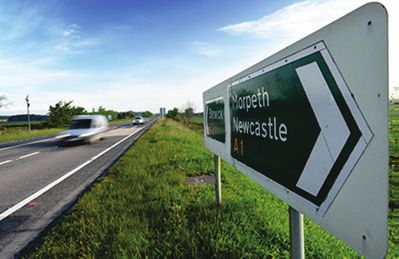
Introduction
This document provides a Non-Technical Summary of the Preliminary Environmental Information
Report for A1 in Northumberland: Alnwick to Ellingham (the “scheme”) to help provide an
understanding of the potential environmental impacts. The Preliminary Environmental Impact Report
can be found our webpage: www.highwaysengland.co.uk/a2e
We are proposing to improve the A1 between Alnwick and Ellingham in Northumberland by widening
the existing single carriageway (one lane in each direction) to a dual-carriageway (two lanes in each
direction). The scheme would increase capacity along the existing route, improve journey times,
increase safety and promote future economic growth whilst seeking to protect and enhance the
environment.

The scheme is a Nationally Significant Infrastructure Project under the Planning Act 2008 (the “2008
Act”), which means that an application will need to be made to the Planning Inspectorate (the
Inspectorate) to build and operate the scheme. This application is called a Development Consent
Order. More information about the Development Consent Order process is available at the
consultation events.
Before an application for a Development Consent Order is submitted to the Inspectorate, the local
community and other stakeholders must be formally consulted on the proposal. This consultation
must include a description of the scheme, the likely significant environmental effects based on the
preliminary environmental information available at the time, the measures proposed to avoid or
reduce such effects and the alternatives that have been considered. The information in this
document supports consultees in developing an informed view of the likely significant environmental
effects of the scheme and respond to the consultation.
The likely significance of an environmental impact is determined by taking account of the sensitivity
of an environmental feature (e.g. house, wildlife habitat or river), the magnitude of the impact (i.e.
the change from the existing situation) and whether it can be mitigated through good design or
management. The greater the sensitivity of the environmental feature and the greater the magnitude

of impact, the more significant the effect. Impacts considered to be of moderate or above
significance are regarded as significant effects. As well as carrying out our consultation we are
continuing to gather environmental information, identifying the potential impacts of the scheme and
developing measures to avoid, reduce or mitigate negative impacts as well as providing
enhancements where possible. This process is known as an Environmental Impact Assessment,
which is required by the Infrastructure Planning (Environmental Impact Assessment) Regulations
2017 (the Environmental Impact Assessment Regulations). The findings of the Environmental
Impact Assessment will be reported in an Environmental Statement.
While the Environmental Impact Assessment is ongoing, the Preliminary Environmental Impact
Report has been developed for consultation and describes the current environmental conditions and
anticipated impacts of the scheme on the environment. This Non-Technical Summary provides a
summary of the Preliminary Environmental Impact Report in non-technical language.
The information in the Preliminary Environmental Impact Report is preliminary and the findings will
be developed further in the Environmental Statement to show the progression of the scheme design
which will be informed by the feedback from the consultation and the ongoing Environmental Impact
Assessment. The Environmental Statement will present the full results from the Environmental
Impact Assessment and will be submitted with the Development Consent Order application.
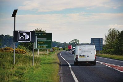
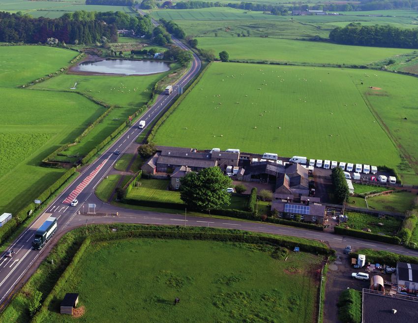
The scheme Surrounding environment The scheme is located on the A1 in Northumberland north of Newcastle-upon-Tyne on the north- east coast of England and forms part of the motorway and major road network. The scheme is located between Denwick and North Charlton and is approximately 8 km in length. Northumberland County Council (NCC) is the local authority for the area. The scheme would be located within open rural countryside, with the existing A1 running next to agricultural fields and near woodlands. The scheme is located in a gently rolling landscape. The closest community near the scheme is Alnwick, with various other smaller villages and hamlets in the area including Denwick, South Charlton, North Charlton and Brownieside. There are number of Public Rights of Way across the scheme. The scheme does not cross any main rivers and there are no protected ecological sites (such as a Special Area of Conservation or Sites of Special Scientific Interest) within the scheme footprint. The scheme lies within areas of flood risk and there are two cultural heritage features within the scheme including prehistoric burial mound and a milepost. In addition, a possible Roman camp and deserted mediaeval village lie immediately adjacent to the scheme. Why is this scheme needed? The A1 is one of the longest roads in the country, connecting London to Newcastle and Edinburgh. The route currently includes areas of motorway standard and dual carriageway standard, with some single carriageway sections including two sections running between Morpeth and Ellingham and north of Ellingham towards Berwick. Over the last 10 years there have been significant upgrades to the A1 south of Newcastle with many sections now motorway standard. As a result, plans to progress these upgrades to the A1 in Northumberland have been considered. A feasibility study completed in 2014 considered the problems experienced by users on the A1 in Northumberland and identified the following: A lack of alternative routes for driver journeys. Different carriageway standards along the route (i.e. single to double carriageway in places) which can lead to confusion for long distance drivers. Poor junction standards and layout – there are many different types of junctions along the route which can be confusing to drivers. Many junctions and direct accesses on to the A1, resulting in delays and potential accidents when vehicles exit or enter the main carriageway Average traffic speeds on the single carriageway sections of the route are much lower than on the dual carriageway sections of the route. There is a high number of heavy goods and agricultural vehicles north of Alnwick which results in reduced speeds for other vehicles. Lack of overtaking opportunities on single carriageway sections of the route which slows down traffic. Peak-hour traffic speeds are much lower than when traffic is free flowing.
As a result, the scheme is designed to address these problems and improve the safety and reliability of journey times along the route. Scheme Objectives The key objectives of the scheme are: Improve journey times Improve network resilience and journey time reliability Improve safety Maintain access whilst improving the conditions for strategic traffic Facilitate future economic growth Avoid, mitigate and compensate for potential impacts upon the built and natural environment To seek to support no net loss of biodiversity To ensure effective measures are put in place to protect watercourses from pollutant spillages on the highway Encourage the use of environmentally friendly operations and products throughout the scheme life cycle. Description of the scheme The scheme would be approximately 8 km in length and would be located along the A1 between Denwick and North Charlton. The key features of the scheme are as follows: Throughout the length of the scheme, the existing A1 would be widened so that the existing road would form the new northbound carriageway and a new southbound carriageway would be constructed to the east and next to the existing route. The existing junctions at Charlton Mires would be replaced with a split level junction located at Charlton Mires, called Charlton Mires Junction. This means a bridge would be built above the A1 which would separate the local traffic from the long-distance traffic.
A roundabout would be constructed where there is an existing sharp north-west bend in the B6347, to the north of Rock Lodge. The roundabout would provide safe access to the B6347 west and B6341, northbound carriageway of the A1 as well as southbound carriageway of the A1 and B6347 east via the new junction. An accommodation bridge for vehicles as well as walkers, cyclists and horse riders would be constructed across the A1 at one of two locations. This would be located either to the west of Broxfield, to be known as the Broxfield option or to the east of Heckley Fence, to be known as the Heckley Fence option. More details on these options can be found in the Alternatives Section, below. It is anticipated that two residential properties (East Cottage and Charlton Mires Farm) would need to be demolished to accommodate the new Charlton Mires Junction. These are located east of the existing junction at Charlton Mires. Private means of access would be provided for properties where existing access on to the A1 would be closed. This includes the existing direct access between Rock South Farm and the A1 which would be closed, Footpath 129/005 would be upgraded to an access road for these properties. The direct access between Heckley Fence and the A1 would also be closed meaning access to and from the A1 would be from the new Charlton Mires Junction. Two access tracks would be located to the north of the new Charlton Mires Junction and run next to the upgraded A1, either side of the route. West Linkhall Access Track would service West Linkhall and Paterson Cottage and East Linkhall access track would service East Linkhall and West Lodge. A new surface water drainage system would be provided and would include six surface water storage basins and six new water discharge outfalls. Highway runoff (surface water from the road during rainfall) would be discharged into surrounding watercourses. The scheme would require a total of fifteen new culverts (structures that allow water to flow under a road) or extension of existing culverts. Public Rights of Way would be temporarily closed or diverted during construction and permanently closed or diverted during operation. The new Charlton Mires Junction includes a separated footway for walkers. Existing traffic signage and technology would be used unless it does not meet current standards, in which case it would be replaced or shut down. No new lighting is proposed as part of the scheme but further consideration is being given to lighting at the new Charlton Mires Junction. Utilities would need to be diverted as part of the scheme including Northumbrian Water mains, gas diversions, electric diversions, water diversions, and BT, Virgin and Vodafone telecoms. Extra high voltage cables that originate at Middlemoor Wind Farm would also have to be diverted as part of the scheme. Two bus stops would be provided along the B6341 to the west of the A1, near to the new Charlton Mires Junction. These would replace one existing bus stops on the B6341 near Charlton Mires. Six parking lay-bys are included in the design along the A1. Three would be on the southbound carriageway and three on the northbound carriageway. If the Development Consent Order is approved, work would start on the scheme in 2021 and would be completed in 2023. Where possible, the A1 would be kept open during the construction work. However, road closures would be required along the A1 and side roads for the installation of
temporary traffic management, construction of the bridges, utility diversions, and carriageway tie-in
work. At the time of writing, seven potential diversion routes were being considered for the
construction period. These potential diversion routes are located along the A1, A697, A698, B6340,
B6341 and B6347, and range in length from 4.5 miles to 52.2 miles. The majority of the diversions
routes would be implemented during the night including weekends. However, it should be noted that
extended closures (beyond nights and weekends) could potentially be required. The main
communities that would be affected by the diversion routes include Rennington, Preston, Bellshill,
Chatton and Wooler.
Three locations for temporary site compounds have been identified, with a maximum of two being
used for the construction of the scheme. The main compound would be located to the west of
Thirston New Houses and shared with the A1 in Northumberland: Morpeth to Felton scheme, being
considered as a separate Development Consent Order application to this scheme. A site compound
has also been proposed to the south of Alnwick adjacent to the salting and gritting depot at
Lionheart Enterprise Park. This salting and gritting depot was designed to service the A1 in
Northumberland. Finally, a field to the south-east of Charlton Mires is also proposed. This potential
site compound would be called Charlton Mires site compound and is located within the scheme
footprint to the east of the existing A1, in an existing field to the south of Charlton Mires.
It should be noted that if the A1 in Northumberland: Morpeth to Felton scheme is not consented, the
Lionheart Enterprise Park Compound and / or the Charlton Mires site compound would be used in
place of the proposed main compound.
These temporary site compounds would be used during construction, for example, to store
construction materials and machinery, for site offices and for welfare facilities for the construction
workers. These site compounds would either be returned to their previous use, or utilised for
environmental mitigation, once construction is complete.
The applicant Highways England Company Ltd is the government company charged with operating, maintain and improving England’s motorways and major A roads. Alternatives Extensive studies, technical consultation and assessment have been undertaken to shape the proposals for the scheme. The process of options identification and route selection leading to the scheme is set out in section 3 of the Preliminary Environmental Impact Report Volume 1 (highwaysengland.co.uk/a2e). In summary, the process included the following steps: Identification and initial assessment of potential route options. Development of three route options, with early public consultation in May 2016. The selection of the scheme’s preferred route, which was publicly announced by the Secretary of State for Transport in September 2017. The three route options that were presented at the early public consultation events include: Orange option: Upgrade the existing road to dual carriageway, widening either to the east or the west depending on local features that need to be considered. Green option: Upgrade approximately 1.2 miles (2 km) of existing road to dual carriageway, and build a new carriageway to the east of the existing road at Heckley Fence, before crossing over to the west of the existing road at Elsnook Plantation and continuing until Shipperton Burn. Blue option: Upgrade the majority of the existing road to dual carriageway, with approximately 2.2 miles (3.5 km) section of new carriageway built to the west of the existing route between Elsnook Plantation and Shipperton Burn. Due to funding constraints, the orange option was identified as the sole viable option and this was our preferred route. Following the preferred route announcement in September 2017, a review of route alignment options concluded that the alignment for the new carriageway would be located to the east of the existing carriageway. This is due to the need to retain two properties to the west of the existing carriageway, operational performance as well as the health and safety concerns associated with constructing new drainage infrastructure next to extra high voltage cables that originate at Middlemoor windfarm. Accommodation bridge options There are currently two options for the location of the accommodation bridge, at the south end of the scheme. The purpose of this bridge is to retain existing public rights of way and crossing points for agricultural vehicles that currently cross the A1 at road level. For safety reasons, these existing crossing points would not be maintained as part of the scheme. The Broxfield option would maintain the existing location of a byway whereas the Heckley Fence option would maintain the existing crossing for farm vehicles. The Preliminary Environmental Impact Report includes an environmental assessment and comparison of both options in each of the assessment sections below and the summary section.
The environmental impact environmental statement
Under the Environmental Impact Assessment Regulations, due to the schemes close proximity and
potential to create direct impacts on sites of historical, cultural or archaeological significance, the
scheme requires an Environmental Impact Assessment. An Environmental Impact Assessment is
therefore being undertaken to meet the requirements of the relevant planning policy and legislation
to consider the effects of the construction and operation of the scheme on the environment. The
relevant policies and legislation have been taken into account when preparing the Preliminary
Environmental Impact Report.
An Environmental Impact Assessment Scoping Report was submitted to the Inspectorate on 7
November 2018, which set out the proposed scope and level of assessment to be undertaken in the
Environmental Impact Assessment. The Inspectorate provided their opinion (Scoping Opinion) on
the Scoping Report on 18 December 2018. This provided comments and recommendations on the
scope of the Environmental Impact Assessment.
The Environmental Impact Assessment considers impacts during the construction and operation of
the scheme. The assessment addresses both temporary and permanent effects likely to occur while
the scheme is being built, and the operational assessment considers the likely permanent effects
when the scheme is completed and open to traffic. Where relevant these temporary and permanent
effects are set out separately in this Non Technical Summary. In addition, a summary of the
environmental conditions without the scheme (known as the ‘baseline’) is presented.
The vulnerability of the scheme to major accidents or disasters will also be assessed as the scheme
progresses.
During construction, some of the scheme’s potential impacts would be avoided or mitigated through
industry standard practices and measures. These will be set out in a Construction Environmental
Management Plan (known as a CEMP) which will be submitted in draft to the Planning Inspectorate
when we submit our Development Consent Order application.
The Environmental Impact Assessment will be undertaken in line with the Design Manual for Roads
and Bridges, the Environmental Impact Assessment Regulations and additional best practice
guidance where appropriate. The Design Manual for Roads and Bridges is the manual that sets out
our design standards and methodologies for use on all our projects,
Air quality

Baseline
The scheme or the routes potentially affected by the scheme are not located within an Air Quality
Management Area. Air Quality Management Areas are areas which the local authority has identified
as requiring management to address air quality concerns. None of Northumberland County Council
air quality monitoring locations, the closest of which is approximately 2.3 km south-west of the
scheme, have reported any exceedances of the relevant objectives in the last five years. Air quality
data held by the Department for Environment, Food and Rural Affairs also indicates that background
pollution is well below the national objective limits for these pollutant concentrations. Table 1 shows
the air quality thresholds as set in UK national legislation and in European Directives.
Notwithstanding the above, we have also carried out air quality monitoring in and around the
scheme. This confirmed that air quality does not exceed national objectives.

Construction
During construction of the scheme, air quality may be temporarily negatively impacted as a result of
dust created from construction activities and emissions created from construction traffic and
equipment / machinery. In addition, traffic management measures may result in both positive and
negative changes to emission from vehicle exhausts and roadside pollution concentrations. This
may affect, for example, properties close to the scheme such as Heckley Fence and West Link Hall
Farm and Cottages. The accommodation bridge options would have similar impacts but would
impact different properties.
Mitigation measures would be outlined in a Construction Environmental Management Plan and
would include, for example, the control of dust and emissions from the construction work, traffic and
construction equipment. These measures may include dampening down surfaces to reduce dust,
road sweeping and good management of stored materials.

Preliminary construction assessment
With the implementation of the above mitigation measures, no significant effects are anticipated for
the scheme including both accommodation bridge options.

Operation
When the road is open both, positive and negative changes to air quality are anticipated as a result
of changes in vehicle flows along the scheme and the wider road network. Although an increase in
pollutants are anticipated along sections of the scheme, this increase is unlikely to exceed the
objective, as background pollution is well below the national objective.

Preliminary operational assessment
No significant effects are anticipated during the operation of the scheme including both
accommodation bridge options.
Noise and vibration

Baseline
The area is predominantly rural and therefore risk of disturbance caused by noise and vibration
levels are relatively low. Existing noise and vibration is dominated by road traffic along the A1 and
other roads in the area. The existing A1 passes close to residential properties, local businesses and
cultural heritage features which would be susceptible to the existing road traffic noise and vibration.
Some noise can also be heard from farming activities within the area. In addition, there are no Noise
Important Areas (areas identified as being most exposed to noise) within the scheme, the closest
being 2.1 km from the north of the scheme.

Construction
Some construction activities such as piling and demolition, together with construction traffic and
temporary construction compounds, may cause temporarily increased levels of noise and vibration.
Night-time and weekend working could also result in negative noise impacts. The accommodation
bridge options would impact different properties with the Heckley Fence option impacting Heckley
Fence.
Mitigation measures within a Construction Environmental Management Plan would aim to reduce
noise and vibration during the construction phase. This may include the use of sound reduced and
low vibration equipment, careful timing of work and deliveries, noise barriers to shield noisy activities
and measurement of noise levels at sensitive locations.

Preliminary construction assessment
Temporary negative effects in localised areas near the construction work may still be experienced
with the implementation of the above mitigation measures. The mitigation measures would reduce
the impacts but the impacts could still be significant.
These noise effects are considered temporary and may shift to different localised areas as the
construction work move. These negative effects are not anticipated to last the full duration of the
construction phase, they would be specific to the types of construction work taking place and the
location of work in relation to nearby properties.
During construction, it is anticipated that the Heckley Fence accommodation bridge option would
have temporary negative effects on Heckley Fence. The above mitigation measures would reduce
the impact on Heckley Fence but the impact is still anticipated to be significant. For both
accommodation bridge options, there is an increased likelihood of significant effects when evening
work takes place.

Operation
When the road is open, increased noise levels could be generated by increased road traffic along
the scheme, particularly as a result of new junctions, the accommodation bridge options and minor
road links which would create new sources of noise. This may affect, for example, properties and
heritage features such as Heckley Fence, West Lodge, East Link Hall Farm and Cottages, as well
as West Link Hall Farm and Cottages. Noise levels may be reduced in other locations as a result of
the new junctions and minor road links reducing traffic in some areas.
Noise reduction measures would include low noise road surfacing along the A1. Noise barriers and
noise insulation work would be considered where significant effects are predicted.

Preliminary operational assessment
With the implementation of the above mitigation measures, significant negative effects may still be
experienced during the operation of the scheme. The mitigation measures would reduce the impacts
but the impacts could still be significant.
No significant effects are anticipated following the implementation of the above mitigation for either
of the accommodation bridge options.
Landscape and visual

Baseline
The surrounding landscape is generally open with arable and pasture farmland, enclosed by
hedgerows, walls and fences. A number of plantation woodlands and waterbodies have been
identified within the area surrounding the scheme. Northumberland Coast Area of Outstanding
Natural Beauty lies approximately 5 km to the east of the scheme. Alnwick Castle Registered Park
and Garden is located approximately 1 km to the south-west of the scheme. Areas of high and
intermediate landscape value are located within 1 km of the scheme (e.g. Kyloe Hills and Glendale).
A network of public footpaths, bridleways and a byway, known as Public Rights of Way, cross and
lie within 500 m of the scheme, connecting smaller hamlets and scattered communities. Isolated
residential dwellings, commercial properties and several farms lie next to and within the scheme
boundary. Locations with views of the scheme have been identified, and include residential,
recreational, commercial and road users; these are broadly present throughout the length of the
scheme.

Construction
Potential impacts upon the landscape during construction are likely to include the loss or alteration
of landscape features such as hedges, field boundaries and trees, and temporary changes in the
landscape (e.g. from construction compounds and soil storage). Permanent changes to the
landscape would include the demolition of Charlton Mires Farm and East Cottage and raised
junction embankments. There would also be temporary negative impacts on views for users of
Public Rights of Way, roads, commercial and residential properties due to the presence of
construction work, machinery and vehicles, artificial lighting, material storage, and loss of trees and
vegetation opening up views. The construction of the proposed accommodation bridge at either
Heckley Fence or Broxfield has the potential to result in negative landscape and visual effects at
sensitive receptors (e.g. residential properties, Public Rights of Way and main roads) located close
to each accommodation bridge.
Mitigation measures may include minimising the loss of existing vegetation, new planting to replace
and enhance vegetation that is lost, and erect site hoarding to block views of the construction work.
Downlighters would be used on any temporary lighting and construction traffic passing properties
would be kept to social hours, as far as practicable.

Preliminary construction assessment
With the implementation of the above mitigation measures, the scheme including both
accommodation bridge options are anticipated to have temporary and permanent negative effects
upon the landscape in the local area during construction. The mitigation measures would reduce the
impacts but the impacts could still be significant. There would not be significant effects on the wider
landscape area as a result of the scheme.
Temporary negative impacts on views and visual amenity are also anticipated from some residential
properties, such as Broxfield and Drythropple, Public Rights of Way and main roads due to the
presence of construction traffic and activities during construction. Both accommodation bridge
options are anticipated to have temporary and permanent effects on residential properties, Public
Rights of Way and main roads with mitigation measures in place. The mitigation measures would
reduce the impacts but the impacts could still be significant.
Permanent negative effects are anticipated as a result of the demolition of Charlton Mires Farm and
East Cottage by removing them from the landscape.

Operation
When the road is open, the scheme could have potential negative impacts upon the landscape and
views due to the widening of the A1, new junctions and minor road links. The widening of the A1
would also increase its prominence in the landscape. Increased light pollution from vehicles using
the new Charlton Mires junction at night could also have negative visual effects.
The operation of the proposed accommodation bridge at either Heckley Fence or Broxfield has the
potential to result in negative landscape and visual effects at sensitive receptors (e.g. residential
properties and Public Rights of Way) located close to each bridge.
Mitigation measures would be included in the landscape design of the scheme. These measures
could include minimising the loss of vegetation and replacement or planting of new vegetation,
retaining views of local landmarks (such as Heiferlaw Tower) and screen planting around
embankments and junctions to lessen the negative views.

Preliminary operational assessment
With the implementation of the above mitigation and enhancement measures, the scheme including
the accommodation bridge options is anticipated to have significant negative effects upon the
landscape in the local area due to the increased prominence of the A1 on the landscape during
operation of the scheme. The mitigation measures would reduce the impacts but the impacts could
still be significant. There would not be significant effects on the wider landscape area as a result of
the scheme.
Significant negative impacts on views and visual amenity are anticipated from some residential
properties, Public Rights of Way and main roads during operation. Both accommodation bridge
options would have negative permanent impacts on views from residential properties and Public
Rights of Way, but Heckley Fence would impact on a greater number of residential properties.
Again, mitigation measures would reduce impacts but the impacts could still be significant.
Cultural heritage

Baseline
There are 106 historical items of national importance (known as designated assets) within 1 km of
the scheme, these include seven schedule monuments, 54 listed buildings, one registered park and
garden (Alnwick Castle), one conservation area (the Rock Conservation Area) and 43 historical
items of local or regional heritage importance (known as non-designated assets). There are two
designated heritage assets within the scheme boundary which includes a scheduled monument (a
prehistoric burial mound north-west of East Linkhall) and a grade II listed building (a milepost 55 m
south-west of Thirston New Houses Farmhouse). Three non-designated heritage assets are also
located within the scheme boundary which include a monument (Stone Cists and Tumulus) and a
Milepost north of Shipperton Bridge. Two scheduled monuments are also located next to the
scheme boundary and one is less than 10 m from the scheme boundary. There are also known
buried archaeological remains, and the potential for further unknown remains to be present.

Construction
During construction, there is the potential for heritage assets to be negatively impacted, both above
and below ground. This could include the irreversible damage or loss of archaeological remains
including the Scheduled Prehistoric burial mound (located north-west of East Linkhall) and assets
associated with the scheduled camp and West Linkhall and North Charlton medieval village to the
north of the scheme. In addition, a milestone may need to be removed during construction and
relocated. Construction activities could also lead to temporary negative impacts on the setting of a
number of heritage assets and historic landscape through visual intrusion and noise. These may
include, for example, Heiferlaw Tower scheduled monument and Grade I Listed Building, and the
Scheduled WWII Zero Station and Patterson Cottage Grade II Listed Building. There is also
potential for the loss of locally important field boundaries which are part of the historic landscape.
The construction of the Heckley Fence accommodation bridge option would negatively impact on the
setting of a Grade II Dovecote and its attached wall whilst the Broxfield accommodation bridge
option would negatively impact on the setting of Grade II listed Heckley House. Both options also
have the potential to directly impact below ground archaeology.
Scheduled Monuments would be excluded from the scheme boundary and construction activities,
where possible, in order to minimise negative impacts. Where this is not possible, ways to preserve
the assets would be discussed with Historic England. A programme of further archaeological
investigation would be carried out to determine the presence and potential impact upon unknown
remains. Mitigation measures would be discussed with the County Archaeologist at Northumberland
County Council and Historic England. The Mileposts that may be removed would be recorded and
photographed, carefully removed, stored and reinstated. Best practice measures to manage work
around cultural heritage assets would be set out in a Construction Environmental Management Plan.
Any historically important hedgerows would be identified and appropriate consent would be obtained
as part of the Development Consent Order. Potential impacts on the setting of historic assets and
the historic landscape would be avoided through design, and where not practicable, screening (e.g.
planting) would be considered. If any unknown archaeological assets are encountered during
construction, impacts would be reduced either by firstly leaving the asset in place wherever possible,
or by photographic record and removal in agreement with Northumberland County Council.

Preliminary construction assessment
With the implementation of the above mitigation measures, there could still be significant negative
effects due to the potential loss or damage of below-ground archaeology for the scheme including
the accommodation bridge options. There could also be temporary negative effects as a result of
indirect and direct impacts on the setting on heritage assets and historic landscapes. Although the
mitigation measures would reduce the impacts, the impacts could still be significant.
The construction of the Heckley Fence accommodation bridge option would have a temporary
negative impact on the setting of a Grade II Dovecote and its attached wall whilst the Broxfield
accommodation bridge option would have a temporary negative impact on the setting of Grade II
listed Heckley House with the implementation of the above measures. Although the mitigation
measures would reduce the impacts, the impacts could still be significant.

Operation
When the road is open, the setting of the identified historic buildings and archaeological remains are
likely to be negatively impacted due to visual intrusion and increased traffic noise from the scheme.
There is also the potential for negative impacts upon buried archaeological remains and built
heritage assets through changes in surface and groundwater flows resulting from a change in
drainage and water levels in and around the scheme.
Heckley Fence accommodation bridge option would negatively impact on the setting of a Grade II
Dovecote and its attached wall whilst the Broxfield accommodation bridge option would negatively
impact on the setting of Grade II listed Heckley House.
Where possible, known assets have been considered within the design of the scheme to avoid
potential impacts upon the setting of heritage assets. Where this is not practicable, screening such
as landscape planting or noise barriers would be considered.

Preliminary operational assessment
Heckley Fence accommodation bridge option would have a significant negative impact on the
setting of a Grade II Dovecote and its attached wall whilst the Broxfield accommodation bridge
option would have a significant, negative impact on the setting of Grade II listed Heckley House with
the implementation of the above measures. Although the mitigation measures would reduce the
impacts, the impacts could still be significant.
Biodiversity

Baseline
There are a number of ecological sites within 2 km of the scheme, including Hulne Park Local
Nature Reserve (1.5 km west of the scheme) which contains mature woodlands and grassland
habitats, and Ratcheugh Crag – Pepper Moor Local Wildlife Site which is located 2 km east of the
scheme. The River Coquet and Coquet Valley Woodlands Site of Special Scientific Interest (SSSI)
is located 580 m north of the Main Compound and includes the River Coquet and surrounding
woodland. Coquet River Felton Park Local Wildlife Site is also located 580 m north of the Main
Compound and provides parkland that connects with the River Coquet. In addition, there are a
number of other important sites for biodiversity within 10 km of the scheme such as Northumbria
Coast Special Protection Area and Ramsar site located 5.6 km east of the scheme and protected for
the presence of breeding and wintering birds.
An Extended Phase 1 Habitat Survey carried out in 2016 identified that within and surrounding the
scheme various important habitat types including farmland, grassland, woodland, hedge, trees,
watercourses, ponds and scrub. These habitats have the potential to support protected or notable
species within the scheme boundary. Field surveys that have already been carried out include
national vegetation classification, bat surveys, great crested newts, breeding and wintering birds,
otter and water voles, barn owls, reptiles, red squirrel and fish and aquatic invertebrate surveys. No
evidence of reptiles, otter, water vole and great crested newts was recorded from these surveys
however further field surveys will be carried out in 2019 to determine the presence or absence of the
identified protected or notable species. Further targeted surveys will be completed to determine the
presence or absence of badgers, wintering and breeding birds and an Extended Phase 1 Habitat
Survey will be carried out to provide updated information from the 2016 survey.

Construction
During construction, potential negative impacts may include direct habitat loss, fragmentation,
damage and loss of species and habitats, and damage to trees and woodlands. Protected and
notable species and their habitats could experience disturbance or direct negative impacts through
habitat severance or fragmentation, accidental death or injury and increased levels of noise, light
and dust pollution should they be present. Construction activities may also disrupt local
watercourses and drainage patterns and could have the potential to spread invasive species. The
accommodation bridge options would have similar impacts but would impact different ecological
habitats and species.
Scheme design considerations, together with mitigation and enhancement measures, could include
habitat replacement and enhancement, planting of native species and working method statements to
address potential impacts on species. A Construction Environmental Management Plan would
include measures such as a careful vegetation removal programme to avoid the bird breeding
season. Should protected species be present on site, protected species licences (for example for
bats, badger, Great Crested Newts, otter and water vole) issued by Natural England would be
applied for before construction starts. The licence would outline specific working methods to reduce
the effects on the identified species.
Preliminary construction assessment
With the implementation of the above mitigation measures, no significant effects are anticipated for
the scheme including both accommodation bridge options. This is subject to the findings of further
field surveys.

Operation
When the road is open, there are likely to include severance of habitats, disturbance to species (for
example bats from increased light, noise and pollution levels), death of birds and mammals
(including bats) through traffic collision and polluted highway runoff affecting nearby watercourses
and roadside vegetation. The accommodation bridge options would have similar impacts but would
impact different ecological habitats and species.
scheme design and enhancement measures would minimise and, where possible, enhance
biodiversity during the operation of the scheme. The drainage design includes surface water storage
basins to filter sediment from highway runoff before it reaches nearby watercourses. Any monitoring
of protected species may be required as part of the protected species licencing to determine the
effects on protected species once construction is completed. This would identify any further
mitigation measures or enhancements required.

Preliminary operational assessment
With the implementation of the above mitigation measures, no significant effects are anticipated for
the scheme including both accommodation bridge options. This is subject to the findings of further
field surveys.
Road drainage and the water environment

Baseline
The scheme crosses or is within 500 m of sixteen watercourses that are managed by
Northumberland County Council. Five are assessed by the Environment Agency to have good
chemical quality, with two of these also having good ecological quality (Shipperton Burn and
Charlton Burn).
The scheme is underlain by limestone, sandstone, siltstone and mudstone. This bedrock is mainly
designated as a ‘Secondary A Aquifer’ which is rock that allows the storage and flow of groundwater
and water supplies at a local level. The scheme does not lie in or within 250 m of a groundwater
‘Source Protection Zone’ (an area where groundwater is protected to safeguard public supply).
The majority of the scheme would be located in areas of low flood risk. However, there are some
areas that have a higher risk of flooding along the scheme, particularly the southern section of the
scheme near Denwick Burn.

Construction
Potential temporary impacts from construction may include increased sediment run-off and spillages
which could cause pollution and risk of contamination to surface and groundwater features,
potentially reducing their chemical and ecological quality. In addition, there could be temporary
negative changes to the physical characteristics of water features (e.g. their shape, content and
boundary) and increased flood risk due to the presence of new culverts. The accommodation bridge
options would have similar impacts but would impact different water features.
A CEMP would incorporate measures to protect both surface and groundwater quality and would
include method statements for the proposed work, details of materials used, and an emergency
response plan, for example covering the actions to be taken in the event of a spillage.

Preliminary construction assessment
With the implementation of the above mitigation and design measures, no significant effects are
anticipated for the scheme including both accommodation bridge options.

Operation
When the road is operational, potential impacts may include polluted surface water runoff which
could reach surface or groundwater features and negatively impact upon their physical
characteristics and quality. In addition, any watercourse diversions and changes to the existing
drainage could act as a permanent barrier to natural overland water flow and could increase the risk
of flooding. The accommodation bridge options would have similar impacts but would impact
different water features.
Design considerations, together with mitigation and enhancement measures, would be
implemented. Such measures would likely include a robust surface water drainage system (which
allows for the effects that climate change could generate such as increased flooding), sustainable
drainage considerations, maintaining the overland flow of water. In addition, any work to existing
features such as culverts and watercourse diversions, would maintain (and improve where possible)
existing storage capacity. Any loss of flood storage area would be replaced to ensure no increased
risk of flooding.

Preliminary operational assessment
With the implementation of the above mitigation and design measures, no significant effects are
anticipated for the scheme, including both accommodation bridge options.
Geology and soils

Baseline
The underlying geology across the scheme is limestone, sandstone, siltstone, mudstone and coal.
Overlaying deposits comprise of sands, gravels and glacial till. Soils within the scheme boundary are
associated with agricultural land including moderate quality soils and peat. There is the potential for
historic mine workings although no underground or open cast mining has been recorded within the
scheme footprint. There are also areas of historic ponds and quarries within the scheme boundary
that may have been infilled and the small potential for unexploded bombs. Ground investigation
work were completed at the end of 2018 however the factual report is not currently available and
therefore the full baseline conditions are not known at the time of writing. Further surveys work
includes an agricultural land classification survey which is proposed to be completed in early 2019.
A number of possible sources of contamination have been identified including the existing road
network, highway runoff, artificial ground (man-made ground such as embankments), agricultural
run-off, fuel storage tanks, storage of agricultural chemicals, potential infilled ponds and quarries,
historical tramway crossing the Lionheart Enterprise Park Compound, and WWII airfield next to the
Main Compound.

Construction
Potential impacts from construction include the permanent and temporary loss of agricultural land,
removal of peat and reduced soil quality. In addition, human health could be negatively impacted
through ground instability and disturbance of contaminated ground and buried unexploded bombs.
Furthermore, the release of contaminants to shallow soils and surface or groundwater could
negatively impact soil and water quality. The accommodation bridge options would have similar
impacts but would impact different resources.
A Construction Environmental Management Plan containing measures to mitigate the above risks,
along with a Materials Management Plan, would be implemented to ensure construction materials
are managed properly. In addition, a Soils Management Plan would also be produced, which would
include measures to ensure careful management of soil during construction. A temporary drainage
strategy, pollution control measures and ongoing maintenance plan would also be included in a
Construction Environmental Management Plan. Discussions with Northumberland County Council
as the Mineral Planning Authority, responsible for defining mineral safeguarding areas, would also
be completed to determine the requirement for mineral safeguarding measures.

Preliminary construction assessment
With the implementation of the above mitigation and design measures, no significant effects are
anticipated for the scheme including both accommodation bridge options. This is subject to the
findings of the ground investigation, agricultural land classification and consultation with
Northumberland County Council.
Operation
When the road is open, vehicle spillages could negatively impact upon shallow soils as well as
surface or groundwater resources through contamination and pollution. There could also be a risk of
negative impacts to human health from potential contamination on grass verges alongside the
scheme and areas requiring groundwork (e.g. service trenches). The accommodation bridge options
would have similar impacts but would impact different resources.
Pollution control measures would be incorporated into the scheme design, including within the
permanent drainage system.

Preliminary operational assessment
With the implementation of the above mitigation and design measures, no significant effects are
anticipated for the scheme including both accommodation bridge options. This is subject to the
findings of the ground investigation, agricultural land classification and consultation with
Northumberland County Council.
Population and health

Baseline
Alnwick is the largest community near to the scheme, with various other smaller villages and
hamlets in the area including Denwick, South Charlton, North Charlton and Brownieside. A number
of residential properties, businesses and community and recreational facilities are located adjacent
or close to the existing A1. The scheme would predominantly pass through agricultural land.
A network of public footpaths, bridleways and a byway extends within and around the scheme,
serving a wide range of users. Surveys noted the most popular Public Rights of Way to be a
bridleway at West Linkhall. In addition to the Public Rights of Way, there are footways along several
sections of the existing A1.
Users of the existing A1 currently experience slight delays due to traffic congestion, which are more
problematic along the minor roads that join the A1 due to drivers having to wait to join the
carriageway.

Construction
It is anticipated that Charlton Mires Farm and East Cottage would be demolished during the
construction of the scheme. Construction activities may also temporarily negatively impact the
pleasantness for people and communities around the scheme, including users of Public Rights of
Way and recreational activities, due to disturbance from noise, dust and disruption to views.
Properties could also experience disruption in access and pleasantness within the area surrounding
the construction work. This disruption could increase stress experienced by drivers in the areas
surrounding the construction work. Some Public Rights of Way would be temporarily closed or
diverted during construction work. In addition, the scheme could also result in the temporary and
permanent loss of private land and temporarily or permanently sever or disrupt farm landholdings
and impact the viability of the farm business. There could also be potential negative impacts on
human health due to changes in air quality, noise and increased flood risk. Benefits to the local
economy may be realised through increased spending and generation of job opportunities through
the local supply chain.
During construction, the Heckley Fence accommodation bridge option would likely require more
temporary and permanent Public Rights of Way diversions than the Broxfield accommodation bridge
option. The construction of the Heckley Fence accommodation bridge option would also disrupt
access for residents at Heckley Fence. The Broxfield accommodation bridge option would require
the closure of an accommodation crossing at Heckley Fence, which could impact on farming
operations during construction.
Construction mitigation would include a traffic management system and diversions of routes,
including Public Rights of Way to maintain connectivity. Land required for temporary work would be
reinstated upon completion and landowners would be compensated for any temporary or permanent
land required. Where possible, measures would be put in place to maximise the local workforce and
supply chain materials. A Construction Environmental Management Plan would contain measures to
reduce dust, light, noise, water and air quality construction impacts, and to reduce potential impacts
upon agricultural land (e.g. through careful planning of construction work through discussions with
landowners).

Preliminary construction assessment
With the implementation of design considerations and mitigation measures, likely significant
negative effects are still anticipated on properties, local businesses, users of Public Rights of Way,
community facilities and recreational resources during construction due to the demolition of two
properties at Charlton Mires, temporary disturbance and reduced access. There would potentially be
significant negative effects on agricultural landowners due to temporary or permanent land
severance and disruption. Although the mitigation measures would reduce the impacts, the impacts
could still be significant.
With the implementation of design considerations and mitigation, significant negative impacts on
Walkers, Cyclists and Horse-riders are still anticipated during construction for both accommodation
bridge options. The mitigation measures identified above would reduce the impacts but the impacts
could still be significant. Based on the currently available information, there is potential for a
significant impact on farming operations during the construction of the Broxfield option.
There are no anticipated significant effects on human health during construction as a result of the
scheme.

Operation
When the road is open, a number of Public Rights of Way would be permanently closed or diverted
during the operation of the scheme. The scheme would provide new vehicle accesses to and from
the A1 via the new Charlton Mires Junction, which would allow for safer access. The scheme would
also improve access to community and recreational facilities. Potential permanent land severance
and disruption to agricultural land has the potential to result in negative effects on the viability of
farm businesses. Appropriate compensation to mitigate the potential loss of land and business
holdings will be implemented. There is the potential for negative impacts on human health due to
changes in air quality, noise and increased flood risk.
The Heckley Fence accommodation bridge option would require a greater number of permanent
Public Rights of Way diversions than the Broxfield accommodation bridge option. The Broxfield
accommodation bridge option would require the closure of the accommodation crossing at Heckley
Fence, which would impact on farming operations during operation.
Facilities for walkers, cyclists and horse-riders have been included in the scheme design including a
footway at Charlton Mires Junction and provision for walkers, cyclists and horse-riders at either
accommodation bridge option.

Preliminary operational assessment
With the implementation of design considerations and mitigation measures, likely significant positive
effects are still anticipated on vehicle travellers, community facilities and recreational resources.
There are likely negative significant effects on users of Public Rights of Way due to increased
journey length and reduced amenity during the operation of the scheme. Although the mitigation
measures would reduce the impacts, the impacts could still be significant.
With the implementation of design considerations and mitigation, significant negative impacts on
walkers, cyclists and horse-riders are still anticipated during the operation of the Heckley Fence
option. The mitigation measures identified above would reduce the impacts but the impacts could
still be significant. Based on the currently available information, there is potential for a significant
impact on farming operations during the construction of the Broxfield option.
There are no anticipated significant effects on human health as a result of the scheme.
Materials

Baseline
Materials such as sand and gravel, ready-mix concrete, steel and asphalt that are typically required
for highway construction schemes are considered to be readily available within the UK. A review of
waste, treatment and recycling facilities shows that there is likely to be capacity for any waste
materials from the scheme. The operation and maintenance of the existing A1 requires a small
number of specialist components such as signage and steelwork as well as some bulk materials
such as asphalt for routine repairs to the highway. Small volumes of waste are produced from
routine maintenance, littering, signage replacement, replacement of reflective road studs, vegetation
from verge clearance and minor barrier refurbishments.

Construction
Potential impacts during construction include the use of materials and the production of waste (e.g.
from excavation and demolition). Impacts are also associated with the production and processing of
material resources. The effects of these impacts would be the permanent depletion of natural
resources and a reduction in landfill capacity. Positive effects would be realised where site waste
can be re-used or recycled and not sent to landfill. The accommodation bridge options would have
similar impacts on materials and production of waste.
The scheme design would seek to ensure efficient use of materials and also to minimise waste.
Mitigation measures during construction could include the re-use and recycling of materials where
possible to minimise export and import of materials. In addition, a Construction Environmental
Management Plan, Site Waste Management Plan, and Materials Management Plan would be
implemented to identify, monitor and manage materials and waste on site. Waste would be diverted
from landfill wherever possible.

Preliminary construction assessment
With the implementation of the above mitigation and design measures, no significant effects are
anticipated for the scheme including both accommodation bridge options.

Operation
When the road is open, minor amendments and changes to the scheme’s assets, such as signage
during maintenance, may be required. This presents the potential for further use of materials that
produce waste. The use and production of materials and waste however is considered negligible for
the scheme, including both accommodation bridge options, and therefore no significant effects are
anticipated.

Preliminary operational assessment
With the implementation of the above design measures, no significant effects are anticipated for the
scheme including both accommodation bridge options.
You can also read