Assessment of the Tsunami Alert - Eastern Samar and Leyte Islands | August 31, 2012 - PreventionWeb
←
→
Page content transcription
If your browser does not render page correctly, please read the page content below
Published by

Assessment of the Tsunami Alert
Eastern Samar and Leyte Islands | August 31, 2012
Imprint
As a federally owned enterprise, we support the German Government in achieving its objectives in the
field of international cooperation for sustainable development.

Items from named contributors do not necessarily reflect the views of the publisher.

Published by
Deutsche Gesellschaft für Internationale Zusammenarbeit (GIZ) GmbH

Registered offices
Bonn and Eschborn, Germany
T +49 228 44 60-0 (Bonn)
T +49 61 96 79-0 (Eschborn)

Environment and Rural Development Program
Disaster Risk Management Component

3rd Floor PhilAm Life Building, Justice Romualdez Street,
Tacloban City, Leyte, Philippines
T +63 (053) 323 8623
F +63 (053) 323 8624
I: www.enrdph.org

Responsible
Dr. Walter Salzer
Environment and Rural Development Program
Program Director and Principal Advisor
E: walter.salzer@giz.de

Olaf Neussner
Chief Advisor
Disaster Risk Management
E: olaf.neussner@giz.de
Chief Adviser Local Governance
Source and Copyrights
© 2013 Deutsche Gesellschaft für Internationale Zusammenarbeit (GIZ) GmbH

Author
Moritz Beitzen Moritz Beitzen Moritz Beitzen Thomas Hänert

Copyright on Photos/ Graphs
The photos in this publication are owned by GIZ unless otherwise indicated on the photo.

Frontpage: Global Disaster Alert and Coordination System
(http://www.gdacs.org/Tsunamis/report.aspx?eventid=119148&episodeid=119151&eventtype=EQ)

Maps
The geographical maps are for information purposes only and do not constitute recognition under
international law of boundaries and territories. GIZ does not guarantee in any way the current
status, accuracy or completeness of the maps. All liability for any loss or damage arising directly or
indirectly from their use is excluded.

Layout/Design etc.
Olaf Neussner

Printed and distributed by
Deutsche Gesellschaft für Internationale Zusammenarbeit (GIZ) GmbH

Place and date of publication
Manila, Philippines
June 2013
Contents

Acronyms           4

Acknowledgement    5

Summary            6

Introduction       8

Methods            9

Results           10

Conclusions       17

Annexes           24

References        30

                       3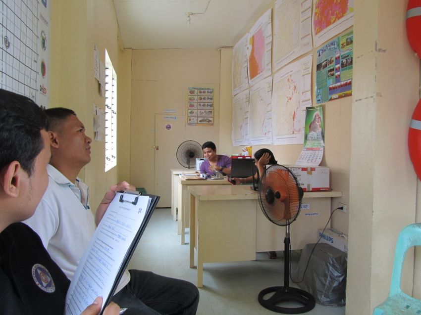
Acronyms

    BDRRMC   Barangay Disaster Risk Reduction and Management Committee
    DILG     Department of Interior and Local Government
    GIZ      Deutsche Gesellschaft fuer Internationale Zusammenarbeit
    LDRRMC/O Local Disaster Risk Reduction and Management Council/Office
    LGU      Local Government Unit
    MDRRMC/O Municipal Disaster Risk Reduction and Management Council/Office    Page 22
    NDRRMC National Disaster Risk Reduction and Management Council
    OCD      Office of Civil Defence
    PDC      Pacific Disaster Center
    PDRRMC/O Provincial Disaster Risk Reduction and Management Council/Office
    PHIVOLCS Philippine Institute of Volcanology and Seismology
    PIA      Philippine Information Agency
    PNP      Philippine National Police
    PTWC     Pacific Tsunami Warning Center
    RDRRMC Reagional Disaster Risk Reduction and Management Council

4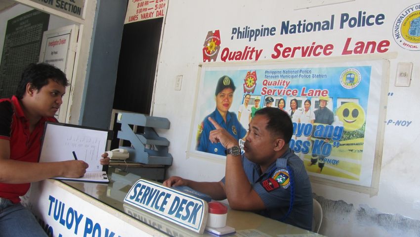
1. Acknowledgement

This study was financially supported by the DIPECHO program of the Commission of the
European Union and the German Federal Ministry for Economic Cooperation and
Development.

The Regional Disaster Risk Reduction and Management Office through the Office of Civil
Defense, Region VIII, was instrumental in carrying out this study and contributed advice at
every step and logistics to facilitate the interviews.

The Pacific Disaster Center of the University of Hawaii calculated wave travel times for the
earthquake on 31 August 2012.

                                                                                               5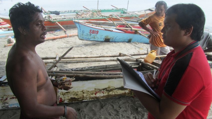
Page 5

    Community members at interviews in Palo

    2. Summary

    On 31 August 2012 a strong earthquake occurred in the Philippine Trench east of the
    southern tip of the Province of Eastern Samar. Initially it was assumed that this earthquake
    could have generated a tsunami wave and the Philippine Institute of Volcanology and
    Seismology (PHIVOLCS) issued an alert shortly after the quake. However, no significant
    wave appeared and no damages were observed, but the event provided an opportunity for
    LGUs and agencies involved in DRM to assess the effectiveness of warnings and
    evacuation along the coastal areas of Region VIII. OCD and GIZ conducted a survey to
    evaluate to what extent people moved to safe place in due time. The results are compared
    with a similar survey carried out by DED (now GIZ) workers which was done after a
    tsunami alert was raised in the end of February 2010. At the time, the source of the wave
    was distant (Chile) and time was not an important factor in the survey.

    In the 2012 alert almost all interviewed persons received the tsunami warning, but many
    people could not remember the exact time of learning about the warning. In many cases,
    especially in the southern areas of Eastern Samar, it appears that the warning reached
    people after the expected arrival of the tsunami. This is most evident for parts of Guiuan
    where the travel time of the wave was calculated to be around 10 minutes while the
    warning by PHIVOLCS was released 14 minutes after the earthquake.Considering a
    reasonable time for actual evacuations the warning reached most people in Leyte also too
    late. There was rarely enough time between the warning and the arrival at safe places.

    Compared to the last survey, more people, especially at the barangay level, got the alert
    information through the designated communication chain. Seventy of the citizens in Leyte
    received the warning by officials; in Samar, it was even 81%. Though in Samar, only 61%
    of the officials (LGU, MDRRMO, police) got the information via the designated
    communication chain. It appears that some officials do not know exactly whom they have
    to convey the warning message to and this lead to interruptions in the chain.

6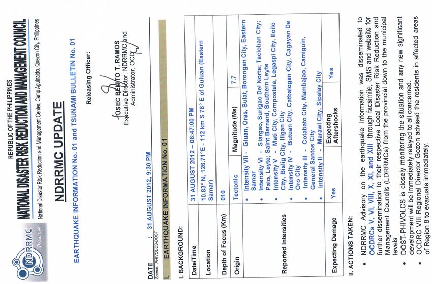
Some mobile phones were not working properly during the alert and many barangays
have no signal reception at all. There were major power cuts and in one municipality even
wrong information was broadcasted by a radio station.

In summary, the observed communication problems lead to delayed and/or distorted
messages reaching the coastal communities.

On both islands, Samar and Leyte, very few knew the meaning of the PHIVOLCS tsunami
                                                                                           Page 6
alert levels. Even some police officers, fireman, barangay councelors and captains or even
DRRMO staffwere not sure about the different meanings of the three levels or cannot
recall the level issued on August 31, 2012.Among the population, the alert levels seem
almost not to be known at all.There is a high awareness of what a tsunami is. Everyone
has seen TV footage of different tsunamis and knows of the danger. It seems that most
people living in tsunami-prone areas are aware of the hazard. Though most municipalities
have neither signage for evacuation routes nor had they conducted evacuation drills, most
residents said they knew safe places. This research did not verify whether these places
are inside or outside the tsunami hazard areas identified by PHIVOLCS.

All surveyed barangayshad an estimated average of 80% of the residents evacuating after
the alert.Only one barangay did not follow the evacuation advice at all. People staying
behind are either driven by fear of losing their belongings or not wanting to leave disabled
and elderly relatives behind. A few people evacuated when they felt the earthquake
without waiting for official advice to seek safety.

Most interviewed persons stated that officials guided the evacuation and supported the
residents. Many interviewees provided suggestions on how to improve evacuation
management, i.e. improvement of transport facilities and closer evacuation sites to avoid
traffic congestions.

Considering the described observations OCD and GIZ recommend to LGUs the following:
  • Advice people to evacuate by themselves if they are in a tsunami prone area and
      feel a strong earthquake.
  • Continue information dissemination to increase the knowledge on tsunamis and
      proper evacuation.
  • Revisit the communication chain for alerts, identify gaps and adjust the system to
      work faster and with clearer messages.
  • Equip evacuation routes and safe places with clearly visible signages and prioritize
      barangays with large flat areas without hills or mountains.

                                                                                               7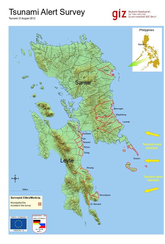
3. Introduction

    On 31 August 2012, at 08:47:34pm (local time) an earthquake occurred near to the coast
    of the Eastern Visayas. It was located at 10.838° North and 126.704° East at a depth of 35
    km and reached a magnitude of 7.6 i. It was felt with intensities IV-VI (light to very strong
    shaking) ii or V-VII (strong to destructive shaking) iii in the Pacific coastal areas of the
    central-southern Philippines.
                                                                                                    Page 7
    At 09:01 pm PHIVOLCS issued alert level 3, meaning immediate evacuation. This
    included all coastal areas of the provinces of Northern Samar, Eastern Samar, Leyte,
    Southern Leyte, Surigaodel Norte and Surigao del Sur. Like the Chile earthquake of 27
    February 2010, this earthquake near Guiuan caused only a very small wave and no
    damages. At 12:10 am, 1 September 2012, PHIVOLCS had not received any information
    of unusual waves near the Philippine coast and issued a tsunami alert cancellation
    statement.

    The      Pacific    Disaster
    Center (PDC) calculated
    travel times for the
    earthquake       with    the
    epicenter        of      the
    31.08.2012 earthquake
    on request of GIZ. The
    result is displayed in map
    1. As the wave travels
    with relatively high speed
    in deep water and
    relatively low speed in
    shallow areas the wave
    could     have      reached
    Guiuan                within
    approximately             10
    minutes, other parts of
    Eastern       and      even
    Northen Samar in up to
    20 minutes, while it
    would have taken more Map 1: Simulation of wave travel time of the earthquake on 31 August,
    than 30 minutes to arrive 2012 (Juliana Lo, Pacific Disaster Center, www.pdc.com)
    in Leyte.

    Evacuation times differ strongly depending on the distance, accessibility of evacuation
    routes and on the mobility of people. Some able bodied residents of coastal areas live
    near hills and can reach safe ground within minutes while others are kilometers away from
    such areas and might be slow in moving (e.g. children or elderly) or not in a position to
    move without assistance at all (e.g. patients in hospitals or persons with disabilities). The
    latter may need an hour or more to arrive in a safe place.

8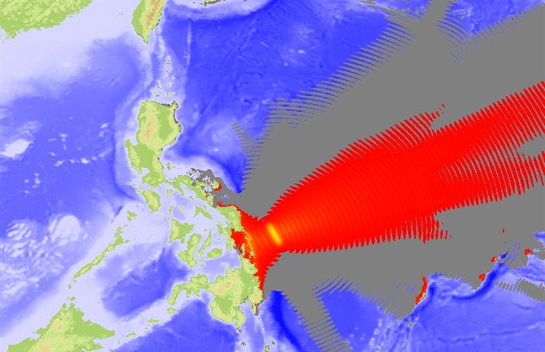
Page 8
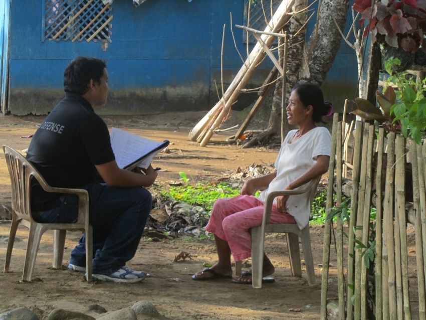
Fisherman interviewed in Tanauan
4. Methods
The documenters consisted of a
team of one OCD staff (Rey
Ezekiel P. Barbasa) and one
GIZ Intern (Moritz Beitzen).
Within one week they covered
the municipalities of Leyte and
then took another week for the
survey in Eastern Samar. In
addition, interviews with
regional headquarters of OCD,
DILG (Department of Interior
and Local Government), PIA
(Philippine Information Agency)
and PNP (Philippine National
Police) were conducted.
Map 2: Areas covered by Tsunami Alert Survey 2012
The documenters used a
questionnaire from a similar survey about a tsunami warning in 2010. Slight adjustments
were made to adapt to the locally generated tsunami. The questions asked involved
general knowledge about tsunamis as well as the actual procedures and behavior on the
day of the earthquake, from whom or where they received the tsunami warning, and who
carried out the evacuation.
In all municipalities, the MDRRM offices (where already existing) were contacted first. All
municipalities were of great help, gave generous information about the way the local
communication chain functioned and provided guides for the documenters going to their
coastal barangays. The barangay officials, in turn, were very welcoming and happy to let
the team interview their residents (fishermen, housewifes, sari-sari shop owners and
others), as well as to give interviews themselves, with the exception of a few.
In every municipality, at least one police officer, fireman or member of the local rescue
team was included in the interviews.
9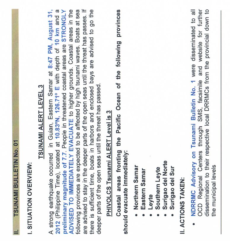
All interviews were carried out in Waray or Tagalog and directly written and translated into
     the English questionnaire by Rey. Barbasa. The same team was involved throughout the
     interview in all the municipalities.

     A total of 97 individuals (57 in Leyte and 40 in Samar) were interviewed, comprising:
                                                                                                       Page 9
     5      MDRRM officers or members
     8      Police chiefs or officers
     3      Firemen
     1      Rescue team member
     2      Law enforcers
     27     Barangay officials
     51     Barangay residents

     The municipalities in Leyte visited were Tolosa and Tanauan (October 10, 2012), Dulag
     and Abuyog (October 11, 2012), Tacloban and Palo (October 12, 2012), St. Bernard
     (October 15, 2012) and Hinundayan (October 16, 2012). In Samar the interviews were
     carried out in Guiuan (November 5, 2012), Llorente and Maydolong (November 6, 2012),
     Borongan (November 7, 2012) and Oras (November 8, 2012).

     Additional interviews without the questionnaires were conducted in the regional
     headquarters of OCD, DILG, PIA and PNP, where selected personnel were asked about
     the activities of their offices after the earthquake. These interviews were held in English by
     Moritz Beitzen.

     5. Results

     5.1.   Official warnings reached most of the people

     In Samar, all 40 people interviewed were reached by a warning. In Leyte, 3 of the
     interviewed 57 persons did not get the warning.

     Thirty six percent of the officials and 49% of the residents stated that they received the
     warning within 15 minutes after the earthquake. However, the survey was conducted 6-7
     weeks after the earthquake incident and the passage of time could affect recall. As the
     official PHIVOLCS alert was issued 14 minutes after the warning given by officials, a
     warning within the first 15 minutes could have been based on TV information iv. The first
     warning was broadcasted 12 minutes after the earthquake, referring to the PTWC warning
     of 8:55pm v.

     Twenty nine out of 40 officials (72%) and 39 out of 52 citizens (75%) received the warning
     through the designated channels. Figure 1 shows that some officials were informed by
     friends, relatives, TV, radio or internet. This was also true for five out of seven interviewed
     police officers and for two out of five MDRRM officers. Only two out of 22 barangay
     officials stated other than official channels, as their sources of information.

10
Most residents said that they got the warning through barangay officials or police roaming
around and informing people. One fifth of the citizens had their alert information from TV or
radio.
100
90
T.V./radio/internet
80
70 Page 10
Persons [numbers]
60
50 Text or other of
friends/relatives/neigh
40 bours
30
20 Officials(radio/megaph
10 one/loudspeaker/bell)
0
Officials Citizens Total
Figure 1: Sources of Warning
On average, 73% of all interviewed person received the warning with the correct content
(immediate evacuation of the coastal areas to the allocated evacuation sites). The others
stated mostly that they got advice for preparation and monitoring.
Sixty percent of involved officials and only 35% of the citizens could recall the correct alert
level. Others stated alert levels of 1 or 2 or even 4, cited earthquake intensities or said no
alert level was specified in the warning.
The cancellation of the tsunami warning was received by 85% of the interviewed persons
before the next morning. Some received the cancellation the next day while others never
received a cancellation at all. .
5.2. While people generally heeded the warnings to evacuate, their response was
marked by panic
The official warning clearly stated that persons in tsunami hazard areas should evacuate
immediately and get out of the danger zone.
Figure 2 shows that 26 of 43 officials (60%) facilitated the evacuation of others and that 29
of 52 citizens (55%) followed the evacuation call. 12 officials (27%) and nine residents
(17%) stated that they monitored and waited for further instructions. Interviewees reported
some confusion about whom to listen to. As the warning was spread via media, official
channels and via phone etc. some people said they received contradicting messages and
did not know what advice to follow.
There were suggestions to adopt the method of other areas where they have a dedicated
acoustical signal like ringing a bell as an alarm that everybody has been taught to
understand.
1160
Inform
others/Evacuate
50 others
Stay
40
Persons [numbers]
30 Monitor/wait
instruction/prep
are Page 11
20
Evacuate
10
0
Officials Citizens
Figure 2: Reaction after warning
Nine of 95 persons asked (17%) said that they did not follow the evacuation advice. The
reasons differed from not believing in an actual danger or staying with disabled relatives
who could not evacuate. In some household one member of the family stayed behind to
guard the property against looters. One person said some youth with scooters even
wanted to stay behind to wait until the last moment and then race away in front of the
wave.
The researchers observed a certain reluctance when admitting non evacuation. The
researchers often had to ask twice to get this information. Not following the advice of
officials constituted disobedience to some extent and therefore one could understand that
people wanted to avoid this impression. The number of people staying in their localities
may actually be higher than the results of this survey.
All officials were asked how many community members really followed the evacuation call.
About half of the officials said everybody evacuated immediately. 27% stated an
evacuation rate of about 80% of the population, 7% estimated that 70% of the residents
evacuated and another 17% said less than 70% of the community followed the evacuation
advice.
Ninety three percent of the officials and 82% of the residents reported that the evacuations
were managed by their officials. Police officers as well as traffic enforcers helped to
spread the information and assisted the evacuation in all the communities involved.
Another impression of most people was that, in their experience, few earthquakes in the
past could compare with the August 31 earthquake in terms of perceived strength.
1260
50
Monitor
Persons [Number]
40
Evacuate on own
30 initiative
Panic/nervous/pray
20 Page 12
10 Hold/duck/cover -
then go outside
0
Officials Citizens
Figure 3: Reaction after a strong earthquake
From the questions of how the people reacted to this earthquake the answers are shown
in Figure 3. Most people - 24 of 45 officials (53%) and 38 of 52 civilians (73%) - stated
they were simply afraid or panicked. The second most common reaction cited was “hold,
duck and cover” or a practice learned from earthquake drills everywhere. This answer was
given by 12 officials (27%) and eight citizens (15%). Meanwhile, seven officials (16%) and
three residents (6%) stated that they would monitor the situation after a strong earthquake,
but they would not initiate evacuation directly.
Only three community members (6%) and two officials (4%) stated that they would
evacuate on their own initiative. Compared to other sites, Guiuan community members
seemed better informed than other municipalities.
Housewife interviewed in St. Bernard
135.3. While knowledge of appropriate evacuation sites and actions was high,
awareness of the meaning of warning levels was low
Eighty five percent of all people interviewed said they knew they live in a tsunami prone
area. The rest were either not aware of the hazards or were not sure.
100
90 Page 13
80
70
Persons [Numbers]
60 Not sure
50
No
40
Yes
30
20
10
0
Officials Citizens Total
Figure 4: Knowledge of safe areas for tsunamis
A total of 71% of the interviewees (70 out of 98) knew feasible tsunami evacuation sites or
that they have to retreat to higher ground or elevated areas. In those places where there
were no nearby hilly areas, people identified far barangays or distant sites where family
members lived, as their possible refuge. This survey did not verify whether these places
are outside the tsunami prone areas identified by PHIVOLCS. Eleven respondents said
they did not know any safe places at all.
The PHIVOLCS tsunami alert levels are not known widely at all. Only 28% of the officials
and 15% of the residents (a combined 21% of respondents) asked knew the correct
meaning of the three different levels. A total of 14% have some knowledge about the alert
levels but can not distinguish them correctly. Sixty four percent, including 44% of officials,
have no knowledge about the levels.. A rescue team member was interviewed in front of
the official alert level chart and he apparently did not know what he was asked about.
The insufficient number of directional signs, the numerous ways of relaying
warning and information and some confusion on how to evacuate was evident The
level of disaster preparedness in barangays is seen not only in the reactive stances of the
officials and residents following an incident, but also in the presence or absence of maps
and directional signs that are visible and understood by all. These, along with the manner
and methods by which warnings are actually relayed to the population, are the factors that
define the resiliency of a community when a disaster strikes.
Very few of the barangays visited had signboards with directions for evacuation routes. In
those barangays, it was noted that awareness of people concerning evacuation routes
appeared to be better than in barangays without such signs.
The majority of the municipalities (60%) had some tsunami hazard maps at their disposal.
Some were on display on walls of the local DRRM offices.
14Regarding previous trainings, 35% of the interviewees said they already participated in
evacuation or earthquake drills. This number included school evacuation trainings.
Officials received more trainings than the general population.
Relaying the warnings
The warning message was forwarded by different means of communication in different
Page 14
municipalities:
• In some LGUs the DRRM offices used handheld radios to inform barangay captains
quickly. The police helped to spread the alert in all the surveyed communities.
• SMS and mobile phone usage was widespread, but not all communities are within
reach of cell sites. The survey team noted that in many places there was no signal
reception of main cellular networks.
• One municipality had messengers trained to spread out into the different
barangays. This appeared to be a slow way of transmitting a very urgent message.
• In Eastern Samar, Guiuan used two-way radio to inform their different island
communities, whereas Borongan relied on TV and mobile phones for off shore
areas.
Getting to the evacuation sites
Most people evacuated on foot while some used their own vehicles (e.g. motor bikes) and
some municipal officials provided private trucks for transportation to get to far evacuation
centers. To work out how long it took until people actually reached safe places was
impossible to find out two month after the incident. From the mentioned times of the
warning as well as the stated reactions, we conclude that in most cases the time was
insufficient to reach safety before the arrival of the tsunami wave.
It was observed that some evacuation routes did not lead away from the coast directly but
went parallel to the coast first although roads leading straight inland were available. This
was observed in Tacloban, where evacuation routes from an outskirt barangay led into
town, where at traffic jams could occur
For people with disabilities or elderly people no specific preparations or plans existed in
any municipality.
5.4. Actions taken by regional institutions
One of the major findings from interviews on regional level is the multitude of
communication channels that were utilized to spread the warning. The main purpose was
to reach as many persons as fast as possible. However, the persons interviewed from
regional agencies stated that the mobile network was not reliable when they tried to call
people on mobile phones and it was very difficult to reach all designated persons. OCD
also explained that power was down in Tacloban and in some parts of Eastern Samar for
the whole night.
The Regional Director of OCD Region 8 stated that after a call to the PHIVOLCS central
office just after the earthquake, a preemptive evacuation of coastal areas was ordered
without NDRRMC having signed official papers. The first calls made were to PIA, the
15governors and mayors in Northern Samar, Eastern Samar and Southern Leyte, as well as
other agencies, offices and media outfits like police regional offices, the regional radio
station DYVL and the national media, who could help spread the information. PDRRMO of
Leyte was said t to be inaccessible by phone. The NDRRMC was called up to process the
legal papers, which as reported were processed by 9:30pm. It was said though, that
making an evacuation call at the regional level would be the planned strategy to speed up
processes.
Page 15
PIA stated their ‘text blast’ would reach all barangay, municipal and media officials as well
as the regional directors of all agencies with one click on their laptop. The alert information
reached PIA from OCD and from the presidential office in Manila by phone. Here it has to
be noted that municipal and barangay officials in interviews did not specify having received
these messages.
The regional heads of OCD and PIA were not in their offices at the time of the earthquake
as the earthquake happened outside of office hours, but their night shift staff was on duty
and they were contacted immediately. OCD staff started calling people from their
communications list: PDRRM officers, councils, governors and MDRRM offices.
DILG also has its own communication chain. All DILG provincial offices in tsunami-prone
provinces in the region were called and asked to convey the alert within their areas. DILG
regional office stated that they were not reached by any official information before
10:00pm and that their primary source for the evacuation call was television. The DRRM
focal person then went to the office at 9:15 pm and started calling up people.
The Regional Police Community Relations office said that Tactical Operations on duty at
that time also called out for preemptive evacuation just after experiencing the earthquake.
Their communication chain reaches all provincial police headquarters. The means of
communication here were SMS as well as radio communications.
PIA told the researchers that they were called up by people from Borongan, Eastern
Samar, because they did not know where to evacuate to. The manager of PIA Northern
Samar was requested to give information over the radio. OCD was called by people until 1
am the next day for information. Even Singaporean media were among those who called.
16Page 16
Police officer interviewed in Tanauan
6. Conclusions
People in tsunami prone areas need time to get to safety. In an ideal case, it might require
only a few minutes but very often half an hour or more is needed, especially if persons
depending needing assistance to be moved are considered. It appears that on 31 August
2012, most people in tsunami-prone areas would not have made it to safety if a high
tsunami wave would have been generated by the earthquake.
Figure 5: Timeline of official alerts and the PDC tsunami calculation
On 31 August 2012 alert level 3 was published by PHIVOLCS at 09:01 pm vi, and by the
NDRRMC at 9:30pm vii, but the news of the tsunami warning was in the media at least at
8:59pm after the PTWC issued a warning at 8:55pm. Obviously all warnings were too late
for areas where the expected tsunami would have hit the shore already at around 8:57pm;
for many other areas the official warning of PHIVOLCS did not come in time for a safe
evacuation. Even if the warning reached all concerned within five minutes after PHIVOLCS
17issued the alert (a very optimistic assumption), many people would only have a slim
chance to reach safety. By that time the wave would have hit the whole of Eastern Samar.
For coastal residents of Leyte Island, the time between the earthquake and the calculated
arrival of the wave was considerably longer - 35-40 minutes. However, a large part of the
coastal area of Leyte (Abuyog to Tacloban) is very flat with very few hills near the shore.
The flat coastal areas result in hazard areas stretching up to 2.5 km inland. Without a
vehicle, this distance would require 30 minutes walking for an able bodied person if the
Page 17
road is nearby and runs straight away from the coast. This means that the person would
have arrived at a safe place at 9:30pm, while the tsunami would be there already at 9:22
pm at the latest. It has to be noted that these assumptions did not consider extra time
needed to arrange for persons depending on assistance or those who some distance
away.
In summary, many residents of Eastern Samar and Leyte Island following official warnings
had little chance to survive a high tsunami wave if it would have been generated by the
powerful earthquake.
In case residents would have started evacuation immediately after they felt the strong
ground movements, many more would have gained sufficient time to reach areas outside
the tsunami prone areas. In Guiuan, Eastern Samar, the time between the earthquake and
the expected arrival time of the tsunami wave was 10 minutes. As the coast is close to
higher ground there, to a large extent this time was long enough for getting out of the
hazard area. In Leyte, the arrival time of the wave was 35-40 minutes after the quake and
with this margin many people could have made it to safer places too.
It should be emphasized that PHIVOLCS does not recommend waiting for official warnings
for locally generated tsunamis but advises: “Do not stay in low-lying coastal areas after a
strong earthquake. Move to higher ground immediately.” viii
In comparision to the last assessment the knowledge about tsunamis and the hazards of
the areas visited has improved evidently. This might be related to the comprehensive
media coverage of the tsunami in Japan in 2011. Only one out of 77 persons stated to
have never seen pictures or videos from that tsunami.
Notwithstanding the above mentioned general reservations to waiting for official warnings
the survey collected information on the performance of the warning system and how
communities followed the warning. Almost everyone received a warning (only 3% in our
sample did not) which is a very good result, however, it appears that many people
probably would have experienced the tsunami before the warning reached them and that
clearly points to a need for improvements.
Eighty two of the citizens reported that evacuations were guided by officials. This is a
good number too, especially as some barangays visited were at a certain distance away
from the poblacion.
Furthermore, either the warning message they received was not clear, contradicted other
warnings or they were not following the advice anyway. This means even if the warning
would have provided enough lead time to evacuate, success was limited by a number of
factors.
18The communication chain (Figure 6) is a long sequence of institutions involved in DRRM.
If it would be followed step-by-step it would surely take much too long to reach people in
tsunami-prone areas in cases of locally generated tsunamis. Therefore several shortcuts
and parallel channels are already in place and being used. The most important of those
are obviously media, with TV being the single most important form followed by radio
broadcasts and the internet. OCD reported that some MDRRM officers started
evacuations based on other than official alert calls. They reacted on media alerts.
Page 18
Though the communication chain was generally followed it still needs some
improvements. This pertains to a large extent to the content of the warning. It seems that
either alert levels were not correctly conveyed or recipients did not understand the content
correctly. More advice and training on communication protocols and alert levels may
improve the performance of the chain.
This should include a feedback/repetition
of the recipient to ensure that the
message was correctly understood. All
involved offices should have lists of who
needs to be informed in case of
emergencies to make sure no one is left
out.
Furthermore, the means of
communication need to be specific and
redundant to ensure that there are no
failures in the chain. One way
communication (e.g. TV, SMS, bells)
should be the last resort, while
communication by two-way radio,
telephone and mobile phone feedback
opportunities Should be prioritized.
Figure 6: Official Communication Chain
Though TV and radio are the fastest means of reaching many people, they also have
grave disadvantages. If there is no electrical power in a certain area (e.g. brownout) or it is
in the middle of the night, no one will will receive the warning. Therefore, mass media is
not sufficient as an information source to be solely relied upon.
The following table shows suggested improvements by officials as well by community
members:
19Officials Citizens Total
Build further evacuation 15 7 22
centers
Conduct further trainings 11 1 12
Improve transportation 3 6 9
Purchase equipment to 8 1 9
monitor and rescue
Page 19
Improve evacuation 3 5 8
times
Appoint one focal point 4 3 7
Conduct information 6 1 7
dissemination
Provide public address 6 0 6
system
Provide radio equipment 3 0 3
Install evacuation signs 3 0 3
Table 1: Ideas for improvement of tsunami evacuations (in numbers of people)
Table 1 contains all ideas mentioned at least three times. Other ideas included improving
coordination, preparing relief goods and the surveillance of incident communications with
protocols. Ten citizens stated either to stay calm, or that there would be no other solution
than praying.
Officials were most concerned about additional evacuation centers, training or more
equipment either to monitor possible tsunamis or for the rescue in the case of a hazard
striking. Community members also named evacuation centers but besides that, they are
more focused on improvement of the transportation and the actual evacuation times.
100%
90%
80%
70%
60%
50%
40%
30%
20%
10%
0%
MDRRMO Barangay Officials Community Members
Figure 7: Percentage of people officially warned
Out of the five MDRRM officers interviewed, only three got the alert through official
channels (Figure 5). The other two got their information from television and SMS from
relatives. The latter two communication channels are most likely not working in the middle
20of the night when everybody is sleeping. This needs improvement it is not to be expected
that an MDRRMO gets the warning and information about the earthquake from concerned
relatives in Manila, or it is dependent on whether he/she is watching TV at the time. Also
an SMS from the PDRRMO is not reliable way as the sender does not necessarily receive
the alert all the time.
The numbers of barangay officials and residents informed officially show improvement
since the last survey in 2010, where only 70% of barangay officials and 50% of community
Page 20
members had official sources. Furthermore, 82% of the citizens reported that evacuations
were guided by officials. That is a good development and shows their commitment to
serving their constituents.
In some areas, the PDRRMC and MDRRMC are not established yet. Obviously the
presence of a designated office with capacity to direct disaster preparations and actual
evacuations would improve the communication chain.
The time involved in evacuation needs to be reduced. Even if residents in tsunami-prone
areas do not wait for official warnings but start evacuation when they feel a strong
earthquake, many of them probably would not have reached safe havens in time. There is
certainly a need to improve the awareness and preparedness of persons in the danger
area. Prepared, ready-to-grab evacuation bags in households would reduce the time
needed for packing essential things. Clear signs for evacuation routes and signs for safe
areas would reduce confusion on where to go. If motorized vehicles are used, pre-defined
arrangements on who joins which vehicle would also get more people out in time.
An issue to be looked into is the fear of looting of abandoned houses during evacuation. If
a solution to this problem could be found more people would actually follow calls for
evacuation.
The OCD/RDRRMC and GIZ recommend the following actions for LGU officials:
• Advice people to evacuate by themselves without waiting for official alerts, if they
are in a tsunami prone area and feel a strong earthquake.
• Continue information dissemination to increase the knowledge on tsunamis and
proper evacuation.
• Revisit the communication chain for alerts, identify gaps and adjust the system to
work faster and with clearer messages.
• Equip evacuation routes and safe places with clearly visible signages and prioritize
evacuation in barangays with large flat areas without hills or mountains.
21Page 21
MDRRM officer being interviewed in Llorente
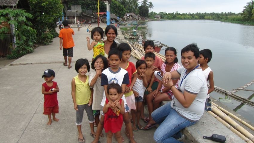
Signages at Llorente
22Annexes
23Annexes
Tsunami Warning Questionnaire
Name of person filling the form:___________________________________________________________
Page 23
Date of filling the form:____________
Place of filling the form (brgy., mun., prov.):_________________________________________________
Name of interviewee:___________________________________________________________________
Function (community member, mayor, DCC member, police, OCD, etc.):___________________________
Did you get to know that there were tsunami warnings on 31August: yes no
If yes continue with the following questions otherwise continue further below:
When exactly did you get a tsunami warning?_______________________________
By what means did the warning reach you (radio, SMS, TV, telephone call, neighbour telling me, etc.)?
____________________________________________________________________________________
What was the content of the warning?_____________________________________________________
____________________________________________________________________________________
What alert level was the warning (Alert level 1, 2, 3)? ________________________________
Did you receive news of the cancellation of the tsunami warning (when)? yes no _____________
What did you do when you received a warning (warning others [whom], nothing, evacuate, go to the
beach to watch the waves, etc.)
_____________________________________________________________________________________
Was an evacuation organized by officials (describe)?__________________________________________
Did you experience an earthquake on 31 August 2012? yes no
If yes, what was your reaction?___________________________________________________________
How many earthquakes in your life do you remember?
Questions for all (whether they received a tsunami warning or not):
Have you seen pictures or videos of a tsunami? _____________________________________________
24Did you experience a tsunami in your life (when, where)?___________________________________
Is your house located in a tsunami-prone area (how do you know)?______________________________
_____________________________________________________________________________________
Do you know the meaning of the PHIVOLCS tsunami alert levels (describe them)?___________________
_____________________________________________________________________________________ Page 24
Do you know recommended evacuation routes in case of tsunami (describe them)?_________________
_____________________________________________________________________________________
Are the routes clearly marked with signboards? yes no
Do you know safe places for tsunami evacuation (describe them)?_______________________________
_____________________________________________________________________________________
Are the places clearly marked with signboards? yes no
Did you participate in an evacuation drill (when)?_____________________________________________
How will you react when experiencing an earthquake?
For members of DRRMC:
Are maps with tsunami-prone areas, evacuation routes and evacuation places available?
yes no
Did you organize (or participated in organizing) an evacuation after tsunami alert level 3 was raised by
PHIVOLCS on 31 August 2012(describe)?
_____________________________________________________________________________________
Did the local DRRM officers execute the tasks designated to them?
To what extent did the residents in tsunami-prone areas follow the evacuation advice?
_____________________________________________________________________________________
Other comments
25Page 25 26
Page 26

  27
Page 28

     Resident interviewed in Oras

28
TSUNAMI BULLETIN NUMBER 001
PACIFIC TSUNAMI WARNING CENTER/NOAA/NWS
ISSUED AT 1255Z 31 AUG 2012
THIS BULLETIN APPLIES TO AREAS WITHIN AND BORDERING THE PACIFICOCEAN AND
ADJACENT SEAS...EXCEPT ALASKA...BRITISH COLUMBIA...WASHINGTON...OREGON AND
CALIFORNIA.
Page 29
... A TSUNAMI WARNING AND WATCH ARE IN EFFECT ...
A TSUNAMI WARNING IS IN EFFECT FOR
INDONESIA / PHILIPPINES / BELAU / YAP / TAIWAN / JAPAN / GUAM / N. MARIANAS /
PAPUA NEW GUINEA
A TSUNAMI WATCH IS IN EFFECT FOR
CHUUK / MARCUS IS. / KOSRAE / POHNPEI / MARSHALL IS. / WAKE IS. / SOLOMON IS. /
RUSSIA / NAURU
FOR ALL OTHER AREAS COVERED BY THIS BULLETIN... IT IS FORINFORMATION ONLY AT
THIS TIME.
THIS BULLETIN IS ISSUED AS ADVICE TO GOVERNMENT AGENCIES. ONLYNATIONAL AND LOCAL
GOVERNMENT AGENCIES HAVE THE AUTHORITY TO MAKEDECISIONS REGARDING THE OFFICIAL
STATE OF ALERT IN THEIR AREA ANDANY ACTIONS TO BE TAKEN IN RESPONSE.
AN EARTHQUAKE HAS OCCURRED WITH THESE PRELIMINARY PARAMETERS
ORIGIN TIME - 1248Z 31 AUG 2012
COORDINATES - 10.9 NORTH 127.1 EAST
DEPTH - 33 KM
LOCATION - PHILIPPINE ISLANDS REGION
MAGNITUDE - 7.9
EVALUATION
IT IS NOT KNOWN THAT A TSUNAMI WAS GENERATED. THIS WARNING IS BASED ONLY ON THE
EARTHQUAKE EVALUATION. AN EARTHQUAKE OF THISSIZE HAS THE POTENTIAL TO GENERATE A
DESTRUCTIVE TSUNAMI THAT CANSTRIKE COASTLINES NEAR THE EPICENTER WITHIN MINUTES
AND MOREDISTANT COASTLINES WITHIN HOURS. AUTHORITIES SHOULD TAKE APPROPRIATE
ACTION IN RESPONSE TO THIS POSSIBILITY. THIS CENTERWILL MONITOR SEA LEVEL DATA
FROM GAUGES NEAR THE EARTHQUAKE TODETERMINE IF A TSUNAMI WAS GENERATED AND
ESTIMATE THE SEVERITY OFTHE THREAT.
Woman interviewed in Borongan
29References
i
United States Geological Survey:
http://earthquake.usgs.gov/earthquakes/eqinthenews/2012/usc000cc5m/#details, PHIVOLCS:
http://www.phivolcs.dost.gov.ph/html/update_SOEPD/2012_Earthquake_Bulletins/August/2012_
0831_1247_B5F.html, accessed on 19.12.2012
ii
United States Geological Survey:
http://earthquake.usgs.gov/earthquakes/dyfi/events/us/c000cc5m/us/index.html, accessed on
19.12.2012 Page 31
iii
PHIVOLCS:
http://www.phivolcs.dost.gov.ph/html/update_SOEPD/2012_Earthquake_Bulletins/August/AUG
UST_31_intensity_B5.pdf, accessed on 19.12.2012
iv
http://www.gmanetwork.com/news/story/272070/news/nation/tsunami-warning-raised-after-
magnitude-7-6-earthquake-off-samar, accessed on 21.12.2012
v
Annex 5
vi
Annex 2
vii
Annex 3,4
viii
http://www.phivolcs.dost.gov.ph/images/IEC/tsunami_poster_english.pdf, accessed on
21.12.2012
30Deutsche Gesellschaft für Internationale Zusammenarbeit (GIZ) GmbH Registered offices Bonn and Eschborn, Germany 2B PDCP Bank Center, V.A. Rufino corner L.P. Leviste Sts. Salcedo Village, Makati City, Philippines Contact Dr. Walter Salzer Program Director and Principal Advisor Environment and Rural Development Program Tel. +63 2 892 9051 Fax +62 2 892 3374 Email: walter.salzer@giz.de www.enrdph.org
You can also read