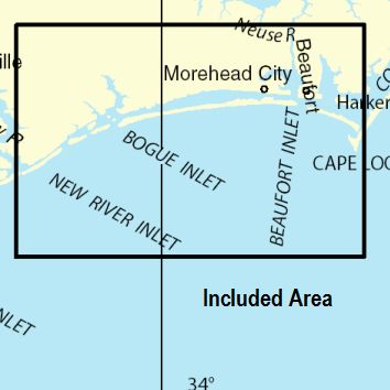
BookletChart Cape Lookout to New River - NOAA Chart 11543 - charts.noaa.gov
←
→
Page content transcription
If your browser does not render page correctly, please read the page content below
BookletChart                                                  ™

Cape Lookout to New River
NOAA Chart 11543

A reduced-scale NOAA nautical chart for small boaters
When possible, use the full-size NOAA chart for navigation.
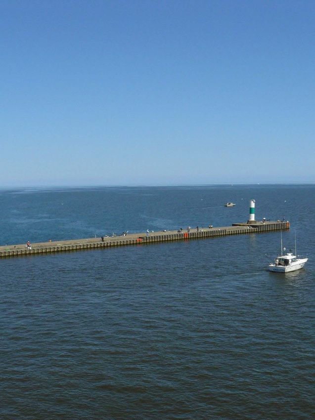
Published by the Bogue Inlet, 22 miles west of Beaufort Inlet, is the seaward approach to
the town of Swansboro, which can be seen from outside. The entrance is
National Oceanic and Atmospheric Administration used almost exclusively by local fishermen. The inlet is between a high
National Ocean Service wooded ridge on the west and a long low spit on the east. On the inside
Office of Coast Survey of the spit, about a mile eastward of the inlet, is Swansboro Coast
Guard Station. The entrance to the inlet, obstructed by a shifting bar
www.NauticalCharts.NOAA.gov extending about 0.5 mile seaward, is subject to frequent change. The
888-990-NOAA channel is marked by uncharted lighted and unlighted buoys which are
frequently shifted to mark the best water. Strangers should wait for a
What are Nautical Charts? rising tide and never attempt to enter when the bar is breaking. If local
fishermen happen to be coming in, it is advisable to follow them. The
Nautical charts are a fundamental tool of marine navigation. They show channels inside the inlet are also subject to considerable change,
water depths, obstructions, buoys, other aids to navigation, and much particularly during southeast and southwest storms.
more. The information is shown in a way that promotes safe and The mean range of tide is 2.2 feet in the inlet; high water occurs 2 hours
efficient navigation. Chart carriage is mandatory on the commercial earlier than at the head of the marshes inside. (See the Tide Tables for
ships that carry America’s commerce. They are also used on every Navy daily predictions.)
and Coast Guard ship, fishing and passenger vessels, and are widely A fish haven, covered 15 feet, is about 4 miles southeastward of Bogue
carried by recreational boaters. Inlet in about 34°36'42"N., 77°02'18"W.
Swansboro, a small town on the west bank of White Oak River 3 miles
What is a BookletChart?
north of Bogue Inlet, is reached by the shifting channel from the inlet,
This BookletChart is made to help recreational boaters locate and from Bogue Sound and Cape Fear River through the Intracoastal
themselves on the water. It has been reduced in scale for convenience, Waterway. Numerous fishermen base at Swansboro. State Route 24
but otherwise contains all the information of the full-scale nautical highway bridge over White Oak River at the town has a 30-foot fixed
chart. The bar scales have also been reduced, and are accurate when span with a clearance of 12 feet. The highway bridge over the easterly
used to measure distances in this BookletChart. See the Note at the channel, about 0.3 mile southeastward, has a 30-foot fixed span with a
bottom of page 5 for the reduction in scale applied to this chart. clearance of 6 feet. Swansboro is described in more detail in connection
with the Intracoastal Waterway, chapter 12.
Whenever possible, use the official, full scale NOAA nautical chart for
For 4 miles above Swansboro, White Oak River has a width of 1 mile or
navigation. Nautical chart sales agents are listed on the Internet at
more through which there is a narrow tortuous channel between the
http://www.NauticalCharts.NOAA.gov.
flats and oyster rocks. Farther up, the river is narrow and deep and leads
This BookletChart does NOT fulfill chart carriage requirements for between marshes to the fixed bridge at the town of Stella, about 8 miles
regulated commercial vessels under Titles 33 and 44 of the Code of above Swansboro. The river above State Route 24 highway bridge is
Federal Regulations. unmarked and has many logs and snags; navigation is limited to shallow-
draft skiffs only.
Notice to Mariners Correction Status Bear Inlet and Browns Inlet, 3 and 6 miles westward of Bogue Inlet,
respectively, are unmarked and used by local boats only; neither is
This BookletChart has been updated for chart corrections published in
recommended to strangers.
the U.S. Coast Guard Local Notice to Mariners, the National Geospatial
The danger zones of firing ranges are in the ocean between Bear Inlet
Intelligence Agency Weekly Notice to Mariners, and, where applicable,
and New River Inlet and in New River. (See 334.440, chapter 2, for limits
the Canadian Coast Guard Notice to Mariners. Additional chart
and regulations.) A Sea Turtle Sanctuary, Marine Protected Area (MPA),
corrections have been made by NOAA in advance of their publication in
extends from Bogue Inlet to New River Inlet.
a Notice to Mariners. The last Notices to Mariners applied to this chart
are listed in the Note at the bottom of page 7. Coast Pilot excerpts are
not being corrected.
For latest Coast Pilot excerpt visit the Office of Coast Survey website at
http://www.nauticalcharts.noaa.gov/nsd/searchbychart.php?chart=115
43.
(Selected Excerpts from Coast Pilot)
Bogue Sound extends about 22 miles
westward along the coast from Beaufort
Inlet to Bogue Inlet. It is shallow and
separated from the ocean by Bogue Banks,
a wooded beach 0.1 to 1 mile wide. The
sound is about 2 miles wide midway of its
length, but narrow at each end; the
western end has numerous marshy islets.
The Intracoastal Waterway route is through U.S. Coast Guard Rescue Coordination Center
the north side of the sound. The mean 24 hour Regional Contact for Emergencies
range of tide in Bogue Sound is about 2.5
feet near the inlets, and about a foot where the tides meet near the RCC Miami Commander
middle. Strong south and southwest winds may raise the tide a foot or 7th CG District (305) 415-6800
more, and north to northwest winds lower it the same amount.
2 Miami, FL
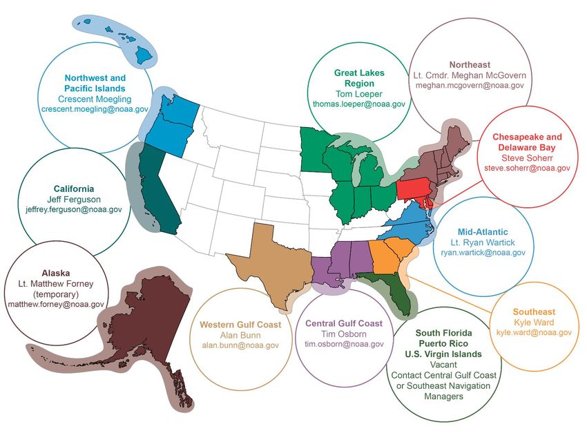
Navigation Managers Area of Responsibility
Northeast
Great Lakes Region Lt. Meghan McGovern
Tom Loeper meghan.mcgovern@noaa.gov
Northwest and thomas.loeper@noaa.gov
Pacific Islands
Crescent Moegling
crescent.moegling@noaa.gov
Chesapeake and
Delaware Bay
Steve Soherr
steve.soherr@noaa.gov
California
Jeff Ferguson
jeffrey.ferguson@noaa.gov Mid-Atlantic
Lt. Ryan Wartick
ryan.wartick@noaa.gov
Western Gulf Coast Southeast
Alan Bunn Central Gulf Coast Kyle Ward
Alaska Tim Osborn
alan.bunn@noaa.gov South Florida kyle.ward@noaa.gov
Lt. Timothy M. Smith tim.osborn@noaa.gov
timothy.m.smith@noaa.gov Puerto Rico
U.S. Virgin Islands
Michael Henderson
michael.henderson@noaa.gov
NOAA’s navigation managers serve as ambassadors to the maritime community.
They help identify navigational challenges facing professional and recreational mariners, and provide NOAA resources and
information for safe navigation. For additional information, please visit nauticalcharts.noaa.gov/service/navmanagers
To make suggestions or ask questions online, go to nauticalcharts.noaa.gov/inquiry.
To report a chart discrepancy, please use ocsdata.ncd.noaa.gov/idrs/discrepancy.aspx.
Lateral System As Seen Entering From Seaward
on navigable waters except Western Rivers
PORT SIDE PREFERRED CHANNEL PREFERRED CHANNEL STARBOARD SIDE
ODD NUMBERED AIDS NO NUMBERS – MAY BE LETTERED NO NUMBERS – MAY BE LETTERED EVEN NUMBERED AIDS
PREFERRED CHANNEL TO PREFERRED CHANNEL
GREEN LIGHT ONLY STARBOARD TO PORT RED LIGHT ONLY
FLASHING (2) TOPMOST BAND GREEN TOPMOST BAND RED FLASHING (2)
FLASHING FLASHING
OCCULTING GREEN LIGHT ONLY RED LIGHT ONLY OCCULTING
QUICK FLASHING QUICK FLASHING
ISO COMPOSITE GROUP FLASHING (2+1) COMPOSITE GROUP FLASHING (2+1) ISO
8
1 2
"2"
Fl R 6s
R "8"
Fl R 4s
"1" G "9" GR "A" RG "B"
Fl G 6s Fl G 4s Fl (2+1) G 6s Fl (2+1) R 6s
LIGHTED BUOY
LIGHT LIGHTED BUOY LIGHT
G
5 G U C
G
6
C "1" "5"
GR
"U" GR RG
N "C"
RG
"G"
R 2 R
"2
C "S" N "6"
"
CAN DAYBEACON CAN NUN NUN DAYBEACON
For more information on aids to navigation, including those on Western Rivers, please consult the latest USCG Light List for your area.
These volumes are available online at http://www.navcen.uscg.gov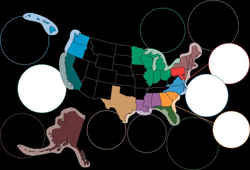


VHF Marine Radio channels for use on the
                          waterways:                                                            Distress Call Procedures
                         Channel 6 – Inter-ship safety communications.
                         Channel 9 – Communications between boats and                   • Make sure radio is on.
                         ship-to-coast.                                                 • Select Channel 16.
                         Channel 13 – Navigation purposes at bridges, locks, and        • Press/Hold the transmit button.
                         harbors.                                                       • Clearly say: “MAYDAY, MAYDAY, MAYDAY.”
 EMERGENCY INFORMATION                                                                  • Also give: Vessel Name and/or Description;
                         Channel 16 – Emergency, distress and safety calls to
                         Coast Guard and others, and to initiate calls to other         Position and/or Location; Nature of
vessels. Contact the other vessel, agree to another channel, and then switch.           Emergency; Number of People on Board.
Channel 22A – Calls between the Coast Guard and the public. Severe weather              • Release transmit button.
warnings, hazards to navigation and safety warnings are broadcast here.                 • Wait for 10 seconds — If no response
Channels 68, 69, 71, 72 and 78A – Recreational boat channels.                           Repeat MAYDAY call.

Getting and Giving Help — Signal other boaters using visual distress signals (flares,
                                                                                         HAVE ALL PERSONS PUT ON LIFE JACKETS!
orange flag, lights, arm signals); whistles; horns; and on your VHF radio. You are
required by law to help boaters in trouble. Respond to distress signals, but do not
endanger yourself.

                       NOAA Weather Radio All Hazards (NWR) is a nationwide network of radio stations broadcasting continuous
                       weather information directly from the nearest National Weather Service office. NWR broadcasts official Weather
                       Service warnings, watches, forecasts and other hazard information 24 hours a day, 7 days a week.
                       http://www.nws.noaa.gov/nwr/

                                                         Quick References
     Nautical chart related products and information - http://www.nauticalcharts.noaa.gov

QR
                             Interactive chart catalog - http://www.charts.noaa.gov/InteractiveCatalog/nrnc.shtml
                           Report a chart discrepancy - http://ocsdata.ncd.noaa.gov/idrs/discrepancy.aspx
    Chart and chart related inquiries and comments - http://ocsdata.ncd.noaa.gov/idrs/inquiry.aspx?frompage=ContactUs
            Chart updates (LNM and NM corrections) - http://www.nauticalcharts.noaa.gov/mcd/updates/LNM_NM.html
                                     Coast Pilot online - http://www.nauticalcharts.noaa.gov/nsd/cpdownload.htm
                                    Tides and Currents - http://tidesandcurrents.noaa.gov
                                     Marine Forecasts - http://www.nws.noaa.gov/om/marine/home.htm
                           National Data Buoy Center - http://www.ndbc.noaa.gov/
         NowCoast web portal for coastal conditions - http://www.nowcoast.noaa.gov/
                            National Weather Service - http://www.weather.gov/
                             National Hurrican Center - http://www.nhc.noaa.gov/
                      Pacific Tsunami Warning Center - http://ptwc.weather.gov/
                                            Contact Us - http://www.nauticalcharts.noaa.gov/staff/contact.htm

                                                        For the latest news from Coast Survey, follow @NOAAcharts

                  This Booklet chart has been designed for duplex printing (printed on front and back of one sheet). If a duplex option
                  is not available on your printer, you may print each sheet and arrange them back-to-back to allow for the proper
                  layout when viewing.

                      NOAA’s Office of Coast Survey                           The Nation’s Chartmaker
You can also read