Community Perception of Marine Protected Areas: The Case of Rote Ndao in the Savu Sea National Marine Conservation Area, Eastern Indonesia - IFishMan
←
→
Page content transcription
If your browser does not render page correctly, please read the page content below
Humboldt Universität zu Berlin
                   Lebenswissenschaftliche Fakultät
            M.Sc. Integrated Natural Resource Management

  Community Perception of Marine Protected Areas:

The Case of Rote Ndao in the Savu Sea National Marine
       Conservation Area, Eastern Indonesia

                  Name: Carla Kerstan (594626)

          Primary Supervisor: Prof. Dr. Christian Schleyer

         Secondary Supervisor: Prof. Dr. Robert Arlinghaus

                         6th February 2020

                                                             1
Table of Contents

I. ABSTRACT                                            5

II. ACKNOWLEDGEMENTS                                   6

III. LIST OF ABBREVIATIONS AND LOCAL TERMS             7

IV. LIST OF FIGURES                                    9

V. LIST OF TABLES                                      9

1 INTRODUCTION                                        10

2 STUDY OBJECTIVE AND RELEVANCE                       10

3 BACKGROUND                                          11
3.1   Area statistics                                 11

3.2   Biodiversity                                    13

3.3   Marine protection efforts                       13

3.4   Savu Sea National Marine Conservation Area      14

3.5   Socio-economic situation                        15

4 METHODOLOGY                                         16
4.1   Literature review                               16

4.2   Stakeholder analysis                            17

4.3 Empirical data collection                         17
  4.3.1 Interviews and focus group discussions        17
  4.3.2 Data Analysis                                 19
  4.3.3 On-site observation                           19

5 GOVERNANCE OF MARINE PROTECTED AREAS (MPA)          19
5.1 Marine Protected Areas                            19
  5.1.1 Definition                                    19
  5.1.2 Forms and types of MPAs                       20
  5.1.3 Global MPA coverage                           20
  5.1.4 MPA effectiveness                             21
  5.1.5 Benefits and limitations of MPAs              23

5.2   MPAs in Indonesia                               24

5.3 Forms of Governance relevant for MPA Management   25
  5.3.1 Factors influencing governance                26

                                                       2
5.3.1.1   Globalization                                                           26
    5.3.1.2   Decentralized and cross-scale governance                                27
    5.3.1.3   Market- and Agent-focused Instruments (MAFIs)                           28
    5.3.1.4   Synthesis: Hybrid approach of MPA governance                            28

6 INSTITUTIONS GOVERNING THE SAVU SEA MARINE
CONSERVATION AREA                                                                     29
  6.1.1   International level                                                         29
  6.1.2   National level                                                              29

7 STAKEHOLDER ANALYSIS                                                                31
7.1 State sector                                                                       32
  7.1.1 Key actors                                                                     33
    7.1.1.1 Ministry of Marine Affairs and Fisheries (MMAF)                            33
    7.1.1.2 National Agency for Marine Protected Areas (Balai Konservasi Kawasan
    Perairan Nasional - BKKPN)                                                         34
  7.1.2 Primary actors                                                                 34
    7.1.2.1 Provincial Government of East Nusa Tenggara                                34
    7.1.2.2 Provincial Conservation Board                                              35
    7.1.2.3 District Government of Rote Ndao                                           35
    7.1.2.4 Village Governments in Rote Ndao                                           35
    7.1.2.5 Directorate-General of Marine and Fisheries Resources Surveillance
    (Ditjen Pengawasan Sumber Daya Kelautan dan Perikanan PSDKP)                       35
    7.1.2.6 Indonesian Navy                                                            35
    7.1.2.7 Indonesian Water Police                                                    36
  7.1.3 Secondary actors                                                               36
    7.1.3.1 Ministry of Tourism                                                        36
    7.1.3.2 Coral Reef Rehabilitation and Management Program - Coral Triangle Initiative
    (COREMAP-CTI)                                                                      36

7.2 Private sector                                                                    37
  7.2.1 Key actors                                                                    37
    7.2.1.1 Fishermen                                                                 37
  7.2.2 Primary actors                                                                37
    7.2.2.1 Seaweed Farmers                                                           38
    7.2.2.2 Entrepreneurs in tourism                                                  38
    7.2.2.3 Inhabitants with other occupations                                        39

7.3 Civil society                                                                     39
  7.3.1 Primary actors                                                                39
    7.3.1.1 Communication Forum of Indigenous Leaders Concerned with Local Culture
    (Forum Komunikasi Tokoh Adat Peduli Budaya (FKTA-PB)                              39
    7.3.1.2 Guardians of Natural Resources (Manaholo)                                 39
    7.3.1.3 Religious institutions                                                    40

7.4 Non Government Organizations (NGOs)                                               40
  7.4.1 Secondary actors                                                              40
    7.4.1.1 The Nature Conservancy (TNC)                                              40
    7.4.1.2 Indonesian Manta Project                                                  40

7.5 Stakeholders’ positions in the governance structure of the Savu Sea National
Marine Conservation Area                                                              41

8 RESULTS                                                                             42
8.1 Community perceptions of marine protection in the Savu Sea National Marine
Conservation Area                                                              43
  8.1.1 Sample description                                                     43

                                                                                       3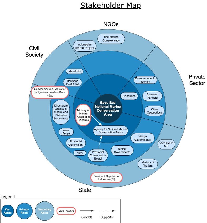
8.1.2 Exploring community perceptions on core issues                      45
  8.1.3 In-depth study of community perceptions                             50
    8.1.3.1 Changes of the natural and economic environment                 50
    8.1.3.2 Functions and use of natural resources                          54
    8.1.3.3 Marine conservation                                             58
    8.1.3.4 Tourism                                                         61
    8.1.3.5 Governance                                                      62

9 RECOMMENDATIONS TO IMPROVE MANAGEMENT OF THE SAVU
SEA NMCA IN ROTE NDAO                               65
9.1 State actors                                                            66
  9.1.1 Participatory MPA planning and management approach                  66
  9.1.2 MPA patrol and surveillance                                         67

9.2 Market actors                                                           67
  9.2.1 Forum of local economic actors for sustainable resource use         67
  9.2.2 Livelihood development                                              67
  9.2.3 Mobilizing alternative funding                                      68
    9.2.3.1 Tourism-based levies                                            68
    9.2.3.2 Philanthropic funds                                             69

9.3 Community actors                                                        69
  9.3.1 Building community awareness                                        69
  9.3.2 Strengthen the role of the indigenous surveillance system Papadak   70
  9.3.3 Knowledge sharing and networking                                    71
  9.3.4 Community education through religious organizations and schools     71
  9.3.5 Communal information centers                                        71

10 CONCLUSIONS                                                              71

11 REFERENCES                                                               73

12 APPENDICES                                                               79

12.1 Interview Questions                                                    79
  12.1.1 Questionnaire                                                      79
  12.1.2 Questions Guiding Semi-structured Interviews                       79

12.2 Full List of Interviewees                                              80
  12.2.1 Nemberala Village                                                  80
  12.2.2 Oeseli Village                                                     81
  12.2.3 Siomeda Village                                                    82

12.3   Photographs                                                          83

                                                                             4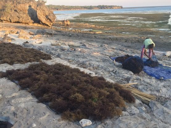
I. Abstract
This study focuses on community perception of marine protection in Rote, Eastern
Indonesia. The Island of Rote is part of the Save Sea National Marine Conservation
Area – the largest MPA in the Republic of Indonesia and the Coral Triangle. A
combination of quantitative and qualitative methods were used to explore local
community perceptions on the status of marine and coastal resources and their use,
of marine conservation efforts in the area and how they could be improved.
Combined with a stakeholder analysis, which identified the relevant actors and their
position within the current governance structure of the MPA, findings provided
insights into how current MPA management has been realized on the ground and
where potential shortcomings lie. There was a widespread perception across local
stakeholder groups that illegal fishing, destructive fishing practices and pollution
continue to threaten Rote’s marine and coastal resources and that these activities
are conducted due to little alternative livelihood opportunities, lack of awareness and
inadequate enforcement of the MPA. Overall, participants recognized the value of
preserving the marine environment for the island’s wellbeing and showed strong
willingness to contribute and engage in MPA related activities. While the current
governance of the Savu Sea NMCA has had some positive impact on the ground,
there are many opportunities for improved management. Building on this positive
environment for conservation work, recommendations are provided to address critical
issues identified in the governance and implementation of the MPA.

Key words: MPA, marine conservation, community perception, local awareness,
stakeholders, marine resources, threats, environmental governance, management,
Savu Sea National Marine Conservation Area, Rote Ndao

                                                                                     5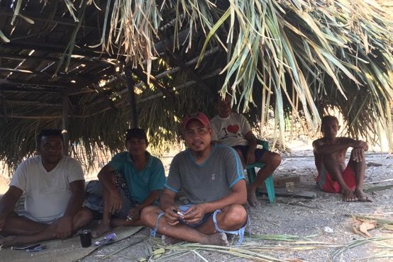
II. Acknowledgements

I would like to thank the Indonesian Manta Project for this opportunity, which allowed
me to immerse myself into the realities of marine conservation in a remote island
context and connect with people on the ground faced with real and pressing
challenges. The experiences and lessons learned during this time connecting with
local communities was eye opening, stimulating and humbling and I hope that the
recommendations provided through my work can contribute to developing useful
conservation strategies that improve MPA management.

I am grateful to the German Academic Exchange Service (DAAD) for the scholarship
awarded through the PROMOS program, which helped cover expenses of the field
study.

I would like to thank both supervisors Professor Christian Schleyer and Professor
Robert Arlinghaus for their support throughout this research project.

Special thanks go to the inhabitants of Rote Ndao Island who were so welcoming
and were always ready to share their knowledge and experiences with me. It was
extremely humbling to see their positivity, passion and smiling faces, despite their
difficult livelihoods. I am especially grateful for those who went out of their way to
support me, invited me into their homes, organized meetings with other community
members for me to interview and accompanied me during village visits and of
course, made sure I had the real traditional Rotinese experience.

Finally, I would like to thank my family and friends for their ongoing support and
motivation during this research process.

                                                                                    6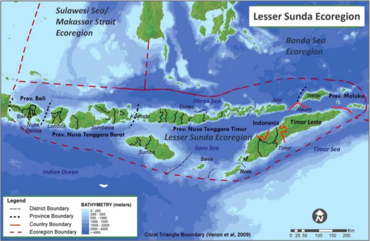
III. List of Abbreviations and Local Terms
ABNJ               Areas Beyond National Jurisdiction
BKKPN              Balai Kawasan Konservasi Perairan Nasional (Agency
                   for National Marine Conservation Areas)
BPS                Badan Pusat Statistic (Central Bureau of Statistics)
CBD                Convention on Biological Diversity
CI                 Conservation International
COREMAP-CTI        Coral Reef Rehabilitation and Management Program - Coral
                   Triangle Initiative
CTI-CFF            Coral Triangle Initiative on Coral Reefs, Fisheries and Food
                   Security
EAF                Ecosystem Approach to Fisheries
EAFM               Ecosystem Approach to Fisheries Management
EEZ                Exclusive Economic Zone
EKKP-3K            Efektivitas pengelolaan Kawasan Konservasi Perairan, Pesiris,
                   dan Pulau-Pulau Kecil (Management Effectivness of Aquatic,
                   Coasts and Small Island Conservation Areas)
FKTA-PB            Forum Komunikasi Tokoh Adat-Peduli Budaya (Indigenous
                   Communication Forum)
FMA                Fisheries Management Area
FMP                Fisheries Management Plan
GD-PAME            Global Database on Protected Area Management Effectiveness
GIZ                Deutsche Gesellschaft für Internationale Zusammenarbeit
IUCN               International Union for Conservation of Nature
IUU                Illegal, Unreported and Unregulated
MMAF               Ministry of Marine Affairs and Fisheries
MPA                Marine Protected Area
NMCA               National Marine Conservation Area
NTB                Nusa Tenggara Barat (West Nusa Tenggara Province)
NTT                Nusa Tenggara Timur (East Nusa Tengarra Province)
PCB                Provincial Conservation Board
PSDKP              Pengelolaan Sumber Daya Kelautan & Perikanan (Directorate
                   General of Marine and Fisheries Surveillance)
TNC                The Nature Conservancy
UN                 United Nations
UNCLOS             United Nations Convention on the Law of the Sea

                                                                                   7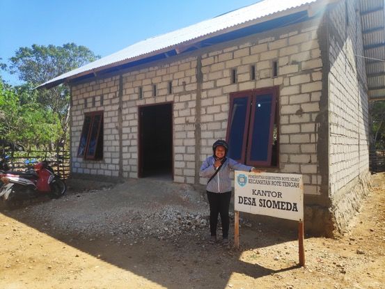
UNEP-WCMC     United Nations’ Environment Program’s World Conservation
              Monitoring Centre
WDPA          World Database for Protected Areas
WWF           World Wildlife Fund
Local terms
Adat          Custom
Akar Tuba     Root of a plant that is used as natural pesticide. Similar to
              potassium cyanide, it is used It is used to stun and capture live
              fish but in shallow tide pools
Bupati        Governor of a district
Ikat          Dyeing technique used to pattern textiles
Kecamatan     Sub-district
Manaholo      Guardians that enforce the Papadak rules
Nire          Sap of the Lontar Palm (Borassus flabellifer), tapped from the
              palm tree flower

Papadak       Set of customary rules regarding natural resource use
Pokja         Kelompok Kerja (Working Group)
Tenun         Traditionally woven textile

                                                                                  8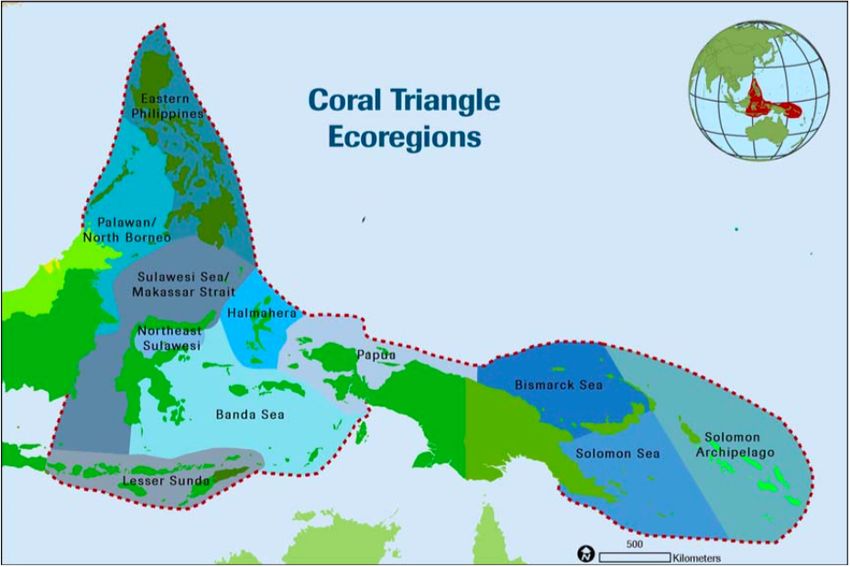
IV. List of Figures
Figure 1: Lesser Sunda Ecoregion showing provincial and national boundaries (Wilson et al., 2011)     12
Figure 2: Coral Triangle Ecoregions (Green and Mous, 2008)                                            12
Figure 3: Map of the Savu Sea National Marine Conservation Area (KepMen 6/2014)                       14
Figure 4: Rote Island and the marine protected zones within the Savu Sea NMCA (Indonesian Manta
     Project)                                                                                         15
Figure 5: IUCN’s six MPA categories (IUCN, n.d.)                                                      20
Figure 6: Stakeholder map showing their position according to key, primary or secondary actors,
     including Veto Players                                                                           32
Figure 7: Governance structure of the Savu Sea National Marine Conservation Area                      41
Figure 8: Composition of occupation types among interviewees                                          44
Figure 9: Education background of interviewees                                                        44
Figure 10: Respondents’ dependency on marine resources for their daily lives according to village     46
Figure 11: Respondents’ perception of ocean health across the three sample villages                   46
Figure 12: Perceptions of stakeholder groups on ocean health                                          47
Figure 13: Perception of ocean health according to gender                                             47
Figure 14: Perceptions according to educational background                                            48
Figure 15: Main perceived threats to ocean health                                                     49
Figure 16: Perceptions on threats to the ocean by stakeholder group                                   49
Figure 17: Changes perceived by respondents according to village                                      50
Figure 18: Perceived changes in marine resources over the past decade                                 51
Figure 19: Decline in marine resource types perceived by stakeholders                                 51
Figure 20: Perceptions of the decline in marine resource according to gender                          52
Figure 21: Perceptions of the decline in marine resource according to education                       52
Figure 22: Predominant response demonstrating an increase in the difficulty of local livelihoods      53
Figure 23: Impact of changes on life according to stakeholder group                                   54
Figure 24: Responses about the functions of coral reefs and mangroves according to educational
     background                                                                                       55
Figure 25: Why are destructive activities still conducted?                                            57
Figure 26: Awareness of the Savu Sea National Marine Conservation Area (NMCA) across three
     villages                                                                                         58
Figure 27: Stakeholder awareness about the existence of the Savu Sea NMCA                             59
Figure 28: What is the objective of an MPA?                                                           59
Figure 29: What is the most effective way to share conservation information to communities in Rote?   60
Figure 30: How does tourism impact the local situation in Rote?                                       61
Figure 31: Interrelation of key actors                                                                66

   V. List of Tables
Table 1: Socio-economic data on three sample villages in the study and an overview of data sources 43
Table 2: Overview of key informants interviewed during study                                       45
Table 3: Questions and answer choices included in the questionnaire                                45

                                                                                                      9
1        Introduction
In the face of growing marine biodiversity loss and overexploitation or marine resources,
marine protected areas (MPAs) are quickly becoming one of the most common tools for
marine conservation around the world (Abecasis et al., 2013; Gurney et al., 2014; Dehens and
Fanning, 2018; Rees et al., 2018). While their primary objective is conservation such as
maintaining ecosystem services and mitigating biodiversity loss, they also play an important
role in sustaining coastal livelihoods (Mascia et al., 2010; Bennett and Dearden, 2014a;
Laffoley et al., 2018). MPAs are particularly important in small island contexts whose
communities are directly dependent on the goods and services provided by the ocean. As the
local economies of small islands are geographically isolated and often have limited
connections to external markets, MPAs can provide a range of new employment opportunities,
for example in conservation or tourism.

Environmental issues have emerged as a core concern for me as I witnessed significant
development changes and their impact on the environment during my upbringing on the
Indonesian island of Bali. My interest for marine conservation was deepened during my
bachelor degree in Environmental Biology at the University of Nottingham, where I wrote my
final year dissertation on coral reef rehabilitation. My motivation to engage in marine
conservation led me to connect with the NGO Conservation International, where I worked for
several years in projects on ecotourism and marine protected areas in Bali and West Papua.
During this time I collaborated with the local organization Indonesian Manta Project in West
Papua. In 2015, this project established a field base on the island of Rote to study manta
populations in the area. Having visited Rote several times, I eventually became aware of its
location within the Savu Sea National Marine Conservation Area and the challenges related to
its enforcement. This motivated me to reconnect with the Indonesian Manta Project in order to
explore how MPA management could be improved on the island.

A common shortfall in successful MPA management is the lack of or limited involvement of
local stakeholders, particularly resident communities (Clarke et al., 2016; Sterling et al., 2017).
Community and stakeholder involvement throughout the establishment and implementation of
MPAs is essential to ensure local congruency of management strategies, increase local
awareness as well as promote support for marine conservation. Further benefits of
stakeholder involvement include creating an opportunity to tap into local knowledge systems,
reduce potential stakeholder conflict, and generate higher levels of local compliance, which
ultimately reduce costs associated with enforcement (Abecasis et al., 2013). As MPAs affect a
broad range of local stakeholders in very different ways, understanding their perceptions,
values and expectations is fundamental for addressing local interests and concerns. Through
exploring the perceptions of local communities on marine protection in Rote, including their
reports of changes, threats and the possibilities to engage for a healthier ocean, I hope to
contribute to the improvement of strategies for improved management of this marine protected
area.

2        Study Objective and Relevance
The objective of this study is to explore the perceptions of local communities on the island of
Rote concerning:

    a) the status of marine resources and their use;
    b) marine conservation efforts in the area;
    c) how marine conservation efforts can be improved.

The perception on marine conservation efforts are analyzed against the backdrop of the
existing marine governance framework of the Savu Sea NMCA.

                                                                                                10
By exploring the perceptions of local communities on how marine resources have changed
over the past decade as well as what conservation efforts have been implemented to date
sheds light on key issues that need to be addressed. Community perceptions can provide
extremely valuable information for MPA managers on where to focus their effort, tap into
existing local frameworks for on-site governance and better assess appropriate mechanisms
for communication and awareness raising.
The study was motivated based on concerns regarding the implementation and enforcement
of the MPA. Based on anecdotal information from foreign and local residents on the island,
very little MPA related activities had been noticeable over the years. Said residents have been
living on the coast of South Rote for many years, close to important no-take zones within the
MPA. Their accounts suggested that there are no regular or visible MPA patrols or community
awareness raising activities in the area. This prompted me to take a closer look and hear from
local communities directly what kind of changes they have experienced with regard to marine
resource health and use, as well as what conservation outreach activities they are aware of.
Globally, it is often the case that MPA designations are publicized and celebrated, although
they may not be achieving tangible improvements on the ground and may exist only as ‘paper
parks’ (Abecasis et al., 2013; Bennett, 2016; Sala et al., 2018). Greater attention is required to
monitor and evaluate the implementation of MPAs in order to continuously adapt and improve
strategies and maximize effectiveness. Conservation in practice has shown that social,
cultural, economic and political factors, more than biological or physical factors, shape the
development, management and performance of MPAs (Fiske, 1992; Kelleher and Recchia,
1998; Pomeroy et al., 2004; Roberts, 2000). Dialogue with local communities can reveal such
factors, which are important to consider for successful marine protection. In addition to
depending directly on marine resources for their livelihoods, coastal communities often have a
strong cultural heritage associated with the sea and are therefore deeply affected by its
condition and management approach. It is therefore imperative that management strategies
consider local concerns. By taking a glimpse at the Savu Sea NMCA through the eyes of the
local people in Rote, this study sheds light on shortcomings in the implementation of the MPA
on the ground. It also help identify which strategies are suitable in the local context to make a
difference for the protection of marine resources and the people directly affected by changes
in the marine environment. Recommendations will be derived in terms of critical factors to be
addressed in MPA implementation in order to maximize community support and contribute to
improved management.
3 Background
3.1 Area statistics
Rote Island lies in the Savu Sea National Marine Conservation Area1 (NMCA) and represents
the most southeastern point of the Indonesian Archipelago. The islands found in this part of
Indonesia are called the Lesser Sunda Islands and are divided into the provinces of Bali, West
Nusa Tenggara (Nusa Tenggara Barat-NTB), East Nusa Tenggara (Nusa Tenggara Timur-
NTT), and the southern part of Maluku. This region, with the inclusion of the independent
country of Timor-Leste in the East, is also referred to as the Lesser Sunda Ecoregion (Fig.1).
Ecoregions are defined as “areas of relatively homogeneous species composition, clearly
distinct from adjacent systems’ (Spalding et al., 2007), a classification that was developed to
facilitate and simplify priority setting and planning for conservation. In the northern part of the
Lesser Sunda Ecoregion, a string of volcanic islands stretch along the convergent boundary of
the East Eurasion and the Indo-Australian tectonic plates, sitting on the East Eurasian plate.
From west to east these islands are Bali, Lombok, Sumbawa, Flores, Alor and Wetar. Many of
the volcanoes on this ridge, also known as the Sunda Arc, are still active today and are fired
by the ongoing subduction of the Australian Plate under the Eurasian Plate (Roosmawati and
1
Savu Sea National Marine Conservation Area (NMCA) is also sometimes referred to as a National Marine Park
(NMP) but for the purpose of consistency in this report, I shall refer to it as the Savu Sea NMCA.
11Harris, 2009). The islands in the southern portion of the Lesser Sunda Ecoregion are situated
on the Australian continental shelf and are not volcanic. From west to east they are Sumba,
Savu, Rote and Timor. The island of Timor is split through the middle with the western portion
belonging to Indonesia and the eastern portion (along with a small exclave in the west)
belonging to the sovereign state of Timor-Leste.
Figure 1: Lesser Sunda Ecoregion showing provincial and national boundaries (Wilson et al., 2011)
The Lesser Sunda Ecoregion covers approximately 35,802,039 hectares (ha) of ocean and
10,886 kilometers of coastline. It is located in the southwest of the Coral Triangle (Fig.2), an
area spanning approximately 6 million km2 and recognized as the global center of marine
biodiversity (Wilson et al., 2011). While the Coral Triangle covers less than 2% of the Earths
surface, it is home to 76% of all reef-building coral species and 37% of all coral reef fish in the
world (Ayers et al., 2014).
Figure 2: Coral Triangle Ecoregions (Green and Mous, 2008)
12The Lesser Sunda Ecoregion characterizes one of the most geologically complex and active
regions in the world. Located on the collision site of two tectonic plates, the topography of the
seafloor is extremely varied with many shallow coral reefs, seamounts, underwater canyons
and abrupt drop offs that occur within kilometers of the coast and reach depths of up to 4000m
(Wilson et al., 2011). These features create very unique ‘deep-sea yet near-shore’ habitats,
and along with shallow coastal environments such as coral reefs, mangroves and seagrass
meadows, this seascape provides a myriad of habitats for a diverse range of species.
Characterized by extremely strong currents from the Indonesian Throughflow (ITF), large
amounts of warmer water spill through the intricate network of Indonesian islands from the
north and central Pacific Ocean into the northeast Indian Ocean. In combination with the steep
underwater landscape of the area, this generates important upwellings of nutrient-rich deep
water into the shallows, contributing to the high productivity of this region (Ayers et al., 2014).
3.2 Biodiversity
Within the Coral Triangle, the Lesser Sunda Ecoregion ranks high in marine biodiversity. The
Lesser Sunda Ecoregion boasts approximately 523 species of reef building coral and 1,783
species of coral reef fish, many of which are endemic (Wilson et al., 2011). Bridging the Pacific
and Indian Ocean, the Lesser Sunda Ecoregion represents an important migratory corridor for
many marine megafauna species including the dugong, and several endangered cetaceans,
elasmobranchs and sea turtles. Cetaceans (including the highly endangered blue whale) and
important pelagic fish that travel through the deep-sea near-shore channels between the
islands as they migrate between the Indian and Pacific Oceans (Wilson et al., 2011).
One of the three main exit passages of the ITF into the Indian Ocean is the Savu Sea. The
Savu Sea likely acts as a sink where currents enriched with nutrients and larvae from
numerous reefs throughout Indonesia accumulate and contribute to the high productivity and
diversity (Sprintall et al., 2009; Ayers et al., 2014; Wilson et al., 2011). Although small, this
body of water bounded within the northern and southern island chains of the Lesser Sunda
Ecoregion is extremely unique. Up to 3,500 meters deep in some parts, the Savu Sea spans
~600 km from west to east and ~200 km from north to south. At least 14 species of whales, 12
species of dolphins, five species of sea turtles, two species of manta rays and dugongs have
been recorded feeding and residing in, and migrating through the Savu Sea (KepMen 6/2014).
Located at the southern most point of the Savu Sea, Rote Island flanks one of the main
gateways to the Indian Ocean. The uninhabited island off the southern coast of Rote Island
called Ndana, is the closest island to the territorial boundary of Australia. Australia’s coast lies
roughly 500km from here, while Australia’s Ashmore Reef is closer at only 150km distance. It
is around this southern most tip of Rote, the gateway between the open-ocean and shallow
inter-island channels, where marine megafauna such as whales, whalesharks and manta rays
are most frequently sighted (personal communication).
3.3 Marine protection efforts
Due to the rich and unique marine life found throughout this seascape, there have been efforts
to develop marine protection in the Lesser Sunda Ecoregion. A collaborative effort between
the Indonesian government and the non-governmental organization (NGO) The Nature
Conservancy (TNC) began in 2006 to design a resilient network of MPAs to protect the
outstanding marine biodiversity as well as support the sustainable use of marine resources for
the benefit of coastal communities in the area (Wilson et al., 2011). Prior to the
commencement of this study, national, provincial and regional governments of Indonesia had
already identified a number of areas for protection in the Lesser Sunda Ecoregion. By the end
of the project in 2009, the final MPA network design, which was guided by resilience principles
at an Ecoregional level, included a total of 100 marine protected areas. Covering an area of
approximately 3.4 million hectares, the Savu Sea NMCA represents the largest MPA not only
in the Lesser Sunda MPA Network, but also in the country and within the Coral Triangle. This
13MPA is also unique in its high representativeness, encompassing both shallow and deep
marine habitats as a result of its highly diversified benthic topography.
Following Indonesia’s commitment to protect 20 million ha of its waters by 2020, the
Indonesian Government began ranking different regions throughout the country in terms of
conservation priority. In this evaluation, the Lesser Sunda Ecoregion ranked 3rd out of 12
Ecoregions in the country, further reinforcing the importance of formalizing the proposed MPA
network in the Lesser Sunda Ecoregion (Huffard et al., 2012). Following the declaration in
2009, the Savu Sea National Marine Conservation Area (NMCA) was officially designated in
2014 under ministerial decree No.5/2014 (KepMen 5/2014).
3.4 Savu Sea National Marine Conservation Area
The large Savu Sea National Marine Conservation Area (NMCA) stretches across several
islands in the Savu Sea and is fragmented by two channels between the islands of Sumba and
Savu, and Savu and Rote (Fig.3). The core zones ensure the absolute protection of habitat
and fish populations in these areas. No activities are allowed except for MPA related
surveillance and infrastructure development (e.g. construction of a patrol post). The utilization
zone is a no-take zone that serves to protect and preserve fish habitats and populations while
allowing activities related to tourism and recreation, research and development, education,
and also allows shipping lines. The sustainable fisheries zone is sub-divided into three sub-
zones namely the traditional sustainable fishing zone, the public sustainable fishing zone, and
the cetacean protection zone. In all sustainable fisheries zones boats larger than 5 gigatons
(GT) are not allowed to fish. There are two additional zones called the local wisdom zone and
the tourism and culture zone.
Rote Ndao Island
Figure 3: Map of the Savu Sea National Marine Conservation Area (KepMen 6/2014)
Rote Ndao Island is located in the southeastern part of the Savu Sea NMCA and with the
exception of part of the eastern coast, is completely surrounded by the MPA. The legend in
Figure 3 shows the core-zone in red, the utilization-zone in green, the traditional fishing zone
in orange, the public fishing zone in purple, and the cetacean protection zone in grey. Other
zones include the customary practice zone in blue and the tourism and culture zone in dark
green.
14Figure 4: Rote Island and the marine protected zones within the Savu Sea NMCA (Indonesian Manta
Project)
Figure 4 shows a closer view of Rote and the relevant MPA zones around it, which include the
utilization, traditional sustainable fishing, public sustainable fishing and cetacean protection
zones.
3.5 Socio-economic situation
Rote Island, along with the number of smaller islands scattered around its coast, make up
Rote Ndao District2 in the Province of East Nusa Tenggara (Nusa Tenggara Timur - NTT).
Formerly part of Kupang District, Rote Ndao was only established as its own district in 2002
with its capital Ba’a located on the island of Rote. The district has an area of approximately
1,280.10 km2 and as of the 2018 census, has a population of 165,807 spread across 10
districts and 112 villages (BPS Kabupaten Rote Ndao, 2018a). As holds true for the entire
province of NTT, Rote Ndao District is predominantly Christian. 92.69% of the people in Rote
are Protestant, followed by 5.5% Islam, 1.73% Catholic and 0.07% Hindu (BPS Provinsi NTT,
2018a).
East Nusa Tenggara is one of the poorest provinces in the country with 21.03% of the
population living below the poverty line in 2018 (Papua ranks 1st and West Papua 2nd). Within
this province, Rote Ndao District represents the 6th poorest out of 22 regencies, with over a
quarter of its population (27.95%) living below the poverty line3 (BPS Provinsi NTT, 2019a).
Although a small island with a dry landscape, the people in Rote are traditionally focused on
subsistence farming. Farmers wrest a meager living off their poor dry soils by planting upland
rice, corn, sorghum, sweet potato, cassava, peanuts and watermelon. A total of 49.4% of
households in Rote are farmers4, compared to a mere 2.5% that are registered as fishermen
(BPS Provinsi NTT, 2016; 2018b). The landscape consists almost equally of hilly regions and
low-lying valleys and land use is dominated by forests, rice fields and plantations. The majority
of existing plantations are of the Lontar palm (Borassus flabellifer) - a tree native to Southeast
Asia and with a multitude of uses (Pemerintah Kabupaten Rote Ndao, 2019). The most
2
A district can also be referred to as regency. For consistency, only the term district is used for this administrative
level.
3
The poverty line in Rote Ndao in 2019 is €20.3/person/month (BPS Provinsi NTT, 2019b).
4
Including horticulture, paddy fields, plantation crops, silviculture and animal husbandry.
15significant function of the palm is the nectar-like sap harvested from the flower called nire. This
sugar water represented a lifeline for the Rotinese and helped them survive times where there
were little other food sources available due to the difficult conditions for agriculture (personal
communication).
In response to the poor standard of living across the island, the provincial government
implemented a program to help alleviate poverty and establish new livelihood opportunities.
This saw the introduction of seaweed farming to Rote in 1998, and farmers were supplied with
materials and seaweed seedlings necessary to start their farms. Seaweed farming quickly
became more attractive than land-based agriculture, as it was not seasonal, easy to learn,
required little input costs and procured a higher return. The industry transformed the lives of
coastal communities, increasing living standards and enabling them to provide higher
education levels for their children (Mariño et al., 2019). Nevertheless, agriculture still remains
an important source of income today, particularly as seaweed harvests have drastically
declined since 2009. Despite its socio-economic importance, seaweed farming has received
little attention from the government since its inception, and is not even accounted for in local
statistics on economic activity5.
Almost a quarter of the population (39.67%) in Rote Ndao District is aged between 0-19 years.
This young population implies a potentially large workforce, but its quality will depend on
improvement of school attendance rates and the level of education. According to the Central
Bureau of Statistics of Rote Ndao, school participation rates in 2018 for the age brackets of 7-
12 years old (primary school) was 96,24%, 71.83% for 13-15 year olds (middle school) and
50.63% for 16-18 year olds (high school). It is evident that many children drop out after
primary school or during middle school. This is likely because once they become old enough
to help around the household or with fieldwork, families that cannot afford to pay tuition fees
will pull their kids out of school (BPS Kabupaten Rote Ndao, 2018b).
In addition to increasing school attendance rates, it will also be important to adapt educational
curricula to include more current and locally relevant issues such as natural resource
management and environmental conservation, starting from elementary school. Environmental
education is imperative for shaping stewards of the environment and embedding
environmental awareness within the youth is essential for changing social behavior and norms
on natural resource use.
4 Methodology
4.1 Literature review
A comprehensive literature review was conducted to understand the existing governance
framework of the Savu Sea NMCA and identify the relevant institutions, structures and
processes herein. Specifically, this included the following aspects: the legal basis of the MPA;
organizational structures at national, provincial, district and village level as well as
communication and outreach activities. Much of this research involved analyzing the official
websites of the relevant government and non-government agencies involved. Unfortunately,
information available on these websites was not always comprehensive and clear, and
sometimes contradicted each other. Local news outlets and media platforms were also used to
crosscheck information and track the implementation of conservation related activities that
were reported. Finally, dialogue with individuals from key stakeholder groups including the
Agency for National Marine Protected Areas (BKKPN), The Nature Conservancy (TNC),
Conservation International Indonesia (CI-I), other professionals in MPA management and the
coordinator of customary law in Rote were held. Information from all sources was triangulated
to crosscheck and confirm data, and identify uncertainties or bias responses from
interviewees.
5
It is possible that seaweed farming statistics are included within the general ‘farming’ category, although this is not
stated anywhere.
164.2 Stakeholder analysis
Communities consist of different stakeholders. To identify the different stakeholders relevant to
my research, I used the Map of Actors tool outlined in the Capacity WORKS management
model developed by the Deutsche Gesellschaft für Internationale Zusammenarbeit (GIZ) (GIZ,
2015). This map distinguishes stakeholders between state, private sector and civil society
actors, and categorizes them into key, primary and secondary stakeholders with regard to the
issue at stake. After determining their position with regard to marine conservation in Rote, I
analyzed their mandate and agendas, scope of influence, relationship with other actors and
their active and potential role in marine conservation. A graphic was created to visualize their
position in the governance framework (Fig.6).
4.3 Empirical data collection
4.3.1 Interviews and focus group discussions
A three-tiered approach was followed, starting with specific and closed-ended questions to
generate a preliminary understanding of the individuals’ or focus groups’ viewpoint. Broad and
open-ended discussions followed, guided by four main themes. Finally, findings were
triangulated with individuals and groups on a semi-continuous basis as they emerged, as well
as with documented sources of information such as MPA laws, NGO reports and government
websites.
The design, implementation and analysis of interviews were guided by the International Union
for the Conservation of Nature’s (IUCN) ‘How is your MPA doing?’ guidebook (Pomeroy et al.,
2004). Interviews were conducted and recorded in the local language (Indonesian) and
transcribed directly into English. Transcriptions were not transcribed word for word, but rather
tried to summarize the responses, making sure to capture all views and opinions relevant to
the topic.
The recruitment of interviewees aimed to capture the most relevant community stakeholder
groups. Participants were selected in a variety of ways. The first interviews conducted were
with members of the community with whom I had already had contact with through my
previous visit to the island (3 years ago), or with whom I was put in touch with through people
that I knew. In Indonesia it is important to introduce oneself to the village head and ask for
permission to interview community members. The village heads are relevant stakeholders
within my sample and therefore, they also represented one of the first interviewees. After
having established contact with the village head, it was often easier to get in touch with other
respondents. These respondents were selected through snowball sampling and convenience
sampling.
Based on the classification of stakeholders in the stakeholder map, I engaged various
community members in a series of questionnaires, semi-structured interviews and focus
groups on marine resources and the Savu Sea NMCA. All of these approaches draw upon
participants’ attitudes, beliefs, and experiences. A total of 50 individuals across 3 villages were
included in this research. Focus groups and one-on-one interviews are different qualitative
research approaches but can be equally effective in answering certain research questions.
The questionnaire applied in this study was designed to get an overview of the broader
perceptions of community members related to the marine environment, while the semi-
structured interviews evoked deeper discussions regarding these opinions and allowed for an
informal exchange on feelings, ideas and desires. While one-on-one interviews allow
respondents to express their own thoughts and opinions without any pressure or fear of
judgment from others, focus groups create a space for community members to exchange their
views and discuss topics that are potentially new to them or rarely talked about in their
personal lives. Depending on the confidence of the interviewee however, respondents may
feel uncomfortable or intimidated, influencing the accuracy and depth of their responses.
Responses in a focus group may have more variety because group members can stimulate
17new thoughts for each other, which might not have otherwise occurred. On the other hand
however, some individuals in focus group discussions might feel hesitant about speaking
openly, influenced by social structures, knowledge and experience, and interest in
participation.
The questionnaire included six multiple-choice questions, after which a semi-structured
interview allowed for the conversation to evolve organically along some core themes. I guided
the interviews according to the four broad themes of change, natural resources, conservation,
and where appropriate, tourism. The questions asked within the themes of Change and
Natural Resources were based on some socioeconomic indicators outlined in the ‘How is your
MPA doing?’ guidebook (Pomeroy et al., 2004). Questions within the Conservation theme
were designed to capture the level of local awareness of and perceptions on the existing MPA
around Rote, and explored their enthusiasm for greater participation in conservation related
activities. In this section, respondents were given the opportunity to comment on the
institutions, structures and processes they were aware of in relation the marine conservation in
Rote. Where appropriate, interviews also explored opinions on tourism. Tourism-related
questions were most useful in Nemberala village, where tourism is developed and has
certainly significantly impacted the local economy.
Initially I planned on conducting only one-on-one interviews with community members, as I felt
that this would allow me to get a more uninfluenced opinion from respondents. I also expected
a greater variety of answers in individual interviews, as respondents would be encouraged to
explore their own thoughts and share their own opinions, rather than agreeing with others in a
focus group. In a focus group context, some participants may not know the function and
importance of coral reefs for example, but simply agree to the response of one that does,
which makes it impossible to know what each of the participants knows and thinks. Although I
preferred individual interviews, I let the interview process unfold naturally and adapted to the
situational context. As such, some interviews emerged as small focus groups. Although the
composition of participants in focus groups are usually planned to assemble a desired group of
stakeholders, the focus groups that I guided were impromptu, as the opportunity arose.
Nevertheless, they provided insightful discussions. The composition of my focus groups was
typically people of the same occupation, for example a group of seaweed farming women, or a
couple of fishermen.
Focus groups were mainly the case in the two villages of Oeseli and Siomeda. The reason
was that the recruitment of interviewees in these villages was opportunistic (approaching
community members during my visits). In many cases, people were in groups and it was
inappropriate to single out individuals. As a result, in such situations I began discussions with
the group, which ranged in size between two and four people. I also felt that this approach was
more appropriate in these two villages as they have had less exposure to foreigners
(compared with the tourist village of Nemberala), and I had the impression that people felt
more comfortable conversing with me together with their peers. In the focus groups, all
individuals provided answers to the questions, but it cannot be excluded that they influenced
each other in their responses.
As the interview questions included some sensitive topics such as illegal and destructive
human activities related to natural resource exploitation, it was important to be aware of
potential response biases. A response bias arises when respondents give inaccurate answers,
which can be due to various reasons including fear of exposing community members that still
practice illegal activities, apprehension of expressing negative opinions regarding government
effort in MPA management, or not knowing the answer to a question. To reduce the response
bias, I tried to create a safe space where interviewees felt comfortable expressing their
thoughts and opinions freely. I did this by introducing myself as a student, which in comparison
to employees either of the government of non-governmental organizations, are considered
more neutral parties. I also assured them that the recordings and information discussed would
remain anonymous, which reduces the ‘threat’ of being accused of exposing bad community
18behavior or critical opinions. Finally, the interviews began with the less sensitive questions and
gradually increased in their sensitivity, allowing respondents to become accustomed to the
interviewing process and myself, rather than facing potentially confronting questions at the
outset.
4.3.2 Data Analysis
Interview recordings were simultaneously translated and transcribed from Indonesian into
English. Results were first compiled in a table format in Excel and then imported into data
analysis software MAXQDA6. Socio-economic data on each respondent including gender, age,
nationality, occupation, education and religion were recorded as set variables within each
transcript. The analysis was conducted by comparing responses to the same question and
identifying common themes among them, creating these as codes. This step was facilitated
through using a word cloud feature, which created a graphic based on the most frequent
words mentioned in the responses. This visualization helped to start the process and identify
the most prominent words and themes discussed. Responses were then analyzed in more
detail for less obvious themes and mentions. After all transcripts had been coded, all codes
and coded segments were checked for consistency. Once all the data was correctly coded, I
was able to use the software to show the distribution of responses across the whole data set
or based on the set variables. I used several variables including village, education, occupation
and gender to compare responses and explore if there were any significant trends.
4.3.3 On-site observation
During my stay on the island, I visited the harbor several times in the early morning to observe
fishermen catch. In Rote, seafood is not sold at the market but is sold directly to individual
traders at the harbor who transport the catch on the back of their motorbikes and distribute
them throughout the villages. In addition to observing activity on the beaches in the three
studied villages, I also visited the uninhabited turtle-nesting island nearby three times during
my stay on the island. During my stay in Nemberala and visits to Oeseli and Siomeda, I
observed local behavior and the presence of any educational material on the environment or
the MPA.
5 Governance of Marine Protected Areas (MPA)
5.1 Marine Protected Areas
5.1.1 Definition
Marine Protected Area (MPA) is an umbrella term that describes various types of protected
areas within the marine realm that are delineated by boundaries primarily aimed at conserving
marine biodiversity and sustaining natural processes (Clarke et al., 2016; Laffoley et al., 2018).
Due to this ambiguity, the IUCN attempted to develop a global definition for MPAs. Initially
adopted in 1999, it was revised in 2012 to remove a distinction between marine and terrestrial
protected areas, merging the definition of MPAs with that of a ‘protected area’ as:
“…a clearly defined geographical space, recognized, dedicated and managed, through
legal or other effective means, to achieve the long-term conservation of nature with associated
ecosystem services and cultural values” (UNEP-WCMC, 2018)
The United Nations’ Convention of Biological Diversity (CBD), considered the most important
national instrument addressing protected areas, has aligned its definition of a “Marine and
Coastal Protected Area” with the above as:
6
Free access provided through the Humboldt University of Berlin.
19“… any defined area within or adjacent to the marine environment, together with its
overlying waters and associated flora, fauna, and historical and cultural features, which has
been reserved by legislation or other effective means, including custom, with the effect that its
marine and/or coastal biodiversity enjoys a higher level of protection than its surroundings”
(Convention on Biological Diversity, 2004)
5.1.2 Forms and types of MPAs
MPA types generally vary according to the different regulations in place that outline permitted
and non-permitted activities within the boundaries. MPAs are typically sub-divided into
different zones within which different activities are allowed. There are a wide range of MPA
types across the world that vary in different levels of protection, but the terminology used to
describe the different types is inconsistent. Thus, the general term ‘MPA’ is used to refer to
any form of protection, from complete no-go zones to mutliple-use areas where extractive
activities are permitted. The use of inconsistent terms when referring to specific MPAs often
leads to confusion and misunderstandings of MPA function and objectives. An international
system that defines and categorizes the different types of MPAs would enable clearer and
more efficient communication regarding marine protected areas globally. The 2008 Guidelines
developed by the IUCN attempt to categorize the different types of MPAs (Fig.5), but in order
for an MPA to qualify for one or more of these categories, it must meet the IUCN definition of a
protected area (Dudley, 2008).
IUCN’s six MPA management categories (one with a sub-division):
Ia Strict nature reserve: Strictly protected for biodiversity and also possibly geological/
geomorphological features, where human visitation, use and impacts are controlled and limited to
ensure protection of the conservation values
Ib Wilderness area: Usually large unmodified or slightly modified areas, retaining their natural
character and influence, without permanent or significant human habitation, protected and managed
to preserve their natural condition
II National park: Large natural or near-natural areas protecting large-scale ecological processes
with characteristic species and ecosystems, which also have environmentally and culturally
compatible spiritual, scientific, educational, recreational and visitor opportunities
III Natural monument or feature: Areas set aside to protect a specific natural monument, which can
be a landform, sea mount, marine cavern, geological feature such as a cave, or a living feature such
as an ancient grove
IV Habitat/species management area: Areas to protect particular species or habitats, where
management reflects this priority. Many will need regular, active interventions to meet the needs of
particular species or habitats, but this is not a requirement of the category
V Protected landscape or seascape: Where the interaction of people and nature over time has
produced a distinct character with significant ecological, biological, cultural and scenic value: and
where safeguarding the integrity of this interaction is vital to protecting and sustaining the area and
its associated nature conservation and other values
VI Protected areas with sustainable use of natural resources: Areas which conserve
ecosystems, together with associated cultural values and traditional natural resource management
systems. Generally large, mainly in a natural condition, with a proportion under sustainable natural
resource management and where low-level non-industrial natural resource use compatible with
nature conservation is seen as one of the main aims
Figure 5: IUCN’s six MPA categories (IUCN, n.d.)
5.1.3 Global MPA coverage
As many regional and national non-governmental bodies including the IUCN and the CBD
have recognized MPAs as an effective tool for the conservation of marine resources, they
have become one of the most common spatial management tools used in marine conservation
globally (UNEP-WCMC, 2018). In 2011, the CBD released the Strategic Plan for Biodiversity
2011-2020, which outlined 20 global targets (the so-called Aichii Targets) to safeguard
biodiversity.
20Aichii Target 11 reads:
“ By 2020, at least 17 per cent of terrestrial and inland water, and 10 per cent of coastal
and marine areas, especially areas of particular importance for biodiversity and ecosystem
services, are conserved through effectively and equitably managed, ecologically
representative and well-connected systems of protected areas and other effective area-based
conservation measures, and integrated into the wider landscapes and seascapes.”
(Convention on Biological Diversity, 2011).
Many scientists however, argue that 10% of MPA coverage is insufficient to safeguard marine
biodiversity, and that a minimum of 30% of fully protected ocean area is necessary. As a
result, the majority of IUCN members at the IUCN World Conservation Congress in 2016
approved the new target to designate 30% of global ocean area as MPAs by 2030, where no
extraction activities would be allowed (Sala et al., 2018).
Despite covering over two-thirds of the Earth’s surface area, the ocean has been largely
neglected in terms of management. Increasing awareness of degrading marine ecosystems
and the grave implications of unregulated and unprotected marine areas, has prompted the
international community to begin taking serious efforts towards marine protection. In 2000, a
mere 0.7% or 2 million km2 of ocean area was protected by MPAs globally, compared to 12%
of terrestrial area that was protected (Zbicz, 2011). Although MPAs still lag behind their
terrestrial counterparts, marine conservation is growing at a faster rate as nations across the
world are developing networks of MPAs. As of 2019, MPAs globally have increased over
tenfold, covering 8% of the global ocean area or over 28 million km2 (UNEP-WCMC and IUCN,
2019). The majority of this area (60%) was added after 2010 and much of the recent growth
was due to the expansion (US Papahãnaumokuãkea Marine National Monument in the USA)
or addition (Pitcairn Islands Marine Reserve and Marae Moana Marine Park in the Cook
Islands) of some very large MPAs (UNEP-WCMC and IUCN, 2019).
It is important to note, that most of these MPAs lie within national waters where existing legal
systems allow for the establishment and implementation of protected areas. National waters
comprise 39% of global ocean, of which 18% are protected. In contrast, only 1% of
international waters or Areas Beyond National Jurisdiction (ABNJ), which comprise the
remaining 61% of global ocean, has been established as protected areas (Laffoley et al.,
2018). As there is no clear system of law in place to govern these waters, designating areas of
protection is extremely complicated and biodiversity here remains largely unregulated and
unprotected. However, with increasing awareness on the important ecosystem services
provided by, and rich marine biodiversity found beyond the limits of national jurisdictions,
international discussions are underway to simplify the process of protecting these areas. The
development of a legally binding instrument on the sustainable use of marine biological
diversity of ABNJ, initiated by the UN’s General Assembly under the UN Convention on the
Law of the Sea (UNCLOS) in 2015, marked the beginning of this global endeavour (Laffoley et
al., 2018).
In an effort to consolidate all data on protected areas, the IUCN and UN Environment
developed the World Database on Protected Areas (WDPA), which today represents one of
the principal global biodiversity data sets used by scientists, businesses, governments,
International secretariats and others to inform planning, policy decisions and management.
Data on marine and terrestrial protected areas in the WDPA are used to report on the progress
of the CBD’s Aichii Biodiversity Targets, the UN Sustainable Development Goals and other
international assessment and targets (UNEP-WCMC and IUCN, 2019).
5.1.4 MPA effectiveness
Despite the rapid growth in global MPAs in the past two decades, gaps in coverage and
representativeness may undermine their conservation impact. Additionally, poor governance
21and management, inter-stakeholder conflict, complicated legal structures and lack of local
community support present barriers to achieving conservation objectives (Bennett and
Dearden, 2014a; Raycraft, 2019). Although 8% of global ocean area is covered by MPAs
today, the effectiveness of these MPAs is largely debated and has become a global concern
(Sala et al., 2018; Ferraro and Pattanayak, 2006; Bennett, 2016). As countries rush to meet
the Aichii Target, it is possible that less attention is granted to effective implementation and in
some cases MPAs merely represent paper parks. The United Nations’ Environment Program’s
World Conservation Monitoring Centre’s (UNEP-WCMC) and the IUCN’s calculation of 8%
global MPA coverage includes all three stages within the MPA establishment process: (1) the
announcement of intended or committed MPAs; (2) legally endorsed MPAs; and (3)
implemented 7 MPAs (Sala et al., 2018). While stage one and two are both important
achievements in the MPA establishment process, it is unrealistic to conclude that all species
and habitats herein are truly protected. Considering only MPAs within stage three, total ocean
area covered by implemented MPAs as of January 2018 drastically drops to 3.6%. If the
additional 1.6% of designated MPAs and 2.1% proposed MPAs are implemented by 2020, this
would reach a total of 7.3% of fully implemented MPAs, still a shortfall of the 10% Aichii Target
(Sala et al., 2018). Furthermore, implemented MPAs still include zones in which certain
extractive activities are permitted, which directly contribute to compromising biodiversity rather
than improving it. As the CBD Aichii Target 11 falls under Strategic Goal C, which states “To
improve the status of biodiversity and safeguarding ecosystems, species and genetic
diversity”, Sala et al., (2018) argue that zones permitting any form of extractive activities that
compromise the health and diversity of marine species should not be included in the
calculation of the CBD target.
While it is generally accepted that MPAs have the potential to generate biological and social
benefits, there are many factors that can affect its effectiveness including uninformed design,
limited management staff, insufficient financial, logistical and technical support, lack of
scientific information and insufficient institutional, decision-making, and political support
(Dehens and Fanning, 2018). These factors can easily inhibit the ability of MPAs to achieve
their objectives. Thus, continuous monitoring and evaluation is required to assess which
actions are producing desired outcomes and which aren’t, so that these findings can be fed
back into improving and adapting management actions. Evaluation needs to be a routine part
of the management process and should be carried out using the same indicators and
methodology, in order to compare changes over time.
The lack of effectiveness has prompted an increase in monitoring and evaluation to better
understand what and where the problems are. The increased attention to monitoring and
evaluation has also been a result of a broader trend towards more adaptive management and
evidence-based conservation in both the natural and social sciences (Bennett, 2016; Evely et
al., 2008). Objective evaluation of protected area performance promotes responsible
management and guides both the planning of future PAs and the efficient allocation of
resources. Scientific evidence is necessary to making unbiased decisions at all stages in the
adaptive management cycle of planning, implementing, monitoring, evaluating, and adapting
conservation actions to improve outcomes (Hockings et al. 2006). However, the majority of
research on management effectiveness has been focused on measuring impacts and
outcomes rather than identifying input variables that produce effective MPAs. While monitoring
and evaluating impacts and outcomes is key, it is not always possible to identify which
governance shortcomings are leading to which outcomes (Bennett and Dearden, 2014a).
Limited or ineffective community participation or consideration of the local context for example,
may lead to distrust or conflict, which could easily be avoided through rapid or participatory
appraisals. Similarly, a brief analysis of input variables such as institutions, structures and
processes can immediately shed light on missing links in the governance framework and
should precede or complement the measurement of ecological and socio-economic indicators
(Bennett and Dearden, 2014b).
7
The paper does not address the degree of effectiveness of these implemented MPAs
22You can also read