EKIL022 - Perth & Kinross Council
←
→
Page content transcription
If your browser does not render page correctly, please read the page content below
2020 Employment Land Audit

   The Perth and Kinross Employment Land Audit has been
   produced to provide up to date and accurate information
   on the supply and availability of employment land for
   business and industrial use within the Perth and Kinross
   Council area.

eKIL022

                                                       June 2020
Contacts
Detailed area information

Perth City
Katie Briggs (Planning Officer)
KatieBriggs@pkc.gov

Perth North
Beatrice Nichol (Planning Officer)
BNichol@pkc.gov.uk

Perth South
Andrew Ballantine (Planning Officer)
ABallantine@pkc.gov.uk

Highland
Katrina Walker (Planning Officer)
KLWalker@pkc.gov.uk

Kinross
Robert Wills (Planning Officer)
RobertWills@pkc.gov.uk

Strathearn
Alasdair Finlayson (Planning Officer)
AFinlayson@pkc.gov.uk

Strathmore
Hajnalka Biro (Planning Officer)
HBiro@pkc.gov.uk

Perth & Kinross Council | Employment Land Audit 2020   1
Contents
Contacts .................................................................................................................................................. 1
Detailed area information................................................................................................................... 1
Perth City......................................................................................................................................... 1
Perth North ..................................................................................................................................... 1
Perth South ..................................................................................................................................... 1
Highland .......................................................................................................................................... 1
Kinross ............................................................................................................................................. 1
Strathearn ....................................................................................................................................... 1
Strathmore ...................................................................................................................................... 1
1. Introduction .................................................................................................................................... 3
Definition of Employment Land .......................................................................................................... 3
Purpose of the Audit ........................................................................................................................... 3
Spatial Overview ................................................................................................................................. 3
2. Background ..................................................................................................................................... 3
Scottish Planning Policy ...................................................................................................................... 4
The National Planning Framework for Scotland 3 .............................................................................. 4
TAYplan Strategic Development Plan ................................................................................................. 4
Perth and Kinross Local Development Plan 2 ..................................................................................... 5
3. Employment Land Audit 2020......................................................................................................... 5
Preparation of the Audit ..................................................................................................................... 5
Monitoring .......................................................................................................................................... 6
Employment Land supply.................................................................................................................... 6
Employment Land Supply Summary Figures....................................................................................... 8
Appendix 1: Glossary of Terms and Abbreviations ............................................................................... 11
Appendix 2: Perth and Kinross LDP Employment Sites 2020................................................................ 12
Appendix 3: Serviced Employment Land Sites ...................................................................................... 20
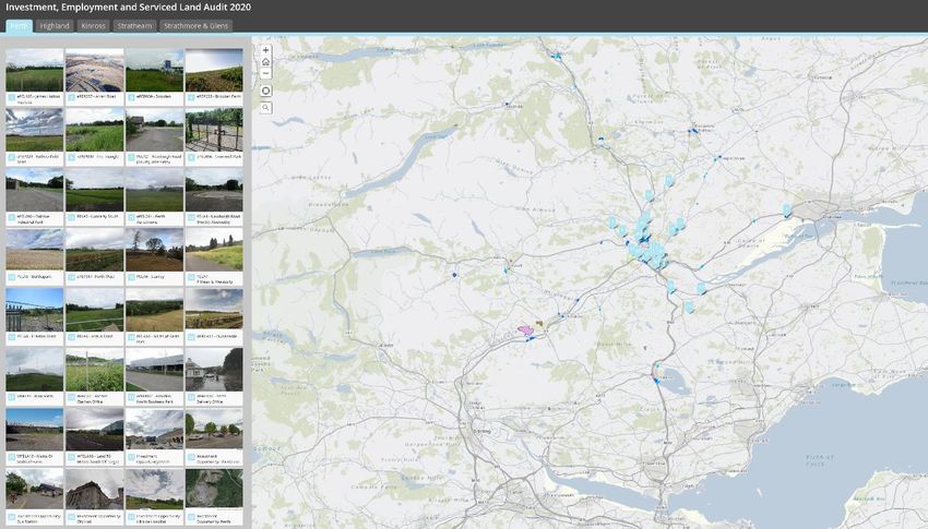
Perth & Kinross Council | Employment Land Audit 2020 21. Introduction Definition of Employment Land Allocated employment land includes general industrial and business/office use, storage and distribution, business parks and specialist technology parks, including research and development uses. This mainly comprises Classes 4, 5 and 6 of the 1997 Town and Country Planning (Use Classes) (Scotland) Order, but is not exclusive to these uses. It does not include land allocated for retail purposes or windfall sites which include buildings that are vacant but not derelict. Purpose of the Audit The Employment Land Audit (ELA) is an annual mechanism for monitoring the employment land supply, identifying serviced business land and highlighting take up of sites. The Perth and Kinross ELA has been produced to provide up to date and accurate information on the supply and availability of employment land for business and industrial use within the Perth and Kinross Council area. It forms an important basis for monitoring and reviewing policies and proposals included within the Local Development Plan (LDP). In addition, it helps to identify areas where further analysis and investigation are required. The information that is held will be of interest to companies, developers and other organisations with a requirement for, or an interest in, employment land in Perth and Kinross. Spatial Overview Each Employment Land Audit site, including the areas identified as serviced can be viewed on our PKC Investment, Employment and Serviced Land Audit Story Map. The spatial overview also includes relevant planning applications, employment take up, investment opportunities not identified within the ELA, employment safeguarding, tourism allocations, related sale schedules and photographs of each site. Perth & Kinross Council | Employment Land Audit 2020 3
From November 2020 the employment sites can also be viewed and downloaded as a shp.file or
csv.file from our Open Data Platform.

2. Background

The Scottish Government’s National Planning Framework 3 (2014) and Scottish Planning Policy (2014),
the TAY plan Strategic Development Plan (2017), and the Perth and Kinross Local Development Plan
(2014) provide the context for the provision of employment land within Perth and Kinross.

Scottish Planning Policy
Scottish Planning Policy (SPP): Economic Development, published in June 2014, sets out the Scottish
Government’s planning policy for sustainable economic growth.

The National Planning Framework for Scotland 3
The National Planning Framework (3), approved in June 2014, is the statutory spatial strategy for
Scotland for the long-term development of Scotland's towns, cities and countryside. The Scottish
Government’s central purpose is to create a more successful country, with opportunities for all of
Scotland to flourish, through increasing sustainable economic growth. To achieve this, the
Government Economic Strategy aims to share the benefits of growth by encouraging economic activity
and investment across all of Scotland’s communities, whilst protecting our natural and cultural assets.
The NPF’s spatial strategy shows where there will be opportunities for growth and regeneration,
investment in the low carbon economy, environmental enhancement and improved connections
across the country. It indicates where we expect most change to happen, from our city regions to rural
areas and coastal towns. Planning Authorities are required to take National Planning Framework 3
into account when preparing development plans and it is a material consideration in the
determination of planning applications. In order to secure sustainable economic growth, there is a
need for sufficient employment land of the right quality and in the right location. The Employment
Land Audit is one mechanism that can be used to assess whether this is being met within Perth and
Kinross.

Note: National Planning Framework 3 (2014) remains in place until it is replaced by an adopted NPF4
in 2021.

TAYplan Strategic Development Plan
TAYplan Strategic Development Plan, approved in 2017, directs development to specific locations such
as the Perth Core Area and the largest settlements within Perth and Kinross to identify and safeguard
at least a 5-year employment land supply that has the potential to support economic growth. Policy
3 (Managing TAYplan’s Assets) recommends that areas are safeguarded for class 4 office type uses in
the main settlements and promote the year-round role of the tourism sector.

Perth & Kinross Council | Employment Land Audit 2020                                               4
Perth and Kinross Local Development Plan 2
Perth and Kinross Local Development Plan 2, published in October 2019, recognises the importance
of its businesses as a key driver of sustainable economic growth and maintaining and improving their
competitiveness is vital to the Perth and Kinross economy.

The Plan also recognises the need for new businesses to be established and through its spatial strategy
and general policies it seeks to create a positive and flexible framework to encourage new wealth
creation opportunities. The Plan promotes mixed use sites to help minimise the need to travel by car
and most sites should be within or on the edge of existing settlements.

The Employment Land Strategy is a main component in the LDP in order to ensure that there is a
readily available supply of employment land. The ELA adopts a hierarchical approach with larger
employment land allocations in larger settlements - in particular the Perth Core Area. It also promotes
sites that will allow existing businesses to expand or for new ones to establish.

3. Employment Land Audit 2020
Preparation of the Audit
This audit has been prepared from information provided in the Local Development Plan (LDP) and
through the monitoring of planning application approvals. Each employment site is visited and
surveyed annually. Employment sites included in the audit are those defined within the LDP and
windfall sites which have valid/current planning permission for employment uses (use class 4, 5, 6).
Each site must be a parcel of land at least 0.1 hectares in size.

The definitions of each use class are displayed below:

Class 4. Business

(a)as an office, other than a use within class 2 (financial, professional and other services);

(b)for research and development of products or processes; or

(c)for any industrial process;

being a use, which can be carried on in any residential area without detriment to the amenity of that
area by reason of noise, vibration, smell, fumes, smoke, soot, ash, dust or grit.
Class 5. General industrial

Use for the carrying on of an industrial process other than one falling within class 4 (business).
Class 6. Storage or distribution

Use for storage or as a distribution centre.

Industrial Process means a process, other than a process carried out in or adjacent to, a mine or
quarry, for or incidental to

Perth & Kinross Council | Employment Land Audit 2020                                                 5
(a) the making of any article or part of any article including a ship or vessel or a film, video or sound
recording;

(b) the altering, repairing, maintaining, ornamenting, finishing, cleaning, washing, packing, canning,
adapting for sale, breaking up or demolition of any article; or

(c) the getting, dressing or treatment of minerals; in the course of any use other than agriculture.

Each site is assessed for provision of services and any potential constraints. The assessment includes
the following criteria; access, drainage and water, onsite broadband, gas networks, flood risk and
presence of peat soils with high carbon levels. The historic environment is also considered which
includes proximity to listed buildings, conservation areas, battlefields and gardens, Designed
Landscapes and whether there are any archaeological records onsite. The natural environment is
assessed regarding protected species or if the site is within a Special landscape Area. Key stakeholders
are included in this process, including Transport Scotland, SEPA and Scottish Water.

The following internal departments are consulted during the ELA process; Local Development Team,
Sustainable Development, Building Standards, Development Management and Estates.

Employment land site details recorded for the purposes of this audit are as follows:

    •   Reference number – unique to employment land sites
    •   Unique Property Reference Number (UPRN)
    •   Location and address
    •   Local Development Plan/planning application reference number
    •   Size (including serviced, constrained, marketable and immediately available area)
    •   Site status (including brownfield or greenfield; ownership; under construction/partially
        developed; planning history and potential constraints)

The base date for the published data is June 2020. All figures are given in hectares and are gross areas,
unless otherwise stated.

Monitoring
Employment land information is updated via monitoring planning applications. This is complimented
by consultation with key stakeholders and cross reference with other land use assessments such as
the Scottish Vacant and Derelict Land Survey (SVDLS) and Perth and Kinross’s Housing Land Audit, as
well as site inspections.

Employment Land supply
Several categories of employment land supply are identified in the audit. These include the following:

Perth & Kinross Council | Employment Land Audit 2020                                                   6
• Total Available Employment Land: This includes land that has been zoned for business,
industrial and general employment use in the adopted Local Development Plan and windfall
sites which have current planning permission for use classes 4,5 and 6.
• Marketable Land: This includes minor and immediately available land.
• Major Constrained Land: Area of land with significant constraints which can affect the
immediate availability of the site. Constraints can include:
o Ownership issues (For example, multiple owners or unwilling sellers)
o Physical constraints including poor infrastructure provision or difficult topography
o Limited road access
o Poor availability of services to the site including water, drainage, gas, electricity
o Ground condition constraints
o Land contamination
• Minor Constrained Land: This is land which meets either one of the following:
o Has constraints, but the extent of the constraints has been assessed to demonstrate
with appropriate mitigation these sites can be marketable within 1-5 years.
o Not yet serviced but there is no insurmountable constraint on servicing capability or
other obstacle to development.
o Requires a Flood Risk Assessment to determine the area of land which is developable
and the potential mitigation costs.
o Is located within the Flood Protection Scheme area - Therefore flooding mitigation
measures are necessary, including water resistance, resilience measures and
evacuation procedures.
• Immediately Available: This is land which:
o Meets business requirements with no known constraints; and
o is fully serviced; and
o is identified within the draft/adopted Local Development Plan; or
o has a secure planning status; and
o has existing or easily achievable connections to road, rail and green networks.
Perth & Kinross Council | Employment Land Audit 2020 7Employment Land Supply Summary Figures
Key characteristics of the council’s employment land figures are:
• There has been 1 site removal from the 2020 audit.
• There are 53 Employment sites in total, consisting of 42 Local Development Plan allocated
sites (79% of Total Sites) and 10 Windfall sites (21% of Total Sites)
• The total area of identified Employment Land is 291.61 Hectares.
• The total area of effective land (Immediately available + marketable) is 289.21 Hectares.
• Of the total area of identified employment land, 85% is constrained by minor factors including
physical, amenity and ownership constraints.
• The second largest proportion is land immediately available which consists of 14% of the total
Employment Land Area.
• The remaining 1% is deemed to be majorly constrained. 2.40 hectares of land has been
identified as major constrained until the Cross Tay Link Road (CTLR) is developed.
• 7.43 hectares of land has been identified as windfall.
• 1.15 hectares of land has been identified as take-up between June 2019 and June 2020.
• 30.44 hectares of land has been identified as serviced.
It is important to consider how the availability of Employment Land is dispersed. A summary of total
employment land supply for 2019 and 2020 is shown below in Table 1 and by area for Perth and
Kinross in Chart 3.
Chart 1: Employment Land Allocations 2020
1%
14%
85%
Major Constraints Minor Constraints Immediately Avaliable
Perth & Kinross Council | Employment Land Audit 2020 8Chart 2: Employment Land Allocations 2019/2020
41.59
Immediately Avaliable Land (IA)
37.28
Minor Constrained Land / Marketable 247.62
Land 250.82
2020
2019
2.40
Major Constrained Land
2.40
Total Effective Employment Land (IA + 289.21
Marketable) 288.10
Table 1: Summary of Total Employment Supply 2019/2020
Major Minor Immediately
Total Available
LDP Area Constrained Constrained Available Area
Land (ha)
Area (ha) Area (ha) (ha)
2019 2020 2019 2020 2019 2020 2019 2020
Perth 216.68 213.54 2.40 2.40 177.89 174.69 36.39 36.45
Strathearn 18.71 20.46 0.00 0.00 18.71 18.71 0.00 4.25
Kinross 20.24 20.24 0.00 0.00 20.24 20.24 0.00 0.00
Highland 8.43 8.43 0.00 0.00 8.30 8.30 0.13 0.13
Strathmore
26.44 26.44 0.00 0.00 25.68 25.68 0.76 0.76
& Glens
Total 290.50 291.61 2.40 2.40 250.82 247.62 37.28 41.59
Perth & Kinross Council | Employment Land Audit 2020 9Chart 3: Summary by area 2020
Major Constrained Land Minor Constrained Land / Marketable Land Immediately Avaliable Land (IA)
Perth
Highland
Kinross
Strathearn
Strathmore & Glens
0.00 50.00 100.00 150.00 200.00 250.00
Hectares
Perth & Kinross Council | Employment Land Audit 2020 10Appendix 1: Glossary of Terms and Abbreviations Area: Site Area (gross) in hectares. Site areas, in all cases are approximate, and are only intended as a guide. Brownfield Sites: Land / sites which have previously been developed or used for some purpose that has ceased. They may encompass vacant or derelict land; infill sites; land occupied by redundant or unused buildings; and developed land within the settlement boundary, where further intensification of use is considered acceptable. Private and public gardens, sports and recreation grounds, woodlands and amenity open space are excluded. ELA Take-up: Calculation of employment sites which have been completely developed. FPS: Flood Protection Scheme FRA: Flood Risk Assessment Greenfield Sites: A Greenfield site has not been built upon previously. Gross Area: This refers to the total area (in hectares) within the boundary of the site and includes allocation for roads, landscaping etc. LDP Ref: The reference used in the latest Local Development Plan. Serviced: Serviced sites should have road infrastructure up to the edge of the individual plot with the other services provided adjacent to the overall site (electricity connection, water supply connection, foul drainage connection, gas connection and telecommunication connection). For smaller sites which are unlikely to require an internal servicing/road network for multiple units they are considered to be serviced if the road access is adjacent. Also, on larger sites where there is a road frontage, we consider this to be serviced in terms of road access and have estimated the area (using the characteristics of neighbouring sites to determine an estimated plot depth). Site Ref: Unique reference for each employment site. Undeveloped Land: A site is considered to be undeveloped, but available, until physical construction is underway. Windfall: Sites which have full current planning permission for employment use and are not allocated for employment use in the Local Development Plan. Note: Windfall sites will be removed from the audit once a building completion is issued, or if the planning application is to lapse where no building works have started. Perth & Kinross Council | Employment Land Audit 2020 11
Appendix 2: Perth and Kinross LDP Employment Sites 2020 I – Immediately Available M – Minor Constraints (Marketable) C – Major Constraints
Perth Core -
Allocated/Windfall
Site Ref Site Name Settlement LDP Type Total I M C Developed Serviced FPS FRA Take- Take-Up Constraint Information ELA Comments
Ref Area Up Date
(ha)
19 20 19 20 19 20
ePEL103 James Hutton Invergowrie E37 Employment 56.44 57.42 56.44 NO NO N N - - Requirement for road and access improvements to the Size adjusted in 2020 due to change between LDP1
Institute satisfaction of the Council and Roads Authority. Requirement and LDP2. Core Employment Uses - Class 4 Food.
to provide new native woodland landscape edge at the Drainage capacity available.
western boundary. Evaluation of archaeological potential and
mitigation on site will be required and protection of the
setting of nearby Schedule Monument
should be ensured. Development must be compatible with
existing uses.
ePEP037 Arran Road Perth E3 Employment 15.11 16.00 15.11 PART PART Y N 0.89 28/04/2020 Access and junction improvements at Arran Road / Bute Drive Partial take-up 2020, erection of a steel portal framed
are required. Potential flood risk, within Flood Protection building for employment uses (19/00668/NDOM7).
Scheme area, therefore Flood Risk Assessment is required to Site identified within Scottish Vacant and Derelict
define the developable area of the site. Southern section Survey (ref 1117, 1111, 1112, 1113, 1114, 1115,
contains vacant and serviced land. Clarification of Scottish 1116). Opportunity for short term development.
Water's intentions regarding a water pumping station are Northern section currently acting as open space.
required. Upgrade programmed by Scottish Water - may need
an extension
ePEP039 Broxden Perth E2 Mixed Use 4.00 4.00 4.00 NO YES N Y - - Land contamination investigations required. Flood Risk Site identified within Scottish Vacant and Derelict
Assessment required which will define the open space which Survey (ref 805).
will be protected in perpetuity for flood risk reasons. Flood
Risk Assessment must demonstrate that development does
not increase the risk of flooding elsewhere particularly
downstream on the Craigie Burn. Environmental
considerations - Open space to also provide a green wedge
into the city and links to the Green Belt. Active Travel - Cycle
paths, core paths and rights of way must be incorporated into
masterplan and designed to improve active transport links to
Perth.
ePEP033 Broxden Farm Perth E340 Employment 2.89 4.50 2.89 NO NO N Y - - Flood Risk Assessment required. This land is identified within LDP2 changed ref from MU1 to E340. Site size
Phase 2. Phase 2 of the business land development must be changed in 2020. LDP allocated 4.5ha of employment
fully serviced before the occupation of 50% of the residential land, however residential use has taken up the
dwellings associated with phase 4. majority of this site. 2.89ha remain for potential
employment use.
ePEP029 Ruthvenfield Perth E38 Employment 18.59 25.00 18.59 NO YES Y N - - A masterplan will be required for the comprehensive The site was split by the new western bypass and the
Road development of this site setting out the phased release of the land south allocated for housing removed from ELA.
employment land. Phasing should incorporate suitable road The access to the site has been Improved (2019).
access through the site into Site H73 (Almond Valley Village).
Site located within the Flood Protection Scheme area,
therefore flooding mitigation measures are necessary,
including water resistance, resilience measures and
evacuation procedures. Land contamination investigations
required.
ePEP030 The Triangle Perth E1 Employment 1.17 1.17 1.17 PART YES N N - - - 1.17ha of employment allocation is available within
this 4.39ha site. Site identified within Scottish Vacant
and Derelict Survey (ref 1110). Potential removal in
2021 as building works have started.
PELA2 Newburgh Road Abernethy E4 Employment 0.50 0.50 0.50 NO NO N N - - Development must be compatible with residential amenity. -
(South)
Perth & Kinross Council | Employment Land Audit 2020 12ePEL094 Cromwell Park Almondbank E6 Employment 0.60 0.60 0.60 NO YES N Y - - Road and access improvements to the satisfaction of the Site identified within Scottish Vacant and Derelict
Council as Roads Authority. Limited drainage capacity available Survey (ref 808).
for Almondbank / Pitcairngreen. Requires a Flood Risk
Assessment to determine the area of land which is
developable and the potential mitigation costs.
ePEL090 Dalcrue Dalcrue E9 Employment 3.46 3.35 3.46 NO YES N Y - - Requires a Flood Risk Assessment to determine the area of Size adjusted in 2019 due to change between LDP1
Industrial Park land which is developable and the potential mitigation costs. and LDP2.
Existing narrow dirt track access, requirement for road and
access improvements to the satisfaction of the Council Roads
Authority. Limited drainage capacity available for Almondbank
/ Pitcairngreen. Enhancement of biodiversity must be
considered.
PELA3 Luncarty South Luncarty MU27 Employment 5.00 5.00 5.00 NO NO N Y - - Requires a Flood Risk Assessment to determine the area of LDP2 changed ref from H27 to MU27. 5.00ha of
land which is developable and the potential mitigation costs. employment allocation is available within this 64.00ha
Masterplan should be submitted at the time of any planning site.
application to ensure built form and layout respond
appropriately to the landscape. Enhancement of biodiversity
and protection of riverbank habitats is required. Where the
development of the site is within 30 metres of a watercourse
an otter survey should be undertaken and a species protection
plan provided, if required so as to ensure no adverse effects
on the River Tay SAC. Cycle paths, core paths and rights of way
should be incorporated into masterplan and designed to
improve active transport links between Luncarty and Perth.
Requirement for developer contribution towards connections
and improvements to core paths in the vicinity. Archaeological
assessment of the site required.
ePEL091 Perth Scone MU3 Mixed Use 2.60 2.60 2.60 NO NO N Y - - Requires a Flood Risk Assessment to determine the area of Site identified within Scottish Vacant and Derelict
Aerodrome land which is developable and the potential mitigation costs. Survey (ref 1095).
Development must be compatible with airport use. Land
contamination investigation is required. Enhancement of
biodiversity and protection of habitats is required. Any
development must incorporate core paths and rights of way to
green networks. Improvements to the adjacent footway along
the A94 required. Existing private drainage system at airport,
therefore spare capacity would need to be investigated.
Servicing investigation required to incorporate water supply
and storage.
PELA4 Newburgh Road Abernethy MU8 Mixed Use 2.17 1.50 2.17 NO NO N Y - - Flood Risk Assessment should be carried out in accordance LDP2 publication listed site as 1.50ha however the
(North) with SEPA’s Technical Flood Risk Guidance for Stakeholders area is 2.17ha. This has be corrected in the ELA 2019.
and PKC’s Flood Risk and Flood Risk Assessments Guidance. Site identified within Scottish Vacant and Derelict
Requirement to restore existing culvert and upgrade layout to Survey (ref 1074).
deal with surface water from steep southern slopes.
Requirement for road and access improvements to the
satisfaction of the Council and Roads Authority. Develop
gateway improvement to settlement from the East to ensure
the built form and layout strengthens the character of the
settlement and creates an attractive eastern village boundary.
A landscape framework is required. Evaluation of
archaeological potential and mitigation will be required.
Perth & Kinross Council | Employment Land Audit 2020 13PELA5 Berthapark Perth MU345 Mixed Use 25.00 25.00 25.00 NO NO N Y - - Requires a Flood Risk Assessment to determine the area of LDP2 changed ref from H7 to MU345. Recognised as a
land which is developable and the potential mitigation costs. A major development site.
masterplan will be required for the comprehensive
development of this site setting out the phased release of
both the housing, community and employment land.
Construction Method Statement to be provided for all aspects
of the development to protect the watercourse. Methodology
should provide measures to protect the watercourse from the
impact of pollution and sediment so as to ensure no adverse
effects on the River Tay Special Area of Conservation. Where
the development of the site is within 30 metres of a
watercourse an Otter survey should be undertaken and a
species protection plan provided, if required so as to ensure
no adverse effects on the River Tay Special Area of
Conservation. Development shall be phased with the delivery
of the Cross Tay Link Road. The first phase of development (for
not more than 750 homes and a secondary school) shall not
commence until the first phase of the Cross Tay Link Road,
linking the site to the A9/A85 junction, has been provided.
Facilities to enable the expansion area to be connected to
Perth’s bus network. Network of paths and cycle routes are
required and should provide good active travel links to Perth,
Almondbank and green corridors. Protection and
enhancement of biodiversity is required, in particular
protection of ancient woodland. Full land contamination
investigation required. Archaeological investigation and report
will be required to detail the sensitive design of development
to protect and maintain the setting of the scheduled ancient
monument of Huntingtower Cairn.
ePEP067 Perth West Perth MU70 Mixed Use 25.00 25.00 25.00 NO NO N Y - - Requires a Flood Risk Assessment to determine the area of LDP2 changed ref from H70 to MU70. 25.00ha of
land which is developable and the potential mitigation costs. A employment allocation is available within this
masterplan will be required for the comprehensive 298.67ha site.
development of this site setting out the phased release of
housing, community and employment land. Development not
to commence before the A9/A85 junction improvements are
complete. Facilities to enable connection to Perth’s bus
network. A geo-environmental audit is required. Drainage
Impact Assessment required. Energy Statement is required
investigating the potential for the provision of, and/or
extension to, a heat network to serve the development. The
Energy Statement will be expected to consider possible
linkages to site MU73. Noise Impact Assessment (and possibly
noise attenuation measures adjacent to the A9). Construction
Method Statement is required for all aspects of the
development to protect the watercourse. Methodology should
provide measures to protect the watercourse from the impact
of pollution and sediment so as to ensure no adverse effects
on the River Tay SAC. Ground investigation to be carried out
for the proposed cemetery site prior to planning permission in
accordance with the Scottish Environment Protection Agency’s
Guidance on assessing the impacts of cemeteries on
groundwater (LUPS GW32). An archaeological programme of
works with results feeding into a mitigation strategy for the
preservation of heritage assets in situ or
by record. Feasibility study is required to assess the
restoration of the existing culvert on the Newton Burn. A
detailed woodland survey at the appropriate time of year
should be carried out by a suitably qualified consultant who
has experience of woodland habitat surveys and include a
National Vegetation Classification (NVC) Survey and map with
site community floristic descriptions, target notes and locally
important site features, and an assessment of the role and
importance of the Lamberkine Woodland’s connectivity to the
wider woodland network.
Perth & Kinross Council | Employment Land Audit 2020 14PELA6 Stanley Perth H30-34 Mixed Use 1.00 1.00 1.00 NO NO N N - - Various Adopted Local Plan Sites (see LDP document for site 1.00ha of employment allocation is available across 5
specifics) Excludes H33 as this site is designated for housing. sites which total 25.70ha.
PELA7 Pitheavlis Perth E165 Employment 2.07 2.00 2.07 Part YES N Y - - Requires a Flood Risk Assessment to determine the area of LDP2 changed ref from MU1 to E165 and size to
land which is developable and the potential mitigation costs. 2.07ha.
Due to the size of this proposed development it is necessary
for Scottish Water to assess the impact this new demand will
have on our existing infrastructure. A totally separate drainage
system will be required with the surface water discharging to a
suitable outlet. Scottish Water requires a sustainable urban
drainage system (SUDS) as detailed in Sewers for Scotland 2 if
the system is to be considered for adoption.
PELA8 Friarton Road Perth Op8 Opportunity 6.74 6.80 6.74 NO NO N Y - - Requires a Flood Risk Assessment to determine the area of Size adjusted in 2019 due to change between LDP1
land which is developable and the potential mitigation costs. and LDP2 due to the creation of a playground. Site
Landscaping improvements are required at the western edge identified within Scottish Vacant and Derelict Survey
of site. (ref 1034).
PELA9 Angus Road Scone MU4 Mixed Use 2.50 2.50 2.50 Part NO N Y - - Requires a Flood Risk Assessment to determine the area of 2.50ha of employment allocation is available within
land which is developable and the potential mitigation costs. this 2.98ha site which includes an existing car park.
PELA10 North of Berth Perth MU168 Mixed Use 2.40 2.40 NO NO N Y - - No access until the CTLR is completed. 2019 addition. 2.40ha of employment allocation is
Park available within this 7.97ha site. Site majorly
constrained due to access until the CTLR is delivered.
site requires a Flood Risk Assessment.
WFELA13 Oudenarde Bridge of Earn n/a Employment 34.00 34.00 34.00 NO NO N N - - - WFELA13 is immediately available and is intended for
employment uses. The site will be considered for
allocation as an allocated employment site through
the preparation of LDP3.
WFELA6 Former Perth n/a Windfall 0.00 0.26 NO YES N N 0.26 02.09.2019 - 2020 Removal. The site was added to the ELA in 2017.
Steading at Hill The site has been removed from the 2020 audit as
Park building works were completed in September 2019
(19/00033/NDOM7) Erection of an office building
(Class 4) and ancillary works.
WFELA8 Binn Farm Glenfarg n/a Windfall 0.94 0.94 0.94 NO PART N N - - Possible ownership restrictions. 2018 addition. Erection of a storage and distribution
building (18/00385/FLL).
WFELA7 Former Clachan Perth n/a Windfall 0.14 0.14 0.14 PART YES N N - - Warrant Issued (18/01482/NDOM7) but building works have 2018 addition. Formation of vehicular accesses,
Office not yet started. Once the completion certificate is issued this erection of a warehouse/workshop and shop/display
site will be removed from the ELA. area building, siting of 2no. storage containers,
formation of parking area, erection of a fence and
associated works
ePEP032 Broxden North Perth n/a Windfall 0.24 0.37 0.24 PART YES N N - - Area currently under development with significant take up in Site size adjusted in accordance with planning
Business Park 2018 - including new Porsche Centre, Costa Drive Thru and permission boundary. Site formerly allocated in local
Broxden Farm Pub. This site will likely be removed from 2021 plan and remains in ELA as windfall. Current
audit once the building completion is issued. permission: Erection of an office building, formation
of a vehicular access, parking area, landscaping and
associated works. Site size has changed to reflect the
current planning application boundary.
WFELA10 Perth Delivery Perth n/a Windfall 0.32 0.22 PART YES N N - - - 2019 addition. Planning approved, erection of 4
Office commercial units (class 4), formation of parking areas
and associated works.
WFELA16 Mains Of Perth n/a Windfall 0.32 0.32 YES PART N N - - - 2020 addition. Planning permission (19/01132/FLL) to
Stobhall Farm form whisky store and bottling area. Warrant
approved (19/01705/NDOM8). Building works have
not yet started.
Perth & Kinross Council | Employment Land Audit 2020 15WFELA18 Land 50 Metres Perth n/a Windfall 0.44 0.44 NO YES N Y - - Development shall not commence on site until a detailed 2020 addition. Planning permission (19/01777/FLL)
South Of Target sustainable urban drainage system (SUDS) has been submitted Erection of an industrial unit (Class 4).
House for the written agreement of the Council as Planning
Authority, in consultation with SEPA where necessary. The
scheme shall be developed in accordance with the technical
guidance contained in The SUDS Manual (C753) and the
Council's Flood Risk and Flood Risk Assessments Developer
Guidance, and shall incorporate source
control. All works shall be carried out in accordance with the
agreed scheme and be operational prior to the bringing into
use of the development.
Perth 2019 Total 213.54 36.45 174.69 2.40
Highland Area -
Allocated/Windfall
HELA1 Borlick Aberfeldy E10 Employment 5.00 5.00 5.00 NO NO N Y - - Requires a Flood Risk Assessment to determine the area of
land which is developable and the potential mitigation costs.
HELA2 Tullymully Dunkeld E12 Employment 1.20 1.20 1.20 NO NO N Y - - Requires a Flood Risk Assessment to determine the area of
South land which is developable and the potential mitigation costs.
Requirement for road and access improvements to the
satisfaction of the Council as Roads Authority. Landscaping
framework required. Built form and layout should respond
appropriately to its sensitive location. Production of
Design Statement to ensure that development is in keeping
with the local landscape and to protect the integrity of the
adjacent designated Dunkeld House Garden and Designed
Landscape. Enhancement of biodiversity and protection of
habitats is required. Feasibility study required to assess the
restoration of the existing culvert.
HELA3 Tullymully Dunkeld E13 Employment 2.10 2.10 2.10 NO NO N Y - - Requires a Flood Risk Assessment to determine the area of
North land which is developable and the potential mitigation costs.
Requirement for road and access improvements to the
satisfaction of the Council and Roads Authority. Landscaping
framework required. Built form and layout should respond
appropriately to its sensitive location. Production of
Design Statement to ensure that development is in keeping
with the local landscape and to protect the integrity of the
adjacent designated Dunkeld House Garden and Designed
Landscape. Enhancement of biodiversity and protection of
habitats is required. Feasibility study required to assess the
restoration of the existing culvert.
WFELA9 Cally Industrial Dunkeld n/a Windfall 0.13 0.13 NO YES N N - - - 2019 addition. Planning approved, erection of an
Estate industrial unit (class 4, 5 and 6). Building warrant
approved (19/01016/NDOM8). No building works
have started. This site will potentially be removed
from the 2021 ELA if a completion certificate is issued.
Highland 2019 Total 8.43 0.13 8.30 0.00
Perth & Kinross Council | Employment Land Audit 2020 16Kinross-shire Area -
Allocated/Windfall
KELA1 South Kinross Kinross E16 Employment 1.20 1.20 1.20 NO NO N Y - - Requires a Flood Risk Assessment to determine the area of
land which is developable and the potential mitigation costs.
Requirement for road and access improvements to the
satisfaction of the Council as Roads Authority. Noise
attenuation measures adjacent to motorway. Noise impact
assessment required. Noise attenuation measures adjacent to
the motorway should be well designed and coordinated with
those at E18 and E20, and should avoid obscuring views of
Loch Leven, the castle, the Lomond Hills or the Ochil Hills.
eKIK112 Station Road Kinross E18 Employment 2.77 2.77 2.77 NO YES N Y - - Requires a Flood Risk Assessment to determine the area of Site identified within Scottish Vacant and Derelict
South land which is developable and the potential mitigation costs. Survey (ref 1120)
The Sustainable Urban Drainage System for development
proposals should include sufficient attenuation to protect
those watercourses which flow into Loch Leven from erosion
during periods of heavy rainfall. Requires provision of link road
and multi-user path from Station Road to southern boundary
of the site. Land contamination investigation required. Noise
attenuation measures adjacent to the motorway should be
well designed and coordinated with those at E16 and E20, and
should avoid obscuring views of Loch Leven, the
castle, the Lomond Hills or the Ochil Hills. Construction
Method Statement to be provided where the development
site will affect a
watercourse. Methodology should provide measures to
protect the watercourse from the impact of pollution and
sediment so as to ensure no adverse effects on Loch Leven
Special Protection Area. Significant woodland planting along
western boundary of site required.
eKIK021 Stirling Road Milnathort E19 Employment 7.75 4.50 7.75 NO YES N Y - - Requires a Flood Risk Assessment to determine the area of Size adjusted in 2019 due to change between LDP1
land which is developable and the potential mitigation costs. and LDP2. Planning permission approved
Drainage constrained in the north due to localised flooding. (19/01243/FLL) for the erection of replacement
The Sustainable Urban Drainage System for development workshop and office.
proposals should include sufficient attenuation to protect
those watercourses which flow into Loch Leven from erosion
during periods of heavy rainfall. Provision of new junction to
Stirling Road, facilitating access to existing industrial areas.
Provide enhancement to core path network through site.
Ownership restrictions. Land contamination investigations
required. Construction Method Statement to be provided
where the development site will affect a
watercourse. Methodology should provide measures to
protect the watercourse from the impact of pollution and
sediment so as to ensure no adverse effects on Loch Leven
Special Protection Area. Significant woodland planting along
western and southern boundary of site required
KELA2 Old Perth Road Milnathort E20 Employment 2.90 2.90 2.90 NO NO N Y - - Requires a Flood Risk Assessment to determine the area of
land which is developable and the potential mitigation costs.
Noise impact assessment required. Noise attenuation
measures adjacent to motorway. Noise attenuation measures
adjacent to the motorway should be well designed and
coordinated
with those at E16 and E18, and should avoid obscuring views
of Loch Leven, the castle, the Lomond Hills or the Ochil Hills.
Archaeological Investigation required.
Perth & Kinross Council | Employment Land Audit 2020 17KELA3 Vicars Bridge Blairingone E22 Employment 0.50 0.50 0.50 NO YES N Y - - Requires a Flood Risk Assessment to determine the area of
Road land which is developable and the potential mitigation costs.
Landscape framework required.
eKIL022 Powmill Powmill E23 Employment 1.50 1.50 1.50 NO PART N Y - - Requires a Flood Risk Assessment to determine the area of
Cottage land which is developable and the potential mitigation costs.
Land slopes steeply down to river therefore landscaping
framework is required to establish topography constraints.
Enhancement of biodiversity, natural space and riparian strip
required. Noise impact assessment required.
eKIK113 Auld Mart Milnathort E21 Employment 0.65 0.65 0.65 YES NO N Y - - Requires a Flood Risk Assessment to determine the area of To date all planning submissions have been refused or
Business Park land which is developable and the potential mitigation costs. expired.
Possible ownership restrictions. Drainage constrained in the
north due to localised flooding. Land contamination
investigations required. Noise impact assessment. Noise
attenuation measures adjacent to motorway. Noise
attenuation measures adjacent to the motorway should be
well designed and coordinated with those at E16 and E18, and
should avoid obscuring views of Loch Leven, the castle, the
Lomond Hills or the Ochil Hills. Archaeological Investigation
required.
eKIL023 Rumbling Rumbling Bridge E24 Employment 0.65 0.65 0.65 NO NO N Y - - Requires a Flood Risk Assessment to determine the area of
Bridge land which is developable and the potential mitigation costs.
Land contamination investigations required.
KELA4 Balado Bridge Kinross E35 Employment 1.90 1.90 1.90 YES YES N Y - - Flood Risk Assessment required. Consideration of retention of
Radar Housing. Consideration of air quality issues.
WFELA11 Nivingston Kinross n/a Windfall 0.42 0.42 PART NO N N - - -
2019 addition. Planning approved, erection of
workshop. Remedial works required - demolition of
shed (18/01316/FLL).
Kinross-shire 2019 Total 20.24 0.00 20.24 0.00
Strathearn Area -
Allocated/Windfall
SELA1 Land south of Auchterarder E25 Employment 8.00 8.00 8.00 NO NO N Y - - Over part of the site there is a flood risk presented by the
A824 watercourse running to the south of the site and a Flood Risk
Assessment will be needed at planning application stage. Any
development at the site should avoid adverse impact on the
Scottish Water Waste Water Treatment Works located
immediately to the south of the site, specifically avoiding
placing any restriction on the works’ ability to continue to
operate. This, plus the landscaping and biodiversity
requirements, may reduce the developable area. Masterplan
to be submitted to ensure built form and layout respond
appropriately to the landscape and to neighbouring residential
property. Transport Assessment required. Landscape
framework, including green buffer to neighbouring residential
property, green buffer to Ruthven Water, extend and retain
riparian planting. Enhancement of biodiversity and protection
of habitats is required.
Perth & Kinross Council | Employment Land Audit 2020 18eSTC061 Bridgend, Crieff E26 Employment 3.00 3.00 3.00 NO NO N Y - - Requires a Flood Risk Assessment to determine the area of Planning permission approved (19/01666/FLL) for
Muthill Road land which is developable and the potential mitigation costs. erection of a office building (class 4)
SELA3 Main Road Aberuthven E29 Employment 2.71 4.80 2.71 NO NO N Y - - Requires a Flood Risk Assessment to determine the area of Size adjusted in 2019 due to change between LDP1
land which is developable and the potential mitigation costs. and LDP2. Minor constraints as this site requires a
Flood Risk Assessment.
SELA4 Broich Road Crieff MU7 Mixed Use 5.00 5.00 5.00 NO NO N N - - - 5.00ha of employment allocation is available within
this 46.73ha site.
WFELA17 Land 50 Metres Aberuthven Windfall 0.25 0.25 NO YES N N - - - 2020 Addition. Planning permission (19/01156/FLL)
North Of 6A Erection of an office building (class 4) and storage and
Maidenplain workshop building (class 6).
Place
WFELA18 Kirkton Auchterarder Windfall 4.00 4.00 NO NO N N - - - 2020 Addition. 4ha of employment land will be
provided in the Auchterarder area, provision to be
phased with the delivery of this major development
site.
Strathearn 2019 Total 22.96 4.25 18.71 0.00
Strathmore & Glens Area -
Allocated/Windfall
eEAA001 Mornity Ind Alyth E30 Employment 0.45 0.45 0.45 NO YES N N - - Potential ownership restrictions. Potential ownership restrictions.
Estate
eEAB007 Welton Road Blairgowrie E31 Employment 13.20 13.00 13.20 NO NO N Y - - Requires a Flood Risk Assessment to determine the area of 13.20ha of employment allocation is available within
land which is developable and the potential mitigation costs. this 17.36ha site as there should be provision of
Land contamination investigations required. Transport indicative landscaping. Minor constraints as this site
Assessment. Link road from Coupar Angus Road to Welton requires a Flood Risk Assessment.
Road - layout to be developed in conjunction with Welton
Housing Site H62. Wastewater Network Investigations may be
required resulting in network improvements. Evaluation of
Archaeological potential and mitigation will be required
specifically for protection of Scheduled Monuments. Retention
of wooded area for screening purposes and Biodiversity study
with provision for the protection of habitats and enhancement
of biodiversity including the provision of buffering between
housing and business land. Construction Method Statement to
eEAC008 Coupar Angus Coupar Angus E32 Employment 6.60 6.60 6.60 NO NO N Y - - Requires
be provideda Flood
for allRisk Assessment
aspects to determineto
of the development theprotect
area ofthe 6.60ha of employment allocation is available within
West land which is developable
watercourse. Methodologyand the potential
should mitigationtocosts.
provide measures this 7.33ha site as there should be provision of
No drainage
protect capacity - unless
the watercourse fromdevelopment
the impact ofgoes to a private
pollution and indicative landscaping.
treatment
sediment so plant,
as tosubsequently freeingeffects
ensure no adverse up space for other
on the River Tay
developments. Scottish WaterWhere
Special Area of Conservation. could the
offerdevelopment
to run the private
of the
plant. Access30
site is within to metres
be assessed in relation toan
of a watercourse existing adjacent
otter survey
land
shoulduses. Noise attenuation
be undertaken measures
and a species may be required.
protection plan provided,
Landscaping
if required soofassite periphery
to ensure required.effects on the River Tay
no adverse
Special Area of Conservation.
SGELA1 Western Blairgowrie MU5 Mixed Use 4.00 4.00 4.00 NO NO N Y - - Requires a Flood Risk Assessment to determine the area of 4.00ha of employment allocation is available within
Blairgowrie land which is developable and the potential mitigation costs. this 24.56ha site. Minor constraints as this site
Development of a masterplan through consultation with the requires a Flood Risk Assessment.
community and Council. Provision of 4ha of business land to
be developed in phased manner with housing development.
Wastewater Network Investigations may be required resulting
in network improvements. Development to be kept below the
90 m contour line to the north of the site, area above that
level to be considered for community woodland or similar use.
Protection of ancient woodland in southern part of site.
Evaluation of Archaeological potential and mitigation will be
required including protection of Fir.
Perth & Kinross Council | Employment Land Audit 2020 19SGELA2 East of Scotland Coupar Angus E33 Employment 1.43 3.00 1.43 PART NO N Y - - Requires a Flood Risk Assessment to determine the area of 1.43 of undeveloped employment allocation available
Farmers land which is developable and the potential mitigation costs. within this 3.00ha site.
Access restrictions - Access to either be through the adjacent
site, alternatively a route should be investigated from
the south-western corner of the site to the roundabout on
Burnside Road. Noise attenuation measures may be required.
SGELA3 Spittalfield Spittalfield MU6 Mixed Use 0.53 0.25 0.53 NO NO N N - - - 0.53ha of employment allocation is available within
this 2.14ha site due to housing constraint of max 75%
of site in LDP2.
WFELA12 Former Glenisla Alyth n/a Windfall 0.23 0.23 NO YES N N - - - 2019 addition. Planning approved, 3no. Class 4
Golf Course business units (phase 1). Masterplan proposes a
further 6no.Units.
Strathmore & Glens 2019 Total 26.44 0.76 25.68 0.00
2019 ELA TOTAL 291.61 41.59 247.62 2.40
Available: 291.61
Effective Land= Immediately available & marketable 289.21
Windfall 3.43
Perth & Kinross Council | Employment Land Audit 2020 20Appendix 3: Serviced Employment Land Sites
Perth Core -
Allocated/Windfall
Serviced
Site Ref Site Name Settlement LDP Ref Serviced Gas Electricity Roads/Access Broadband/telecom Water Drainage Serviced Land Comments/Explanation
Size (ha)
ePEP037 Arran Road Perth E3 Part 6.00 Y Y Y Y Y Y Reduction is size as 0.89ha has been developed in 2020. There is planning
permission (15/01826/FLM) for multiple units at the southern end of the
site, a NID was submitted in September 2018, however it does not appear
that the access has been provided yet so this part remains unserved. The
middle part of the site has planning permission (12/01356/FLM) which
includes internal access road and has been serviced in terms of access. The
northern part of the site does not have planning application and would
likely need an internal road network to service individual plots.
ePEP039 Broxden Perth E2 Yes 3.73 Y Y Y Y Y Y The condition to service this land (12/01692/IPM) has been discharged.
There are 2no. large plots available and access has been provided up to
the edge of both of these plots, the condition related to other services has
been discharged.
ePEP029 Ruthvenfield Perth E38 Yes 2.82 Y Y Y Y Y Y Full Estates survey has been carried out Oct 19. This is a large site which
Road will require internal service access within it but there are frontage plots
along Ruthvenfield Road which could be considered to be serviced in terms
of having direct road access. The serviced area has been estimated along
Ruthvenfield Road using the plot depth of existing properties to the east.
Broadband (BT) and fibre optic is available North East along Ruthvenfield
Road. LV Mains is available North West of the site and from Bertha Park
View. Gas, water supply and drainage are available from Ruthvenfield
Road.
ePEP030 The Triangle Perth E1 Yes 1.17 Y Y Y Y Y Y The LDP allocation is now largely developed. The remaining area has a
planning permission (18/00088/FLL) which suggests that this site will be
taken up by an individual occupier and with the road access being
immediately adjacent to this site, and its proximity to existing businesses,
it is considered to be serviced. Full service check required in 2020 if it has
not been taken up.
ePEL094 Cromwell Almondbank E6 Yes 0.60 Y Y Y Y Y Y Neighbouring properties gain access from the same road, therefore this
Park site is considered to be serviced. Full service check required in 2020.
ePEL090 Dalcrue Dalcrue E9 Yes 3.46 Y Y Y Y Y Y Access passes through middle of site, providing plots either side.
Industrial Neighbouring properties gain access from the same road, therefore this
Park site is considered to be serviced. Full service check required in 2020.
PELA7 Pitheavlis Perth E165 Yes 2.15 Y Y Y Y Y Y There is an internal road layout within this site left from the previous use
which might be sufficient for any future use. Full service check required in
2020.
WFELA8 Binn Farm Glenfarg n/a Part 0.94 N N Y N N N Full Estates survey has been carried out Oct 19. Access only. BT line is
available on the South boundary of this site, however works would be
required as no telecommunication box is located nearby. LV mains
electricity line is located 50 metres south west of the site.
Perth & Kinross Council | Employment Land Audit 2020 21WFELA7 Former Perth n/a Yes 0.14 N Y Y Y Y Y Full Estates survey has been carried out Oct 19. Formation of access
Clachan required from Ruthvenfield Road as stated in permission (18/00517/FLL).
Office Building works not started Oct 2019. Gas available on Ruthvenfield
Road,10 Metres South of the site boundary. LV mains electricity runs on
the South boundary of the site. Broadband (BT), water supply and drainage
are available on site.
ePEP032 Broxden Perth n/a Yes 0.24 Y Y Y Y Y Y Serviced status confirmed - no need for Estates check. Building works
North started and the main structure is now built. It is anticipated the site will be
Business removed in 2020 ELA.
Park
WFELA10 Perth Perth n/a Yes 0.22 N Y Y Y Y Y Full Estates survey has been carried out Oct 19. Neighbouring property
Delivery PH2 Business Centre is connected to gas and has shared access. The LV
Office mains electricity line runs on the East boundary of the site. Broadband
(BT/Virgin), water supply and drainage are available on site.
WFELA16 Mains Of Perth n/a Part 0.32 N Y Y Y N N Full Estates survey has been carried out June 20. Partially serviced to the
Stobhall southern boundary of the site, including access, 11kV electricity line,
Farm broadband (Openreach). There is no gas supply owned by SGN. Please
note that privately owned gas pipes or pipes owned by other Gas
Transporters may be present in this area and information regarding those
pipes needs to be requested from the owners. Distribution water mains is
located on A93, however there is no current connection to Mains of
Stobhall. Virgin services are not available
WFELA18 Land 50 Perth n/a Yes 0.44 Y Y Y Y Y Y Full Estates survey has been carried out June 20. Fully serviced to the
Metres southern boundary of the site, including access to Ruthvenfield Road, 11kV
South Of electricity line and service cable is available on site, broadband
Target (Openreach), mains water supply available from Blairgowrie Road. SGN gas
House supply (intermediate pressure mains) is located on the south boundary of
this site. Virgin and fibreoptic services available
Perth 2020 Total 22.23
Highland Area -
Allocated/Windfall
WFELA9 Cally Dunkeld n/a Yes 0.13 N Y Y Y Y Y Full Estates survey has been carried out June 20. Partially serviced to the
Industrial southern boundary of the site, including, access, LV main electricity,
Estate broadband (Openreach) box located on access road, mains water supply
available from Blairgowrie Road. There is no gas supply owned by SGN.
Please note that privately owned gas pipes or pipes owned by other Gas
Transporters may be present in this area and information regarding those
pipes needs to be requested from the owners. Virgin services are not
available.
Highland 2020 Total 0.13
Kinross-shire Area -
Allocated/Windfall
eKIK112 Station Road Kinross E18 Yes 1.90 Y Y Y Y Y Y Full Estates survey has been carried out Oct 19. The site has existing access
South roads. The area to south of the SuDS has been omitted due flood risk. All
(North and the plots are serviced, including LV main electricity, gas mains, broadband
middle plot) (BT), mains water supply and drainage is proposed by Scottish Water.
However, the southern plot currently doesn't have access to electricity and
no plans have been proposed for water or drainage supply.
Perth & Kinross Council | Employment Land Audit 2020 22You can also read