GFED Fire Monitoring: Improvements to Crop Residue Emissions DR. JOANNE HALL UNIVERSITY OF MARYLAND, DEPARTMENT OF GEOGRAPHICAL SCIENCES ...
←
→
Page content transcription
If your browser does not render page correctly, please read the page content below
GFED Fire Monitoring:
Improvements to Crop Residue Emissions
DR. JOANNE HALL
U N I V E R S I T Y O F M A R Y L A N D , D E PA R T M E N T O F G E O G R A P H I C A L S C I E N C E S , C O L L E G E PA R K , M D , U S A
GFED Team
Jim Randerson – University of California, Irvine
Louis Giglio – University of Maryland, Maryland
Guido van der Werf – Vrije Universiteit, Amsterdam
Niels Andela – NASA
Doug Morton – NASA (Biospheric Sciences Laboratory)
Yang Chen – University of California, Irvine
Joanne Hall – University of Maryland, Maryland
Stijn Hantson – University of California, Irvine

                                                      2 of 16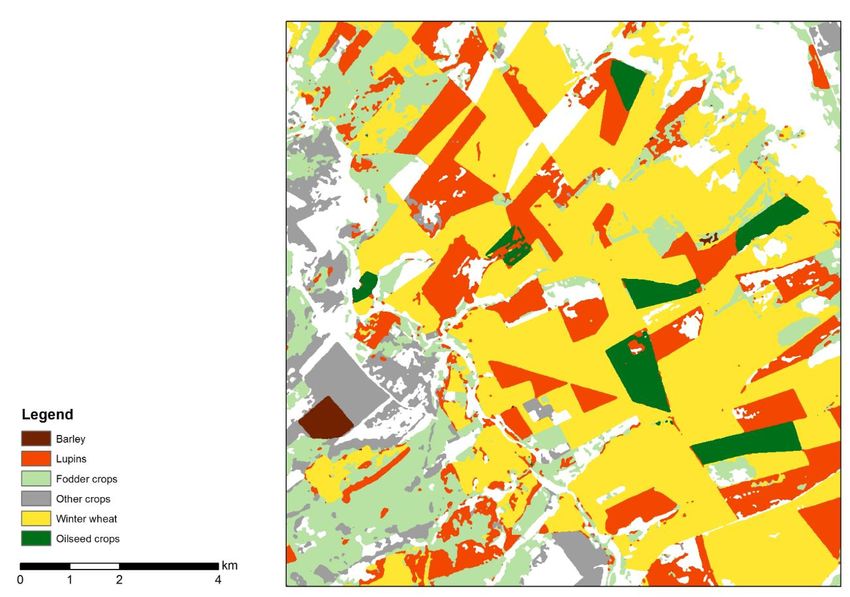
Global Fire Emissions Database (GFED)
Website: https://www.globalfiredata.org/index.html

                                                     3 of 16
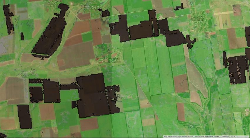
Monthly MODIS Active Fire Count: Ukraine (2003 – 2018)

                                                         4 of 16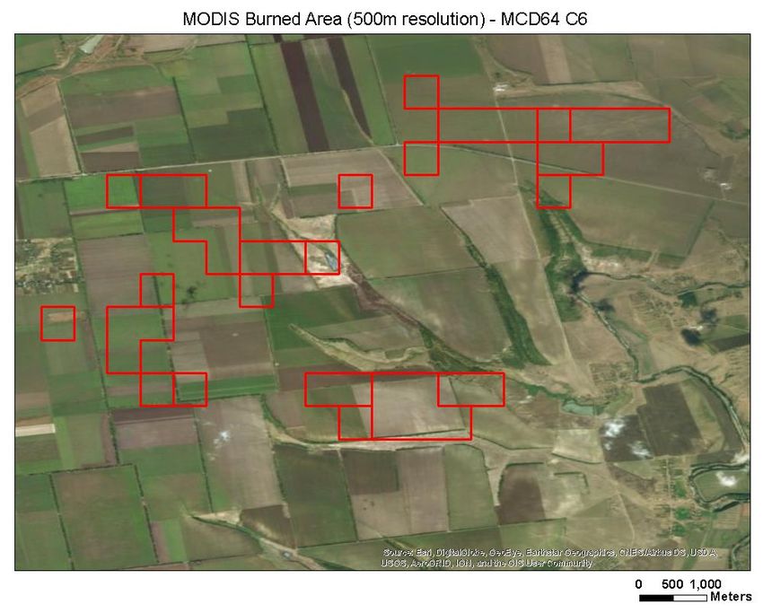
GFED Product History
      Version    Spatial Resolution        Burned Area Approach                             Notes
GFED v1 (2003)   1 degree             TRMM active fires calibrated to BA Tropics, monthly for 1998-2004
                                      using a few MODIS BA tiles
GFED v2 (2006)   1 degree             MODIS active fires calibrated to BA Global, monthly
GFED v3 (2010)   0.5 degree           Nearly complete MODIS BA from      Global, monthly, daily and 3-hourly
                                      MCD64A1                            deforestation fires
GFED v4 (2017)   0.25 degree          Wall-to-wall MODIS BA,             Fuel consumption constrained using obs.
                                      augmented by a statistical         Improved emission factors from
                                      approach to capture small fires    Akagi et al.
GFED v5          ?                    MODIS BA adjusted by               New emissions factors, near real time,
(2020/2021)                           Sentinel/Landsat BA                validation with ILAMB and atm. CO

                                                                                                       5 of 16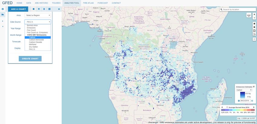
GFED5 – Ongoing Research Project
Near Real Time Component
◦ Led by NASA colleagues (Dr. Niels Andela)

◦ Based on VIIRS (Suomi-NPP and NOAA-20)

◦ Better captures/reduces day-to-day active
  fire variability caused by off-nadir scan
  angles

◦ Calibrated against VNP14IMGML
  ◦ 375m active fire product

                                              6 of 16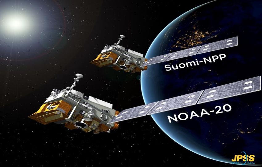
2013 – 2018 global mean

            Aqua-MODIS    SNPP-VIIRS (750m) only   SNPP-VIIRS (375m) only

                                                                              VIIRS 375 observed
                                                                              more FRP due to
                                                                              small omission of
                                                                              small fires

                                                                              Combining both
                                                                              VIIRS sensors –
                                                                              only use data up to
                                                                              750km off-nadir
                                                                              thereby reducing
                                                                              scan angle effect

                                                                            Created by Niels Andela

                                                                                     7 of 16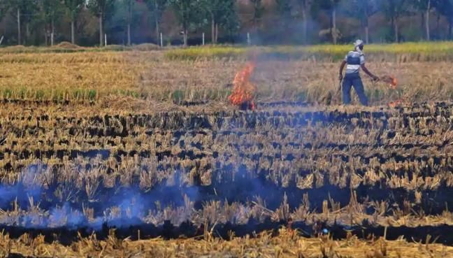
Updated GFED NRT Analysis Tool (under development)

                                                     8 of 16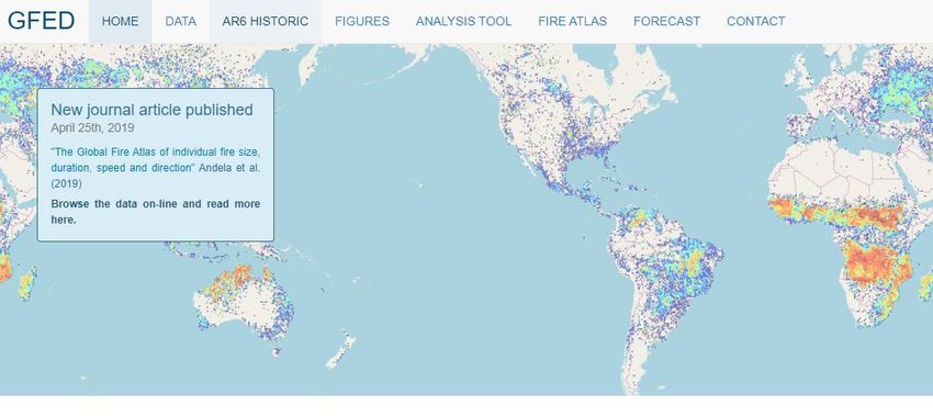
GFED5 – Ongoing Research Project
Improved Spatial Resolution
◦ GFED4 = MCD64 (500m) burned area product
◦ GFED4s = MCD64 with Small Fire scaling factor
◦ GFED5 = Coarser BA product (likely MCD64) will be calibrated against
  Landsat/Sentinel (30m) BA

◦ GFED4 = 0.25 degree spatial resolution
◦ GFED5 < 0.25 degree spatial resolution

                                                                         9 of 16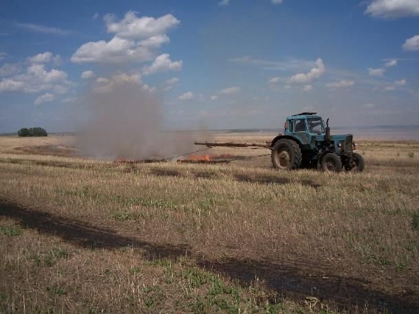
GFED5 Improvements – Ongoing Research
Improved burned area resolution = improved emission estimates

                                                                 Landsat-8 Data
                                                                (30m resolution)

                                                                     10 of 16
GFED5 – Ongoing Research Project
Fuel Consumption and Emission Factors Improvements
◦ Led by Dr. Guido van der Werf et al. (Vrije Universiteit Amsterdam)
◦ For all major land cover types
Van der Velde et al. (in prep) Van Wees and van der Werf (in press)
11 of 16Crop Residue Burning Improvements
Led by University of Maryland
Complete overhaul of current crop residue burning representation in GFED/CASA
Agricultural Waste ----> Crop Type Specific Information
Improved representation of cropland “burned area”
◦ Global BA products are not suitable
◦ But…..we require a global method
12 of 16Emissions Calculation using Satellites
Emissions = A x PB x FL x CF x EF
• A* = Planted area
• PB* = Percent of the surface burned
• FL = Fuel load (amount of straw and stubble available to burn)
• CF = Combustion factor (completeness of combustion)
• EF = Emissions factor of a trace gas species
*Modifications from standard GOCF-GOLD/IPCC-AFOLU equations by Lasko and Vadrevu (2018)
to account for lack of reliable burned area data at the field scale
13 of 16Crop Type Maps
Identify crop types using
satellites
Crop type is important to
accurately calculate emissions Example from
southern Africa
from burning
Crop type impacts emission
factor
http://www.esa-sen2agri.org/products/crop-type-map
14 of 16Emission Coefficients
GFED4 Emission Factors
AGRI based off Akagi et al., 2011 crop residue biome Example taken from:
http://wgbis.ces.iisc.ernet.in/energy/paper/rser_carbon_footprint/methods.htm
15 of 16Local Information Needed
Field level information to help improve fire
mapping and emissions calculations in
cropland
1) Causes of burning
2) Why are some fields only partially burned?
3) How quickly do you till/plow after burning?
4) How do you burn your fields?
16 of 16
Source: Kelley O’NealThank You
You can also read