Google Maps for Mobile - COMPETITIVE ANALYSIS - Gaurav Anand, Jacqueline Cerretani, Jim Laing, Beilei Zhang SI 622, February 8, 2008
←
→
Page content transcription
If your browser does not render page correctly, please read the page content below
Google Maps for Mobile
                             COMPETITIVE ANALYSIS

     Gaurav Anand, Jacqueline Cerretani, Jim Laing, Beilei Zhang
                                       SI 622, February 8, 2008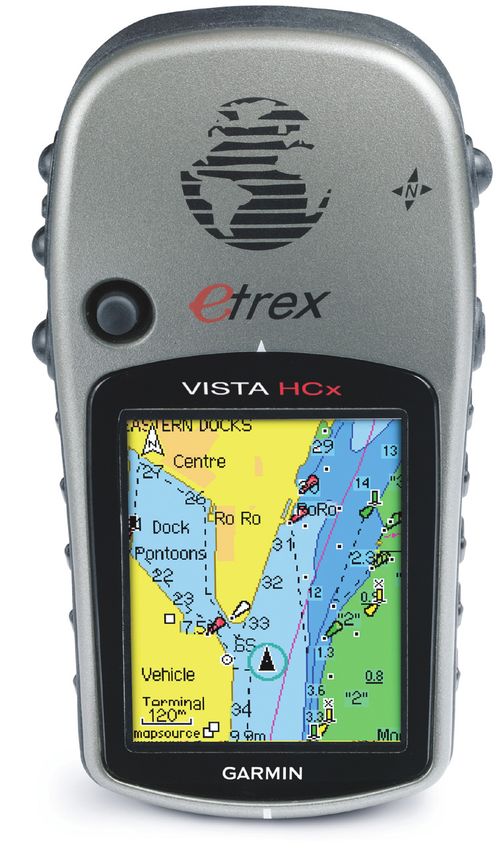
Contents
1. Overview 3
2. Description of Google Maps for Mobile (GMM)              3

3. Competitors 4
4. Description of Competitors 5
    4.1 VZ Navigator      5

    4.2 TeleNav GPS Navigator 5
    4.3 Garmin’s eTrex Vista® Cx   6

5. Comparative Evaluation     7

    5.2 Usability    7
    5.3 Aesthetics   13

6. Areas of Potential Innovation        15

    6.1 Presenting Contextual Information for Increased Relevance 15
    6.2 Alternatives for Communicating Route Information    16

    6.3 Cognitive Considerations of Route and Survey Knowledge    18

7. Actionable Intelligence & Conclusion 19
8. Bibliography 202

                                                                       2
1. Overview
The advent of mobile internet access and the simultaneous advancement of mobile device
capabilities has resulted in the proliferation of mobile mapping and navigational services.
Navigation, which was first aided by paper maps, and later by mapping websites, is now possible
on tiny mobile screens using any number of applications and devices.
The size, interfaces and access constraints on mobile devices impose numerous challenges for
designers of mobile mapping applications, and as a relatively new area of development, leaves
them with very little precedent to build upon. As a result, the functionality, aesthetics and usability
of these applications varies widely. In the following sections, we provide an in-depth evaluation of
the Google Maps for Mobile (GMM) service by comparing it with three other similar services.
2. Description of Google Maps for Mobile (GMM)
Described as “the power of Google Maps on a mobile phone,” Google Maps for Mobile (GMM)
delivers step-by-step driving directions, traffic information, satellite imagery, and interactive
mapping to mobile phones. The application takes advantage of Google’s informational prowess
by allowing users to search for map features by category, vague location or colloquial name, and
returns results that include location, but phone number, reviews and other pertinent information.
GMM integrates search results with the devices’ phone via its click-to-dial feature, and allows
users to personalize the application with an option to save favorite locations. In addition, the latest
version of GMM is location aware, allowing users to map to
and from their present location.
Technical Details
• Freely downloadable to mobile devices.
• Requires data plan from mobile service provider to
function
• Works on most Java-enabled (J2ME) phones, Palm devices
with Palm OS 5 and above, all color Blackberry devices,
Windows Mobile devices with Windows Mobile 2003, 5.0
and above, and Symbian Series 60 3rd edition devices.
• Not reliant on GPS technology due to cell-tower triangulation
algorithm, but able to take advantage of it when present.
• Real-time download of map data
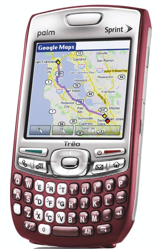
Google Maps for Mobile on the Treo
3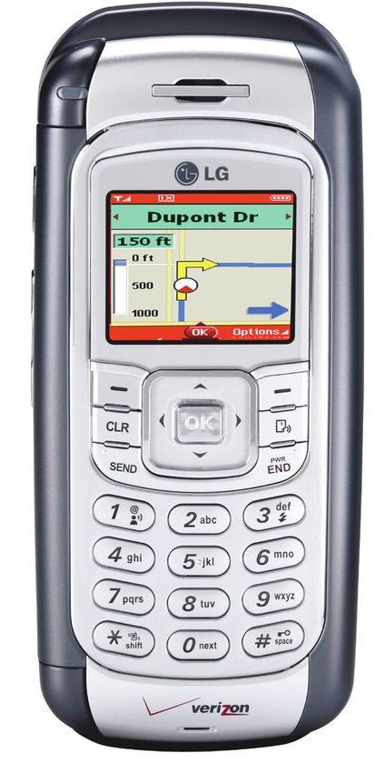
3. Competitors
From the beginning of our project, we have worked to ascertain Google Maps for Mobile’s
competitive landscape by comparing it regularly and thoroughly with similar services. During our
persona interviews, we not only asked about users’ experiences with GMM, but also encouraged
them to compare GMM to other mapping technologies they had used, both analog and digital, and
both desktop and mobile-based.

Building on these interviews, we researched mapping devices and systems, identifying competitors
based on their ability to provide similar mapping capabilities as GMM in similar user scenarios. We
ignored factors such as business models and revenue, focusing instead on user concerns such as
portability, accessibility, price-point, and underlying technology.

The variety of available mapping solutions is impressive, with services and devices designed for
highly specialized circumstances and ranging widely in price and subscription fees. We considered
paper maps and atlases, GPS units from Magellan, Garmin, and TomTom, mapping websites, as
well as device-non-specific mobile services such as Mapquest Mobile Maps and Microsoft Streets
& Trips for Mobile.

Since it was impossible and uninformative to compare such a huge spectrum of mapping services,
we honed in on what we consider to be GMM’s “Tier 1” (Kuniavsky 2003) competitors: mapping
applications on hand-held devices with a focus on road-based travel. They are:

• VZ Navigator
• TeleNav GPS Navigator
• Garmin’s eTrex Vista® Cx

We carried out extensive testing of VZ Navigator and TeleNav Navigator, and read many user
reviews about eTrex Vista® Cx applications, and then compared their functionality, usability, and
aesthetics.

                                                                                                      4
4. Overview of Competitors
4.1 VZ Navigator
Recognized as easy-to-use and access, VZ Navigator is Verizon’s
proprietary mobile mapping application. Similar to GMM, the service
allows the cell phone to act as a navigation device by providing turn-by-
turn directions, points of interest, and local maps. Among distinguishing
advanced features, the service includes audible directions, and allows
one to send location information via text message to other Verizon
phones.
Technical attributes
• Location-aware via GPS
• For use with Verizon service plans only
• Requires a data plan
• Downloadable via Verizon Mobile Web
• Real-time download of map data VZ Navigator on an LG phone
4.2 TeleNav GPS Navigator
Claiming to provide all the benefits of an expensive in-car
navigation system, and more convenience than other handheld
GPS systems, TeleNav GPS Navigator offers maps and accurate
text- and voice-guided driving directions on mobile phones.
Advanced features include text-to-speech functionality and ability
to find gas stations by fuel price.
Technical attributes
• Location-aware via GPS
• Available on most major mobile service providers
• Requires a data plan
• Available via wireless download
• Real-time download of map data
TeleNav on a Blackberry Curve 54.3 Garmin’s eTrex Vista® Cx
eTrex Vista® Cx by Garmin is a popular handheld navigator
that provides most of the features of online mapping services,
with additional unique features such as a bright color screen,
barometric altimeter, electronic compass, microSD card for
expandable memory, and on- and off-road routing. The electronic
compass provides bearing information even while the user is
standing still, and the barometric altimeter tracks changes in
pressure to pinpoint the user’s precise altitude.
Technical attributes
• Location-aware via GPS
• Uses map data from built-in and external flash memory
• Map data must be manually updated by connecting to a PC via
USB cable
• Includes additional navigation sensors like barometric altimeter
and electronic compass
• Software specific to this device only Garmin’s eTrex Vista® Cx
65. Comparative Evaluation
As described above, based on key features, attributes, and user interviews, we narrowed our
competitor list to VZ Navigator, TeleNav GPS Navigator, and Garmin’s eTrex Vista® Cx. In the
following section, we compare the functionality, usability, and aesthetics of each.
5.1 Functionality
Prompted by Kuniavsky (2003), we realized that a user’s perception of what constitutes a feature
may be different from ours, so we collected lists of features using three means: asking users,
researching user reviews of the products, and by looking ourselves. The following matrix illustrates
the functionality offered by GMM service, and compares it with the three selected competitors
(please note that the scope of this list is limited by the priorities of our this analysis):
Table 1. Comparison of Functions
GMM VZ Navigator Telenav eTrex Vista®
Cx
Step-by-step driving yes yes yes yes
directions Step-by-step Visual prompts
directions with about current
total distance and street, next turn,
estimated travel distance to next
time turn, and ETA
Audible directions yes yes yes
Satellite imagery yes yes yes yes
Search for local yes yes yes yes
businesses Entering names Can search Ratings and user
or generic terms by address, reviews display in
GMM will pinpoint favorites, airport, searches for local
locations. or intersection businesses.
Place point on map yes yes
Tracks route
traveled and
identifies nearby
places
Save favorite places yes yes yes yes
Click-to-dial yes yes yes
Recalculate route yes yes yes yes
Zoom in and out yes yes yes yes
7(Table 1. Comparison of Functions, continued)
GMM VZ Navigator Telenav eTrex Vista®
Cx
Browse nearby yes yes yes yes
areas
Traffic information yes yes yes yes
Displays Shows ETA.
congestion
density; “Traffic
Delay” feature
estimates time of
delay.
Text messages of yes yes
directions Only with other With all SMS
Verizon phones.1 enabled phones.2
Manage addresses yes yes yes yes
and searches with a
desktop component
Create a route yes
based on whether Two options: one
you’re walking or for walking, one
biking for biking.
Route directions yes
from recently
searched places
1 This feature lets users send the address and coordinates of his or her location via text message with a personal note.
If the recipient is a VZ Navigator user, he or she can then view the user’s location on a map, get driving directions,
search for businesses around the area, or add it to their favorites list.
2 If the recipient also uses TeleNav, all relevant information will appear when Telenave is launched, while non-TeleNav
users will get one of two options. If the service provider allows URLs within text messages, the recipient can click on
the address to get a map; otherwise, he or she will only receive the address within the body of the text. No personal
note functionality in this feature.
85.2 Usability
While we did use user feedback on GMM to frame our views, the following is a compilation and
distillation of expert product reviews available on technically-focused websites such as CNET.
com, BusinessWeek.com, PCMag.com, and TechWeb.com, and others.
5.2.1 GMM
Pros
• Easy download and minimal initial setup
• Saves entered searches and addresses
• Offers favorite lists
• Driving directions provide accurate total distance and estimated driving time
• Business search returns phone numbers of businesses for direct calling
• Traffic delay feature gives an estimated time of delay
• Traffic information shown on map is highly accurate
• Provides additional information -- user reviews, for example -- about a listing, if available
Cons
• Sometimes maps are sluggish to load/redraw if data connection is slow
• Sometimes driving directions are inaccurate
• Sometimes provides an indirect route when a direct route is possible
• Doesn’t provide a list of cities for which traffic information is available
• It’s hard to get a good overview of the area or advice on alternative routes
5.2.2 VZ Navigator
Pros:
• Offers choice of two voices for speak-aloud directions along a route
• Easy wi-fi install
• Compatible with most GPS enabled phones
• The listed distances to the next turn are accurate
• Walking and biking route options accommodate a variety of transportation modalities
9• Automatically recalculates a route if one misses a turn
• If a user makes or receives a call, VZ Navigator will suspend services until a user hangs up, and
then updates the directions
• Search by address, favorites, airport, or intersection
• One can identify places near route by clicking on a map location
• Allows users to send address or coordinates of location via text message, with a personal note
• Supports automatic calling from search results
• Favorites and searches can be managed from PC or laptop using the VZ Navigator web site
and synchronize to the phone via USB cable or wi-fi
Cons:
• Sometimes there is a lag in recalculating route, resulting in user disorientation
• Doesn’t support planning long trips with multiple points of interest
• The frequency of the audible directions is somewhat sparse
• The text messaging feature only works with other Verizon phones
• Website cannot get driving directions and transfer them to phone
• “Follow me” locating is sometimes inaccurate
5.2.3 TeleNav GPS Navigator
Pros:
• Preferences page lets you set your measurement unit, how you want routes calculated (fastest,
shortest, avoid highway, prefer highway, or pedestrian)
• Maps are presented in 2D or 3D view
• Automatically recalculates route
• Supports text-to-speech functionality
• Fuel Finder features lists gas stations near your location by fuel price
• Supports calling establishments from search results
• Extras include a compass and an option to record and name your location.
Cons
• A dead spot in Sprint’s data coverage in a rural area was observed
• Maps are sometimes slow to redraw
105.2.4 eTrex Vista® Cx
Pros
• Customizable software allows you to adapt to various tasks (e.g. road navigation, marine,
recreational)
• Color screen is readable even in bright sunlight
• Lightweight
• Simple icons and understandable pull-down menus
• MicroSD expansion slot allows user to carry multiple versions of the software
• Waterproof, durable construction
Cons
• Requires purchasing extra software to access some features
• Main control on left side of device does not work well for right-handed users
• Small screen size compared to other GPS units
• Lacks real-time map updates
5.3 Aesthetics
The aesthetics of mobile mapping interfaces should be judged less by their beauty or uniqueness,
and more by qualities such as simplicity of navigation, scannability for relevant information, contrast
of important elements from background, information density and readability of text (Perez, 2006;
W3C, 2006). Below, we document the most salient aspects of each device with regards to the
qualities listed above.
5.3.1 GMM
Simplicity of Navigation:
The simplicity of navigation in GMM for mobile varies according to function. On the main page, the
menu uses brief language and high contrast text in a layover menu, making options easy to read.
However, the graphic conventions laid out in this first menu are not upheld in subsequent menus,
which vary in layout, color use, and buttons used for navigation. GMM could benefit from more
consistent use of color, size, location and functionality of navigation.
Screen Scannability:
When on a map view, the presence of fairly large street names can make scanning for nearby
locations difficult. Paradoxically, the large size font of the street names makes them fairly easy
to read. In the search results screen, there is no graphic features that distinguish text from menu
options, making it difficult for users to glance at the screen and ascertain their action options.
11Contrast/Background:
GMM uses muted colors for most features of their maps, and overlays dark text, bright lines and
bright graphics for route information and favorites. In this way, they are able to overcome the trap
of very densely populated maps subsuming salient features.
Information Density:
GMM displays a uniform density of information on maps across all zoom levels. While it is not
necessarily easy to scan, it strikes a balance between too much and too little information, which is
critical to achieving to conveying the information a user seeks.
Text Readability:
GMM’s text is largely readable in all screens. However, as outlined above, the interface is
inconsistent in its use specific font sizes, faces, and weights to signify functionality and could
benefit from a closer mapping of text style to function.
5.3.2 VZ Navigator
Simplicity of Navigation:
VZ Navigator uses a high-contrast, consistently placed menu bar at the bottom of the screen for
most navigation options. This makes navigation simple, and allows the user to recognize options
quickly by their color and placement.
Screen Scannability:
The user of large, well-spaced icons on the main page makes scanning easy; however, the icons
are not intuitive, and therefore necessitate additional searching for their text explanation. Map
scanning is difficult due to low contrast and small text; see below. However, the directions screen
is very easy to scan, displaying next-action information in large text and simple graphics.
Contrast/Background:
On the main page, VZ Navigators uses a dark background with light text and bright icons. However,
in several interactive and feedback screens, the background is a gradient. These gradients vary in
darkness, orientation, and color, making it difficult for users to read them, or even get accustomed
to a suboptimal convention. In addition, there is very little contrast between the color of the streets
and the background of the maps.
Information Density:
In most parts of the VZ Navigator interface, information density is good to acceptable. However,
the exception to the rule is the search results page, where information is very dense, and action
options are hard to distinguish.
Text Readability:
Text in menus is bright and clear, often using light text on a dark background. Text in interactive
forms is also easy to read, employing consistent conventions across input screens. However, the
text on maps (such as street names) is exceedingly small, making it hard to see at any distance,
and the text on search results screens uses a light font making it difficult to scan.
125.3.3 TeleNav GPS Navigator
Simplicity of Navigation:
Restricting options to a single line of text simplifies navigation, and allows users to quickly ascertain
the extent of menus. The use of a yellow bar to highlight location in the menu is significantly more
noticeable than the light blue bar used in GMM.
Screen Scannability:
Menu items in TeleNav directions are easy to locate, due to a high contrast menu bar placed
consistently at the bottom of the screen. In addition, the use of a bright line on a low-contrast map
background, combined with a top-down perspective, makes it easy for users to locate themselves
within the (albeit limited) landscape of the map they are navigating.
Contrast/Background:
High contrast menus and map objects make directions in Telenav easy to distinguish from the
map background. However, search results are displayed on a slightly darker background, which
combined with the density of information, reduces readability. TeleNav uses an eminently visible
yellow bar to highlight the users placement in navigation menus.
Information Density:
Highly schematic maps overcome the problems of information density seen in GMM; however, they
lose out by lacking details. Menus and search results leave no space between lines or options,
resulting in a density that can disorient users scanning the list.
Text Readability:
Menu items in TeleNav directions are easy to read, due to bright, all caps text on a dark background.
Search results benefit from the use of boxes to distinguish each, however, the text is densely
packed and therefore hard to read.
5.3.4 eTrex Vista® Cx
Simplicity of Navigation:
We were unable to use navigation screens on this device, so have no comments for this
parameter.
Screen Scannability:
Some maps appear so densely packed with points and information as to obscure important
features. In addition, screen resolution is low, smearing or pixelating edges of objects, making
them heard to distinguish.
Contrast/Background:
The eTrex interface uses bright colors at similar saturations for all map features, essentially
minimizing contrast and straining the eyes to determine which items are foreground and back, and
which items are of highest relevance.
13Information Density:
Information density in the eTrex varies according to screen. The compass screen is sparsely
populated; in contrast, in some cases the maps are so feature-rich as to be intractable.
Text Readability:
The low screen resolution, coupled with a inconsistent use of bold, capitalization, and abbreviation,
makes text hard to read in this interface. The jagged, blocky sans-serif font further impedes quick
reading and scanning.
146. Areas of Potential Innovation
The field of location-based mobile navigation systems is rapidly expanding, with many potential
avenues for innovation. Presentations and evaluations of new ideas within this product space
can be found in various academic journals, often with detailed information about user reception
and benefit. If Google Maps for Mobile (GMM) is to remain competitive, the product team should
be aware of this valuable research, and consider how their application can benefit from the
incorporation of these ideas. The GMM team might choose to ignore these innovations; however,
they should realize the potential of their competitors to implement one of more of these features
and the impact that might have on GMM’s strategic position.
6.1 Presenting Contextual Information for Increased Relevance
Many popular conceptions of the future of location-based mapping services center around
increasing contextual information. This is very much in keeping with GMM’s recent move to allow
users to know and work their present location. Increasing contextual information integrated into
a maps leads to increased relevance and decreases a user’s cognitive load. As Kaasinen (2003)
points out, “An efficient way of improving the usability of mobile services and applications is to
adapt the contents and presentation of the service to each individual user and his/her current
context of use.”
While, GMM already incorporates a users current location into its maps, there are many possibilities
for additional contextualization. Burigat and Chittaro (2007) suggest adaptive map generation as
a way to increase a map’s relevance to the user. In this process, information that distracts the user
is removed from the map and relevant features are highlighted by “considering a wide range of
variables such as user preferences and interests, tasks, cultural aspects, communicative goals
and current context and location.”
(Image from Burigat and Chittaro 2007, p. 3) 15Incorporating such variables, as well as other context clues like current and past routes, time
of day or year, and estimations of a user’s knowledge of a area, provide promising avenues for
tailoring GMM’s mapping information so that it is most useful to each individual user. While such
systems do not require the creation of a complex infrastructure, Jason Hong and James Landay of
the University of California at Berkeley have considered the benefits of creating an infrastructure
to broadcast contextual information. Under such a system, points-of-interest would communicate
with mobile mapping devices like GMM using established protocols. This would enable devices to
display real-time information about the area immediately surrounding the user, providing a source
of immediate and current contextual information on the map.
6.2 Alternatives for Communicating Route Information
Mobile mapping applications have been heavily shaped by the paradigm originally created by
desktop mapping applications. In no system is this more true than GMM, which, in its current state,
is largely a port of the Google Maps website. While this strategy provides users with a familiar
mental model on which to base their interactions, it fails to adapt to some of the unique tasks
associated with mobile navigation.
One of the most noticeable ways GMM fails to anticipate the needs of mobile users is its lack of
audio signals to the user. This oversight, while detrimental to GMM’s current competitive position,
does present GMM with the opportunity to emerge as a leader in this feature space through
innovation. There has been experimentation is creating complex audio signals to serve the needs
of blind users (Makino 1996); however, a more promising and salient innovation for GMM is the
use of audio to create Minimal Attention User Interfaces (MAUI) (Holland, et. al. 2002). Based on
the fact that mobile location services often do not have the full attention of the user (e.g. when
driving or walking), there has been successful research into the use of spatial audio signals (i.e.
so-called 3D audio) to communicate directional and distance information to users. Such a system
has several advantages over spoken directions, including that it requires less user attention and
does not compete with other environmental sounds. If GMM were to implement such a system,
it could easily remedy one of its major shortcomings while simultaneously leap-frogging over it’s
competitors.
Being a Google product, GMM is also uniquely well-positioned to remedy another interface
shortcoming through it’s use of Google Maps’ Street View data. These images of major cities
from the street level are a unique asset available only to Google, and are far superior to their
competitors attempts to use 3D modeling to mimic a similar perspective. As Chittaro and Burigat
(2007) note:
The results of our evaluation show that when combining a map with photographs
that clearly show to the user the direction to follow during a tour or when removing
the map completely and replacing it with a combination of directional arrows and
photographs, users find their way more quickly than when using the map alone.
This is likely due to the mental effort needed to switch between the egocentric
perspective of the user and the geocentric perspective of the map (even when the
map is forward-up).
16Thus, GMM could benefit by utilizing their existing Street View photographs to create an immersive,
3D interface. Such an interface has been shown to reduce the cognitive load of users and provide
them with a more intuitive and enjoyable experience.
GMM has also committed to the road/driving paradigm which characterizes other mapping
applications, both desktop and mobile. The GMM team should consider how their product performs
transportation modalities, as the literature suggests that turn-based navigation and measured
distances are not the most effective way of communicating this information to users in situations
like biking or walking. Geiger et al. (2006) note, “Because pedestrians are less restricted in their
movement, instructions like ‘turn left in 234m’ can be highly ambiguous, especially as few people
are trained to judge distances correctly.“ While location-centered systems like GMM improve on
this problem, Geiger et al. continue, “such systems still place high cognitive demands on their
users in order to translate the information provided in the map into navigation actions.”
Geiger, et. al. propose an innovative solution to this problem, employing what they refer to as
“storytelling.” Here routes are translated into stories based around characters and their interactions
with landmarks. These stories can often be conveyed in a single sentence, which enables the user
to encode the story in their working memory and then put their mobile device away to concentrate
on the journey. If GMM were to enable customization of navigation based on mode of transportation
context, storytelling might be an appropriate way to convey route information to pedestrians.
Minimally Landmark Street name Reference (Story
Counterintuitive Element – Geographical
Example Element)
Main character F. rides on Karstadt shop Bahnhofstraße Locomotive – central
the roof of a locomotive (central station) station
F. meets Georg, the H&M shop Georgstrasse Name of mouse – street,
mouse with a H&M hat H&M hat – H&M shop
F. jumps from a burning Health Otto-Brenner- Burning tree – Otto
tree but does not get hurt insurance Strasse Brenner
due to his health building (burning=brennen) (phonetic similarities)
insurance “Allianz” Health insurance building
F. meets yelling stone Stone Brühlstraße Yelling statues – street
Statues that guide him statues (yelling=brüllen) name
(phonetic similarities)
F. is a tailor with a scissor University Schneiderberg Scissors/tailor – street
and gets away from a building (tailor=Schneider) name(phonetic similarities)
crocodile
F. eats apples lying on the Appelstraße Apples – street name
street (phonetic similarities)
Example stories for pedestrian navigation. (Table 1 from Geiger et al. 2006)
176.3 Cognitive Considerations of Route and Survey Knowledge
Finally, while the goal of mobile mapping applications has traditionally been to support navigation
and decision-making, it might be worthwhile to step back from that assumption and look at alternative
goals. Indeed, one of the common complaints we heard during user interviews (often listed as a
primary reasons for continuing to use paper maps or desktop mapping services) was the lack of
survey knowledge that could be obtained from a service like GMM. Users said that they would
use GMM when out and about, but if given the option, they would use an alternative service that
provided a broader overview of an area in order to gain a better understanding of the geographic
area of concern. This shows a desire from users to understand not just how to get from point A to
point B, but also to understand and gain the ability to navigate the surrounding area.
Unfortunately, no mobile mapping application currently satisfies this desire. While this issue is
inherently related to the small display area of a mobile device, there have been attempts to further
characterize and address this phenomenon. Muenzer et. al. (2006) asked two groups of users to
navigate a zoo, one group utilizing a paper map and the other a mobile navigation device. They
then administered unexpected tests of the participants’ route and survey knowledge. The results
showed that the incidental knowledge of the map-using group was much higher in both route and
survey tests:
Map users not only acquired better survey knowledge but they also acquired better
route knowledge, which additionally supports an ‘‘active learning hypothesis’’. We
assume that this learning advantage comes from the additional active effort that
map users invested in dealing with the route information during wayfinding. Unlike
the assistance (mobile device) users the map users had to derive the direction
information by relating the pictures of the intersections to the marked intersections
on a fragmentary map (thereby processing mental spatial transformations) and, by
walking a route segment from memory, they had to keep the to-be-adopted direction
for the current segment in working memory. (Muenzer, et. al. 2006)
While these researchers attempted to increase the incidental learning of the mobile device users
through interface changes incorporating audio, visual, and contextual clues, there was no statistical
difference in their results.
Despite the fact that there is no available research on how to address this problem, the GMM team
should continue to be aware of this shortcoming. Based on our user interviews, it appears that
users want a mobile mapping application that promotes route and survey memorization, rather
than the current crop which seem to inhibit such learning. It stands to reason that the mobile
application which develops a workable solution to this problem will likely increase its users base
by attracting those who currently stick to paper maps and desktop tools for their primary mapping
needs. The GMM team should consider this problem and monitor attempts to address it.
187. Actionable Intelligence & Conclusion
While several of the features detailed in the above section require specialized hardware or
additional infrastructure installation, there are many practical areas where GMM could make
incremental improvements to maintain a competitive advantage. The most ready source of these
features and innovations is in the products of their competitors. These products have features
which have proven feasible and attractive to users, and Google can leverage the experience of
their competitors to improve upon their own product.
Indeed the most glaring shortfall of GMM when compared with VZ Navigator or TeleNav is its
lack of voice-announced directions. This may have been a conscious decision on the part of
the GMM team to remain hardware agnostic, since not all mobile devices provide access to the
speaker. However, GMM could utilize the same approach that it has toward GPS and offer voice-
announced directions the hardware supports it. This would enable users of compatible devices to
use this highly-desired feature and potentially provide GMM with the market-share necessary to
assert more control over hardware vendors.
Furthermore, the GMM team should examine TeleNav’s ability to provide up-to-date contextual
information like gas station location and prices. The Google Maps website currently provides rich
data on specific locations, some of which is made available in GMM. This demonstrates that
Google has a solid foundation for providing such contextual information to mobile users. However,
if GMM is going to provide the same level of value that the TeleNav feature provides, they must
expand and enhance this information as well as how it is accessed.
Finally, as already mentioned above, GMM is in a unique position to provide 3D, user-perspective
photographs due to Google’s Street View project. Research shows this to be the most natural way
for users to interpret navigation information, and it is low-hanging fruit with a potentially high return
for the GMM team. While there may be certain technical hurdles to overcome (e.g. increased
bandwidth requirements), this is a very promising avenue. If the GMM team were to implement this
feature, it could potentially be a distinguishing aspect of the system which could set it apart from
other location-based mobile mapping services.
198. Bibliography
Aquino, Grace. (2007). Google on Your Cell Phone. Retrieved February, 2008 from PC World.
Website: http://www.pcworld.com/article/id,132162/article.html
Burigat S., Chittaro L. (2007). Geographic Data Visualization on Mobile Devices for User’s
Navigation and Decision Support Activities. In Belussi A., Catania B., Clementini E., Ferrari E.
(Eds.), Spatial Data on the Web - Modeling and Management (pp. 261-284). Berlin: Springer.
Cha, B. (2006). TeleNav GPS Navigator (AT&T). Retrieved February, 2009 from CNet.Website:
http://reviews.cnet.com/handheld-software/telenav-gps-navigator-at/4505-3638_7-32136318.
html?tag=also
Cha, B. (2006). Verizon Wireless VZ Navigator. Retrieved February, 2008 from CNet. Website:
http://reviews.cnet.com/handheld-software/verizon-wireless-vz-navigator/4505-3638_7-
31814632.html?tag=prod.txt.1
Chittaro L., Burigat, S. (2005). Augmenting Audio Messages with Visual Directions in Mobile
Guides: an Evaluation of Three Approaches. MobileHCI ’05.
Geiger, C., Paelke, V., Gansen, I. (2006). Navigating by Following Stories. TIDSE 2006, LNCS
4326 (Eds.), (pp. 324–333).
Holahan, C.(2007). VZ Navigator: GPS on the Cheap. Retrieved February, 2008 from Business
Week. Website: http://www.businessweek.com/technology/content/sep2007/tc2007094_468965.
htm?chan=technology_phone+services+reviews_phone+service+reviews.
Holland, S., Morse, D.R., Gedenryd, H. (2002). AudioGPS: Spatial Audio Navigation with a Minimal
Attention Interface. Personal and Ubiquitous Computing, 6, 253–259.
Hong, J. and Landay, J. (2001). An Infrastructure Approach to Context-Aware Computing. Human-
Computer Interaction, 16, 287–303.
Janowski, D. (2002). Garmin eTrex Vista. Retrieved February, 2008 from PC Magazine. Website:
http://www.pcmag.com/article2/0,1759,758238,00.asp.
Janowski, D. (2006). TeleNav GPS Navigator 4.0. Retrieved February, 2009 from PC Magazine.
Website: http://www.pcmag.com/article2/0,1895,1941950,00.asp.
Kaasinen, E. (2003). User needs for location-aware mobile services. Pers Ubiquit Comput, 7,
70–79.
Kuniavsky, Mike. (2003). Observing the user experience : a practitioner’s guide to user research.
San Francisco: Morgan Kaufmann Publishers.
Magrid, L. (2006). Review: Google Mobile Maps Goes In A New Direction. Retrieved February,
202009 from Tech Web Network. Website: http://www.techweb.com/showArticle.jhtml?articleID=16
0700001
Makino, H., Ishii, I., Nakashizuka, M. (1996). Development of Navigation System for the Blind
Using GPS and Mobile Phone Combination. 18th Annual International Conference of the IEEE
Engineering in Medicine and Biology Society, 2.7.1: Interfaces for Control.
Muenzer, S., Zimmer, H.D., Schwalm, M., Baus, J, Aslan, I. (2006). Computer-assisted navigation
and the acquisition of route and survey knowledge. Journal of Environmental Psychology, 26,
300–308.
Perez, M. (2006). Designing Windows Mobile 5.0 Application UIs. Retrieved February, 2008 from
Windows for Devices. Website: http://www.windowsfordevices.com/articles/AT4228820897.html
Etrex Vista Cx Handheld GPS. Retrieved February, 2008 from PC World. Website: http://www.
pcworld.com/product/userreviews/prtprdid,17006774/userreviews.html.
Garmin eTrex Vista Cx. Retrieved February, 2008 from CNet. Website: http://reviews.cnet.com/
gps/garmin-etrex-vista-cx/4505-3490_7-31734746.html.
W3C. (2006) Mobile Web Best Practices 1.0. Retrieved February, 2008 from W3C. Website:
http://www.w3.org/TR/2006/WD-mobile-bp-20060113/ (Mobile Web Best Practices)
21You can also read