HARLEY OWNERS GROUP 50 rides, one nation - Harley-Davidson
←
→
Page content transcription
If your browser does not render page correctly, please read the page content below
H A R L E Y O W N E R S G R O U P®
5 0 r i d e s , o n e n at i o n

                                     RIDE 365
                                                1
from sea to shining sea:
announcing two new ride
challenges                 04
                                                                               50 Rides, One Nation
RIDING TIPS:
WHAT TO PACK               46                                                  Welcome to the official ride guide for 50 Rides, One Nation.
RIDING TIPS:
RALLY SAFE RIDING          68                                                  Enjoying the thrill of the open road on two wheels and the adventure of

RIDING TIPS:                                                                   exploring new places is one of the many reasons you own a Harley-Davidson
TOURING                    90                                                  motorcycle. Being part of Harley Owners Group means there are a million
RIDING TIPS:                                                                   fellow enthusiasts with whom to share those experiences. 50 Rides, One
CAPTURING YOUR RIDE WITH
YOUR SMARTPHONE            112                                                 Nation is part of the H.O.G.® Ride 365 program, but at its heart it’s a recipe
                                                                               for exploring America and a road map to a lifetime of epic journeys.

                                                                               Harley Owners Group® has curated a wealth of information in these pages
                                                                               on the great places to visit in each state to help you get started exploring
                                                                               the beauty and majesty of America as it can only be experienced from the
                                                                               saddle of a Harley-Davidson® motorcycle. You’ll also find some useful tips
                                                                               on riding – from packing to checking your motorcycle to group riding.

                                                                               While we think these rides collectively represent the best riding that
                                                                               America has to offer, with some obvious and not so obvious choices, the
                                                                               list is by no means exhaustive. These rides are a starting point, an
                                                                               invitation to begin an epic journey that never has an end.

                                                                               So put fists to the wind and head off on the adventure of a lifetime. We
                                                                               always love to hear about your adventures, so email us at hogmagazine@
                                                                               harley-davidson.com (please include 50 Rides, One Nation in the subject line).

                                                                               Harley Owners Group

50 Rides, One Nation is edited and designed for H.O.G.® by Archant Dialogue,
Prospect House, Rouen Road, Norwich NR1 1RE, United Kingdom
Tel: +44 (0) 1603 664242 archantdialogue.co.uk

All state maps sourced via freevectormaps.com
P    4

                   From sea
                      to shining sea
                       A nno u n c i ng t w o n e w r i d e c h a l l e ng e s !

For Harley-Davidson® motorcycle riders,              announced, giving you more chances
nothing beats the freedom of the open                for more riding and more rewards!                                          R i d e 3 6 5 : 1 0 R i d e s f or ’ 2 0
road – the wind in your face, sun on your
back, and knees in the breeze. For 2020,             10 Rides for ’20 destinations                 with thrilling riding and great scenery along            latest issue of HOG® magazine or
we’re rolling out two new challenges to              • The Archway, Kearney, NE                    the way. Some of the locations are well                  the cover of this guide
supercharge your riding experience:                  • Avery Point Lighthouse, Groton, CT          known – Tennessee’s Dragon, for example –
10 Rides for ’20 and 50 Rides, One Nation.                                                                                                                  Submit your photo via
                                                     • Beavertail Lighthouse, Jamestown, RI        while others may surprise you: Alaska’s             3
Find your freedom, explore the country                                                                                                                      H-D.com/Ride365/submit
                                                     • Black Mountain, Harlan County, KY           Richardson Highway may not have been on
from the saddle of your Harley motorcycle,
                                ®
                                                     • Bonneville Salt Flats, UT                                                                            Earn digital badges and other
                                                                                                   your bucket list, but now it is! Other bucket-
and earn rewards – and bragging                      • Cape Hatteras Lighthouse, Buxton, NC
                                                                                                                                                       4
                                                                                                   list-worthy attractions include Colorado’s               rewards
rights – while doing it!                             • Donner Pass, CA                             Million Dollar Highway, the Arkansas Pig
                                                     • Portland Head Lighthouse, Cape             Trail, and the Overseas Highway through
10 Rides for ’20                                         Elizabeth, ME                             the Florida Keys. Details of all 50 rides are       For Harley-Davidson Ride Planner routes
10 Rides for ’20 is an annual challenge              • Route 60, Millville, MN                     available in this downloadable guide.               for each ride, visit maps.harley-davidson.
featuring 10 great destinations throughout           • USS Alabama, Mobile, AL                                                                         com/map, where you can print out route
the country, along with a recommended                                                                                                                  guidance or download GPX files for
                                                                                                   The Nitty-Gritty
scenic route for each. This year’s 10 Rides          50 Rides, One Nation                          Rules for the 10 Rides for ’20 annual
                                                                                                                                                       bikes equipped with the Boom!™ Box
                                                                                                                                                       GTS infotainment system.
for ’20, which are featured in the 2020              50 Rides, One Nation presents 50 “rides       challenge and 50 Rides, One Nation lifetime
H.O.G.® Membership Guide, includes                   of a lifetime,” and there’s no time limit                                                         From sea to shining sea, America’s
                                                                                                   challenge are simple:
historic lighthouses along the Eastern                                                                                                                 great rides await – get your motor
                                                     to complete them! From mountains to
                                                                                                         Ride your Harley-Davidson motorcycle          runnin’ and head out on the highway!
Seaboard, a decorated battleship in the              meadows, canyons to coastline, and desert      1
South, a “flat-out” amazing Western                                                                      to one of the featured destinations           Full program details, Ride Planner
                                                     to delta, there’s something for everyone.
expanse, and lots of surprises in between.                                                                                                             routes, and official rules are available
                                                     With one ride in each state, you’ll explore         Snap a picture of yourself at the
                                                                                                     2                                                 at H-D.com/HOG.
Each year, a new 10 Rides challenge will be          some of the country’s most iconic places,           designated checkpoint with the
P     6
ride 1: alabama

                                             LOOKOUT MTN PKWY

                    Lookout Mountain
                        Parkway
                  gadsen, al to the al abama-georgia border | 59 miles

                  Lookout Mountain and its namesake Parkway run nearly 100 miles
                  through Alabama, Georgia, and Tennessee. That’s one long mountain!
                  A network of country roads traces the ridge, past canyons, waterfalls,
                  and state and national parks and preserves.
                    Alabama’s portion of the parkway meanders 59 miles through
                  the northeastern corner of the state. Starting at Noccalula Falls
                  Park in Gadsden, head north on the parkway toward Collinsville
                  and Fort Payne. Fort Payne sits along the infamous Trail of Tears,
                  in which thousands of Native Americans perished during their
                                                                                                                                                                                         l o c at i o n
                                                                                                                al tourism dept._steve duzell, tom bosse_hmdb.org

                  forced removal in the 1830s.                                                                                                                        Checkpoint
                                                                                                                                                                                        bin Historic
                                                                                                                                                                        Fort Payne Ca
                                                                                                                                                                                        te d near the
                                                                                                                                                                        Site sign: loca
                                                                                                                                                                                                     h and
                                                                                                                                                                                     Gault St. Sout
                                                                                                                                                                    intersection of                   ail of
                                                                                                                                                                                               th e Tr
                               Scan the code to download the route to                                                                                                               Payne, on
                                                                                                                                                                    4th St. in Fort                  ai l.
                                                                                                                                                                                       l Historic  Tr
                               y o u r d e v i c e , o r v i s i t b i t. ly/ h o g r i d e a l a b a m a 5 0                                                           Tears Nationa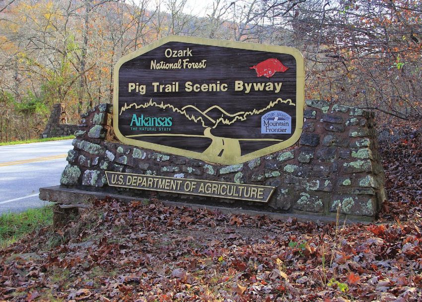
P     8
r i d e 2 : ALASKA

                                                                                                RICHARDSON HWY
                                                   RICHARDSON HWY

                             Richardson
                                    Highway
                                 v a l d e z t o fa i r b a n k s , a k | 3 6 3 m i l e s

                     As the first road through America’s last frontier, Alaska’s Richardson
                     Highway began as a pack trail in the late 1890s, bringing fortune
                     seekers to the Klondike goldfields in the state’s interior. Paved in
                     1957, the highway features some of the state’s most breathtaking
                     scenery, including glaciers, waterfalls, towering mountain ranges,
                     and green valleys. Bridal Veil Falls, Keystone Canyon, Thompson
                     Pass, and Worthington Glacier rank among its many highlights.
                       Richardson Highway is primarily a two-lane, changing to four
                     lanes near Fairbanks. On the road, watch for wildlife, frost heaves,
                     and frost sinks. You’ll want to travel on a sunny, clear day for
                                                                                                                                                                                        l o c at i o n
                                                                                                                                                                      Checkpoint
                     viewing the best scenery.
                                                                                                                  AK Dept. of Transportation & Public Facilities

                                                                                                                                                                                                     ’
                                                                                                                                                                                    ss, ELEV 2678
                                                                                                                                                                       Thompson Pa                     iles
                                                                                                                                                                                               t 30  m
                                                                                                                                                                                 located abou
                                                                                                                                                                   highway sign:                  -4 N .
                                                                                                                                                                                      ldez on AK
                                   Scan the code to download the route to                                                                                             northeast of Va

                                   y o u r d e v i c e , o r v i s i t b i t. ly/ h o g r i d e a l a s k a 5 0
P    10
r i d e 3 : ARIZONA

                                                    CORONADO TRAIL

                      Coronado Trail
                            Scenic Byway
                              clifton to springerville, az | 120 miles

                      Arizona’s Coronado Trail Scenic Byway just might be the ultimate
                      thrill ride. With more than 400 curves and precious few guardrails,
                      US-191 winds through mountainous high desert and the Apache-
                      Sitgreaves National Forest in southeastern Arizona. A National
                      Scenic Byway, Coronado Trail has been nicknamed the “Devil’s
                      Highway” due to its previous designation as US-666.
                        Named for Spanish explorer Francisco Vasquez de Coronado who
                                                                                                                                                                                      l o c at i o n
                      traversed the area in 1540 on a quest for the legendary Seven Cities                                                                        Checkpoint                       g in
                                                                                                                                                                                  Depot buildin
                      of Cibola, this lightly traveled trail is well worth discovering yourself!                                                                 Historic Train
                                                                                                                                                                                            e so ut h end
                                                                                                                                                                                 sits at th
                                                                                                                                                               Clifton: Clifton                      depot
                                                                                                                     az dept. of transportation, clifton, az

                                                                                                                                                                                                ai n
                                                                                                                                                                              do Trail. Its tr
                                                                                                                                                               of the Corona                         to day
                                                                                                                                                                                                  d
                                                                                                                                                                                ted in 1901 an
                                                                                                                                                                was construc
                                    Scan the code to download the route to                                                                                                                      nter. Your
                                                                                                                                                                               ty’s visitor ce
                                                                                                                                                                houses the ci                         part
                                    y o u r d e v i c e , o r v i s i t b i t. ly/ h o g r i d e a r i z o n a 5 0                                                                 include all or
                                                                                                                                                                   photo should
                                                                                                                                                                                           ild in g.
                                                                                                                                                                         of the depot bu
P    12
ri d e 4 : arkansas

                                                       PIG TRAIL

                              Pig Trail
                                   Scenic Byway
                        N O R T H O F W H I T E O A K T O B R A S H E A R S , A R | 1 9 . 5 m i l es

                      In a state renowned for great motorcycle roads, Pig Trail Scenic
                      Byway stands heads and “tails” above the rest. Nestled within
                                                                                                                                                    l o c ation
                                                                                                                                 Che c k p oint
                      the hills and hollows of northwest Arkansas, the byway meanders                                                                       : located
                                                                                                                                             ic Byway sign
                                                                                                                              Pig Trail Scen                      ce
                      19 miles through the lush greenery of Ozark National Forest.                                                               e south entran
                                                                                                                                 on AR-23 at th                     t
                                                                                                                                                                 ou
                        No one knows exactly how the Pig Trail got its name. One theory                                                          nal Forest, ab
                                                                                                                                 to Ozark Natio
                                                                                                                                                                ection
                      is that its twists and turns resemble a pig’s tail. Another claims                                                        h of the inters
                                                                                                                               five miles nort
                                                                                                                                                       hite Oak.
                      it’s named for the feral pigs that once roamed the region. But                                                  of AR-352 in W
                      the most frequently cited “tale” is that the byway has long been
                      a popular backroads route to football games at the University of
                      Arkansas in Fayetteville (whose team is the Razorbacks). In any
                      case, you won’t want to miss this curvy country road sometimes
                      called “The Arkansas Dragon.”

                                    S c an the c o d e to d own l oa d the ro u te to
                                                                                                       TOP photo: gary ivey

                                    y o u r d e v i c e , or v isit bit. ly/ ho g ri d earkansas 5 0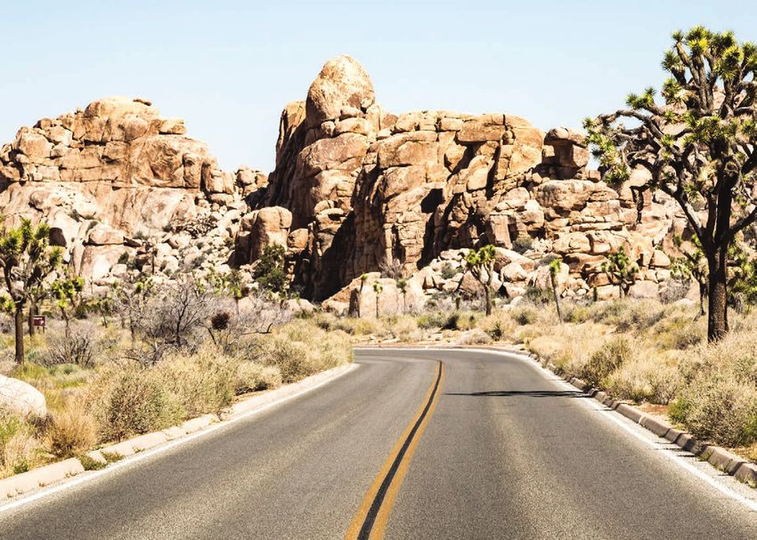
P    14
ride 5: california

                                                    PA L M S T O P I N E S

                     Palms to Pines
                            Scenic Byway
                         pa l m d e s e r t t o m o u n ta i n c e n t e r , c a | 4 1 m i l e s

                     Even if you’ve never ridden Palms to Pines Scenic Byway, you’ve
                     probably seen it on television and in movies. Its spectacular curves,
                     sparse desert, and forested mountain terrain made it a favorite
                     filming location for many years. Starting in Palm Desert, CA -74
                     winds through the Santa Rosa and San Jacinto Mountains and into
                     San Bernardino National Forest, ending in Mountain Center. Many
                     published accounts claim that Palms to Pines continues north from
                     Mountain Center to Banning along CA -243, but that portion
                     is actually called the Banning-Idyllwild Panoramic Highway. It’s
                     a great ride too, and we highly recommend including it in your
                     journey. However, check with local officials before continuing
                     north from Idyllwild; for much of 2019, the road was closed at
                                                                                                                                                                        l o c at i o n
                     Lake Fulmor for repairs due to flood damage.                                                                                     Checkpoint
                                                                                                                                                                                   cated in
                                                                                                                                                                   monument: lo
                                                                                                                                                   Idyllwild town                   43; the
                                                                                                                                                                    lwild on CA -2
                                                                                                                                                    downtown Idyl
                                                                                                                                                                                   features
                                                                                                                                                                  ood sculpture
                                                                                                                                                    25-foot tall w
                                                                                                                    ALL PHOTOS: VISIT CALIFORNIA

                                                                                                                                                                                    created
                                   Scan the code to download the route to                                                                                           bear and was
                                                                                                                                                    a giant grizzly
                                                                                                                                                                           t David Roy.
                                   y o u r d e v i c e , o r v i s i t b i t. ly/ r i d e c a l i f o r n i a 5 0                                        in 2012 by artis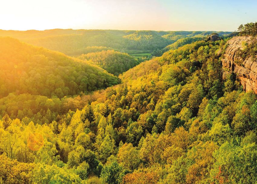
P    16
r i d e 6 : co l o r a d o

                                                               MILLION
                                                              DOLLAR HWY

                             Million Dollar
                                         Highway
                                          O u r a y t o S i lv e r t o n , C O | 2 3 m i l e s

                             Steep drop-offs, switchback curves, and precious few guardrails
                             keep the adrenaline pumping on Colorado’s Million Dollar Highway.
                             Part of the San Juan Skyway Scenic Byway, the Million Dollar Highway
                             runs 23 miles through the San Juan Mountains between Ouray and
                             Silverton. With all its twists and turns, you’ll find the scenery as
                             breathtaking as the ride is vertigo inducing.
                               No one really knows how the highway got its nickname. Some say
                             it’s because of its “million dollar” views; others say the road cost a
                             million dollars to complete in the 1920s. And some say it’s because
                                                                                                                                                                    l oc at i o n
                             the fill dirt used for the roadway was rich in gold ore.                                                            Checkpoint
                                                                                                                                                                   y-Davidson
                                                                                                                                                                                 ®

                                                                                                                                                  Silverton Harle
                                                                                                                                                                                 est
                                                                                                                                                                 World’s High
                                                                                                                                                 exterior: “The
                                                                                                                                                                             , located
                                                                                                                                                             ” at 9,318 feet
                                                                                                                                               Harley Store,
                                           S c a n t h e co d e t o d o w n l o a d t h e r o u t e t o                                                             St., Silverton.
                                                                                                                                                  at 1139 Greene
                                           y o u r d e v i c e , o r v i s i t b i t. ly/ h o g r i d e co l o r a d o 5 0
                                                                                                                             Robert Schaefer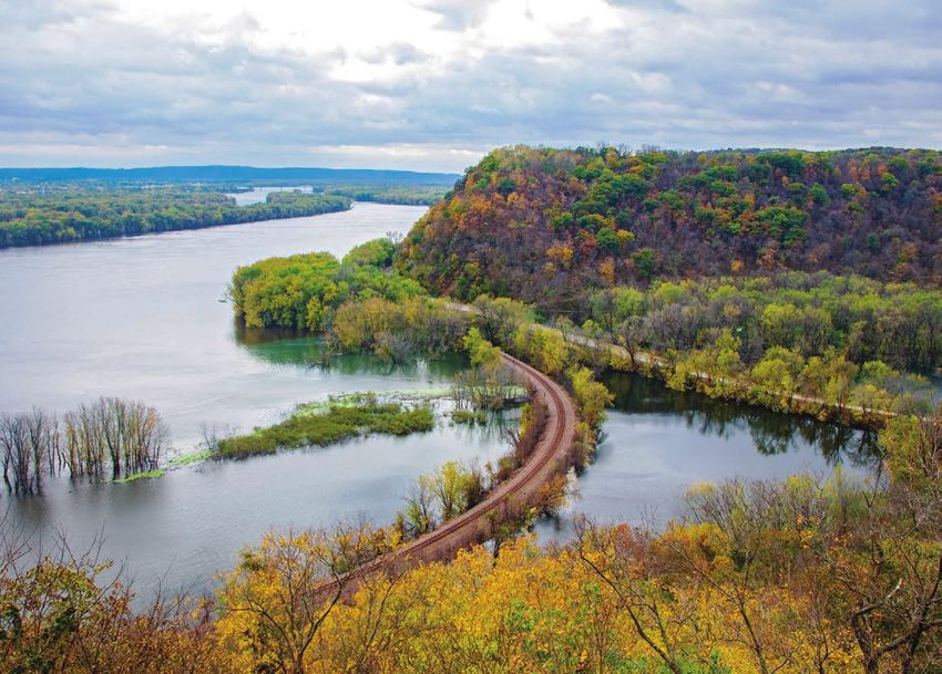
P     18
r i d e 7 : c o nn e c t i c u t

                                                                 LITCHFIELD HILLS
                                                                       LOOP

                                           Litchfield
                                                  Hills Loop
                                                N o r t h w e s t C o nn e c t i c u t | 9 0 m i l e s

                                                                                                                                                                                                   l o c at i o n
                                                                                                                                                                                Checkpoint                      ge:
                                                                                                                                                                                              l Covered Brid
                                                                                                                                                                               West Cornwal                       -128
                                                                                                                                                                                                              CT
                                                                                                                                                                                             t Cornwall at
                                   Nestled in the foothills of the Berkshire Mountains, the Litchfield                                                                       located in Wes
                                                                                                                                                                                                           oric idge
                                                                                                                                                                                                                  br
                                                                                                                                                                                           one-lane hist
                                   Hills region of northwestern Connecticut offers a plethora of                                                                            off US-7, this                     d spans
                                                                                                                                                                                            e mid-1800s an
                                   visual delights. Rolling hills, tranquil lakes, dense forests,                                                                            dates from th                     photo
                                                                                                                                                                                               ic River; your
                                   and rich farmland characterize the area, and Colonial towns                                                                                  the Housaton
                                                                                                                                                                                                           of th is iconic
                                                                                                                                                                                           e part or all
                                   dot the serene landscape.                                                                                                                 should includ                     sp  an.
                                                                                                                                                                                                  ttice truss
                                                                                                                                                                                  red wooden la
                                     Begin your loop in the historic town of Litchfield, incorporated
                                   in 1719. With its shaded village green and unspoiled Colonial
                                   architecture, it has been called one of New England’s prettiest
                                   places. Later, along the loop’s western edge, you’ll pass through
                                   the town of West Cornwall, site of the West Cornwall Covered Bridge.
                                                                                                                                         ALL PHOTOS: CT office of tourism

                                                 Sc a n t h e c o d e t o d o w n l o a d t h e r o u t e t o
                                                 y o u r d e v i c e , o r v i s i t b i t. ly/ h o g r i d e c o nn e c t i c u t 5 0
P 20
ride 8: delaware
BAYSHORE BYWAY
Bayshore
Byway
New Castle to Lewes, DE | 87 miles Checkpoint
l o c at i o n
m
mmand Museu
Air Mobility Co
Heritage Rd.,
located at 1301
exterior sign:
open Tuesday–
e museum is
Dover AFB, th o can be of
PM. Your phot
Sunday, 9AM-4 e
te located at th
at the front ga
either the sign and Ba ys id e
Heritage Rd.
intersection of
visitdelaware.com
pi ct ured here at
the sign
Dr. (DE-9), or
d accessible
e museum an
Bayshore Byway meanders along eastern Delaware’s rural shoreline the front of th
ss hours.
during busine
and the East Coast’s largest preserved coastal marshland. A scenic
two-lane country road, the byway crosses nature preserves, historic
towns, and beaches on the Delaware River and Bay Estuary.
Along the way, you’ll want to stop at the Air Mobility Command
Museum at Dover Air Force Base. The free museum contains more
than 30 aircraft, and is the country’s only museum dedicated to
airlift and air refueling history.
Sc a n t h e c o d e t o d o w n l o a d t h e r o u t e t o
visitdelaware.com
y o u r d e v i c e , o r v i s i t b i t. ly/ h o g r i d e d e l a w a r e 5 0P 22
ride 9: florida
SOUTHERNMOST PT
Southernmost
Point
k e y l a r g o t o k e y w e s t, f l | 1 0 6 m i l e s
Blue skies, emerald green waters, and salt-soaked breezes –
a journey down US-1 through the Florida Keys is probably the
closest you’ll get to tropical paradise in the mainland United
States. Just follow the mile markers south, counting down from
Key Largo to Key West (“Mile 0”), a city lovingly referred to as
the “Conch Republic” by locals.
Life moves at a different pace there. You might see a bumper
sticker in the Keys reading “Slow down, this ain’t the mainland!”
It’s great advice.
l o c at i o n
Checkpoint
t Point buoy:
Southernmos
the
spot located at
popular photo ad
Scan the code to download the route to h and Whitehe
corner of Sout
y o u r d e v i c e , o r v i s i t b i t. ly/ h o g r i d e f l o r i d a 5 0 W es t.
Streets in KeyP 24
ride 10: georgia
SUCHES LOOP
Suches
Loop
north georgia | 51 miles
Living up to its nickname as “Georgia’s Dragon,” the Suches Loop
snakes through the Blue Ridge Mountains and Chattahoochee
National Forest. Three mountain gaps with lots of twists, turns,
and elevation changes make this ride a “bucket list” experience.
Brilliant fall foliage attracts its share of riders during autumn,
but the scenery is stunning any time of year. l o c at i o n
Checkpoint park
rk sign: at the
Vogel State Pa
Vogel
-129/19: 405
explore georgia, vogel state park
entrance on US
., Blairsville.
Scan the code to download the route to State Park Rd
y o u r d e v i c e , o r v i s i t b i t. ly/ h o g r i d e g e o r g i a 5 0P 26
r i d e 1 1 : H A W A II
HANA HWY
Hana
Highway
Maui, HI | 50 miles
Maui’s Hana Highway is 50 miles of spectacular curves through lush,
tropical rainforest. Wildflowers bloom, waterfalls thunder, and the sun
sparkles off of an impossibly blue Pacific Ocean. Traversing the island’s
unspoiled northeastern shore, Hana is truly the highway to heaven.
With more than 600 curves and 59 narrow bridges (many one lane),
Hana Highway takes you past steep seaside cliffs and black volcanic
l o ca t i o n
sand beaches. You’re on island time; slow down and enjoy the journey!
Checkpoint st
na sign: just pa
Halfway to Ha
on HI-360 in
Mile Marker 17
de
popular roadsi
Ke’anae; this
stan d se lls
Sca n t h e c o d e t o d o w n l o a d t h e r o u t e t o refreshment
ac ks , and banana
y o u r d e v i c e , o r v i s i t b i t. ly/ h o g r i d e hawa i i 5 0 fruit, sn
l specialty.
bill mcgowan
bread – a locaP 28
ride 12: idaho
L O L O PA S S
Lolo
Pass
north central idaho from lewiston, id to missoul a, mt | 220 miles
Following in the footsteps of Lewis and Clark’s 1805 expedition in
search of the Northwest Passage, Idaho’s US-12 crosses some of
MONTANA
the most scenic terrain in the West. Called Northwest Passage
Scenic Byway, the route also traces the trail the Nez Perce North
American Indians took while fleeing government forces in 1877.
Lolo Pass sits along the Idaho-Montana border, but you’ll want
to take in all of US-12, from Lewiston, Idaho, to Missoula, Montana.
Crossing the Nez Perce-Clearwater National Forests and the
Bitterroot Range of the northern Rocky Mountains, the curves
and scenery can’t be beat.
l o c at i o n
Checkpoint :
tor Center sign
Lolo Pass Visi
0 US-12 W,
located at 4400
idaho tourism, brad stinson
.
Scan the code to download the route to Lolo, Montana
y o u r d e v i c e , o r v i s i t b i t. ly/ h o g r i d e i d a h o 5 0P 30
r i d e 1 3 : i l l i n o is
OHIO RIVER BYWAY
Ohio River
Scenic Byway – IL
S o u t h e r n I l l i n o is , f r o m C a i r o t o M t. V e r n o n | 1 7 1 m i l e s
l o c at i o n
Checkpoint
an statue:
Giant Superm
in
rman Square
located in Supe at
th
ropolis, a city
downtown Met
The Ohio River National Scenic Byway hugs the river’s shoreline ial home
itself the offic
proudly calls
on its path through Illinois, Indiana, and Ohio. Offering dramatic annual
and holds an
of Superman
iva l.
views of the Ohio River Valley, the Illinois portion of the byway Superman fest
runs through Shawnee National Forest over rolling hills and
through quaint river towns.
The area is rich in Civil War history, natural attractions, and state
parks. Don’t miss Garden of the Gods Recreation Area in Shawnee
National Forest, which features unique sandstone formations and
spectacular views of the surrounding wilderness area.
illinois office of tourism; sandra mclain
Scan the code to download the route to
y o u r d e vic e , o r visi t b i t. ly/ h o g r i d e i l l i n o is 5 0P 32
ride 14: indiana
LINCOLN HWY
Indiana Lincoln
Highway
northern indiana, from monroeville to dyer | 169 miles
More than a century ago, mass production of affordable automobiles
and an increasingly mobile society brought about the need for
better roadways. The Lincoln Highway was developed to meet
this need, becoming America’s first named coast-to-coast
automobile road in 1913.
Named in honor of the 16th president, the highway is still in
existence, although it has undergone various realignments over
the years. Our route through Indiana follows the highway’s
l o c at i o n
1928-1930 final course, giving you a chance to experience living
Checkpoint a
ue: located in
history along its rural and urban paths. Giant Egg stat n
W . M ai
lot at 202
bank parking
Indiana, a fe w
creager smith, kosciusco county cvb
St., Mentone, ,
Li ncoln Highway
miles south of
Scan the code to download the route to atue
ll concrete st
this 10-foot ta
y o u r d e v i c e , o r v i s i t b i t. ly/ h o g r i d e i n d i a n a 5 0 as th e “E gg
e city
celebrates th
Midw es t.”
Basket of theP 34
r id e 1 5 : I o w a
HISTORIC
HILLS BYWAY
Historic Hills
Scenic Byway
S o u t h e a s t I o w a , D o n n e l l s o n t o M o r a v i a | 1 2 8 mi l e s
Travel through history along Iowa’s Historic Hills Scenic Byway.
Among its rolling hills, forests, and small towns, you’ll find the state’s
oldest operating courthouse, the first church west of the Mississippi,
the Mormon Pioneer Trail, and Iowa’s only Civil War battle site.
The region is also home to Mennonite and Old Order Amish
communities and businesses, so stay alert for the presence of
l o c at i o n
Checkpoint
horse-drawn carriages on the roadways.
se:
unty Courthou
Van Buren Co
os au qua;
4th St., Ke
located at 902 ,
courthou se
Scan the code to download the route to Iowa’s oldest
built in 1843.
y o u r d e v i c e , o r v isi t b i t. ly/ h o g r id e i o w a 5 0
deb finneyP 36
ride 16: kansas
FLINT
HILLS BYWAY
Flint Hills
Scenic Byway
ca ssoday to council grove, ks | 47 miles
Pull over and shut off your motorcycle in the middle of the Kansas
Flint Hills, and you’ll hear the sounds of silence: breezes blowing
through swaying prairie grass, insects buzzing, and birds chirping. To
ride the Flint Hills is to experience a vanishing bit of America; miles
of unspoiled prairie punctuated by small towns steeped in history.
At one time, tallgrass prairie – a mixture of grasses that can grow as
high as eight feet tall – blanketed the Midwest. Today, less than four
percent of that original 170-million-acre prairie remains, a result of
the country’s westward expansion over the last couple of centuries. l o c at i o n
Checkpoint
rie National
Tallgrass Prai
e
: located at th
Preserve sign
-1 77 ,
, 2480 KS
Scan the code to download the route to visitor center
Strong City.
y o u r d e v i c e , o r v i s i t b i t. ly/ h o g r i d e k a n s a s 5 0P 38
ride 17: kentucky
RED RIVER
GORGE
Red River Gorge
Scenic Byway
B e t w e e n S ta n t o n a n d Z a c h a r i a h , KY – i n D a n i e l B o o n e
N at i o n a l F o r e s t | 4 5 m i l e s
Winding through Kentucky’s Daniel Boone National Forest, Red River
Gorge Scenic Byway offers a wealth of natural wonders. Sandstone
arches and bluffs, waterflows, forested ridges, and natural bridges
make this one of the state’s prettiest rides. You’ll see why the region
has been named a National Natural Landmark, National Geological
Area, and a National Wild and Scenic River.
One of the route’s highlights is the large sandstone arch at
Natural Bridge State Park, a short walk from the park’s visitor
center (park entry fee applies).
l o c at i o n
Checkpoint
State Resort
Natural Bridge
1,
ted along KY-1
Park sign: loca
ade.
Scan the code to download the route to Bridge Rd., Sl
2135 Natural
kentucky state parks
y o u r d e v i c e , o r v i s i t b i t. ly/ h o g r i d e k e n t u c k y 5 0P 40
All photos: visit lake charles
ride 18: louisiana
CREOLE
NATURE TRAIL
Creole Nature Trail
Scenic Byway
Southwest Louisiana | 180 to 222 miles
Deep among the swamps, coastal marshes, and bayous of southwest
Louisiana, the Creole Nature Trail runs through the heart of
“Louisiana’s Outback.” Generations of Cajun and Creole settlers
hunted and fished there, and the region’s abundant natural
beauty and resources continue to attract outdoor enthusiasts today.
You’re likely to spot alligators and other wildlife. The area is Checkpoint
home to more than 400 bird species, and encompasses five federal l o c at i o n
e
Trail Adventur
and state wildlife refuges and sanctuaries. After riding the trail, Creole Nature St.,
40 Ru th
cated at 27
you’ll understand why the region is sometimes called “one of Point sign: lo vis ito r
tio n/
free attrac
America’s last great wildernesses.” Sulphur. This t yo ur
ar
eat place to st
center is a gr
ure Trail, with
the Creole Nat
journey along ation about th
e
lays and inform
hands-on disp enery.
culture, and sc
Scan the code to download the route to area’s history,
ludes a ferry
pped route inc
y o u r d e v i c e , o r v i s i t b i t. ly/ h o g r i d e l o u i s i a n a 5 0 NOTE: The ma
me ron ac ross the Calcasieu
crossing at Ca ry runs 24 ho
urs
annel. The fer
River/Ship Ch $1 we stbound;
daily and co sts
ssing is free.
eastbound croP 42
ride 19: maine
ACADIA LOOP
Acadia National
Park Loop
m a i n e s e a c o a s t, b a r h a r b o u r a r e a | 2 9 m i l e s
Acadia National Park encompasses lots of diverse terrain within
its 47,000 acres: mountains, woodlands, sandy beach, and rocky
coastline. Observation points along the 27-mile Acadia Loop around
Mt. Desert Island provide great views of the park’s natural wonders.
A couple of don’t-miss highlights: Thunder Hole, a rocky inlet along
Frenchman Bay where waves crash and thunder against a natural
crevice; and Cadillac Mountain, whose 1,530-foot peak marks the
highest point on the North Atlantic seacoast and the first place in
l o c at i o n
Checkpoint
the U.S. where you can see the sunrise during part of the year.
cated
l Park sign: lo
Acadia Nationa ,
Visitor Center
at Hulls Cove
r Ha rb or.
er Rd., Ba
Scan the code to download the route to 25 Visitor Cent y
l Park en tr
NOTE: Nationa
y o u r d e v i c e , o r v i s i t b i t. ly/ h o g r i d e m a i n e 5 0 fees ply.
ap
bill mcgowanP 44
ride 20: maryl and
HALLOWED
GROUND
Through Hallowed Ground
Scenic Byway - MD
E m m i t s b u r g t o P o i n t o f R o c k s , MD | 3 9 m i l e s
Stretching from Gettysburg, Pennsylvania, to Monticello, Virginia, the
Journey Through Hallowed Ground Scenic Byway follows a path through
early American history. Major Civil War battles took place there, and
nine presidents lived along its route. Running through Maryland,
Pennsylvania, and Virginia, the 180-mile byway – part of a National
Heritage Area – truly lives up to its slogan “Where America Happened.”
Maryland’s section of the byway runs along the Catoctin Mountain
chain, and includes state and national parks, a Civil War battlefield,
and the National Museum of Civil War Medicine in Frederick.
l o c at i o n
Checkpoint
visit frederick, national park service
:
ntain Park sign
Catoctin Mou
,
park entrance
located at the
t.
Sc a n t h e c o d e t o d o w n l o a d t h e r o u t e t o Rd., Thurmon
6602 Foxville
y o u r d e v i c e , o r v i s i t b i t. ly/ h o g r i d e m a r y l a n d 5 0P 46
TOP TIP
Riding Tips: DRESSING IN L AYERS IS KEY TO
FA C I N G C H A N G E A B L E W E AT H E R
What to Pack CONDITIONS ON THE ROAD.
those shoes on the plane, compensate for
the bulkiness of the boots in your luggage
by putting items like socks or a rolled-up
T-shirt inside of them.
DRESSING FOR
WHERE TO PUT IT Try to keep one
5 THE ELEMENTS
saddlebag for your outerwear and
the other for things you won’t need until COLD GEAR You never know when you
you stop for the night. If you have Tour-Pak ® might hit some cold air, wherever
luggage, you can use it for items you need you are in the world. Thermal
to access frequently. Consider putting your underwear helps a lot and doesn’t
S o you ’ v e picked your overnight things in a single lightweight bag take up much packing space. Make
destination and planned the the skin and dry very quickly. Take advantage within the saddlebag. A selection of zipper- sure you have a warm pair of gloves,
route – now it ’ s time to pack f or of hotel laundry services, or simply rinse lock plastic bags is also a great option for and remember that there’s no shame
the road . H ere are our top tips out underwear and socks and hang to dry keeping everything organized. in waiting for the air to warm up
f or what to bring ( and what to overnight on the shower curtain – with help before you set out in the morning.
HOLD BACK On a short trip, or if you’re
lea v e behind ! ) . from the hotel blow dryer if necessary. 6
bringing several pieces of luggage, HEAT Pack light, breathable clothing
CLOTHES You’ll be surprised at how little HEAD GEAR Full-face helmets are one you may find yourself with extra room. Resist that will keep your arms covered
1 3
you can get by with. Two pairs of jeans of the trickiest things to pack. It the temptation to fill up all available space. while you ride. A mesh riding jacket
are plenty: one to wear while you ride, the helps to stuff something inside, such as Leave a little room for items you might buy is a great choice if you know it’s
other to wear after you stop for the night. riding gloves – just take care not to damage along the way. Also, if it’s hard work to fit going to be hot.
Even one can be enough, depending on the inner foam core. Keep in mind that if everything onto the bike, remember that
WET A waterproof jacket of some
your willingness to wear dirty, sweaty your plans include an H-D EagleRider bike you’ll have to do it every morning on the road.
sort is a must, with waterproof pants
clothes on the road. Remember, you’re you have the option of borrowing a helmet
ASK YOUR DEALER Remember that a close second. Waterproof riding
a biker – nobody expects you to look for the duration of your ride. 7 boots that are comfortable to wear
dealerships can help with many
clean and polished all of the time.
FOOTWEAR Your riding boots may not luggage matters – whether you want to while riding and walking should be
4
UNDERGARMENTS Synthetic fabrics are make good walking shoes, so it’s wise send your luggage ahead, store it during a high priority – unless your bike
2
ideal for underclothes and base to have a pair of sneakers handy for time your trip, or send things back home if has lower fairings, which will help
layers, as they draw moisture away from spent off of your bike. If you choose to wear you’ve bought more than you can carry! keep your feet dry.
47P 48
ride 21: massachusetts
MT GREYLOCK
BYWAY
Mt. Greylock
Scenic Byway
l anesborough to north adams, ma | 18.5 miles
On a clear day, the view from atop Mount Greylock’s 3,491-foot
summit reaches 90 miles, offering panoramic views into five states.
Located in the Taconic Mountains adjacent to the Berkshires, Mount l o c at i o n
Checkpoint er:
Greylock is the highest point in Massachusetts. Memorial Tow
Veterans War ,
ount eylock
Gr
It’s important to note that the byway, which runs through Mount e summit of M
Located at th nstruc te d in
Greylock State Reservation, opens one week before Memorial Day in anite tower, co
this 92-foot gr of the First
ra ns
late May and remains open through October 31, so plan accordingly! ializes vete
1932, memor e-minute
e tower is a fiv
World War. Th there’s an
d
parking lot, an
walk from the For H.O.G.
®
e w ith so m e stairs. NOTE:
inclin allenged,
Scan the code to download the route to are mobility ch
members who
y o u r d e v i c e , o r v i s i t b i t. ly/ h o g r i d e m a s s a c h u s e t t s 5 0 the parking
summit from
a photo of the
applies at
. Parking fee
lot will suffice it.
eylock su m m
the Mount GrP 50
ride 22: michigan
TUNNEL OF TREES
Tunnel
of Trees
bayview to cross vill age, mi | 28 miles
The aptly named Tunnel of Trees is shaded by a canopy of hardwoods
and evergreens for much of its 28-mile length. The winding, narrow
road runs along the high bluffs overlooking Lake Michigan, with
occasional breaks in the foliage offering glimpses of the water below.
Plan on having lunch at Legs Inn in Cross Village at the end of the
ride. The restaurant, open from mid-May through late October, was
started by a Polish immigrant in the early 1920s. The funky stone-
and-timber eatery was named for the row of inverted stove legs
Legs inn, Petoskey area convention and visitors bureau
that form a railing around the roof and even has its own Michigan
Historical Marker (which is the checkpoint for this ride). l o c at i o n
Checkpoint cated
ical marker: lo
Legs Inn histor 25
restaurant, 64
outside of the
Village.
ore Dr., Cross
Scan the code to download the route to North Lake Sh
y o u r d e v i c e , o r v i s i t b i t. ly/ h o g r i d e m i c h i g a n 5 0P 52
r i d e 2 3 : m i n n e s o ta
NORTH SHORE TOUR
North Shore
Scenic Drive
D u l u t h t o G r a n d P o r ta g e , M N | 1 4 9 m i l e s
Cruise along the scenic north shoreline of Lake Superior, the
world’s largest freshwater lake in surface area. Seven state parks
explore minnesota_allie hoeft, explore minnesota, scott syring, explore minnesota
dot the route, including Split Rock Lighthouse State Park with its
historic 1910 light station, constructed after nearly 30 ships were
lost on the treacherous rocks during a gale.
If you’re a fan of great homemade pie – and who isn’t? –
l o c at i o n
we recommend stopping at Betty’s Pies when you pass through Checkpoint d at
thouse: locate
Two Harbors. Split Rock Ligh , 3755
at e Pa rk
thouse St
Split Rock Ligh o Ha rbors.
thouse Rd., Tw
Split Rock Ligh
trance fee
10PM daily; en
urs are 8AM-
NOTE: Park ho oo k with a view of
the
Scan the code to download the route to applies. There
’s a Scen ic Overl
so uth of the state
out 1-1/2 miles
y o u r d e v i c e , o r v i s i t b i t. ly/ h o g r i d e m i n n e s o ta 5 0 lighthouse ab not to enter
, if you prefer
park on MN-61
te pa rk .
the staP 54
ride 24: mississippi
NATCHEZ TRACE
Natchez Trace
Parkway
N at c h e z , MS t o t h e M i s s i s s i p p i - A l a b a m a b o r d e r | 3 1 1 m i l e s
Following the path of the “Old Natchez Trace,” a trail used for
thousands of years by Native Americans and early European settlers,
Natchez Trace Parkway runs 444 miles through three states, from
Natchez, Mississippi, to Nashville, Tennessee.
In Mississippi, the national parkway’s gently curving two-lane
winds past grassy fields, and stands of towering oaks and evergreens.
Remnants of the original footpath leading into the woods are visible
in several areas, marked by “Sunken Trace” signs. The Cypress Swamp
at milepost 122 is also worth seeing, where a boardwalk leads over l o c at i o n
Checkpoint :
a cypress-studded stagnant marsh. e Parkway sign
Natchez Trac r
Servic e si gn fo
National Park te d
is lo ca
e Parkway
Natchez Trac er e’s
ez entrance. Th
Sc a n t h e c o d e t o d o w n l o a d t h e r o u t e t o near its Natch ea
g ar
ut and parkin
y o u r d e v i c e , o r v i s i t b i t. ly/ h o g r i d e m i s s i s s i p p i 5 0 a paved pullo
th e lo ca tio n.
for vehicles atP 56
r i d e 2 5 : MISSOURI
BAGNELL DAM LOOP
Bagnell Dam
Loop
l ake of the ozarks region in central missouri | 71 miles
Winding through Missouri’s Ozark Mountains, this 71-mile loop packs
a lot of punch into its short distance. Curving through rural central
Missouri before reaching the Lake of the Ozarks, the highway crosses
Bagnell Dam, whose construction formed the Lake of the Ozarks by
damming the Osage River in 1931.
Popular parks in the region include Lake of the Ozarks State Park
and Ha Ha Tonka State Park, whose highlights include the ruins of
a 1905 stone castle situated on a high bluff overlooking the lake. l o c at i o n
Checkpoint ”
Bagnell Dam
“Welcome to
h d of
en
ted at the sout
billboard: loca m Blvd.
on Bagnell Da
Scan the code to download the route to Bagnell Dam
ss Route).
y o u r d e v i c e , o r v i s i t b i t. ly/ h o g r i d e m i s s o u r i 5 0 (US-54 Busine
FUNLAKE.COMP 58
r i d e 2 6 : m o n ta n a
GOING-TO-THE-SUN
ROAD
Going-to-the-Sun
Road
g l a c i e r n at i o n a l pa r k | 5 0 m i l e s
Truly one of the top bucket-list rides in the nation, Montana’s
Going-to-the-Sun Road sits in a class all by itself. From cedar forests
and glacial lakes to alpine tundra, the road bisects Glacier National
Park, offering myriad spectacular scenic views and crossing over
the Continental Divide at Logan Pass.
It’s advised to check weather conditions before riding, as snow can
delay the opening of the alpine portion of the road until late June or
early July, and weather closures at any time of the year are possible. l o c at i o n
Checkpoint the
gn: located at
Logan Pass si
Visitor
e Logan Pass
entrance to th
wning.
summit –Bro
all photos: visit montana
Scan the code to download the route to Center at the ce
l Park entran
y o u r d e v i c e , o r v i s i t b i t. ly/ h o g r i d e m o n ta n a 5 0 NOTE: Nationa
fee applies.P 60
ride 27: nebraska
SANDHILLS
JOURNEY
Sandhills Journey
Scenic Byway
G r a n d I s l a n d t o A l l i a n c e , NE | 2 7 2 m i l e s
l o c at i o n
Checkpoint
ney/Nebraska
Nebraska’s Sandhills Journey Scenic Byway traverses a long stretch Sandhills Jour
y one
gn: Choose an
of windblown prairie through the middle of the state. Covering more Byway road si s
byway sign (a
s
of the official
ute.
than 19,000 square miles and nearly a quarter of the state’s land, ) along the ro
pictured here
the Sandhills comprises the largest area of grass-stabilized dunes
in the Western Hemisphere.
Cows outnumber people by almost four to one, as the sandy soil
isn’t suitable for farming but is ideal for cattle ranching.
Scan the code to download the route to
y o u r d e v i c e , o r v i s i t b i t. ly/ h o g r i d e n e b r a s k a 5 0P 62
r i d e 2 8 : NE V ADA
EXTRATERRESTRIAL
HWY
Extraterrestrial
Highway
C R y s ta l S p r i n g s t o W a r m S p r i n g s , N V | 9 9 m i l e s
Prepare for “close encounters” along the Extraterrestrial Highway –
NV-375 between Crystal Springs and Warm Springs. Whether these
encounters are with UFOs – the region abuts the infamous Area 51
government test facility – or with the free-range cattle that roam
the high desert area – you’ll want to exercise due care.
Roughly halfway along the journey, stop in Rachel at Little A’Le’Inn,
the legendary bar/restaurant/souvenir shop. Even if you don’t try
its specialty – the Alien Burger – you’ll want to photograph the sign
and flying saucer outside – it’s this ride’s checkpoint.
l o c at i o n
Checkpoint
sign: located
Little A’Le’Inn
ill Rd., Alamo
Sc a n t h e c o d e t o d o w n l o a d t h e r o u t e t o at 9631 Old M
(Rachel, NV)
y o u r d e v i c e , o r v i s i t b i t. ly/ h o g r i d e n e v a d a 5 0P 64
r i d e 2 9 : NEW H AMPS H IRE
THE KANC
Kancamagus
Highway
l i n c o l n t o C o n w a y, N H | 3 5 m i l e s
Known as “the Kanc,” the Kancamagus Highway runs through
White Mountain National Forest between Lincoln and Conway.
The road twists and turns over Kancamagus Pass on the flank
of Mount Kancamagus – at almost 2,900 feet, the highest
elevation on the highway.
A peeper’s paradise – leaf peepers, that is – the Kanc attracts
l o c at i o n
legions of travelers each fall for its spectacular foliage displays, Ch e c k p o i n t
: located
Highway sign
and traffic congestion during that time can be a problem. Kancamagus sign
– look for the
at the pullout
te M ou ntain
ing Whi
reading “Enter 112,
N H-
ic Forest” on
National Scen n with
tio
Scan the code to download the route to est of the junc
2-1/2 miles w m sile
Conway (or 33
y o u r d e v i c e , o r v i s i t b i t. ly/ h o g r i d e n e w h a m p s h i r e 5 0 NH-113/16 in .
n on NH-112)
east of LincolP 66
r i d e 3 0 : NEW J ERSEY
Bayshore
Heritage Byway
Cape May to Pennsville, NJ | 124 miles
Winding along Delaware Bay on New Jersey’s western shore,
the Bayshore Heritage Byway runs through historic towns and
villages, farmland, rivers, and tributaries. Abundant wetlands
along the shoreline provide natural habitat for migratory shore
and wading birds.
Historic sites on the byway include the Hancock House in
Hancocks Bridge, site of a Revolutionary War massacre; and
the Greenwich Tea Burning Monument in Greenwich, which
commemorates a tea burning that took place there in 1774,
l o c at i o n
a year after the Boston Tea Party. Checkpoint d at
thouse: locate
Cape May Ligh
t State Park,
Cape May Poin
Point;
Ave., Cape May
215 Lighthouse ted in
Sc a n t h e c o d e t o d o w n l o a d t h e r o u t e t o e was construc
the lighthous
ill in us e.
y o u r d e v i c e , o r v i s i t b i t. ly/ h o g r i d e n e wj e r s e y 5 0 1859 and is stP 68
Riding Tips: TOP TIP
WHEREVER YOU ARE AND
Rally Safe Riding WHOMEVER YOU’RE WITH, HAVE
THE CONFIDENCE TO RIDE YOUR
O W N R I D E , AT T H E S P E E D T H AT
SUITS YOU.
basic advice easily minimizes the risks.
Probably the most important general advice
is not to get too caught up in the excitement.
Always ride within your own comfort zone ridi N G
and make your own decisions. SOMEWHERE NEW
Special events, such as parades or
No doubt you’re already looking ahead slow-speed tip-over. This is due to several
concerts, can be particularly challenging.
While it’s always exciting to ride
reasons: middle-of-the-street parking, the
to the next riding season and planning Avoid the inevitable traffic jams that occur
somewhere you’ve never been
commotion of many riders and pedestrians,
which rallies you’ll be taking part in. slow speeds, and the added pressure of being
when these events end by carefully timing
before, beware of the challenges
of riding roads and regions you’re
Here are our top tips to help you get watched by hundreds of peering eyes. The
your departure to avoid the rush.
experiencing for the first time. In
the most out of your rally experience, best way to avoid this is to practice riding and
Such advice sounds simple and obvious,
an unfamiliar location, it becomes
wherever you’re headed! parking slowly. Once you’re at the event, aim
but the nature of groupthink has a peculiar
more vital than ever to maintain
way of turning individuals into lemmings.
to park with the rear wheel on the curb and these basics of road safety:
the front wheel pointing toward the middle of MAKE THE MOST OF IT Focus on what
FIRST THINGS FIRST Make sure your bike 5 Ride at a speed that you can
1 the road. Leave an open path forward to pull makes the event special in the first
is ready for the journey and festivities, easily slow down or stop from.
out and park in a spot where the bike’s jiffy place. Why is it famous? Take advantage of
and that you have everything you need – see
stand provides optimal balance. If a tip-over local knowledge; guided tours from local Search aggressively within the
our detailed tips on packing on page 46.
does happen, don’t panic. Take a moment to chapters can show you things you would visible sight distance.
HAVE A PLAN It can be difficult to get evaluate yourself and your motorcycle, and never find yourself.
2 Always position yourself to
consensus among a group of riders. recruit help if needed.
FINALLY… Remember, the rally itself have an escape path.
Before you set out, agree on what you’d like 6
LARGE GROUPS: DON’T BE A LEMMING Whether is not the sole reason to visit that
to see and do, the type of roads you want to 4 Cover your brake and clutch
it’s a casual excursion with friends or area. There’s likely to be a lot of interesting
ride, and the distances and speeds you’re controls to reduce your
a massive organized parade, riding in large things to see and do away from the main
comfortable with for each day. reaction time.
groups is a near certainty at most rallies. rally site, so don’t miss out. Check out the
ONCE YOU ARRIVE One of the most Group riding is one of the great experiences suggested regional routes and top tips, Pay heightened attention
3
common accidents at rallies is the of a motorcycle rally and following some spread throughout this guide. to road signs.P 70
ride 31: new mexico
ENCHANTED CIRCLE
Enchanted Circle
Scenic Byway
northern new mexico | 113 miles
New Mexico’s Enchanted Circle Scenic Byway blends
astonishing natural beauty with eons of human history. Home
to Taos Pueblo, a UNESCO World Heritage Site that has been
continuously inhabited for more than 1,000 years, and the country’s
first Vietnam Memorial, in Angel Fire, the byway offers a wealth
of “enchanting” scenery and riding.
Circling the highest point in the state – Wheeler Peak in the
Sangre de Cristo Mountains, at 13,159 feet – and running through
l o c at i o n
Carson National Forest, the region is also home to the popular Checkpoint
l sign:
rans Memoria
Taos Ski Valley. Vietnam Vete
Rd.,
Country Club
located at 34 ,
dicated in 1971
Angel Fire. De by
tr uc te d
was cons
the memorial r th e
family to ho no
Scan the code to download the route to the Westphall m en
e 15
eir son and th
y o u r d e v i c e , o r v i s i t b i t. ly/ h o g r i d e n e w m e x i c o 5 0 memory of th d
who were kille
in his platoon
1968.
in Vietnam inP 72
ride 32: new york
CAYUGA
LAKE BYWAY
Cayuga Lake
Scenic Byway
u p s tat e n e w y o r k | 8 7 m i l e s
Cayuga Lake Scenic Byway circles upstate New York’s longest
Finger Lake, past lakeside bluffs, farmland, wetlands, state parks,
and a national wildlife refuge. The region hosts the country’s first
wine trail – its microclimate is ideal for growing grapes – and also
played important historical roles in the Underground Railroad,
as well as the Women’s Suffrage Movement.
Taughannock Falls State Park on the lake’s southwestern
edge is worth a visit. Its namesake falls is the highest single-drop
waterfall in the Northeast – at 215 feet, it’s three stories taller
l o c at i o n
Checkpoint
MATT champlin, cayuga county office of tourism
than Niagara Falls.
:
Falls Overlook
Taughannock
e waterfall
photograph th
tor
look at the Visi
from the over
Taugha nn oc k
Scan the code to download the route to Center, 2381
y o u r d e v i c e , o r v i s i t b i t. ly/ h o g r i d e n e w y o r k 5 0 Park Rd ., Tr umansburg.P 74
ride 33: north carolina
HELLBENDER
28
Hellbender 28
deals gap to stecoah, NC | 22 miles
Sure, the Dragon gets all of the attention, but the Hellbender 28
– just adjacent to its more famous cousin – is no less exciting to
ride. Skirting Fontana Lake through the middle of Great Smoky
Mountains National Park, the road features more elevation changes,
sweeping curves, and expansive views than the Dragon, making
l o c at i o n
Checkpoint
one a perfect complement to the other.
erlook:
The Hellbender 28 is also known as the Moonshiner 28, but from scenic ov
Fontana Lake t
erlook doesn’
whatever you choose to call it it’s a heck of a ride! r the scenic ov
The pullout fo ately 11 m s
ile
t it’s approxim
have a sign, bu -129 and
rsection of US
east of the inte
p d riding
an
g in Deals Ga
NC-28 (startin
Scan the code to download the route to for a break in
ecoah). Look
east toward St king/picnic
visit north carolina
y o u r d e v i c e , o r v i s i t b i t. ly/ h o g r i d e n o r t h c a r o l i n a 5 0 a pullout/par
the trees, with ic
rs a panoram
area that offe
a La ke .
view of FontanP 76
r id e 3 4 : n o r t h d a k o ta
R O O S E V E LT PA R K
LOOP
Roosevelt
National Park Loop
W e s t e r n N o r t h D a k o ta | 1 3 1 M I L ES ( i n c l u d e s N o r t h a n d S o u t h U n i t s )
In the heart of North Dakota’s rugged Badlands, Theodore Roosevelt
National Park is often referred to as a hidden gem. Sitting on three
separate land areas (the North and South Units contain paved roads,
while the Elkhorn Ranch Unit has gravel roads), the park covers a
total of nearly 70,500 acres.
Both the North Unit, accessible off of US-85, and the South
Unit, off of Interstate 94 Exit 24, feature scenic drives with dramatic
scenery, wilderness areas, and abundant wildlife. The Elkhorn Ranch Checkpoint
bill mcgowan, north dakota tourism, north dakota tourism
Unit is the site of Theodore Roosevelt’s cattle ranch, built in 1884 l o c at i o n
trance
ional Park en
on the Little Missouri River. Roosevelt Nat y of the
at an
l Park sign
sign: a Nationa ffe r from
s (sign may di
park entrance l Park
ed). A Nationa
the one pictur
applies.
Scan the code to download the route to entrance fee
p
South Unit loo
y o u r d e v i c e , o r v i s i t b i t. ly/ h o g r id e n o r t h d a k o ta 5 0 NOTE: A short
section of the
no set re-opening
date,
air wi th
is closed for rep driven.
the loop can be
but the rest ofP 78
ride 35: OHIO
TRIPLE NICKEL
The Triple
Nickel
B r u s h C r e e k t o L i t t l e H oc k i n g , O H | 6 1 m i l e s
l oc at i o n
Checkpoint
ay sign:
OH-555 highw
ute sign
Any OH-555 ro
h Creek
between Brus
ing.
and Little ck
Ho
Winding through southeastern Ohio’s Appalachian region, OH-555,
better known as the “Triple Nickel,” features bucolic scenery and
curvy, hilly roads. Running through four rural counties, the route
also skirts the edge of Wayne National Forest.
Just a simple country road, albeit one with roller-coaster hills
and pastoral farmland, this is a ride you’re sure to enjoy.
zanesville-muskingum county cvb
Sc a n t h e co d e t o d o w n l o a d t h e r o u t e t o
y o u r d e v i c e , o r v i s i t b i t. ly/ ho g r i d e oh i o 5 0P 80
r i d e 3 6 : ok l a h om a
TALIMENA
BYWAY
Talimena
Scenic Byway
Ta l i h i n a , O K to M e n a , A R | 6 0 m i l e s
l o c at i o n
Checkpoint ita
ic Drive/Ouach
Talimena Scen wood
ca rved
st sign: The
Winding through Ouachita National Forest in southeastern Oklahoma National Fore la ho ma-
sits at the Ok
and western Arkansas, Talimena Scenic Drive provides a peaceful and stone sign si de
e line (either
Arkansas stat
okay to use).
fhwa
passage through forested hills and verdant valleys. The route
of the sign is
follows the crests of Winding Stair and Rich Mountains, part of
the highest mountain range between the Appalachians and the
Rockies, offering lots of curves, steep grades, and numerous
scenic overlooks. It’s a region renowned for fall foliage, but the
views are spectacular year-round.
The byway derives its combined name from the towns on either
ARKANSAS
end: Talihina, Oklahoma, and Mena, Arkansas.
S c a n t h e c o d e to d o w n l o a d t h e ro u t e to
y o u r d e v i c e , or v i s i t b i t. ly/ h o g r i d e ok l a h om a 5 0P 82
ride 37: oregon
COLUMBIA
RIVER HWY
Historic Columbia
River Highway
Northern Oregon | 82 miles
bill carey
Winding through the dramatic Columbia River Gorge on the
Washington-Oregon border, you’ll be captivated by the same
breathtaking scenery that greeted Lewis and Clark on their
westward journey more than 200 years ago.
The scenery includes waterfalls, sheer cliffs, canyons, and
mountain views as the byway follows the river’s path through l o c at i o n
Checkpoint sign:
the Cascade Mountains. ilding and/or
Vista House bu
lu m bia River
te d at 40 70 0 Historic Co
lo ca e
the Vista Hous
Hwy., Corbett; ilt
one building bu
Scan the code to download the route to is a historic st
own
-1918 at the Cr
y o u r d e v i c e , o r v i s i t b i t. ly/ h o g r i d e o r e g o n 5 0 between 1916
erlook.
Point scenic ovP 84
r i d e 3 8 : P ENN S YLVANIA
LAUREL
HIGHLANDS
Laurel Highlands
Scenic Byway
S o u t h w e s t e r n P e n n s y lv a n i a | 6 9 m i l e s
Nestled in the foothills of the Allegheny Mountains, Pennsylvania’s
3,000-square-mile Laurel Highlands region is a feast for the senses.
Rolling hills, farmland, rivers, waterfalls, and state parks rank
among its natural attractions, and four landmark Frank Lloyd
Wright homes, a Revolutionary War battlefield, and a reconstructed
French and Indian War fortress are just a few of the area’s historic
and architectural attractions.
l o c at i o n
Running 68 miles on PA-711 and 381 from Seward, Pennsylvania, Checkpoint
cated at
e Park sign: lo
to the West Virginia state line, Laurel Highlands Scenic Byway Ohiopyle Stat
Main St.,
quarters, 124
crosses two rural counties, and provides a bonanza of scenic the park head
rk’s signs are
of the state pa
and relaxed riding. Ohiopyle. Any d
oint photo an
r your checkp
acceptable fo ur ed . Th is
m the one pict
may differ fro
ts ne ar th e southern
rk si
20,500-acre pa bisected
Scan the code to download the route to e byway and is
terminus of th
popular
y o u r d e v i c e , o r VI S I t b i t. ly/ h o g r i d e p e n n 5 0 ogheny River,
by the Youghi
rafting.
for whitewater
lynn abbottP 86
ride 39: rhode island
POINT
JUDITH LIGHT
Ocean Road to
Point Judith Lighthouse
n a r r a g a n s e t t, R I | 6 m i l e s
Summertime in Rhode Island is all about the beach. Head down
to South County (which you won’t find on the map because it’s not
an actual county; it’s just what everyone calls the state’s coastal
region), grab some chowder and clam cakes, and maybe a Del’s
frozen lemonade, and you’re all set.
Wind along Ocean Road, past Narragansett Town Beach and
through the stone archway of The Towers, curve along the rocky
coastline past more beaches, and at the end of the road you’ll
l o c at i o n
come to Point Judith Lighthouse – a squat, octagonal brick light Checkpoint ted at
ghthouse: loca
station that has sat on the spot since 1857. Point Judith Li t. The
., Narragans et
1460 Ocean Rd
s of Coast
on the ground
lighthouse is which
Point Judith,
Guard Station rk at
e publ ic , so pa
Scan the code to download the route to isn’t open to th walk
an d
rking area
y o u r d e v i c e , o r v i s i t b i t. ly/ h o g r i d e r h o d e i s l a n d 5 0 an adjacent pa the
of
ter perimeter
around the ou
e lighthouse.
grounds to thP 88
ride 40: south carolina
CHEROKEE
FOOTHILLS BYWAY
Cherokee Foothills
Scenic Highway
upcountry south carolina | 118 miles
l o c at i o n
Checkpoint
cated
ater tower: lo
“Peachoid” w 1,
Winding through the Blue Ridge Mountains’ southern foothills, this ad off of SC-1
on Peachoid Ro
rth of I-85,
national scenic byway follows a trail once used by the Cherokees immediately no
and early fur traders. Along the way, you’ll find small towns, peach in Gaffney.
orchards, three state parks, and two national battlefields.
Gaffney, South Carolina, is home of the 135-foot-tall landmark
“Peachoid” water tower. Why a giant peach? It’s claimed that at
one time Cherokee County in South Carolina produced more peaches
per year than the entire state of Georgia.
south carolina parks, recreation & tourism
Scan the code to download the route to
y o u r d e v i c e , o r v i s i t b i t. ly/ h o g r i d e s o u t h c a r o l i n a 5 0P 90
need to make sure you can securely strap a
Riding Tips:
bag to the passenger pillion. Consider adding
a backrest and/or luggage rack if necessary.
A backpack is always an option, but make
Touring sure it’s small enough to not interfere
with your other luggage and isn’t too heavy.
Maintenance Check your maintenance
couple of “in-between” suggestions to 4
schedule. Will your bike need an oil
get you started.
change? How do the tires look? It’s advisable
Consider making a reservation for
to have your bike checked out before you
every other night or every third night as
set out on a long trip. If you need help while
a compromise. Another option is to make
you’re away, any H-D® dealerships should
reservations a day at a time after checking
be able to assist, but they’ll appreciate a
the weather forecast. That way you can take
heads-up if possible.
your time without having to worry about
stopping early to find a suitable hotel. Remember These tips only scratch
5
If you’re traveling with others, make the surface of what there is to GETTING REA D Y
sure you’re all on the same page regarding know about touring. The best source of make sure you THINK ABOUT:
hotel stays, dining preferences, riding information is your fellow riders and
So you’ve decided to take a long styles, and so forth. H.O.G.® members, so don’t be afraid to Packing Prepare for the elements
Even if your only real goal is to see where ask and never stop learning. but don’t overdo it – check out the
motorcycle trip. Great! Whether it’s
the road takes you, it’s nice to have at least tips on page 46.
your first big ride or you’re a touring
one planned destination, as this gives your
veteran, here are a few tips to help trip more purpose and provides a greater
Sunscreen Wear it, even if you
don’t think you need it. Trouble spots
you get the most from it. sense of satisfaction when you get there.
can include the back and sides of
Comfort How far have you ridden on your neck, along with that space
2
your bike? Hundreds of miles a day between your gloves and the end of
Before you go The first thing you
1 can wear you out a lot faster than trips your sleeves. And, yes, you can get
should ask yourself is “What’s my
around town. Try a test run to see if you TOP TIP sunburned through the face shield
tolerance for the unexpected?”
want to put on a more comfortable seat Be sure to check out local of your helmet.
For instance, some people won’t take to
or add a windshield, for example. riding requirements and
the road before booking a hotel for every Navigation In this age of easy GPS,
r e g u l at i o n s f o r y o u r
night, while others prefer to play it by Capacity Have you thought about how there’s still something to be said for
3 d e s t i n at i o n b e f o r e y o u t r a v e l
ear. There’s no such thing as the correct you’re going to pack everything you a good old-fashioned paper map for
to avoid any na st y surprises!
approach in this regard, but here are a need? If you don’t have saddlebags, you’ll pondering the next leg of your trip.P 92
r i d e 4 1 : s o u t h d a k o ta
BADLANDS
LOOP
Badlands Loop
Scenic Byway
B a d l a n d s N at i o n a l Pa r k | 3 8 m i l e s
l o c at i o n
Checkpoint
ional Park
Badlands Nat
y of
: located at an
entrance sign
A N at io nal
ances.
the park entr
Badlands National Park is truly a monument to erosion. Its slowly fee ap pl ie s.
Park entrance
changing pinnacles, spires, and bluffs evolved over thousands
of years, and continue to erode by as much as one inch per year.
Geologists estimate they will be gone completely in the next 500,000
years, so naturally you’ll want to see ’em while you still can!
Badlands Loop winds for 38 miles through an eerie multi-hued
landscape of spectacular rock formations. Be sure to stop at any
of the park’s 15 scenic overlooks to soak in nature’s majesty.
Scan the code to download the route to
y o u r d e v i c e , o r v i s i t b i t. ly/ h o g r i d e s o u t h d a k o ta 5 0P 94
ride 42: tennessee
THE
DRAGON
The Dragon
d e a l s g a p, t n - n c s tat e l i n e | 1 1 m i l e s
It just may be the e-ticket of motorcycle rides. After all, lots of
places call their twisty roads, “(insert place name here)’s Dragon,”
but everyone knows there’s only ONE Dragon – and that’s in Deals
Gap, deep in the Great Smoky Mountains on the Tennessee-North
Carolina border. With 318 curves in 11 miles, it’s at the top of N. CAROLINA
nearly every rider’s bucket list.
Less experienced riders can be intimidated by the Dragon,
but veteran riders advise to “ride your own ride”; that is to ride
safely within the speed limit and your comfort limits, and pull
over to let faster vehicles pass.
l o c at i o n
Checkpoint “The
orcycle Resort
Deals Gap Mot
als Gap
: located at De
Dragon” sign poco
Scan the code to download the route to sort, 17548 Ta
Motorcycle Re lina.
th Ca ro
y o u r d e v i c e , o r v i s i t b i t. ly/ h o g r i d e t e n n e s s e e 5 0 ille, Nor
Rd., RobbinsvYou can also read