HURRICANE OPAL ASSESSMENT - REVIEW OF THE USE AND VALUE OF HURRICANE EVACUATION STUDY PRODUCTS IN THE HURRICANE OPAL EVACUATION, ALABAMA AND ...
←
→
Page content transcription
If your browser does not render page correctly, please read the page content below
HURRICANE OPAL ASSESSMENT
REVIEW OF THE USE AND VALUE OF HURRICANE EVACUATION STUDY PRODUCTS
      IN THE HURRICANE OPAL EVACUATION, ALABAMA AND FLORIDA
                         OCTOBER 3-4, 1995

                FEDERAL EMERGENCY                U.S. ARMY
                MANAGEMENT AGENCY                CORPS OF ENGINEERS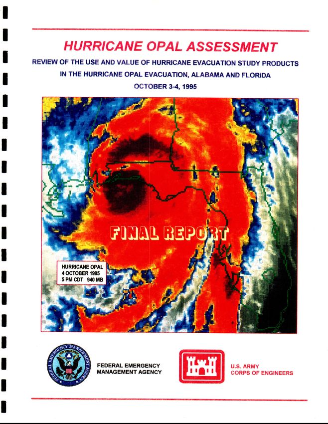
HURRICANE OPAL ASSESSMENT
Review of the Use and Value of Hurricane Evacuation Studies
    in the Hurricane Opal Evacuation, Alabama and Florida
                      October 34, 1995

                        Prepared for

                U.S. Army Corps of Engineers
                       Mobile District
                           and
          Federal Emergency Management Agency
                          Region IV

                         Prepared by

                U.S. Army Corps of Engineers
                     Philadelphia District

                       September 1996
SUMMARY AND RECOMMENDATIONS

           This report presents the results of an assessment of the use and the value of products of the
Hurricane Evacuation Studies (HES) available in the coastal areas of Alabama and Western Florida
impacted by Hurricane Opal on October 4, 1995. Similar assessments were performed after recent
major hurricanes including Hurricane Hugo (1989), Hurricane Bob (1991), Hurricane Andrew
(1992), Hurricane Iniki (1992), and Hurricane Emily (1993).          These assessments are one of the
means employed by the Federal Emergency Management Agency (FEMA) and the U. S. Army Corps
of Engineers to continuously improve Studies and to learn how they can be used more effectively in
state and local hurricane evacuation planning.

           The Hurricane Opal evacuation did not go smoothly. The evacuation network was not
cleared prior to the arrival of pre-hurricane landfall hazardous conditions; some evacuees returned
home because of traffic congestion; and for a number of hours on October 4 there was a real
possibility that thousands of evacuees were going to be caught by violent winds on open highways.
Fortunately, Opal weakened significantly just before landfall and evacuees were not subjected to the
core winds of a major hurricane. One death, caused by a tornado, occurred in the Florida Panhandle.

           It would be difficult to construct a hurricane evacuation scenario more difficult for an
emergency manger to cope with than the one provided by Opal on Tuesday, October 3. Opal was
the third hurricaneof the 1995 season to threaten the region and, while the winds of Hurricane Erin
in August had caused significant wind damages, neither of the two earlier storms went beyond
minimal hurricane intensity nor caused human casualties in the Alabama-Florida Panhandle region.
The relative weakness of these storms may have reinforced a tendency for the public to take a "wait
and see" attitude regarding Opal. There had been some post storm second guessing of one county's
decision to order evacuations and to close schools for Hurricane Allison in June.

           Throughout the crucial period of Tuesday afternoon and evening Opal had to compete for the
attention of the news media with coverage of the verdict of the most publicized murder trial in
history.     In addition, Yom Kippur, the solemn Jewish holiday, began at sunset Tuesday, thus
presenting an additional complication to public information during a crucial period           in Opal's
approach.

           Like Hurricane Andrew in 1992, Opal evolved from a tropical storm to a strong Category 4
hurricane in 48 hours. Opal's pace of intensification quickened especially during the twenty-five to

POST-OPAL ASSESSMENT
FINAL REPORT SEPTEMBER' 96
five hours preceding landfall, going from a Category 1 to a Category 4 during this period. At the
same time the storm's forward speed increased significantly. The final strengthening occurred late
during the night Tuesday and early Wednesday, after some of the counties had set evacuation
timetables for a less intense hurricane, and after vulnerable households had made plans to leave
Wednesday by noon. When Wednesday morning brought with it the realization that a Category 4
hurricane was bearing down on the Florida Panhandle the stage was set for the all-at-once loading
of the evacuation network and the resultant frightening traffic jams. To further aggravate the traffic
situation highway construction significantly reduced traffic capacity on Interstate 10 and several other
major evacuation routes.
This assessment addresses the subject of evacuation timing in some depth and makes
suggestions about how to promote more appropriate public responses in future hurricanes. The need
for coordination and the recognition of hurricane evacuation concerns in construction scheduling and
maintenance of traffic plans has been recognized by the Florida Department of Transportation and
state and local emergency management.
However, even if clear and coordinated evacuation orders had resulted in a prompt public
response Tuesday evening, October 3, and even if all evacuation routes were able to handle their
design traffic capacities, it is not assured that a successful evacuation could have been accomplished.
Clearance time data available to the five westernmost Florida counties and to the two coastal
Alabama counties was developed by the 1986 Tri-State Hurricane Evacuation Study (five Florida,
two Alabama and three Mississippi counties). Housing and population data used in the Tri-State
Study were obtained from the 1980 census and were already critically obsolete in 1990. By 1990 the
total year round population of the six counties in the Tri-State Study area east of Mobile Bay had
increased by 24 percent and total housing units by 42 percent. Growth was generally concentrated
in the southern, or coastal, portions of the counties, the portions most affected by hurricanes.
In response to the major changes in population housing in coastal Northwest Florida and the
request of the State of Florida, FEMA and the Corps of Engineers initiated the Northwest Florida
HES in 1994. The availability of funding, however, has slowed the performance of the study. At the
current pace of funding neither county level internal clearance times nor regional bottleneck clearance
times will be available in time for the 1996 hurricane season. It is essential that the Northwest Florida
Hurricane Evacuation Study be promptly funded.
Besides the problems relating to the age of the Tri-State Study data, it did not appear that the
evacuation decision making data and tools provided by that Study or the Draft Apalachee Bay Region
POST-OPAL ASSESSMENT
FINAL REPORT SEPTEMBER'96 iiHES were totally used to their best advantage during Hurricane Opal. Several counties in the
Apalachee Bay Region were not yet familiar enough with the tools to value or use them or did not
have ready access to National Hurricane Center advisories. Several counties in the Tri-State Study
area used components of the data and tools, but do not appear to have used them in the systematic
fashion implicit in their design. This assessment concludes that instruction in the use of HES data
for new County emergency managers and refresher sessions for veteran managers should be provided
periodically. It also concludes that in depth briefings of HES study results and decision making
issues and operations should be made available to components of local government whose
understanding and cooperation are necessary for successful evacuation decision making and
implementation. These would include county commissioners, sheriffs' departments, school boards
and administrators, health and social service departments, etc. Corps of Engineers Districts should
be funded to stay involved in training and other HES related activities.
A synopsis of specific conclusions and recommendations and information items generated by
this assessment follows. Chapters two through seven provide background and more detailed
treatments of these subjects. Agencies assumed to have primary interest and/or responsibility are
listed for each conclusion/recommendation. Also, recommendations considered to need immediate
attention are so noted. Not all conclusions or information items carry with them a specific
recommendation. These are rather offered because of their potential interest to various agencies.
Some items included in the synopsis or in the main body of this report are concerned with subjects
not directly associated with hurricane evacuation studies but related to hurricane evacuation
operations in general (e.g., communications hardware). These items are also offered because of their
potential interest.
Finally, it is also recognized that many subjects covered by this assessment are already being
addressed by a variety of local, state and federal agencies.
POST-OPAL ASSESSMENT
FINAL REPORT SEPTEMBER '96 iiiPOST-HURRICANE OPAL HURRICANE EVACUATION STUDY ASSESSMENT
CONCLUSIONS AND RECOMMENDATIONS
SUBJECT: HURRICANE EVACUATION STUDY PROGRAM AND ANALYSES
Mobile District - Corps of Engineers
4 A first level evacuation traffic analysis of Florida/Alabama northbound roads and connections to
Interstate 65 and other major evacuation routes should be conducted in order to:
1) Establish as reliable as possible estimates of regional clearance times (Alabama, Northwest
Florida, Georgia) pending completion of the Northwest Florida HES and other components
of the new "Tri-State" studies currently planned for the region.
2) Test the effects on regional clearance times of road widening, reverse laning or new roads.
Mobile District - Corps of Engineers
4 Northwest Florida HES evacuation traffic should be examined for its impacts for the Apalachee Bay
Region HES and vice versa. The compatibility of Northwest Florida HES data and Apalachee Bay
Region HES data should be ensured. [Note: the ongoing Florida Statewide Hurricane Transportation
Analysis will obviously be of relevance to this and the preceding recommendation].
Mobile District - Corps of Engineers
Corps of Engineers HES Mgmt Districts
The Tri-State Study did not explicitly treat inland county clearance times. The traffic congestion
experienced in inland counties in Florida and Alabama affirms the necessity of the regional approaches
taken in more recent studies. The Northwest Florida HES should include regional traffic modeling.
Regional clearance times may be just as important as coastal clearance times in planning for a safe
and timely evacuation.
All hurricane evacuation studies should carefully examine potential regional traffic issues.
FEMA/Army Corps of Engineers
4 There have been very large increases in population and housing units in the Alabama and Florida
portions of the Tri-State HES study area since it was published in 1986. Given the highway chaos
that occurred during Hurricane Opal it is imperative that the Northwest Florida Hurricane Evacuation
Study proceed quickly.
FEMA/Army Corps of Engineers
Given the huge increases in housing units in Baldwin County, Alabama, a high priority should be
given to a restudy of the Alabama counties included in the Tri-State HES. Alternately, consideration
4 Indicates recommendation needing immediate attention.
POST-OPAL ASSESSMENT
FINAL REPORT SEPTEMBER'96 iVshould be give to the addition of Mobile and Baldwin Counties to the NW Florida HES.
Mobile District - Corps of Engineers
Housing and population changes in the Mississippi portion of the 1986 Tri-State HES should be
checked to learn whether an HES update is indicated. The character of the Gulfport-Biloxi coast has
changed significantly in recent years due to the coming of the gaming industry.
Mobile District - Corps of Engineers
As in many HES study areas significant non-surge areas in the Northwest Florida HES Study are
currently included in evacuation areas because of the potential for isolation by flooding. Examples
include barrier island communities such as the City of Destin in Okaloosa County as well as non-
barrier island localities such as Escambia County south of US 98. Given the large population growth
in the southern portions of the study area and the expected resultant increases in clearance times, and
notwithstanding the hazards associated with being cut off from other non-surge areas, there may be
some areas where non-surge evacuation policies should be reexamined. Evacuation zones for the
Northwest Florida HES should be drawn in close consultation with county emergency management
directors and with close attention to issues such as isolation.
Mobile District & Other
Corps HES Mgmt Districts
Attention should be paid to the clarity of the descriptions of evacuation zone boundaries as these
zones may be used in public information products. Assistance should be made available to counties
that desire help in developing customized storm surge or evacuation zone maps.
Mobile District - Corps of Engineers
FEMA REGION IV
County Emergency Management
Housing unit increases for 1980-1990 in the nine Apalachee Bay Region HES study area counties
(four coastal and five inland counties) ranged from twenty-six to forty-one percent. Assuming that
this growth is likely to continue, vulnerability data for this region should be frequently updated.
Mobile District - Corps of Engineers
Mobile housing units and population in Holmes and Washington Counties were not included in the
1986 Tri-State HES. Given the large numbers of these units and their potential impact on evacuation
traffic, they should be addressed in the vulnerability analysis and included in the transportation
analysis of the Northwest Florida HES and in regional analyses suggested in (1.) above.
POST-OPAL ASSESSMENT
FINAL REPORT SEPTEMBER'96 VSUBJECT: EVACUATION DECISION MAKING TRAINING & REVIEW
Mobile District - Corps of Engineers
Jacksonville District - Corps of Engineers
FEMA REGION IV
Florida DEM
4 Table top exercises in the use of HES decision making tools and available computer decision making
aids should be scheduled for county emergency management officials. There has been an almost
complete turnover in Tri-State HES county emergency directors in Alabama and Florida since the
Study was completed. Refresher exercises should be held frequently. Opal advisory data would
provide excellent material for a table top exercise.
All coastal counties should be provided with full access to National Hurricane Center advisories.
FEMAICorps of Engineers Hdqtrs.
Corps of Engineers HES Mgmt Districts
Corps of Engineers Districts in cooperation with state emergency management agencies (EMA's)
should offer instruction in the use of HES data for new County emergency managers and refresher
sessions for veteran managers periodically (i.e. at least every two years). Corps of Engineers Districts
that do not have a study or restudy in progress should be funded to stay involved in HES related
activities such as local training, review of data, etc.
FEMA/Corps of Engineers Hdqtrs.
Corps of Engineers HES Mgmt Districts
State Emergency Management Agencies
The understanding and cooperation of many elements of local government are essential for successful
evacuation decision making and implementation. While many emergency management agencies
(EMA's) have been able to build and maintain the needed supportive relationships with their elected
officials and other agencies and offices, it is apparent that many EMA's could use assistance.
Briefings, seminars, workshops or other vehicles for the education of elected officials and support
agencies should be made available to jurisdictions as new hurricane evacuation studies are concluded,
revisions completed, or as otherwise needed (recent elections, agency turnovers, length of time since
last workshop, etc.) This type of activity should be included in budgeting for hurricane evacuation
studies and for ongoing Corps of Engineers District involvement.
4 Indicates recommendation needing immediate attention.
POST-OPAL ASSESSMENT
FINAL REPORT SEPTEMBER'96 VIFEMA Region IV
Mobile District - Corps of Engineers
4 Several county emergency directors in the Apalachee Bay Region HES study area indicated that they
were not familiar with, or ignored, data produced by the draft study. It seems advisable that a
renewed effort be made to acquaint these directors with the study and its potential usefulness.
County Emergency Management
Florida DEM
Coordinated decision-making among jurisdictions is a significant factor in the success or failure of
any regional evacuation. During Opal various emergency managers altered evacuation plans yet failed
to communicate these changes to other jurisdictions that would experience impacts from those
changes. Also, some emergency managers had difficulty coordinating with decision makers within
their own counties. Procedures for decision-making must be established across jurisdictions, thereby
minimizing the chances of conflicts and redundancies.
SUBJECT: TRAFFIC CONTROL
Florida Department of Transportation
County Emergency Management
4 State Departments of Transportation should consider hurricane evacuation concerns in highway
scheduling and maintenance of traffic plans and should work with emergency
construction
management and traffic control personnel (in-state and out-of-state) to mitigate the impedance of
hurricane evacuation traffic.
Florida Department of Transportation
Traffic counters have proven very useful in recent evacuations in testing public response and traffic
flow assumptions. It is recommended that Florida DOT consider the need for hurricane evacuation
traffic data in its placement of counters.
Florida Department of Transportation
Florida DEM
Several counties expressed the need for additional signs for evacuation routes.
4 Indicates recommendation needing immediate attention.
POST-OPAL ASSESSMENT
FINAL REPORT SEPTEMBER '96 ViiSUBJECT: PUBLIC EDUCATION. PUBLIC INFORMATION. PUBLIC WARNING
County Emergency Management
Florida DEM
There is a continuing need for up-to-date printed materials such as brochures and pamphlets that
remind the public and tourists that an area is subject to hurricane hazards and provides general
evacuation information. These materials should be available at tourist welcome and information
locations, hotel/motel lobbies and rooms, etc. Evacuation zones, evacuation routes, shelter locations
and at least rudimentary evacuation concepts should be covered.
County Emergency Management
4 It is likely that a significant percentage of Opal evacuees were non-surge residents who either were
not aware of their non-surge status, or who were prompted to leave by the Wednesday morning
Category 4 status of Opal. The fact that five people were killed by Opal related winds in the Atlanta
area while one person was killed by winds in Florida (a tornado in Crestview, Okaloosa County)
points out the need for explicit public policies regarding who should evacuate under what
circumstances; a clear communication of these policies; and public education regarding these policies
and the justifications for them.
County Emergency Management
4 It is recommended that counties in the Opal impact area, in preparing for the 1996 hurricane season,
make a concerted effort to impart to the public an education in clearance times and related concepts.
It is also recommended that extreme care be given to the wording of evacuation orders. The delayed
behavioral response curve observed in Opal suggests the need for evacuation decision makers to be
aware of the factors influencingthe promptness of public response and ramifications for timely
evacuations.
Florida DEM
Weather Channel
Several counties believe that dependence on the Weather Channel, whose information on local
conditions or anticipated conditions may lag behind local information, may have hindered timely
reception of, and response to, evacuation orders. It is recommended that the Weather Channel and
Florida Division of Emergency Management continue to seek ways to impress on the public the
importance of attention to local emergency management.
4 Indicates recommendation needing immediate attention.
POST-OPAL ASSESSMENT
FINAL REPORT SEPTEMBER'96 ViiiFlorida Division of Emergency Management
Several counties not close to media centers such as Pensacola or Panama City had difficulty
disseminating information unique to their situations.
County Emergency Management Agencies
Several counties maintain unlisted phone numbers to be used by local media to call emergency
managers for information to be relayed to the public. Availability of these numbers assured TV and
radio stations access to essential information.
County Emergency Management Agencies
Automated fax systems to provide information to broadcast media were used in Opal by Florida DEM
and by several county EMA's with apparent success. It was also suggested that state and county
highway patrol agencies compile a list of media and fax numbers to provide TV and radio stations
with traffic and shelter information.
County Emergency Management Agencies
Law enforcement and fire personnel were effectively utilized in Opal for neighborhood alerting. In
at least one county there was a lack of cooperation by sheriffs department probably rooted in a lack
of conviction that an evacuation was necessary. This may have contributed to the slow start of the
evacuation and affirms the value of this type of notification.
County Emergency Management Agencies
The primary evacuation route used by Gulf County evacuees was State Highway 71. US 98 was
open but relatively unused as many people believed it to be flooded. The lack of local media outlets
contributed to this problem.
County Emergency Management Agencies
Cellular phones were extensively used by evacuees during Opal to report traffic conditions to local
radio stations, which were able to pass on this information via radio stations to other evacuees
attempting to find less congested routes and to avoid construction, road flooding, etc. Some of this
information was incorrect and in conflict with information being disseminated by the counties. Local
EMA's and radio station managers may wish to consider how the effectiveness of cellular phone use
can be enhanced, especially in coastal areas that do not have everyday media traffic information
resources, and how the accuracy of this information can be insured.
POST-OPAL ASSESSMENT
FINAL REPORT SEPTEMBER'96 iXSUBJECT: COMMUNICATIONS
Florida Division of Emergency Management
Gulf County, which is one of the counties lacking in TV/radio service, noted a potentially critical
problem with the telephone company facilities in Port St. Joe. The building housing the phone lines
is within a mile from the coast in a surge vulnerable location. Steps to mitigate this problem should
be considered to avoid loss of long distance communication and resultant isolation.
SUBJECT: SHELTERING
The following shelter related issues and concerns surfaced during the Hurricane Opal evacuation:
- The need for outside assistance in identifying suitable structures for use as public shelters.
- The need for public sheltering to be recognized as a regionalized function.
- Reluctance of some local school boards to be partners in public shelter planning and
implementation.
- Reluctance of state colleges to allow the use of college buildings as public shelters.
- The need for clarification of compensation and liability for non-governmental shelter
management agencies as well as host jurisdictions.
- The need to educate the public in non-surge areas regarding the nature of hurricane hazards
and the possible mitigation of wind hazards, in order to limit unnecessary evacuations.
- Evacuation and care of hospital and nursing home residents and other special needs citizens.
- Personnel support and other resources to accompany out-of-county evacuees, especially
special needs evacuees.
- Registration of shelter occupants
As mentioned in Chapter 4 of this report, none of these issues are new. Each is addressed by the
1993 Lewis Report which was published by the Governor's Disaster Planning and Response Review
Committee following Hurricane Andrew. The Report provides detailed recommendations regarding
shelter issues.
POST-OPAL ASSESSMENT
FINAL REPORT SEPTEMBER'96 XTABLE OF CONTENTS
Page
Summary and Recommendations i
Chapter Title
1 Introduction 1-1
2 Hazards and Vulnerability Data 2-1
3 Public Response 3-1
4 Public Shelter Issues 4-1
5 Transportation/ Clearance Time Data 5-1
6 Evacuation Decision Making 6-1
7 Public Information 7-1
Table Title
1-1 Hurricane Opal Evacuation Chronology 1-8
2-1 Tri-State Study Area Population Growth 2-7
2-2 Tri-State Study Area Mobile Home Unit Growth 2-8
4-1 Hurricane Opal Public Shelter Data 4-4
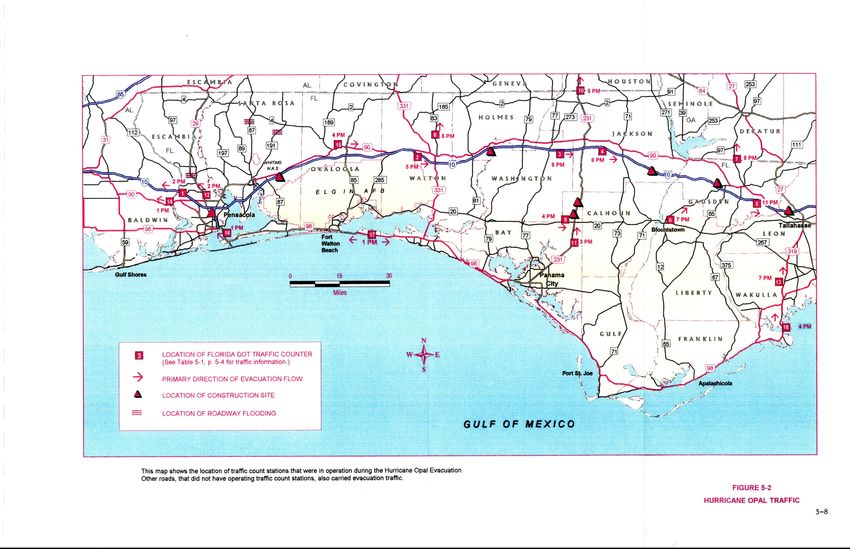
5-1 Hurricane Opal Traffic Count Summaries 5-4
5-2 Traffic/Clearance Time Data 5-7
6-1 Opal Advisory 25 Decision-Making Data 6-6
6-2 Opal Advisory 26 Decision-MakingData 6-7
7-1 Public Information 7-4
POST-OPAL ASSESSMENT
FINAL REPORT Aug '96 xiFigure Title Page Figure Title Page 1-1 Post-Opal Assessment Counties 1-2 1-2 Northwest Florida 1995 Hurricane Tracks 1-3 1-3 Hurricane Evacuation StudyAreas 1-6 1-4 Hurricane Opal Positions/Intensities 1-7 2-1 Observed Versus SLOSH Calculated Storm Surge for Hurricane Opal 2-4 2-2 Observed Shoreline Surge and Wave Effect Profiles for Hurricane Opal 2-5 3-1 Sample Behavioral Response Curves 3-3 3-2 Cumulative Evacuation in Hurricane Opal 3-4 5-1 Hurricane Andrew/Hurricane Opal Behavioral Response Curves 5-3 5-2 Interstate 10 Eastbound Traffic Counts, East of US 231, October 3-4, 1995 5-5 5-3 Hurricane Opal Traffic 5-8 Appendix Title A Public Response to Hurricane Opal: Preliminary Findings B Persons Providing Input/Hurricane Opal Assessment Team Members POST-OPAL ASSESSMENT FINAL REPORT Aug '96 xii
CHAPTER   1

                                              INTRODUCTION

      Hurricane Opal crossed the western Florida coastline late in the afternoon of Wednesday,
October 4, 1995. Earlier Wednesday Opal had intensified to a strong Category 4 hurricane with
tropical storm force winds extending more than 200 miles away from the center. The storm then
weakened somewhat, coming ashore between Pensacola Beach in Escambia County and Navarre
Beach in Santa Rosa County as a marginal Category 3 hurricane at about five p.m., Wednesday. At
landfall the storm had a forward speed of 23 mph and was on a north-northeastward track. Maximum
storm tide heights were just over eight feet. Combined storm surge and wave effects reached a
maximum near 24 feet in the Fort Walton Beach area and caused extensive property damage along
approximately 120 miles of the Florida Coast from Pensacola Beach to Mexico Beach (eastern end
of Bay County). Wind damages occurred well inland. With damage estimates near $3 billion, Opal
was one of the top ten costliest hurricanes of the twentieth century. Given the severity of the storm,
however, human casualties were minimal. A tornado spawned by Opal caused one death in the
Florida Panhandle (at Crestview in Okaloosa County); several wind related deaths occurred in
Alabama, Georgia and North Carolina. No deaths were caused by storm surge flooding.

       Recent major hurricanes such as Hugo (1989) or Andrew (1992) which produced enormous
property damages, did not cause many deaths or injuries. Evacuations of storm surge areas and
mobile homes were completed before the arrival of pre-landfall surge or high winds, and evacuees
had reached safe destinations.        Following these storms Federal Emergency Management Agency
(FEMA)/Corps of Engineers post-hurricane assessment teams concluded that hurricane evacuation
study products          had played a useful role in the evacuation plans that had been successfully
implemented by state and local emergency management officials.

       An estimated 100,0001 people evacuated for Hurricane Opal. While the successful evacuation
of storm surge areas can be credited with preventing storm surge deaths during Opal, only fortune
or providence can be credited for the lack of human casualties caused by wind. As Opal moved
across the Florida panhandle, thousands of evacuees found themselves in wind vulnerable locations --
on highway evacuation routes, parked in service station plazas, or in whatever refuge of last resort
could be found. Had Opal not weakened shortly before landfall it is probable that winds in the core
of the hurricane would have killed or injured many people.

         1   NCDC Technical Report 95-02, National Climatic Data Center, November 1995. Several
reviewers of the Draft Report questioned this estimate, believingthat the number of evacuees was
significantly larger.

POST-OPAL ASSESSMENT
FINAL REPORT SEPTEMBER '96                                                                         1-1
To attempt to learn from the experience, FEMA requested the Corps of Engineers to analyze
the Hurricane Opal evacuation and to make recommendations for improvements to hurricane
evacuation studies and also to recommend measures, both short and long term, which might help
jurisdictions in and out of the Opal impact area avoid the chaos that marked this evacuation. A team
composed of representatives from the Corps, FEMA, Florida and Alabama Emergency Management
and the firm of Post, Buckley, Schuh & Jernigan visited and conferred with state and county
emergency management officials and support agencies and interviewed media representatives,
commercial proprietors and private citizens.
Discussions with local emergency management officials were centered on if, and how, products
produced by hurricane evacuation studies were used and whether study data were accurate and in
usable formats. Suggestions for improvementsto the products themselves or to the way they are
used were solicited. Meetings were held with representatives of ten coastal counties, from Mobile
County in Alabama to Wakulla County in Florida, and a total of nine Florida and Alabama inland
counties during the week of December 11 to 15 and on December 18 and 19, 1995. The counties
visited are shown in Figure 1-1.
MS AL
AL i
m'a Ftff|m
):W U flic
CitY
GULF OF MEXCO MpbchbolS
FIGURE 1-1
POST-HURRICANE OPAL ASSESSMENT COUNTIES
1995 HURRICANE SEASON
Hurricane Opal was the 14th named tropical cyclone of the extremely busy 1995 Atlantic
hurricane season and it was the third 1995 hurricane to hit the Florida Panhandle (see Figure 1-2,
page 1-3). Hurricane Allison was a minimal hurricane on a somewhat erratic track when it came
POST-OPAL ASSESSMENT
FINAL REPORT SEPTEMBER'96 1-2ashore on June 5 in the Apalachee Bay Region south of Tallahasse. Total estimated damages from
Allison were less than one million dollars. On August 2 Hurricane Erin swept across Central Florida
from the Atlantic Ocean, exited the Florida Peninsula and headed in the direction of Louisiana. On
August 3 Erin turned to the northwest, striking Pensacola, Florida. During its passage through two
Florida regions Erin caused 11 deaths and $700 million in damages. The experience of these two
earlier storms may have had some effects, not necessarily consistent, on evacuation decision making
and on public response during Opal. There was some post storm second guessing of one county's
decision to order evacuations and to close schools for Hurricane Allison. The relative weakness of
these storms may have prompted the public to take a "wait and see" attitude regarding Opal. On the
other hand, there were widespread and lengthy power outages during Erin. The inconvenience and
discomfort caused by the loss of power in Erin may have served to make some of those threatened
by Opal more ready to evacuate.
FIGURE 1-2
NORTHWEST FLORIDA
1995 HURRICANE TRACKS
POST-OPAL ASSESSMENT
FINAL REPORT SEPTEMBER'96 1-3HISTORY OF HURRICANE OPAL
The tropical depression which produced Opal did not develop until September 27. After
forming the depression wandered slowly over the Yucatan peninsula for several days, becoming a
tropical storm midday Saturday, September 30. Opal gradually strengthened and moved slowly
westward over the Gulf of Mexico. It finally became a hurricane early on October 2, only two and
a half days before its eventual landfall in Northwest Florida. At 4 a.m. on October 3 the National
Hurricane Center posted the first hurricane watch for the United States Gulf Coast; it extended from
Morgan City, Louisiana to just west of Pensacola, Florida. Later on the 3rd and early on the 4th Opal
turned northeast and rapidly intensified. At 10 AM CDT on Tuesday, October 3 the hurricane watch
was extended further east to the Suwannee River, Florida. At this time Opal was still a Category 1
hurricane but was forecast to strengthen to a strong Category 2 storm before landfall. The 10 a.m.
CDT advisory (Advisory 24) the forecast track showed Opal coming ashore in the Pensacola Beach
- Navarre Beach vicinity.
The intermediate advisory (24A) issued by the Hurricane Center at 1 p.m. CDT on Tuesday,
October 3, warned of an expected increase in forward speed and a further strengthening during the
next 24 hours. The advisory also noted that tropical storm force winds extended outward up to 230
miles.
Advisory 25 issued at 4 PM CDT on Tuesday, October 3, reported sustained wind speeds of
85 knots and predicted further strengthening to 95 knots -- a strong Category 2 hurricane on the
Saffir- Simpson -- and some increase in forward speed. The advisory mentioned the likelihood of a
hurricane warning being posted later that evening. The projected track had shifted very slightly to
the east; highest strike probabilities were centered on the Florida coast between Pensacola and
Panama City. Intermediate advisory 25A included a tropical storm warning for the Gulf coast from
Morgan City, Louisiana to the Suwannee River, Florida and again noted that a hurricane warning for
the same area could be expected shortly.
By the time advisory 26 was issued by the Hurricane Center at 10 p.m. CDT Tuesday Opal had
become a Category 3 hurricane. A hurricane warning was posted from Mobile, Alabama to Anclote
Key, Florida. The projected track had the center of the storm hitting the coast on Wednesday
afternoon. Tropical storm force winds extended outward over 200 miles from the center and were
predicted to reach the Northwest Florida coast by four or 5 a.m. CDT. The Hurricane Center in this
advisory urged that all preparations be rushed to completion. Probabilities of Opal passing within 65
miles by 7 p.m. Wednesday were as follows: Appalachicola - 33%, Panama City - 35%, Pensacola -
26%. These numbers are at the upper end of the range of probabilities that the Hurricane Center will
issue 24 hours before predicted landfall.
POST-OPAL ASSESSMENT
FINAL REPORT SEPTEMBER'96 1-4Throughout Tuesday night Opal continued to strengthen, eventually peaking Wednesday
morning as a full Category 4 hurricane. From midmorning and through the rest of Wednesday, the
storm weakened somewhat, making landfall at 5 p.m. CDT as a marginal Category 3 hurricane with
maximum sustained winds of 100 knots. As it moved inland across the Florida Panhandle, into
Alabama and further north, it continued to weaken, reaching tropical storm, tropical depression and
extra-tropical storm status fairly rapidly. Although no land areas were subject to the core winds of
a Category 3 hurricane, wind damages were experienced over wide portions of the Southeastern
United States. Figure 1-4, page 1-7, shows Opal's positions for several days before landfall.
OPAL EVACUATION CHRONOLOGY
Table 1-1 (foldout sheet, page 1-8) provides an overview of the timing of County evacuation
orders and evacuating traffic movements shown in relation to significant changes in the behavior of
Hurricane Opal and information and advisories provided by the National Hurricane Center. The 2
PM Wednesday, October 4 entry shows a 79 mph wind gust at Pensacola and a fatal tornado in
Okaloosa County. Meanwhile, the chart of duration of major evacuating traffic flow shows that the
evacuation actually continued for at least another six hours after two p.m. within Northwest Florida.
Obviously, the goal of completion of the evacuation before the arrival of tropical storm force winds
was not met.
HURRICANE EVACUATION STUDY PRODUCTS
This assessment considers data from two hurricane evacuation studies, the 1986 Tri-State HES
and the Draft Apalachee Bay Region HES. The Tri-State study encompassed the three Mississippi
and the two Alabama coastal counties and the five westernmost coastal counties of Florida. The
Draft Apalachee Bay Region LHESthat covered four coastal and five inland counties was distributed
in early 1995. A restudy of the Florida portion of the Tri-State HES was begun in 1994. Figure 1-3,
p. 1-6, shows the locations of the three study areas.
Results of all hurricane evacuation studies are presented in Technical Data Reports. A standard
sequence of analyses usually employed in hurricane evacuation studies was used in the Tri-State and
the Apalachee Bay Region studies and is beingused in the Northwest Florida Study. The results of
the Apalachee Bay Region HES were also incorporated into HURREVAC an evacuation decision
assistance software package. HURREVAC allows quick access to critical study data and prompts the
user to utilize this data and National Hurricane Center advisories in the evacuation decision-making
process.
POST-OPAL ASSESSMENT
FINAL REPORT SEPTEMBER'96 1-5This assessment is organized similarly to an HES Technical Data Report. Separate chapters
address the following five analyses of an HES:
Hazards Analysis Behavioral Analysis (Public Response)
Vulnerability Analysis Transportation Analysis
Shelter Analysis
Additional chapters also address evacuation decision-making and public information. Short and long
term recommendations for improvements to HES products and their use are summarized at the end
of each chapter.
FIGURE 1-3
HURRICANE EVACUATION STUDY AREAS
POST-OPAL ASSESSMENT
FINAL REPORT SEPTEMBER'96 1-690W 85°W
- 1-----g--------
----------- -------- > ------------ 10 m
We--WF 61~ ------ --------------;-I------------i-I--------
MS AL , Albany
w Dothan GA
LA
' --- ----- ; -- ------ --
T---- - - - - - - ------- ---- -------------- -/----- V lo t- --
MO \ 00, -j///
j.Wd9m*C--
(CDT) Bato ~Wed-DWed-Qa//
'~' C3Ue5m*C
25°N \Lafayette ~* 400r _
.7 X/25
. CENTRAL -X '\ Tuv10aL C1___120 / P
,ake
CharTuelesm
C2-t - ah
pm
4 C2--
0,rI
*Tue-, Su-WmT eNISUam24 5rQ ,-
---- ---- I ---- ---- - --------
Tu-am4 C1
i-_~s-,
Mon--------C1-----i at-t 10a ---- -- - ---
Mon-7Pm4*C1 i TS iAs
Mofl-Apmr C1 4Sn*a < ANCUN
C
AL SunL7TMETS
Mon-;r~l .T ' 4TD} /|-
iSn 7m TS :j YUCXTAN j / ij
90° W 850 W
FIGURE 14
HURRICANE OPAL POSITIONS/INTENSITIES
Information obtained from National Hu)cane Center Huriane Opal advisories 11 through 30, Saturday,
September 30 through Wednesday, October 4, 1995.
1-7CHAPTER 2
HAZARDS AND VULNERABILITY DATA
The main objective of a Hurricane Evacuation Study hazards
analysis is a determination of
the effects of storm tide flooding from hurricanes of varying
intensities that have some probability of
striking the study area. The hazards analysis quantifies the
expected hurricane generated storm tide
flooding that would inundate an area. The National Weather
Service's SLOSH (Sea, Lake, and
Overland Surge from Hurricanes) numerical storm surge
prediction model was used as the basis for
the storm surge analysis performed for the Tri-State HES
and the Apalachee Bay Region HES.
Updated SLOSH modeling was performed in 1994 for the
Northwest Florida portion of the Tri-State
Study (Pensacola Basin and Panama City Basin). The Apalachee
Bay Region was modeled in 1991
(Apalachicola Basin).
A general reference is usually made to possible riverine flooding
caused by rainfall associated
with a hurricane. However, because of the great variability
both in the amount of precipitation
caused by hurricanes and in the antecedent conditions that
may contribute to or mitigate the flooding
effects of rainfall, no distinct attempt is made to quantify
possible riverine flooding. National Flood
Insurance Studies and Flood Insurance Rate Maps and/or areas
that have historically flooded are
usually referenced as a reasonable starting point for evacuation
planning efforts for non tidal flood
areas.
Historically, hurricane evacuation studies have addressed the
wind effects of hurricanes (other
than the generation of tidal surge) in a very general manner.
The Saffir-Simpson Scale, which
classifies the intensity of hurricanes, is included in each
HES Technical Data Report (TDR).
Reference to the Saffir-Simpson scale provides jurisdictions
with some idea of the maximum wind
velocities that a threatening hurricane may produce. A recently
developed tool that is currently being
tested in several study areas, including the Apalachee
Bay Region LIES, is a wind decay model
developed by the Hurricane Research Division/Atlantic
Oceanographic and Meteorological
Laboratory (AOML). This model provides information that
can be included in the Tropical Cyclone
Forecast and Hurricane Local Statements that will help inland
communities prepare for threatening
high wind conditions. FEMA has developed software
that enables state and local emergency
managers to display anticipated wind intensities in the path
of a hurricane. The program is designed
to be used only in the last hours before storm landfall, when
the NHC wind field forecast errors are
relatively low.
The next step is the development of vulnerability data. Using
the results of the hazards
analysis, storm tide maps are produced showing the inland
extent of surge inundation for various
hurricane intensities. Analyzing these maps together with
census maps, the population vulnerable to
POST-OPAL ASSESSMENT
FINAL REPORT SEPTEMBER '96
2-1surge inundation is identified. Also identified are the locations and numbers of people living in mobile
homes or other structures at increased risk to high winds. At-risk areas are mapped and included
in "evacuation zones" which are used in traffic modeling. These zones are operational tools, used
in communicating to the public what areas should evacuate under various hurricane threats.
This Hurricane Opal Assessment addresses the accuracy and usefulness of the hazards and
vulnerability data provided by the Tri-State HES and the Apalachee Bay Region FES. The following
subjects are addressed in the following paragraphs:
- Were the technical data and storm tide maps provided accurate in depicting potential and
actual hazards?
- Were demographic data accurate and presented within the hurricane evacuation study so as
to enhance the usefulness of the study as an evacuation planning resource?
- Was the data contained in the Study appropriately used for this evacuation?
SLOSH MODEL PERFORMANCE
Usually, the peak surge from a hurricane occurs to the right of the storm path and within a
few miles of where the radius of maximum winds is found. This is largely due to the
counterclockwise rotation of the windfield surrounding the eye of the hurricane (in the northern
hemisphere). To the right of the landfall point the winds blow toward the shoreline; to the left of the
landfall point the winds blow away from the shoreline. It is important to note, however, that the least
accurately predictable parameter of a hurricane is the point of landfall. The average error in the
National Hurricane Center landfall forecast at twenty-four hours is approximately 100 nautical miles;
the average error in the 12-hour landfall forecast is about 50 nautical miles.
Because of the inability to predict exactly where a hurricane will make landfall, and because
it may be necessary to begin evacuations of areas susceptible to hurricane surges as much as 24 hours
before landfall, it is necessary to predict potential surge elevations for a given hurricane over a range
of potential landfall points. To meet this need, the SLOSH model is used to develop a map termed
a "MEOW", which is the Maximum Envelope Of Water from a number of individual hurricane
simulations that differ only in point of landfall of the storm center. In this manner, the maximum
water surface elevations for a segment of coastline are calculated for different hurricanes, defined by
direction, forward speed, and intensity, independent of where the storm actually crosses the coastline.
This data is then compressed into a MOM (Maximum Of Maximums) which shows the maximum
expected level of surge inundation irrespective of direction and forward speed, with category of
hurricane being the only defining factor. This MOM data is incorporated into the Storm Tide Atlases
POST-OPAL ASSESSMENT
FINAL REPORT SEPTEMBER '96 2-2upon which the Vulnerability Analysis is based.
The preceding information on how the SLOSH Model is used in hurricane evacuation
studies
is necessary for an understanding of how the Model is evaluated for its performance
for a given
storm. The model can only be evaluated on how its storm surge calculations
compared to the surge
produced by a particular storm having its own unique track, forward speed and intensity
at or near
landfall. The calculated surge heights that are compared with actual surge heights
are those that the
SLOSH Model produces for the storm parameters in evidence at landfall,not on the
parameters that
may have been predicted 6, 12 or 24 hours before landfall.
As it has throughout its history, the SLOSH Model performed well for Hurricane
Opal.
Figure 2-1 (page 24) provides a comparison of the maximum surge heights experienced
at a number
of locations during Opal with the surge heights calculated by the SLOSH Model
for a hurricane with
Opal's track, intensity and forward speed. Observed surge heights are based mainly
on maximum tide
gage readings and on high water marks taken from inside buildings where the effects of
waves can
be eliminated.
The SLOSH Model calculates potential stillwater surge heights. Some very
large breaking
waves accompanied Opal's storm surge (Figure 2-2, page 2-5). While the
additional height of
breaking waves was a significant factor in the property damage sustained during Opal,
the wave
heights are not very significant in an evaluation of SLOSH's utility in hurricane
evacuation planning.
Wave height damages are generally limited to areas and structures immediately along
the open
shoreline. These areas will be included in any hurricane evacuation. The severity
of wave action
should not be a factor in the number of evacuees and evacuating vehicles, or in evacuation
clearance
times.
TRI-STATE HES COUNTIES USE OF INUNDATION MAPPING/EVACUATION
ZONES
In general, the coastal counties in the Tri-State HIESmade use of inundation mapping
and,
to varying degrees, evacuation zone maps provided by the Tri-State HES, and considered
them
reasonably accurate.
Mobile County recommended evacuation of Dauphin Island, trailers and low-lying areas.
These areas were included based on a combination of Tri-State inundation and
zone maps and the
experience of local officials. Following this recommendation, the Governor issued
a mandatory
evacuation order for Dauphin Island, which is completely inundated by a worst
case Category 3
hurricane. Baldwin County addressed its evacuation order to residents of Orange
Beach and Gulf
Shores and "anyone within a mile of water." Both Alabama Counties believe the
Tri-State maps are
fairly accurate and that appropriate areas were evacuated for Opal. Both, however, desire
to have
an updated SLOSH model and maps.
POST-OPAL ASSESSMENT
FINAL REPORT SEPTEMBER '96
2-3"-U
>0
O-U
-1W-
CO)rM
aC Ft Walton
Ies aoa Boac
K Island Gulf _ = ad
coah I Navarre
s
Ft MorgnBBeac
Beachh
ItI
EYE~ RAD1USOF anBias
LANDFALL MAXIMUM
WINDS
00
I I
Fiur adaptes
Beaoiia rvddbyNtoa urcn ene tnSreGop
14
OBSEVEDV1 SUSLOSH CALCULATED STORM SURGE
10R URRIANEOPALOCOBER199
Fiue
dptdfomoignl rvde y8aioa urian ene tomSug Gopm m - m m m m - m m - m m m m -
>0
r- 7f
"0
o r-
-4>
Chl
Mn0
w-I
C.3z
'
M
FIGURE 2-2
OBSERVED SHORELINE SURGE AND WAVE EFFECT PROFILES
FOR HURRICANE OPAL, OCTOBER 1995
Figure adapted from original provided by National Hurricane Center Storm Surge Group.Escambia, the westernmost Florida county, ordered evacuation of Category 1-3 areas as well
as all mobile homes. There are significant non-surge areas south of US 98 that are included in
evacuation areas (Zones 20 and 21) because they would be isolated by tidal flooding. This situation
will warrant careful examination during the vulnerability analysis of the Northwest Florida HES.
Inclusion of these areas in evacuations can be expected to have significant ramifications on
calculations of evacuating vehicles, shelter demand and clearance times. Santa Rosa, Oakloosa and
Walton Counties also indicated they used Tri-State evacuation zones as the general basis for their
evacuations.
Bay County used Category 1-3 zones as the basis of the area it evacuated. The Emergency
Management Director regards the written zone descriptions provided by the Tri-State HES as not
very useful for instructing the public. In 1994 the county "translated" the boundaries into "plain
English."
APLACHEE BAY REGION HES COUNTIES USE OF INUNDATION MAPPING/EVACUATION ZONES
The Draft Apalachee Bay Region HES was distributed early in 1995. There was variety
among study area counties both in the use of the Study produced maps and the attitude toward them.
The Gulf County Emergency Management Director indicated that the county makes use of
the Maximum Envelope of Water (MEOW) data presented by the HES in conjunction with advisory
data from the National Hurricane Center and the Florida Division of Emergency Management, rather
than relying on the absolute worst case surge height generated by a particular hurricane category
(MOM - maximum of maximums). This approach takes storm track direction into account and thus
does not "overstate the risk so dramatically." County emergency management feels that there is a
"cry wolf' syndrome in effect and that the MEOW approach may help to mitigate it.
Franklin County based all its evacuation decisions on conference calls with the National
Hurricane Center. With the exception of storm surge maps, no products from the Apalachee HES
were used. The County's evacuation order was mandatory for low lying areas and barrier islands
only. Storm surge maps were used for information purposes only in talking to other agencies. They
are not used to establish evacuation zones. The County has established two zones: mainland and
islands.
Wakulla County indicated that it did not perceive the Apalachee Bay Region. FIES to be
complete and thus had questions regarding its usefulness.
The inland counties of Holmes, Washington, Jackson, Calhoun, Liberty, Gadsden and Leon
generallywere aware of the vulnerability of mobile homes and ordered evacuation of these at some
point.
POST-OPAL ASSESSMENT
FINAL REPORT SEPTEMBER'96 2-6TRI-STATE HES POPULATION AND HOUSING DATA
Base population, housing unit and vehicle ownership data used in the Tri-State HES was
initially developed using 1980 census counts. These data were then supplemented and updated with
traffic analysis zone data obtained from planning organizations and urban transportation studies.
Tourist population and dwelling unit data was developed through state, regional and local planning
agencies, travel bureaus, trade associations and chambers of commerce. When aggregated by
evacuation zone and combined with tourist occupancy rates and various public behavioral
assumptions, this demographic data is crucial to calculation of evacuating vehicles, shelter demand
and clearance times. Table 2-1 reflects the enormous increases in population and housing units in
the two Alabama and five Florida counties since the Tri-State data was developed. These increases
constitute one of the primary reasons for initiation of the Northwest Florida HES and lends credence
to the argument for an update of the Alabama portion of the Tri-State Study.
While Table 2-1 does not detail population or housing unit increases in surge vs. non-surge
vulnerable areas, it is reasonable to assume those increases in surge areas are at least as large as
county-wide increases. Emergency managers interviewed indicated that growth has occurred
primarily in the southern, or coastal, end of these counties.
POPULATION TOTAL HOUSING UNITS
1990 Percent 1990 Percent
COUNTY 1986 TDR Census Change 1986 TDR Census Change
Mobile, AL 364,980 378,643 4% 134,917 151,220 12%
Baldwin, AL 78,556 98,280 425% 31,734 50,933 460%
Escambia, FL 233,794 262,798 12% 88,724 112,230 4 26%
Santa Rosa, FL 55,988 81,608 - 46% 21,238 32,831 4 55%
Okaloosa, FL 109,920 143,776 e31% 46,493 62,569 4 35%
Walton, FL 21,300 27,760 430% 11,462 18,728 463%
Bay, FL 97,740 126,994 4 30% 43,763 65,999 4 51%
TABLE 2-1: TRI-STATE STUDY AREA POPULATION GROWTH
Along with the significantgrowth of population and housing units throughout most of these
counties there has also been enormous growth in mobile home units in some of the counties. In
addition, it should be noted that a high percentage of housing units in Holmes and Washington
Counties are mobile homes. These inland counties were not included in the Tri-State HES.
Assumingfill evacuation of these units to nearby shelters, additional volumes of background traffic
should be factored into the region's clearance times in the ongoing Northwest Florida HES.
POST-OPAL ASSESSMENT
FINAL REPORT SEPTEMBER '96
2-7MOBILE HOME UNITS
1986 1990 Percent
COUNTY TDR Census Chang
Mobile, AL 6,852 22,376 4 227%
Baldwin, AL 3,818 8,821 4 131%
Escambia, FL 6,435 10,576 4 64%
Santa Rosa, FL 2,492 6,467 4 160%
Okaloosa, FL 5,225 6,050 16%
Walton, FL 1,507 2,164 444%
Bay, FL 6,070 11,084 4 83%
Holmes, Fl 6,785
Washington, FL 7,703
TABLE 2-2: TRI-STATE STUDY AREA MOBILE HOME UNIT GROWTH
APALACHEE BAY REGION HES POPULATION AND HOUSING DATA
The population and housing data base for the Apalachee Bay Region HES was developed using
1990 census data and can, therefore, be considered reasonably up-to-date. The four coastal counties
(Gulf, Franklin, Wakulla and Jefferson) are lightly populated with a total population under 50,000.
However, a high percentage of housing units are either in surge areas or are mobile homes. In
addition, the inland counties in the HES study area (Jackson, Calhoun, Liberty, Gadsden and Leon),
which are more heavily populated, have high percentages and high absolute numbers of mobile
homes, thus makinga large contribution to the total number of vehicles on the evacuation network.
Because of the small populations of the four coastal counties and the high percentages of those
populations living in surge areas or mobile homes, any increases in housing units can be expected to
produce large percentage increases in the vulnerable population, shelter demand, and highway
clearance times. Frequent updating of the Apalachee Bay Region HES housing and population
figures would be prudent.
CONCLUSIONS AND RECOMMENDATIONS
Northwest Florida Hurricane Evacuation Study
- Significant non-surge areas of Escambia County south of US 98 are currently included in
evacuation areas because of the potential for isolation by flooding. Evacuation zones for the
Northwest Florida HES should be drawn in close consultation with county emergency
management directors and with close attention to issues such as isolation. Given the large
population growth in the southern portions of the study area and the expected resultant
increases in clearance times, it may be necessary for some counties to attempt to strongly
POST-OPAL ASSESSMENT
FINAL REPORT SEPTEMBER'96 2-8discourage non-surge area residents from evacuating while taking into account the hazards
associated with being cut off from other non-surge areas.
- Attention should be paid to the clarity of the descriptions of evacuation zone boundaries as
these zones may be used in public information products.
- Several county emergency directors in the Apalachee Bay Region HES study area indicated
that they were not familiar with, or ignored, data produced by the draft study. It would seem
advisable that a renewed effort be made to acquaint these directors with the study and its
potential usefulness.
- Given the huge increases in housing units in Baldwin County, Alabama, a high priority should
be given to a restudy of the Alabama counties included in the Tri-State HES. Alternately,
consideration should be give to the addition of Mobile and Baldwin Counties to the NW
Florida HES.
- Mobile housing units and population in Holmes and Washington Counties were not included
in the Tri-State HES. Given the large numbers of these units and their potential impact on
evacuation traffic, they should be addressed in the vulnerability and shelters analyses of the
Northwest Florida HES.
- Housing unit increases for 1980-1990 in the eight Apalachee Bay Region HES study area
counties (four coastal counties and five inland counties: Leon, Liberty, Gadsden, Calhoun and
Jackson) ranged from twenty-six to forty-one percent. Assuming that this growth is likely
to continue, vulnerability data for this region should be frequently updated.
- It is likely that a significant percentage of Opal evacuees were non-surge residents who either
were not aware of their non-surge status, or who were prompted to leave by the Wednesday
morning Category 4 status of Opal. The fact that five people were killed by Opal related
winds in the Atlanta area while one person was killed by winds in Florida (a tornado in
Crestview, Okaloosa County) points out the need for explicit public policies regarding who
should evacuate under what circumstances; a clear communication of these policies; and
public education regarding these policies and the justifications for them.
POST-OPAL ASSESSMENT
FINAL REPORT SEPTEMBER '96 2-9You can also read