Hurricane Sandy Briefing #5 - Post-Tropical Impacts 10/29/12
←
→
Page content transcription
If your browser does not render page correctly, please read the page content below

Hurricane Sandy Briefing #5
                              Post-Tropical Impacts

                                                 10/29/12
                                          Charlie Woodrum
                                      National Weather Service
                                           Pittsburgh, PA

Information provided is covered by the “Fair Weather: Effective Partnerships in Weather and Climate Services"   1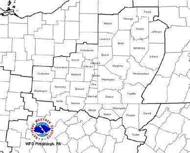
Executive Summary
Post-tropical Sandy will bring significant impacts to our region.
High Wind and Blizzard Warnings along with a Flood Watch are in effect.
Threats
• Wind- Sustained 25-35 mph with gusts as high as 60 mph. This may
lead to downed trees and power outages across the area.
• Flooding- Small creeks, streams, and areas of poor drainage through
Tuesday and then rivers possibly later this week.
• Heavy/wet snow- Elevation dependent with currently 8-14 inches
forecast above 2500 feet. Small changes in Sandy’s track and
ultimately temperatures could still lead to significant changes in this
forecast. Blizzard conditions will occur in the highest elevations.
Significant impacts will begin this evening, with the strongest winds and
heavy rain through Tuesday morning. Wind damage may lead to power
outages across the area.
Forecast Track of Sandy
       as of 5 AM Monday

The post-tropical surface low of Sandy is forecast to come closest to
the area late on Tuesday. Impacts will extend far from the center of
the low.
Watches/Warnings in Effect

Flood Watch for our forecast area
Today through Tuesday

High Wind Warning for our area
Noon Today – Noon Tuesday

                                    Blizzard Warning
                                    Elevations above 2500 ft, especially
                                    south of Oakland, MD
                                    6 PM Today through 6 PM Tuesday
Wind Forecast
Sustained Wind Speed on left
    Winds gust on right

                               5
Forecast Rainfall

2-4 inches of rainfall possible through Wednesday morning.
Storm Total Snowfall
                 6pm Monday – 8 pm Tuesday

                                                              • Tucker, Garrett, and Preston
                                                              counties will be on the northern edge
                                                              of heavy accumulating snows and
                                                              blizzard conditions.

                                                              • Low confidence forecast in snowfall
                                                              amounts
                                                                   -If temperatures are slightly
                                                                   colder, 1-2 feet of snow are
                                                                   possible in the ridges.
                                                                   -If temperatures are slightly
                                                                   warmer, less than 8 inches
                                                                   possible in the ridges.

       8-14 inches of                                         • Snow will begin as early as 2 PM
       heavy wet snow                                         today above 2500 ft with Blizzard
                                                              conditions (visibilities near zero and
       are possible                                           winds at 40 mph possible as early as
                                                              6 PM this evening.

Significant accumulation mostly for locations above 2500 ft
Potential Impacts
1) Strong gusty winds (Tonight into early Tuesday)
- Coming from the Northwest at 25-35 mph with gusts to 50-60 mph
- Possible downed trees and some power outages
2) Heavy rain and flooding (Today into Thursday)
-Flooding possible Tuesday into Wednesday on creeks and streams
-River flooding possible late this week
-NOTE: plenty of leaves on the ground and this will worsen flooding
potential with possible clogged drains
3) Heavy, wet snow and Blizzard Conditions (Tonight until Tuesday)
-Ridges of WV and MD are right on the northern edge of the coldest air and
heaviest snowfall with 8-14 inches of accumulation possible
-Snow and strong winds with blizzard conditions
(near zero visibilities and winds over 40 mph)
-The weight of heavy wet snow may lead to trees and power outagesTiming Details
1) Strong gusty winds (Tonight into Tuesday)
Strongest and damaging winds after 9PM and continuing until 9AM Tuesday.
Flooding in urban poor drainage areas possible after midnight tonight.
2) Heavy rain and flooding (Today into Thursday)
Flooding in urban poor drainage areas possible after midnight tonight.
Creeks and streams filling to near bank-full by Tuesday morning and flooding
possible by Tuesday afternoon.
3) Heavy, wet snow (Late Tonight until Wednesday)
Snow beginning to mix in with rain above 2500ft around 2PM in Preston,
Tucker, and Garrett Counties.
Blizzard conditions beginning as early as 6PM above 2500 ft.
Snowfall rates decrease and blizzard conditions subside by Tuesday evening.
Accumulating snow possible through Wednesday across the ridges.Preparations
Final preparations for the strong winds, heavy rain, and blizzard
conditions need to be made early today.
Suggested precautionary/preparedness actions:
1. Avoid unnecessary travel tonight into early Tuesday.
2. Fuel up your vehicles.
3. If have a generator, assure you have adequate fuel on hand.
4. To prepare for the possibility of prolonged power outages, make sure you have a
supply of fresh batteries and a supply of candles or flashlights on hand.
5. Be sure to have several days of fresh water on hand for drinking and cooking.
6. Secure or store loose items outside as they could become airborne in strong winds.
7. Clean out any storm drains or gutters that may be clogged by leaves.
8. If you live in a flood prone area and if possible, consider moving items that may be
damaged to higher ground.
9. If you have limited mobility or know of someone who may be disabled, consider
arranging for temporary shelter if they live in an area that may flood or could lose.Updates Ahead
Continue to monitor NWS products and additional Decision Support
Products for more information.
Briefing packages will be distributed daily until further notice. A
webinar/conference call will be conducted at 1100 AM this morning and
1230 PM today for the rivers.
• 11am info: Register at the following link
https://www2.gotomeeting.com/register/531057954
Conference call info: 800-369-1995 pin 44880 Press *6 to mute phoneWeather Information
• Visit our website www.weather.gov/pittsburgh for the latest information:
Weather Dashboard: http://www.erh.noaa.gov/pbz/newdashboard/index.html
• Sign up for NWSChat – great way to receive the latest information from the National Weather
Service in Pittsburgh
Call us if you need information: 800-242-0510
• Follows us on
• Like us on
http://inws.wrh.noaa.gov/You can also read