Institute for Sensible Transport - Capability Statement
←
→
Page content transcription
If your browser does not render page correctly, please read the page content below
Capability Statement
Institute for
Sensible Transport
Who we are
and what
we do
‘a city is judged
by the quality
of its streets.’
Jane Jacobs

2
The Institute for Sensible Transport is an Australian
transport consultancy focused on helping cities become
more vibrant and sustainable. We develop innovative,
data-led transport strategies, rigorous analyses and
carefully designed plans, all focused on helping to make
cities more liveable, sustainable and vibrant.

As the urbanist Jane Jacobs said, a city is judged by the quality of its streets. We are committed to the
application of evidence based, best practice transport strategy to help make city streets great.

We work with all levels of government, both in Australia and internationally on sustainable mobility,
disruptive transport innovation, professional development, as well as policy and strategy formation.

Our key capabilities include:
• Disruptive transport innovation

• Active transport planning, forecasting
  and cost benefit analysis

• Bicycle plans, strategies, network designs, and ‘complete streets’ development

• Car parking policy and reform

• Active transport wayfinding strategy and design

• Study tours and seminars on transport innovation

• Electric bike policy and assessment of impacts

• Bike share feasibility and evaluation

• Transport emissions auditing and emissions reduction strategy development

• Place based transport plans

• Shared transport platform policy development.

                                                                                                            3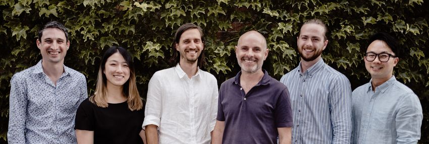
Our
People

4
Dr Elliot Fishman
Director

As the Director of the Institute for Sensible Transport over the past 15 years, Elliot has played
a pivotal role in all of our major projects and leads our work on bike share, e-bikes, disruptive
transport and professional development. Dr Fishman has extensive experience in the field of
integrated transport planning, and was coordinator and lecturer of the Integrated Transport
Planning course at RMIT University.

Dr Fishman’s ability to inspire cities to think boldly about the city they want to be in 50 years
is highly sought after, both in Australia and internationally. Elliot has led investigations for
governments around Australia on emerging transport technology and the implications for
policy makers. Dr Fishman is ranked by Stanford University in the top 2% of scientists globally.
He completed his PhD at the Centre for Accident Research and Road Safety and his Post Doc
at Utrecht University in the Netherlands.

Dr Fishman is a leading thinker on integrated transport and sustainable mobility planning,
having provided advice to the Prime Minister’s Office, Transport for London and the NYC
Department of Transportation. In recent years he has prepared ambitious, best practice
transport strategies for local governments in Victoria, South Australia, Tasmania and NSW.
These have included land use and transport planning elements that have sought to maximise
the beneficial components of emerging transport technology, such as MaaS possibilities and
the shift from short car trips to active transport. Dr Fishman’s innovative work on the possible
impacts of driverless vehicles has led governments to rethinking how best to capitalise on the
emergence of these technologies.

Elliot has written for The Age, Newscorp publications, the Canberra Times, Sydney Morning
Herald as well as many of the world’s highest-ranking peer reviewed transport journals. Elliot
has undertaken work for the OECD and the National Government of Singapore. Dr Fishman
is an experienced communicator and has facilitated a large number of transport planning
workshops and has an excellent ability to write technical documents accessible to a wide
audience.

                                                                                                    5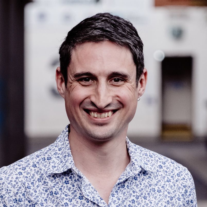
Liam Davies
      Senior transport analyst and
      cost benefit modeller

      Liam is a Senior Transport Analyst and has worked for the Institute
      for Sensible Transport since late 2015. Prior to his appointment at
      the Institute for Sensible Transport, Liam was RMIT’s top transport
      planning student, demonstrating his understanding of transport
      research and strategic principles, emerging issues and best practice
      transport innovation. He has an in depth knowledge of the Victorian
      Planning Scheme as well as the NSW DA and LEP process.

      Liam’s excellent GIS and analytical skills have helped our clients
      understand their current transport problems and his ability to
      envision a path towards a more sustainable, less car dependent
      future has proven tremendously valuable to the government
      agencies he has worked with. Liam has a deep understanding
      of all modes of public transport, including their operational and
      infrastructure requirements. There is always a public transport
      element in the projects Liam is involved in.

      Vaughn Allan
      Senior transport analyst

      Vaughn has worked as a Transport Analyst at the Institute for
      Sensible Transport since 2017. He has also worked at the Department
      of Premier and Cabinet, and Bicycle Network. Vaughn has a very
      strong understanding of the Victorian Planning Scheme, transport
      data analysis, street redesigns, integrated transport, active transport
      and GIS based analysis and modelling.

    Our People
6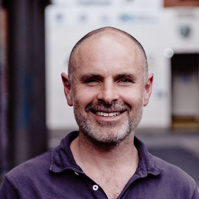
Takuya Katsu
Takuya is in his final year of a Masters in Urban Planning and Design
at Monash University. Prior to this, Takuya worked for many years in
the film industry, as a sound engineer. Blending these two disciplines,
Takuya is passionate about the impact and influence sound has on
our cities.

At the Institute, Takuya takes a lead role in the development of info
graphic material, car parking assessment and visualisation, policy
review and visual communication. Takuya is a competent map maker
and creates visual storyboards using ArcGIS Online and other online
platforms.

Jack Batson
Jack is a geospatial scientist with a passion for creating high quality,
engaging maps. Jack is able to bring together data across a range of
fields to create insights for clients on transport and land use patterns.

Jack has a passion for cities and a deep interest in the factors that
influence how people choose to move. He completed his Honours
project on dissecting the 20-minute neighbourhood concept and is
highly competent in the use of GIS tools to examine transport and
land use data. His keen eye for detail and aesthetics elevates the work
of the Institute and helps clients make informed decisions regarding
the future of their city.

Jessie Tram
Jessie is currently undertaking a Bachelor of Urban and Regional
Planning at RMIT. She completed undergraduate transport planning
and received the highest mark in her year. Her excellent analytical
skills combined with strong written communication helps to make
the Institute’s reports clear, accessible and impactful. Her passion for
transport planning and the potential to make cities better underpins
the motivation she brings to her work

                                                                           7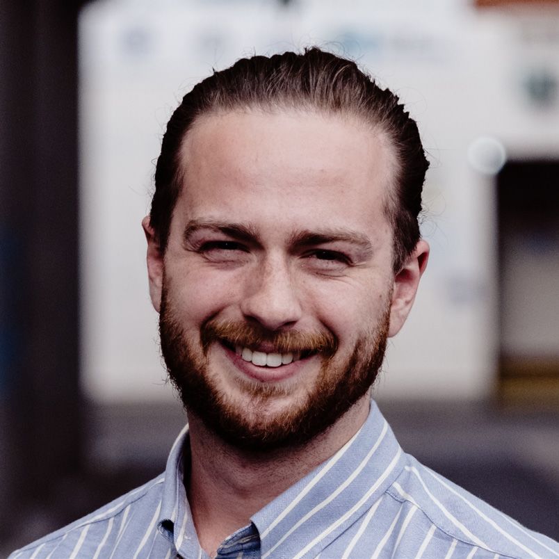
8

Selection
of recent
projects

            9
Project                                                                 Clients

Melbourne Bike
                                                                        City of Melbourne, City of Port
                                                                        Phillip, City of Stonnington,

Network Model                                                           City of Yarra & Maribyrnong City
                                                                        Council; 2019

This project was commissioned jointly by Melbourne’s five
inner most Councils and Resilient Melbourne. It involved the
development of a Model to determine the level of bike riding taking
place across the Inner Melbourne Action Network (IMAP) and
forecast the increase in bike riding due to infrastructure upgrades.
The Model provides a range of analysis options that can be visualised into either static or
interactive maps. We provided maps that illustrated showing crash exposure, and the projected
number of daily bike trips on every street and road in the study area. Additional analysis
opportunities were also realised, including the ability to filter Model variables to create ‘corridors
of opportunities’, including one that highlights areas most likely to mode shift from cars to bikes.

The Model was developed with a methodology designed to be easily updatable by Council staff
and expandable to Greater Melbourne and other metro areas.

Bike Network

10
Project Client
Bike Network
Prioritisation Tool Transport for NSW, 2020
We were commissioned by Transport for NSW to develop a
geospatial prioritisation framework to assist in the staging
of their proposed Principal Bicycle Network for Sydney
and Parramatta. The Framework was able to analyse over
1,300km of future proposed network, providing a score
across 16 individually weighted criteria.
Transport for NSW were presented with a representation of their proposed network, in
terms of how each element performed across each of the 16 criteria. The 16 criteria were
divided into desirability and deliverability categories. The desirability and deliverability
conceptual framework (as shown below) was used to inform the development of the
bike network, such as prioritising links and estimating latent demand for cycling.
Our network tool is also useful for costing the proposed network, and how the use of
different designs can influence overall cost.
Stage 2 Stage 1B
Short-Medium Priority (BA) Immediate Priority (AA)
Deliverability
Medium Priority (BB) Immediate-Short Priority (AB)
Desirability
Desirability and deliverability conceptual framework
11Project Client EV Charging Implementation Plan City of Port Phillip, 2019 In partnership with SGS Economics and Planning, we led this project for the City of Port Phillip, to prepare their transition to a zero-emission fleet by 2028. This project involved a detailed analysis of best practice electric vehicle charge examples, from both Australia and overseas, and an audit of the Council’s existing fleet. We also developed a proposed publicly available charging network, including a policy to allow residents without off street parking to charge their vehicles. Our work with the City of Port Phillip provided the blueprint for a zero emission fleet and a publicly available charging network. A public charging network is essential for greening Australia’s vehicle fleet 12
Project                                                                  Client

Sustainability
Mobility Plan                                                            City of Launceston, 2020

In partnership with SAGE Automation, we developed the Launceston
Sustainable Mobility Plan. We worked as part of a larger consortium
on a Smart Cities project designed to help Launceston take
advantage of changes to transport technology (e.g. on demand
transport, micro mobility) to support Launceston’s ambition to
become Australia’s most liveable regional city.
The development of the Sustainable Mobility Plan included consideration of all modes of
transport, as well as measures that take advantage of emerging technology to maximise the
efficient use of space and resources.

Cycling was one component of this Plan and included an enlarged network of bicycle
infrastructure. The map shown below was developed for this project and indicates both the type
of bicycle infrastructure proposed and the estimated travel time to travel between key centres.

Launceston conceptual bike network showing existing and proposed routes
with estimated journey times

                                                                                                    13
Project Client
Narre Warren Access
& Movement Study Casey City Council, 2020
We were commissioned by Casey City Council to prepare the
Narre Warren – Fountain Gate Access and Movement Strategy. The
Strategy identified transport and infrastructure projects to support
a recently adopted Structure Plan for the Fountain Gate Narre
Warren Metropolitan Activity Centre. The project was funded by the
Victorian Planning Authority’s Streamlining for Growth Grant.
We used a mix of Census data, number plate surveys, and site visits to develop a deep
understanding of how people access the area and where they come from. This project delivered
a set of recommendations covering enhancements to the pedestrian environment, enhanced
cycling options, better integrated public transport and more effective parking management. We
also delivered recommendations designed to reduce the impact of through traffic on the activity
centre.
This Access and Movement Strategy provided a comprehensive set of actions designed to change
the transport landscape in Narre Warren Fountain Gate, in order to achieve the goals set out in
the Structure Plan, and the targets established in this Strategy. The key challenges and actions are
summarised in the figure below.
Major challenges Key actions
Lower traffic volume
Poor pedestrian New crossings Raised threshold Lower speed limits
on pedestrian
amenity and safety opportunities treatments on key streets
priority streets
Barriers to cycling Key cycling links including protected bike lanes Better integration
as a transport mode on Webb Street and Victor Crescent of cycling and public transport
More bus stops
Poor bus service More direct routes Better coverage
in key destinations
Enhanced station
Pedestrian and cycle bridge
access and connection Green spine along Webb Street
over Cranbourne Rd to station
to Fountain Gate
27 Real time information displays Parking controls to better
Car parking 121
on parking availability coordinate supply and demand
Wayfinding strategy to provide directional
Legibility
signage for people walking and cycling
Narre Warren’s major transport challenges and key actions
14Project Client
Yarra Ranges Integrated
Transport Strategy Yarra Ranges Council
2018
We prepared a 20-year Integrated Transport Strategy for Yarra
Ranges, a peri-urban and partly rural municipality on the eastern
fringe of Melbourne. The Strategy was endorsed by Councillors in
May, 2020.
Community consultation was an important element in the development of the Strategy,
and this included pop up sessions, online surveys and interactive online maps of both the
strengths and limitations of the transport system.
A detailed analysis of existing travel behaviour was undertaken, and this found that over half
of all car trips were under three kilometres, partly dispelling the myth that most car trips are
too long to do by foot or bike. Our analysis of land use patterns also found that 90% of the
population lives in just 9% of the land area.
In the Yarra Ranges, where many streets were designed decades ago, the strategy delivers
a set of preferred street redesigns (as shown below) to adapt to today’s transport and
liveability challenges.
2.6 2.3 1.5 0.6 2.1 3.0 3.0 0.6 1.5 2.3 2.6
Footpath Bike Parking Driving Driving Bike Footpath
22.0 m
A preferred street redesign for Yarra Ranges’ Activity Centres
15Project Client
Australian Guidelines Austroads / Australian
for Active Travel Transport Assessment
and Planning, 2020
We have been commissioned by Austroads/Australian Transport
Assessment and Planning (ATAP) to update the national Guidelines
for Active Travel assessment and planning. This project has required
our team to immerse themselves in the latest data/literature
regarding:
• Walking and cycling planning
• Impact and evaluation methodology
• Health impact assessment
• Road safety
• Best practice network design.
The Guidance document is designed to assist practitioners responsible for the planning, design
and evaluation of active transport infrastructure.
Tool to determine appropriate bike infrastructure design
16Project Client
Darebin Parking Strategy: Darebin
City Council,
Issues and Opportunities 2018
This project involved a detailed policy and data analysis on
issues related to car parking, to assist Darebin City Council as
it began a process of car parking policy reform.
This project enabled our team to demonstrate what can be gained by reforming parking
policy, including the opportunity created when unnecessary parking is replaced by wider
footpaths, more green space, protected bicycle lanes and public transport priority routes.
The two images below offer an impression of the conceptual proposal we were able
to offer the client, highlighting that when kerbside parking is removed, more space is
available for protected bike lanes, dedicated tram routes and more reliable and less
frustrating general traffic lanes. Creating these multi-modal ‘complete streets’ is a core
part of our work.
High Street, Thornbury, VIC High Street, Thornbury, VIC
(current) (conceptual proposal)
17Project Client
Transport City of
and Emissions Melbourne,
2018
We assisted the City of Melbourne in developing a stronger
understanding of the emissions within their municipality
attributable to transport (air, land, water).
We were able to provide a snapshot and data led discussion of current trends in
transport emissions. We aligned the City of Melbourne’s method of calculating
emissions with international (GPC) protocols. This project also provided a set of
recommendations designed to bring the City of Melbourne’s transport emissions in line
with climate change commitments.
To help illustrate the relationship between emissions, and space consumption, we
developed the infographic shown below, which demonstrates why public and active
transport are so important for growing cities seeking to reduce their emissions and
congestion levels.
The black balloons represent emissions, while the footprints represent the space
consumption of the different transport modes shown.
243.8
209.1
121.9
119.6 28.6
20.2
17.7
6
Average Tesla Model S Dual Motorcycle Train Tram Bus Tesla Model S e-Bike Bike Walking
Victorian (Victorian grid) occupancy (Green power)
car car
Dirty Clean
.5 .6 .8 .5
1.9 1.5 1.5
4.9
9.7 9.7 9.7
= Grams of CO 2 per person kilometre travelled = Space in m 2 required per occupant
Understand the emissions and space intensity of different transport modes
18Project Client
Dockless Bike Share VicRoads,
Parking Infrastructure Guidelines 2017
Melbourne, like many other cities,
witnessed the unplanned introduction
of dockless bike share in 2017.
In this work, we assisted the Victorian government develop an
understanding of the parking requirements of dockless bike share
and what measures could to taken to enhance the contribution of this
growing mode of transport to mobility options in cities.
In this VicRoads commissioned report, we highlighted the
experience of other cities with dockless bike share and identified
strategies that could be used in Victoria to enhance micro-mobility
options while protecting the public realm from an influx of randomly
placed bikes.
The problem associated with poorly designed bike share in Melbourne
19Project Client
Homebush Bay Wayfinding City of
Strategy and Masterplan Canada Bay,
2017
We led an international consortium to deliver Testimonial
a comprehensive design for a cohesive walking “The Institute for Sensible Transport
and cycling circuit around Sydney’s iconic were able to demonstrate an exceptional
Homebush Bay, the site of the 2000 Olympics. understanding of world’s best practice in
balancing the needs of different modes
This Homebush Bay Wayfinding Strategy and Masterplan was of transport and integrating more walking
commissioned by the City of Canada Bay, Sydney Olympic Park and cycling into local travel…(They)
Authority and the City of Parramatta, and funded by the NSW utilised graphically clear street cross
Government. sections and mapping demonstrating
that the provision of safe and attractive
walking and cycling facilities could be
achieved on the Circuit while recognising
the needs of motorists”
Vincent Conroy,
Place Management
Coordinator, City of Canada Bay
We developed a comprehensive walking and cycling network,
integrated with wider transport opportunities in Sydney
20Project Client
City of
Bike Plan Parramatta,
2017
As Parramatta continues its urban intensification and rapid
population growth, we assisted the City of Parramatta in the
development of a detailed Bike Plan, designed to boost the
contribution of cycling to meeting current and future transport
challenges.
This project involved a ‘saddle survey’ using HD handlebar mounted video and a specially
designed mobile app to document existing conditions and potential improvements (see
snapshot of data overview below).
A detailed network of bicycle lanes and paths were recommended, costed and usage
forecast provided over the next 30 years, taking into account government estimates of
population growth rates.
We were able to provide Parramatta with a cost benefit ratio, offering an indication of the
long-term return on investment in building their bicycle network. To ensure that the bicycle
infrastructure was being recommended in the areas with the highest latent demand, we
developed a data-led Bike Use Propensity Index, utilising Census and bicycle count data, the
results of which are shown below. This helped to ensure the infrastructure recommended
was being placed in the areas most likely to be used.
The collection of detailed, A data-led illustration of where
local data in a GIS format is latent demand exists for future cyclng
essential to our approach
21Project Client
Hampton Park Central Casey
Access and Movement Study City Council,
2017
We recently completed
this place-based
transport plan for Casey
City Council.
The focus was on people, rather
than vehicles and this led to a
design process in which priority
was offered to pedestrians, cyclists
and public transport users, as
these are the modes that are
current under-represented within
this Activity Centre.
As with all our work, a data-led
approach was taken and this
included an analysis of the address
of registration for the vehicles
parked within the study area
(see image below). This provided
our team with insights as to the
likely distance people may have
been travelling to arrive at the
Activity Centre. Most vehicles
were registered at the same, or an
adjoining postcode to the study
area itself.
Understanding where cars are registered
22Project Client
Potential for electric
bike use in Melbourne City of
Melbourne, 2018
As part of the City of
Melbourne’s Transport
Strategy Refresh, we
provided an analysis of
the potential for e-bikes
to contribute to the
growing transport task
facing a fast-growing
Melbourne.
16k
m
This project included an overview
of the latest developments in
10k
m
the e-bike market, the influence
6k
e-bikes are having on travel
m
4km
behaviour in other markets and
what the City of Melbourne can
do to maximise the contribution
of e-bikes to provide safe, efficient
mobility.
City of Melbourne workers commuting by bicycle
1 Dot = 1 cyclist
Potential e-cyclists (proportinal increase)
Current cyclists
City of Melbourne Boundary
0 2.5 5 10
km
Helping the City of Melbourne understand the potential for
e-bikes to meet the growing transport challenge
23Project Transport innovation study tour to the Netherlands The Institute for Sensible Transport uses its extensive network of Dutch transport and land use experts to curate a week-long tour of transport innovation in the Netherlands. An emphasis is placed on translating best practice examples into the Australian context and past attendees have included representatives from Infrastructure Australia, Transport for NSW and local government transport planners and Councillors from around Australia. Our study tours look at the Dutch transport and land use system as a whole, with a focus on lessons that can be translated into more car dependent contexts. Whilst it is impossible to ignore cycling in the Netherlands, our study tours take a broader view, encompassing the full set of transport options in the Netherlands and what it means for Australian cities. The 2018 study tour delegates learning about street transformation and vibrancy from the chief landscape architect, City of Amsterdam 24
Project

Professional
development seminars                                                      2010
                                                                          - ongoing

The Institute for Sensible Transport have, for over eight
years, held professional development seminars on a range of
emerging transport topics.
These include seminars on:
• Innovations in parking policy and practice, with the world’s foremost
  authority on the topic, Professor Donald Shoup.
• App and ride sharing services and the impact on mobility,
  with Professor Allan Fels, Uber and the taxi industry.
• The Psychology of Transport Behaviour with New York Times best selling author,
  Tom Vanderbilt.
• Road user pricing and autonomous vehicles with former Victorian Premier
  John Brumby, Reserve Bank Board Member Professor Ian Harper, and the then
  Productivity Commission Chairman Peter Harris.

The former Premier of Victoria, John Brumby AO, delivering his Keynote
address at our seminar on road user pricing in 2017

                                                                                      25
Project Client
Sydney Bike Share Inner Sydney
Feasibility Study Councils,
2017
We assisted a group of inner Sydney Councils understand the
global context regarding the rapidly changing international bike
share industry.
Our work included:
• Bike share case studies from London, • Assessment of suitable bike share
NYC, Washington, D.C., San Francisco, hardware for Sydney.
Melbourne, and Brisbane.
• Optimal process for user sign up and
• Key benefits and opportunities for bike customer interface.
share in Sydney.
• Consideration of helmet requirements
• Integration of a future Sydney bike share and potential measures to mitigate lower
program with public transport, including usage levels due to existing legislation.
options for Smartcard compatibility.
• Bicycle infrastructure network and
• Bike share propensity index: This was impact on usage
developed as a map of Sydney, indicating
• Potential funding sources and program
areas of high and low forecast bike share
costs.
use.
• Governance and contract management.
• Design principles for the placement of
docking stations.
26
Sydney Bike Share Feasibility StudyIntegrating
sustainability
Creating more sustainable cities and towns through
transport innovation underpins everything we do.
Naturally, our commitment to sustainability also covers
our own business practices.
We lower our environmental footprint everyday through the following actions:
• Our office is powered by 100% certified Greenpower (wind)
• Use public transport and cycling as our default mode of transport to the office,
meetings and site visits. Use an electric vehicle when travelling beyond the active or
public transport network
• Only use 100% post consumer waste recycled paper in the office
• Offset our emissions from air travel and only choose to travel by air when there are
no other options
• Use green/biodegradable cleaning products in the office.
The former Premier of Victoria, John Brumby AO, delivering his Keynote
address at our seminar on road user pricing in 2017
27Institute for Sensible Transport ABN 78 504 466 884 102/1 Silver Street Collingwood, Melbourne, Australia VIC 3066 E: info@sensibletransport.org.au www.sensibletransport.org.au T: 1300 952 759
You can also read