MEDIA PLANNER - The Institute of Navigation
←
→
Page content transcription
If your browser does not render page correctly, please read the page content below

M E D I A P L A N N E R
EDITORIAL CALENDAR 2021
Mapping, Innovation
Cover Story Secondary Feature Special Sections & Research Bonus Distribution
JANUARY Receiver Innovator Q&As: Mapping Marvel ION ITM/PTTI
Technologies & Trends (Jan. 25-28)
Ad Close: 12/4 (Part 1 of 2)
Materials: 12/11
FEBRUARY Receiver Innovator Q&As: Innovation
Technologies & Trends (Part 2 of 2)
Ad Close: 1/7
Antenna Innovator Q&As:
Materials: 1/14 Technologies & Trends
MARCH Leading-Edge Applications: Simulator Buyers Guide Research Roundup
Machine Control—
Ad Close: 2/2 Three case studies: precision
Materials: 2/11 agriculture, construction,
and port automation
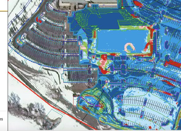
APRIL Leading-Edge Applications: UAV-based lidar surveying Mapping Marvel European Navigation
UAVs Conference
Ad Close: 3/4
(April 11-16)
Materials: 3/11
AUVSI XPONENTIAL
(May 3-6)
MAY Leading-Edge Applications: Machine control for Innovation Joint Navigation
Defense & Government an expanding list of Conference
Ad Close: 4/1 equipment types (July 7-10)
Materials: 4/8
JUNE Leading-Edge Applications: Crowd-sourced GNSS/PNT Buyers Guide Research Roundup ESRI User Conference
Mapping dead reckoning (July 12-16)
Ad Close: 4/27 and mapping of Contact Emily Adkins
Materials: 5/5 indoor environments 216-675-6006 for more
information on the
GNSS/PNT Buyers Guide
IN EVERY ISSUE
LAUNCHPAD | SURVEYING & MAPPING
Launchpad MARKET
WATCH
Segment Snapshot:
Applications, Trends & News
Market Watch SYSTEM
OF SYSTEMS
Policy and System
Developments
GPS GLONASS BeiDou Galileo
System
of Systems
2 3
UAV
New product releases Business news in
2
Fighting Coronavirus with Delivery Drones Third GPS III Satellite Orbiting
Through its group company Antwork, Japanese
Photo: TerraDrone
GPS III SV03 increases the number of There, they declared rocket booster over any previous GPS satellite. They
company Terra Drone is employing its UAV system
in survey, mapping, survey, mapping,
military code (M-code)-enabled GPS separation and satellite control about also offer the L1C civil signal, which
to transport medical samples and quarantine satellites to 22 in the 31-satellite GPS
supplies in China to fight the coronavirus. 90 minutes after the satellite’s launch is compatible with other international
constellation. aboard a SpaceX Falcon 9 rocket from global navigation satellite systems, like
A
1 5 t 9 a.m. on Feb. 6, a medical delivery drone Cape Canaveral Air Force Station, Europe’s Galileo, to improve civilian
GNSS constellation
flew from the People’s Hospital of Xinchang
A
fter a successful launch Florida. The Falcon 9's Stage 1 booster user connectivity.
County to the disease control center of Xinchang on June 30, the third successfully landed on a pad at sea. GPS III also continues the Space
OEM, UAV, mobile, OEM, UAV, defense
County, marking the launch of the first urban-air Lockheed Martin-built Once in operational orbit, SV03 will Force’s plan to field M-code, a more-
transportation channel to help fight the novel coronavirus GPS III satellite headed deploy its solar arrays and antennas, secure, harder-to-jam and spoof GPS
(COVID-19 ), a global health emergency. to orbit under its own and then be handed off to Space signal for U.S. and allied military forces.
As of press time, the World Health Organization reports propulsion. The satellite separated Operations Command. Originally scheduled to launch
4 at least 297,090 people are infected and at least 12,755 have from its rocket and used onboard After on-orbit testing, GPS III SV03 on April 29, the GPS III-3 mission
developments and
died. China, where COVID-19 originated, is in a tense period power to climb to its operational orbit, is expected to join the GPS constellation took a 60-day tactical pause to protect
of epidemic prevention and control. Xinchang County is in approximately 12,550 miles above Earth. — including GPS III SV01 and SV02, launch and operations crew during the
defense & government, & government,
1. RTK THERMAL MAPPER be monitored in real time anywhere in 4. MOBILE MAPPING
ASPHALT PAVING WITH RTK the world. The Z-Boat 1800-T is a high- INERTIAL NAVIGATION SYSTEMS Zhejiang province — one of the areas most severely hit by GPS III Sp ace Vehicle 03 is which were declared operational in COVID-19 pandemic, with minimal
POSITIONING resolution shallow-water hydrographic the virus. responding to commands from U.S. January and April. impacts to cost and schedule.
unmanned survey vehicle with the newly
A drone departs from the disease control center of Xinchang
The Atlans Series of FOG-based inertial As soon as the Wuhan quarantine began on Jan. 23, County. Space Force and Lockheed Martin The new GPS IIIs provide three times The fourth GPS III satellite is
The Thermal Mapper is designed to released Odom Hydrographic Echotrac navigation systems (INS) is designed for land
E20 Singlebeam Echosounder and dual-
Antwork petitioned to provide drone technical support. engineers in the Launch & Checkout better accuracy and up to eight times scheduled to launch in August.
policy news
monitor temperature segregation to and air mobile-mapping applications. Based
prevent future problems and measure antenna Trimble BX992 GNSS heading on iXBlue’s fiber-optic gyroscope (FOG)
Antwork’s RA3 and tr7s drones and unmanned RH1 ensure the safety of medical samples during transportation. Center at the company’s Denver facility. improved anti-jamming capabilities
performance, as well as provide accurate receiver. Each sensor is integrated into technology, the Atlans Series is a scalable station are ensuring that medical samples and quarantine Using drones has increased the speed of transport by
transportation, and transportation, mobile,
compliance reporting, using real-time a compact, portable package for marine range of north-seeking and north-keeping materials can travel with minimal risk between Xinchang more than 50% compared to road transportation, proving
kinematic (RTK) positioning accuracy.
It records temperature readings behind
construction and allows data collection
under harsh conditions. Both sensors
can be removed and mounted on other
INS. They provide FOG performance to
the full spectrum of land and air mobile-
County People’s Hospital and Xinchang County’s disease
control center. The automatic, unmanned air delivery system
to be a more efficient means of transportation for epidemic
prevention and control. The drones also relieve the personnel
China Completes BeiDou-3 Constellation
an asphalt paver during paving and mapping applications and offer highly
Screenshot: China Global Television Network video
C
provides a visualization to operators in watercraft and barges. accurate positioning up to 0.01 meter in all
significantly reduces contact between samples and personnel, shortage as more and more medical staff and ambulances are hina completed its worldwide
real time of whether the mix falls within Teledyne Marine, teledynemarine.com conditions, including within GNSS-denied as well as improves delivery speed. transferred to the front lines — making the best use of human BeiDou navigation satellite
a predefined temperature range. If the Trimble, trimble.com environments such as urban canyons, Antwork branch company Aerodeli, which undertook the and material resources. system on June 23 with the
machine control and machine control
readings are unacceptable, operators mountainous or forested areas. operation, obtained the first urban drone delivery license After the project for Xinchang People’s Hospital was launch of its final satellite, marking
can make adjustments. The system also 3. AERIAL MAPPING iXBlue, www.ixblue.com issued by the Civil Aviation Administration of China (CAAC) put into operation, Antwork began assisting more medical the completion of the country’s
creates data reporting files to download for LARGE-FORMAT PHOTOGRAMMETRY
applications such as U.S. Department of in October 2019. The sample delivery work is carried out institutions in China to deploy drone transport services for domestically developed BeiDou-3
5. CENSUS DATA
Energy compliance through the interactive The 280MP Aerial Solution has an image 2020 NEIGHBORHOOD BLOCKS AVAILABLE
in strict accordance with certified operation procedures to the anti-epidemic effort. (BDS-3) constellation.
Pavelink module, the Topcon cloud-based coverage width of more than 20,000 pixels. The satellite launched aboard a
logistics application for asphalt paving. The large format enables high-quality The Maptitude 2020 U.S. Census Blocks Long March-3B carrier rocket from
Topcon Positioning Group,
topconpositioning.com
aerial surveys. Compact and lightweight,
the aerial mapping solution consists of
Groups data is now available for the United
States. The small-area Census Summary Level Drones Go to Work for U.S. States the Xichang Satellite Launch Center at
9:43 a.m. Beijing time (0143 GMT). The
an iXM-RS 280F large-format camera, is packed with neighborhood information for
roneUp LLC and seven of the United The award is the first of its kind for the all 50 states, the District of Columbia,
2. UNMANNED FLEET
AIDS NEAR-SHORE PROJECTS
Applanix GNSS/inertial measurement
unit (IMU) POS-AV receiver, DSM 400
Somag gyro-stabilized mount, Phase One
making accurate geography-based decisions.
Users can explore locations by income, income
growth, daytime population, age, race, gender,
D States have signed Participating
Addendums for the NASPO ValuePoint
drone industry, according to DroneUp, an
end-to-end drone pilot service provider
and the territories of the United States
through the National Association of
launch followed a delay after originally
being scheduled for July 16 because of
a technical issue discovered in pre-
The Z-Boat 1800-T unmanned survey iX Controller and iX Flight Management ethnicity, occupation, housing characteristics contract for UAV services. for aerial data collection. DroneUp was State Procurement Officials (NASPO) flight tests.
vessel is equipped with Trimble’s high- software. It is designed for use in a wide and more. The data can be leveraged by The signed addendums open the door awarded Unmanned Aerial Systems ValuePoint Cooperative Purchasing
range of aircraft. data scientists and market research analysts
The final satellite is a geostationary
precision GNSS heading receiver for agencies in these states to purchase (UAS) Services Master Agreement #E194- Organization. The signing states are now
and compatible with Trimble Marine Phase One Industrial, using the Maptitude application. The files Earth orbit satellite of the BDS-3 short-message communication. service to the Asia-Pacific region.
Construction (TMC) software. The Z-Boat industrial.phaseone.com are also available as shapefile, KML, KMZ or complete drone solutions. As of press 79435 by the Commonwealth of Virginia able to use the award for the benefit of system. It is the 30th BDS-3 satellite Begun in 1994, BDS-1 was Once the final satellite achieves
1800-T enables marine construction and GeoJSON. time, states that have signed include in August 2019, established as contract state departments, institutions, agencies, and the 55th BeiDou satellite. BDS-3 is completed in 2000 to provide orbit and is checked out successfully,
dredging projects to run efficiently and Caliper, www.caliper.com Alaska, Arizona, Connecticut, Utah, number #2020DRONE0002. The services political subdivisions, and other eligible a 30-satellite navigation system, which services to China. In 2012, BDS-2 was BDS-3 will provide navigation services
Montana, New Mexico and South Dakota. under the award are available for use by entities. offers high-precision positioning and completed and has provided navigation worldwide.
G P S W O R L D 39 10 G P S W O R L D
|
APRIL 2020 WWW.GPSWORLD.COM
|
12 G P S W O R L D WWW.GPSWORLD.COM AUGUST 2020
|
WWW.GPSWORLD.COM MAY 2020
2
EDITORIAL CALENDAR 2021
Mapping, Innovation
Cover Story Secondary Feature Special Sections & Research Bonus Distribution
JULY Alternative PNT Innovator Mapping Marvel
Ad Close: 5/27 Q&As: Technologies & Trends
Materials: 6/3
AUGUST Leading-Edge Online post-processing Innovation
Ad Close: 6/22 Applications: Survey
Materials: 6/29
SEPTEMBER Simulator Innovator Q&As: Intergeo Research Roundup Commercial UAV
SUPPLEMENT TO
Ad Close: 7/28 Technologies & Trends Must-See Expo (Sept. 7-9)
Exhibits Guide MUST-SEE
Materials: 8/5 EXHIBITS GUIDE
ION-GNSS+
(Sept. 20-24)
PAGE EXHIBITOR BOOTH
Intergeo
S3 CHC Navigation B3.052
S4 Hemisphere GNSS C3.030
S5 JAVAD GNSS G1.050
S6 Lidar USA B3.042
(Sept. 21-23)
S7 Tallysman F3.082
S8 Tersus GNSS B1.006
OCTOBER Survey: What the availability of eLoran funding, testing and GNSS Solutions: Mapping Marvel
Ad Close: 8/25 four complete GNSS developments Suppliers discuss latest
constellations means tech and trends
Materials: 9/1 ADVERTORIAL
GNSS SOLUTIONS
Q+A Kolmostar with
Q: What is your most proven GNSS solution?
NOVEMBER
Lucy Fan
A: Kolmostar specializes in ultra-low-power, instant cold-boot GNSS positioning
Kolmostar
Leading-Edge OEM solutions for asset Innovation
VP of Sales and Marketing
solutions for Internet-of-Things (IoT) applications, mobile devices and beyond.
Q: What are the solution’s key specs?
A: Our advanced GNSS positioning module JEDI-200 is specially designed for
location-based IoT applications such as asset tracking, fleet management, pet/livestock
Applications: OEM tracking
tracking, smart wearables and share economy. It is also optimized for integration with
LPWAN (low power wide area network) technologies such as LoRaWAN®/NB-IoT/
LTE-M to provide the ultimate ultra-low-power profile for IoT applications. There are
two outstanding advantages of JEDI-200: ultra-low-power and instant cold-boot. With
Ad Close: 9/30
25mW power consumption and the revolutionary 1-second TTFF (time-to-first-fix),
JEDI-200 is able to reduce the energy consumption to get one position fix by up to 120x JEDI-200
compared to traditional GNSS modules on the market.
Q: What are the solution’s key features and benefits?
A: GNSS/GPS sensors are one of the most power-consuming sensors in IoT or
mobile devices. Battery life will be significantly shortened when GNSS/GPS sensors
are turned on. Hence, many IoT and mobile devices either do not include GNSS/GPS
sensors or have to equip themselves with very large-sized batteries, incurring much
Materials: 10/7
inconvenience and cost. Kolmostar’s ultra-low-power and instant cold-boot JEDI-200
module is specially designed to solve this long-standing industry pain point.
With its ultra-low-power feature, JEDI-200 is able to reduce the energy consumption Kolmostar Inc.
to get one position fix by up to 120x when compared to traditional GNSS modules. IoT 48531 Warm Springs Blvd
devices with very limited-sized batteries are now able to have GNSS positioning ability Ste.407, Fremont, CA 94539
while still maintaining a battery life up to 10+ years. Another key feature of JEDI-200
is instant cold-boot. Unlike traditional GNSS modules’ 30-second TTFF (time-to- Phone:
first-fix) in cold-boot, JEDI-200 can achieve an instant 1-second TTFF, providing a +1 510-270-8322
better and more seamless customer experience when short latency/response time is
particularly desired in certain applications. In addition, JEDI-200 is optimized for Email:
LPWAN technologies such as LoRaWAN®/NB-IoT/LTE-M, further reducing both the
DECEMBER
sales@kolmostar.com
cost and the power consumption of devices’ wireless communication, which is another
big challenge most IoT and mobile devices previously faced.
Leading-Edge Intelligent transportation Research Roundup
Web:
kolmostar.com
|
42 G P S W O R L D WWW.GPSWORLD.COM OCTOBER 2020
Ad Close: 10/28 Applications: Transportation systems Directions 2022
Materials: 11/4
Ad Close and Materials Due dates are subject to change. Bonus distribution also is subject to change if events are cancelled or become virtual.
IN EVERY ISSUE
GPS WORLD EDITORIAL ADVISORY BOARD
Tony Agresta, Nearmap Clem Driscoll, C.J. Driscoll Mitch Narins, Consultant
Miguel Amor, & Associates Bradford W. Parkinson,
John Fischer, Orolia
PNT Corner Seen & Heard
Hexagon Positioning Stanford Center for Position,
Inertial Ranging & eLoran Wi-Fi Bluetooth
corner
SEEN HEARD Intelligence Bernard Gruber, Navigation and Time
Northrop Grumman Stuart Riley, Trimble
WHERE’S THE BEEF? USE THAT APP IN GERMANY?
Thibault Bonnevie,
A new mapping app is NO WAZE!
MAGNETIC FIELDS helping Los Angeles The German
County residents find government has
Image: NOAA National Geophysical Data Center
Riding Earth’s Magnetism
News coverage of Photo-illustrated
more than 2,000 food amended its road
SBG Systems
resources, during and traffic regulations
Ellen Hall, Spirent Federal Jean-Marie Sleewaegen,
after the COVID-19 to outlaw apps
pandemic. Sponsored that alert drivers
by the non-profit 211 to speed cameras.
LA County, the LA The law makes it
Systems Septentrio
FoodFinder is powered by Slingshot Earth, which aggregates clear that any app
Alison Brown,
other positioning, news items from
food resources and service data from multiple public and private used for traffic-
sources. The app enables residents to find resources for child monitoring alerts
nutrition, meal services, groceries/food pantries, senior food is forbidden,
needs and government food benefits programs. Since the whether it runs on a phone, tablet or a GPS
NAVSYS Corporation Jules McNeff, Overlook Michael Swiek, GPS Alliance
COVID-19 outbreak, 211 LA County has experienced a 10-fold navigation system. Violating the traffic laws
increase in website traffic for food needs. and using speed camera apps inside a car could
result in a fine of up to €75 (about $83). Both
navigation and around the world
Garmin and TomTom have emailed registered
users alerting them to the news.
EMAG2 World Digital Magnetic Anomaly Map.
MAKING THE MOST OF GPS DATA
University of Nevada 2020 Outstanding
Researcher Geoffrey Blewitt has made the
most of GPS data to study changes in Earth’s
Ismael Colomina, Systems Technologies, Inc. Julian Thomas,
timing technologies GeoNumerics Terry Moore, University Racelogic Ltd.
crust, from the Ice Age to today. Nevada Today
BY Matteo Luccio / GPS WORLD CONTRIBUTING EDITOR changes very little over time. However, unlike topographic
outlines his significant discoveries, including
features, which only occur on the third of the planet’s
that GPS data may hold a key to detecting
T
here are many ways to navigate. For most ap- surface covered by land, magnetic variations also occur
dark matter. Other discoveries: Nevada is the
plications, none surpass the accuracy, afford- on the oceans. This makes them potentially very useful as
of Nottingham
fastest growing state, geologically speaking,
ability and convenience of satellite navigation. landmarks to the Navy and Air Force. Magnetic variations
Greg Turetzky, Consultant
as it spreads apart. Drought in the western
However, given the threats to GNSS from have the additional benefit that they cannot be jammed or
U.S. is causing the Sierra Nevada to lift, and the
spoofing and jamming, and the possibility that spoofed.
GNSS satellites could be destroyed accidentally by space Just like other features of Earth, magnetic fields can be melting of ice sheets in Greenland is changing
debris or intentionally during a war, the search is on for mapped, using scalar magnetometer sensors to measure the shape of Earth.
alternative sources of positioning, navigation, and timing their strength and direction. In fact, government agencies
(PNT) data. Potential alternative PNT (APNT) approaches and mining companies have been making these maps for
KOALA CARE
include computer vision, terrain contour matching (TER- many decades, for geological exploration and other purposes,
Drones equipped with FLIR thermal-imaging cameras helped
COM, which was used to guide cruise missiles in the 1970s though mostly on land. Conversely, these maps can be used
save koalas injured in this summer’s Australia bushfires. In
and 1980s), and using magnetic anomalies (MAGNAV). to navigate by comparing the data from magnetometers to
a search-and-rescue operation, Victoria wildlife experts and
Diverse animals — such as sea turtles, spiny lobsters, and the map, just like cruise missiles used to use on-board radar
birds — use magnetoreception for orientation and navigation. altimeters to match the contours of the land beneath them police used DJI Mavic 2 Enterprise Dual drones to scan the
However, while animals likely perform way-finding using the to contour lines on a digital map and navigators on vessels forest for injured koalas, many found clinging to scorched
direction of the magnetic field, similarly to how humans use in shallow waters compare the depths reported by their eucalyptus trees. The images were relayed to a ground
a compass, high-resolution maps used in conjunction with fathometers to those marked on a chart. station in a nearby van for closer inspection. When a koala
atomic instruments enable us to perform absolute positioning Before this approach to navigation can be widely imple- was located, the experts stepped in to assess the animal, and
to tens of meters, explained Maj. Aaron Canciani. mented, however, magnetic maps need to greatly improve if needed, provide healthcare and relocate it. The team used
Canciani, an assistant professor of electrical engineering in coverage and quality. In addition to magnetic maps and cherry pickers to retrieve the little animals.
at the Air Force Institute of Technology, has been designing sensors, MAGNAV also requires sophisticated algorithms
PHOTO CREDITS: Grocery store/Drazen Zigic/iStock/Getty Images/Getty Images Plus; speed control in Hamburg/Symbiont/iStock/Getty Images Plus; Geoffrey Blewitt/ Debra Vigil;
algorithms for MAGNAV flight testing for several years. and careful calibration, to do such things as subtract errors koala/iStock/Getty Images Plus/Getty Images
Earth’s crustal magnetic field varies from location to loca- from space weather and the local magnetic field of the COPYRIGHT 2020 NORTH COAST MEDIA LLC. All rights reserved. No part of this publication may be reproduced or transmitted in any form by any means, electronic or mechanical including by photocopy, recording, or information storage and retrieval without permission in writing from the publisher.
tion as much as topographic features do and, like them, it aircraft or ship. Authorization to photocopy items for internal or personal use, or the internal or personal use of specific clients is granted by North Coast Media LLC for libraries and other users registered with the Copyright Clearance Center, 222 Rosewood Dr, Danvers, MA 01923, phone 978-750-8400, fax 978-750-4470. Call for copying
3
beyond that permitted by Sections 107 or 108 of the U.S. Copyright Law.
PRIVACY NOTICE: North Coast Media LLC provides certain customer contact data (such as customers’ names, addresses, phone numbers and email addresses) to third parties who wish to promote relevant products, services and other opportunities which may be of interest to you. If you do not want North Coast
Media LLC to make your contact information available to third parties for marketing purposes, simply call 847-763-4942 between the hours of 8:30 am and 5 pm (CT) and a customer service representative will assist you in removing your name from North Coast Media LLC’s lists.
12 G P S W O R L D GPS WORLD (ISSN 1048-5104) is published monthly by North Coast Media LLC, IMG Center, 1360 East 9th Street, Tenth Floor, Cleveland, OH 44114. SUBSCRIPTION RATES: For U.S., Canada and Mexico, 1 year $89.95 print and digital; two years $148.95 print and digital. All other countries, 1 year print
|
WWW.GPSWORLD.COM AUGUST 2020 and digital $159.95 2 years $265.95. For air-expedited service, include an additional $75 per order annually. Single copies (prepaid only) $10 plus postage and handling. For current single copy or back issues, call 847-763-4942. Periodicals postage paid at Cleveland OH 44101-9603 and additional mailing
offices. POSTMASTER: Please send address change to GPS World, P.O. Box 2090, Skokie, IL 60076. Printed in the U.S.A.
50 G P S W O R L D
|
WWW.GPSWORLD.COM JULY 2020
T H E                 G P S                    W O R L D                               T E A M

Business
        President & CEO                                 Publisher                                             Associate Publisher             Account Manager
        KEVIN STOLTMAN                                  MARTY WHITFORD                                        MIKE JOYCE                      RYAN GERARD
        kstoltman@northcoastmedia.net                   mwhitford@northcoastmedia.net                         mjoyce@northcoastmedia.net      rgerard@northcoastmedia.net
        216-706-3740                                    216-706-3766                                          216-706-3723                    216-363-7921

        Director of Marketing                           VP, Graphic Design &
                                                                                                              Manager, Production Services    Marketing & Sales Manager
        & Events                                        Production
                                                                                                              CHRIS ANDERSON                  EMILY ADKINS
        MICHELLE MITCHELL                               PETE SELTZER                                          canderson@northcoastmedia.net   eadkins@northcoastmedia.net
        mmitchell@northcoastmedia.net                   pseltzer@northcoastmedia.net
                                                                                                              216-978-5341                    216-675-6006
        216-363-7922                                    216-706-3737

Editorial
        Editorial Director                              Senior Editor                                         Contributing Editor             Staff Editor
        MARTY WHITFORD                                  TRACY COZZENS                                         MATTEO LUCCIO                   DIANE SOFRANEC
        mwhitford@northcoastmedia.net                   tcozzens@northcoastmedia.net                          mluccio@northcoastmedia.net     dsofranec@northcoastmedia.net
        216-706-3766                                    541-255-3334                                          541-543-0525                    216-706-3793

                                                        Content Marketing
        Digital Media Manager                                                                                 Editor, Innovation              Editor, Survey & Mapping
                                                        Project Manager
        ALLISON BARWACZ                                                                                       RICHARD LANGLEY                 TIM BURCH
        abarwacz@northcoastmedia.net
                                                        GRACE RYBAK                                           editor@gpsworld.com             editor@gpsworld.com
                                                        grybak@northcoastmedia.net
        216-706-3796                                                                                          506-453-5142                    773-329-0189
                                                        216-706-3775

        Editor, Professional OEM
                                                        Editor, Survey & Mapping                              Editor, Geointelligence
        and UAV
                                                        DAVE ZILKOSKI                                         WILLIAM TEWELOW
        TONY MURFIN                                     editor@gpsworld.com                                   wtewelow@gpsworld.com
        tmurfin@gpsworld.com
                                                        704-668-6793                                          301-541-7506
        941-445-4217

      All ad materials must be submitted via the ad portal: northcoastmedia.sendmyad.com. For help in using the ad portal, please contact Chris Anderson.
       GPS World ads, advertorials and sponsored content (print and digital) must avoid comparisons to other companies’ solutions.

                                                                                          ©2021 North Coast Media, LLC. All Rights Reserved




You can also read


