MONITORING COASTAL EROSION FROM SPACE: WHAT IS FEASIBLE AND HOW CONFIDENT ARE WE ON THE CHANGES DETECTED? - ANDRES PAYO, PHD, MSC BRITISH ...
←
→
Page content transcription
If your browser does not render page correctly, please read the page content below
Monitoring coastal erosion from space:
what is feasible and how confident are we on the changes detected?
Andres Payo, PhD, MSc
British Geological Survey
Online lecture for THE CENTRAL SCOTLAND REGIONAL GROUP OF THE GEOLOGICAL SOCIETY
25 February 2021
THIS RESEARCH IS PART OF BGS COASTS & ESTUARIES PROGRAMME
 BGS Coasts and Estuaries provides independent and expert geoscientific tools and advice for
 collaborative decision making to assess different adaptation options for coastal flooding and erosion.
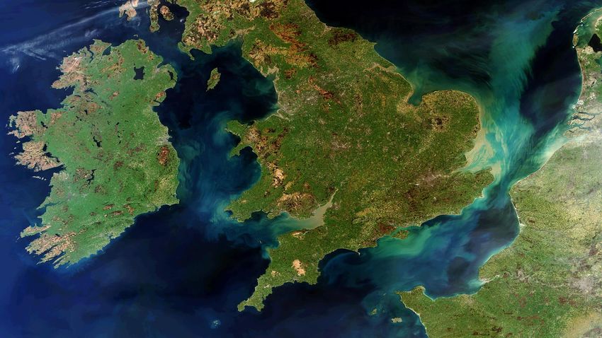
FOCUS OF THIS PRESENTATION
 Waterlines OPTICAL Waterlines SAR Shorelines
1D Vector

 Bathy Morpho Terrain Model
 Land cover for backshore classification

 3D Raster
2D Raster
THE TEAM
DEFINITIONS
Waterline – the edge of the sea at a
snapshot in time

Shoreline – the prediction of where the
tidal waterline would be at a determined
time

Littoral Line – a highwater line depicting
a hard boundary where a fixed object

Time Series – a derived product based on
a series of different shorelines or
waterlines.

Depth of Closure – the depth beneath
which erosion is not significant
OUR PROCESSORS AND
PRODUCTS
GEOLOCATION PROCESSOR

 front view perspective view front view perspective view

 Master Slave 2
 Master Slave 1 Slave 2
 (VHR) (HR) (HR)
 Slave 1

 t0 t1 t2
 Time evolution event
 real case ( different sensor )
GEOLOCATION PROCESSOR
GEOLOCATION PROCESSOR

 Before After
PRODUCTS
Optical Waterlines
PRODUCTS
Optical Waterlines

 29 May 30 July 14 August
 2016 2017 2018
PRODUCTS
Optical Waterlines
PRODUCTS
SAR Waterlines
 SAR Data Base
 - Sentinel - 1
 DEM Config - Envisat - ASAR
 - ERS1/2
 - COSMO-SkyMed

 Image calibration
 and geo-correction

 Aux Image Processing

 Waterline

 Quality Control

 Waterline + QC
PRODUCTS
Shorelines
PRODUCTS
Shorelines
Instantaneous
 MSL Shorelines
 Waterline
PRODUCTS
Shorelines
PRODUCTS
Shorelines
PRODUCTS
Seafront
PRODUCTS
Seafront
PRODUCTS
Seafront
PRODUCTS
Seafront
PRODUCTS
Seafront 2017 2019
PRODUCTS
Seafront 2017 2019
PRODUCTS
Bathy-Morpho Terrain Models

 Estimation of
 ocean
 morphology using
 multispectral
 sensors

 What we want :
PRODUCTS
Bathy-Morpho Terrain Models
• Physics-based model, Method of Hedley et al., 2009
• Different method from Satellite Derived Bathymetry
PRODUCTS
Bathy-Morpho Terrain Models
 1. Pre-Selection of images
 One good single image – One Bathy-Morpho Terrain Model
 U.K. Canada

 Ireland
 Sediments and Clouds Sediments and Glint Ice
 ...and others
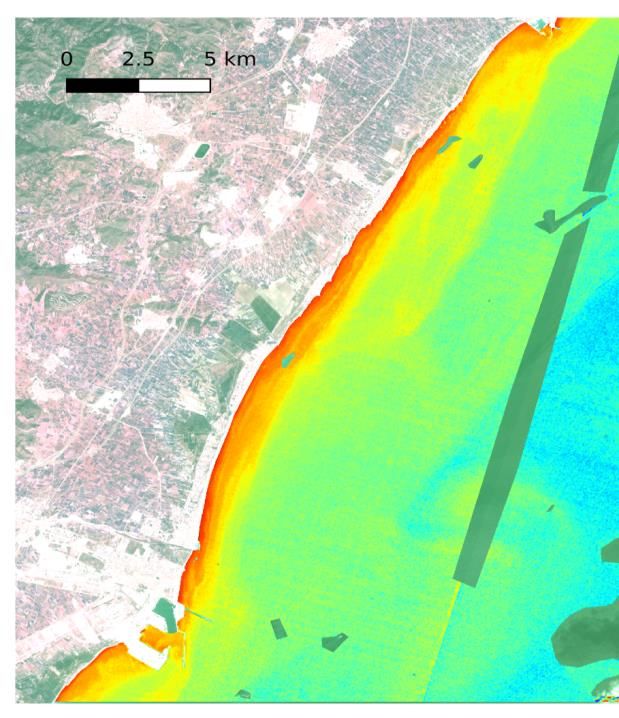
PRODUCTS
Bathy-Morpho Terrain Models
 2. Atmospheric correction
 (m)

 Cádiz, Spain
PRODUCTS
Bathy-Morpho Terrain Models
 Coloured disolved Suspended Confidence maps
 Reflectance organic matter particulate matter

 Good
 Intermediate
 Bad
PRODUCTS
Bathy-Morpho Terrain Models

Potential time series
analysis for the annual
evolution 2016-2019
END USERS PRODUCT
VALIDATION

 X 4 products
 1D x 2 | 2D | 3D
USER’S NEEDS DRIVEN PROJECT
What are the end users requirements?

 Summary of URD & Feasibility study (10 pp)
 Payo_et_al_ICE_2019_LaRochelle.pdf

Full URD consolidated version (122 pp) Slides presented at ICE 2019 Broader end user community inputs
User Requirement Document_v2.pdf
END USERS OVERARCHING &
SPECI USER’S NEEDS

 “Any policy for coastal erosion should increase coastal resilience by
 restoring the sediment balance and providing space for coastal processes”
 (EUROSION, 2004)

 + f(Country, site specific, End-User Type)
10th December 2020, recorded sessions here
 17th November 2020, recorded sessions here

30th Nov, 14th December 2020, recorded sessions 7th Dec 2020 recorded sessions here
here
https://bgscoastalerosion.siteonsite.es/
 499
 (S1)
 284
 (S2) 164
 (S3)

 Total Views 947

 Before After
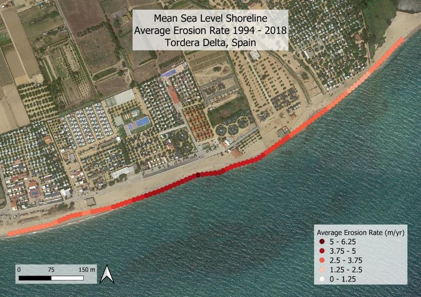
Change over 25 years
using SL | OPT
 Process: long-term shoreline evolution in Tordera

 184 shorelines (1994 a 2018 – 24 years)

 p63
 p5 60m
 p33

 Source Average
 erosion
 Satellite 4.79
 m/year
 Aerial 4.68
 photogrametry m/year
SL OPT able to detect
seasonal change
 Process: seasonal beach rotation in Castellón
 Analysis of Sentinel 2 shorelines:
 Seasonal cheanges and beach rotation

 Summer 2017 Winter 2018 Summer 2018
 Hs Hs

 sediment
 sediment transport
 transport

 Changes summer 2017 Changes winter
 to winter 2018 2018 to summer
 2018
We are still validating large
SL archive produced
 Total number of shorelines OPT Sentinel 2

 Missions Landsat 8
 Waterford
 Landsat 5

 Products
 Wexford

 Cork

 26 years
 2020 1994
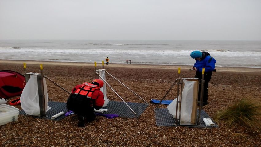
We use different ground
truth data bases
 Shoreline validation vs Vegetation lines
 Transect
 1
 ± • GSI Vegetation line series from 1995 to 2020

 Vegetatio
 Dun
 n line
 e

 Vegetation line 2017
 Onshore
 Vegetation line 2018
 20 Offshore
 Meters Sh_HAT_20180516
Littoral lines & backshore maps
2D backshore maps are used to delineate the littoral line which helps the QA of WL to SL transformations

 1 2

 (c) Neil A White

Properties at risk at Aldborough, East, England.

 4 3
 Vegetation line
 2018
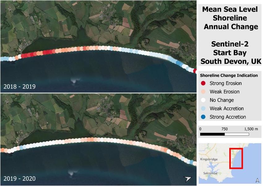
Old missions still require
visual QA
 Start Bay Area – OS data vs Landsat 8 WL 2016 - 2020
• OS HWM
• OS LWM
• Waterline is generally
 between the HWM and
 LWM.
 • Boats mapped as land
 • Pier /harbour breakwater = wider
 than it is
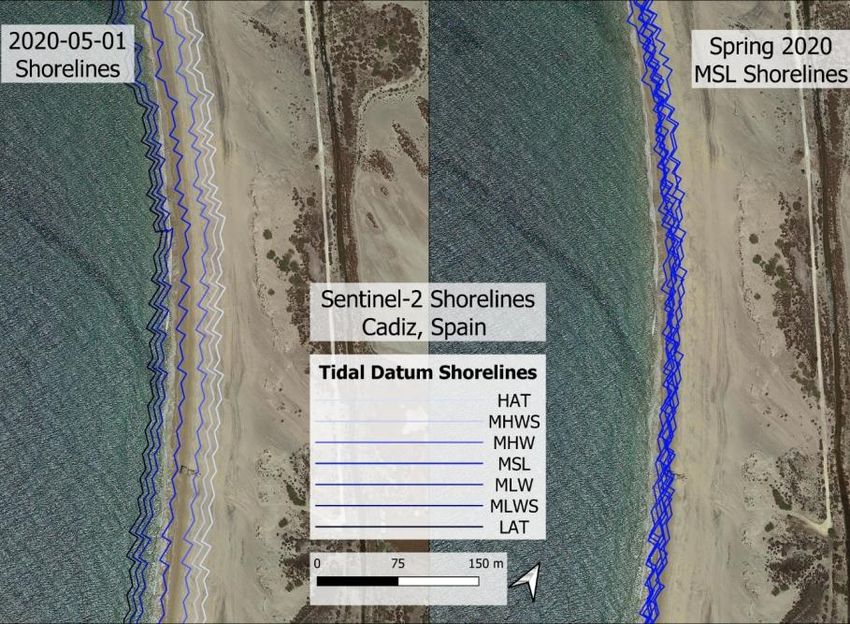
New methods developed for
accuracy assessment
As no standard method exist to assess absolute accuracy of waterlines we
have chosen points with no foreshore
 OS VectorMap District

 Tidal Boundaries
 HWM & LWM Accuracy
 absolute, relative, geometric fidelity
New methods developed for
accuracy assessment
As no standard method exist to assess absolute accuracy of waterlines we
have chosen points with no foreshore
 Absolute accuracy

 S2 | Start Bay | 2019-10-02
New methods developed for
accuracy assessment
As no standard method exist to assess absolute accuracy of waterlines we
have chosen points with no foreshore
 Relative accuracy

 S2 | Start Bay | 2019-10-02
OPT WL extracted even
in cloudy regions

 Iles de la Madeleine: Mingan: Manicouagan:
 122 Water lines 216 Water lines 233 Water lines
 183 km 112 kms 163 kms
SAR is transparent to clouds
so more WL can be extracted
Are SAR waterlines able to capture the observed beach rotation?

 Volume change (m3)
 (c) Amanda Smalley
 Servan

 Slapton line Road damaged in
 2018 causing local traffic
 Wiggins et al. (2019) Geomorphology
 disruption.
Are WL SAR able to detect beach
rotation?
High frequency of SAR waterlines allows a more detailed analysis
Are WL SAR able to detect beach
rotation?
 Rotation is clear when annual mean values of SAR WL for years
 2016 and 2017 are used

 Blackpool Sands
Validation
Bathy-Morpho Terrain Model
Example of results from Barcelona
 Absolute error [m]

 R2=0.83
 EAM=0.81m

 Mean absolute error:
 = 0.81
Confidence metadata prevent
miss-interpretation
 Confidence index
We are still exploring the
potential of all EO products
 Observing costal squeeze from space?
Thanks for your attention!
 10th December 2020, recorded sessions here
 17th November 2020, recorded sessions here

 30th Nov, 14th December 2020, recorded sessions 7th Dec 2020 recorded sessions here
 here
You can also read