National Wildlife Refuge System Protocol Framework for the Inventory and Monitoring of Secretive Marsh Birds
←
→
Page content transcription
If your browser does not render page correctly, please read the page content below
U.S. Fish and Wildlife Service
U.S. Department of the Interior

National Wildlife Refuge System

National Wildlife Refuge System Protocol Framework for
the Inventory and Monitoring of Secretive Marsh Birds
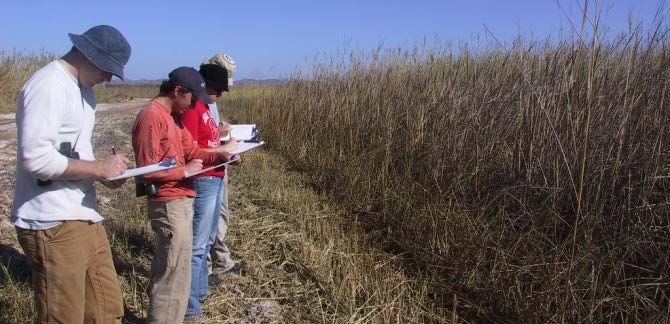
ON THE COVER
Observers at Imperial National Wildlife Refuge in Arizona conducting a marsh bird survey. Birds (clockwise from top left):
American bittern, black rail, least bittern, king rail, American coot, limpkin, Virginia rail, sora, pied-billed grebe, common
gallinule. Photographer: CJ Conway.
NWRS Survey Protocol Signature Page

1
  Version is a decimal number with the number left of decimal place indicating the number of times this protocol has
been approved (e.g., first approved version is 1.0.; prior to first approval all versions are 0.x; after first approval, all
minor changes are indicated as version 1. x until the second approval and signature, which establishes version 2.0,
and so on).
4
  Signature by Regional I&M Coordinator signifies approval of a protocol framework to be used at multiple stations
within a Region.
5
  Signature by National I&M Coordinator signifies approval of a protocol used at multiple stations from two or more
 Regions.

                                                             i
Survey Protocol Summary
This survey protocol provides standardized methods for monitoring secretive marsh birds during
the breeding season on National Wildlife Refuges across North America. The standardized
survey methods for marsh birds originated from suggestions during a workshop at Patuxent
Wildlife Research Center (Ribic et al. 1999), and the methods were discussed and recommended
for widespread use at a subsequent workshop at Patuxent (U.S. Fish and Wildlife Service 2006).
The survey methods incorporate a 5-minute passive listening period followed by a series of 1-
minute segments of call broadcasts to increase detection probability of focal marsh bird species.
Several approaches that allow analysts to account for imperfect detection are provided. We
include suggestions and guidance on probabilistic sampling designs and data analysis techniques
to meet a variety of local and regional scale management objectives. Survey timing and
associated costs will vary among refuges depending on logistics and the number and location of
survey points.
Suggested citation:
Conway CJ and Seamans ME. 2016. National Wildlife Refuge System Protocol Framework for
the Inventory and Monitoring of Secretive Marsh Birds. Inventory and Monitoring, National
Wildlife Refuge System, U.S. Fish and Wildlife Service, Fort Collins, Colorado.
This protocol is available from the USFWS Service Catalog (ServCat):
http://ecos.fws.gov/ServCatFiles/reference/holding/53291
iiAcknowledgments
This document draws mainly from the North American Marsh Bird Monitoring Protocol
(Conway 2011), which was based on suggestions during a marsh bird workshop at Patuxent
Wildlife Research Center (Ribic et al. 1999). The protocol was then discussed, reviewed and
recommended for use at a subsequent marsh bird workshop at Patuxent (U.S. Fish and Wildlife
Service 2006). The protocol incorporates suggestions from Conway and Gibbs (2001) as well as
recent methodological advances in estimating components of detection probability (Nichols et al.
2000; Farnsworth et al. 2002; MacKenzie et al. 2002, Royle and Nichols 2003, Kéry et al. 2005).
Many people have contributed to the development of the protocol by field testing survey
methods and providing suggestions for improvement. Dr. Soch Lor from the USFWS led a team
of biologists that thoroughly reviewed the protocol and provided many recommendations for
improvement and standardization. Mark Wimer from the USGS Patuxent Wildlife Research
Center developed the initial web-based data entry portal and helped standardize the data entry
process for users. Leo Salas and Michael Fitzgibbon of Point Blue Conservation Science have
been integral in transferring the marsh bird data to the Avian Knowledge Network and
developing a user interface for data entry, data sharing, and data analysis.
Portions of this protocol were adapted from the Landbird Monitoring Protocols (Knutson et al.
2008). The following people served on the National Wildlife Refuge System User Acceptance
Team (UAT), a committee that worked on modifications of the North American Standardized
Marsh Bird Monitoring Protocol, helped to develop the marsh bird database, and reviewed this
protocol, to ensure that the monitoring protocol meets the needs and objectives of land managers.
Lee O’Brien (USFWS, I&M Branch)
Bruce Peterjohn (USGS Patuxent Wildlife Research Center)
Mark Wimer (USGS Patuxent Wildlife Research Center)
Lisa Carter (Contractor, USFWS I&M Branch)
Soch Lor (USFWS, Region 7)
Terry Doyle (USFWS, Region 4)
Jennifer Casey (USFWS, Region 5)
Paul Hess (USFWS, Region 5)
Jeanne Holler (USFWS, Region 3)
Alice Hanley (USFWS, Region 3)
Diane Granfors (Region 3, Habitat and Population Evaluation Team)
Kathleen Blair (USFWS, Region 2)
Melinda Knutson (USFWS, Region 3)
Kathleen Carlyle (USFWS, Region 3)
Kelly Chadbourne (USFWS, Region 5)
Erin King (USFWS, Region 5)
Keith Hamilton (Contractor, USFWS I&M Branch)
iiiContents
NWRS Survey Protocol Signature Page ...................................................................................... i
Survey Protocol Summary ........................................................................................................... ii
Acknowledgments ........................................................................................................................ iii
List of Tables ............................................................................................................................... vii
List of Figures .............................................................................................................................. vii
Narrative ........................................................................................................................................ 1
Element 1: Introduction ................................................................................................... 1
Background .................................................................................................................. 1
Objectives .................................................................................................................... 2
Element 2: Sampling Design ............................................................................................ 3
Sample design .............................................................................................................. 3
Sampling units and sample frame ................................................................................ 3
Sample selection and sample size ................................................................................ 3
Survey timing and schedule ......................................................................................... 4
Element 3: Field Methods and Sample Processing ........................................................ 4
Pre-survey logistics and preparation ............................................................................ 4
Establishment of survey points .................................................................................... 5
Data collection procedures .......................................................................................... 6
Processing of collected materials................................................................................. 6
End-of-season procedures ............................................................................................ 6
Element 4: Data Management and Analysis .................................................................. 6
Data entry, verification, and editing ............................................................................ 6
Metadata ...................................................................................................................... 6
Data security and archiving ......................................................................................... 7
Analysis methods ......................................................................................................... 7
Software ....................................................................................................................... 7
Element 5: Reporting........................................................................................................ 7
Implications and application ........................................................................................ 7
Sections to include in reports ....................................................................................... 8
Reporting schedule ...................................................................................................... 8
Report distribution and archiving ................................................................................ 9
ivElement 6: Personnel Requirements and Training........................................................ 9
Roles and responsibilities ............................................................................................ 9
Qualifications ............................................................................................................... 9
Training........................................................................................................................ 9
Element 7: Operational Requirements ......................................................................... 10
Budget ........................................................................................................................ 10
Schedule and staff time .............................................................................................. 11
Coordination .............................................................................................................. 11
Element 8: References .................................................................................................... 11
Standard Operating Procedures ................................................................................................ 19
SOP 1: Sampling Design .............................................................................................................. 19
Target population and sampling frame ...................................................................... 19
Objectives .................................................................................................................. 20
Survey timing and schedule ....................................................................................... 20
Spatial considerations ................................................................................................ 22
Sample size for temporal trend .................................................................................. 22
Sample designs .......................................................................................................... 23
SOP 2: Conducting Surveys ......................................................................................................... 26
Broadcast sequence, equipment and placement......................................................... 26
Species to include in the survey effort ....................................................................... 26
Species to include in the broadcast sequence ............................................................ 27
Estimating distance to each focal bird ....................................................................... 27
Filling out the data sheet ............................................................................................ 28
Recording detections of focal species........................................................................ 29
Recording detections of focal, non-broadcast species ............................................... 30
Recording non-focal species (optional) ..................................................................... 30
Recording types of calls............................................................................................. 30
Birds detected at a previous point or between points ................................................ 31
Recording whether focal birds are in the “target area”.............................................. 31
What to do if the observer becomes overwhelmed with detections .......................... 31
Distinguishing between king and clapper rails .......................................................... 32
Recording ambient noise level................................................................................... 32
Weather restrictions ................................................................................................... 33
vRecording weather conditions ................................................................................... 33
Recording water levels .............................................................................................. 34
Recording salinity (optional) ..................................................................................... 35
Recording date of fire, disturbance, or management action ...................................... 35
Inclusion of an initial settling period (NOT recommended) ..................................... 35
Multiple observer surveys (optional) ......................................................................... 36
SOP 3: Data Management ............................................................................................................ 37
Database description .................................................................................................. 37
Data access roles ........................................................................................................ 37
Getting started ............................................................................................................ 37
Data entry, verification, and editing .......................................................................... 38
Metadata .................................................................................................................... 39
Data security and archiving ....................................................................................... 39
SOP 4: Data Analysis ................................................................................................................... 41
Sources of variation ................................................................................................... 41
Sampling designs ....................................................................................................... 41
Analyses ..................................................................................................................... 41
SOP 5: Associating Vegetation Classes with Survey Locations .................................................. 44
Appendices ................................................................................................................................... 48
Appendix A: AOU Codes ............................................................................................................ 48
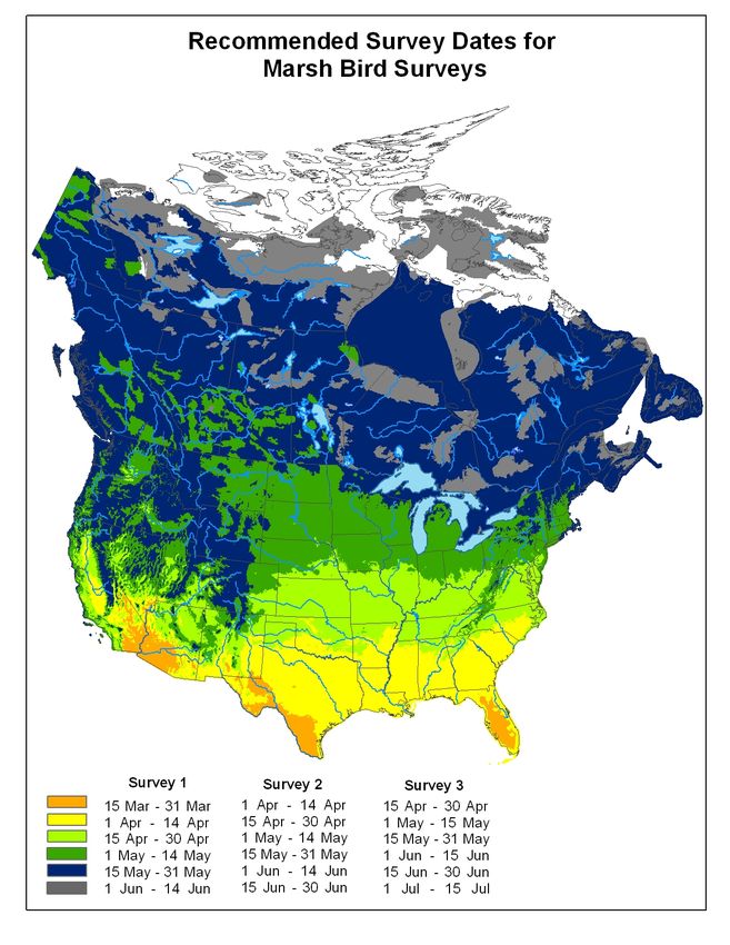
Appendix B: Survey Timing ........................................................................................................ 49
Appendix C: Focal Species and Field Data ................................................................................. 50
Appendix D: Call Types .............................................................................................................. 51
Appendix E: Sample and Blank Datasheets ................................................................................ 53
Appendix F: Contact Information................................................................................................ 55
viList of Tables
Table 6.1. Estimated annual costs to conduct this survey on a station. ....................................... 11
Table SOP 1.1. Guidelines for number of secondary sampling units. ......................................... 25
Table SOP 2.1. Background noise-rating scale ........................................................................... 33
Table SOP 2.2. Wind speed codes. .............................................................................................. 34
Table SOP 2.3. Sky condition codes............................................................................................ 34
Table SOP 5.1. Fields to be added to wildlife survey data sheets or databases. ......................... 45
Table SOP 5.2. Disturbances. ...................................................................................................... 46
Table A.1. AOU 4-letter species acronyms.................................................................................. 48
Table C.1. Focal marsh bird species and their field data requirements ....................................... 50
Table D.1. List of the most common calls for the focal species of marsh birds. ......................... 51
List of Figures
Figure B.1 Recommended dates of 3 annual survey windows .................................................... 49
viiNarrative
Element 1: Introduction
Background
The amount of emergent wetland habitat in North America has declined dramatically in the past
century (Tiner 1984; Dahl 2006; Stedman and Dahl 2008). Some evidence suggests that
populations of many marsh birds that depend on emergent wetlands are declining as a result
(Tate 1986; Eddleman et al. 1988; Conway et al. 1994; Conway and Sulzman 2007). However,
limited information is available regarding abundance, distribution, population trends, habitat
relationships, and effects of common wetland management actions for most marsh bird species.
The North American Breeding Bird Survey provides some survey data for secretive marsh birds
but many of the survey routes follow roads and thus do not adequately sample emergent
wetlands (Bystrak 1981; Robbins et al.1986; Gibbs and Melvin 1993; Lawler and O’Connor
2004). Moreover, many marsh bird species are secretive or inconspicuous, seldom observed, and
vocalize infrequently, making them difficult to detect during typical avian point-count surveys
even when surveys are conducted in optimal habitat. Hence, targeted efforts that focus
specifically on marsh birds are needed to advance our understanding of the population biology
and effects of management actions on marsh birds.
Marsh birds include species that are marsh-dependent. Focal species for this monitoring
framework include those identified by a group of marsh bird biologists as species for which we
lack quality information on status or population trends (Ribic et al. 1999), and include: king rail
(Rallus elegans), clapper rail (Rallus crepitans), Ridgway’s Rail (Rallus obsoletus), Virginia rail
(Rallus limicola), sora (Porzana carolina), black rail (Laterallus jamaicensis), yellow rail
(Coturnicops noveboracensis), American bittern (Botaurus lentiginosus), least bittern
(Ixobrychus exilis), pied-billed grebe (Podilymbus podiceps), limpkin (Aramus guarauna),
American coot (Fulica americana), purple gallinule (Porphyrio martinicus), and common
gallinule (Gallinula galeata). The U.S. Fish and Wildlife Service (USFWS) has identified the
black rail, yellow rail, limpkin, and American bittern as Birds of Conservation Concern because
they are relatively rare and we lack basic information on status and trends in most areas (USFWS
2008). Moreover, yellow, black, clapper, and king rails are four of the 139 “Focal” species that
USFWS has given priority for active management because they pose special management
challenges (USFWS 2005). Black, king, and yellow rails were also listed on the National
Audubon Society’s Watch List in 2014 (National Audubon Society 2007; U.S. NABCI
Committee 2014). Many U.S. states consider these species threatened or of special concern for
similar reasons.
Marsh ecosystems are extremely vulnerable to large‐scale habitat stressors, including loss from
conversion to agriculture, invasive vegetation, urban growth, changes in wetland hydrology and
river diversions, lack of habitat disturbance, and/or factors resulting from climate change
including sea level rise. Marsh bird species can often serve as indicators for assessing the health
of remaining wetland ecosystems, and their presence can be used as one measure of the success
of wetland restoration efforts (Lewis and Casagrande 1997). For example, marsh birds may be
affected by accumulation of environmental contaminants in wetland substrates because they
consume a wide variety of aquatic invertebrates (Odom 1975; Klaas et al. 1980; Eddleman et al.
1988; Gibbs et al. 1992; Conway 1995). Marsh birds are also vulnerable to changes in wetland
1plant composition and invasion of wetlands by invasive plant species (Gibbs et al.1992;
Meanley1992; Nadeau et al. 2011). Marsh birds also have high recreational value; many of these
species are highly sought after by recreational birders because they are rare and secretive.
Finally, gallinules, coots, and several rails are hunted in many U.S. states and Canadian
provinces, yet we lack the necessary information on population trends and status upon which to
base sustainable harvest limits.
Evidence of population declines, the paucity of information on many marsh-dependent species,
and the need to set responsible harvest limits prompted the need for a monitoring protocol
specifically designed to determine status and estimate population trends of secretive marsh birds.
Recognizing this need, the USGS and USFWS held workshops in 1998 and 2006 that
emphasized the need for range-wide estimates of abundance, distribution, and population trends,
and advocated for a standardized continental monitoring program (Ribic et al. 1999; USFWS
2006). Numerous federal agencies have been cooperating to monitor marsh bird populations in
North America with the hope of gaining better knowledge on their status and distribution.
Continual field testing and analysis of survey data have provided guidance for subsequent
revisions of a unified North American marsh bird monitoring protocol (Conway and
Timmermans 2005; Conway and Nadeau 2006, 2010; Nadeau et al. 2008; Conway 2011).
Continued monitoring will also allow resource managers to evaluate whether management
actions or other activities adversely impact wetland ecosystems. Any action that alters water
levels, alters salinity, reduces mudflat/open-water areas, alters invertebrate communities, or
alters the amount of emergent plant cover within marsh habitats could potentially affect habitat
quality for marsh birds (Conway et al. 1993; Conway 1995; Conway et al. 2010; Nadeau et al.
2011).
The USFWS has the legal responsibility under the Migratory Bird Treaty Act to manage and
protect all migratory birds. The National Wildlife Refuge System of the USFWS has been a key
partner in developing and promoting a standardized marsh bird survey protocol because the
refuge system has a disproportionate amount of wetlands within their boundaries, and the
management actions used by refuges could affect marsh bird populations. This document was
developed to help guide the National Wildlife Refuge System and its Inventory and Monitoring
Program in the collection of marsh bird data. However, most of the contents should be useful to
a broader audience interested in collecting marsh bird data.
Objectives
The Standardized North American Marsh Bird Monitoring Protocol is intended to provide
guidance to individuals planning to survey secretive marsh birds to address a variety of different
objectives. The marsh bird monitoring protocol makes use of a standardized set of sampling
methods that will allow multiple uses of the resulting data at multiple geographic scales. For
example, data collected to examine marsh bird response to habitat management can also be used
to model occupancy or abundance across a given region, which would be useful information to
help guide harvest management.
The most common objectives for those interested in conducting marsh bird surveys include: 1)
document presence or distribution of marsh birds within a defined area; 2) estimate or compare
density or population trend of marsh birds among management units, wetlands, or regions; 3)
estimate population size or trend for marsh birds at local or regional scales; 4) evaluate effects of
2management actions (often actions that target other species) on marsh birds; and 5) document
habitat types or wetland conditions that influence abundance of, or occupancy by marsh birds.
Detection Probability – People who conduct marsh bird surveys are typically interested in
estimates of abundance, density, or population trend. However, surveys rarely count all
individuals present in the sampling area because detection probability during surveys is typically
less than 100%. Thus, most of the parameters that users hope to obtain from marsh bird surveys
rely upon estimates of detection probability by either 1) assuming a constant and positive
correlation between the number of individuals detected during a survey and the number of
individuals actually present in the area sampled (i.e., low spatial and temporal variation in
detection probability), or 2) incorporating environmental covariates into the estimation process
that effectively adjust for most of the variation in detection probability. Few reliable estimates of
detection probability during marsh bird surveys are currently available (but see Conway et al.
1993; Legare et al. 1999; Conway and Gibbs 2001, 2011; Bogner and Baldassarre 2002; Nadeau
et al. 2008). These survey protocols incorporate several alternative methods for estimating
components of detection (see Conway et al. 2010 for an example of how estimates of detection
probability derived from these methods can be useful). Some authors have expressed skepticism
about the value of incorporating methods intended to estimate detection probability into surveys
(Johnson 2008), but others have advocated for such methods (Burnham 1981; Thompson et al.
1998; Thompson 2002; Rosenstock et al. 2002).
Element 2: Sampling Design
Sample design
The sampling design will determine how the data are interpreted and will influence the
conclusions and inferences that can be made from the survey data. This protocol relies on
random, stratified-random, and multi-stage cluster sampling. We include suggestions on several
types of sampling designs to address a range of monitoring objectives and logistical constraints.
Standard Operating Procedure (SOP) #1, Sampling Design, describes sampling designs
appropriate for local and regional scale management objectives.
Sampling units and sample frame
This protocol is designed to monitor the entire community of breeding marsh bird species within
a defined area. The sampling frame is defined as the spatial and temporal distribution of all
possible sampling units (i.e., survey points) with a non-zero probability of being selected. The
response variable is the abundance (or density, or presence/absence in the case of occupancy) of
marsh birds at a survey point. SOP #1 includes additional details on probabilistic sampling and
how to define the target population.
Sample selection and sample size
Samples will be randomly selected from all possible samples. A two-tiered design will have two
levels of sampling. For example, hexagons that cover the entire study area could delineate
sampling units at the largest spatial scale (first tier). After randomly selecting a subset of
hexagons, survey points (second tier) can be randomly located in marsh habitat within these
selected hexagons.
3Sample size will depend on the management objectives, desired precision of results, and type of
analysis. For analysis of population trend, sample size will depend on the time frame and the
desired precision around the trend estimate, as well as natural variability from patterns of
occupancy and abundance of the focal species (Steidl et al. 2013). General guidance on the
tradeoffs between number of sampling units and number of replicates per sampling unit is
provided in SOP #1.
Survey timing and schedule
Optimal survey timing varies temporally, and among species and regions. Observers should
conduct surveys when detection probability is highest and temporal variation in detection
probability is low. This information will likely come from expert knowledge of breeding
phenology of the focal species in the target area. Specific guidance on time of day, optimal
seasonal timing, and number of replicate surveys are included in SOP #1, Sampling Design.
Element 3: Field Methods and Sample Processing
Pre-survey logistics and preparation
The Survey Coordinator is the lead biologist in charge of implementing the survey protocol at a
land unit or across a group of land units. The Survey Coordinator will select a sampling design
(see SOP #1) based on explicit management objectives before the field season begins. Consult
with the national or regional Inventory and Monitoring (I&M) staff, a statistician, or other
sampling design experts, if necessary, to ensure that the design meets the defined management
and monitoring objectives.
The Survey Coordinator and all field crew members should read and review this entire protocol,
including all of the SOPs before the field season begins. The Survey Coordinator will ensure that
all observers are properly trained and qualified (see Element 5, Personnel Training). The Survey
Coordinator should organize all of the field equipment listed below, make sure it is ready and
functional at the outset of the field season, upload coordinates of survey points into a GPS
device, and make copies of the field data forms. Prior to conducting surveys observers should
attempt to navigate to each survey point and mark each with flagging tape. This will ensure that
observers do not waste time looking for the survey points in the field during the narrow survey
window. Observers will need the following field equipment and supplies to conduct marsh bird
surveys:
• Flagging (to mark survey points)
• GPS
• Clipboard, datasheets, pencils
• Printed site map with survey locations
• CD or mp3 broadcast file (obtained from the program coordinator in Appendix F)
• CD or mp3 player
• Amplified speakers
• Batteries for CD or mp3 player and amplified speakers
• Sound level meter with ±5 dB precision (e.g., Radio Shack model #33-2050, $35; or
EXTECH sound level meter, $99 from Forestry Suppliers, Inc.)
• Rangefinder
• Headlamp or flashlight
4• Rubber boots, hip waders or chest waders
• Thermometer
• Watch or other time recording device
• Cell phone in case of emergency
If habitat is to be measured observers may need a water gauge and salinity meter (e.g., Oregon
Scientific Handheld Salinity Meter [ST228], $25). In addition, the sound level meter should be
used to check volume of broadcast equipment prior to going into the field. Batteries should be
changed or re-charged frequently (before sound quality declines). Participants should routinely
ask themselves if the quality of the broadcast sound is high. Observers should carry replacement
batteries and, if possible, a spare CD or mp3 player on all surveys in case the primary unit fails
to operate.
The Survey Coordinator will establish a survey schedule. Guidance for timing of surveys is
provided in SOP #1 but should coincide with the peak of breeding activity for the focal species
in your region. Survey schedules should allow for flexibility due to weather or other logistical
considerations.
Establishment of survey points
Fixed, permanent survey points will be chosen and marked with inconspicuous markers in the
field. See SOP #1, Sampling Design, for details on how to select locations for permanent survey
points. Each survey point receives a unique identification number. Use a GPS to record the UTM
coordinates, UTM zone, and map datum for each survey point. If possible, locations of all survey
points should also be plotted on maps of each wetland. Maps should include the direction in
which the speakers should point during the survey at each survey point. Inconsistent speaker
direction may increase variation in the number of birds detected, and speaker direction from
previous surveys may not be obvious to a new observer.
Survey points should be located on either the upland-emergent vegetation interface or the open
water-emergent vegetation interface. Conducting surveys at points within the interior of marshes
is not practical in most inland wetlands due to the tremendous disturbance to emergent plants and
the changes in calling behavior of marsh birds caused by walking into the interior of a marsh.
Observers should stick to established trails or paths when possible and avoid stepping on clumps
of live or dead vegetation, especially during the breeding season, to prevent trampling of nests,
nestlings, and/or adult birds. However, conducting surveys from upland edges, roadside edges,
and open water edges may create some bias in estimation of population trends. Hence, observers
should record whether each point is:
1) along a ditch, dike, or berm with emergent vegetation on both sides,
2) along a ditch, dike, or berm with emergent vegetation on one side,
3) along a public road with emergent vegetation on both sides,
4) along a public road with emergent vegetation on one side,
5) along an upland/emergent edge (record type of upland: grassland, scrub-shrub, or forest),
6) along an open water/emergent edge,
7) within a narrow water channel or tidal creek with emergent vegetation on both sides,
8) within a contiguous patch of emergent vegetation (also record distance from edge), or
9) other (and provide description of point placement).
5Data collection procedures
The survey methods incorporate a 5-minute passive listening period followed by a series of 1-
minute segments during which pre-recorded marsh birds calls are broadcast to elicit responses
from resident marsh birds (Conway 2011). Observers record each individual marsh bird detected
during surveys on a separate line on the datasheet and estimate the distance to each bird. This
approach allows for estimation of detection probability using several methods. SOP #2 includes
detailed instructions on survey methods and how to record data during surveys. Observers may
obtain datasheets from the program website
(http://www.cals.arizona.edu/research/azfwru/NationalMarshBird/). An example of a completed
datasheet is provided in Appendix E.
Processing of collected materials
At the outset of a new study or project, establish a new project in the Avian Knowledge Network
(AKN) database (see Element 3 and SOP #3 for information on data entry and data
management). Proofread all datasheets to ensure that they are filled out completely and that the
data are legible upon completion of each survey. Mark any corrections in pen (different color
than that used to record original data) and document the reason for the correction if necessary.
Make a paper or electronic (digital) copy of each datasheet upon return from the field each day.
Store originals in a fire and flood proof cabinet, and ensure that copies are stored in a separate
building.
End-of-season procedures
All data should be entered and proofed for accuracy by the end of each field season. Initial and
date each datasheet after entering it into the database and again after proofing the electronic
record. Once the data are verified and correct in the electronic database, summaries of the data
may be downloaded for use in annual reports. A summary of the field season with the survey
dates, order or sequence of points, maps of the sampling locations, list of species detected,
hazards encountered, or other noteworthy events should be prepared and stored with the season’s
field datasheets. Field equipment should be cleaned and batteries removed for storage. Ensure
that all metadata describing the data collection procedures and storage locations are entered into
the AKN database. Additional details on database management and suggestions for data analysis
are included in SOP #3 and SOP #4.
Element 4: Data Management and Analysis
Data entry, verification, and editing
Use of the standardized protocols proposed herein allows data sharing and comparisons among
sites though a shared database managed by the Avian Knowledge Network. SOP #3 provides
detailed information on how to enter, proof, and manage marsh bird survey data.
Metadata
The sampling design and the methods followed will determine how the data can be used.
Properly documenting the details of your objectives and sampling design is important so that
those using the data will understand how and why the data were collected. Some fields exist in
the AKN database to provide details on survey methods, sampling and observers. There will also
be a field in the database for a link to the USFWS Service Catalog (ServCat), where site-specific
protocols will be stored and where detailed descriptions of each study should also be stored.
6Data security and archiving
Electronic copies of datasheets should be made upon returning from the field. The AKN
database administrators are responsible for ensuring security and backup of the electronic data
stored in the database. SOP #3 and Element 2 provide additional details on end of season
procedures and data security and archiving.
Analysis methods
SOP #3 provides general guidance on data analysis to meet a variety of objectives associated
with marsh bird monitoring. The main objectives discussed in the SOP are to: 1) provide basic
data summaries for use in annual reports, 2) estimate detection probabilities, 3) estimate
abundance, density, or occupancy of marsh bird species, 4) determine species habitat
relationships, and 5) analyze long-term trends for individual species over time.
The AKN database has simple reporting functions such as relative species abundance based on
defined groupings of land units or management areas. More advanced analyses may require a
statistician depending on the complexity of the analyses and expertise of staff. Budget estimates
should include funding to analyze data.
Software
A variety of software applications are available for data analysis and display. Simple data
summaries and graphs can be prepared using the data visualization and analysis tools available
through the AKN online interface (see SOP #3), MS Excel, or specialized graphing software
such as Sigma Plot. More complex statistical analyses will require specialized statistical software
such as SAS, SPSS, MARK, Distance, or R.
Element 5: Reporting
Implications and application
Regular and timely dissemination of survey results is essential for making informed management
decisions. Summarizing bird survey data will help determine if management objectives are being
met and will help to identify species in need of conservation. Annual and synthesis reports
should be prepared for the purpose of summarizing and interpreting point-count survey data and
should be submitted to the Project Leader at the land unit. The USFWS encourages publication
of significant findings in scientific journals or USFWS publications (USFWS 2007).
Annual Reports
Annual reports are required for all surveys each year. Data analysis and report writing should be
completed prior to the start of the subsequent survey season. The annual report serves several
purposes, including: 1) documenting monitoring activities and archiving data at the end of the
field season each year, 2) describing current conditions that may explain abrupt changes in
occupancy or abundance, 3) providing information about bird populations and their habitat
associated with management actions, and 4) documenting any changes in the monitoring
protocols. The report should summarize the field season and describe patterns of bird species
composition and relative abundance. The Survey Coordinator should meet with the Project
Leader to determine how the survey results should be used to improve management practices.
7Analysis and Synthesis Reports, Trends and Habitat Relationships – Analysis and synthesis
reports should be completed on a time interval consistent with original survey objectives. For
general and ongoing surveys (e.g., surveys with status and trend objectives) we recommend
preparing analysis and synthesis reports at least every 5 years. The analysis and synthesis report
is intended to: 1) evaluate patterns and trends in bird species occupancy or abundance over time,
2) determine if correlations exist between bird abundance and habitat features, disturbance
events, or specific hydrologic or other management regimes, 3) determine the amount of change
that can be detected, or the sample size needed to estimate population trend within the area of
interest, or 4) recommend changes to management strategies based on patterns observed in
survey data.
The Project Leader should budget for preparation of reports in the Annual Habitat Work Plan.
The report should document stated objectives, statistical methods, results, and include a
discussion of population trend and/or habitat analysis. Peer review is encouraged. The Survey
Coordinator should discuss with the Project Leader how the result should be used to inform
management.
Sections to include in reports
Objectives and Methods – All reports should include an introduction that explicitly states the
objectives and the reasons for conducting the survey. This should be followed by methods that
describe the exact procedures followed. For field methods included in the survey protocols, it is
sufficient to write a brief statement and cite the protocol document. If methods differed from
those outlined in the protocol, document the reasons the methods differed, the specific
procedures followed, and describe analytical methods and assumptions of those methods.
Summary of Results – Include any relevant data summaries and graphs that will help convey
patterns detected in the survey data. SOP #4, data analysis, contains additional information and
suggestions on how to summarize survey data and produce graphs. Summaries should reflect the
objectives identified in the monitoring protocol.
Important Findings – Include a discussion of the implications of the survey results, and how they
relate to the survey objectives and relevant management decisions. For example, you may
compare the survey results to pre-defined values that may trigger specific management actions or
to results from survey efforts in other areas or regions. Discuss the reliability of the survey
results, conclusions, and recommendations with regards to changes in management strategies. If
the survey results have implications for management decisions, include additional information
that will help others understand how the results might be used to inform management. Additional
information may include citations of additional studies that support the findings or provide
analyses of additional data with larger sample sizes or at larger spatial scales.
Reporting schedule
An annual report should be produced at the end of each field season and should include any
interpretations relevant to current management concerns. Annual reports should be completed
prior to the start of the subsequent survey season. More complex analyses can be completed less
frequently (every 3-5 years).
8Report distribution and archiving
Results should be discussed with the Project Leader and a copy of the final report archived at the
refuge station, uploaded to ServCat made available on the station’s website, and copies
distributed to all interested partners.
Element 6: Personnel Requirements and Training
Roles and responsibilities
The Survey Coordinator is responsible for implementing the monitoring program and ensuring
data quality. The Survey Coordinator 1) defines management and sampling objectives and
selects the appropriate sampling design to meet the stated objectives, 2) hires and trains
observers prior to the field season, 3) implements survey protocols, 4) oversees data entry, data
proofing, and quality control, and 5) analyzes data and prepares annual reports.
The Survey Coordinator ensures that observers are familiar with all SOPs and know how to
operate all field equipment including GPS, rangefinder and emergency communication
equipment. Observers are encouraged to practice navigating to survey points and to become
familiar with the survey areas before starting official surveys. Observers should review safety
procedures, first aid, and emergency plans prior to conducting field work.
Qualifications
A well-trained and competent observer is essential to the collection of credible, high-quality
data. Observer bias is a major source of error in trend analyses of bird populations (Sauer et al.
1994; Kendall et al. 1996). Training has been shown to improve the ability of observers to detect
birds (McLaren and Cadman 1999) and to estimate distance to marsh birds during surveys
(Nadeau and Conway 2012). Adequate training prior to surveys is particularly important with
marsh bird surveys because of the different repertoire of courtship and territory calls that each
marsh bird species exhibit, and the similarity of calls among species (Conway 2011). Good
hearing ability is essential because most inconspicuous marsh birds are detected only by sound,
and many calls are often very faint. Observers must be capable of identifying all focal species by
sight and sound. Additionally, observers must be proficient at estimating the horizontal distance
of detected birds from the observer. Observers must also be physically fit enough to navigate to
the survey points and able to arrive at their survey point(s) on or before the start of the surveys.
Training
An important part of gathering credible data is having experienced and well-trained observers. A
minimum of 7 days of bird identification and survey training in the field is required before
observers can conduct surveys independently. Many people require more than 7 days of full-
time training (as many as 14 days) before they are able to detect most marsh birds that vocalize
during a marsh bird survey. All observers should have the ability to identify all common calls of
focal and non-focal marsh bird species in their local area. Regularly listening to the recorded
calls used for surveys can help someone learn calls, but observers should also practice call
identification at marshes where the focal species frequently vocalize. Conduct field training
during the time of day when vocalization probability is highest, typically during the 2 hours
surrounding sunrise and the 2 hours surrounding sunset. Marsh bird training workshops are often
available free of charge during March; contact the Program Coordinator for information on
upcoming training workshops.
9The Survey Coordinator or technicians conducting surveys may be required to take the
Department of the Interior Motor Boat Operation Certification Course if motorboats are required
to access survey points. Whether a motorized boat or non-motorized, a float plan and other safety
recommendations should be followed (i.e. life jackets, portable radio, etc).
Distance Estimation – Observers should also be trained to accurately estimate distance to calling
marsh birds. Methods for training observers to accurately estimate distance include: 1) place a
CD or MP3 player in the marsh at an known distance and with varying speaker directions (e.g.,
directly toward and away from observers) and have observers estimate distance to the recorded
call, 2) choose a landmark in the marsh where the bird is thought to be calling from and use a
rangefinder to determine distance, 3) have an observer estimate the distance to a bird that is
calling with regularity and is at a very acute angle to a road or marsh edge, then have a second
observer walk along the road/edge until they are adjacent from that calling bird, and then
measure this distance (by pacing or use of a GPS). Observers may also practice estimating
distance to stationary objects (e.g. a tree or flag pole) and use a GPS or tape measure to verify
the correct distance to the object.
Multiple-observer Surveys – Multiple-observer methods (described in SOP #2) can be very
useful during training. After completing a survey, the observers can discuss what they heard and
their distance estimates to each bird. Periodic multiple-observer surveys not only produce
estimates of detection probability (see SOP #4) but also allow participants to determine whether
one person is constantly underestimating or overestimating distance to calling birds. First-time
observers can tag along on surveys conducted by more experienced observers in their region
prior to starting their own surveys. They should conduct at least one “trial run” before their first
data collection window begins to become familiar with the data sheet and practice recording the
data properly.
Hearing Tests – Hearing acuity is important because ~90% of secretive marsh birds detected
during a marsh bird survey are heard and not seen, and many of the calls are very faint.
Observers are strongly encouraged to have a hearing test (audiogram) at a qualified hearing or
medical clinic before, during, or immediately after the survey season each year. We encourage
observers or potential observers to discuss the results of their hearing with their doctor and with
their supervisor (or the Program Coordinator) to determine whether the quality of the data they
collect may be compromised. These data could be included as a covariate and would help control
for observer bias in trend analyses.
Element 7: Operational Requirements
Budget
Element 2, pre-survey logistics and preparations, provides a list of required equipment. A 4-
wheel drive truck or boat (kayak, canoe, or motorboat) may be needed to access some sampling
units. Computers will be needed for data entry, data analysis, and report writing. Field and travel
costs (per diem, fuel or mileage, and lodging) will vary according to the number and spatial
extent of sampling units and logistical constraints.
10Table 6.1. Estimated annual costs to conduct this survey on a station.
Estimated
Personnel/Equipment
Annual Cost
Survey Coordinator (refuge staff) $0
Observers and data entry techs (Biological Technicians or volunteers) $0 – $5,000
Statistician (contract) $2,000
Equipment (MP3 player, amplified speakers, GPS units, waders, batteries, clipboards,
$1,000
datasheets, rangefinder, sound meter)
TOTAL: $3,000 – $8,000
Schedule and staff time
The survey schedule will vary among regions according to local breeding phenology of focal
species. Guidance on appropriate survey windows is included in SOP #1 and Appendix B.
Schedules should be flexible to allow for unforeseen changes in the survey schedule due to
weather or other logistical constraints. The staff time required will depend on the number of
sampling units, time required to travel between points, and other survey logistics. Survey
Coordinators should also plan time in the schedule for data entry, analysis, and report writing.
Coordination
Coordination may be required among biological survey staff and staff or contractors that are
responsible for implementing management actions such as prescribed fire, irrigation, mowing,
herbicide treatments, or other habitat manipulations. Coordination may also be required for
shared use of equipment, vehicles, boats, or computer equipment. Coordination may also be
warranted among land units on a regional or national scale, and with other agencies or NGOs
conducting marsh bird surveys in your area.
Element 8: References
Alldredge MW, Pacifici K, Simons TR, Collazo JA, Shriner SA. 2007. Time-of-detection
method for estimating abundance from point count surveys. Auk 124:652-664.
Allen T, Finkbeiner SL, Johnson DH. 2004. Comparison of detection rates of breeding marsh
birds in passive and playback surveys at Lacreek National Wildlife Refuge, South Dakota.
Waterbirds 27:277-281.
Bogner HE, Baldassarre GA. 2002. The effectiveness of call-response surveys for detecting least
bitterns. Journal of Wildlife Management 66:976-984.
Bookhout, TA. 1995. Yellow Rail (Coturnicops noveboracensis). No. 139 in The Birds of North
America (A. Poole and F. Gill, Eds.). Academy of Natural Sciences, Philadelphia, Pennsylvania;
American Ornithologists’ Union, Washington, D.C
11Buckland ST, Anderson DR, Burnham KP, Laake JL, Borchers DL, Thomas L. 2001.
Introduction to distance sampling: estimating abundance of biological populations. New York,
NY: Oxford Press.
Burnham, KP. 1981. Summarizing remarks: Environmental influences. Studies in Avian Biology
6:324-325.
Bystrak D. 1981. The North American breeding bird survey. Studies in Avian Biology 6: 34-41.
Comer P, Faber-Langendoen D, Evans R, Gawler S, Josse C, Kittel G, Menard S, Pyne M, Reid
M, Schulz K, Snow K, and Teague J. 2003. Ecological systems of the United States: a working
classification of U.S. terrestrial systems. NatureServe, Arlington, Virginia.
http://www.natureserve.org/library/usEcologicalsystems.pdf
Conway CJ. 1995. Virginia Rail (Rallus limicola). In The birds of North America. No. 173. (A.
Poole, P. Stettenheim and F. Gill, Eds.). Philadelphia, Pennsylvania: The Academy of Natural
Sciences.
Conway CJ. 2011. Standardized North American marsh bird monitoring protocol. Waterbirds
34:319-346.
Conway CJ, Droege S. 2006. A Unified Strategy for Monitoring Changes in Abundance of Birds
Associated with North American Tidal Marshes. Studies in Avian Biology 32:382-397.
Conway CJ, Eddleman WR, Anderson SH. 1994. Nesting success and survival of Virginia rails
and soras. Wilson Bulletin 106:466-473.
Conway CJ, Eddleman WR, Anderson SH, Hanebury LR. 1993. Seasonal changes in Yuma
Clapper Rail vocalization rate and habitat use. Journal of Wildlife Management 57:282-290.
Conway CJ, Gibbs JP. 2001. Factors influencing detection probabilities and the benefits of call-
broadcast surveys for monitoring marsh birds. Laurel, Maryland: Final Report, USGS Patuxent
Wildlife Research Center.
Conway CJ, Gibbs JP. 2005. Effectiveness of call-broadcast surveys for monitoring marsh birds.
Auk 122:26-35.
Conway CJ, Gibbs JP. 2011. Summary of the intrinsic and extrinsic factors affecting detection
probability of marsh birds. Wetlands 31:403-411.
Conway CJ, Nadeau CP. 2006 Development and field-testing of survey methods for a
continental marsh bird monitoring program in North America. Wildlife Research Report #2005-
11. USGS Arizona Cooperative Fish and Wildlife Research Unit, Tucson, AZ.
Conway CJ, Nadeau CP. 2010. The effects of conspecific and heterospecific call-broadcast on
detection probability of marsh birds in North America. Wetlands 30:358-368.
12Conway CJ, Nadeau CP, Piest L. 2010. Fire helps restore natural disturbance regime to benefit
rare and endangered marsh birds endemic to Colorado River. Ecological Applications 20:2024-
2035.
Conway CJ, Sulzman C. 2007. Status and habitat use of the California black rail in the
southwestern U.S.A. Wetlands 27:987-998.
Conway CJ, Sulzman C, Raulston BA. 2004. Factors affecting detection probability of California
Black Rails. Journal of Wildlife Management 68:360-370.
Conway M, Nadeau CP, Conway CJ. 2010. Optimal seasonal timing of marsh bird surveys and
the effect of water quality on marsh bird relative abundance in south Florida. Wildlife Report #
2010-03, USGS Arizona Cooperative Fish and Wildlife Research Unit, Tucson, Arizona.
Conway CJ, Timmermans STA. 2005. Progress toward developing field protocols for a North
American marshbird monitoring program. USDA Forest Service General Technical Report.
PSW-GTR-191.
Dahl TE. 2006. Status and trends of wetlands in the conterminous United States 1998 to 2004.
Washington, D.C.: U.S. Department of the Interior, Fish and Wildlife Service.
Dail D, Madsen L. 2011. Models for estimating abundance from repeated counts of an open
metapopulation. Biometrics 67:577-587.
Eddleman WR, Flores RE, Legare ML. 1994. Black rail (Laterallus jamaicensis). No. 123 in The
Birds of North America (A. Poole and F. Gill, Eds.). Academy of Natural Sciences, Philadelphia,
Pennsylvania; American Ornithologists’ Union, Washington, D.C.
Eddleman WR, Knopf FL, Meanley B, Reid FA, Zembal R. 1988. Conservation of North
American rallids. Wilson Bulletin 100:458-475.
Erwin RM, Conway CJ, Hadden SW. 2002. Species occurrence of marsh birds at Cape Code
National Seashore, Massachusetts. Northeastern Naturalist 9:1-12.
Farnsworth GL, Pollock KH, Nichols JD, Simons TR, Hines JE, Sauer JR. 2002. A removal
model for estimating detection probabilities from point‐count surveys. Auk 119:414‐425.
Field SA, Tyre AJ, Possingham HP. 2005. Optimizing allocation of monitoring effort under
economic and observational constraints. Journal of Wildlife Management, 69:473–482.
Flores RE, Eddleman WR. 1995. California black rail use of habitat in southwestern Arizona.
Journal of Wildlife Management 59:357-363.
Gibbs JP, Melvin SM. 1993. Call-response surveys for monitoring breeding waterbirds. Journal
of Wildlife Management 57:27-34.
13You can also read