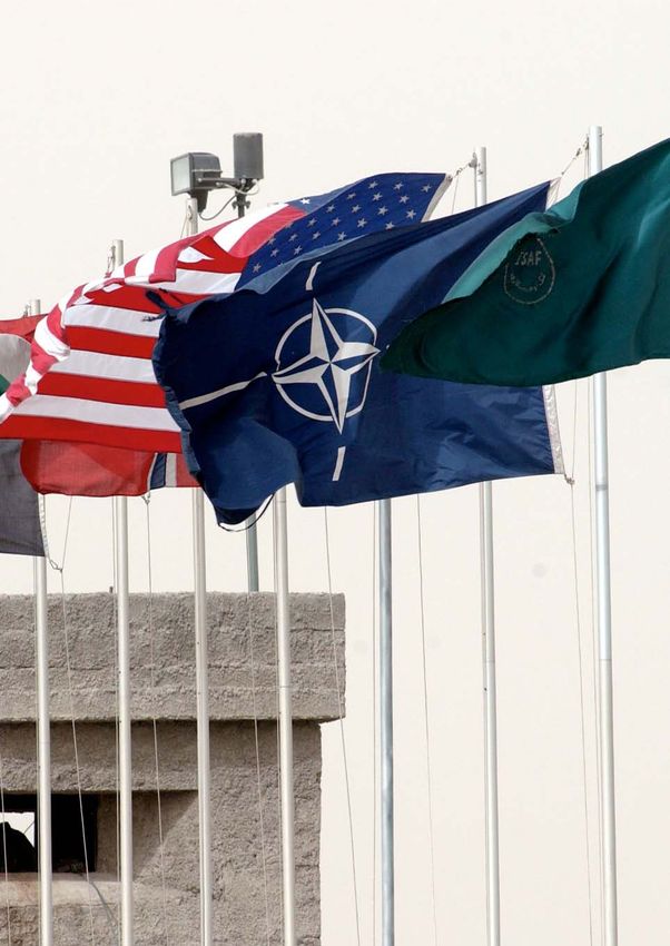
NATO Intelligence Fusion Centre
←
→
Page content transcription
If your browser does not render page correctly, please read the page content below
Delivering shared situational understanding
              NATO Intelligence Fusion Centre

 Challenge
 t Deliver new levels of capability to meet the increasing
    demands of IFC’s users

 Outcome
 t Faster intelligence product delivery

 t New levels of clarity and consistency

 t Enhanced intelligence sharing capability

                                                              Case study
Delivering shared situational understanding

    Whether NATO is conducting air                  It develops sophisticated, up-to-the-minute      reports weren’t always consistent in their
    strikes on enemy targets or organising          intelligence products, which are used            appearance and could be inappropriately
    sea patrols to prevent maritime piracy,         exclusively by NATO to support strategic         interpreted.
    it has to have rapid access to accurate         and tactical decision making on a daily basis.
    and timely information that is easy                                                              Over the years since its foundation, the
    to interpret. The Intelligence Fusion           Challenge                                        IFC had also built up a very large library of
    Centre’s use of Geospatial Information          The IFC produces a large number of               imagery and mapping data. However, many
    Systems (GIS) helps to provide NATO             intelligence products that range from            of these important resources resided on
    commanders from twenty eight                    fairly straight-forward large-scale maps         CDs, in multiple versions, in different desks
    countries with the insight they need,           of a region, to highly focused intelligence      and cabinets around the offices. What is
    when they need it.                              products, combining a wide range of data         more, the IFC’s processes for managing its
                                                    and high-resolution satellite imagery.           data relied on file-based storage and were
    Client                                          Some of the larger intelligence reports          failing to keep up with the rapidly expanding
    The North Atlantic Treaty Organisation          produced by the IFC may contain many             data store. “The time had come for a new
    (NATO) is a political and military alliance     hundreds of component images and                 approach to data management,” explains
    of twenty eight countries that promotes         maps that come together to make up the           Ric Diaz, chief of geospatial intelligence at
    peace, helps to manage the resolution           final delivered product. Large and small,        the IFC. “We needed to create a centralised
    of international crises and encourages          all of the products produced by the              data store and adopt new standard ways of
    cooperation on issues of defence and            centre play a vital role in supporting           working across our business.”
    security. In recent years, it has supported     NATO’s peace-keeping, military and
    national governments in Iraq and                humanitarian operations.                         At the same time, the IFC wanted to make
    Afghanistan, undertaken peace-keeping                                                            its intelligence products more accessible
    activities in Africa and Kosovo, responded      To produce its intelligence products,            to NATO commanders. It often received
    to threats of piracy and terrorism, and taken   the IFC makes extensive use of Geospatial        requests for the same information, again
    action to protect the people of Libya.          Information System (GIS) technology.             and again. This was particularly the case
                                                    Indeed, as much as 80% of the output             in regions like Afghanistan, where NATO
    For all of its missions, the organisation has   of the organisation has an integral GIS          commanding officers changed every few
    to have access to accurate, up-to-date and      element. Although the IFC’s image and            months. Once products had been delivered
    easy to assimilate information about the        geospatial analysts were highly skilled,         to the original requestor, it was difficult for
    environments in which it is operating.          the organisation realised that not everyone      other people to find them, because there
    The Intelligence Fusion Centre (IFC) was        used the same processes, symbols or              was no way of searching the product
    formed in 2005, to meet precisely this need.    formats in their work. This meant that           database spatially. Instead, users had to

2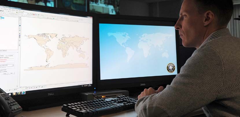
“   The Esri consultants sat side by side with us,
asked a lot of questions and offered a lot of advice.
It was a great partnership.
Ric Diaz, chief of geospatial intelligence at the IFC   ”
        rely on searching long lists of product names,   questions and offered a lot of advice,”          The deployment of the new GIS
        which frequently failed to identify relevant     says Diaz. “It was a great partnership.”         environment had to be carefully planned
        products and was not very user friendly.                                                          to ensure that it did not disrupt day-to-day
                                                         As a result of the business process              operational work. For example,when
        Solution and capability delivered                analysis, the IFC realised that it needed        military action was launched in Libya,
        The IFC had been using Esri GIS software         to establish the new role of data manager.       the needs of the project had to be
        since its foundation in 2005, and it relied      “It quickly became apparent to us that           balanced against a sudden increase
        heavily on Esri desktop tools for geo-           the role of the data manager was actually        in demand for new intelligence products.
        analysis, in particular. The organisation        one of the most important roles in the           “Esri understood the complexities of our
        recognised that it could address its data        geospatial team,” Diaz remarks. “It would        working environment,” observes Diaz.
        management and workflow challenges               be the job of the data manager to ensure         “Its consultants worked with us every
        through Esri’s latest GIS technology             that the whole team always had the most          step ofthe way, to help us meet our
        (ArcGIS Server) and support services             up-to-date data to work from – in the very       own requirements.”
        (software implementation, development            demanding timelines that we have to work
        of standard operating procedures and             with.” With no-one immediately available         Using ArcGIS Server, Esri UK created
        support in data management). “We did             with the right skill sets within the IFC,        a single central data repository for the
        consider alternative GIS vendors at the          Esri UK provided one of its own team to          IFC’s geospatial data and imagery. Esri
        time, but other products didn’t appear           fill the critical role of data manager.          UK’s technical services team then built
        to meet our needs as well as the Esri            This gave the IFC the time it needed to          an internal web service, through which
        software,” says Diaz. “NATO has also             secure a permanent appointment.                  all of the organisation’s analysts are able
        standardised on Esri solutions for its core                                                       to search for, retrieve, view, analyse and
        GIS platform, so it didn’t make sense for        Alongside the deployment of ArcGIS Server,       use that data as a part of their day-to-day
        the IFC to change to a different supplier.”      Esri UK worked with the IFC to establish         work. In addition, Esri UK developed a
                                                         new Standard Operating Procedures                new external web service, to give NATO
        Prior to deploying the new solution, Esri UK     (SOPs) and to define common symbols and          personnel the ability to easily discover,
        analysed the IFC’s processes to establish        formats for use across all of its intelligence   view and download recent and historical
        how the team worked with the existing GIS        products. “We were trying to identify            intelligence reports. Deployed on a
        and verify the requirements of the business.     and implement best business practices,”          Microsoft SharePoint platform, the external
        Esri UK then specified and proposed the          explains Diaz. “With their experience, the       web portal was initially developed as a
        new technical architecture to meet specific      consultants quickly understood what we           stand-alone prototype, which reduced
        business needs. “The Esri consultants            were doing, so they could show us the            project risk for the IFC and allowed it to
        sat side by side with us, asked a lot of         easiest and best ways to work.”                  carry out a phased roll out.

                                                                                                                                                         3
“  Esri understood the complexities of our
                                                           working environment. Its consultants worked
                                                           with us every step of the way, to help us meet
                                                           our own requirements.
                                                                                                           ”
                                                           Ric Diaz, chief of geospatial intelligence at the IFC

Benefits                                        practices and established common                  almost instant access to useful situational
Faster intelligence product delivery            standards for symbols and document                intelligence. Because they won’t have to
All of the IFC’s geospatial data and imagery    formats, that are supported within ArcGIS.        put in specific requests for information –
is now stored centrally and maintained by       Consequently, all of the IFC’s products           and wait for the resulting reports – they will
a dedicated data manager. As a result, the      now have a consistent look and feel. “This        be able to make appropriate tactical and
organisation no longer maintains several        gives us more credibility in the eyes of our      strategic decisions much more quickly.
versions of the same data, which was            customers,” Diaz believes.
not only inefficient but could also result                                                        Future
in inaccurate or inappropriate information      An added, unexpected benefit of this              The software and services provided by Esri
being generated.                                approach has been that other defence              UK have delivered real benefits to the IFC,
                                                agencies, in other countries, have started        and the two organisations have developed
As well as being able to manage and work        to copy the templates and standard                a strong collaborative relationship. Building
from a single, up-to-date source, analysts      methods articulated by the IFC. As a result,      on this, the IFC and Esri UK meet every
can be more time-efficient, because they        NATO commanders are receiving reports             four to six weeks to discuss emergent new
don’t waste time looking for the latest CDs     that are generally more consistent and,           requirements and make sure that the IFC’s
and images. When urgent requests come           therefore, clearer and easier to interpret.       investment in GIS capability continues
in, analysts can start work on intelligence     Diaz says: “Hopefully, the improved quality       to be exploited to deliver real benefits.
products straight away, without having          of intelligence products means that NATO          “Our migration to ArcGIS Server has far
to wait for relevant data to be found and       can be more effective in its operations.”         exceeded any expectations that we had
assembled. “Whereas it used to take 24-                                                           before the project commenced,” declares
48 hours to bring in imagery, that data is      Improved intelligence sharing                     Diaz. “As a result, we are looking to further
now right there, at our fingertips, already,”   The IFC is currently in the process of            our relationship with Esri UK over the next
says Diaz. “It’s a cleaner and quicker          introducing its external web portal,              three years.”
process overall.” This faster turnaround        alongside the roll out of Microsoft
time enables NATO commanders to react           SharePoint within NATO. Once SharePoint
more quickly to emergent new situations         is fully deployed, all authorised personnel
in theatre.                                     from NATO will be able to use the web
                                                portal to search spatially for any recent
Improved intelligence product quality           intelligence products relating to the area
and consistency                                 where they are working. Recent and
With Esri UK’s support, the IFC has             historical reports will be much easier to
introduced new, documented working              find and should provide commanders with

                                                                                                                                                   4
“  The time had come for a new approach
to data management
                                            ”
Ric Diaz, chief of geospatial intelligence at the IFC

                                                        5
Esri UK is part of the global Esri
network, world leader in geographic
information system (GIS) software.
We mobilise the UK’s largest pool of GIS
expertise, with the worlds most proven
geospatial capability, to provide solutions,
consulting and training services to defence
and intelligence organisations and system
integrators. Its solutions are successfully
deployed with wide application from
Expeditionary Warfare and National Security
to management of the Defence Estate.

Esri UK is helping these organisations
make faster and more informed decisions
by delivering the capability to extract
the greatest value from their information
and enabling this intelligence to be more
easily shared.

For more information please visit our website
at www.esriuk.com/defence

Esri UK Millennium House 65 Walton Street Aylesbury Buckinghamshire HP21 7QG
T 01296 745500 F 01296 745544 E info@esriuk.com www.esriuk.com

© ESRI (UK) Limited 2011. Registered in England and Wales No.1288342. VAT No.787 4307 91. Registered Address: Millennium House, 65 Walton Street, Aylesbury, Bucks HP21 7QG. All rights reserved.
The Esri globe and Esri products, services and trademarks mentioned are trademarks of Environmental Systems Research Institute, Inc. Other companies and products mentioned herein are the property of their respective trademark owners.
You can also read