NEW FRONTIERS IN OCEAN EXPLORATION
←
→
Page content transcription
If your browser does not render page correctly, please read the page content below
NEW FRONTIERS IN
OCEAN EXPLORATION
                  The Ocean Exploration Trust, NOAA Ocean Exploration,
                      and Schmidt Ocean Institute 2021 Field Season

GUEST EDITORS
Samantha Wishnak, Joanne Flanders,
Emily Crum, and Carlie Wiener

OCEANOGRAPHY
Vol. 35, No. 1, Supplement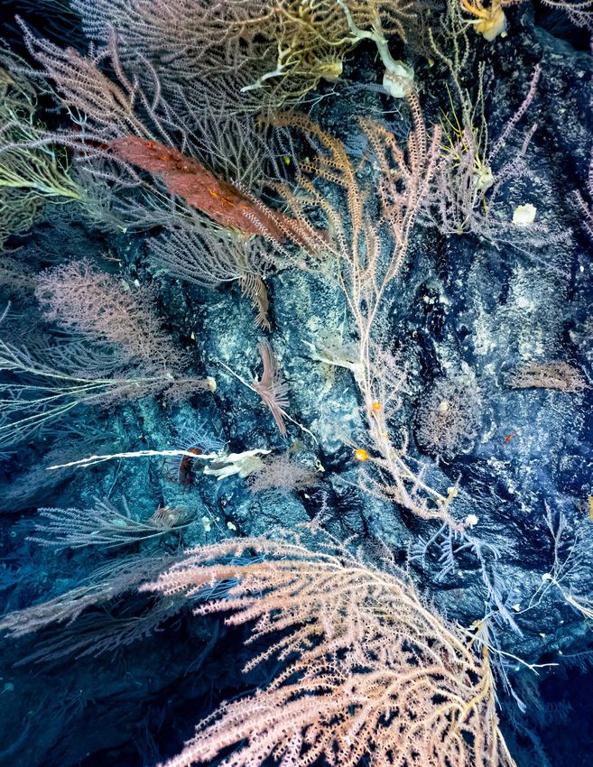
ON THE COVER
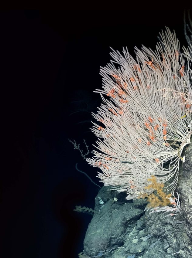
A diversity of deepwater coral species was imaged on Ha‘aheo
Seamount during E/V Nautilus expedition Lu‘uaeaāhikiikapapakū
(NA134) in Papahānaumokuākea Marine National Monument.
Image credit: Ocean Exploration Trust
PREFERRED CITATION
Wishnak, S., J. Flanders, E. Crum, and C. Wiener, eds. 2022.
New frontiers in ocean exploration: The Ocean Exploration
Trust, NOAA Ocean Exploration, and Schmidt Ocean Institute
2021 field season. A Supplement to Oceanography 35(1),
78 pp., https://doi.org/10.5670/oceanog.2022.supplement.01.
BELOW
A squat lobster perches atop a bubblegum coral on San Juan
Seamount in the Southern California Borderland. The image was
taken by remotely operated vehicle SuBastian as researchers
investigated several sites where marine minerals are known (or
expected) to occur, while assessing the biological communities liv-
ing among the mineral substrates. Image credit: ROV SuBastian/
Schmidt Ocean Institute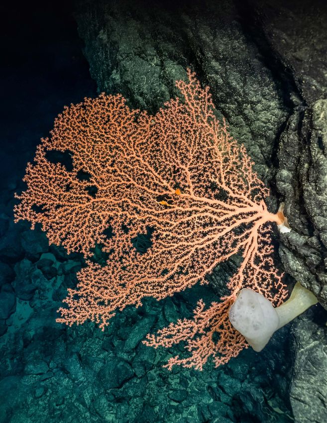
CONTENTS
INTRODUCTION......................................................................................................................................................................................................................... 1

2021 EXPEDITION OVERVIEW MAP.................................................................................................................................................................. 4

PART 1. OCEAN EXPLORATION TRUST – E/V NAUTILUS........................................................................................................ 6
Technology.......................................................................................................................................................................................................................................... 8
From Seeps to Seamounts: E/V Nautilus Expedition Samples in 2021............................................................................................ 16
Building Community from Ship to Shore Through Ocean Exploration.......................................................................................... 18
Nautilus Field Season Overview...................................................................................................................................................................................... 22
 • E/V Nautilus 2021 Mapping: US West Coast to Papahānaumokuākea Marine National Monument............. 24
 • Probing the Santa Barbara Basin Benthos...................................................................................................................................................... 26
 • Investigating Active Methane Seeps Along the Cascadia Margin............................................................................................. 28
 • Ocean Networks Canada: Supporting Innovative Technology for Science, Society, and Industry................. 30
 • A Herculean Effort: Complex Collaboration to Rescue ROVs.......................................................................................................... 32
 • Midwater Exploration with Mesobot, Radiometry, and Environmental DNA.................................................................... 34
 • Lu‘uaeaahikiikapapakū: Ancient Volcanoes in Papahānaumokuākea Marine National Monument............. 36
 • Exploration of an Unnamed Seamount Chain............................................................................................................................................ 38
 • Autonomous Mapping Technology Returns to the Great Lakes................................................................................................. 40
PART 2. NOAA OCEAN EXPLORATION....................................................................................................................................................... 42
Mapping the Deep Ocean.................................................................................................................................................................................................... 44
Putting “Eyes” on the Deep Ocean: Remotely Operated Vehicle Operations............................................................................. 46
Advancing Technology........................................................................................................................................................................................................... 47
Discovering Our Maritime Heritage........................................................................................................................................... 48
Accelerating Ocean Exploration Through a Culture of Diversity, Inclusivity, and Openness....................................... 49
Expanding Outreach and Education........................................................................................................................................................................... 50

PART 3. SCHMIDT OCEAN INSTITUTE – R/V FALKOR............................................................................................................... 52
Expanding Horizons: The Schmidt Ocean Institute 2021 Field Season.......................................................................................... 54

                        PART 4. COLLABORATIVE PROJECTS AND PARTNERS
                        Ocean Exploration Cooperative Institute...................................................................................................................................... 62
                        Deep Ocean Education Project.............................................................................................................................................................. 64
                        Inner Space Center Media Production............................................................................................................................................. 66

                        WHAT’S NEXT................................................................................................................................................................................................ 68

                        Authors...................................................................................................................................................................................................................... 70
                        Acknowledgments........................................................................................................................................................................................... 73
                        References............................................................................................................................................................................................................... 77
                        Acronyms................................................................................................................................................................................................................. 78
This beautiful Venus flytrap anemone was observed
perched high on the branches of a bamboo coral at
a depth of 2,766 m during the 2021 NOAA Ocean
Exploration North Atlantic Stepping Stones expedi-
tion. Image credit: NOAA Ocean Exploration
INTRODUCTION                                             By Samantha Wishnak, Genene Fisher, and Carlie Wiener

This twelfth installment of the ocean exploration sup-
plement to Oceanography, the official magazine of
The Oceanography Society, highlights the work of three
vessels that contribute to exploring the world ocean: Ocean
Exploration Trust’s (OET’s) E/V Nautilus, NOAA Ship Okeanos   mission (pages 32–33). Next, Nautilus hosted the first NOAA
Explorer, and Schmidt Ocean Institute’s (SOI’s) R/V Falkor.   Ocean Exploration Cooperative Institute (OECI) technology
   Expedition programs in 2021 featured exploration of        demonstration, which focused on advancing the efficiency
two ocean basins, with Nautilus off the west coast of the     and effectiveness of vehicle technology and engineering
United States and British Columbia, and out to the Central    for ocean exploration (pages 34–35 and 62–63). Nautilus
Pacific; Okeanos Explorer in the North Atlantic; and Falkor   then mapped its way to Hawai‘i to begin a multi-year
leaving the Pacific to return to the Atlantic Ocean. All      emphasis on exploring the US Exclusive Economic Zone
three organizations continued to develop shipboard and        (EEZ) in the Central Pacific. Two expeditions within and near
shoreside collaborations to adapt to conducting opera-        Papahānaumokuākea Marine National Monument (PMNM)
tions at sea during the evolving COVID-19 pandemic. The       included ROV surveys on seamount chains to document
pages that follow contain expedition summaries, including     coral and sponge communities and to lay the groundwork
initial results, highlights of new scientific programs and    for 2022 surveys (pages 36–39). During the field season,
education and outreach initiatives, and previews of future    several expeditions mapped large swaths of seafloor to fill
exploration plans.                                            gaps in existing bathymetric data, supporting OECI goals
   The first expeditions of the 2021 Nautilus season cen-     as well as those of national and international collaborations
tered on the west coast of North America, featuring oxy-      to map the entire global seafloor by 2030 (pages 24–25).
gen minimum zones off southern California (pages 26–27),      The OET section of the supplement includes detailed sum-
methane seeps on the Cascadia margin (pages 28–29),           maries of Nautilus shipboard technologies (pages 8–15),
and continued work with University of Victoria’s Ocean        specimen collection highlights (pages 16–17), and early
Networks Canada (ONC) to support its offshore cabled          findings from several expeditions. In preparation for our
observatory (pages 30–31). As Nautilus neared the end of      work within PMNM, OET expanded its suite of education
the ONC expedition, the remotely operated vehicles (ROVs)     and outreach offerings and collaborated with local part-
Hercules and Argus became detached from the vessel, and       ners to co-develop meaningful outreach and education
thanks to the incredible support of the oceanographic         opportunities that incorporate Hawaiian culture and worl-
community, we were able to quickly mount a recovery           dview into Nautilus expeditions (pages 18–21). In addition
                                                              to the E/V Nautilus field season, OET also partnered with
                                                              the University of New Hampshire and the NOAA Office of
                                                              National Marine Sanctuaries to conduct an inland expedi-
                                                              tion at Thunder Bay National Marine Sanctuary located in
                                                              Lake Huron (pages 40–41).

                                                                                                                         1
The second section of this supplement features NOAA
Ocean Exploration’s 2021 season, with the pace and effi-
ciency of mapping operations increasing, and Okeanos
Explorer becoming the first ship in the world to receive a          In 2021, Schmidt Ocean Institute’s research vessel Falkor
complete upgrade to Kongsberg’s new EM 304 multibeam             traveled across the Pacific, then made its way back to the
sonar (page 44). Season highlights include the exploration       Atlantic to prepare for passing the baton to the newly
of Blake Plateau off the coast of the southeastern United        acquired research vessel Falkor (too) and marking a new era
States (page 44), when NOAA Ocean Exploration marked             of oceanographic research and evolution for the institute.
the mapping of 2,000,000 km2 of seafloor since Okeanos           The final section of the supplement reviews an extraordi-
Explorer was commissioned in 2008. A pilot project to            nary year for SOI activities, including the seven expeditions
process mapping data in the cloud created an environ-            that took place in Australian waters and beyond, as well as
ment in which simultaneous work on data could occur              the institute’s Artist-at-Sea program and growing partner-
from anywhere in the world (page 44). Highlights from the        ships activities (pages 52–61).
North Atlantic Stepping Stones expedition are presented             A key part of all three organizational missions is shar-
(page 46), and there is an overview of ROV operations and        ing research and expeditions with students, educators,
how they inform exploration, as well as a brief description of   and the general public through collaborations that allow
discoveries, including the first visual confirmation of ferro-   all partners to amplify their work. OECI, a consortium of
manganese nodule fields in the New England Seamount              five organizations that work together to advance ocean
Chain (page 46). NOAA Ocean Exploration moved on to              exploration technology and training in concert with NOAA
investigate the Blake Spur where rich sponge gardens             Ocean Exploration, moved forward into its third year
were revealed (page 46), before discovering and exploring        with operations and educational outreach (pages 62–63).
SS Bloody Marsh, a World War II-era oil tanker sunk off the      Over the last two years, NOAA Ocean Exploration, the
coast of South Carolina by a German U-boat (page 46).            Ocean Exploration Trust, and Schmidt Ocean Institute
NOAA Ocean Exploration support for advancing technol-            collaborated to build a single online hub for ocean science
ogy is featured, describing emerging tools such as ’omics as     and exploration-themed educational resources, which
well as testing and deployment of two autonomous sensor          launched in summer 2021 (pages 64–65). Collaborating
platforms. An update on DriX, a technology the OECI is           across the ocean exploration field, the Inner Space Center
developing, is included. An overview of maritime heritage        at the University of Rhode Island supports professional
work highlights the discovery, with “reasonable certainty,”      development, online learning, and live event programming
of US Revenue Cutter Bear following a nearly two-decade          (pages 66–67).
search for this historically significant ship of exploration        Looking ahead at 2022, the Ocean Exploration Trust
(page 48). This section of the supplement concludes              will continue to build upon partnerships and research
with a summary of NOAA Ocean Exploration’s expanded              from E/V Nautilus within the Central Pacific, particularly
diversity and inclusivity efforts during the year (page 49)      Papahānaumokuākea Marine National Monument and the
before turning to outreach and education endeavors that          Pacific Remote Islands Marine National Monument. During
included a “brand refresh,” a new education website, and an      summer 2022, NOAA Ocean Exploration’s Okeanos Explorer
expansion of internship opportunities (page 50).                 will work along the Mid-Atlantic Ridge and then transit to
                                                                 the Panama Canal, crossing into the Pacific in August to
                                                                 begin exploration off the US West Coast. The year will bring
                                                                 a sea change for Schmidt Ocean Institute, with delivery of
                                                                 Falkor (too) in fall 2022. We all look forward to continuing to
                                                                 explore the ocean and to connecting diverse communities
                                                                 with the deepest parts of our planet (pages 68–69).

2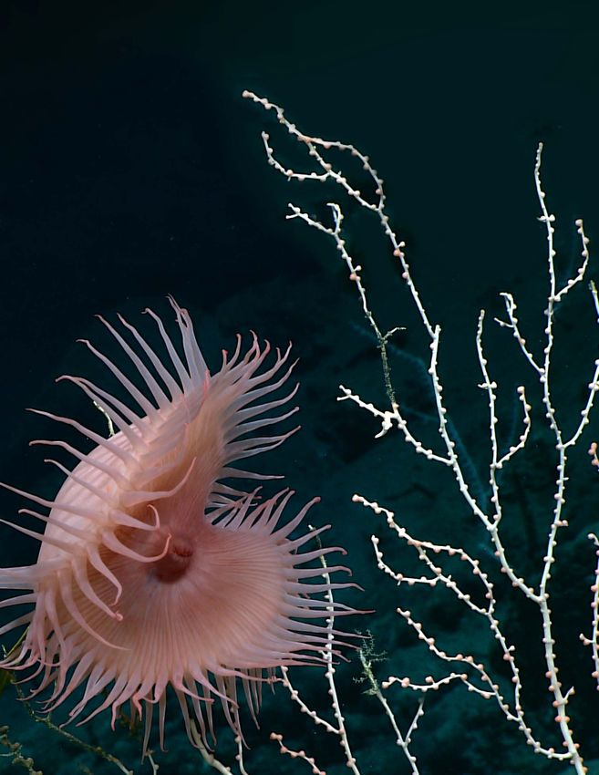
Hemicorallium sp., an octocoral in the pre-
cious coral family Coralliidae, observed in
Papahānaumokuākea Marine National
Monument during E/V Nautilus expedi-
tion NA134. Image credit: OET

                                              3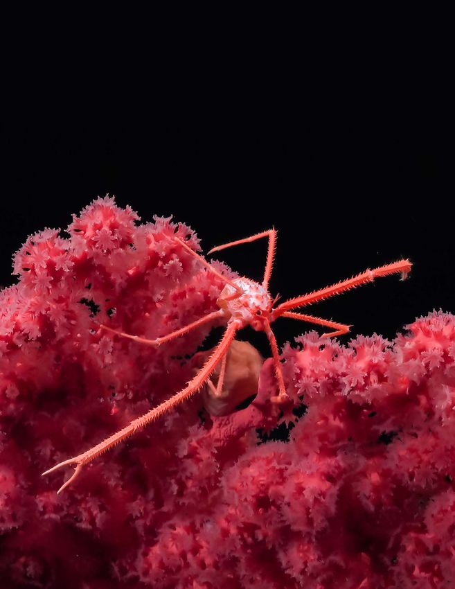
E/V NAUTILUS EXPEDITIONS

            Page 26                                 Page 34
1           The Santa Barbara        5              Midwater
            Basin Benthos                           Exploration

                                                    Page 36
            Page 28
                                                    Ancient
2           Cascadia Margin          6              Volcanoes
            Methane Seeps
                                                    in PMNM

                                                    Page 38                               6
            Page 30
                                                    Unnamed
3           Ocean Networks           7              Seamount                                         7
            Canada
                                                    Chain

            Page 32                                 Page 40
4           Collaboration to         8              Mapping the
            Rescue ROVs                             Great Lakes

                                                                                                               4

            3

                                                        2
                                                    1

                                                                                              Page 58
                                   R/V FALKOR EXPEDITIONS
                                                                                      5       The Biodiverse
                                                                                              Borderlands

                                                                  Page 56
                         Page 54                                                              Page 59
                                                                  Australian
        1                Mapping the Tasman     3                 Mesophotic Coral
                                                                                      6       Designing the
                         and Coral Seas                                                       Future 2
                                                                  Examination

                                                                  Page 57                     Page 60
                         Page 55
                                                                  Discovering Deep            Interdisciplinary
        2                Seafloor to Seabirds   4                                     7       Investigation of the
                                                                  Sea Corals of the
                         in the Coral Sea
                                                                  Phoenix Islands 2           Pescadero Basin

    4
2021 EXPEDITION OVERVIEW MAP
 3 4

  2                               8

                                                                                  3
       1
           5 5
            6                                 2
                                         4
                                        1 5
                 7

                                           NOAA OCEAN EXPLORATION

                                       Page 44
                                                                              Page 44
                                       Sea Testing
                     1                 and Mapping
                                                            4                 Blake Plateau
                                                                              Mapping*
                                       Shakedown*

                                       Page 47                                Page 46
                     2                 Technology           5                 Windows to
                                       Demonstration*                         the Deep*

                                       Page 46
                                       North Atlantic
                     3                 Stepping
                                       Stones*                                *

                         COMPETITIVE GRANTS
                         NOAA Ocean Exploration also provided support for nine projects
                         through its competitive grants program.

                                                                                      5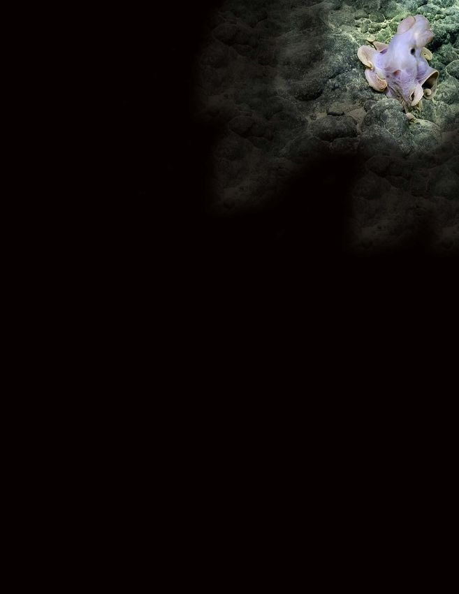
6
PART 1
Ocean Exploration Trust
         – E/V Nautilus

             Note: All images in the Nautilus section of this
             publication are copyright Ocean Exploration
             Trust Inc. unless otherwise indicated.

                                                          7
TECHNOLOGY SHIP SERVICE GENERATORS. Two 585 kVA generators,
one 350 kVA generator
PORTABLE VAN SPACE. Four 6.1-meter (20-foot) vans
COMPLEMENT. 17 crew; 33 science and operations
E/V Nautilus FLAG. St. Vincent and the Grenadines
Exploration Vessel (E/V) Nautilus is an efficient 68-meter ADDITIONAL EQUIPMENT
ship, with berthing for 17 permanent crew members in • Dynacon 369i ROV winch with 7,000 meters (23,000 feet)
addition to 33 berths for members of the rotating Corps of of 1.73 centimeter (0.681 inch) diameter electro-optic
Exploration. The ship is equipped with a Kongsberg EM 302 Rochester cable
multibeam echosounder and two remotely operated vehi- • DT Marine 210 winch
cles (ROVs), Hercules and Argus. Nautilus has a data lab and • Bonfiglioli knuckle-boom crane, 2–6 ton capacity,
two extensions
newly renovated wet lab for processing digital data and
physical samples. As part of the Ocean Exploration Trust’s • Two airtuggers, SWL 900 lbs each
effort to share expeditions with students, public audi-
• A-frame, SWL 8 tonnes
ences, and colleagues, we utilize telepresence technology
• Two rescue boats; crane and davit with SWL 0.9 mtn
to stream live video from the ROVs and various locations
• Oceanscience UCTD 10-400 profiling system;
max depth 1,000 meters (3,280 feet)
aboard the ship in real time to the Nautilus Live website
(https://nautiluslive.org).
TELEPRESENCE TECHNOLOGY
VSAT. 2.4 meter stabilized Sea Tel 9711 uplink antenna
GENERAL capable of C- and Ku-band operation of up to 20 Mbps
(C-band circular or linear)
BUILT. 1967, Rostock, Germany
REAL-TIME VIDEO STREAMING. Six Haivison Makito X
LENGTH. 68.23 meters (211 feet)
encoders streaming live video via satellite to the Inner
BEAM. 10.5 meters (34.5 feet) Space Center ashore (including spares)
DRAFT. 4.9 meters (14.75 feet)
TONNAGE. 1,249 gross, 374 net
RANGE. 24,000 kilometers (13,000 nautical miles)
at 10 knots
ENDURANCE. 40 days at sea
SPEED. 10 knots service, 12 knots maximum
FUEL CAPACITY. 330 cubic meters
PROPULSION. Single 1,285 kilowatt (1,700 hp)
controllable pitch main thruster; 280 kW bow
tunnel thruster; 300 kW jet pump stern thruster
8CAMERAS. 23 high-definition cameras: aft port, amid REFRIGERATION
and starboard (pan/zoom/tilt), transom, bow, Command • Panasonic MDF-C8V1 ULT –80°C/–86°C scientific freezer,
Center (7), wet lab, ROV hangar, winch hold (6) 0.085 cubic meters (3 cubic feet)
COMMUNICATIONS • Two science refrigerators, approximately
• Ship-wide RTS Odin intercom system for shipboard 0.57 cubic meters (20 cubic feet) each
communications and connection with shoreside • Science freezer, –20°C, 0.14 cubic meters (5 cubic feet)
participants HAZMAT
• Software audio connection for global participants using • Fume hood
VLink multi-platform intercom client (Mac, Windows, • Two HAZMAT lockers for chemical and waste storage
Android, iOS); telephone interface is available through • Carry-on, carry-off chemical policy
a Rhode Island exchange for real-time collaboration
between scientists ashore and on the ship ROV HANGAR
• Full Internet connectivity from shipboard LAN and wifi
AREA. 24 square meters (258.3 square feet)
• KVH TracPhone-v7 for redundant bridge
communication, providing telephone and IP service POWER. 110/60 Hz and 220/50 Hz available
PERSONAL PROTECTIVE EQUIPMENT. Hard hats, PFDs,
DATA PROCESSING & VISUALIZATION LAB high voltage gloves
AREA. 44.5 square meters (480 square feet) LIFTS. 2 × 2-ton overhead manual chainfall lifts
WORKSTATIONS. Seven workstations for science STORAGE. Storage for spares and other equipment
managers, data loggers, navigators, educators, data
engineers, satellite engineer, video engineer; seafloor ROV WORKSHOP
mapping data processing; flexible bench space
AREA. 18 square meters (193.8 square feet)
RACK ROOM TOOLS. Complete set of hand tools, cordless tools,
electrical and fiber optic test equipment, mill-drill
AREA. 17.3 square meters (185 square feet)
combination machine
DATA STORAGE. 50 TB onboard storage for non-video
STORAGE. Storage for spares and other equipment
data; 150 TB disk storage for video data
EMERGENCY COMMUNICATIONS. Iridium phone,
CONTROL, COMMAND, & OUTREACH VANS
KVH phone
AREA. 43 square meters (476 square feet)
ELECTRONICS WORKBENCH. 2.3 cubic meters
(80 cubic feet) of storage WORKSTATIONS. Twelve; typical configuration for ROV
operations: two to four scientists, data logger, pilot and
copilot, navigator, video engineer, educator
PRODUCTION STUDIO
VIDEO RECORDING AND STORAGE. Two Cinedeck
AREA. 12 square meters (130 square feet)
ZX85 video recorders that capture ROV footage in
CAMERA. UHD Panasonic BGH1 studio camera; Sony A1 two simultaneous codecs, two Blackmagic Hyperdeck
camera kit for topside video with live broadcast capacity uncompressed 4K recorders, two AJA KiPro Go recorders,
via Teradek 500 2x LTO-6 archive media drives, 2x LTO-8 archive
PRODUCTION. 8-input video production switcher for media drives
live-produced interactions; full production editing
workstation with ship-to-shore transmit capacity for
remote production needs
WET LAB
AREA. 19 square meters (204.5 square feet) with
5.3-meter-long (17.5-foot) stainless steel bench and
2.3-meter-long (7.6-foot) worktop
9Acoustic Systems
KONGSBERG EM 302 MULTIBEAM KNUDSEN SUB-BOTTOM PROFILER
ECHOSOUNDER AND ECHOSOUNDER
The EM 302 is a hull-mounted 30 kHz multibeam echo- The Knudsen 3260 is a sub-bottom echosounder mounted
sounder composed of two long transducer arrays mounted inside the hull of Nautilus. It operates at low frequencies
in a T-shape on the hull of Nautilus. It was installed on the (3.5/15 kHz) so that the sound it emits can penetrate layers
ship between 2012 and 2013 to collect bathymetric, back- of sediment to about 100 m below the surface. The sound
scatter, and water column data. This information is useful that bounces back from each layer is captured by the system,
for identifying areas or features of interest, including gas creating a cross section of the seafloor. Scientists can use
seeps, and creating bathymetric maps for ROV dive plan- the data to identify subsurface geological structures such as
ning and situational awareness. The EM 302 can map the faults and ancient channels and levees. The Knudsen 3260
seafloor in water depths from 10 meters to 7,000 meters can operate in full ocean depths. The Knudsen system also
(33 feet to 22,965 feet) at ship speeds up to 12 knots. collects 15 kHz single-beam echosounding data.
FREQUENCY. 30 kHz PROFILER. Knudsen 3260 Chirp sub-bottom profiler
and echosounder
DEPTH RANGE. 10–7,000 meters (33–22,966 feet)
OPERATING FREQUENCY. Dual frequency,
PULSE FORMS. CW and FM chirp
3.5 kHz and 15 kHz
BEAMWIDTH. 1° × 1°
POWER. 4 kW on Channel 1 and up to 2 kW on Channel 2
APPROXIMATE SWATH WIDTH. 3–5 times water depth,
RANGE. 50–5,000 meters (164–16,404 feet)
up to 8 kilometers (5 miles)
APPROXIMATE GRID RESOLUTION. 1%–5% water
ULTRA-SHORT BASELINE
depth (e.g., 10–50 meters [33–164 feet] at 1,000 meters
NAVIGATION SYSTEMS
[3,281 feet] depth)
SYSTEM. Sonardyne Ranger 2 with Lodestar GyroUSBL
transceiver deployed from the moonpool for USBL
tracking of ROVs Hercules and Argus
RANGE. Up to 7,000 meters (22,966 feet)
POSITIONING ACCURACY. 0.5% of slant range
OPERATIONAL COVERAGE. ±90°
OPERATING FREQUENCY. 19–34 kHz
TARGETS TRACKED. Hercules, Argus, and two additional
transponders are available. More targets can be tracked
with the addition of compatible Sonardyne transponders
SYSTEM. TrackLink 5000MA system for backup USBL
tracking of ROVs Hercules and Argus
RANGE. Up to 5,000 meters (16,404 feet)
POSITIONING ACCURACY. 1° (~2% of slant range)
OPERATIONAL BEAMWIDTH. 120°
OPERATING FREQUENCY. 14.2–19.8 kHz
TARGETS TRACKED. Hercules, Argus, and two additional
transponders are available
10Remotely Operated Vehicle (Towsled) Argus
ROV Argus was first launched in 2000 as a deep-tow system
capable of diving to 6,000 meters. Argus is mainly used in
tandem with ROV Hercules, where it hovers several meters
above in order to provide a bird’s-eye view of Hercules
working on the seafloor. Argus is also capable of oper-
ating as a stand-alone system for large-scale deepwater
survey missions.
GENERAL
DEPTH CAPABILITY. 6,000 meters (19,685 feet),
currently limited to 4,000 meters (13,123 feet)
CABLE. 4,500 meters (14,764 feet), 0.681 electro-optical,
3x #11 conductors, 4x SM fibers
SIZE. 3.8 meters long × 1.2 meters wide × 1.3 meters high
(12.5 feet long × 3.9 feet wide × 4.3 feet tall) VEHICLE SENSORS & NAVIGATION
SYSTEM. NavEst integrated navigation system solution
WEIGHT. 2,100 kilograms (4,700 pounds) in air,
1,360 kilograms (3,000 pounds) in water USBL NAVIGATION. Sonardyne Ranger 2
MAXIMUM TRANSIT SPEED. 2 knots PRIMARY HEADING. Crossbow high-resolution magnetic
ASCENT/DESCENT RATE. 30 meters/minute
motion and attitude sensor
(98 feet/minute) max PRESSURE SENSOR. Paroscientific Digiquartz 8CB series
PROPULSION. Two Tecnadyne Model 1020 thrusters ALTIMETER. Benthos PSA-916
for heading control
FORWARD-LOOKING SONAR. Mesotech 1071, 300 kHz,
0.5–100 meter (1.6–328.1 foot) range typical
IMAGING & LIGHTING SUB-BOTTOM PROFILING SONAR. TriTech SeaKing
CAMERAS Parametric Sub-bottom Profiler (10–30 kHz)
• One Insite Pacific Zeus Plus high-definition camera
with Ikegami HDL-45A head and Fujinon HA
10 × 5.2 lens, 1080i SMPTE 292M output format, SCIENTIFIC INSTRUMENT SUPPORT
2 MP still image capable on tilt platform POWER. 110 V 60 Hz AC, 24 VDC and 12 VDC
• Three utility cameras (fixed mounted) 480 line power options
NTSC format
• One DeepSea Power & Light Wide-i SeaCam, downward- DIGITAL DATA CHANNELS. Ethernet
looking standard definition camera (fixed mounted)
LIGHTING
• Three CathX Aphos 16 LED lampheads,
28,000 lumens each
• Two DeepSea Power & Light 250 Watt
incandescent lights
11Remotely Operated Vehicle Hercules
Since it was first launched in 2003, ROV Hercules has been DESCENT/ASCENT RATE. 30 meters/minute
working in tandem with ROV Argus to explore the geol- (98.4 feet/minute), 15 meters/minute (49.2 feet/minute),
ogy, biology, archaeology, and chemistry of the deep sea. or 20–22 meters/minute (65.6–7.2 feet/minute) average
Hercules is equipped with a high-definition video camera,
PROPULSION
several LED lights, two manipulator arms, and a variety
of oceanographic sensors and samplers. A suite of high-
• Six hydraulic thrusters powered by 15 kW (20 hp),
207 bar (3,000 psi) hydraulic system
resolution mapping tools is available for use upon request.
Hercules can deliver up to 113 kg (250 lbs) of samples or
• Fore/Aft & Vertical – Four 27.94 cm (11 inch) ducted
thrusters, each providing 900 N (200 lbf ) thrust
tools to and from the seafloor.
• Lateral – Two 22.86 cm (9 inch) ducted thrusters,
each providing 450 N (100 lbf ) thrust
GENERAL
DEPTH CAPABILITY. 4,000 meters (13,123 feet) VEHICLE SENSORS & NAVIGATION
TETHER. 30–45 meters (98.4–147.6 feet), 20 millimeters SYSTEM. NavEst integrated navigation system solution
(0.79 inches) diameter, neutrally buoyant
HEADING AND ATTITUDE
SIZE. 3.9 meters long × 1.9 meters wide × 2.2 meters tall • Primary Heading – IXSEA Octans III north-seeking fiber-
(12.8 feet long × 6.2 feet wide × 7.2 feet tall) optic gyrocompass (0.1° secant latitude accuracy with
0.01° resolution)
MASS. ~ 2,500 kilograms (5,500 pound) mass in air
• Secondary Heading – TCM2 solid state fluxgate compass
PAYLOAD. Up to 113 kilograms (250 pounds)
PRESSURE SENSOR. Paroscientific Digiquartz 8CB series
MAXIMUM VEHICLE SPEED. 0.77 meters/second
CTD. Sea-Bird FastCAT 49
(1.5 knots) forward, 0.25 meters/second (0.5 knots)
lateral, 0.5 meters/second (1 knot) vertical (on site, OXYGEN OPTODE. Aanderaa 3830
within tether range)
TEMPERATURE PROBE. WHOI high-temperature probe
MAXIMUM TRANSIT SPEED. 1 meter/second (2 knots), (0°–450°C, 0.1°C resolution)
no sampling, in layback mode
DOPPLER NAVIGATION & ALTITUDE. RDI Workhorse
MAXIMUM ON-BOTTOM TRANSIT SPEED Navigator Doppler Velocity Log 600 kHz, 0.7–90 meter
0.5 meters/second (1 knot), no sampling range (2.3–295.3 feet)
MAXIMUM SAMPLING TRANSIT SPEED FORWARD-LOOKING SONARS
0.25 meters/second (0.5 knots) on flat seafloor; • Kongsberg Mesotech 1071 scanning sonar, tunable• Three Insite Pacific NOVA utility cameras, mounted to
view the starboard sample box, port rail, and aft region,
480 line NTSC format
• One Insite Pacific Aurora utility camera to view the
eight-jar suction sampler, NTSC format
• One DeepSea Power & Light Wide-i-SeaCam to view
starboard side sample box, NTSC format
LIGHTING. Fifteen DeepSea Power & Light SeaLite Sphere
LED lights, 6,000 lumens, mounting configurable
SCALING. Two green DeepSea Power & Light Micro Sea-
Lasers, mounted 10 cm (3.94 inches) apart, HD camera only
HIGH-RESOLUTION MAPPING SUITE
• Available for nonstandard mapping products
• Typical configuration is downward looking; forward-
looking configuration possible
• Two stereo Prosilica GT 2750 still cameras, one black &
white, one color; 2,750 × 2,200 pixels; 29° × 39° field of SCIENTIFIC INSTRUMENT SUPPORT
view; 2–4 meter (6.5–13 feet) range; 200 watt-second
SWITCHED POWER
strobe lighting at one image every three seconds
• Structured light laser system with a dedicated Prosilica • 110 V, 60 Hz AC
GC 1380 still camera; runs concurrently with stereo • 24 VDC
imaging; 532 nanometer, 100 mW coherent laser; • 12 VDC
45° line generating head DIGITAL DATA CHANNELS
• System also supports Kongsberg M3 sonar • RS-232: 115 Kbauds
• RS-485/422: 2.5 Mbauds
MANIPULATORS AND SAMPLING • Ethernet: 10/100/1,000 Mbps links available
• TTL: one TTL link
MANIPULATORS
HYDRAULIC. Proportional and solenoid hydraulic
• Kraft Predator: Hydraulic, seven function spatially functions:
correspondent, force feedback, 200 lb lift
• ISE Magnum: Hydraulic, seven function, 300 lbs lift • 1,150 psi at 5 GPM
• 1,850 psi at 5 GPM
SUCTION SYSTEMS • 3,000 psi at 5 GPM (advance notice needed)
• Suction sampling system, eight 3-liter discrete samples
• Venturi dredge excavation system EXAMPLES OF USER-INSTALLED
SAMPLING TOOLS. Mission configurable: TECHNOLOGY
• Up to eight 6.35 centimeter (2.5 inch) inner diameter, Advance notice is required for custom solutions to
28 centimeter (11 inch) long push cores
engineering integration of user-provided sensors
• Up to six 5-liter Niskin bottles, manually triggered
and equipment.
• Custom tools and sensors can be integrated
• In situ mass and laser spectrometers
SAMPLE STORAGE • Fluorometer, pH sensor, eH sensor
• Forward sample tray (inboard): 45 cm × 33 cm × 25 cm • Kongsberg M3 multibeam sonar
(17.7 inches × 13 inches × 9.8 inches) • Norbit wideband mulitbeam sonar - forward or
• Forward sample tray (outboard): 68 cm × 35 cm × 30 cm downward facing
(26.8 inches × 13.8 inches × 11.8 inches) • 18 MP Ethernet connected digital still camera
• Starboard sample drawer: 65 cm × 50 cm × 30 cm • Low-light camera
(25.5 inches × 19.7 inches × 11.8 inches) • Modular soft grippers
• Payload: Up to 113 kilograms (250 pounds) depending
on sensor package
• Custom configuration of boxes, crates, and containers
13Remotely Operated Vehicle
(Towsled) Atalanta
GENERAL
DEPTH CAPABILITY. 6,000 meters (19,685 feet)
SIZE. 2.16 meters long × 1.0 meters wide × 1.2 meters tall
(7 feet long × 3.28 feet wide × 3.94 feet tall)
WEIGHT. 1,000 kilograms (2,200 pounds) in air;
771 kilograms (1,700 pounds) in water
MAXIMUM TRANSIT SPEED. 2 knots
Atalanta was first launched in 2019 and is a smaller version ASCENT/DESCENT RATE. 20–30 meters/minute
of Argus. It is used in tandem with ROVs Little Hercules or (65–98 feet/minute) max
Hercules, hovering several meters above in order to provide
PROPULSION. Two Tecnadyne Model 1020 1 HP thrusters
a bird’s-eye view of the ROV working on the seafloor.
for heading control
Atalanta is also capable of operating as a stand-alone
system for wider-scale deepwater survey missions.
IMAGING & LIGHTING
CAMERAS
• One Insite Pacific Mini Zeus high-definition camera
• Two mini utility cameras (fixed mounted), 480 line
NTSC format
LIGHTING. Eight DeepSea Power & Light (LED) SeaLite
LSL-1000 sphere lights
VEHICLE SENSORS &
NAVIGATION
HEADING. Lord Microstrain 3DM-GX5-
25 Attitude and Heading Reference
System (AHRS)
PRESSURE SENSOR. Paroscientific
Digiquartz 8CB series
ALTIMETER. Valeport VA500 500 kHz
altimeter
FORWARD-LOOKING SONAR.
Mesotech 1071, 675 kHz, 0.5–100 meter
range typical
SCIENTIFIC INSTRUMENT
SUPPORT
POWER. 110 V 60 Hz AC, 24 VDC and
12 VDC power options
DIGITAL DATA CHANNELS. Ethernet,
RS-232
14Remotely Operated Vehicle
Little Hercules
VEHICLE SENSORS & NAVIGATION
HEADING. Lord Microstrain 3DM-GX5-25 Attitude and
Heading Reference System (AHRS)
PRESSURE SENSOR. Paroscientific Digiquartz 8CB series
ALTIMETER. Valeport VA500 500 kHz altimeter
FORWARD-LOOKING SONAR. Kongsberg Mesotech 1071
scanning sonar, 675 kHz, 1–200 meter (3–656 feet) range
ROV Little Hercules is a smaller sister to Hercules, designed typical
to function similarly with Argus or Atalanta but with a focus
on gathering high-quality video imagery. Little Hercules is
equipped with a high-definition or 4K video camera, LED SCIENTIFIC INSTRUMENT SUPPORT
lights, and basic sensors for navigation and situational POWER. 110 V 60 Hz AC, 24 VDC and 12 VDC power options
awareness. Little Hercules was originally built in 2000 and
DIGITAL DATA CHANNELS
was extensively refurbished and upgraded to 6,000-meter
capability in 2019.
• RS-232 serial
• Ethernet: 10/100/1,000 mbps links available
GENERAL
ROV POSITIONING
DEPTH CAPABILITY. 6,000 meters (19,685 feet)
The ROV systems are outfitted with an ultrashort baseline
TETHER. 30–45 meters (98.4–147.6 feet), 20 millimeters (USBL) navigation system compatible with the operational
(0.79 inches) diameter, neutrally buoyant platform and scientific requirements.
SIZE. 1.4 meters long × 1.0 meters wide × 1.2 meters tall USBL NAVIGATION. Sonardyne Ranger II or TrackLink 5000
(4.59 feet long × 3.28 feet wide × 3.93 feet tall)
WEIGHT. 400 kilograms (900 pounds) in air;
45.36 kilograms (100 pounds) payload
MAXIMUM TRANSIT SPEED. 2 knots
ASCENT/DESCENT RATE. 20–30 meters/minute, 2021 TECHNOLOGY COLLABORATIONS
(65–98 feet/minute) max
PROPULSION. Four Tecnadyne Model 1020 thrusters for
• OREGON STATE UNIVERSITY. Sexton still camera
heading control • UNIVERSITY OF RHODE ISLAND. Norbit wideband
multibeam sonar
IMAGING & LIGHTING
CAMERAS
• High definition or ultra high definition
• Two mini utility cameras (fixed mounted), 480 line
NTSC format
LIGHTING. Four Deepsea Power & Light LED sphere lights
15FROM SEEPS TO SEAMOUNTS
E/V Nautilus Expedition Samples in 2021
By Steven Auscavitch, Lila Ardor Bellucci, Tamara Baumberger, Elizabeth Miller,
Christopher Kelley, and Nicole Raineault
Continued efforts by the Ocean Exploration Trust staff, contractors, and partners to engage the Scientist Ashore community
resulted in an increased quantity and diversity of samples collected by E/V Nautilus in 2021. Season-wide, over 450 sample
collections were recovered, including biological voucher specimens, sediment cores, rocks and crusts, and eDNA extracts.
Scientists Ashore were able to connect and participate via the integrated OET Science Portal that allowed more compre-
hensive interaction with watch standers on board Nautilus using collaborative tools. Building on the success of the 2020
season’s collaborative sampling effort, a sample request tracker was employed for collections in the Papahānaumokuākea
Marine National Monument (PMNM) and the Exclusive Economic Zone (EEZ) surrounding Hawai‘i to maximize the avail-
ability of sampling products to the scientific community and to minimize disturbance of monument biological, geological,
and cultural resources. From these areas, 132 rock samples and cores totaling over 650 kg of material were collected and
sent to the Marine Geological Samples Laboratory at the University of Rhode Island Graduate School of Oceanography for
curation. In addition, 166 biological samples were deposited at the Museum of Comparative Zoology at Harvard University
to facilitate scientific studies of biodiversity in these regions.
CASCADIA MARGIN SEEP ECOSYSTEMS – Tamara Baumberger and Lila Ardor Bellucci
Over the past decade, the number of known active meth- geological setting, chemical composition, methane output,
ane seeps along the Cascadia margin has increased dra- and the biological community supported. Over 150 bulk
matically from fewer than 100 to more than 1,000 (Merle samples of gas, methane hydrate, seawater, sediment, rock,
et al., 2021). To better understand their influence on the and fauna were collected from actively seeping sites, and
biogeochemistry and ecology of the region, 34 of these they were subsampled for a wide range of analyses that are
sites have now been characterized by E/V Nautilus ROVs, currently underway. Sampling spanned diverse habitats,
and an additional five have been visited by R/V Falkor’s including bacterial mats, clam beds, tubeworm bushes,
ROV SuBastian. Working with NOAA Ocean Exploration and background sediments, and the overlying water column
OET, cruise NA128 investigated diverse seep sites within (Figure 1). Analysis of these sample collections will increase
six regions along the Cascadia margin off the US Pacific understanding of the sources and fates of the gas exiting
Northwest coast to identify relationships among depth, the seafloor, sediment biogeochemistry, microbial and
macrofaunal communities in seep-driven ecosystems, and
seep-related hard ground formation. An extensive multi
beam sonar data set collected by Nautilus provides more
constraints on the number of seeps at the Cascadia margin
and improves methane flux estimates. The detailed maps
constructed from this data set allow more in-depth analysis
of seafloor structures. Importantly, the data collected along
the Cascadia margin will provide a baseline for studies that
inform fisheries management decisions, coastal carbon
cycles, climate models, and knowledge of the natural
resources and hazards along active margins, all of which
have wide-ranging implications for the Blue Economy.
FIGURE 1. Samples of vesicomyid clams
collected from a seep site off the Cascadia
margin during NA128.
16SPONGES IN THE PAPAHĀNAUMOKUĀKEA MARINE
NATIONAL MONUMENT – Christopher Kelley
Direct collections of sponges from Papahānaumokuākea Marine National
Monument yielded insights into potential new sponge species dwelling in
this fully protected marine conservation area. In all, 13 sponge specimens
were collected during expedition NA134: 12 glass sponges (Hexactinellida)
and one demosponge (Demospongiae). The spicules of 11 of these
sponges were examined microscopically and photographed on shore fol-
lowing bleach digestion of small aliquots from each specimen (Figure 2).
Hexactinellid specimens included three members of the family Farreidae,
two in the genus Farrea, and one that could only be identified as being a
farreid. Other hexactinellid specimens included three pheronematids, all
probably in the genus Poliopogon; two euplectellids, one a new species
in the genus Hertwigia and another that is likely a new species in the
subfamily Corbitellinae; and two euretids, one a new species in the genus
Periphragella and the other a new species in the genus Heterorete. One of
the Poliopogon sp. that was bright yellow when collected was also believed
to be dying. The lone demosponge was one of the 11 specimens examined
microscopically and was determined to be in the genus Poecillastra. Two
other hexactinellid specimens were not examined microscopically but are
believed to be another pheronematid in the genus Poliopogon and the
other in the family Rossellidae. The current plan is to submit new species
FIGURE 2. Spicule microscopy and in situ imagery for
descriptions for the Periphragella sp. and the Heterorete sp. after additional specimen NA134-063, a pheronematid glass sponge in
examination this year. the genus Poliopogon. Image credit: C. Kelley
DEEP-SEA FOOD WEBS – Elizabeth Miller
Sea cucumbers are abundant and important members of sea cucumbers were collected between 500 m and
deep-sea communities that consume low-quality detrital 4,000 m depth around the Hawaiian Islands and across the
material and make it available for higher trophic levels. Papahānaumokuākea Marine National Monument during
They have a variety of strategies for surviving on detritus, expeditions NA134 and NA135 (Figure 3). To determine the
but the potential role played by their gut microbiomes influence of gut microbiota on their diets, the specimens
remains largely unstudied. Symbioses between animals will be dissected to isolate their gut contents from their
and microbial communities residing in their guts have body tissues. Gut microbial communities will be charac-
been widely documented, especially for animals that terized using 16S rRNA sequencing, and stable isotope
consume low-quality food. In 2021, seven deposit-feeding analysis will be used to quantify microbial reworking and
processing along the length of the animals’ gut tracts.
The use of stable isotopes will also indicate what types
of organic material, detrital versus microbial, are utilized
by sea cucumbers at different depths. As food supply and
quality decline with depth, we expect to find that gut com-
munities are increasingly utilized to break down detritus.
Deeper-living sea cucumbers may also directly consume
their gut bacteria as an additional food source. Obtaining
specimens across a wide depth range will permit direct
examination of how these animal-microbe symbioses vary
as a result of environmental conditions.
FIGURE 3. A sea cucumber (Oneirophanta sp.)
collected during NA134 in Papahānaumokuākea
Marine National Monument.
17Building Community from Ship to Shore
Through Ocean Exploration
By Megan Cook, Samantha Wishnak, Kelly Moran, Jonathan Fiely, Jamie Zaccaria,
Jacob Ottaviani, Madison Dapcevich, and Emily Ballard
As OET continued to safely conduct at-sea operations role model team, learn about technologies, and enjoy
amidst the ongoing pandemic, the 2021 E/V Nautilus recent discovery highlights. During the 2021 field season,
expedition season had a very successful year in education Nautilus Live brought together curious minds for more
and outreach with the return of our signature programs, than 287,000 hours of live stream viewing and received
including at-sea experiences for educators and students over 19,700 questions submitted to the onboard expedi-
and interactive streaming experiences with the onboard tion teams by public audiences online.
expedition teams. Additionally, we continued to leverage Building on the momentum of a social media event series
new programs that were developed as a necessity for that began in 2020, our team produced 14 events this year
remote engagement pivots, including a social media live for YouTube and Facebook audiences via a Next on Nautilus
event series (Figure 1) and the expansion of direct ship-to- series that previewed expedition science and introduced
shore classroom connections. 39 key expedition personnel in a casual format. Supported
by the University of Rhode Island’s Inner Space Center, this
series has tallied over 93,000 views since April 2021.
Celebrating Ocean Exploration Together with
As ocean exploration discoveries gain broad public
Live Streaming and Digital Outreach attention, our catalog of nearly 15 years of discoveries con-
Across 10 expeditions and five months, global audiences tinues to inspire audiences. Our media library received over
and learners of all ages joined Nautilus in the Eastern Pacific 9.1 million views this year and tallied nearly 600,000 view-
Ocean from California to Canada and in the Central Pacific ing hours of ocean discoveries and STEM career content.
throughout the Hawaiian Islands and Papahānaumokuākea Social media platforms continue to be one of the most
Marine National Monument. Live exploration streamed direct ways to reach young audiences and offer real-time
from the seafloor onto NautilusLive.org, the online home glimpses behind the scenes of shipboard operations. Our
of the Corps of Exploration, where viewers could dive social media outreach is a key part of how we share new
deeply into the backgrounds and experiences of our discoveries and interact with the public and the press
around the world. Instagram followers grew by nearly
12%, and YouTube subscribers increased by 10% in 2021.
The Corps of Exploration is active in our social media pres-
ence including through Instagram Story takeovers, which
offer fun and personal introductions to the various roles
required for the success of our team. Fourteen team mem-
bers hosted Instagram takeovers this year, including our
first ‘Ōlelo Hawai‘i (Hawaiian language) takeover, generat-
ing content that remains discoverable across the platform.
Social media remains one of our fastest-growing methods
for sharing ocean stories with our 700,000+ followers.
Our return to Papahānaumokuākea Marine National
Monument garnered considerable interest from local
Hawaiian news stations and national media intrigued by
the richly diverse coral and sponge reefs observed by the
team, as well as sightings like a small pink Chaunacops
anglerfish. Ongoing research involving data collected
FIGURE 1. Live events introduced audiences to at-sea role models
through OET field programs continues to be featured in
and upcoming expedition objectives in a fun, casual setting perfect
for fielding questions from at-home learners and interested fans of online news publications, with headlines that include:
ocean exploration. “Microbial Predators at Hydrothermal Vents Play Important
18Role in Deep-Sea Carbon Cycling” (SciTech FIGURE 2. Science Communication Fellow
Maynard Okereke, also known as Hip Hop
Daily), “NASA tests mixed reality, scientific M.D., combines science, music, and enter-
know-how and mission operations for tainment to bring STEM elements into
exploration” (PhysOrg), and “The Drone everyday pop culture to inspire diverse
minority and youth involvement in STEM
Boat of ‘Shipwreck Alley’” (The Verge).
fields. Alongside other Fellows hosting
Footage collected during Nautilus expedi- ship-to-shore interactions and engaging
tions is actively licensed for use by national global audiences is live streaming ROV
and international production companies; dives, Maynard created media including
this TikTok introduction to shipboard life
museums and aquariums; professional that reached thousands of learners.
development events; and academic film
makers, including BBC Natural History Unit,
Plimsoll Productions for Netflix, Field Museum, NASA’s Jet and research with students and public audiences in their
Propulsion Laboratory, and Monterey Bay Aquarium for communities and around the world. The SCF includes
a new deep-sea exhibit. This year, we also celebrated the science communication training; experience sailing two
release of the National Geographic-published biography to three weeks as expedition storytelling moderators; a
and biopic of OET founder Robert Ballard’s long and suc- cohort-based year-long professional collaboration with
cessful career in ocean exploration. OET, STEM professionals, and fellow educators; and the
The unexpected mid-season ROV recovery aided by development of a STEM lesson or outreach materials for
the University of Washington’s R/V Thomas Thompson and their learners as a culminating deliverable.
Woods Hole Oceanographic Institution’s ROV Jason was Fellows use their unique platforms and outlets—from
a triumph of teamwork. It served as a powerful reminder school assemblies to journalism to original art to TikTok—to
of the connections the Nautilus Live community has to reach those in their networks and invite learners to join in
our work as dedicated viewers poured out their support, the ocean exploration process, immerse in STEM subjects,
especially in response to the live streaming of the recovery and envision possibilities for their own or their students’
and a short recap video of the recovery efforts. Interaction careers (Figure 2). This year the program included 11 SCFs
with our audience during this challenging time reflects the from seven states that had originally been accepted into
deep investment the public has in the platform and team the 2020 cohort and were deferred due impacts of the
aboard Nautilus: pandemic on our at-sea expedition staffing. Reflecting our
> “Exploration at its finest and you’re bringing us along focus on providing professional development experiences
with you. THANK YOU SO MUCH!!!! Love hearing about to educators with reach in underserved communities,
the stuff we’re seeing on screen too. People are jumping this cohort included seven educators who teach at Title-1
in (the stream) all the time so every grenadier, ghost schools or serve audiences historically marginalized from
shrimp, or sea cuke could be someone’s first!” STEM as well as four educators of color.
> “We are family. With the live feeds we are allowed to This at-sea program provides professional experiences
become part of Nautilus and we celebrate with you and among STEM professionals and develops educators’ under-
mourn with you when things go wrong. We try to teach standing and confidence in interpreting cutting-edge
our kids how to handle themselves during tough times.” science for students. A participant summarized their
> “You guys are amazing. The way you do science com- learning this way: “Through my at sea experience aboard
munication for the public is really inspiring. I’m 26 and E/V Nautilus I was able better appreciate and understand
feeling a bit lost, but marine biology has always been the importance of many topics such as the interrelation-
a passion. The realization that underwater fungi exist ships between Earth’s global systems in the ocean, the
might just be the thing that pushes me to go back to uni need for protecting the nonrenewable ecosystems of the
and get that degree!” deep sea, the need to nurture the biocultural resources,
among others. Experiencing first-hand exploration of the
ocean and life at sea—sharing this experience with my
Return of At-Sea Programs
students and teachers—will enrich my biology curriculum
After a yearlong COVID-19 hiatus, OET’s Science Commu- with ocean education for the rest of my life.”
nication Fellowship (SCF) program once again welcomed This year also brought back OET’s Science & Engineering
educators back aboard Nautilus. SCFs are formal and infor- Internship Program (SEIP), providing at-sea experiences
mal educators who join the Nautilus Exploration Program for nine college students and early career professionals
as communicators to share the excitement of exploration from seven states and provinces. SEIP provides vocational
19training and real-world experience for students in commu- lessons focused on the intersection of science and creativity
nity college through graduate programs studying ocean through art, and videos that take students into the roles of
science, engineering, and video through internship posi- explorers at sea. In parallel with a suite of over 100 educa-
tions that entail two to four weeks working aboard Nautilus tional resources available on Nautilus Live, on World Ocean
as data loggers, seafloor mappers, navigators, ROV pilots, Day the team was proud to launch the Deep Ocean
or video engineers (Figure 3). Education project website, developed with support from
These internships are modeled to expand students’ the National Marine Sanctuary Foundation and partners
learning, teamwork, and communication skills as they work NOAA Ocean Exploration and Schmidt Ocean Institute as a
alongside a wide array of scientists, engineers, students, one-stop-shop for the best deep-sea educational resources.
and educators who also serve as role models for other
learners in educational outreach activities. Six women
Ship-to-Shore Engagement
joined this workforce development program this season.
Interest in real-time dialog with STEM professionals con-
tinues to grow as classrooms and communities explore
Reaching Learners in Classrooms and Beyond
careers and seek role models who provide representation
In an effort to begin expanding the accessibility of ocean in spaces students may not yet envision themselves. OET’s
exploration content available to educators and classrooms, live ship-to-shore interactions connect K–12 classrooms,
we launched Spanish language translations of all of OET’s universities, museums, science centers, and out-of-school
online STEM lessons, bringing 30 national standards-aligned, programs with opportunities to learn about ocean explo-
inquiry-based, hands-on, deep-sea lessons to native speak- ration and direct questions to the at-sea team located in a
ers and language learning audiences. All media produced newly constructed onboard broadcast studio, where views
this year, along with the top 150 most-viewed Nautilus Live into the Nautilus ROV control room allow viewers to witness
videos were captioned in English and Spanish. active exploration. The new studio’s capabilities include
Eager to reach learners both in and out of the classroom, shipboard camera and underwater stream video switching,
OET partnered with Tumble Science Podcast for Kids to cre- video playback, and the ability to conduct live interactions
ate the How to Become an Ocean Explorer podcast episode from other workspaces around the vessel (Figure 5).
featuring Corps of Exploration role model Taylorann Smith. Throughout the season, OET used social media and
This podcast tallied over 40,000 listens in the first three leveraged partnerships to publicly advertise ship-to-shore
months, and its audience continues to grow (Figure 4). interaction programs as openly available worldwide. We
Alongside these efforts, we continue to develop new expanded our reach to the largest level in the last five years
resources for learning in classrooms, at home with family, and conducted 341 live ship-to-shore interactions that
and remotely. These include engaging animations, new reached over 13,900 students in 38 states and US territories
and 11 other countries. Beyond streaming into conferences
and community events, 253 programs connected directly
with K–12 classrooms, and another 35 linked the team with
community college and college courses. These connections
remain one of OET’s most dynamic and popular ways to
engage students with professionals essential to an expedi-
tion and, as such, are a key component of the role modeling
FIGURE 3. Ocean Science Intern Kainalu Steward assists with sample
documentation and processing.
FIGURE 4. Find the How to Become an Ocean
Explorer podcast from Tumble Science Podcast
20 for Kids wherever you get your podcasts.You can also read