North Dakota Update
February 04, 2021
House Energy and Natural Resources Committee HB 1401
←
→
Page content transcription
If your browser does not render page correctly, please read the page content below
North Dakota Update February 04, 2021 House Energy and Natural Resources Committee HB 1401
Legacy Brine Pit Sites Background 2020 Update Budget
Legacy Brine Pit Sites Background 2020 Update Budget
NDSU SOILS DEPT 1984 STUDY

Identified 121 old brine pond sites in Bottineau and
Renville Counties.

Estimated the area contaminated by old brine
ponds at 1,450 acres (average of 12 acres per site).

  Interpreted aerial photographs from various years and scales.
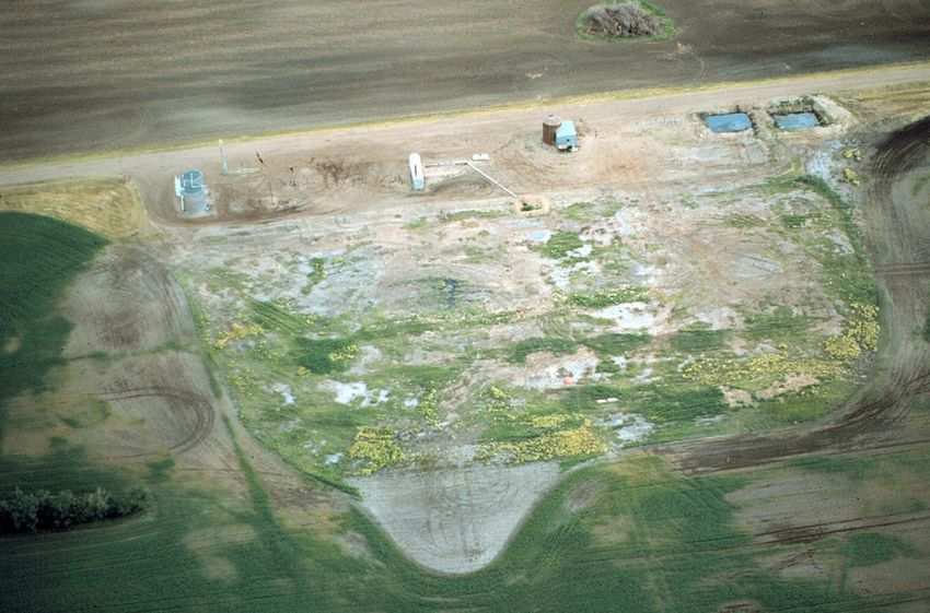
Stratton SWD #1 site (Edson Brown #1)

                                                                          1984

Drilled in 1959 by Cardinal Petroleum (Edson Brown #1).
Produced oil from 1959-1970.                                       1961
Converted to a saltwater disposal well by Phillips Petroleum in 1978
(Stratton SWD #1).
The site contained two brine holding ponds from 1959 to at least 1970
(5 feet deep and 100 x 90 ft & 60 x 100 ft = 0.7 acres).
Produced 178,000 barrels of saltwater.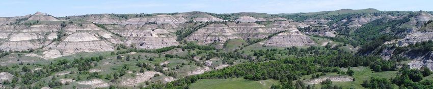
2005

A high salinity plume extends laterally around the site over an area of about 3 acres.
Plume restricted to till and not impacting any useable water supply (ND Health Dept. concurred in 2006).
High chloride levels at 160 feet (500 - 750 mg/l) appear to be coming from the underlying Fox Hills Formation (hydraulic heads).
Energy & Environmental Research Center

                                                             LEGACY BRINE PIT PROJECT
                                                                            Wednesday, March 15, 2017

                                                           Presentation to the North Dakota Industrial Commission
                                                                           Bismarck, North Dakota

                                                                                     Bethany Kurz
                                                                               Principal Hydrogeologist

© 2017 University of North Dakota Energy & Environmental Research Center.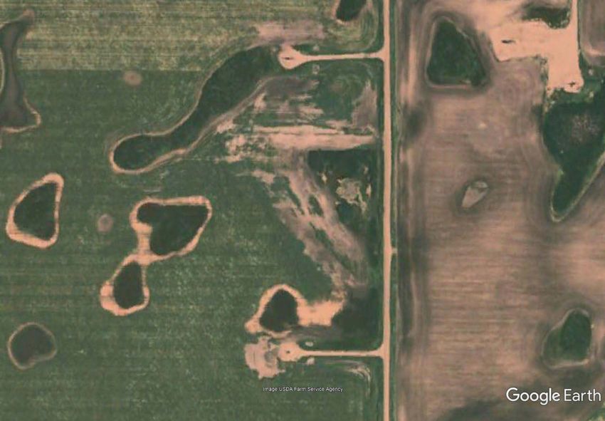
BACKGROUND

• Project goal
  – Apply a best practice, a common
    practice, and a novel remediation
    approach to a “representative” legacy
    brine pit site to assess the efficacy and
    cost of each.
• Project team
  – Energy & Environmental Research
    Center
  – Habitat Management, Inc.
  – Dakota Technologies, Inc.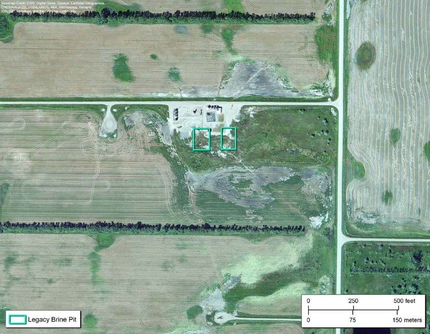
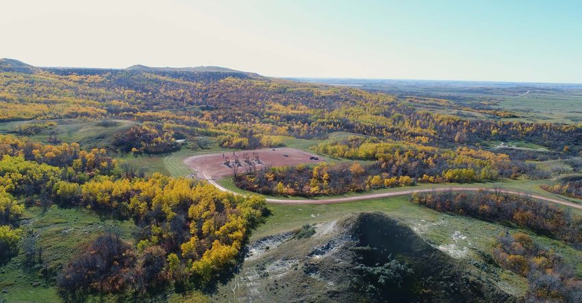
SITE LOCATIONS
        Initial Site Location

                                $450,000
ORIGINAL PROJECT OBJECTIVES • Site characterization to determine areal and vertical extent of brine contamination • Site remediation system design (drain tile, sumps, wells, irrigation, deep hydraulic delivery) • Site preparation • Extensive site irrigation at the best practice site area • Hydraulic delivery of amendments at the novel technique site area • Periodic, regular soil sampling until threshold levels are met
SITE #2: STRATTON SWD   B
NDIC File No. 2318
48.739°N 101.216°W
Spud Date: 05/07/1959

                        B’
Stratton SWD Site B B’
KEY CONCLUSIONS

• Salt-impacted zones extend well beyond the original pit area and may be increasing
  in size.
  – Contaminant migration is exacerbated by the shallow water table in the Prairie
     Pothole Region.
• Soil remediation (soil amendments/irrigation) coupled with drain tile may be a
  mechanism to remediate the near-surface soils (0–6 feet), but costs are highly
  dependent on availability of freshwater supplies for irrigation as well as disposal
  options for the drain tile effluent.
• Given the low-permeability of the soils, in situ treatment of the deeper zones will
  likely be challenging, and excavation of the contaminated soils is very expensive.

                                          14
Reclamation Options for Legacy Brine Waste Pits
in North-central North Dakota:
Effects of remediation techniques on grass species
Funded by Abandoned Oil and Gas Well Reclamation Fund 405-448-15
Drs. Ryan Limb, Kevin Sedivec, Aaron
Daigh, and Tom DeSutter
School of Natural Resource Sciences
North Dakota State UniversityNDSU Field Studies – 2016
Survivability of Grass Plugs and Seedlings on
Legacy Brine Spills using Amendments
Plugs and Seed
Amendments
Survival
Compost
Gypsum Plugs planted in August
Combination of Compost Seeds planted in
and Gypsum October (dormant
seeding)
Ferric hexacyanoferrate
Western wheatgrass
(C18F7N18) crystallization
Inland saltgrass
inhibitor
Alkali sacaton
ControlNorth of Glenburn, ND in Bottineau
County(T157N, R82W, NW1/4 Section 36)
NLeaching Column Results No difference between amendment types (commercial vs gypsum) There was a more than one magnitude reduction in EC (78.4 to 4.67 dS m-1) for all treatments after trial termination. Based on these findings, we CAN MOVE water and salt down the soil profile
Findings to Date
$435,759
Ferric hexacyanoferrate (C18F7N18) crystallization inhibitor DID
NOT work on legacy sites
Nuttall alkaligrass, alkali sacaton, inland saltgrass were superior
grass species to plant on brine impacted soils
Western wheatgrass worked successfully on soils with EC levels < 20 dS m-1North Central Area
216 potential sites
166 sites in aerial photos (Golder)
52 no visual impacts (Golder)
114 impacted sites (Golder)
9 settlements identified (Barr)
105 potential remediation sites
$83,159 100 square feet - 5.75 acres $35,698Brine Pond Remediation Techniques
Project No. 405.2-17-010
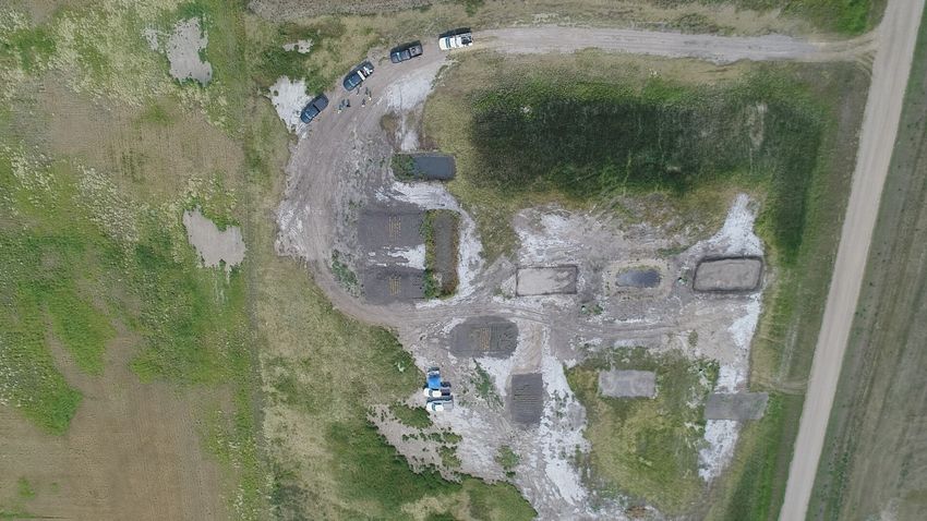
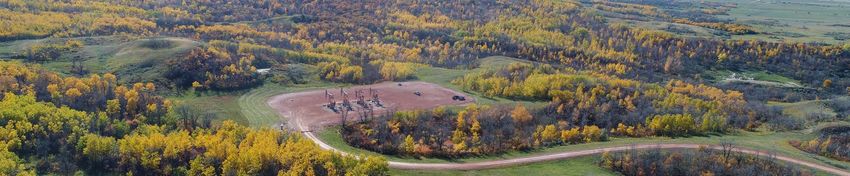
$429,120Drone Aerial Photography
2017
Site B21-13 South of Site Looking North Prior to Field Work
A high salinity plume extends laterally around the site over an area of 250,000 ft2 (about 6 acres).
Plume extends to a depth of over 80 feet (highest concentrations in top 40 feet).
Plume restricted to till and not impacting any useable water supply (ND Health Dept. concurred in 2006).
High chloride levels at 160 feet (500 - 750 mg/l) appear to be coming from the underlying Fox Hills Formation (hydraulic heads).Stratton SWD #1 (Fossum Site 1)
1985
A high salinity plume extends laterally around the site over an area of 250,000 ft2
(about 6 acres).
Plume extends to a depth of over 80 feet (highest concentrations in top 40 feet).
Plume restricted to till and not impacting any useable water supply (ND Health Dept.
concurred in 2006).
High chloride levels at 160 feet (500 - 750 mg/l) appear to be coming from the
underlying Fox Hills Formation (hydraulic heads).PRC-1
5A
PRC-2 3A PRC-3 3B
5B
1B 2B
2A
1A 4
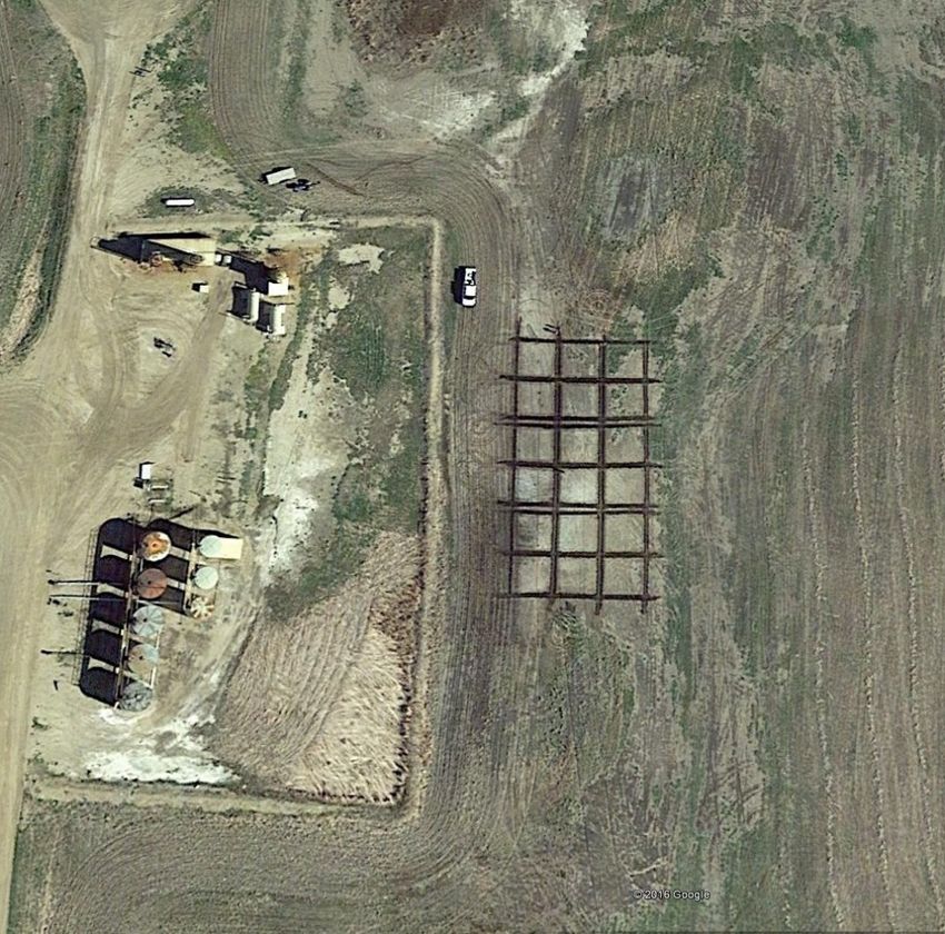
Tested 9 different techniques 2017-2018
$655,396
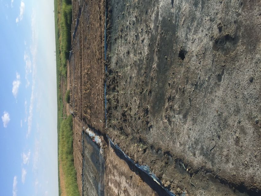
3B performed bestTest Plot 3B – Amended Soil with Water
Flooding
3B Diagram
Test 3B on a typical 1-2 acre site in 2020• Legacy Brine Pit Sites • Background • 2020 Update • Budget
2019
2019
2019
2019
2019
2019
2019
2019
2019
$342,602 2020
• Legacy Brine Pit Sites
• Background
• 2020 Update
• Budget
Budget with Brine Pond Remediation
Fiscal Year    Wells Well Plug & Reclaim Illegal Dumping Legacy Sites   Brine Ponds          Total Fund Balance
       2007    4,603            $231,911                                               $7,500,000 Revenue/year
       2008    5,483             $26,750
       2009    5,547            $141,089
       2010    6,409                  $0
       2011    7,746            $142,729
       2012    9,760             $87,026
       2013   11,945                  $0         $283,389
       2014   14,377                  $0      $1,387,223
       2015   15,853             $49,749         $127,058   $102,201                     $279,008   $11,500,000
       2016   16,513          $1,800,000          $19,407 $1,200,000       $450,000    $3,469,407   $14,030,593
       2017   17,527             $82,075           $6,665   $340,716       $435,759      $865,215   $15,190,378
       2018   18,749             $87,794         $187,577 $1,694,700       $429,120    $2,399,191   $14,791,187
       2019   19,999             $93,648         $124,819 $1,694,700       $118,857    $2,032,024   $22,139,680    0
       2020   20,380             $73,502         $124,819 $1,335,413       $261,501    $4,256,530   $25,654,211    1   $1,695,237
       2021   21,276         $10,000,000         $124,819 $1,000,000        $81,101   $13,944,626   $16,517,736    0
       2022   22,172          $2,500,000         $124,819   $500,000     $1,000,000    $4,124,819   $19,892,917   13
       2023   23,068          $3,500,000         $124,819   $500,000     $1,000,000    $5,124,819   $22,268,098   13
       2024   24,348          $3,500,000         $124,819   $500,000     $1,000,000    $5,124,819   $24,643,278   13
       2025   25,628          $1,000,000         $124,819 $1,694,700     $2,305,300    $5,124,819   $27,018,459   31
       2026   26,908            $750,000         $124,819 $1,694,700     $2,555,300    $5,124,819   $29,393,640   34   $7,941,701

               Total        $24,066,274      $3,009,874 $12,257,130      $9,636,938   $59,370,098 $243,040,177 105
2. Resources Attached With the Public Trust
Historically, the public trust has attached to such resources as tidelands, lands beneath lakes, land beneath a state's navigable
waters, water in whatever form, and parklands.
Purposes protected by the Public Trust Doctrine include navigation, fishing, and hunting.
North Dakota has developed a trust concept in relation to an easement held for the public in the congressional section lines of the
state for transportation purposes. North Dakota is not alone in applying the trust to these easements.
Water appears to be the resource most affected by Public Trust Doctrine.
The idea of the navigable stream beds being held in trust is consonant with the public's right to travel upon the
waters. Riparian landowners and appropriators do not own the streams from which they receive their water but
merely have a usufructuary right.
61-01-01. Waters of the state - Public waters. All waters within the limits of the state from the following sources of
water supply belong to the public and are subject to appropriation for beneficial use and the right to the use of these
waters for such use must be acquired pursuant to chapter 61-04:
1. Waters on the surface of the earth, excluding diffused surface waters but including surface waters whether
flowing in well-defined channels or flowing through lakes, ponds, or marshes which constitute integral parts of a
stream system, or waters in lakes;
2. Waters under the surface of the earth whether such waters flow in defined subterranean channels or are diffused
percolating underground water;
3. All residual waters resulting from beneficial use, and all waters artificially drained; and
4. All waters, excluding privately owned waters, in areas determined by the state engineer to be noncontributing
drainage areas. A noncontributing drainage area is any area that does not contribute natural flowing surface water to a
natural stream or watercourse at an average frequency more often than once in three years over the latest thirty-year
period.IV. CONCLUSION The common law Public Trust Doctrine is not and should not be a substitute for careful planning by legislative and administrative officials charged with co'ordinating allocation and disposition of the publicly owned resources of North Dakota. Beneficial industrial development planning requires a much higher degree of social responsibility than is presently required by the minimal safeguards provided by the Public Trust Doctrine. What the Public Trust Doctrine does provide for the citizens of North Dakota is a judicially developed safeguard with procedural and substantive limitations applied to dispositions of resources which are allocated by the public to the private sector. The Public Trust Doctrine accomplishes this by providing standing in the courts for concerned citizens who wish to challenge an allocation of resources that they feel is not in the public interest. The Public Trust Doctrine serves the interests of the public when a governmental body which is required to represent the public ignores or reacts arbitrarily with regard to the terms of the trusteeship with which the public has been vested with property rights. As a short term concept it can and will provide a minimum standard for review of governmental action but is no substitute for careful, detailed planning and mandatory legislative guidelines for wise energy related development.
North Dakota
Department of Mineral Resources
                    www.dmr.nd.gov
        Phone: 701.328.8020      Email: oilandgasinfo@nd.gov
Mailing Address: 600 East Boulevard Ave. Dept 405; Bismarck, ND 58505
You can also read