NORTH WEST Bush Fire Management Committee Bush Fire Risk Management Plan - Page 1 of 24 - NSW Rural Fire Service
←
→
Page content transcription
If your browser does not render page correctly, please read the page content below
NORTH WEST       Bush   Fire     Management
Committee

Bush Fire Risk Management Plan

                                      Page 1 of 24
Table of Contents
Glossary                                                                 6
Chapter 1. Introduction                                                  8
  1.1 Background                                                         8
  1.2 Aim and Objectives                                                 8
  1.3 Description of the North West BFMC Area                            9
    1.3.1 Location and land tenure                                       9
    1.3.2 Climate and bush fire season                                   9
    1.3.3 Population and demographic information                         9
    1.3.4 History of bush fire frequency and ignition cause              9
Chapter 2. Identifying and Assessing the Bush Fire Risk                 10
  2.1 Process                                                           10
  2.2 Communication and Consultation                                    10
  2.3 Identifying the Bush Fire Risk                                    11
    2.3.1 Assets                                                        11
    2.3.2 Assessing the Bush Fire Risk - Consequence                    12
    2.3.3 Assessing the Bush Fire Risk - Likelihood                     13
    2.3.4 Identifying the level of risk                                 13
    2.3.5 Evaluating the Bush Fire Risk                                 13
    2.3.6 Prioritising Treatments                                       13
    2.3.7 Risk Acceptability                                            13
Chapter 3. Treating the Risk                                            14
  3.1 Bush Fire Management Zones                                        14
  3.2 BFMC Wide Treatments                                              16
  3.3 Asset Specific Treatments                                         17
  3.4 Fire Thresholds                                                   18
  3.5 Annual Works Programs                                             19
  3.6 Implementation                                                    19
Chapter 4. Performance Monitoring and Reviewing                         20
  4.1 Review                                                            20
  4.2 Monitoring                                                        20
  4.3 Reporting                                                         20
  4.4 Performance Measurements                                          20
Appendix 1 Community Participation Strategy                             21
Appendix 2 Asset Register                                               22
Appendix 3 Treatment Register                                           23
Appendix 1-8 Maps                                                       24

                                                              Page 2 of 24
List of Tables
Table 3.1 Bush Fire Management Zones: Purpose, objectives and characteristics                                                          15
Table 3.2 Asset specific treatments used in the North West BFMC area                                                                   18
Table 3.3 Fire Thresholds for Vegetation Categories                                                                                    19

List of Figures
Figure 2.1 Overview of the risk assessment process ..................................................................................... 10

                                                                                                                            Page 3 of 24
Authorisation

In accordance with Part 3 Division 4 of the Rural Fires Act 1997, this Plan has been
prepared by the North West Bush Fire Management Committee and has been endorsed at
the Coonamble Fire Control Centre 15th March 2017 for submission to the Bush Fire
Coordinating Committee.

Recommended

                   Chairperson
                   North West Bush Fire Management Committee

Approved

                      On behalf of the
                      NSW Bush Fire Coordinating Committee

                                                                          Page 4 of 24
Amendment List

         Amendment                      Entered
Number        Date          Signature       Date

                                                   Page 5 of 24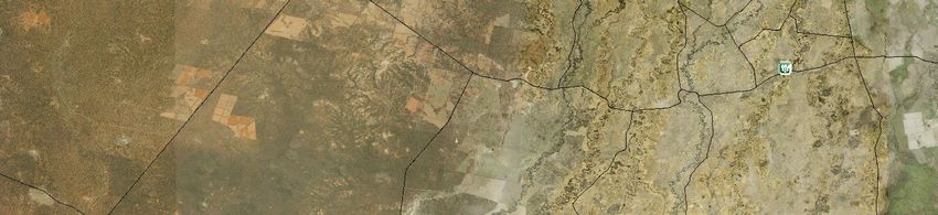
Glossary
Assets: anything valued by the community which includes houses, crops, heritage
buildings and places, infrastructure, the environment, businesses, and forests, that may be
at risk from bush fire.

Bush Fire: a general term used to describe fire in vegetation, includes grass fire.

Bush Fire Hazard: the potential severity of a bush fire, which is determined by fuel load,
fuel arrangement and topography under a given climatic condition.

Bush Fire Risk: the chance of a bush fire igniting, spreading and causing damage to the
community or the assets they value.

Bush Fire Risk Management: a systematic process that provides a range of treatments
which contribute to the well being of communities and the environment, which suffer the
adverse effects of wildfire/bush fire.

Bush Fire Threat: potential bush fire exposure of an asset due to the proximity and type
of a hazard and the slope on which the hazard is situated.

Consequence: outcome or impact of a bush fire event.

Fire Fighting Authorities: the NSW Rural Fire Service, Fire & Rescue NSW, the National
Parks and Wildlife Service and Forests NSW.

Likelihood: the chance of a bush fire igniting and spreading.

Major Bush Fire: A bush fire which requires the attendance of multiple brigades, or
causes damage to property or injury to one or more persons.

Display area: geographic area determined by the Bush Fire Management Committee
which is used to provide a suitable area and scale for community participation and
mapping display purposes.

Recovery costs: the capacity of an asset to recover from the impacts of a bush fire.

Risk Acceptance: an informed decision to accept the consequences and the likelihood of
a particular risk.

Risk Analysis: a systematic process to understand the nature of and to deduce the level
of risk.

Risk Assessment: the overall process of risk identification, risk analysis and risk
evaluation.

Risk Identification: the process of determining what, where, when, why, and how
something could happen.

                                                                                  Page 6 of 24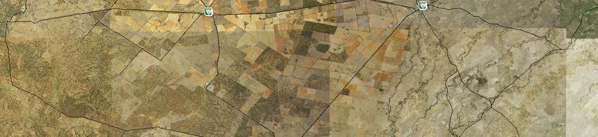
Risk Treatment: the process of selection and implementation of measures to modify risk.

Vulnerability: the susceptibility of an asset to the impacts of bush fire.

                                                                              Page 7 of 24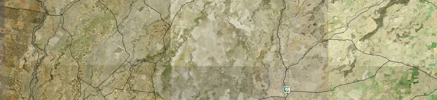
Chapter 1. Introduction
1.1 Background
Under the Rural Fires Act 1997 the Bush Fire Coordinating Committee (BFCC) must
constitute a Bush Fire Management Committee (BFMC) for each area in the State, which
is subject to the risk of bush fires. Each BFMC is required to prepare and submit to the
BFCC a draft Bush Fire Risk Management Plan (BFRMP).
A BFRMP is a strategic document that identifies community assets at risk and sets out a
five-year program of coordinated multi-agency treatments to reduce the risk of bush fire to
the assets. Treatments may include such things as hazard reduction burning, grazing,
community education, fire trail maintenance and establishing community fireguard groups.
Annual programs to implement the treatments identified in this plan will be undertaken by
the relevant land managers and fire fighting authorities.
In exercising its functions under the Rural Fires Act 1997, including the preparation of a
draft bush fire risk management plan, the North West BFMC is required to have regard to
the principles of ecologically sustainable development (ESD).
This document and the accompanying maps together form the BFRMP for the North West
BFMC area.
This BFRMP has been prepared by the North West BFMC and covers both public and
private lands. This BFRMP must be reviewed and updated within each successive five-
year period from the constitution of the BFMC.
The BFCC recognises that climate change has the potential to increase bush fire risk. The
risk assessment process applied in this BFRMP is based on current climatic conditions.
The BFCC will monitor information on climate change and will modify the process when
necessary.
1.2 Aim and Objectives
The aim of this BFRMP is to minimise the risk of adverse impact of bush fires on life,
property and the environment.
The objectives of this BFRMP are to:
reduce the number of human-induced bush fire ignitions that cause damage to life,
property and the environment;
manage fuel to reduce the rate of spread and intensity of bush fires, while minimising
environmental/ecological impacts;
reduce the community’s vulnerability to bush fires by improving its preparedness; and
Effectively contain fires with a potential to cause damage to life, property and the
environment.
Page 8 of 24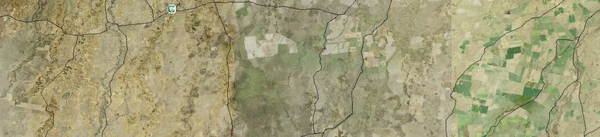
1.3 Description of the North West BFMC Area
1.3.1 Location and land tenure
The North West BFMC area is located in North West New South Wales and includes the
Local Government Areas of Bogan, Coonamble, Walgett and Warren

North West BFRMC has less than 57,000 km square (approx) comprising with the majority
of being private land holdings & the rest including State Forest, National Parks, and Rural
Land Protection & Department of Lands.

1.3.2 Climate and bush fire season
The typical / average climate in the North West BFMC area is hot summers and cold
winters with predominantly summer rainfall and the bush fire season generally runs from
October to March.
Prevailing weather conditions associated with the bush fire season in the North West
BFMC area are North-westerly winds accompanied by high daytime temperatures and low
relative humidity. There are also frequent dry lightning storms occurring during the bush
fire season.

1.3.3 Population and demographic information
The population of the North West BFMC area is approximately 17,400 people. The major
population centres are Coonamble, Lightning Ridge, Nyngan, Walgett and Warren. The
following issues have been identified within the North West BFMC area as potentially
impacting on the ability of certain sections of the community to prepare themselves for
bush fire: absentee landowners, seasonal workers e.g. harvest time, tourism at Lightning
Ridge, Warrumbungle National Park.

1.3.4 History of bush fire frequency and ignition cause
The North West BFMC area has on average 20 bush fires per year, of which 1 can be
considered to be a major fire.
The main sources of ignition in the North West BFMC area are:
Ignition from farming machinery, electrical storms & arson.

                                                                                Page 9 of 24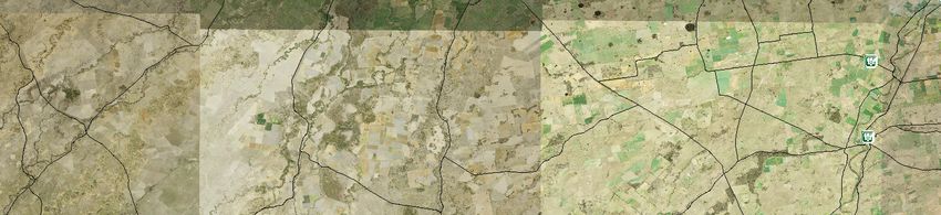
Chapter 2. Identifying and Assessing the Bush Fire Risk
2.1 Process
The Australia/New Zealand Standard AS/NZS 4360: 2004 Risk Management was used as
the basis for the risk assessment process. See Figure 2.1 for the steps involved. For a
detailed description of the process undertaken see the Bush Fire Risk Management
Planning Guidelines for Bush Fire Management Committees on the RFS website:
www.rfs.nsw.gov.au.

                                Establish the
                                  Context
      Communicate and consult

                                Identify risks
                                                 Risk Assessment

                                                                   Monitor and review
                                Analyse risks

                                Evaluate risks

                                 Treat risks

     Figure 2.1 Overview of the risk assessment process

2.2 Communication and Consultation
Community participation is an integral part of risk management. The Community
Participation Strategy involved developing and implementing a process to address the
needs, issues and concerns of stakeholders within the BFMC area in regards to the
BFRMP. See Appendix 1 for the Community Participation Strategy used by the North West
BFMC in preparing this BFRMP.

                                                                                        Page 10 of 24
2.3 Identifying the Bush Fire Risk
Identifying the level of bush fire risk firstly involved identifying important community assets
considered to be at risk from bush fire in the North West BFMC area, and then assessing
the likelihood and consequence ratings.
2.3.1 Assets
BFMC members and the community, including RFS volunteers, identified assets within the
North West BFMC that they believed were at risk of bush fire.
The assets were divided into four asset types:
Human settlement
Residential areas including urban bushland interface areas and rural properties;
Special Fire Protection areas including schools, hospitals, nursing homes, and
tourist facilities; and
Other human settlement areas including commercial and industrial areas where
distinct from major towns.
Economic
Agricultural; e.g. major silos, regional saleyards, cropping/grazing land;
Commercial/industrial e.g. major industries, waste treatment plants, sawmills;
Infrastructure e.g. large power lines, gas and oil pipelines, railway lines, electricity
substations, communication facilities;
Tourist and recreational e.g. tourist sites and facilities, resorts, retreats;
Mines;
Commercial forests e.g. pine plantations, eucalypt plantations and commercial
native forests; and
Drinking water catchments.
Environmental
Threatened species, populations and ecological communities and Ramsar
wetlands;
Locally important species and ecological communities, such as species and
ecological communities especially sensitive to fire.
Page 11 of 24Cultural
Aboriginal significance – Aboriginal places and items of significance;
Non-indigenous heritage – places and items arising from the early occupation of
NSW by European or other non-indigenous settlers; and
Other cultural assets – community halls, clubs and recreational facilities.
See Appendix 2 for the full list of assets identified in the North West BFMC area. See
maps 1-8 for the location of assets to be treated under this BFRMP.
2.3.2 Assessing the Bush Fire Risk - Consequence
Once the assets were identified, the consequence of a bush fire impacting on these assets
was assessed.
See Appendix 2 for the consequence ratings assigned to each asset identified in the North
West BFMC area.
The different asset types had different assessment processes used to determine the
consequence. These processes are identified below.
Human settlement
A potential fire behaviour model using vegetation type, slope and separation distance was
used to produce a threat rating for human settlement assets. The vulnerability of the asset
to a bush fire was also assessed and a rating assigned. These ratings were then used to
assess the consequence of a bush fire impacting upon a human settlement asset.
Special Fire Protection (SFP) assets were considered inherently more vulnerable to bush
fire due to mobility capacity, knowledge or other issues relating to their inhabitants, (e.g.
the elderly, infirm, children or tourists) and therefore stricter requirements for vulnerability
assessment and rating were applied.
Economic
The level of economic impact e.g. local, regional or state, as well as the economic
recovery costs (how long and complicated a financial recovery will be) of the asset were
identified. These ratings were used to assess the consequence of a bush fire impacting
upon an economic asset.
Environmental
Environmental assets with known minimum fire threshold were assessed to determine if
they were at risk of a bush fire within the 5 year life of the BFRMP using fire history data.
Those environmental assets which were within or above the fire threshold were not
assessed in the BFRMP, as the negative impact of a fire within the 5 year period was
determined as being low and may even be of benefit to the asset and surrounding habitat.
The vulnerability of an environmental asset was determined by its conservation status and
its geographic extent (distribution across the landscape). Vulnerability and potential impact
of bush fire were used to assess the consequence of a bush fire impacting upon an
environmental asset.
Page 12 of 24Cultural
For non-indigenous historical, Aboriginal and other cultural assets a potential fire
behaviour model using fuel load, slope and proximity was used to produce a threat rating.
The physical vulnerability of the asset to a bush fire was also assessed. These ratings
were then used to assess the consequence of a bush fire impacting upon a cultural asset.
2.3.3 Assessing the Bush Fire Risk - Likelihood
For all asset types the likelihood of a bush fire occurring was assessed. This involves
considering fire history, including ignition cause and patterns, known fire paths, access,
containment potential and potential fire run (size of the vegetated area). See Appendix 2
for the likelihood ratings assigned to each asset identified in the North West BFMC area.
2.3.4 Identifying the level of risk
The consequence and likelihood ratings were then used to identify the level of risk. See
Appendix 2 for the risk ratings assigned to each asset identified in the North West BFMC
area.
2.3.5 Evaluating the Bush Fire Risk
Once the risk ratings for each asset were identified, they were evaluated to:
a) confirm that risk levels identified in the risk analysis process are appropriate and
reflect the relative seriousness of the bush fire risk;
b) identify which assets require treatments; and
c) Identify treatment priorities.
2.3.6 Prioritising Treatments
No organisation has limitless resources to deal with adverse risk. It is therefore necessary
to define priorities. The bush fire risk ratings determined were used to prioritise the risk
treatments, i.e. areas of extreme risk were considered first for treatment, then very high,
then high then medium then low.
2.3.7 Risk Acceptability
Risks below a certain level were assessed as not requiring treatment within the life of this
plan. This is due to a combination of higher priority works taking precedence and the ability
to achieve works within the life of this plan. Within the North West BFMC area the level of
acceptability is Low. Areas of Low risk are likely to be managed by routine procedures and
so do not require a specific application of resources, however the BFMC has identified
treatments for those assets that will be undertaken.
Page 13 of 24Chapter 3. Treating the Risk
3.1 Bush Fire Management Zones
Bush Fire Management Zones were identified within the North West BFMC area and
mapped (see maps 1-8). These zones identify the fire management intent for a specific
area. See Table 3.1 for descriptions of the zones and their purposes. The four categories
of Bush Fire Management Zones are:
Asset Protection Zone (APZ);
Strategic Fire Advantage Zone (SFAZ);
Land Management Zone (LMZ); and
Fire Exclusion Zone (FEZ).
Some of these zones (usually Land Management Zones) may be further classified within
this category by the land manager, e.g. LMZ -Heritage Management Zone (NPWS).
Page 14 of 24Zone Purpose Suppression Objective(s) Zone characteristics
Asset To protect human To enable the safe use of As per RFS document
Protection life, property and Direct Attack suppression Standards for Asset
Zone highly valued public strategies within the zone. Protection Zones.
assets and values. To minimise bush fire impacts
on undefended assets.
Strategic To provide strategic To improve the likelihood and Zone width related to
Fire areas of fire safe use of: suppression objectives
Advantage protection and dependent upon:
Zone advantage which Parallel Attack suppression Topography
will reduce the strategies within the zone. Aspect
speed and intensity and/or Spotting propensity
of bush fires, and Indirect Attack (back Location of adjacent
reduce the potential burning) in high to very high firebreaks
for spot fire fire weather conditions within Mosaic pattern of
development; the zone. treatment
To aid containment Assess Overall Fuel
of wildfires to To reduce the likelihood of: Hazard (OFH) once
existing Crown fire development vegetation communities
management within the zone. reach minimum fire
boundaries. and/or thresholds within this
Spot fire ignition potential plan.
from the zone
Management practices
should aim to achieve
. mosaic fuel reduction
patterns so that the
majority of the SFAZ has
an OFH of less than
high.
Land To meet relevant As per the land management As appropriate to
Management land management and fire protection objectives achieve land
Zone objectives in areas of the responsible land management e.g.
where APZs or management agency. heritage and/or fire
SFAZs are not To reduce the likelihood of protection e.g. broad
appropriate. spread of fires. scale mosaic burning
objectives.
To undertake mosaic burning
Fire To exclude bush N/A Variable dependant on
Exclusion fires. size of fire sensitive area
Zone requiring protection.
Table 3.1 Bush Fire Management Zones: Purpose, objectives and characteristics
NB: OFH refers the Overall Fuel Hazard Guide as described in the document published by
(Dept. of Sustainability and Environment 3rd ed. 1999 & NPWS version); State-wide
procedures for assessment of fuel hazard will be developed in conjunction with the BFCC.
Note: All areas that are not mapped or described as APZs or SFAZs are considered as
LMZs.
*For the purpose of the Bush Fire Environmental Assessment Code:
Page 15 of 241. Plantations that are approved under the Plantations & Reafforestation Act 1999
after closure of the public exhibition period for this BFRMP are considered to be
identified in this BFRMP; and
2. Retained vegetation within the aforementioned plantations is considered to be a
Strategic Fire Advantage Zone identified in the text of this BFRMP as long as it
meets the suppression objectives for SFAZs included in the BFRMP, and is not
mapped or otherwise described as a Fire Exclusion Zone in the BFRMP.
3.2 BFMC Wide Treatments
BFMC wide treatments are activities which reduce the overall bush fire risk within the
BFMC area and are undertaken on an ongoing basis as part of normal business. These
treatments are not linked to specific assets in the BFRMP, rather they are applied across
all or part of the BFMC area as designated by legislation or agency policy. BFMC wide
treatments include the following:
Reviewing the bush fire prone land map
These maps identify bush fire prone land and are used to trigger whether a
development application is assessed using Planning for Bush Fire Protection1.
Ensuring developments in bush fire prone land comply with Planning for
Bush Fire Protection
This assessment process requires new applications for development to include
bush fire protection measures.
Using the Local Environment Plan/s (LEPs) to control developments in areas
with a bush fire risk
LEPs can be used to exclude development in extreme bush fire risk areas or where
bush fire protection measures cannot be incorporated.
Varying the standard bush fire danger period as required
In years where the weather is particularly adverse the bush fire danger period may
be brought in early or extended. This is assessed every year by the BFMC.
Requiring permits during the bush fire danger period
In the bush fire danger period a fire safety permit is required to light a fire in the
open. Permits specify conditions such as fire fighting equipment that must be on
site, or restrict burns based on weather conditions.
1NSW Rural Fire Service 2006 Planning for Bush Fire Protection: A guide for councils, planners, fire
authorities and developers.
Page 16 of 24 Prosecution of arsonists/offenders
Under the Rural Fires Act 1997 persons may be prosecuted for breaching the
conditions on a fire permit, lighting a fire during a Total Fire Ban, allowing fire to
escape their property, or other breaches of the Act.
Investigation of bush fire cause
All bush fires which do not have a known cause are investigated to identify how
they started.
Normal fire suppression activities
Responding to bush fire is a normal business activity for the fire fighting authorities.
Assessing and managing compliance with strategic fire fighting resource
allocation provisions
Strategic fire fighting resource allocation provisions is the process used to identify
the number of stations, brigades and appliances required in an area, and considers
members, training, assets and hazards.
Preparation of a S52 Operations Coordination Plan
The Operations Coordination Plan is prepared biannually and sets out how
coordinated fire fighting will occur. It includes specific operational restrictions on fire
fighting techniques in certain areas, where fires will be managed from, and how
agencies involved can communicate during operations.
Fire Management Plans or Plans of Management
Some land management agencies have developed fire management plans or plans
of management with specific fire or fuel management strategies, for example a
Forests NSW Regional Fuel Management Risk Plan, a NPWS Fire Management
Strategy. These publicly exhibited plans form the basis for operational fire planning
on public parks, reserves and forests.
Bush Fire Hazard Complaints
If someone is concerned about possible bush fire hazards on a neighbouring
property or any other land, then this can be reported to the RFS Commissioner or
their local RFS Fire Control Centre. The complaint will be investigated and may
result in a notice being issued to the landowner or manager to reduce the hazard.
Implement Atlas Wildlife Management Conditions
Relevant Agencies/Land Managers to implement as required.
Deliver Property Preparedness Advice
As required via relevant means – such as social media, letter-box drop and
community meetings.
3.3 Asset Specific Treatments
There are five broad strategy groups available to treat the bush fire risk to assets identified
in the BFRMP.
Page 17 of 24The types of asset specific treatments in each strategy group used in the North West
BFMC area are listed below. A full list of the treatment strategies in the North West BFMC
area are in Appendix 3.
Strategy Targeted treatments used in the North West BFMC area
Ignition Manage and control ignition sources through the use of Fire
Management Safety Permits and Total Fire Ban days.
Hazard To reduce the amount of available fuels either by mechanical
Reduction means or prescribed burning.
Community To inform and arm the community with the information that they
Education need to prevent, mitigate and survive bush fires.
Property Use of Bush Fire Prone Land Map to determine developments
Planning that shall be referred to the RFS for assessment under Planning
for Bush Fire Protection.
Preparedness Inspect villages for bush fire hazards and maintain mapped fire
trails.
Table 3.2 Asset specific treatments used in the (North West) BFMC area
3.4 Fire Thresholds
The vegetation in the North West BFMC area was classified into fire threshold categories
(Table 3.3*).
Minimum Minimum
Maximum
Vegetation formation SFAZ LMZ Notes
Threshold
Threshold Threshold
Rainforest NA NA NA Fire should be avoided.
Alpine complex NA NA NA Fire should be avoided.
Wet Sclerophyll forest Crown fires should be avoided in
25 30 60
(shrubby sub formation) the lower end of the interval range.
Wet Sclerophyll forest Crown fires should be avoided in
10 15 50
(grassy sub formation) the lower end of the interval range.
Minimum interval of 10 years should
apply in the southern Tablelands
Grassy woodland 5 8 40
area. Occasional intervals greater
then 15 years may be desirable.
Occasional intervals greater than 7
years should be included in coastal
areas. There was insufficient data
Grassland 2 3 10 to give a maximum interval;
available evidence indicates
maximum intervals should be
approximately 10 years.
Dry sclerophyll forest
Occasional intervals greater than 25
(shrub/grass sub 5 8 50
years may be desirable.
formation)
Dry sclerophyll forest Occasional intervals greater than 25
7 10 30
(shrub sub formation) years may be desirable.
Occasional intervals greater than 20
Heath lands 7 10 30
years may be desirable.
Page 18 of 24Occasional intervals greater than 30
Freshwater wetlands 6 10 35
years may be desirable.
Some intervals greater than 20
Forested wetlands 7 10 35
years may be desirable.
Saline wetlands NA NA NA Fire should be avoided.
Semi-arid woodlands Not enough data for a maximum fire
6 9 No max
(grassy sub formation) interval.
Semi-arid woodlands Not enough data for a maximum fire
10 15 No Max
(shrubby sub formation) interval.
Arid shrub lands
NA NA NA Fire should be avoided.
(chenopod sub formation
Arid shrub lands (acacia Not enough data for a maximum fire
10 15 No Max
sub formation) interval.
Table 3.3 Fire Thresholds for Vegetation Categories
3.5 Annual Works Programs
The land management agencies and fire fighting authorities responsible for implementing
the treatments identified in this plan will include those treatments in their annual works
programs detailing how, when, and where the required activities will be undertaken.
3.6 Implementation
When the treatments identified in this BFRMP are implemented there are a number of
issues that need to be considered by the responsible agency including environmental
assessments and approvals, smoke management and prescribed burn plans.
*Local permit issuing/hazard reduction burning exclusion periods
In the North West BFMC area the issuing of permits/hazard reduction burning is not
permitted during grain harvest and between 23rd December to 2nd January (in line with the
local NSW RFS Permit Policy).
Page 19 of 24Chapter 4. Performance Monitoring and Reviewing
4.1 Review
This BFRMP must be reviewed and updated within each successive five-year period from
the constitution of the BFMC. The North West BFMC will also review this plan as
necessary to account for any changes in context or risk. This may be triggered by a range
of circumstances, including but not limited to:
changes to the BFMC area, organisational responsibilities or legislation;
changes to the bush fire risk in the area; or
following a major fire event.
4.2 Monitoring
The BFMC is required to monitor progress towards the completion of treatment works
listed in the BFRMP, and the timeliness of the works.
4.3 Reporting
The BFMC is required to report annually to the BFCC on its progress in implementing the
bush fire risk management activities identified in this plan.
4.4 Performance Measurements
State wide performance measurements which are linked to the BFRMP have been
identified by the BFCC. All BFMCs must use these to monitor and report on their success
in reducing the bush fire risk in their BFMC area.
Page 20 of 24Appendices
Appendix 1 Community Participation Strategy
Page 21 of 24Appendix 1: North West Bush Fire Management Committee
Community Participation Strategy
Proposed Target Method of Method of Key messages/ purpose Resources required Responsibility Date
Date Audience communication notification Completed
March Coonamble Pre-planned RFS Introduce Venue Angus McDowall 24/03/14
Captain’s meeting; correspondence, BFRMPs Powerpoint RFS
Meeting Presentation and agenda Community presentation
open discussion issues Maps
Identify assets Facilitators
Asset
assessments
Discuss
treatment options
Community
responsibilities
March Walgett Pre-planned RFS Introduce Venue Angus McDowall 25/04/14
Captain’s meeting; correspondence, BFRMPs Powerpoint RFS
Meeting Presentation and agenda Community presentation
open discussion issues Maps
Identify assets Facilitators
Asset
assessments
Discuss
treatment options
Community
responsibilities
March Bogan Pre-planned RFS Introduce Venue Angus McDowall 26/04/14
Captain’s meeting; correspondence, BFRMPs Powerpoint RFS
Meeting Presentation and agenda Community presentation
open discussion issues Maps
Identify assets Facilitators
Asset
assessments
Discuss
treatment options
Community
responsibilitiesMarch Warren Pre-planned RFS Introduce Venue Angus McDowall Meeting not
Captain’s meeting correspondence, BFRMPs Powerpoint RFS held due to
Meeting agenda Community presentation volunteer
issues Maps availability.
Identify assets Facilitators
Asset Media article
assessments
Discuss
treatment options
Community
responsibilities
March RFS Senior Pre-planned RFS Introduce Venue Angus McDowall 29/04/14
Management meeting; correspondence, BFRMPs Powerpoint RFS
Team Presentation and agenda Community presentation
open discussion issues Maps
Identify assets Facilitators
Asset
assessments
Discuss
likelihood/conseq
uence
Discuss
treatment options
Community
responsibilities
March General Media Release N/A Introduce Media Release Angus McDowall 15/04/14
Public BFRMPs RFS
Encourage
community input
Community
responsibilities
19/06/2014 RFS Senior Pre Planned RFS Update on draft Maps Angus McDowall Meeting not
Management meeting, correspondence, plan development held due to
Team Presentation, agenda Identified assets volunteer
open discussion, and treatments availability
maps Hazards in the
community20/08/15 Bogan Pre Planned RFS Update on draft Maps Angus McDowall 03/03/2016
Captains meeting, correspondence, plan development Facilitator
Meeting Presentation, agenda Identified assets
open discussion, and treatments
maps Hazards in the
community
21/08/2015 Coonamble Pre Planned RFS Update on draft Maps Angus McDowall 16/03/2016
Captains meeting, correspondence, plan development Facilitator
Meeting Presentation, agenda Identified assets
open discussion, and treatments
maps Hazards in the
community
27/08/2015 Walgett Pre Planned RFS Update on draft Maps Angus McDowall 06/04/2016
Captains meeting, correspondence, plan development Facilitator
Meeting Presentation, agenda Identified assets
open discussion, and treatments
maps Hazards in the
community
28/08/2015 Warren Pre Planned RFS Update on draft Maps Angus McDowall 10/03/2016
Captains meeting, correspondence, plan development Facilitator
Meeting Presentation, agenda Identified assets
open discussion, and treatments
maps Hazards in the
community
12/01/2016 RFS Senior Pre Planned RFS Presentation of Maps Angus McDowall 20/02/2016
Management meeting, correspondence, Draft Plan before Spreadsheets RFS
Team Presentation, agenda Public Exhibition
open discussion,
maps
18/04/16– General Static displays Office number Maintain BFMC Angus McDowall 31/05/2016
31/05/16 Public Contact number community Representative RFS
participation Greg Sim
Record and RFS
consider issues
and commentsAppendix 2 Asset Register
Page 22 of 24Appendix 2 - Asset Register
Map reference # Asset type Asset sub type Asset name Asset Location LGA Display area Likelihood Consequence Risk Priority Treatment number
1 Human Settlement Residential Glengarry/Grawin Opal Fields 65km north west of Walgett on Wilby Wilby Rd Walgett North West Likely Major Very High 2A 1;3;6
4 Economic Commercial Forest Pilliga West State Forest Coonamble East Almost certain Moderate Very High 2C 9
8 Human Settlement Residential Cumborah Village Walgett North West Likely Moderate High 3A 1;3;6
9 Human Settlement Other Victoria Park NSP Udora Road, Warren Warren South East Likely Moderate High 3A 12
10 Economic Infrastructure Come By Chance Communications Tower Walgett North East Likely Moderate High 3A 13
11 Economic Infrastructure Sandy Camp Communications Tower Coonamble Central Likely Moderate High 3A 13
12 Economic Infrastructure Mt Foster Communications Tower Warren Central Likely Moderate High 3A 13
13 Economic Infrastructure Girilambone Communications Tower Bogan South West Likely Moderate High 3A 13
14 Economic Infrastructure Babinda Communications Tower Bogan South Likely Moderate High 3A 13
18 Economic Commercial Forest Gillwarny State Forest Walgett Central Likely Moderate High 3A 9
21 Economic Commercial Forest Narraway State Forest Coonamble Central Likely Moderate High 3A 9
22 Economic Commercial Forest Tallegar State Forest Coonamble Central Likely Moderate High 3A 9
23 Economic Commercial Forest Sandgate State Forest Coonamble Central Likely Moderate High 3A 12
24 Economic Commercial Forest Bourbah State Forest Coonamble Central Likely Moderate High 3A 9
26 Economic Commercial Forest Talby State Forest Coonamble East Likely Moderate High 3A 9
27 Economic Commercial Forest Warrie Warrie State Forest Coonamble East Likely Moderate High 3A 9
28 Economic Commercial Forest Girilambone State Forest Bogan South West Likely Moderate High 3A 9
29 Economic Commercial Forest Miandetta State Forest Bogan South West Likely Moderate High 3A 9
30 Economic Commercial Forest Grayrigg State Forest Bogan South Likely Moderate High 3A 9
31 Economic Commercial Forest Barrow State Forest Bogan South Likely Moderate High 3A 9
32 Economic Commercial Forest Cumbine State Forest Bogan South Likely Moderate High 3A 9
33 Economic Commercial Forest Pangee State Forest Bogan South Likely Moderate High 3A 9
34 Economic Commercial Forest Peisley State Forest Bogan South Likely Moderate High 3A 9
35 Economic Commercial Forest Grahway State Forest Bogan South Likely Moderate High 3A 9
36 Economic Commercial Forest Balgay State Forest Bogan South Likely Moderate High 3A 9
37 Economic Commercial Forest Talgong State Forest Bogan South Likely Moderate High 3A 9
38 Economic Commercial Forest Wharfdale State Forest Bogan South Likely Moderate High 3A 9
39 Economic Commercial Forest Bobadah Bogan South Likely Moderate High 3A 9
40 Economic Commercial Forest Nangerybone State Forest Bogan South Likely Moderate High 3A 9
42 Human Settlement Residential Collarenebri Aboriginal Village Walgett North East Likely Moderate High 3A 3
43 Human Settlement Residential Namoi Village Walgett North East Likely Moderate High 3A 3
North West Bush Fire Management Plan
Bush Fire Coordinating Committee - Policy No 1/2008Appendix 2 - Asset Register
Map reference # Asset type Asset sub type Asset name Asset Location LGA Display area Likelihood Consequence Risk Priority Treatment number
44 Human Settlement Special Fire Protection Marra Creek Public School Marra Rd Warren Central Possible Major High 3B 6
45 Economic Commercial Coonamble Waste Landfill Depot Quambone Rd, Coonamble Coonamble East Almost certain Minor High 3D 6
46 Economic Commercial Burren Junction Waste Disposal Depot Kamilaroi Hwy, Burren Junction Walgett North East Almost certain Minor High 3D 6
47 Economic Commercial Warren Waste Disposal Depot Oxley Hwy, Warren Warren South East Almost certain Minor High 3D 6
48 Economic Commercial Coolabah Tip Arthur VC Hall Way, Coolabah Bogan South West Almost certain Minor High 3D 6
52 Economic Commercial Nyngan Waste Depot Canonba Rd, Nyngan NSW Bogan South West Almost certain Minor High 3D 6
53 Human Settlement Special Fire Protection Gulargambone Central School Coonamble East Unlikely Major Medium 4 19;6
54 Human Settlement Residential Collarenebri Walgett North East Likely Minor Medium 4 17;3;6
55 Human Settlement Residential Lightning Ridge Walgett North Likely Minor Medium 4 17;1;3;6;5;16
56 Human Settlement Residential Carinda Town Walgett Central Likely Minor Medium 4 17;3;6
57 Human Settlement Residential Coonamble Coonamble East Likely Minor Medium 4 17;3;6
58 Human Settlement Residential Gulargambone Coonamble East Likely Minor Medium 4 17;3;6
59 Human Settlement Residential Nevertire Warren South East Likely Minor Medium 4 17;3;6
60 Human Settlement Residential Hermidale Bogan South West Likely Minor Medium 4 17;3;6
61 Human Settlement Residential Warren Warren South East Likely Minor Medium 4 17;3;6
62 Economic Infrastructure Coonamble Airport Coonamble Coonamble East Unlikely Major Medium 4 6
63 Human Settlement Other Spider Brown Memorial Oval NSP Corner of Kaolin and Agate Streets, Lightning Ridge Walgett North Unlikely Major Medium 4 12
64 Human Settlement Other Swimming Pool Grounds NSP Herbert St, Collarenebri Walgett North East Unlikely Major Medium 4 12
65 Human Settlement Other Gray Park NSP Corner of Pitt and Euroka Streets, Walgett Walgett North East Unlikely Major Medium 4 12
66 Human Settlement Other Algy Friend Oval NSP Pitt St X Coral Ave, Walgett Walgett North East Unlikely Major Medium 4 12
67 Human Settlement Other Swimming Pool Grounds NSP Cnr Waterloo & Alma Streets, Burren Junction Walgett North East Unlikely Major Medium 4 12
68 Human Settlement Other Rowena Public School Playground NSP Shaw St, Rowena Walgett North East Unlikely Major Medium 4 18
69 Human Settlement Other Coonamble Golf Course NSP Castlereagh Hwy, Coonamble Coonamble East Unlikely Major Medium 4 12
70 Human Settlement Other Quambone Sportsground NSP Corner of Yarea & Mungie St, Qaumbone Coonamble Central Unlikely Major Medium 4 12
71 Economic Commercial Gulargambone Waste Transfer Station Castlereagh Hwy, Gulargambone Coonamble East Likely Minor Medium 4 6
72 Economic Commercial Quambone Waste Depot Sandy Camp Rd, Qumabone Coonamble Central Likely Minor Medium 4 6
73 Economic Commercial Carinda Village Tip Shakespeare St, Carinda Walgett Central Likely Minor Medium 4 6
74 Economic Commercial Collarenenbri Tip Collarenebri Cemetry Rd, Collarenebri Walgett North East Likely Minor Medium 4 6
75 Economic Commercial Rowena Waste Disposal Depot Rowena Rd Walgett North East Likely Minor Medium 4 6
76 Economic Infrastructure Collarenebri Airport Walgett North Likely Minor Medium 4 6
77 Economic Infrastructure Walgett Airport Walgett North East Likely Minor Medium 4 6
North West Bush Fire Management Plan
Bush Fire Coordinating Committee - Policy No 1/2008Appendix 2 - Asset Register
Map reference # Asset type Asset sub type Asset name Asset Location LGA Display area Likelihood Consequence Risk Priority Treatment number
78 Economic Infrastructure Lightning Ridge Airport Walgett North Likely Minor Medium 4 6
79 Economic Infrastructure Warren Airport Oxley Hwy, Warren Warren South East Likely Minor Medium 4 6
81 Human Settlement Residential Gingie Village Walgett North West Unlikely Major Medium 4 3
82 Human Settlement Other Yathella SFAZ Walgett East Unlikely Major Medium 4 5
86 Human Settlement Residential Rowena Village Walgett North East Unlikely Minor Low NA 17;3;6
87 Human Settlement Residential Burren Junction Village Walgett North East Unlikely Minor Low NA 17;3;6
88 Human Settlement Residential Come-By-Chance Village Walgett Central Unlikely Minor Low NA 17;3;6
89 Human Settlement Residential Nyngan Bogan South West Unlikely Moderate Low NA 17;3;6
90 Human Settlement Residential Coolabah Bogan South West Unlikely Minor Low NA 17;3;6
91 Human Settlement Residential Girilambone Bogan South West Unlikely Minor Low NA 17;3;6
92 Human Settlement Residential Collie Warren South East Unlikely Minor Low NA 17;3;6
93 Human Settlement Residential Quambone Coonamble Central Unlikely Minor Low NA 17;3;6
94 Human Settlement Residential Walgett Walgett North East Possible Minor Low NA 17;3;6
95 Human Settlement Other Len Cramm Park NSP Corner of Cardinal and Opal Streets, Lightning Ridge Walgett North Unlikely Moderate Low NA 12
96 Human Settlement Other Carinda Park NSP Cnr Colin & Snakespear Streets, Carinda Walgett Central Unlikely Minor Low NA 12
97 Human Settlement Other Coonamble Sportsground NSP Cnr Castlereagh Hwy & McCullough Street, Coonamble Coonamble East Unlikely Minor Low NA 12
98 Human Settlement Other Gulargambone Sportsground Yoolundry St, Gulargambone Coonamble East Unlikely Moderate Low NA 12
99 Human Settlement Other Larkin Oval NSP Bogan St, Nyngan Bogan South West Unlikely Minor Low NA 12
100 Human Settlement Other Girilambone Public School NSP Vega St, Girilambone Bogan South West Unlikely Moderate Low NA 12
101 Human Settlement Other Nevertire Community Park NSP Narromine St, Nevertire Warren South East Unlikely Moderate Low NA 12
102 Human Settlement Other Collie Hotel NSP Cnr of Oxley Hwy & Coonamble St, Collie Warren South East Unlikely Moderate Low NA 21
103 Human Settlement Other Carter Oval NSP Stafford St, Warren Warren South East Unlikely Moderate Low NA 12
104 Economic Infrastructure Lightning Ridge Communication Tower Walgett North Unlikely Moderate Low NA 13
105 Economic Infrastructure Mt Brandon Commuinications Tower Walgett North East Unlikely Moderate Low NA 13
106 Economic Infrastructure Cumborah Communications Tower Walgett North West Unlikely Moderate Low NA 13
107 Economic Infrastructure Walgett Communications Tower Walgett North East Unlikely Moderate Low NA
108 Economic Infrastructure Nyngan Communications Tower Bogan South West Unlikely Moderate Low NA
109 Economic Infrastructure Warren Communications Tower Warren South East Unlikely Minor Low NA
110 Economic Commercial Lightning Ridge Waste Disposal Depot Lightning Ridge Tip Road, Lightning Ridge Walgett North Possible Minor Low NA 6
111 Human Settlement Other Hermidale Public School NSP Mouramba St Bogan South West Unlikely Moderate Low NA 18
112 Economic Infrastructure Coonamble Communications Tower Coonamble East Unlikely Moderate Low NA
North West Bush Fire Management Plan
Bush Fire Coordinating Committee - Policy No 1/2008Appendix 2 - Asset Register
Map reference # Asset type Asset sub type Asset name Asset Location LGA Display area Likelihood Consequence Risk Priority Treatment number
113 Human Settlement Other Marra Hall NSP Marra Rd, Macquarie Marshes Warren Central Unlikely Minor Low NA 21
0 Economic Agricultural North West BFMC Farming & Grazing land Throughout the North West BFMC Area Bogan undefined Almost certain Moderate Very High 2C 7;8;1;10;11
0 Economic Infrastructure 132Kv & 66Kv Transmission Lines Lines from Dubbo heading W through Warren/Bogan Bogan undefined Unlikely Major Medium 4
Central;East;North;North
Warren, Nevertire, Nygan, Coonamble, Walgett, Warren,
0 Economic Infrastructure Substations Bogan East;North West;South Unlikely Moderate Low NA
Lightning Rdge, Burren Jtn.
East;South West
North West Bush Fire Management Plan
Bush Fire Coordinating Committee - Policy No 1/2008Appendix 3 Treatment Register
Page 23 of 24Appendix 3 - Treatment Resister
Support
Asset ID Asset Name Asset Location Class Subclass Strategy Treatment ID Action Description Responsible Agencies Other RA Other SA 1617 1718 1819 1920 2021 2122
Agencies
3 Conduct Section 63 Hazard Inspections. RFS [1617] [1718] [1819] [1920] [2021] [2122]
Hazard Reduction
1 Glengarry/Grawin Opal Fields 65km north west of Walgett on Wilby Wilby Rd Human Settlement Residential 6 Inspect and Maintain APZ as required LGA TI CL;DPI [1617] [1718] [1819] [1920] [2021] [2122]
Preparedness 1 Inspect & maintain mapped Fire Trails as required. TI CL [1617] [1718] [1819] [1920] [2021] [2122]
4 Maintain LMZ OEH [1617] [1718] [1819] [1920] [2021] [2122]
2A (Very High) Hazard Reduction
2 Warrambool State Conservation Area Environmental Endangered 5 Maintain SFAZ OEH [1617] [1718] [1819] [1920] [2021] [2122]
Preparedness 2 Inspect & Maintain mapped Fire Trails OEH [1617] [1718] [1819] [1920] [2021] [2122]
Hazard Reduction 4 Maintain LMZ OEH [1617] [1718] [1819] [1920] [2021] [2122]
3 Quanda Nature Reserve Environmental Vulnerable
Preparedness 2 Inspect & Maintain mapped Fire Trails OEH [1617] [1718] [1819] [1920] [2021] [2122]
Community Education 7 Publish media releases throughout the BFDP. RFS [1617] [1718] [1819] [1920] [2021] [2122]
8 Maintain mapped roadside SFAZ LGA TI CL;Other LLS [1617] [1718] [1819] [1920] [2021] [2122]
Hazard Reduction
0 North West BFMC Farming & Grazing land Throughout the North West BFMC Area Economic Agricultural 11 Maintain mapped SFAZ RailCorp [1617] [1718] [1819] [1920] [2021] [2122]
Ignition Management 10 Mange and control ignition sources. FRNSW;RFS
Preparedness 1 Inspect & maintain mapped Fire Trails as required. TI CL [1617] [1718] [1819] [1920] [2021] [2122]
4 Pilliga West State Forest Economic Commercial Forests Hazard Reduction 9 Conduct grazing hazard reduction as required. FCNSW [1617] [1718] [1819] [1920] [2021] [2122]
Hazard Reduction 4 Maintain LMZ OEH [1617] [1718] [1819] [1920] [2021] [2122]
2C (Very High) 5 Warrumbungle National Park Environmental Endangered
Preparedness 2 Inspect & Maintain mapped Fire Trails OEH [1617] [1718] [1819] [1920] [2021] [2122]
4 Maintain LMZ OEH [1617] [1718] [1819] [1920] [2021] [2122]
Hazard Reduction
6 Pilliga West National Park Environmental Vulnerable 5 Maintain SFAZ OEH [1617] [1718] [1819] [1920] [2021] [2122]
Preparedness 2 Inspect & Maintain mapped Fire Trails OEH [1617] [1718] [1819] [1920] [2021] [2122]
4 Maintain LMZ OEH [1617] [1718] [1819] [1920] [2021] [2122]
Hazard Reduction
7 Pilliga West State Conservation Area Environmental Vulnerable 5 Maintain SFAZ OEH [1617] [1718] [1819] [1920] [2021] [2122]
Preparedness 2 Inspect & Maintain mapped Fire Trails OEH [1617] [1718] [1819] [1920] [2021] [2122]
3 Conduct Section 63 Hazard Inspections. RFS [1617] [1718] [1819] [1920] [2021] [2122]
Hazard Reduction
8 Cumborah Village Human Settlement Residential 6 Inspect and Maintain APZ as required LGA TI CL;DPI [1617] [1718] [1819] [1920] [2021] [2122]
Preparedness 1 Inspect & maintain mapped Fire Trails as required. TI CL [1617] [1718] [1819] [1920] [2021] [2122]
9 Victoria Park NSP Udora Road, Warren Human Settlement Other Preparedness 12 Maintain mapped NSP sites. LGA TI CL;DPI [1617] [1718] [1819] [1920] [2021] [2122]
10 Come By Chance Communications Tower Economic Infrastructure Hazard Reduction 13 Maintain APZ RFS [1617] [1718] [1819] [1920] [2021] [2122]
11 Sandy Camp Communications Tower Economic Infrastructure Hazard Reduction 13 Maintain APZ RFS [1617] [1718] [1819] [1920] [2021] [2122]
12 Mt Foster Communications Tower Economic Infrastructure Hazard Reduction 13 Maintain APZ RFS [1617] [1718] [1819] [1920] [2021] [2122]
13 Girilambone Communications Tower Economic Infrastructure Hazard Reduction 13 Maintain APZ RFS [1617] [1718] [1819] [1920] [2021] [2122]
14 Babinda Communications Tower Economic Infrastructure Hazard Reduction 13 Maintain APZ RFS [1617] [1718] [1819] [1920] [2021] [2122]
Hazard Reduction 4 Maintain LMZ OEH [1617] [1718] [1819] [1920] [2021] [2122]
15 Barwon Nature Reserve & State Conservation Area Environmental Endangered Hazard Reduction 14 Inspect and Maintain APZ as required OEH [1617] [1718] [1819] [1920] [2021] [2122]
Preparedness 2 Inspect & Maintain mapped Fire Trails OEH [1617] [1718] [1819] [1920] [2021] [2122]
North West Bush Fire Management Plan
Bush Fire Coordinating Committee - Policy No 1/2008Appendix 3 - Treatment Resister
Support
Asset ID Asset Name Asset Location Class Subclass Strategy Treatment ID Action Description Responsible Agencies Other RA Other SA 1617 1718 1819 1920 2021 2122
Agencies
Hazard Reduction 4 Maintain LMZ OEH [1617] [1718] [1819] [1920] [2021] [2122]
16 Carrabear Nature Reserve Environmental Vulnerable
Preparedness 2 Inspect & Maintain mapped Fire Trails OEH [1617] [1718] [1819] [1920] [2021] [2122]
Hazard Reduction 4 Maintain LMZ OEH [1617] [1718] [1819] [1920] [2021] [2122]
17 Ginghet Nature Reserve Environmental Vulnerable
Preparedness 2 Inspect & Maintain mapped Fire Trails OEH [1617] [1718] [1819] [1920] [2021] [2122]
18 Gillwarny State Forest Economic Commercial Forests Hazard Reduction 9 Conduct grazing hazard reduction as required. FCNSW [1617] [1718] [1819] [1920] [2021] [2122]
19 Nebea State Forest Economic Commercial Forests Hazard Reduction 9 Conduct grazing hazard reduction as required. FCNSW [1617] [1718] [1819] [1920] [2021] [2122]
20 Waubebunga State Forest Economic Commercial Forests Hazard Reduction 9 Conduct grazing hazard reduction as required. FCNSW [1617] [1718] [1819] [1920] [2021] [2122]
21 Narraway State Forest Economic Commercial Forests Hazard Reduction 9 Conduct grazing hazard reduction as required. FCNSW [1617] [1718] [1819] [1920] [2021] [2122]
22 Tallegar State Forest Economic Commercial Forests Hazard Reduction 9 Conduct grazing hazard reduction as required. FCNSW [1617] [1718] [1819] [1920] [2021] [2122]
23 Sandgate State Forest Economic Commercial Forests Hazard Reduction 9 Conduct grazing hazard reduction as required. FCNSW [1617] [1718] [1819] [1920] [2021] [2122]
3A (High)
24 Bourbah State Forest Economic Commercial Forests Hazard Reduction 9 Conduct grazing hazard reduction as required. FCNSW [1617] [1718] [1819] [1920] [2021] [2122]
25 Merri Merri State Forest Economic Commercial Forests Hazard Reduction 9 Conduct grazing hazard reduction as required. FCNSW [1617] [1718] [1819] [1920] [2021] [2122]
26 Talby State Forest Economic Commercial Forests Hazard Reduction 9 Conduct grazing hazard reduction as required. FCNSW [1617] [1718] [1819] [1920] [2021] [2122]
27 Warrie Warrie State Forest Economic Commercial Forests Hazard Reduction 9 Conduct grazing hazard reduction as required. FCNSW [1617] [1718] [1819] [1920] [2021] [2122]
28 Girilambone State Forest Economic Commercial Forests Hazard Reduction 9 Conduct grazing hazard reduction as required. FCNSW [1617] [1718] [1819] [1920] [2021] [2122]
29 Miandetta State Forest Economic Commercial Forests Hazard Reduction 9 Conduct grazing hazard reduction as required. FCNSW [1617] [1718] [1819] [1920] [2021] [2122]
30 Grayrigg State Forest Economic Commercial Forests Hazard Reduction 9 Conduct grazing hazard reduction as required. FCNSW [1617] [1718] [1819] [1920] [2021] [2122]
31 Barrow State Forest Economic Commercial Forests Hazard Reduction 9 Conduct grazing hazard reduction as required. FCNSW [1617] [1718] [1819] [1920] [2021] [2122]
32 Cumbine State Forest Economic Commercial Forests Hazard Reduction 9 Conduct grazing hazard reduction as required. FCNSW [1617] [1718] [1819] [1920] [2021] [2122]
33 Pangee State Forest Economic Commercial Forests Hazard Reduction 9 Conduct grazing hazard reduction as required. FCNSW [1617] [1718] [1819] [1920] [2021] [2122]
34 Peisley State Forest Economic Commercial Forests Hazard Reduction 9 Conduct grazing hazard reduction as required. FCNSW [1617] [1718] [1819] [1920] [2021] [2122]
35 Grahway State Forest Economic Commercial Forests Hazard Reduction 9 Conduct grazing hazard reduction as required. FCNSW [1617] [1718] [1819] [1920] [2021] [2122]
36 Balgay State Forest Economic Commercial Forests Hazard Reduction 9 Conduct grazing hazard reduction as required. FCNSW [1617] [1718] [1819] [1920] [2021] [2122]
37 Talgong State Forest Economic Commercial Forests Hazard Reduction 9 Conduct grazing hazard reduction as required. FCNSW [1617] [1718] [1819] [1920] [2021] [2122]
38 Wharfdale State Forest Economic Commercial Forests Hazard Reduction 9 Conduct grazing hazard reduction as required. FCNSW [1617] [1718] [1819] [1920] [2021] [2122]
39 Bobadah Economic Commercial Forests Hazard Reduction 9 Conduct grazing hazard reduction as required. FCNSW [1617] [1718] [1819] [1920] [2021] [2122]
40 Nangerybone State Forest Economic Commercial Forests Hazard Reduction 9 Conduct grazing hazard reduction as required. FCNSW [1617] [1718] [1819] [1920] [2021] [2122]
4 Maintain LMZ OEH [1617] [1718] [1819] [1920] [2021] [2122]
Hazard Reduction
41 Narran Lake Nature Reserve Environmental Endangered 14 Inspect and Maintain APZ as required OEH [1617] [1718] [1819] [1920] [2021] [2122]
Preparedness 2 Inspect & Maintain mapped Fire Trails OEH [1617] [1718] [1819] [1920] [2021] [2122]
42 Collarenebri Aboriginal Village Human Settlement Residential Hazard Reduction 3 Conduct Section 63 Hazard Inspections. RFS [1617] [1718] [1819] [1920] [2021] [2122]
43 Namoi Village Human Settlement Residential Hazard Reduction 3 Conduct Section 63 Hazard Inspections. RFS [1617] [1718] [1819] [1920] [2021] [2122]
3B (High) 44 Marra Creek Public School Marra Rd Human Settlement Special Fire Protection Hazard Reduction 6 Inspect and Maintain APZ as required LGA TI CL;DPI [1617] [1718] [1819] [1920] [2021] [2122]
45 Coonamble Waste Landfill Depot Quambone Rd, Coonamble Economic Commercial Hazard Reduction 6 Inspect and Maintain APZ as required LGA TI CL;DPI [1617] [1718] [1819] [1920] [2021] [2122]
North West Bush Fire Management Plan
Bush Fire Coordinating Committee - Policy No 1/2008Appendix 3 - Treatment Resister
Support
Asset ID Asset Name Asset Location Class Subclass Strategy Treatment ID Action Description Responsible Agencies Other RA Other SA 1617 1718 1819 1920 2021 2122
Agencies
46 Burren Junction Waste Disposal Depot Kamilaroi Hwy, Burren Junction Economic Commercial Hazard Reduction 6 Inspect and Maintain APZ as required LGA TI CL;DPI [1617] [1718] [1819] [1920] [2021] [2122]
47 Warren Waste Disposal Depot Oxley Hwy, Warren Economic Commercial Hazard Reduction 6 Inspect and Maintain APZ as required LGA TI CL;DPI [1617] [1718] [1819] [1920] [2021] [2122]
48 Coolabah Tip Arthur VC Hall Way, Coolabah Economic Commercial Hazard Reduction 6 Inspect and Maintain APZ as required LGA TI CL;DPI [1617] [1718] [1819] [1920] [2021] [2122]
49 Creswell House Inspect and Maintain APZ as required TI CL [1617] [1718] [1819] [1920] [2021] [2122]
3D (High) Macquarie Marshes NP Cultural Heritage Non Indigenous Hazard Reduction 15
50 Creswell Cottage Inspect and Maintain APZ as required TI CL [1617] [1718] [1819] [1920] [2021] [2122]
4 Maintain LMZ OEH [1617] [1718] [1819] [1920] [2021] [2122]
Hazard Reduction
51 Macquarie Marshes Nature Reserve Environmental Endangered 5 Maintain SFAZ OEH [1617] [1718] [1819] [1920] [2021] [2122]
Preparedness 2 Inspect & Maintain mapped Fire Trails OEH [1617] [1718] [1819] [1920] [2021] [2122]
52 Nyngan Waste Depot Canonba Rd, Nyngan NSW Economic Commercial Hazard Reduction 6 Inspect and Maintain APZ as required LGA TI CL;DPI [1617] [1718] [1819] [1920] [2021] [2122]
0 132Kv & 66Kv Transmission Lines Lines from Dubbo heading W through Warren/Bogan Economic Infrastructure
Hazard Reduction 6 Inspect and Maintain APZ as required LGA TI CL;DPI [1617] [1718] [1819] [1920] [2021] [2122]
53 Gulargambone Central School Human Settlement Special Fire Protection
Preparedness 19 Implement Bush Fire Emergency Management/Evac Plan Other DET [1617] [1718] [1819] [1920] [2021] [2122]
3 Conduct Section 63 Hazard Inspections. RFS [1617] [1718] [1819] [1920] [2021] [2122]
54 Collarenebri (blank) Human Settlement Residential Hazard Reduction 6 Inspect and Maintain APZ as required LGA TI CL;DPI [1617] [1718] [1819] [1920] [2021] [2122]
17 Undertake roadside ploughing, slashing, grading or LGA TI CL;Other LLS [1617] [1718] [1819] [1920] [2021] [2122]
3 Conduct Section 63 Hazard Inspections. RFS [1617] [1718] [1819] [1920] [2021] [2122]
5 Maintain SFAZ OEH [1617] [1718] [1819] [1920] [2021] [2122]
Hazard Reduction 6 Inspect and Maintain APZ as required LGA TI CL;DPI [1617] [1718] [1819] [1920] [2021] [2122]
55 Lightning Ridge Human Settlement Residential
16 Inspect and Maintain SFAZ as required TI CL;DPI [1617] [1718] [1819] [1920] [2021] [2122]
17 Undertake roadside ploughing, slashing, grading or LGA TI CL;Other LLS [1617] [1718] [1819] [1920] [2021] [2122]
Preparedness 1 Inspect & maintain mapped Fire Trails as required. TI CL [1617] [1718] [1819] [1920] [2021] [2122]
3 Conduct Section 63 Hazard Inspections. RFS [1617] [1718] [1819] [1920] [2021] [2122]
56 Carinda Town Human Settlement Residential Hazard Reduction 6 Inspect and Maintain APZ as required LGA TI CL;DPI [1617] [1718] [1819] [1920] [2021] [2122]
17 Undertake roadside ploughing, slashing, grading or LGA TI CL;Other LLS [1617] [1718] [1819] [1920] [2021] [2122]
3 Conduct Section 63 Hazard Inspections. RFS [1617] [1718] [1819] [1920] [2021] [2122]
57 Coonamble Human Settlement Residential Hazard Reduction 6 Inspect and Maintain APZ as required LGA TI CL;DPI [1617] [1718] [1819] [1920] [2021] [2122]
17 Undertake roadside ploughing, slashing, grading or LGA TI CL;Other LLS [1617] [1718] [1819] [1920] [2021] [2122]
3 Conduct Section 63 Hazard Inspections. RFS [1617] [1718] [1819] [1920] [2021] [2122]
58 Gulargambone Human Settlement Residential Hazard Reduction 6 Inspect and Maintain APZ as required LGA TI CL;DPI [1617] [1718] [1819] [1920] [2021] [2122]
17 Undertake roadside ploughing, slashing, grading or LGA TI CL;Other LLS [1617] [1718] [1819] [1920] [2021] [2122]
3 Conduct Section 63 Hazard Inspections. RFS [1617] [1718] [1819] [1920] [2021] [2122]
59 Nevertire Human Settlement Residential Hazard Reduction 6 Inspect and Maintain APZ as required LGA TI CL;DPI [1617] [1718] [1819] [1920] [2021] [2122]
17 Undertake roadside ploughing, slashing, grading or LGA TI CL;Other LLS [1617] [1718] [1819] [1920] [2021] [2122]
3 Conduct Section 63 Hazard Inspections. RFS [1617] [1718] [1819] [1920] [2021] [2122]
60 Hermidale Human Settlement Residential Hazard Reduction
4 (Medium)
North West Bush Fire Management Plan
Bush Fire Coordinating Committee - Policy No 1/2008You can also read