NORWICH WESTERN LINK ROAD - Norfolk County Council 2020 Otter and Water Vole Survey Report
←
→
Page content transcription
If your browser does not render page correctly, please read the page content below
Norfolk County Council

NORWICH WESTERN LINK ROAD
2020 Otter and Water Vole Survey Report

70061370-09-09
JUNE 2021                                 PUBLIC
Norfolk County Council

NORWICH WESTERN LINK ROAD
2020 Otter and Water Vole Survey Report

TYPE OF DOCUMENT (VERSION) PUBLIC

PROJECT NO. 70061370
OUR REF. NO. 70061370-09-09

DATE: JUNE 2021

WSP
62-64 Hills Road
Cambridge
CB2 1LA
Phone: +44 1223 558 050
Fax: +44 1223 558 051
WSP.com

                                          PUBLIC
QUALITY CONTROL
Issue/revision First issue Revision Revision Revision
1 2 3
Remarks First Draft
Date June 2021
Prepared by UKHJR003
Checked by UKODP001
Authorised by UKKHF800
Project number 70061370
Report number 70061370-09-09
NORWICH WESTERN LINK ROAD PUBLIC | WSP
Project No.: 70061370 | Our Ref No.: 70061370-09-09 June 2021
Norfolk County CouncilCONTENTS
1 INTRODUCTION 1
1.1 PROJECT BACKGROUND 1
1.2 ECOLOGICAL BACKGROUND 2
1.3 BRIEF AND OBJECTIVES 2
1.4 STUDY AND SURVEY AREAS 2
2 RELEVANT LEGISLATION 4
2.1 LEGAL COMPLIANCE 4
3 METHODS 5
3.1 OVERVIEW 5
3.2 DESK STUDY 5
3.3 FIELD SURVEY 5
3.4 DATES OF SURVEY AND PERSONNEL 6
3.5 NOTES AND LIMITATIONS 8
4 RESULTS 9
4.1 OVERVIEW 9
4.2 DESK STUDY 9
4.3 HABITAT DESCRIPTIONS 9
4.4 OTTER FIELD SURVEY 12
4.5 WATER VOLE FIELD SURVEY 12
4.6 TRAIL CAMERA DEPLOYMENT 17
4.7 RELATIVE WATER VOLE POPULATION DENSITY 17
5 REFERENCES 19
NORWICH WESTERN LINK ROAD PUBLIC | WSP
Project No.: 70061370 | Our Ref No.: 70061370-09-09 June 2021
Norfolk County Council5.1 PROJECT REFERENCES 19
5.2 TECHNICAL REFERENCES 19
TABLES
Table 3-1 – Otter and Water Vole Survey Dates 7
Table 4-1 – Summary of Evidence of Species Recorded During 2019 and 2020 Surveys 9
Table 4-2 – Evidence of Otter 12
Table 4-3 – Evidence of Water Vole 13
Table 4-4 – Evidence of Species Recorded During Deployment of Trail Cameras 17
Table 4-5 – Relative Water Vole Population Densities 18
APPENDICES
Appendix A – March 2020 Desk Study (see separate document)
Appendix B – Otter and Water Vole Survey Area (see separate document)
Appendix C – Otter and Water Vole Survey Results – North (see separate document)
Appendix D – Otter and Water Vole Survey Results – South (see separate document)
Appendix E – Field Survey Data (contained within this Report)
NORWICH WESTERN LINK ROAD PUBLIC | WSP
Project No.: 70061370 | Our Ref No.: 70061370-09-09 June 2021
Norfolk County Council1 INTRODUCTION
1.1 PROJECT BACKGROUND
1.1.1. The Norwich Western Link (NWL) is a highway scheme linking the A1270 Broadland
Northway from its junction with the A1067 Fakenham Road to the A47 trunk road near
Honingham.
1.1.2. As part of a separate planned scheme, Highways England proposes to realign and dual the
A47 from the existing roundabout at Easton to join the existing dual carriageway section at
North Tuddenham. If the above mentioned A47 scheme proceeds, it is expected that
Highways England will construct the Honingham junction and the NWL will connect to the
north-eastern side of this junction.
1.1.3. From July 2018 to November 2018, an initial optioneering and appraisal process was
carried out to assess a list of options which would potentially address the issues identified
by NCC, the key stakeholders and project consultants WSP, through a traffic forecasting
study.
1.1.4. The process resulted in a shortlist of four highway options (routes A – D) and a series of
non-highway options. The non-highway options were reserved to be taken forward for
consideration as part of a package of complementary sustainable transport measures. The
four highway options, which performed best within the appraisal, consisted of three new
dual carriageway highway options and an existing single carriageway highway upgrade
option.
1.1.5. The four highway options were presented at a public consultation undertaken between
November 2018 and January 2019.
1.1.6. In 2019, a Strategic Outline Business Case (SOBC) was developed and submitted to DfT
setting out the assessments undertaken on the shortlisted options. The SOBC, along with
an Option Selection Report (OSR), provided the basis for a preferred route to be determined
for the NWL. Route C was selected as the preferred route in July 2019.
1.1.7. The NWL preferred route, hereafter referred to as ‘the Scheme’, will comprise a new dual
carriageway all-purpose road to the west of Norwich, from the A47 to the A1067/A1270,
including a new viaduct bridge over the River Wensum and its floodplain. The Scheme will
provide a direct connection between the Strategic Road Network and the A1270 Broadland
Northway through the west of Norwich. This will complete an orbital route around Norwich,
which forms part of the Major Road Network.
1.1.8. The Scheme will cross the River Wensum and its flood plain by means of a viaduct. The
Scheme will also cross four minor roads by means of overpass or underpass bridges. The
Scheme will include ancillary works such as provision for non-motorised users, necessary
realignment of the local road network and the provision of environmental mitigation
measures.
NORWICH WESTERN LINK ROAD PUBLIC | WSP
Project No.: 70061370 | Our Ref No.: 70061370-09-09 June 2021
Norfolk County Council Page 1 of 191.1.9. The Scheme will therefore comprise the following elements listed below:
A dual carriageway road, including a viaduct over the River Wensum and associated
floodplain;
A “grade separated” junction with the A47;
An “at grade” junction with the A1067;
Dualling of a section of the existing A1067 between the proposed NWL roundabout and
existing A1270 roundabout; and
A bridge carrying the NWL over Ringland Lane.
1.2 ECOLOGICAL BACKGROUND
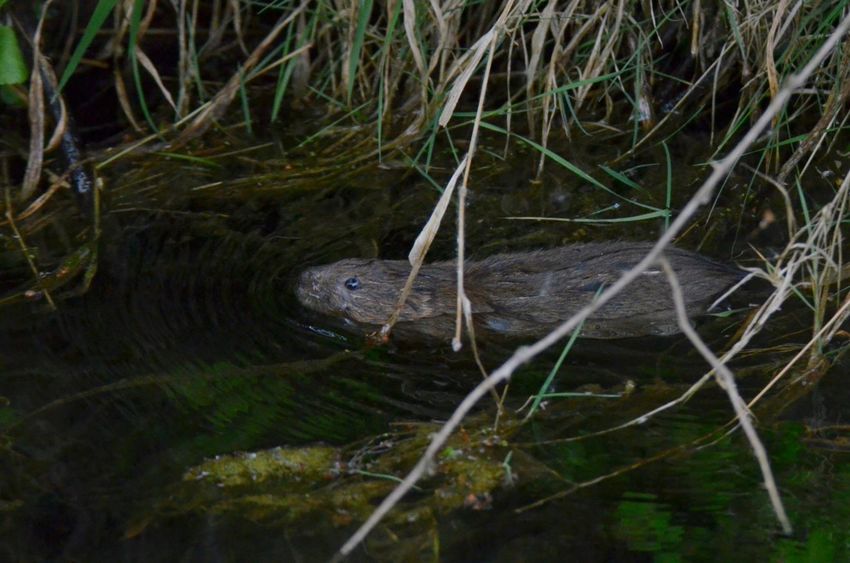
1.2.1. The requirement for an otter Lutra lutra and water vole Arvicola amphibius survey followed
the identification of suitable habitats with the potential to support otter and water vole
populations, that may be impacted by the Scheme. These habitats were identified following
the Phase 1 Habitat Survey (WSP, 2018) and the refined survey in 2020 and comprised the
River Wensum, two ponds, two streams and a number of ditches, as shown in separate
document Appendix B.
1.2.2. In addition, a local records search obtained through Norfolk Biodiversity Information Service
(NBIS) returned records of otter and water vole within 2km of the Scheme. The presence of
both species was confirmed incidentally during a macrophyte survey in 2019; otter through
an actual sighting and water vole through the presence of a recent latrine. It was therefore
recommended that otter and water vole surveys be undertaken to establish a sufficient
baseline to inform impact assessment.
1.3 BRIEF AND OBJECTIVES
1.3.1. WSP has been commissioned by Norfolk County Council to complete a comprehensive
suite of otter and water vole surveys, with the following objectives as listed below.
Establish whether otter and water vole are present or likely absent within the Survey
Area;
Determine, if present, the distribution of otter and water vole within the Survey Area; and
Present the findings of the survey in a baseline report.
1.3.2. The findings of these objectives will be used to inform the impact assessment and proposed
mitigation for all otter and water vole present across the Scheme. Details of the impact
assessment and mitigation will be included within the Biodiversity Chapter of the
Environmental Statement for the Scheme.
1.4 STUDY AND SURVEY AREAS
DESK STUDY
1.4.1. An ecological Desk Study was completed in March 2020 to include recent data relevant to
the Scheme. The Study Area for this was defined as a 2km radius of the Scheme, as shown
in separate document Appendix A.
NORWICH WESTERN LINK ROAD PUBLIC | WSP
Project No.: 70061370 | Our Ref No.: 70061370-09-09 June 2021
Norfolk County Council Page 2 of 19OTTER SURVEY AREA
1.4.2. The Survey Area in relation to otter comprised 300m sections up and downstream from the
Scheme Alignment. This also included all directly connected water features and associated
riparian/holt building habitat. As with water voles the use of the River Wensum by otter is
well documented and the species was considered likely to be present and actively moving
through suitable habitat.
1.4.3. The Survey Area was selected to focus on the immediate area impacted by the Scheme,
particularly focussing on the discovery of holts, couches or evidence of features of
importance to otters. All suitable habitat identified as having potential to support otter
populations was surveyed within the Survey Area. The Survey Area extents are shown in
separate document Appendix B.
WATER VOLE SURVEY AREA
1.4.4. The Survey Area in relation to water vole comprised 300m sections up and downstream
from the Scheme Alignment. This also included all directly connected water features and
associated riparian habitat. The survey area was informed by The Norfolk Wildlife Trust
identifying water vole in the area (Norfolk Wildlife Trust, 2020).
1.4.5. The Survey Area was informed by guidance in The Water Vole Mitigation Handbook (Dean,
et al., 2016) which recommends a field survey area of between 200m and 500m upstream
and downstream for a scheme with the potential for permanent impacts affecting more than
50m of watercourse. All suitable habitat identified as having potential to support water vole
populations was surveyed within the Survey Area. The Survey Area extents are shown in
separate document Appendix B.
NORWICH WESTERN LINK ROAD PUBLIC | WSP
Project No.: 70061370 | Our Ref No.: 70061370-09-09 June 2021
Norfolk County Council Page 3 of 192 RELEVANT LEGISLATION
2.1 LEGAL COMPLIANCE
2.1.1. Under the Conservation of Habitats and Species Regulations 2017 (as amended) otter is
listed on Schedule 2 of the Habitats Directive (Council Directive 92/43/EEC) and as such is
a European Protected Species (EPS). Under Part 3 of the Habitat Regulations it is an
offence to;
deliberately capture, injure or kill a wild otter;
deliberately disturb a wild otter; and
damage or destroy a breeding site or resting place used by otter.
2.1.2. Otter and water vole are both listed on Schedule 5 of the Wildlife and Countryside Act
(WCA) 1981 (as amended), though they receive different levels of protection under this
legislation. An otter is protected from sale and from disturbance ‘while it is occupying a
structure or place which it uses for shelter or protection’. It is also an offence to ‘obstruct
access to any structure or place used for shelter or protection’. Water vole receive full
protection under the WCA and it is an offence to;
intentionally kill, injure or take water vole;
intentionally or recklessly obstruct, damage or destroy any structure or place used for
shelter or protection by water vole, or disturb water vole while they are occupying such a
structure; and
sell or advertise for sale water vole, whether live or dead.
2.1.3. The Natural Environment and Rural Communities (NERC) Act 2006 reinforces the duty
upon all public authorities, including planning authorities, to have regard for the
conservation of biodiversity when discharging their duties. The Act refines the definition of
biodiversity conservation, stating that it includes restoring or enhancing a population or
habitat. Section 41 of the NERC Act requires the Secretary of State to list habitats and
species of principal importance (HPIs and SPIs) for the conservation of biodiversity in
England. The habitats and species listed in accordance with Section 41 largely replicate
those listed on the UK Biodiversity Action Plan (BAP) which occur in England and includes
otter and water vole.
NORWICH WESTERN LINK ROAD PUBLIC | WSP
Project No.: 70061370 | Our Ref No.: 70061370-09-09 June 2021
Norfolk County Council Page 4 of 193 METHODS
3.1 OVERVIEW
3.1.1. A single otter and water vole survey was undertaken in autumn in 2019 which was limited
by agreed access. The Scheme subsequently evolved and two further surveys were
undertaken in 2020 in the appropriate season for otter (otter surveys can be carried out
year-round, but spring is preferable) and water vole (mid-April to September). The surveys
were undertaken across multiple days due to the size of the survey area. In addition to this,
trail cameras were deployed in habitat suitable for otter and water vole in 2020 and
incidental records were noted during other survey work undertaken on site.
3.1.2. All otter and water vole records collected during the 2019 and 2020 surveys will be
submitted to Norfolk Biodiversity Information Service (NBIS) in a timely manner.
3.2 DESK STUDY
3.2.1. An ecological desk study was completed in March 2020 to include recent data relevant to
the Scheme. Records of any notable or legally protected species, including otter, water vole
and American mink Neovison vison, from within a 2km radius of the Scheme (see separate
document Appendix A) were requested from NBIS. Records of American mink were
requested due to their known predation on water vole.
3.3 FIELD SURVEY
3.3.1. All watercourses and ponds identified as suitable habitat in the Survey Area were subject to
detailed otter and water vole survey. Watercourses are labelled WC1-WC6, with the
exception of the River Wensum which is labelled simply as the River Wensum. The
surveyed ponds are labelled as Pond 1 and Pond 2. The River Wensum is located in the
north of the Scheme, with WC1-WC5 and Pond 1 and Pond 2 all located within the River
Wensum’s floodplain. WC6 is located in the south of the Scheme, south of Foxburrow
Plantation. The locations of the watercourses and waterbodies are shown in separate
document Appendix B.
OTTER SURVEY
3.3.2. The survey for otter was carried out with reference to good practice guidance (Chanin,
2003B) and other standard guidance documents (Chanin, 2003A) (Liles, 2003) and
comprised a minimum of two visits to each surveyed watercourse and pond within the
appropriate season to look for evidence of otters. The surveys incorporated the following:
NORWICH WESTERN LINK ROAD PUBLIC | WSP
Project No.: 70061370 | Our Ref No.: 70061370-09-09 June 2021
Norfolk County Council Page 5 of 19 A walked survey of each watercourse, pond and associated riparian/holt building habitat,
accessing the channel where possible, to search for field signs of otter1.
WATER VOLE SURVEY
3.3.3. The survey for water vole was carried out with reference to good practice guidance (Dean,
et al., 2016) and comprised a minimum of two visits to each surveyed watercourse and
pond within the appropriate season, incorporating the following elements:
The recording of habitat variables and features relevant to water voles (for example
general habitat type, shore/bank substrate, bordering land use, vegetation, disturbance
level, bank profile, water depth);
A walked survey of each watercourse and pond, accessing the channel where possible,
to search for field signs of water vole2; and
The recording of any field signs or evidence relating to other relevant wildlife (for example
American mink or other rodent species).
TRAIL CAMERA DEPLOYMENT
3.3.4. Trail cameras were deployed along suitable habitat for a period of 13-21 days to gain
additional information. The trail camera locations are labelled TC1-TC3 and are shown in
separate documents Appendix C and D. The footage was analysed for sightings of otter,
water vole and any other relevant species (for example American mink or brown rat).
3.4 DATES OF SURVEY AND PERSONNEL
3.4.1. The otter and water vole surveys were led by ecologists with extensive otter and water vole
survey experience with a strong understanding of their ecology and the ability to identify
their field signs. All lead surveyors met the criteria within the CIEEM Competencies for
Species Survey for Eurasian otter (CIEEM, 2013A) and water vole (CIEEM, 2013B).
Surveys were completed on the dates shown in Table 3-1 for both otter and water vole between
19 September 2019 and 10 September 2020.
1
Field signs for otter include spraints, footprints, feeding remains, otter slides, holts and couches
2
Field signs for water vole include faeces, latrines, feeding stations, burrows, ‘lawns’, nests, footprints and runways in vegetation
NORWICH WESTERN LINK ROAD PUBLIC | WSP
Project No.: 70061370 | Our Ref No.: 70061370-09-09 June 2021
Norfolk County Council Page 6 of 19Table 3-1 – Otter and Water Vole Survey Dates
Date Watercourse surveyed Water vole
surveying
season
(early/late3)
19 September WC6 Late
2019
2 October 2019 WC5 (partial), WC4 (partial) Late
6 May 2020 WC6 Early
30 June 2020 River Wensum, WC1 (western half), Pond 2 Early
1 July 2020 Pond 1, WC5, WC2, WC3, WC1 (eastern half), Late
WC4
12 August 2020 WC6, River Wensum (north bank) Late
13 August 2020 WC5 (central section of north bank and eastern Late
section of south bank)
8 September River Wensum (central and eastern section of Late
2020 south bank), WC5 (central and eastern section of
north bank and central section of south bank),
WC3, WC4, Pond 2
10 September River Wensum (western section of south bank), Late
2020 WC1, WC2, WC5 (western section of north and
south bank), Pond 1
3.4.2. Trail cameras were deployed or collected on the following dates;
18 August 2020 – TC1 deployed;
27 August 2020 – TC2 deployed;
3 September 2020 – TC1 collected;
9 September 2020 – TC2 collected;
18 November 2020 – TC3 deployed; and
8 December 2020 – TC3 collected.
3
The early surveying season for water vole is between mid-April/early May and the end of June and the late surveying season is
between July and September
NORWICH WESTERN LINK ROAD PUBLIC | WSP
Project No.: 70061370 | Our Ref No.: 70061370-09-09 June 2021
Norfolk County Council Page 7 of 193.5 NOTES AND LIMITATIONS
3.5.1. All watercourses and waterbodies south of the River Wensum, apart from WC5, were
surveyed from within the channel where access allowed. WC5 and the River Wensum
comprised a mixture of steep, sloping and poached banks which allowed sufficient visibility
for surveying from the bank.
3.5.2. As close contact with water vole during the surveys was unnecessary and undesirable, their
genetic clade is undetermined. This does not have an impact on the survey results however
if further intervention in the local water vole population was proposed, this may need to be
confirmed.
3.5.3. The extent of dense vegetation present within WC1 and Pond 1 meant that access to the
full length of their channels was not possible. Spot checks were carried out along the water
channel wherever safe access was possible. No field signs were recorded within these
waterbodies, but as a result of the accessibility issues the presence of water vole or otter
evidence cannot be discounted. Habitat assessments have been used to inform the relative
water vole population densities.
3.5.4. The central section of the south bank of WC5 was heavily vegetated and a barbed wire
fence was present close to the bank. This meant areas of bank could not be thoroughly
examined, however, the watercourse did not exceed approximately 3m in width so non-
accessible banks were largely observable across the channel and this is not considered a
significant survey limitation.
NORWICH WESTERN LINK ROAD PUBLIC | WSP
Project No.: 70061370 | Our Ref No.: 70061370-09-09 June 2021
Norfolk County Council Page 8 of 194 RESULTS
4.1 OVERVIEW
4.1.1. A summary of positive evidence of species occurrence recorded during the surveys is
presented in Table 4-1.
Table 4-1 – Summary of Evidence of Species Recorded During 2019 and 2020
Surveys
Species Watercourse
Water vole River Wensum, WC3, WC5
Otter River Wensum
American mink WC5
Brown rat River Wensum, WC5, WC6
Small mammals, such as bank vole WC3, WC6
Myodes glareolus
4.2 DESK STUDY
4.2.1. The Desk Study returned two records of otter, two records of water vole and eleven records
of American mink within the 2km Study Area. The nearest otter record was found dead
860m from the Scheme on Fakenham Road and the most recent sighting of an otter was
2km southeast of the Scheme near Taverham, on the River Wensum. The nearest and most
recent record of a water vole was found dead 650m south of the Scheme, near the River
Tud in Honingham. The nearest and most recent record of American mink was recorded
250m from the Scheme, near Morton Farm on a camera trap, with eight sightings recorded.
Three mink were also recorded on the River Wensum, near Attlebridge. Full detail of the
Scheme, Desk Study Area and Desk Study Results are included within separate document
Appendix A.
4.3 HABITAT DESCRIPTIONS
4.3.1. The watercourses and waterbodies surveyed comprised two ponds set within broadleaved
woodland and semi-improved grassland, the River Wensum, four drainage ditches and two
streams which were set within a combination of grassland and floodplain grazing marsh.
The locations of the watercourses and waterbodies are shown in separate document
Appendix B.
NORWICH WESTERN LINK ROAD PUBLIC | WSP
Project No.: 70061370 | Our Ref No.: 70061370-09-09 June 2021
Norfolk County Council Page 9 of 19RIVER WENSUM
4.3.2. The River Wensum had a mixture of steep and sloping banks, with the eastern part of the
north bank very dry and poached by cattle. Bankside vegetation was dominated by reed
sweet grass Glyceria maxima with nettle Urtica dioica also frequent and occasional willow
trees Salix sp. present. Areas of steep bank offered burrowing potential and abundant
riparian vegetation supplied cover and foraging opportunities, providing optimal habitat for
water vole. The River Wensum also offered linear connectivity with other watercourses,
providing optimal habitat for otter.
WATERCOURSE 1
4.3.3. An unmanaged ditch that was only accessible for short stretches as the majority of the
watercourse was bordered with barbed wire. Accessibility was further decreased by areas of
steep banks and thick vegetation. The ditch was choked with reeds, hawthorn Crataegus
monogyna, goat willow Salix caprea, bramble Rubus fruticosus agg. and scrub and
although damp and sludgy in places, no standing water was observed. As a result of
accessibility issues, even though no field signs were observed during surveys the presence
of water vole could not be discounted. WC1 offered limited burrowing opportunities in some
of the areas accessed with steeper banks and suitable foraging habitat. WC1 also provided
links between optimal water vole habitat so was considered to offer limited suitable habitat
for water vole.
WATERCOURSE 2
4.3.4. An unmanaged ditch with shallow banks that were heavily poached by cattle. Dense
vegetation was present throughout the whole ditch which was generally damp with shallow
standing water in places. As the banks were extremely shallow and composed of cattle
poached earth WC2 provided low quality habitat for burrowing, however offered suitable
foraging habitat and links to areas of optimal water vole habitat. WC2 was therefore
considered to provide limited suitable habitat for water vole.
WATERCOURSE 3
4.3.5. An unmanaged ditch with shallow banks that were heavily poached by cattle. Dense
vegetation was present throughout the whole ditch and the ditch generally contained only a
few centimetres of water. As the banks were extremely shallow and composed of cattle
poached earth WC3 provided low quality habitat for burrowing, however offered suitable
foraging habitat and links to areas of optimal water vole habitat. WC3 was therefore
considered to provide limited suitable habitat for water vole.
NORWICH WESTERN LINK ROAD PUBLIC | WSP
Project No.: 70061370 | Our Ref No.: 70061370-09-09 June 2021
Norfolk County Council Page 10 of 19WATERCOURSE 4
4.3.6. A ditch with shallow banks that were heavily poached by cattle. The eastern side of the ditch
was bordered with a barbed wire fence so was slightly less poached. The ditch was densely
vegetated and the majority of it contained shallow standing water. Some hawthorn and
willow trees were also present. WC4 provided limited opportunities for burrowing on the
eastern bank, as although the bank had less impact from poaching, it was still fairly shallow.
Additionally, WC4 offered suitable foraging habitat and links to areas of optimal water vole
habitat therefore was considered to provide limited suitable habitat for water vole.
WATERCOURSE 5
4.3.7. A stream approximately 3m wide with frequent yellow flag iris Iris pseudacorus. The western
section generally had steep loose soil banks, which were more stable on the south where
they were bound together by tree roots. The central section had fairly steep banks, with the
north bank heavily poached. The south bank in this section was heavily vegetated and
bordered by a barbed wire fence, meaning access was limited and it was mainly observed
from across the channel. The eastern section had an increased concentration of yellow flag
iris along the banks. The south bank was fairly steep; however, the north bank was more
gently sloped. The eastern section also had minimal impact from cattle. Areas of steep and
moderately sloping bank offered burrowing potential and sections of abundant riparian
vegetation supplied cover and foraging opportunities, providing optimal habitat for water
vole.
WATERCOURSE 6
4.3.8. A shallow flowing stream with steep earth banks that were poached by cattle in short
sections. The stream was heavily vegetated by bramble, nettle, bittersweet Solanum
dulcamara, bracken Pteridium aquilinum, soft rush Juncus effusus, creeping thistle Cirsium
arvense, broad-leaved dock Rumex obtusifolius and elder Sambucus nigra, with some
areas completely choked by the vegetation. The majority of the stream was observed from
within the channel. WC6 offered banks with areas of burrowing potential, where poaching
was minimal, and abundant foraging opportunities, providing optimal habitat for water vole.
POND 1
4.3.9. A shallow pond with very shallow banks. The pond was dominated by common reed
Phragmites australis and covered in duckweed Lemna minor with bramble present on the
banks. The pond was also surrounded by very dense nettle, with the combination of thick
nettles, reeds and a shallow sludgy bank meaning that some areas, particularly the northern
part of the pond, were inaccessible. The pond offered suboptimal habitat for burrowing as
the banks were shallow and very soft, however there were some opportunities for foraging
meaning that the habitat had limited suitability for water vole.
NORWICH WESTERN LINK ROAD PUBLIC | WSP
Project No.: 70061370 | Our Ref No.: 70061370-09-09 June 2021
Norfolk County Council Page 11 of 19POND 2
4.3.10. A pond with largely shallow sloping banks. The pond had limited aquatic vegetation and
only a small amount of marginal vegetation, meaning there was limited cover for water
voles. The majority of the pond provided suboptimal habitat for burrowing due to shallow
banks, however steeper banks were present on the east side where some vegetation cover
was present, providing limited suitable habitat for water voles.
4.4 OTTER FIELD SURVEY
4.4.1. An otter sighting and field signs of otter were recorded in the River Wensum; a summary of
evidence of otter is given in Table 4-2. Full survey data is included in Appendix E.
4.4.2. The survey did not record any signs of otter within WC1 - WC6 or Pond 1 and Pond 2.
Table 4-2 – Evidence of Otter
Watercourse Date evidence recorded Description of evidence
present
River Wensum 26/09/2019 Otter sighting recorded in
Incidental record the central section of the
River Wensum.
River Wensum 30/06/2020 Potential otter holt recorded
on the north bank of the
River Wensum in a small
section of trees. Potential
holt found under tree roots
with shell remains with
scrapes present inside and
several spraints also
present.
4.5 WATER VOLE FIELD SURVEY
4.5.1. Field signs of water vole were recorded in the River Wensum, WC3 and WC5; a summary
of evidence of water vole is given in Table 4-3. Full survey data is included in Appendix E.
4.5.2. The survey did not record any signs of water vole within WC1, WC2, WC4, WC6, Pond 1 or
Pond 2. However, as some of the watercourses and waterbodies were subject to limitations,
as shown in section 3.5, and water vole are widespread in the area, habitat suitability was
also used to infer water vole presence for certain watercourses and waterbodies, as shown
in Table 4-3.
NORWICH WESTERN LINK ROAD PUBLIC | WSP
Project No.: 70061370 | Our Ref No.: 70061370-09-09 June 2021
Norfolk County Council Page 12 of 19Table 4-3 – Evidence of Water Vole
Watercourse Survey Date Water Water vole Description of
number vole presence evidence present
presence inferred
from
habitat
suitability
River Incidental 26/09/2019 ✓ A single water vole
Wensum record latrine recorded in the
middle section on the
south bank.
River Survey 1 30/06/2020 ✓ Three burrows
Wensum 2020 recorded in the middle
section on the south
bank, including
entrances on top of
bank. One of the
burrows in this area
was recorded with
associated feeding
remains and a latrine.
A single additional
burrow was recorded
further to the west on
the north bank and a
single latrine was also
recorded in the same
area.
River Survey 2 12/08/2020 ✓ A single potential
Wensum 2020 (north burrow and a single
bank) old latrine recorded on
the north bank at the
west end of the River
Wensum.
River Survey 2 08/09/2020 ✓ A single burrow
Wensum 2020 (central recorded on the south
and bank at the
eastern easternmost end of
section of the River Wensum.
south Ten records of
bank) feeding remains were
distributed throughout
the central and
eastern part of the
south bank of the
River Wensum.
NORWICH WESTERN LINK ROAD PUBLIC | WSP
Project No.: 70061370 | Our Ref No.: 70061370-09-09 June 2021
Norfolk County Council Page 13 of 19Watercourse Survey Date Water Water vole Description of
number vole presence evidence present
presence inferred
from
habitat
suitability
Thirteen latrines were
recorded in the same
areas, with the
majority of feeding
remains records
associated with a
latrine. Two runs were
recorded on the south
bank at the
easternmost end and
were both associated
with other field signs.
River Survey 2 10/09/2020 ✓ A single latrine
Wensum 2020 (western recorded on the south
section of bank at the west end
south of the River Wensum.
bank)
WC1 Survey 1 30/06/2020 ✓ No evidence of water
2020 vole recorded.
Suitable habitat not
fully accessible.
WC1 Survey 1 01/07/2020 ✓ No evidence of water
2020 vole recorded.
Suitable habitat not
fully accessible.
WC1 Survey 2 10/09/2020 ✓ No evidence of water
2020 vole recorded.
Suitable habitat not
fully accessible.
WC2 Survey 1 01/07/2020 No evidence of water
2020 vole recorded.
WC2 Survey 2 10/09/2020 No evidence of water
2020 vole recorded.
WC3 Survey 1 01/07/2020 No evidence of water
2020 vole recorded.
WC3 Survey 2 08/09/2020 ✓ Two records of
2020 possible feeding
remains recorded.
NORWICH WESTERN LINK ROAD PUBLIC | WSP
Project No.: 70061370 | Our Ref No.: 70061370-09-09 June 2021
Norfolk County Council Page 14 of 19Watercourse Survey Date Water Water vole Description of
number vole presence evidence present
presence inferred
from
habitat
suitability
WC4 Survey 1 02/10/2019 No evidence of water
2019 vole recorded.
WC4 Survey 1 01/07/2020 No evidence of water
2020 vole recorded.
WC4 Survey 2 08/09/2020 No evidence of water
2020 vole recorded.
WC5 Survey 1 02/10/2019 No evidence of water
2019 vole recorded.
WC5 Survey 1 01/07/2020 ✓ One record of feeding
2020 remains with an
associated latrine was
recorded on the south
bank at the east end
of WC5. A single
possible burrow
recorded 3m east of
the bridge at the east
end of WC5 on the
south bank.
WC5 Survey 2 13/08/2020 ✓ ✓ Two burrows recorded
2020 (central on the north bank of
section of WC5 in the central
north bank section, with one
and burrow on top of the
eastern bank. One burrow
section of was associated with a
south latrine and feeding
bank) remains. Six records
of feeding remains
were recorded
throughout the central
and east sections of
WC5 on the south
bank with a
concentration of
feeding remains
recorded at the east
end of WC5.
NORWICH WESTERN LINK ROAD PUBLIC | WSP
Project No.: 70061370 | Our Ref No.: 70061370-09-09 June 2021
Norfolk County Council Page 15 of 19Watercourse Survey Date Water Water vole Description of
number vole presence evidence present
presence inferred
from
habitat
suitability
WC5 Survey 2 08/09/2020 ✓ ✓ Three records of
2020 (central feeding remains with
and associated latrines
eastern recorded on the north
section of bank of WC5 in the
north bank central section.
and central
section of
south
bank)
WC5 Survey 2 10/09/2020 No evidence of water
2020 (western vole recorded.
section of
north and
south
bank)
WC6 Survey 1 19/09/2019 No evidence of water
2019 vole recorded.
WC6 Survey 1 06/05/2020 No evidence of water
2020 vole recorded.
WC6 Survey 2 12/08/2020 No evidence of water
2020 vole recorded.
Pond 1 Survey 1 01/07/2020 ✓ No evidence of water
2020 vole recorded.
Suitable habitat not
fully accessible.
Pond 1 Survey 2 10/09/2020 ✓ No evidence of water
2020 vole recorded.
Suitable habitat not
fully accessible.
Pond 2 Survey 1 30/06/2020 No evidence of water
2020 vole recorded.
Pond 2 Survey 2 08/09/2020 No evidence of water
2020 vole recorded.
4.5.3. No evidence of American mink or brown rat were recorded during these surveys. For
sightings of American mink and brown rat see trail camera results, shown in section 4.6
below.
NORWICH WESTERN LINK ROAD PUBLIC | WSP
Project No.: 70061370 | Our Ref No.: 70061370-09-09 June 2021
Norfolk County Council Page 16 of 194.5.4. Evidence of small mammals, such as bank vole, were recorded in WC3 and WC6.
4.6 TRAIL CAMERA DEPLOYMENT
4.6.1. TC1 and TC3 recorded brown rat and TC2 recorded American mink and brown rat; a
summary of evidence is given in Table 4-4. Full survey data is included in Appendix E.
4.6.2. TC1-TC3 did not record any signs of otter or water vole.
Table 4-4 – Evidence of Species Recorded During Deployment of Trail Cameras
Trail Date Description of species recorded
camera
TC1 18/08/2020 – Seven recordings of brown rat.
03/09/2020
TC2 27/08/2020 – One recording of brown rat and one recording of
09/09/2020 American mink.
TC3 18/11/2020 – Three recordings of brown rat.
08/12/2020
4.7 RELATIVE WATER VOLE POPULATION DENSITY
4.7.1. The latrine counts from the surveys can give an indication of relative water vole population
density for each watercourse and waterbody (as described in section 4.3 above). This aids
in identifying the most valuable parts of the site for water voles, along with areas most
suitable for enhancement, however latrine counts cannot provide robust estimates of
absolute numbers of animals. The method was informed by guidance in The Water Vole
Mitigation Handbook (Dean, et al., 2016).
4.7.2. The thresholds used were based on the approximate number of latrines per 100m of
bankside habitat and the overall threshold was decided by taking into account the varying
thresholds met throughout the whole watercourse or waterbody. During the early survey
season, the thresholds were ≥10 for high density, 3-9 for medium density and ≤2 (or none
with other confirmatory field signs) for low density. During the late survey season, the
thresholds were ≥20 for high density, 6-19 for medium density and ≤5 (or none with other
confirmatory field signs) for low density. Latrine counts from the surveys indicate the
following relative population densities, as shown in Table 4-5.
NORWICH WESTERN LINK ROAD PUBLIC | WSP
Project No.: 70061370 | Our Ref No.: 70061370-09-09 June 2021
Norfolk County Council Page 17 of 19Table 4-5 – Relative Water Vole Population Densities
Watercourse Relative population densities
River Medium density.
Wensum
WC1 None.
WC2 None.
WC3 None (only two records of possible feeding remains in September).
WC4 None.
WC5 Low density.
WC6 None.
Pond 1 None.
Pond 2 None.
4.7.3. The limitations on surveys (as noted in section 3.5) meant that water vole absence could not
be confirmed by the lack of field signs in WC1 and Pond 1, so habitat assessments were
used to assist in estimating the water vole population densities present. WC1 and Pond 1
had limited suitable habitat for water vole and an existing water vole population in nearby
habitat. However, they both also had mink present in the surrounding area, so were
assessed as having low densities of water vole present.
NORWICH WESTERN LINK ROAD PUBLIC | WSP
Project No.: 70061370 | Our Ref No.: 70061370-09-09 June 2021
Norfolk County Council Page 18 of 195 REFERENCES
5.1 PROJECT REFERENCES
WSP. (2018). Phase 1 Habitat Survey. Cambridge.
5.2 TECHNICAL REFERENCES
Chanin, P., 2003A. Ecology of the European Otter Lutra lutra. Conserving Natura 2000 Rivers
Monitoring Series No.10, Peterborough: English Nature.
Chanin, P., 2003B. Monitoring the Otter Lutra lutra. Conserving Natura 2000 Rivers Monitoring
Series No. 10, Peterborough: English Nature.
CIEEM, 2013A. Competencies for Species Survey: Eurasian Otter. [Online]
Available at: https://cieem.net/wp-content/uploads/2019/02/CSS-EURASIAN-OTTER-April-2013.pdf
[Accessed November 2020].
CIEEM, 2013B. Competencies for Species Survey: Water Vole. [Online]
Available at: https://cieem.net/wp-content/uploads/2019/02/CSS-WATER-VOLE-April-2013.pdf
[Accessed November 2020].
Dean, M., Strachan, R., Gow, D. & Andrews, R., 2016. The Water Vole Mitigation Handbook,
London: The Mammal Society.
Liles, G., 2003. Otter Breeding Sites: Conservation and Management. Conserving Natura 2000
Rivers Conservation Techniques Series No. 5, Peterborough: English Nature.
Norfolk Wildlife Trust, 2020. Water Vole Arvicola Amphibius. [Online]
Available at: https://www.norfolkwildlifetrust.org.uk/wildlife-in-norfolk/species-
explorer/mammals/water-
vole#:~:text=The%20water%20vole%20is%20a%20threatened%20species.%20It,Fens%20area%2
0and%20on%20the%20South%20Norfolk%20Claylands.
[Accessed December 2020].
NORWICH WESTERN LINK ROAD PUBLIC | WSP
Project No.: 70061370 | Our Ref No.: 70061370-09-09 June 2021
Norfolk County Council Page 19 of 19MARCH 2020 DESK STUDY (SEE
SEPARATE DOCUMENT)
PublicOTTER AND WATER VOLE SURVEY
AREA (SEE SEPARATE DOCUMENT)
PublicOTTER AND WATER VOLE SURVEY
RESULTS – NORTH (SEE SEPARATE
DOCUMENT)
PublicOTTER AND WATER VOLE SURVEY
RESULTS – SOUTH (SEE SEPARATE
DOCUMENT)
PublicFIELD SURVEY DATA
PublicTable E-1 – River Wensum Field Survey Results
Date Grid reference Field sign Species Description
26/09/2019 TG1397915485 Latrine Water vole Incidental
record.
26/09/2019 TG1393015509 Sighting Otter Incidental
record.
30/06/2020 TG1375115657 Latrine Water vole Old latrine on a
log in the water,
x9 droppings.
30/06/2020 TG1379215641 Holt Otter Possible otter
holt under tree
roots.
30/06/2020 TG1379215641 Feeding Otter Shell remains
remains with scrapes
present inside.
30/06/2020 TG1379215641 Spraint Otter Several spraint
present.
30/06/2020 TG1381515640 Burrow Water vole
30/06/2020 TG1402715423 Burrow Water vole
30/06/2020 TG1402715423 Feeding Water vole
remains
30/06/2020 TG1402715423 Latrine Water vole
30/06/2020 TG1397415479 Burrow Water vole Burrow
entrance at top
of bank. Tunnel
leading east.
30/06/2020 TG1397315478 Burrow Water vole Burrow on top
of bank.
12/08/2020 TG1376215654 Latrine Water vole x1 old dropping.
12/08/2020 TG1376215654 Burrow Water vole Possible
burrow.
08/09/2020 TG1423815321 Latrine Water vole x2 droppings.
NORWICH WESTERN LINK ROAD WSP
Project No.: 70061370 | Our Ref No.: 70061370-09-09 June 2021
Norfolk County CouncilDate Grid reference Field sign Species Description
08/09/2020 TG1423815321 Feeding Water vole
remains
08/09/2020 TG1423815321 Burrow Water vole
08/09/2020 TG1424315325 Latrine Water vole x2 droppings.
08/09/2020 TG1424315325 Feeding Water vole
remains
08/09/2020 TG1424315325 Run Water vole
08/09/2020 TG1424615319 Latrine Water vole x4 droppings.
08/09/2020 TG1424615319 Feeding Water vole
remains
08/09/2020 TG1424615319 Run Water vole
08/09/2020 TG1424815321 Latrine Water vole x1 dropping.
08/09/2020 TG1424815321 Feeding Water vole
remains
08/09/2020 TG1425015320 Latrine Water vole x10 droppings.
08/09/2020 TG1417815351 Latrine Water vole x10 droppings.
08/09/2020 TG1417815351 Feeding Water vole
remains
08/09/2020 TG1406915386 Latrine Water vole x1 dropping.
08/09/2020 TG1406915386 Feeding Water vole
remains
08/09/2020 TG1402715429 Latrine Water vole x2 droppings.
08/09/2020 TG1402715429 Feeding Water vole
remains
08/09/2020 TG1396215494 Latrine Water vole x13 older
droppings.
08/09/2020 TG1396815492 Feeding Water vole
remains
NORWICH WESTERN LINK ROAD WSP
Project No.: 70061370 | Our Ref No.: 70061370-09-09 June 2021
Norfolk County CouncilDate Grid reference Field sign Species Description
08/09/2020 TG1391115522 Feeding Water vole
remains
08/09/2020 TG1391115522 Latrine Water vole Old latrine
largely
disintegrated.
08/09/2020 TG1426215313 Latrine Water vole x3 droppings.
08/09/2020 TG1421015320 Latrine Water vole Minimum of 20
droppings.
08/09/2020 TG1411015373 Latrine Water vole x9 droppings,
some
disintegrating.
08/09/2020 TG1410815374 Feeding Water vole Possible
remains feeding
remains.
10/09/2020 TG1374115650 Latrine Water vole x3 droppings.
Table E-2 – Watercourse 3 Field Survey Results
Date Grid reference Field sign Species Description
08/09/2020 TG1352215449 Feeding remains Water vole Possible water
vole feeding
remains - large
and with correct
angle.
08/09/2020 TG1354415474 Latrine Small
mammal
08/09/2020 TG1354415474 Feeding remains Small
mammal
08/09/2020 TG1354515472 Feeding remains Water vole Possible water
vole feeding
remains as some
feeding remains
are the correct
size - mixture of
old and new.
NORWICH WESTERN LINK ROAD WSP
Project No.: 70061370 | Our Ref No.: 70061370-09-09 June 2021
Norfolk County CouncilDate Grid reference Field sign Species Description
08/09/2020 TG1352615456 Latrine Small
mammal
08/09/2020 TG1352615456 Feeding remains Small
mammal
Table E-3 – Watercourse 5 Field Survey Results
Date Grid reference Field signs Species Description
01/07/2020 TG1387315190 Feeding Water
remains vole
01/07/2020 TG1387315190 Latrine Water x2 droppings.
vole
01/07/2020 TG1387115194 Burrow Water Potential water vole burrow
vole 3m east of bridge.
13/08/2020 TG1389115179 Feeding Water
remains vole
13/08/2020 TG1387515192 Feeding Water
remains vole
13/08/2020 TG1388015188 Feeding Water
remains vole
13/08/2020 TG1382915228 Feeding Water
remains vole
13/08/2020 TG1375615266 Feeding Water Old feeding remains.
remains vole
13/08/2020 TG1373615279 Burrow Water Burrow on top of bank.
vole
13/08/2020 TG1372615288 Burrow Water Burrow entrance at water’s
vole edge.
13/08/2020 TG1372615288 Feeding Water
remains vole
13/08/2020 TG1372615288 Latrine Water x3 droppings.
vole
NORWICH WESTERN LINK ROAD WSP
Project No.: 70061370 | Our Ref No.: 70061370-09-09 June 2021
Norfolk County CouncilDate Grid reference Field signs Species Description
08/09/2020 TG1369915305 Latrine Water x4 droppings.
vole
08/09/2020 TG1369915305 Feeding Water
remains vole
08/09/2020 TG1369815305 Latrine Water x2 droppings.
vole
08/09/2020 TG1369815305 Feeding Water
remains vole
08/09/2020 TG1369615307 Latrine Water x12 droppings.
vole
08/09/2020 TG1369615307 Feeding Water
remains vole
Table E-4 – Watercourse 6 Field Survey Results
Date Grid reference Field signs Species Description
06/05/2020 TG1035113478 Feeding remains Small mammal
06/05/2020 TG1035513481 Feeding remains Small mammal
06/05/2020 TG1035513481 Latrine Small mammal
06/05/2020 TG1037213475 Feeding remains Small mammal
06/05/2020 TG1051613331 Burrow Small mammal
NORWICH WESTERN LINK ROAD WSP
Project No.: 70061370 | Our Ref No.: 70061370-09-09 June 2021
Norfolk County CouncilTable E-5 – Trail Camera Results
Trail camera Date Description of species recorded
TC1 18/08/2020 – 360x pheasant Phasianus colchicus, 30x cow
03/09/2020 Bos taurus, 14x wood pigeon Columba
palumbus, 8x feral pigeon Columba livia, 7x
brown rat, 6x jay Garrulus glandarius, 2x mouse
Apodemus sp. and 1x buzzard Buteo buteo.
TC2 27/08/2020 – 1x American mink and 1x brown rat.
09/09/2020
TC3 18/11/2020 – 8x little egret Egretta garzetta, 5x grey heron
08/12/2020 Ardea cinerea, 12x pheasant and 3x brown rat.
NORWICH WESTERN LINK ROAD WSP
Project No.: 70061370 | Our Ref No.: 70061370-09-09 June 2021
Norfolk County Council62-64 Hills Road
Cambridge
CB2 1LA
wsp.com
PUBLICYou can also read